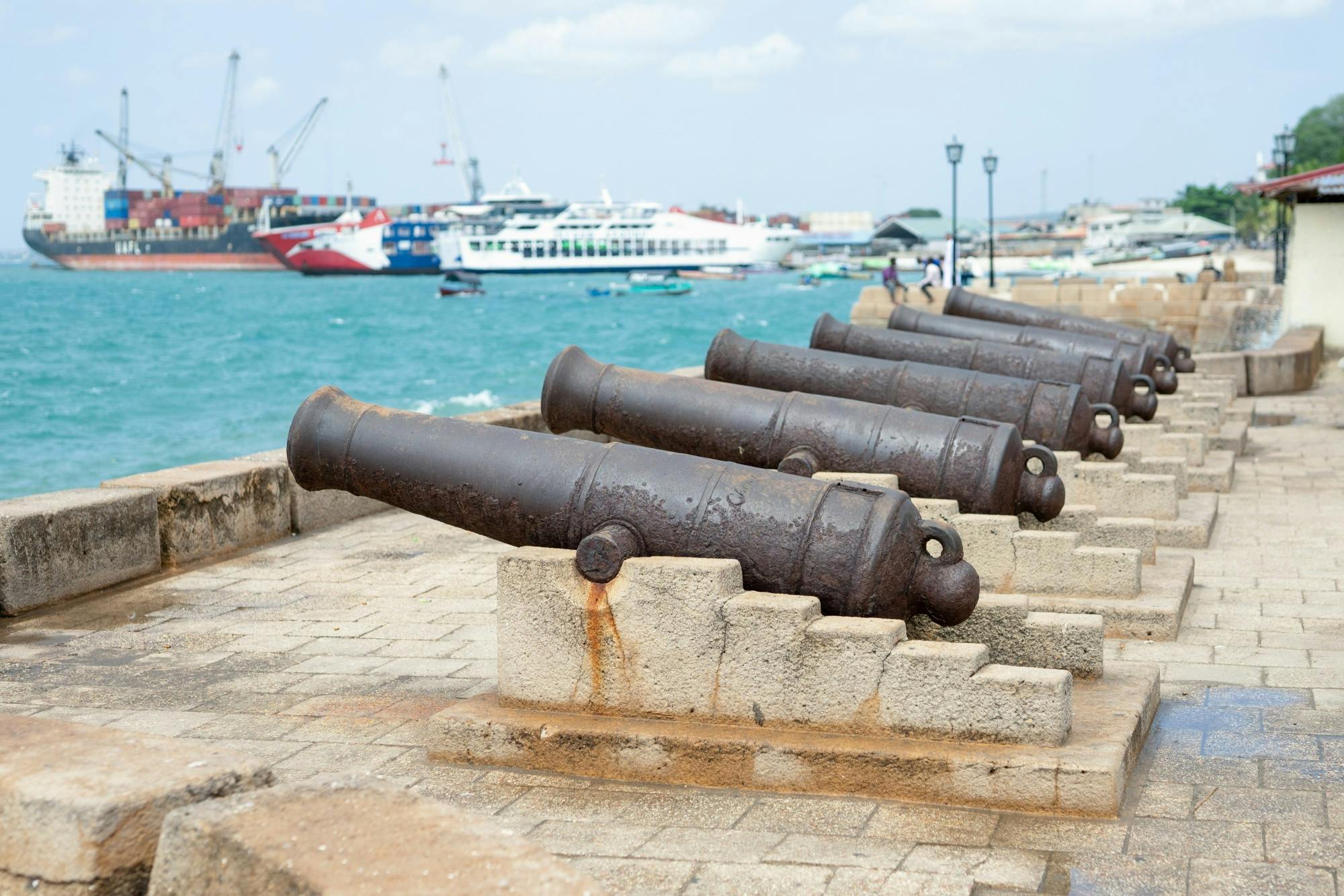
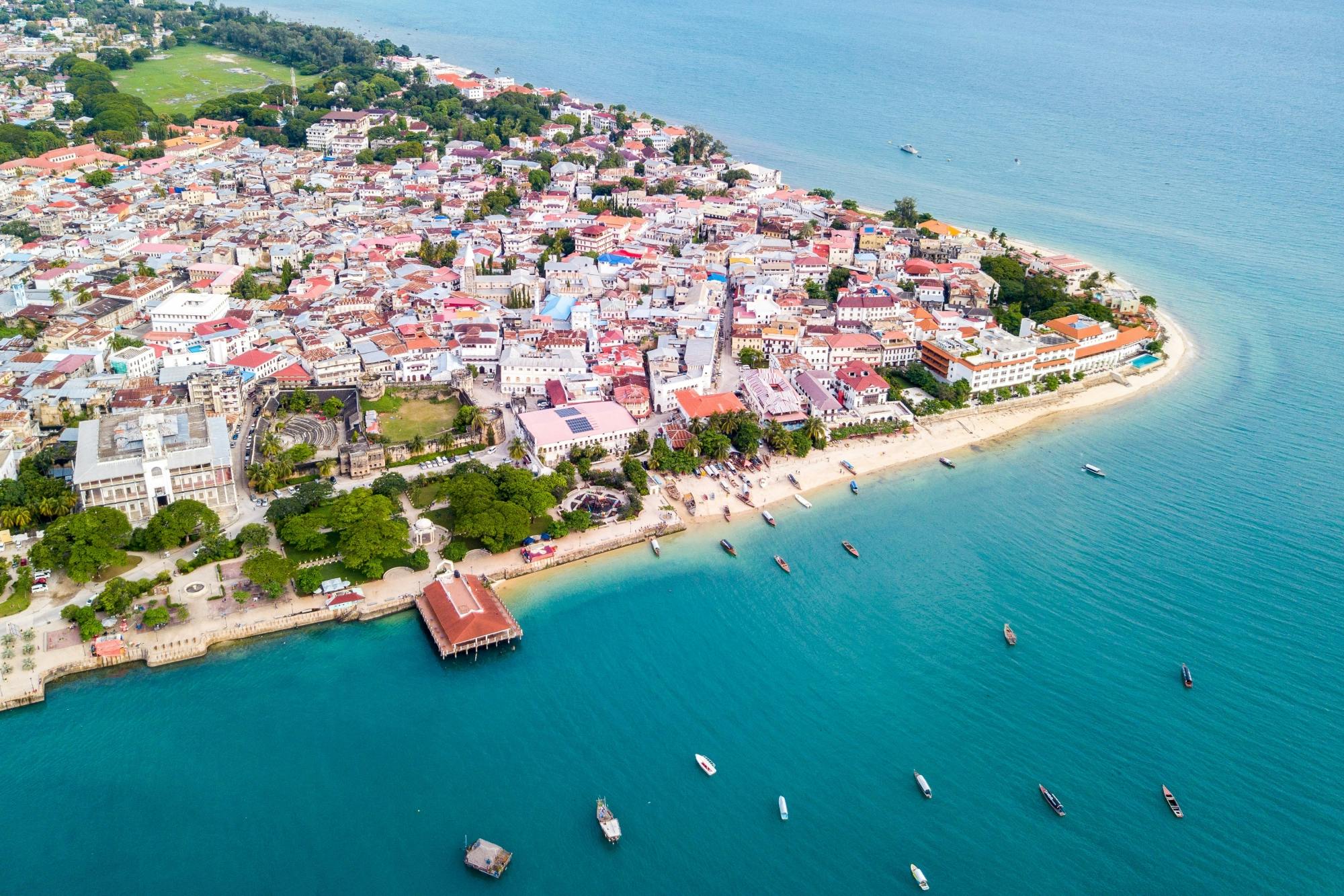
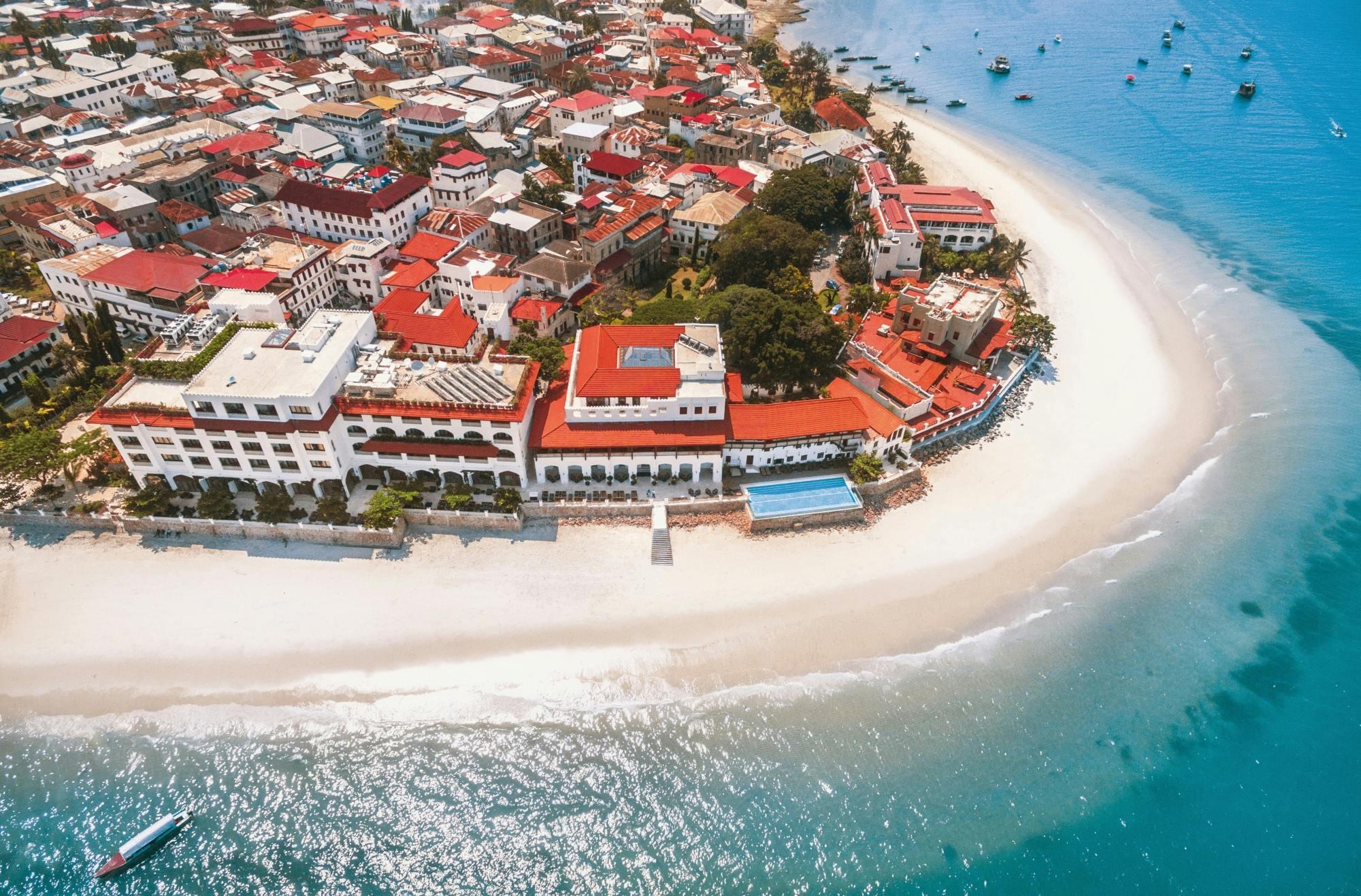
Stone Town is the historic heart of Zanzibar City and one of the most fascinating old towns on the East African coast. Behind its Indian Ocean waterfront lies a maze of narrow lanes filled with coral-stone houses, elaborately carved wooden doors, mosques, churches, former palaces, merchants’ houses, markets and small courtyards.
Stone Town was inscribed on the UNESCO World Heritage List in 2000. UNESCO describes it as an outstanding example of a Swahili coastal trading town whose architecture reflects more than a thousand years of interaction between African, Arab, Indian and European cultures.
This is not an open-air museum. Around the historic buildings are homes, schools, workshops, cafés, shops, mosques and markets used every day by local residents. That mixture of monumental history and ordinary life is a large part of Stone Town’s appeal.
Stone Town at a Glance
Visitor Information
Details
Location
Zanzibar City, Unguja Island, Tanzania
UNESCO World Heritage
Since 2000
UNESCO property area
96 hectares
Best known for
Swahili architecture, carved doors, trading history and waterfront
Essential sights
Old Fort, Forodhani Gardens, Anglican Cathedral, Darajani Market, Old Dispensary and historic lanes
Time needed
At least half a day; 1–2 days is better
Best way to explore
On foot
Stone Town admission
Free – individual museums and monuments may charge admission
Main airport
Abeid Amani Karume International Airport
Airport location
About 5 km south of Zanzibar City
Best for
History, architecture, culture, food, photography and walking
Why Is Stone Town So Important?
Stone Town developed as part of the network of Swahili trading communities along the East African coast. Its position in the Indian Ocean connected Zanzibar with mainland Africa, Arabia, Persia, India and eventually European trading powers.
Those connections are visible in the buildings. A single street can contain African and Swahili building traditions beside Omani Arab houses, Indian merchant architecture and European colonial structures.
UNESCO considers Stone Town an exceptional example of cultural fusion rather than a town representing only one civilisation. Its winding street pattern, low-rise buildings, large seafront mansions and enclosed courtyards remain key elements of its historic character.
A Town Built From Coral Stone
The name Stone Town distinguishes the historic stone-built centre from surrounding neighbourhoods that traditionally contained simpler structures.
UNESCO notes that many historic buildings were constructed primarily from coralline ragstone and mangrove timber, held together with thick lime mortar before being plastered and limewashed.
These traditional materials helped create the distinctive pale buildings and irregular walls that line the narrow streets today.
The Famous Zanzibar Doors
One of the first architectural details most visitors notice is the collection of enormous carved wooden doors.
Historic houses often have double doors surrounded by deeply carved timber frames. Some incorporate floral motifs, geometric patterns, Arabic inscriptions or metal studs.
UNESCO identifies these elaborately carved double doors as one of the distinctive external features of Stone Town’s traditional houses.
Do not concentrate only on the most elaborate examples. Once you begin looking carefully, even ordinary lanes reveal beautiful old doors, balconies, shutters and decorated entrances.
Getting Lost Is Part of the Experience
Stone Town’s lanes were never laid out as a modern grid.
UNESCO describes a network of narrow, winding streets and alleys created as different communities and groups of buildings developed around courtyards and shared spaces.
You will frequently turn a corner expecting another street and instead discover:
A tiny square
A mosque entrance
A carved doorway
A small café
A textile shop
A courtyard
A glimpse of the sea
Navigation apps are useful, but Stone Town is one of those destinations where following every instruction on your phone can actually make the visit less interesting.
1. Start at Forodhani Gardens
Forodhani Gardens is one of the easiest places to begin exploring Stone Town.
The waterfront park sits beside several of the historic centre’s best-known monuments, including the Old Fort and the House of Wonders area.
During the day it is a convenient landmark and meeting place. During the evening it becomes much livelier as food vendors set up stalls around the waterfront.
Forodhani Gardens at Night
The evening food market is one of Stone Town’s most popular experiences.
Depending on the stalls operating that night, food can include:
Grilled seafood
Mishkaki meat skewers
Chapati
Fresh sugar-cane juice
Local snacks
Zanzibar-style pizza
Go for the atmosphere as much as the food. Families, visitors and local residents gather along the waterfront as the temperature becomes more comfortable after sunset.
2. Explore the Old Fort
The imposing Old Fort, also known as the Arab Fort or Ngome Kongwe, is one of Stone Town’s most obvious landmarks.
UNESCO lists it among the major 18th- and 19th-century monuments contributing to Stone Town’s World Heritage significance. The fort occupies the site of an earlier Portuguese church.
Its thick defensive walls and battlements provide a striking contrast to the elaborate merchant houses elsewhere in the old town.
The interior has been adapted over time for cultural uses and events, while the building remains an excellent landmark for orientating yourself near the waterfront.
3. See the House of Wonders
Beit al-Ajaib, or the House of Wonders, is one of Zanzibar’s most important historic buildings.
UNESCO describes it as a large ceremonial palace built by Sultan Barghash and identifies it as one of the major monuments defining Stone Town’s historic waterfront.
Important 2026 House of Wonders Information
The House of Wonders should not currently be treated as a normal museum attraction with guaranteed interior access.
A major section of the building collapsed in December 2020 while restoration work was underway. UNESCO and Zanzibar authorities subsequently began extensive assessment, documentation and rehabilitation planning.
A UNESCO technical mission published in 2026 was still examining rehabilitation, reconstruction and future-use plans for the House of Wonders. Visitors should therefore check its latest status locally rather than relying on older guides that describe it as an operating museum.
Even when the interior is unavailable, the site remains an important part of understanding Stone Town’s seafront history.
4. Visit the Anglican Cathedral and Former Slave Market Site
One of the most important historical stops is Christ Church Anglican Cathedral.
The cathedral stands on the site of Zanzibar’s former slave market. UNESCO describes it as a monument associated with the abolition of the slave trade and highlights Zanzibar’s wider symbolic importance in the suppression of slavery.
This is an essential part of Stone Town’s history and should not be reduced to a brief photographic stop.
Zanzibar was one of East Africa’s major slave-trading ports. Enslaved people from the African mainland were transported through Zanzibar as part of Indian Ocean trading networks.
The site provides an opportunity to learn about this history and the human consequences of the trade that contributed to Zanzibar’s commercial wealth.
Take Time at the Memorial
The experience is naturally much more sombre than visiting the waterfront or markets.
Give yourself enough time to read the interpretation and understand why UNESCO specifically includes Zanzibar’s role in both the slave trade and its abolition among the reasons Stone Town has international historical significance.
5. Walk Through Darajani Market
Darajani Market lies beside the historic district and provides one of the best opportunities to experience everyday Zanzibar rather than solely its preserved monuments.
Expect a busy working market selling combinations of:
Fruit
Vegetables
Spices
Fish
Meat
Household products
Clothing
The market can be hot, crowded and chaotic, which is precisely why it feels completely different from Stone Town’s boutique shops and heritage hotels.
Current Zanzibar travel information continues to identify Darajani as one of the principal markets for spices and tropical produce in the historic city area.
Photography at the Market
Ask before taking close photographs of individual stallholders.
A busy market is a workplace rather than simply a tourist attraction, and respecting people who do not want to be photographed makes for a better visit.
6. See the Old Dispensary
The Old Dispensary is one of Stone Town’s most distinctive buildings.
UNESCO’s Urban Heritage Atlas describes it as a symbol of the different peoples and cultural influences that contributed to Zanzibar’s development during the 19th century.
Its architecture is particularly notable for:
Decorative balconies
Carved timber
Indian-influenced ornamentation
Multiple levels overlooking the waterfront area
Even if you are not visiting every museum, the building is worth seeking out for its architecture.
7. Find St Joseph’s Cathedral
St Joseph’s Roman Catholic Cathedral provides another example of Stone Town’s cultural and religious diversity.
UNESCO identifies the cathedral as one of the major religious monuments contributing to the World Heritage townscape.
Its twin spires occasionally appear above the surrounding rooftops while walking through the narrow lanes, helping you orientate yourself when the streets become confusing.
8. Look for the Hamamni Persian Baths
Hamamni is one of Stone Town’s surviving Persian-style bath complexes.
UNESCO describes it as one of the town’s largest and best-preserved historic monuments originally constructed for public bathing.
The baths are particularly interesting because they reveal a different side of urban life from palaces, churches and forts.
Where access is available, look for the interconnected rooms traditionally associated with changing, washing, hot-water bathing and cooling.
9. Explore Stone Town’s Mosques Respectfully
Mosques remain an important part of Stone Town’s living character.
UNESCO specifically identifies historic religious structures including the Malindi Bamnara Mosque, whose distinctive minaret dates to the 19th century.
Many mosques are active places of worship rather than tourist monuments. Do not assume non-Muslim visitors may enter every building.
Observe signs, dress respectfully and avoid interrupting prayer.
10. Walk the Waterfront at Sunset
Stone Town’s relationship with the Indian Ocean is fundamental to its history.
The historic city developed as a trading port, and UNESCO considers the relationship between its buildings, open spaces and the sea an important part of the World Heritage site’s integrity.
Late afternoon is an excellent time to walk along the waterfront. The heat begins to ease, fishing and passenger boats move across the water and the old seafront buildings catch the softer evening light.
11. Take a Traditional Dhow Trip
Traditional sailing vessels remain one of the most recognisable sights around Zanzibar.
Sunset dhow cruises and short boat trips leave from areas around Stone Town and can provide excellent views back towards the historic skyline from the water.
This is particularly worthwhile after spending the day walking the lanes because the town looks completely different from offshore.
12. Visit Prison Island
Changuu Island, commonly called Prison Island, is a popular boat excursion from Stone Town.
It is normally visited as a half-day outing rather than being included within a walking tour of the city.
If you only have one day in Stone Town, prioritise the historic centre first. If you have two days, an offshore excursion becomes much easier to include.
13. Visit Nakupenda Sandbank
Nakupenda is another popular boat excursion from Stone Town.
The sandbank lies offshore and is generally visited for swimming, beach time and seafood lunches.
Current destination information places Nakupenda approximately 20 minutes by boat from Zanzibar’s port, although journey times naturally depend on boat and sea conditions.
A common full-day combination is:
Prison Island → Nakupenda Sandbank → Stone Town sunset
Stone Town’s Connection With the Indian Ocean Trade
The architecture makes much more sense once you understand why so many cultures are represented.
For centuries the East African coast participated in trade connecting:
Inland Africa
The Swahili coast
Arabia
Persia
India
Other parts of the Indian Ocean
UNESCO states that the architecture and urban structure of Stone Town provide exceptional evidence of this long period of seaborne trading between Africa and Asia.
Omani Influence
Omani Arab influence became particularly important in Zanzibar’s later history and is clearly visible in some of the town’s palaces, houses and defensive structures.
The large mansions facing the sea and enclosed courtyard houses illustrate how imported traditions were adapted to local Swahili urban life rather than simply copied unchanged.
Indian Merchant Influence
Indian traders also left a strong architectural legacy.
UNESCO identifies narrow-fronted Indian shop houses along Stone Town’s bazaar streets, with commercial areas at ground level and residential space above.
Decorative balconies and elaborately worked timber on several important buildings also reflect Indian architectural traditions.
Stone Town Is Still a Living City
This may be the most important thing to remember.
UNESCO describes Stone Town not simply as a historic settlement but as an important commercial and socio-cultural centre of the Zanzibar Archipelago.
People live above the shops, children walk to school, residents meet on stone benches outside houses and businesses operate inside buildings that may themselves be several generations old.
Visitors should therefore avoid treating every doorway or courtyard as public property.
The Baraza
As you explore, look for stone or concrete benches built along the front of buildings.
These social spaces, often referred to as baraza, are an important element of Swahili urban life and provide places for residents to sit, talk and interact with neighbours.
UNESCO heritage-planning work in Zanzibar specifically identifies the importance of protecting traditional baraza and other shared public and semi-public spaces.
Should You Take a Guided Walking Tour?
A guided tour is very worthwhile on your first morning.
Stone Town’s greatest sights are not difficult to find, but understanding what you are looking at is much harder.
A knowledgeable guide can explain:
Swahili architecture
The slave trade
Omani rule
Indian merchant communities
Carved door symbolism
Historic houses
Religious buildings
Local customs
After the tour, spend additional time exploring independently rather than leaving immediately.
How Long Do You Need in Stone Town?
3 Hours
Enough for a guided highlights walk, but too short to understand the town properly.
Half a Day
Good minimum.
You can see the Old Fort, waterfront, Anglican Cathedral area, Darajani Market and some of the historic lanes.
One Full Day
Good for most visitors.
Add museums, shopping, a long lunch, sunset and the Forodhani evening market.
Two Days
Best if you enjoy culture and photography.
You can explore without rushing and add Prison Island, Nakupenda or another short boat excursion.
A Good One-Day Stone Town Itinerary
8:30 am – Historic Lanes
Begin before the strongest heat and explore the quieter streets while shops are opening.
9:30 am – Anglican Cathedral and Former Slave Market
Give this site enough time to understand Zanzibar’s role in the East African slave trade and its abolition.
11:00 am – Darajani Market
Walk through the busy market and surrounding commercial streets.
Noon – Hamamni and Historic Lanes
Continue through the old residential area, watching for carved doors and courtyards.
1:00 pm – Lunch
Stop for Swahili or Zanzibari food and escape the strongest midday heat.
3:00 pm – Old Dispensary and Waterfront
Explore the northern side of the historic town before gradually returning along the sea.
4:30 pm – Old Fort and House of Wonders Area
Explore the fort and view the historic palace area from outside, remembering that House of Wonders access remains affected by rehabilitation work.
6:00 pm – Sunset
Walk along the waterfront.
Evening – Forodhani Gardens
Finish with the night food market and the atmosphere around the harbour.
A Better Two-Day Stone Town Itinerary
Day 1 – History and Architecture
Guided walking tour
Anglican Cathedral and former slave-market site
Darajani Market
Hamamni Baths
Old Dispensary
Old Fort
Waterfront sunset
Forodhani Gardens
Day 2 – Sea and Slow Exploration
Prison Island or Nakupenda excursion
Lunch in Stone Town
Carved-door photography
Shopping
St Joseph’s Cathedral area
Rooftop sunset
What to Eat in Stone Town
Zanzibar’s food reflects the same cultural mixture seen in its architecture.
Look for dishes involving:
Fresh fish
Octopus
Coconut
Rice
Cardamom
Cinnamon
Cloves
Chilli
Tropical fruit
Current Zanzibar travel guidance highlights dishes such as coconut octopus curry, pilau and grilled seafood as characteristic island foods.
Try Mishkaki
Mishkaki are seasoned grilled meat skewers and are easy to find at casual food stalls.
They make a good addition to an evening at Forodhani, especially if you prefer tasting several small dishes rather than sitting down for a formal meal.
Zanzibar Pizza
Despite the name, Zanzibar pizza bears little resemblance to a traditional Italian pizza.
A thin piece of dough is filled, folded and fried on a hot plate. Savoury and sweet versions are available.
Forodhani Gardens is one of the best-known places for visitors to try it.
Shopping in Stone Town
The old centre contains everything from inexpensive souvenirs to high-quality craft and design shops.
Popular purchases include:
Spices
Textiles
Woven bags and baskets
Paintings
Wood carvings
Jewellery
Locally designed clothing
If buying an item represented as locally handmade, ask where it was produced rather than assuming every souvenir is made in Zanzibar.
Spice Shopping
Zanzibar is strongly associated with spices, particularly cloves as well as cinnamon, pepper, nutmeg and other products.
Darajani and numerous specialist shops sell packaged spices, but a dedicated spice-farm tour elsewhere on Unguja gives a much better explanation of how the plants actually grow.
What Should You Wear?
Zanzibar has a predominantly Muslim culture, and Stone Town is a lived-in urban community rather than a beach resort.
Visitors should generally choose relatively modest clothing while walking around town.
Lightweight clothing is important in the tropical climate, but beachwear is better kept for beaches, pools and boats rather than historic residential lanes and religious sites.
Walking Conditions
Stone Town is compact but not particularly smooth.
Expect:
Uneven paving
Narrow alleys
Occasional steps
Busy market areas
Motorbikes in some lanes
Strong heat and humidity
Comfortable closed shoes or secure sandals are preferable to footwear that becomes uncomfortable after several hours of walking.
Accessibility
Stone Town can be challenging for travellers with significant mobility limitations.
The historic street pattern includes narrow lanes and uneven surfaces, while many older buildings were constructed long before modern accessibility standards.
A traveller who uses a wheelchair or has limited walking ability may still enjoy the waterfront and selected accessible sites, but a specialised vehicle and guide can make the visit much easier.
Stone Town With Children
Families can enjoy Stone Town, especially if the visit is broken into shorter sections.
Children may particularly enjoy:
Exploring the maze-like streets
Finding carved doors
Watching boats
Old Fort
Fresh fruit juices
Forodhani Gardens
A short boat trip
The former slave-market site naturally involves distressing history, so parents may want to decide how much detail is appropriate for younger children.
Getting to Stone Town From Zanzibar Airport
Abeid Amani Karume International Airport is the principal airport serving Zanzibar.
The Zanzibar Airports Authority places it approximately 5 kilometres south of Zanzibar City.
A taxi or pre-arranged hotel transfer is normally the simplest option when arriving with luggage.
Stone Town’s narrow interior streets mean vehicles cannot necessarily drive directly to every hotel entrance. If your accommodation is deep inside the historic lanes, you may need to walk the final section with your luggage.
Arriving by Ferry From Dar es Salaam
Fast passenger ferries operate between Dar es Salaam and Zanzibar.
Azam Marine currently operates daily services on the route.
As a current 2026 example, Azam Marine lists non-resident economy fares at:
Passenger
Current Economy Fare
Adult
US$35
Child aged 5–11
US$30
Schedules and fares can change, so check the operator directly before travelling.
The ferry company also warns passengers to purchase tickets through its official offices, website or approved agents rather than unofficial sellers approaching travellers in the street.
Important 2026 Zanzibar Travel Insurance Requirement
International visitors should be aware of Zanzibar’s mandatory inbound travel insurance.
The Zanzibar Insurance Corporation currently states that this insurance is compulsory for foreign visitors even when they already hold private travel or medical insurance from another provider.
Current 2026 prices are:
Visitor
Current Mandatory Insurance Cost
Adult
US$44
Child
US$22
SADC/EAC traveller
US$22
The official insurer notes that fees and coverage can change, so verify the requirement before departure.
Where to Stay in Stone Town
Waterfront and Shangani
Best for first-time visitors.
This area places you close to:
Forodhani Gardens
Old Fort
Restaurants
Waterfront sunsets
Boat excursions
Accommodation ranges from converted historic buildings to larger international-style hotels.
Inside the Historic Lanes
Best for atmosphere.
Staying inside an old merchant house or traditional building can become part of the Stone Town experience.
The trade-off is access. Taxis may be unable to reach the door, and luggage sometimes needs to be carried through narrow streets.
Near Darajani
Best for markets and local activity.
This side of the historic centre is busier and less polished than the waterfront but provides quick access to everyday shopping and transport.
Stay in Stone Town or at a Beach Resort?
The best solution for many visitors is to do both.
Stay in Stone Town If You Want:
History
Architecture
Restaurants
Walking
Markets
Boat excursions
Evening atmosphere
Stay at Nungwi, Kendwa, Paje or Another Beach If You Want:
Swimming
Beachfront resorts
Long days beside the sea
Diving
Snorkelling
Kitesurfing in suitable areas
A very good Zanzibar holiday combines one or two nights in Stone Town with several nights on the coast.
Stone Town Is Not Zanzibar’s Best Swimming Beach
The waterfront is attractive, but travellers coming to Zanzibar primarily for white-sand beaches will find much better swimming areas elsewhere around Unguja.
Use Stone Town for history, culture, food and atmosphere and then move to one of the island’s dedicated beach areas.
Best Time of Day for Photography
Early Morning
Best for streets and doors.
There are fewer visitors, temperatures are lower and the commercial lanes are only beginning to wake up.
Late Afternoon
Best for waterfront photography.
Warm light reaches the seafront buildings before sunset.
Evening
Best for people and atmosphere.
Forodhani and surrounding streets become lively after dark.
Do Not Rush Stone Town
It is easy to treat Stone Town as a checklist:
Old Fort – photograph. Cathedral – photograph. Door – photograph. Market – photograph.
That misses much of what makes the place special.
Some of the most memorable moments come from sitting for a drink, watching people in a small square or deliberately taking a lane that does not appear to lead to a major attraction.
Heritage Conservation Matters
The historic buildings are vulnerable.
UNESCO has repeatedly identified challenges including deterioration, maintenance problems and development pressure within and around the World Heritage area.
The partial collapse of the House of Wonders in 2020 dramatically demonstrated the difficulties involved in preserving historic coral-stone architecture in a busy tropical city.
Visitors can help by respecting protected buildings, avoiding damage to old doors and plasterwork and supporting responsible heritage businesses and local guides.
Practical Stone Town Tips
Allow at least one full day if history interests you.
Take a guided walk first and explore independently afterwards.
Wear comfortable shoes for uneven streets.
Dress respectfully in residential and religious areas.
Ask before photographing people closely.
Carry drinking water in the heat.
Visit Darajani earlier in the day for the busiest market atmosphere.
Return to Forodhani after sunset.
Do not rely on old information about House of Wonders access.
Arrange airport transfers if carrying heavy luggage.
Check mandatory Zanzibar travel insurance before departure.
Is Historic Stone Town Zanzibar Worth Visiting?
Absolutely. Stone Town is essential to understanding Zanzibar.
The beaches explain why Zanzibar is a famous holiday destination, but Stone Town explains much of why Zanzibar became historically important in the first place.
UNESCO recognises the town because its remarkably intact urban structure demonstrates centuries of cultural interchange between Africa, Arabia, India and Europe. Its houses were constructed from coral stone and mangrove timber; its streets grew into a maze of interconnected communities; and its architecture records centuries of Indian Ocean trade.
The same history also contains a much darker chapter. Zanzibar became one of East Africa’s major slave-trading ports, and the Anglican Cathedral now stands on the site of the last open slave market. Understanding that history is essential to appreciating Stone Town honestly rather than seeing it only as a collection of beautiful old buildings.
Allow at least a full day. Start in the lanes while the morning is cooler, visit the former slave-market site and Darajani, examine the carved doors and historic houses, then move towards the Old Fort and waterfront during the afternoon.
Finish at Forodhani Gardens after sunset, when the waterfront fills with food stalls and people and the historic city becomes a living public space rather than simply a heritage attraction.
If your itinerary allows it, stay overnight. Stone Town is at its most atmospheric early in the morning and after the day-trippers have left.
Stone Town’s greatest attraction is not any single palace, fort or museum. It is the entire historic city: a living Swahili trading town where centuries of African, Arab, Indian and European history remain visible around almost every corner.
Sponsored Popular Items
Quick take: Musement.com offers a worldwide selection of tours and attractions
Zanzibar historic stone town tour and Masingini Forest walk Tanzania Plan Zanzibar historic stone town tour and Masingini Forest walk, a cultural or heritage experience, with practical tips on timing, inclusions and what to check before booking. Compare current availability, prices and booking conditions before you go.
Zanzibar historic stone town and Masingini Forest walk private tour Tanzania Plan Zanzibar historic stone town and Masingini Forest walk private tour, a cultural or heritage experience, with practical tips on timing, inclusions and what to check before booking. Compare current availability, prices and booking conditions before you go.
Zanzibar Historic Stone Town Private Tour – Guided Tour Tanzania You’ll find African, Indian, European and Arabic influences all muddled together in the UNESCO World Heritage Site of Stone Town. Check current availability, inclusions and booking details before you go.
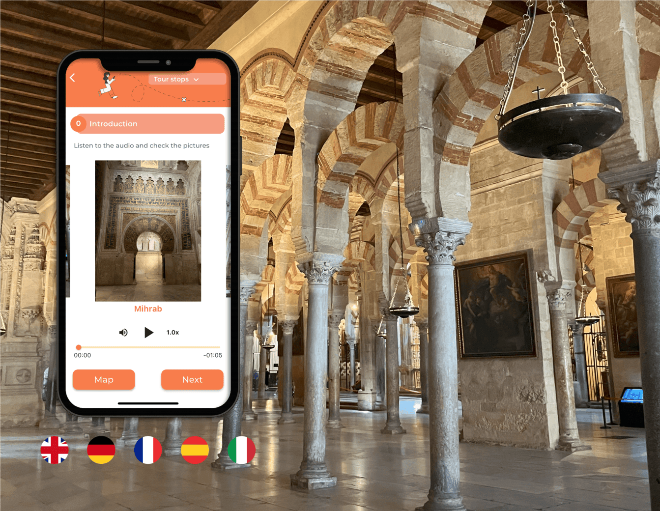
The Mosque-Cathedral of Córdoba, often simply called the Mezquita of Córdoba, is one of the most remarkable historic buildings in Spain. Rows of red-and-white arches stretch through a vast former Islamic prayer hall, an elaborately decorated 10th-century mihrab survives near the qibla wall, and a monumental Christian cathedral rises unexpectedly from the centre of the earlier mosque.
Few European monuments reveal so many architectural layers within a single building. Construction of the original Umayyad mosque began under Abd al-Rahman I in 786. It was enlarged repeatedly as Córdoba grew into one of the great cities of medieval al-Andalus. Following Córdoba’s Christian conquest, the building was consecrated for Catholic worship in 1236. Major Christian additions followed over subsequent centuries, including the Renaissance cathedral transept begun in 1523. :contentReference[oaicite:2]{index=2}
The result is not simply a mosque beside a cathedral. The two histories physically occupy the same enormous structure, which is why walking through the building can feel unlike visiting almost any other religious monument in Europe.
Mosque-Cathedral of Córdoba at a Glance
Visitor Information
Details
Spanish name
Mezquita-Catedral de Córdoba
Location
Historic centre of Córdoba, Andalusia, Spain
Address
Calle Cardenal Herrero 1, 14003 Córdoba
Original mosque
Built 786–788
Christian dedication
1236
Cathedral transept begun
1523
UNESCO World Heritage status
1984
2026 general admission
€15
Bell Tower
€4
Night visit
€25
Children under 10
Free for the standard monument visit
Recommended visit
1½–2 hours
With Bell Tower
Allow 2–2½ hours
Best for
Architecture, Islamic history, Christian art, photography and Spanish history
The official site currently lists general admission at €15, with several reduced and free-entry categories. Opening times are date-specific because the building remains an active cathedral and schedules can change for religious celebrations. :contentReference[oaicite:3]{index=3}
Why the Mosque-Cathedral Is So Important
The building is an exceptional physical record of Córdoba’s long history. Earlier remains on the site include the Visigothic Basilica of San Vicente, while the great mosque that followed became one of the most important architectural expressions of Umayyad rule in al-Andalus. :contentReference[oaicite:4]{index=4}
The original mosque established architectural features that would define the building throughout its Islamic expansions, particularly its rows of columns and distinctive superimposed arches. The official monument history notes influences from Hellenistic, Roman and Visigothic architecture and describes the system as enormously influential in later architectural history. :contentReference[oaicite:5]{index=5}
After 1236, Christian worship adapted the existing building rather than demolishing it. Chapels, a Gothic nave, choir, transept, altarpieces and other Christian elements were gradually inserted into the former mosque. The unusual visual tension between these layers is one of the main reasons the monument is so memorable. :contentReference[oaicite:6]{index=6}
UNESCO World Heritage Site
The Mosque-Cathedral was declared a Spanish National Monument in 1882 and became a UNESCO World Heritage Site in 1984. UNESCO recognition was later incorporated into the wider designation of Córdoba’s historic centre. :contentReference[oaicite:7]{index=7}
Its significance rests not only on its scale or age but also on the extraordinary concentration of Islamic, medieval Christian, Mudéjar, Gothic, Renaissance and Baroque elements found within one continuously used religious complex.
The Original Mosque of Abd al-Rahman I
The first major mosque was constructed between 786 and 788 under Abd al-Rahman I, founder of the independent Umayyad Emirate of Córdoba. Its prayer hall was organised into eleven naves running perpendicular to the qibla wall. :contentReference[oaicite:8]{index=8}
One of its great architectural innovations was the use of two levels of arches. Lower horseshoe arches helped brace the columns while the upper arches increased the height of the roof.
Roman and Visigothic architectural materials were reused in the early mosque, contributing to the remarkable variety of columns and capitals visible throughout the hall. :contentReference[oaicite:9]{index=9}
The Famous Red-and-White Arches
The endless ranks of arches are the image most visitors associate with Córdoba.
From many positions inside the prayer hall, columns and striped arches seem to repeat indefinitely. Walking slowly rather than following the shortest route gives you the best sense of the building’s scale.
The alternating light and dark voussoirs emphasise the rhythm of the arches and make the interior instantly recognisable. The effect is especially impressive where the historic lighting and forest of columns allow one section of the building to disappear into another.
Three Great Islamic Expansions
The mosque expanded several times as Córdoba’s population and political importance increased.
Abd al-Rahman II – 833 to 848
Eight additional sections were added towards the south, extending the prayer hall and enlarging the courtyard. :contentReference[oaicite:10]{index=10}
Al-Hakam II – 962 to 966
This expansion produced some of the most sophisticated Islamic architecture in the monument, including the magnificent maqsura and mihrab. Twelve additional sections extended the building southwards, while decorated domes and skylights created a ceremonial focus near the qibla wall. :contentReference[oaicite:11]{index=11}
Almanzor – 991 to 994
Because the nearby Guadalquivir River prevented another major extension southwards, Almanzor expanded the mosque eastward instead. This created the immense rectangular footprint that helps explain the extraordinary breadth of the prayer hall today. :contentReference[oaicite:12]{index=12}
Do Not Miss the Mihrab
The mihrab is one of the absolute highlights of the visit.
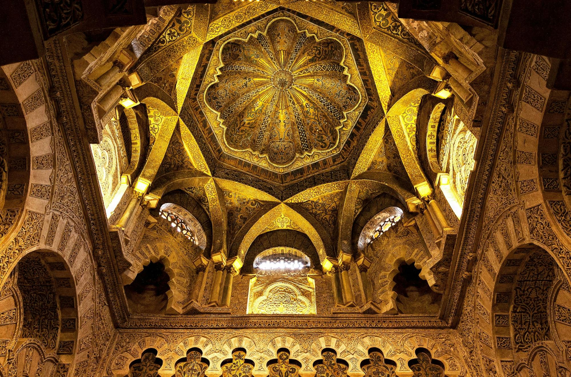
Created during the expansion of Al-Hakam II, it is far more elaborate than a simple wall niche. The structure opens through a horseshoe arch into a small octagonal chamber beneath a shell-like dome. :contentReference[oaicite:13]{index=13}
The entrance is surrounded by extraordinary gold and coloured mosaics, Qur’anic inscriptions, marble and stylised plant decoration. The official monument history attributes the mosaic tradition to craftsmen sent by Byzantine Emperor Nicephorus II. :contentReference[oaicite:14]{index=14}
Many visitors instinctively move towards the cathedral in the centre and only later search for the mihrab. It is better to make a point of finding it rather than accidentally passing through the building without seeing one of its greatest masterpieces.
The Maqsura
The maqsura is the highly decorated area immediately associated with the mihrab.
This part of the mosque was developed during the 10th-century reign of Al-Hakam II and represents the political, cultural and artistic prosperity of the Caliphate of Córdoba. Decorative marble, mosaics, interlacing arches and sophisticated ribbed domes combine to create one of the richest spaces in the entire monument. :contentReference[oaicite:15]{index=15}
Spend time looking upward. Some of the most remarkable architecture is above eye level.
The Cathedral Inside the Mosque
The most dramatic change in atmosphere comes when you reach the Christian cathedral complex inserted into the centre of the former Islamic prayer hall.
The building was dedicated to Catholic worship in 1236, but the large Renaissance intervention began much later. In 1523, Bishop Alonso Manrique ordered work on a new cathedral transept under architect Hernán Ruiz I. :contentReference[oaicite:16]{index=16}
The vertical scale suddenly changes. Instead of low repeating arches extending horizontally through the building, the cathedral rises upward with monumental vaulting, clerestory light, carved choir stalls and a richly decorated high altar.
The Main Chapel and Transept
The Renaissance cathedral occupies the visual centre of the complex.
Even visitors primarily interested in Islamic architecture should take time here, because understanding the Mosque-Cathedral means seeing how later Christian architecture interacted with the earlier building.
The transition is deliberately dramatic: a comparatively low forest of columns gives way to towering stone vaults and a traditional Christian liturgical arrangement.
The Choir Stalls
The cathedral choir contains an extraordinary group of carved wooden stalls created under Pedro Duque Cornejo during the 18th century.
Work began in 1748 and produced an ensemble of upper and lower seating together with an elaborate episcopal throne. The carving includes a large series of religious scenes and decorative imagery. :contentReference[oaicite:17]{index=17}
The contrast between these highly sculptural Baroque furnishings and the geometric Islamic architecture surrounding the cathedral is one of the building’s defining experiences.
Villaviciosa Chapel
The Villaviciosa Chapel occupies another historically important area.
Its Christian architectural history was superimposed on part of the former mosque, and restoration work in the 20th century exposed earlier architectural elements that had been hidden beneath later vaults and altarpieces. :contentReference[oaicite:18]{index=18}
It is worth slowing down here because the space demonstrates how many times parts of the monument have been adapted, covered, uncovered and restored.
The Patio de los Naranjos
Before or after entering the main building, spend time in the Patio de los Naranjos, or Courtyard of the Orange Trees.
During the Islamic period, the courtyard was associated with ritual ablutions before prayer. After the Christian conversion of the complex, it became an important ceremonial courtyard for the cathedral. :contentReference[oaicite:19]{index=19}
Today the courtyard contains rows of orange trees, fountains and views towards the Bell Tower.
It is one of the most pleasant places to pause after the dark interior of the building, particularly outside the hottest part of an Andalusian summer afternoon.
The Bell Tower
The Bell Tower is the tallest structure in Córdoba, reaching approximately 54 metres. Its story reflects the larger monument: the existing Christian tower incorporates remains of the earlier Islamic minaret. :contentReference[oaicite:20]{index=20}
Abd al-Rahman III constructed a major minaret in the 10th century. After the Christian conquest, it became a bell tower. Damage and later reconstruction eventually resulted in the present structure, which envelops surviving parts of the Caliphate minaret. :contentReference[oaicite:21]{index=21}
Should You Climb the Bell Tower?
Yes, if you are physically comfortable with stairs.
The tower provides elevated views across:
The Mosque-Cathedral roof
The Patio de los Naranjos
The historic centre
The Guadalquivir River
The Roman Bridge
The surrounding rooftops of Córdoba
Bell Tower visits currently cost €4 and operate in fixed 30-minute slots with a maximum of 22 visitors per group. :contentReference[oaicite:22]{index=22}
The Bell Tower Is Not Suitable for Everyone
The climb rises approximately 40 metres, roughly equivalent to a 12-storey building, using numerous narrow and relatively steep steps. :contentReference[oaicite:23]{index=23}
For safety reasons, the official rules exclude several visitor groups, including:
Children under 7
Visitors using wheelchairs
People with reduced mobility
Pregnant visitors
People affected by significant vertigo or claustrophobia
People with certain heart or respiratory conditions
Children aged 7–14 must be accompanied by an adult. :contentReference[oaicite:24]{index=24}
Current 2026 Mosque-Cathedral Ticket Prices
As of August 2026, official admission prices are:
Visitor
Current Price
General admission
€15
Over 65 / students 15–26 / Youth Card
€12
Children 10–14
€8
Disability up to 64%
€8
Large-family adult
€8
Large-family child 10–14
€6
Children under 10
Free
Bell Tower
€4
Other free categories include qualifying Córdoba diocesan residents, holders of the Andalucía Junta 65 card, people with disability above 64% together with one companion, and ICOMOS members. Appropriate identification or accreditation may be required. :contentReference[oaicite:25]{index=25}
Can You Visit for Free?
Yes, during a limited early-morning period from Monday to Saturday.
The current official arrangement allows individual visitors to enter free between:
8:30 am and 9:30 am, Monday to Saturday
This does not operate when extraordinary celebrations interfere with the visit. Group visits are not permitted during the free period, entry stops at approximately 9:20 am, and visitors then begin leaving before the normal tourist programme starts. :contentReference[oaicite:26]{index=26}
This is a particularly useful option for travellers on a budget, but it is short. If you want to examine the building carefully, use an audio guide or spend two hours inside, a normal paid visit is more practical.
Current Opening Hours
Opening times vary according to the date and the cathedral’s religious schedule. The official site therefore provides a date-specific calendar rather than one permanent year-round timetable. :contentReference[oaicite:27]{index=27}
For example, on Sunday 16 August 2026, the official schedule lists the Mosque-Cathedral open:
8:30 am–11:30 am
3:00 pm–7:00 pm
Last entry is normally 30 minutes before closing. :contentReference[oaicite:28]{index=28}
Always check the official schedule for the actual day you intend to visit, especially on Sundays, religious feast days and during Holy Week.
Best Time of Day to Visit
Early Morning
Best overall for atmosphere and generally lower crowds.
If visiting Monday to Saturday, the limited free early session can be attractive, although the time available is short.
10:00 am to Noon
This is a convenient mainstream visiting period but can become busy, particularly during major tourism seasons.
Late Afternoon
A later visit can work very well because the building is usually cooler and you can continue directly towards the Roman Bridge for evening light.
How Long Should You Allow?
1 Hour
Possible if you mainly want to see the arches, cathedral and mihrab, but it will feel rushed.
1½ Hours
Good minimum for most visitors.
You can see the principal Islamic and Christian architectural highlights without hurrying excessively.
2 Hours
Best for a first visit.
This gives you time to study the architecture, listen to an audio guide and spend longer around the mihrab and cathedral choir.
2–2½ Hours With Bell Tower
Add at least another 30 minutes for the fixed Bell Tower visit, plus time to reach the tower entrance.
Audio Guides
Audio guides are available from the Patio de San Eulogio Information and Reception Center. The service ends approximately one hour before the monument closes. :contentReference[oaicite:29]{index=29}
The monument also supplies an explanatory map in several languages, including:
Spanish
English
French
German
Italian
Arabic
Japanese
Official guides can also be hired. :contentReference[oaicite:30]{index=30}
Start at the Patio de San Eulogio Visitor Centre
The newer Patio de San Eulogio Information and Reception Center is designed to introduce visitors to the monument before they enter the main historic complex.
It contains information services, exhibition and audiovisual areas, ticket sales, audio-guide collection, a shop and toilets. Entry to the centre is included with the Mosque-Cathedral ticket. :contentReference[oaicite:31]{index=31}
Using it first is worthwhile if you arrive knowing little about the difference between the original mosque, later Islamic enlargements and Christian cathedral additions.
The Soul of Córdoba Night Visit
For a very different experience, the monument operates an audiovisual night visit called The Soul of Córdoba.
Current prices are:
Night Visit
Price
General
€25
Reduced
€18
Children under 7
Free when accompanied by a ticketed adult
The visit lasts approximately one hour and is offered in several languages. During June, July and August, the standard scheduled time slots are normally around 10:00 pm and 11:30 pm, although actual performance dates depend on the monument calendar. :contentReference[oaicite:32]{index=32}
Day Visit or Night Visit?
Choose the Day Visit If You Want:
To examine architectural details closely
More freedom to move at your own pace
To photograph the interior where permitted
To add the Bell Tower
A first introduction to the building
Choose The Soul of Córdoba If You Want:
A more atmospheric presentation
Dramatic lighting
An evening cultural activity
A structured one-hour experience
If the Mosque-Cathedral is one of the main reasons you are visiting Córdoba, the daytime visit is the more important of the two.
Photography Rules
Personal photography is generally possible in the normal tourist areas, but tripods and stands are prohibited. Photography and filming of liturgical celebrations are not allowed. :contentReference[oaicite:33]{index=33}
For the special Soul of Córdoba night programme, photography and filming are prohibited. :contentReference[oaicite:34]{index=34}
The interior is relatively dark, so modern phones with good low-light capability often perform better than attempting to use flash.
Dress Code and Behaviour
The Mosque-Cathedral is not simply a historic attraction; it remains the principal Catholic church of Córdoba.
Visitors are expected to wear appropriate clothing, maintain a respectful tone and observe silence during religious celebrations. :contentReference[oaicite:35]{index=35}
Current rules also state:
Remove hats or caps inside
Do not enter barefoot
Do not remove footwear inside
No food or drink
No smoking
No large bags or packages
No pets except guide dogs
Children must be supervised
These rules reflect the building’s continuing religious use. :contentReference[oaicite:36]{index=36}
Accessibility
The main Mosque-Cathedral visit provides several accessibility services.
Current facilities include:
Accessible entrance through Deanes Gate
Adapted toilets
Wheelchairs available
Guide dogs permitted
Information material for blind visitors
The main monument is therefore considerably more accessible than the Bell Tower. :contentReference[oaicite:37]{index=37}
The tower itself requires a long stair climb and is not accessible to wheelchairs or people with significant mobility limitations. :contentReference[oaicite:38]{index=38}
Visiting With Children
The Mosque-Cathedral can work very well with older children, particularly if they enjoy architecture or history.
Children under 10 currently receive free standard admission. :contentReference[oaicite:39]{index=39}
The arches, enormous scale and changing styles can also be easier for children to appreciate visually than a museum consisting mainly of display cases.
Children under 14 must remain appropriately supervised inside the monument. Children under 7 cannot climb the Bell Tower, while those aged 7–14 need an accompanying adult. :contentReference[oaicite:40]{index=40}
Where Is the Mosque-Cathedral?
The official address is:
Calle Cardenal Herrero 1
14003 Córdoba
Spain
The building stands in the heart of Córdoba’s historic centre, immediately beside the old Jewish Quarter and only a short walk from the Guadalquivir River and Roman Bridge. :contentReference[oaicite:41]{index=41}
Getting There by Bus
The official monument information lists the Puerta del Puente stop as a useful public-transport stop, served by urban bus routes 3 and 12. :contentReference[oaicite:42]{index=42}
If you are already staying in Córdoba’s historic centre, walking is usually easier because many surrounding streets are narrow and pedestrian-oriented.
Getting There From Córdoba Railway Station
Córdoba’s railway station lies outside the historic core.
From the station, you can reach the Mosque-Cathedral by:
Taxi
Local bus
Walking through the city centre
If you arrive on a high-speed train for a Córdoba day trip, allow enough time to walk or transfer into the historic centre before your scheduled monument entry.
Combine the Mosque-Cathedral With the Roman Bridge
The Roman Bridge is one of the easiest attractions to combine with your visit.
The bridge, river, Gate of the Bridge and Mosque-Cathedral together create one of Córdoba’s most famous views. Córdoba Tourism particularly recommends the area around sunset, when the final light illuminates the historic stonework. :contentReference[oaicite:43]{index=43}
The bridge has Roman origins but has been altered substantially through later centuries. Its current appearance reflects many medieval and later interventions. :contentReference[oaicite:44]{index=44}
Explore the Jewish Quarter
The Judería surrounds the Mosque-Cathedral and should not be treated as a separate distant attraction.
This historic Jewish neighbourhood forms part of Córdoba’s UNESCO-listed historic centre. Its narrow streets preserve a street pattern characterised by winding lanes, small squares and occasional dead-end alleys. :contentReference[oaicite:45]{index=45}
Highlights include:
Córdoba Synagogue
Calle Judíos
Small courtyards
Traditional whitewashed streets
Local craft shops
Visit Córdoba Synagogue
The Córdoba Synagogue dates from the 14th century and is one of the city’s most important reminders of medieval Jewish life.
It lies within comfortable walking distance of the Mosque-Cathedral, making the two sites easy to see during the same historic-centre walk. Córdoba’s official tourism service identifies it among the principal monuments of the Judería. :contentReference[oaicite:46]{index=46}
Visit the Alcázar of the Christian Monarchs
The Alcázar de los Reyes Cristianos is another major historic monument close to the Mosque-Cathedral.
The fortified complex developed over Roman and Islamic remains and later became associated with the Christian monarchy. Córdoba Tourism identifies it as one of the city’s essential heritage sites. :contentReference[oaicite:47]{index=47}
The combination of Mosque-Cathedral, Judería, Alcázar and Roman Bridge creates an excellent full day without requiring significant transport.
A Good Half-Day Around the Mosque-Cathedral
9:30 am – Mosque-Cathedral
Spend approximately two hours exploring the monument.
11:30 am – Patio de los Naranjos and Exterior
Walk around the perimeter and inspect the historic doors and tower.
Noon – Judería
Explore the narrow streets around Calle Judíos and the Synagogue area.
1:00 pm – Lunch
Stop in the historic centre for a traditional Córdoba lunch.
Afternoon – Alcázar
Continue towards the nearby Alcázar of the Christian Monarchs.
Late Afternoon – Roman Bridge
Finish beside the Guadalquivir for views back towards the Mosque-Cathedral.
A Good One-Day Córdoba Itinerary
Morning
Mosque-Cathedral
Bell Tower if booked
Judería
Córdoba Synagogue
Lunch
Eat in the historic centre.
Afternoon
Alcázar of the Christian Monarchs
Historic streets and patios
Roman Bridge
Evening
Return towards the Mosque-Cathedral area for dinner or, on an available date, book The Soul of Córdoba night visit.
Where to Stay Near the Mosque-Cathedral
Judería
Best overall area for a first visit.
Staying in the Jewish Quarter places you within easy walking distance of the Mosque-Cathedral, Synagogue, Roman Bridge and Alcázar.
The atmosphere is particularly attractive early in the morning and later in the evening after many day visitors have left.
Around the Mosque-Cathedral
Best for maximum convenience.
Several small hotels and guesthouses sit within only a few minutes’ walk of the monument.
This is ideal if you want an early entrance or a late evening walk around the illuminated historic centre.
Central Córdoba
Best for combining monuments with shopping and restaurants.
Staying slightly north of the Judería provides easier access to modern city facilities while keeping the monument within walking distance.
What to Eat Nearby
Córdoba has several distinctive dishes worth trying after your visit.
Look for:
Salmorejo – thick chilled tomato and bread soup
Flamenquín – rolled pork and ham, breaded and fried
Rabo de toro – slow-cooked oxtail
Berenjenas con miel – fried aubergine traditionally served with a sweet syrup or honey-style topping
A leisurely lunch is especially appealing during the hot middle of the day before returning to outdoor sightseeing later in the afternoon.
Summer Visits
Córdoba can be extremely hot in summer, so the Mosque-Cathedral works especially well as an early-morning activity.
The vast stone interior is generally more comfortable than walking exposed streets during peak afternoon heat.
A practical summer plan is:
Visit the Mosque-Cathedral in the morning
Have a long lunch during the hottest period
Return to sightseeing later in the afternoon
Walk the Roman Bridge around sunset
Do You Need a Guide?
No, but a guide can add considerable value.
The building’s history is complicated, and without explanation it is easy to see only beautiful arches and a cathedral without understanding which ruler built each section.
Visit Independently If:
You prefer moving slowly
You are comfortable using an audio guide
You mainly want architecture and photography
Choose a Guide If:
You want a detailed explanation of Islamic Córdoba
You want help identifying the different expansions
You are interested in religious history
You only have one visit and want to understand the building properly
Official guides can be hired through the monument, and audio-guide services are also available. :contentReference[oaicite:48]{index=48}
What Should You Look For?
If you are visiting without a guide, prioritise these features:
The double red-and-white arches
The oldest section of Abd al-Rahman I
The Al-Hakam II expansion
The maqsura
The mihrab mosaics
Villaviciosa Chapel
The Renaissance cathedral transept
The carved choir stalls
The Patio de los Naranjos
The Bell Tower
Mosque or Cathedral?
Visitors sometimes wonder which name is correct.
Historically, the building was the great mosque of Islamic Córdoba. Since its Christian dedication in 1236, it has functioned as a Catholic church and cathedral. The official name used today is Mosque-Cathedral of Córdoba, reflecting both the surviving Islamic monument and its continuing cathedral function. :contentReference[oaicite:49]{index=49}
Is It Still Used for Worship?
Yes.
The building remains Córdoba’s principal Catholic cathedral and operates regular liturgical celebrations. Tourist access may therefore be interrupted or adjusted around worship and special religious events. :contentReference[oaicite:50]{index=50}
This is why current opening hours should always be checked for the exact date of your visit.
Common Mistakes to Avoid
Rushing Straight to the Cathedral
The Christian cathedral is spectacular, but the mihrab and Al-Hakam II section are equally important.
Missing the Mihrab
It is one of the greatest surviving artistic features of Islamic Córdoba.
Assuming the Bell Tower Is Included
It currently requires a separate €4 ticket. :contentReference[oaicite:51]{index=51}
Assuming Opening Hours Are the Same Every Day
They vary around religious services and special events. :contentReference[oaicite:52]{index=52}
Bringing Large Luggage
Large objects and packages are not allowed inside. :contentReference[oaicite:53]{index=53}
Planning the Bell Tower Without Considering the Stairs
The climb is substantial and access restrictions are strict. :contentReference[oaicite:54]{index=54}
Practical Tips
Allow around two hours for your first visit.
Book the Bell Tower separately if you want panoramic views.
Check the official opening calendar for your exact date.
Visit early in summer to avoid the strongest heat.
Do not miss the mihrab.
Look upward around the maqsura and cathedral crossing.
Use an audio guide or guided tour if the history is important to you.
Dress appropriately because the monument remains a functioning cathedral.
Leave large luggage elsewhere.
Combine the visit with the Judería and Roman Bridge.
Is the Mosque-Cathedral of Córdoba Worth Visiting?
Absolutely. It is the essential monument in Córdoba and one of the most extraordinary buildings in Spain.
The original mosque was begun under Abd al-Rahman I between 786 and 788 and expanded repeatedly as Córdoba became the political and cultural centre of Umayyad al-Andalus. The 10th-century additions of Al-Hakam II produced the magnificent maqsura and mihrab that remain among the building’s greatest masterpieces. :contentReference[oaicite:55]{index=55}
After the building was consecrated for Catholic worship in 1236, successive generations added chapels, a Gothic nave, Renaissance transept, choir and Baroque decoration without completely erasing the earlier mosque. :contentReference[oaicite:56]{index=56}
Current general admission in 2026 is €15, while the Bell Tower costs an additional €4. Children under 10 currently enter the main monument free. :contentReference[oaicite:57]{index=57}
For the strongest experience, allow around two hours, spend time among the arches rather than following the shortest route, study the mihrab and maqsura carefully and then step into the cathedral to see just how dramatically the architecture changes.
Afterwards, walk through the Patio de los Naranjos and continue down towards the Roman Bridge for one of the classic views back towards the monument and the historic skyline of Córdoba. :contentReference[oaicite:58]{index=58}
The Mosque-Cathedral is remarkable not because one culture simply replaced another, but because the architecture allows visitors to see centuries of Córdoba’s history occupying the same space at the same time.
Sponsored Popular Items
Quick take: Musement.com offers a worldwide selection of tours and attractions
Guided tour of Cordòba Mosque-Cathedral without tickets Spain Plan Guided tour of Cordòba Mosque-Cathedral without tickets, a cultural or heritage experience, with practical tips on timing, inclusions and what to check before booking. Compare current availability, prices and booking conditions before you go.
Mosque-Cathedral of Córdoba Ticket and Audio Guide Spain Plan Mosque-Cathedral of Córdoba Ticket and Audio Guide, a cultural or heritage experience, with practical tips on timing, inclusions and what to check before booking. Compare current availability, prices and booking conditions before you go.
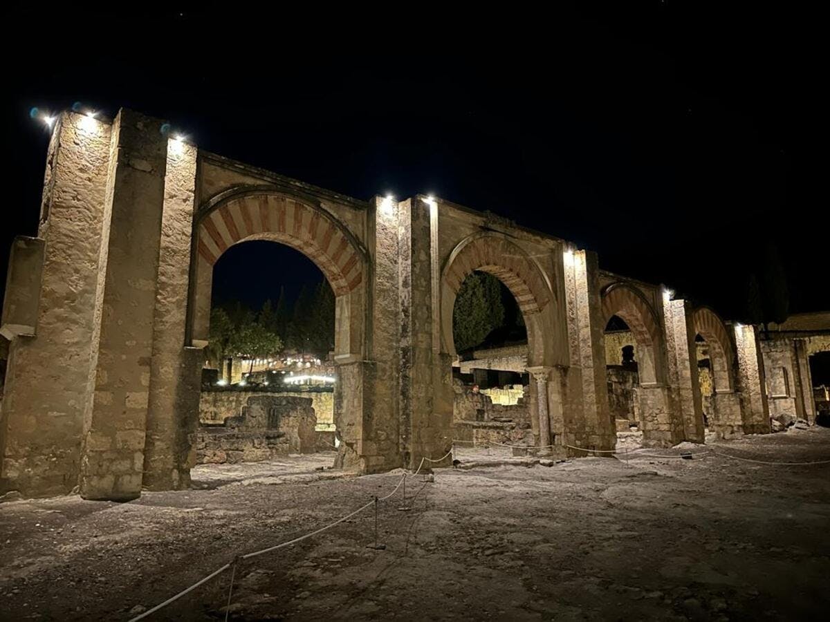
Medina Azahara night tour with transfer from Cordoba Spain Plan Medina Azahara night tour with transfer from Cordoba, a cultural or heritage experience, with practical tips on timing, inclusions and what to check before booking. Compare current availability, prices and booking conditions before you go.
The Pantheon in Rome is one of the best-preserved buildings to survive from the ancient Roman world and one of the most remarkable pieces of architecture anywhere in Italy.
Standing in Piazza della Rotonda in Rome’s historic centre, the Pantheon appears relatively conventional from the front, with an enormous classical portico supported by granite Corinthian columns. Walk through its ancient bronze doors, however, and you enter a vast circular space covered by a concrete dome more than 43 metres across.
At the centre of that dome is the famous oculus, an opening almost nine metres wide that provides the principal source of natural light inside the building.
The Pantheon began as a Roman temple and has functioned as a Christian church since AD 609. That continuous use is one of the main reasons it survived when many other monumental buildings of ancient Rome were dismantled or fell into ruin.
Pantheon Rome at a Glance
Visitor Information
Details
Location
Piazza della Rotonda, Rome
Original temple
Commissioned by Marcus Agrippa in 27 BC
Present building
Mainly reconstructed under Emperor Hadrian between AD 118 and 125
Current use
Basilica of Santa Maria ad Martyres
Dome diameter
Just over 43 metres
Oculus diameter
8.92 metres
2026 adult admission
€7
Reduced admission
€2 for eligible EU citizens aged 18–25
Opening hours
Daily 9:00 am–7:00 pm
Last individual admission
6:30 pm
Recommended visit
45–60 minutes
Best for
Roman history, architecture, art and photography
A Temple That Has Survived for Nearly 2,000 Years
The history of the Pantheon begins in 27 BC, when Marcus Vipsanius Agrippa, an important military commander, statesman and son-in-law of Emperor Augustus, commissioned a temple on the site.
The original building did not survive in its initial form.
The structure seen today is principally the result of a major rebuilding undertaken during the reign of Emperor Hadrian between approximately AD 118 and 125.
Despite Hadrian’s reconstruction, the famous inscription across the front continued to honour Agrippa.
What Does the Inscription Mean?
Across the front of the Pantheon you will see the enormous inscription:
M·AGRIPPA·L·F·COS·TERTIVM·FECIT
It refers to Marcus Agrippa and essentially records that he built the original temple while serving as consul for the third time.
Many first-time visitors therefore understandably assume that the complete building dates from Agrippa’s period. In reality, most of the surviving monument belongs to the later reconstruction under Hadrian.
The Pantheon Became a Christian Church
A crucial moment in the building’s survival came in AD 609.
Byzantine Emperor Phocas gave the Pantheon to Pope Boniface IV, who consecrated it as the Christian church of Santa Maria ad Martyres.
The Pantheon remains a functioning Catholic church today.
This distinguishes it from many of Rome’s other ancient monuments. You are not simply entering an archaeological site; you are visiting a building that has continued to serve a religious function for more than 1,400 years.
The Extraordinary Pantheon Dome
The great dome is the feature that makes the Pantheon an engineering masterpiece.
The internal diameter is just over 43 metres, while the interior height from the floor to the top of the dome is also approximately 43 metres.
The proportions mean that a perfect imaginary sphere could fit within the interior rotunda.
Even after almost two millennia, the dome remains one of the great achievements of Roman concrete construction.
Look Up at the Coffered Ceiling
The interior of the dome is divided into enormous recessed panels known as coffers.
There are five concentric rings containing 28 coffers in each ring.
The coffering provides a striking visual pattern while also reducing the amount of material required within the dome.
As your eyes move upward, the structure appears to become progressively lighter until everything converges on the open circle of the oculus.
The Oculus
The circular opening in the centre of the dome is known as the oculus.
It measures approximately 8.92 metres across.
There is no glass covering it.
The opening is genuinely open to the sky.
Sunlight therefore moves around the walls and floor of the Pantheon as the position of the sun changes throughout the day.
The effect can be extraordinary when a clearly defined beam of sunlight enters through the opening and illuminates part of the interior.
What Happens When It Rains?
Rain comes through the oculus.
The Romans expected this and designed the building accordingly.
The floor contains a drainage system incorporating 22 drainage holes that allows rainwater entering through the dome to escape.
If you happen to visit Rome during rain, seeing water entering an almost 2,000-year-old Roman building through its open roof can actually make the visit more memorable.
Look at the Floor
Do not spend the entire visit looking upward.
The geometric marble floor is an important part of the architecture.
Circles and squares appear repeatedly throughout the interior design, reinforcing the remarkable geometric order of the building.
The coloured stone and marble also provide an impression of how richly decorated monumental Roman interiors could be.
Raphael’s Tomb
The Pantheon is also the burial place of Raphael, one of the greatest artists of the Italian Renaissance.
Raphael died in Rome in 1520 at only 37 years of age and was buried inside the Pantheon.
His tomb is one of the most important features to look for around the edge of the rotunda.
Visitors interested in Renaissance Rome sometimes overlook this because the building itself is so overwhelmingly associated with antiquity.
The Tombs of the Kings of Italy
The Pantheon later became associated with the modern Italian state.
Following Italian unification, it became a memorial location for members of the royal House of Savoy.
Among those buried here are:
Victor Emmanuel II, the first king of a unified Italy
Umberto I
Queen Margherita of Savoy
Their tombs add another historical layer to a building that had already existed for more than 1,600 years before the creation of modern Italy.
The Pantheon Is Still a Church
The official name is the Basilica of Santa Maria ad Martyres.
Religious celebrations continue to take place inside, and opening hours or tourist access can therefore change when services are being held.
Visitors should behave as they would when entering any functioning Catholic church.
Appropriate clothing is required, including covered shoulders and knees.
Current 2026 Pantheon Ticket Price
The standard admission price changed during 2026.
From 1 July 2026, the full adult ticket increased from €5 to:
€7 per person
The standard reduced ticket remains:
€2
The reduced rate applies to eligible European Union citizens between the ages of 18 and 25.
Who Can Enter the Pantheon Free?
Current free-admission categories include:
Visitors under 18
Residents of the Municipality of Rome
Visitors qualifying under other statutory Italian cultural-site exemptions
The Pantheon also participates in Italy’s first Sunday of the month free-admission programme.
On these Sundays, admission is free, but the monument can become particularly busy.
Current Opening Hours
The Pantheon currently opens:
Daily from 9:00 am to 7:00 pm
The ticket office closes at 6:00 pm.
The normal last admission for individual visitors is 6:30 pm.
Opening times may change because of religious services, special events and major holidays.
Should You Book Pantheon Tickets in Advance?
Yes, particularly during busy periods.
The Pantheon is one of the most visited monuments in central Rome, and queues can become substantial.
Advance admission is particularly sensible:
At weekends
During Easter
During summer
During major Rome events
If you have a tightly scheduled sightseeing day
Official tickets can be purchased through the Italian state museum ticketing system.
Be careful when searching online because numerous third-party websites sell Pantheon tickets bundled with audio guides or tours at substantially higher prices than the basic €7 admission charge.
How Long Do You Need at the Pantheon?
30 Minutes
Enough for a quick visit if your time in Rome is limited.
You can see the dome, oculus, main chapels and important tombs without reading everything in detail.
45–60 Minutes
Best for most first-time visitors.
This gives you time to examine the architecture, watch the changing light from the oculus and look properly at Raphael’s tomb and the royal memorials.
More Than One Hour
Worthwhile for visitors with a serious interest in Roman architecture, engineering or church history.
Beyond the Pantheon: A Special 2026 Experience
Visitors during 2026 also have access to a special experience known as Oltre il Pantheon – Beyond the Pantheon.
The route explores previously inaccessible spaces connected with the Basilica of Neptune behind the Pantheon’s rotunda.
The experience incorporates:
Archaeological remains
Historic marble fragments
Frescoes
Architectural reconstructions
3D models
Video mapping
Displays explaining the Roman and Christian phases of the Pantheon
The current programme is scheduled to operate until 31 December 2026, with visits offered in both Italian and English at selected times.
A new internal lift has also made this special route accessible to visitors with mobility difficulties.
Best Time of Day to Visit
Opening Time
Best for avoiding the largest crowds.
Arriving close to 9:00 am also leaves the rest of your day free for nearby attractions.
Late Morning
This can produce beautiful effects as sunlight moves through the oculus, although visitor numbers are normally higher.
Late Afternoon
A late-afternoon visit can work well if you have spent the day exploring central Rome and want to finish around Piazza della Rotonda.
Do not leave your arrival too close to the 6:30 pm last admission.
Visit Piazza della Rotonda
The Pantheon opens directly onto Piazza della Rotonda, one of central Rome’s most atmospheric squares.
In the centre stands the Fontana del Pantheon.
The fountain originated from a 1575 design by Giacomo della Porta and was subsequently modified. An ancient Egyptian obelisk associated with Pharaoh Ramses II was added to the fountain in the early 18th century.
Do not rush immediately into the Pantheon when you arrive.
Stand on the opposite side of the square first and look at the complete façade.
After your visit, return to the square and look back at the building again. Having seen the enormous circular interior, it becomes easier to appreciate how much of the rotunda is hidden behind the apparently conventional classical portico.
Combine the Pantheon With Piazza Navona
Piazza Navona is only a short walk from the Pantheon and makes an ideal next stop.
The piazza occupies the general footprint of the ancient Stadium of Domitian and is now one of Rome’s finest Baroque public spaces.
Its centrepiece is Bernini’s magnificent Fountain of the Four Rivers.
Combining the two attractions provides an excellent contrast between ancient Roman engineering at the Pantheon and the theatrical architecture and sculpture of Baroque Rome at Piazza Navona.
Combine the Pantheon With the Trevi Fountain
The Trevi Fountain is also within easy walking distance through the historic centre.
The route passes through narrow Roman streets filled with churches, cafés, palaces and small piazzas.
Trevi provides another striking contrast with the Pantheon. The Pantheon is dominated by the controlled geometry of ancient Roman architecture, while Trevi is a spectacular Baroque composition of water, sculpture and architecture.
How to Get to the Pantheon
The Pantheon is located at:
Piazza della Rotonda
00186 Rome
Italy
It lies directly within Rome’s historic centre.
There is no Metro station immediately beside the Pantheon, so most visitors reach it by walking or using a combination of public transport and walking.
If you are already sightseeing around Piazza Navona, Trevi Fountain or other central attractions, walking is usually the easiest option.
Driving is generally unnecessary and inconvenient because the surrounding historic streets are narrow and subject to traffic restrictions.
Where to Stay Near the Pantheon
Pantheon and Piazza Navona Area
Best for first-time visitors who want to walk almost everywhere.
Staying around the Pantheon places you within easy walking distance of many of central Rome’s major sights.
The area is particularly enjoyable in the evening, when day-trip crowds begin to decrease and the historic centre becomes more atmospheric.
The disadvantage is price. Accommodation in this extremely central part of Rome can be expensive.
Trevi and Spanish Steps Area
Best for combining sightseeing with shopping and easier access towards Metro Line A.
This area remains close enough to walk to the Pantheon while offering convenient access to other parts of Rome.
For a first visit to Rome, either location provides an excellent central base.
Is the Pantheon Suitable for Children?
Yes.
The Pantheon works surprisingly well with children because the visit does not need to be long.
Rather than expecting them to study every historical detail, draw their attention to:
The enormous dome
The open hole in the roof
Rain entering through the oculus
The ancient columns
The idea that the building has stood here for almost 2,000 years
The architecture itself usually communicates the scale of Roman engineering more effectively than a long explanation.
Accessibility
The main Pantheon visitor experience is at ground level, making it considerably easier to visit than many historic Roman attractions containing extensive staircases.
The newer Beyond the Pantheon route also includes an internal lift specifically intended to improve access for visitors with mobility difficulties.
Photography Inside the Pantheon
The interior is particularly rewarding for photography because the appearance changes throughout the day as light moves through the oculus.
Useful photographic subjects include:
The complete dome and oculus
The geometric marble floor
The Corinthian columns
The bronze entrance doors
The beam of sunlight entering through the dome
The view back towards Piazza della Rotonda
Remember that the Pantheon is an active church, so photography should never interfere with religious services or other visitors.
What Happens at the Pantheon on Pentecost?
One of the Pantheon’s most famous traditions occurs around Pentecost.
Rose petals are released through the enormous oculus and fall through the interior of the church.
The event attracts significant interest and is very different from an ordinary sightseeing visit, so anyone hoping to experience it should check the official religious and visitor arrangements well in advance.
What to Look for Before Leaving
Before walking out, stop near the centre of the rotunda and slowly look around the complete space.
Notice how carefully the architecture balances:
Circle and square
Light and shadow
Heavy concrete and apparently weightless space
Ancient Roman architecture and later Christian decoration
Then look directly upward through the oculus.
That view has remained fundamentally familiar to generations of people for nearly two millennia.
Is the Pantheon Worth Visiting?
Absolutely.
If you visit only a handful of ancient Roman buildings, the Pantheon should be one of them.
The Colosseum impresses through enormous scale and ruin. The Roman Forum requires imagination to reconstruct the city that once surrounded its surviving columns.
The Pantheon is different.
You can actually walk through the monumental entrance and stand inside an enormous Roman interior that remains roofed and in continuous use.
The dome measures more than 43 metres across, the open oculus remains its principal natural light source and the Roman drainage system still deals with rain entering through the roof.
The building also contains layers of later history, from its conversion into a Christian church in AD 609 to the tomb of Raphael and memorials to the kings of modern Italy.
For a first visit, allow approximately 45–60 minutes, book ahead during busy periods and arrive close to opening time if you want a quieter experience.
As of August 2026, standard admission is €7, the Pantheon normally opens daily from 9:00 am until 7:00 pm, and individual visitors can normally enter until 6:30 pm.
Most importantly, spend some time simply standing beneath the dome.
Almost 2,000 years after Hadrian’s architects created it, the Pantheon still has the ability to make visitors wonder how the Romans managed to build something so enormous, precise and enduring.
Sponsored Popular Items
Quick take: Musement.com offers a worldwide selection of tours and attractions
Scala dei Turchi is one of the most distinctive natural landmarks in Sicily. Rising from the Mediterranean coast near Realmonte in the province of Agrigento, the brilliant white cliff forms a series of smooth natural terraces that appear almost like a giant staircase descending into the blue sea.
The contrast is extraordinary: intensely white rock, turquoise water and the deep blue Sicilian sky combine to create one of the most photographed coastal landscapes in southern Italy.
The cliff lies on the coast between Realmonte and Porto Empedocle, making it particularly easy to combine with Agrigento and the famous Valley of the Temples.
Scala dei Turchi at a Glance
Visitor Information
Details
Location
Realmonte, Province of Agrigento, Sicily
Italian meaning
Stair of the Turks
Rock type
White marl containing limestone and clay
2026 controlled-access ticket
€6 per person
Current visiting hours
8:00 am–7:40 pm last entry
Controlled cliff visit
20 minutes
Closest town
Realmonte
Best larger base
Agrigento
Best combined with
Valley of the Temples
Best for
Scenery, photography, beach visits and coastal sightseeing
What Is Scala dei Turchi?
Scala dei Turchi is not a staircase constructed by people.
It is a natural white cliff made predominantly from marl, a relatively soft sedimentary material containing limestone and clay.
Over a very long period, wind, sea spray and waves have eroded the rock into smooth curves and broad horizontal terraces. The result resembles an enormous flight of irregular white steps leading towards the Mediterranean.
The official Sicily tourism authority describes the rock as soft, calcareous and clay-rich, with the sea and salty breeze gradually creating its distinctive rounded terraces.
Why Is It Called the Stair of the Turks?
Scala dei Turchi translates as the Stair of the Turks.
The name is traditionally associated with Arab and Turkish raiders who used this stretch of coastline as a sheltered landing area during periods when Mediterranean pirates attacked settlements along Sicily’s coast.
The smooth stepped shape of the cliff provided a relatively accessible route between the sea and higher ground, leading to the name that survives today.
Can You Walk on Scala dei Turchi?
Yes, but access is now controlled.
This is one of the most important things to know before visiting.
For years, the fragile white marl suffered from erosion, uncontrolled visitor traffic and damage. Access has therefore been regulated to protect the formation.
As of August 2026, the Municipality of Realmonte is allowing controlled pedestrian visits to part of Scala dei Turchi.
The current system requires visitors to reserve their visit in advance.
Current 2026 Scala dei Turchi Ticket
The Municipality of Realmonte currently charges:
€6 per person
Payment is made at the entrance by credit or debit card using the POS payment system.
According to the municipality’s current instructions, reservations are presently made by email rather than through a conventional online ticketing calendar.
Visitors are asked to provide:
Number of people visiting
Date of visit
Preferred or approximate visiting time
The municipality currently lists the reservation email as:
Because access arrangements have changed several times in recent years, check the Municipality of Realmonte’s latest information shortly before travelling.
Current Opening Times
The currently published visiting period is:
Daily from 8:00 am until 7:40 pm last admission.
The controlled visit to the protected section of Scala dei Turchi currently lasts approximately 20 minutes.
This does not mean that your entire visit to the surrounding coastline needs to last only 20 minutes. You can allow additional time for walking, viewpoints and the nearby beach.
Access Can Be Closed at Short Notice
Scala dei Turchi is a fragile natural site, so access depends on weather and safety conditions.
The Municipality of Realmonte can close the protected area because of:
Rain
Weather alerts
Strong winds
Rough seas
Very high temperatures
Recent seismic activity
Other conditions considered unsafe
Current municipal rules specifically allow closure during particularly high temperatures, including conditions above approximately 34–35°C.
This is especially relevant during July and August.
What Shoes Should You Wear?
The white marl is both smooth and fragile.
The current visitor rules recommend footwear with a soft, non-slip sole.
Shoes containing sharp projections or features capable of cutting, scratching or removing the marl should not be worn on the protected formation.
A good pair of comfortable walking shoes or suitable soft-soled footwear is preferable.
Do Not Remove the White Rock
Do not break pieces from the cliff or take marl home as a souvenir.
Removing material or deliberately damaging the formation is prohibited.
The official Visit Sicily tourism authority also warns visitors not to remove fragments of the marl and specifically dismisses claims that the white material has cosmetic or therapeutic properties.
Protecting the surface is particularly important because the softness that makes Scala dei Turchi so beautiful also makes it vulnerable to erosion.
Photography at Scala dei Turchi
Scala dei Turchi is an exceptional photography location.
The most striking feature is the contrast between the white cliff and blue Mediterranean.
For better photographs, consider visiting early in the morning or later in the afternoon rather than under the harshest midday sun.
Late-afternoon light can create subtle shadows along the horizontal layers of the rock, making the natural staircase effect more visible.
Current protection rules also state that photographic and video equipment should not be placed directly onto the marl surface.
Best Time of Day to Visit
Early Morning
One of the best choices.
Temperatures are cooler, particularly during summer, and the coastline generally feels more peaceful.
Late Afternoon
Excellent for photography and softer light.
It can also be more comfortable than visiting during the hottest part of a Sicilian summer day.
Midday
The white cliff can appear spectacular under strong sunshine, but midsummer temperatures can become intense and there is limited natural shade around exposed coastal areas.
Because access can be suspended during extreme heat, early or later visits are generally more sensible during July and August.
How Long Should You Allow?
About 1 Hour
Enough for the controlled cliff visit plus a relatively quick look around the surrounding coastline.
1½–2 Hours
Best for most visitors.
This provides enough time to walk from parking, enjoy the beach area, complete your controlled visit and take photographs.
Half a Day
A good option if you also want time at the beach and a relaxed coastal visit.
How to Get to Scala dei Turchi
Scala dei Turchi lies on Sicily’s southern coast near Realmonte.
The Municipality of Realmonte directs motorists towards Provincial Road SP68 between Realmonte and Porto Empedocle.
This road provides access to parking areas and routes leading down towards the beach and the entrance to the protected cliff area.
Parking at Scala dei Turchi
The Municipality of Realmonte currently identifies several paid car parks along SP68 and additional parking around the end of Discesa Majata.
From the parking areas, visitors continue on foot towards beach access points leading to Scala dei Turchi.
Do not assume you will be able to park immediately beside the cliff.
Allow time to park and walk to the site, particularly during the busy summer season.
Is There a Beach at Scala dei Turchi?
Yes.
There are sandy coastal areas around Scala dei Turchi, and reaching the protected cliff generally involves approaching along the beach.
The combination of beach and unusual white geology makes the area attractive even for visitors who do not enter the controlled section of the formation itself.
Sea conditions vary, so exercise normal caution before swimming and pay attention to local warnings.
Closest Town: Realmonte
Realmonte is the municipality containing Scala dei Turchi and the closest practical town.
It is a convenient choice if your main priority is spending time around the coast.
Accommodation around Realmonte can work particularly well for travellers who want to visit Scala dei Turchi early in the morning or late in the afternoon without travelling back and forth from Agrigento.
Where to Stay: Agrigento or Realmonte?
Realmonte
Best for Scala dei Turchi and the beach.
Choose Realmonte if you want:
Easy access to Scala dei Turchi
A coastal stay
Quieter evenings
More time around nearby beaches
Agrigento
Best overall for first-time visitors.
Agrigento provides a much wider selection of accommodation, restaurants and services and is the obvious base if your itinerary also includes the Valley of the Temples.
The official Sicilian tourism authority specifically promotes Scala dei Turchi as one of the major coastal attractions complementing a visit to Agrigento and its archaeological heritage.
Combine Scala dei Turchi With the Valley of the Temples
The best sightseeing combination in this part of Sicily is undoubtedly:
Valley of the Temples + Scala dei Turchi
The experiences could hardly be more different.
At the Valley of the Temples, you explore one of Sicily’s great archaeological landscapes, filled with remains of ancient Greek temples.
At Scala dei Turchi, the attraction is entirely natural: white marl, sea and erosion.
The two can comfortably form part of the same day if you have a car, although separating them over two days provides a more relaxed experience.
A Good One-Day Agrigento and Scala dei Turchi Itinerary
Morning – Valley of the Temples
Visit the archaeological park before the strongest afternoon heat.
Allow several hours if you want to explore the principal temples properly rather than simply photographing one or two monuments.
Lunch – Agrigento Area
Stop for lunch and take a break during the hotter part of the day.
Late Afternoon – Scala dei Turchi
Drive towards Realmonte and arrive in time for your reserved access period.
Enjoy the coastline and beach before or after entering the protected cliff area.
Early Evening
Stay for the softer late-afternoon light before returning to Agrigento or your coastal accommodation.
Best Time of Year to Visit Scala dei Turchi
April to June
One of the best periods.
The weather is generally warmer without the extreme temperatures that can occur during high summer.
July and August
The busiest and hottest period.
The Mediterranean is attractive for swimming, but temperatures can become very high and access to the protected cliff may be suspended during unsafe heat or weather conditions.
September and October
Another excellent period, particularly if you want warm weather with fewer peak-season crowds.
Winter
The coastline remains beautiful, but swimming conditions and weather are much less predictable.
Because access to the marl depends on weather, wind and sea conditions, check current arrangements before making a special journey.
What to Bring
Soft-soled, non-slip footwear
Sun hat
Sunscreen
Drinking water
Sunglasses
Swimwear if planning a beach visit
Towel
Camera or phone
Credit or debit card for the controlled-access fee
What Not to Do
Do not remove pieces of marl
Do not carve or scratch the rock
Do not place tripods or photographic equipment directly on the marl
Do not ignore barriers or closed areas
Do not attempt to enter during dangerous sea or weather conditions
Do not leave rubbish behind
The cliff is a naturally eroding formation, and protecting it is essential if future visitors are to experience it in anything close to its present form.
Is Scala dei Turchi Suitable for Children?
Families can certainly enjoy the beach and views, but parents should take additional care around the smooth rock, water and steeper areas.
The marl can become slippery, particularly when wet.
Children should remain closely supervised and must follow the same conservation rules as adults.
Is Scala dei Turchi Suitable for Visitors With Limited Mobility?
Scala dei Turchi is a natural coastal formation rather than a fully accessible constructed attraction.
Reaching the protected area involves parking away from the formation and approaching via beach access routes.
Sand, uneven ground and the smooth natural marl can therefore create difficulties for visitors with limited mobility.
If accessibility is important, check the latest conditions with the Municipality of Realmonte before travelling.
Is Scala dei Turchi Worth Visiting?
Yes.
Scala dei Turchi is one of those places where a relatively simple geological feature produces an extraordinary landscape.
There are no ancient ruins, elaborate buildings or man-made monuments.
Instead, the attraction is the combination of brilliant white marl, naturally sculpted terraces and the intensely blue Mediterranean Sea.
Its location also makes it particularly easy to include in an Agrigento itinerary.
Spend the morning among ancient Greek temples and the late afternoon beside one of Sicily’s most unusual natural formations.
Just remember that visiting Scala dei Turchi is different in 2026 from the uncontrolled experience shown in many older photographs and travel articles.
Access to the protected cliff is currently controlled, reservations are required, the entrance fee is €6 per person and the permitted visit lasts approximately 20 minutes. Weather, extreme heat and sea conditions can also cause temporary closures.
Plan ahead, wear suitable soft-soled footwear, respect the barriers and never remove any of the white marl.
For most travellers, the best approach is to combine Scala dei Turchi with the Valley of the Temples, stay in either Agrigento or Realmonte, and visit the coast in the cooler early morning or late afternoon.
Handled that way, Scala dei Turchi can be one of the most memorable natural stops on a journey through southern Sicily.
Sponsored Popular Items
Quick take: Musement.com offers a worldwide selection of tours and attractions
Valley of the Temples & Scala dei Turchi Full-Day Tour Agrigento Italy Full-day Valley of the Temples and Scala dei Turchi tour is a convenient way to add structure, local context and purposeful sightseeing to the itinerary. Check current availability, inclusions and booking details before you go.
Few buildings explain Venice as well as the Doge’s Palace (Palazzo Ducale).
Standing beside St Mark’s Basilica on the edge of the Venetian Lagoon, the palace is one of Venice’s most recognisable landmarks. Its pale patterned stone, Gothic arches and waterfront position make it beautiful from the outside, but the real experience begins once you step inside.
For centuries, Doge’s Palace was the political and administrative heart of the Venetian Republic. The Doge lived here, but the building also contained government chambers, courts, administrative offices, an armoury and prisons.
A normal visit takes you through lavish state rooms decorated by some of Venice’s greatest artists, the enormous Hall of the Great Council, the historic armoury, the famous Bridge of Sighs and the former prison complex.
For most visitors, allow around 2½ to 3 hours. History and art enthusiasts could easily spend longer.
Doge’s Palace at a Glance
Visitor Information
Details
Italian name
Palazzo Ducale
Location
Piazza San Marco, Venice
Origins
9th century
Architectural style
Venetian Gothic with later Renaissance additions
Recommended visit
2½–3 hours
Nearest useful vaporetto stop
San Zaccaria
Best for
Venetian history, architecture, art and photography
What Was a Doge?
Venice did not have a conventional hereditary king.
The Doge was the highest-ranking figure in the Venetian Republic and was elected for life through an elaborate political process.
Although the Doge became the symbolic leader of Venice, his powers were restricted by a complicated system of councils and laws designed to prevent one person from gaining absolute control.
This is important when visiting Doge’s Palace because much of the enormous building was not the Doge’s private home.
The palace functioned as a combination of:
Royal residence
Government headquarters
Parliament
Law courts
Security administration
Armoury
Prison
Prisoners could literally be sentenced in rooms inside the palace and then walk across the Bridge of Sighs into their cells.
More Than 1,000 Years of History
The origins of Doge’s Palace date back to the 9th century, although the building visitors see today developed over many centuries.
Major rebuilding during the 14th and 15th centuries created much of the magnificent Venetian Gothic exterior that faces St Mark’s Basin and the Piazzetta.
A major fire in 1483 resulted in further reconstruction and the introduction of important Renaissance elements.
Additional fires in 1574 and 1577 damaged sections of the palace, although its established appearance was largely preserved during reconstruction.
The Venetian Republic finally came to an end in 1797 following Napoleon Bonaparte’s advance into northern Italy. The last Doge, Ludovico Manin, abdicated that year.
Look at the Exterior Before Going Inside
Before entering, spend a few minutes walking around the palace.
The façade is unusual because it seems to reverse normal architectural expectations.
The lower levels are light and open, supported by rows of elegant Gothic arches and columns. Above them sits an enormous wall of patterned stone.
Despite the size of the building, the design makes the palace appear surprisingly light.
Walk around both principal façades.
The Piazzetta façade faces St Mark’s Campanile and the Marciana Library.
The lagoon façade faces St Mark’s Basin.
The waterfront side is particularly beautiful early in the morning.
The Palace Courtyard
Once inside, visitors enter the large central courtyard.
The atmosphere changes immediately from the open waterfront outside to a grand enclosed ceremonial space surrounded by arcades and ornate façades.
One of the most important features is the Giants’ Staircase, which became associated with the ceremonial installation of Venice’s Doges.
The palace was designed not only to function as a centre of government but also to impress ambassadors, foreign dignitaries and citizens.
The Golden Staircase
The magnificent Scala d’Oro, or Golden Staircase, leads visitors towards the palace’s great state rooms.
Its elaborate gilded decoration provides a taste of the extraordinary interiors ahead.
Throughout Doge’s Palace, remember to look upwards. Some of the most impressive paintings and decorative details are found on the ceilings.
The Doge’s Apartments
The Doge maintained private apartments inside the palace, although they are less extravagant than many visitors expect.
This reflects the unusual political position of Venice’s leader.
The palace belonged to the Venetian Republic rather than to the Doge personally. When a Doge died, his family had to remove its belongings so that the newly elected Doge could occupy the rooms.
The Great Government Chambers
Much of the visitor route passes through rooms once used by the institutions that governed Venice.
These included chambers associated with:
The Senate
The Great Council
The Council of Ten
The Councils of Forty
State advocates
Judicial magistrates
The decoration was highly political.
Paintings and sculptures celebrated ideas including justice, peace, good government and the power of the Venetian state.
Major Venetian artists represented throughout the palace include Tintoretto and Paolo Veronese.
The Council of Ten
One of Venice’s most intriguing political institutions was the Council of Ten.
Originally created following a conspiracy against the state, the council became closely associated with security, intelligence and politically sensitive investigations.
Its rooms form part of the judicial section of the palace.
This darker side of Venetian political history becomes particularly interesting when combined with the prison areas later in the visit.
The Hall of the Great Council
One of the highlights of Doge’s Palace is the enormous Sala del Maggior Consiglio, or Hall of the Great Council.
The room is approximately 53 metres long and 25 metres wide and once accommodated huge gatherings of Venice’s ruling patrician class.
The scale is difficult to appreciate until you stand inside.
There are almost no internal columns interrupting the enormous space. Paintings cover the walls, while the ceiling is filled with gilded decoration.
The entire room was designed to demonstrate the wealth, confidence and political power of Venice.
Tintoretto’s Paradise
At one end of the Great Council Hall is one of the palace’s most famous paintings: Tintoretto’s Paradise.
The enormous canvas was produced by Jacopo Tintoretto and his workshop following the rebuilding and redecoration required after the palace fire of 1577.
Stand close enough to examine some of the extraordinary number of figures within the painting, but then move farther back.
The work is most impressive when seen as part of the entire ceremonial hall.
Look for the Missing Doge
Around the upper walls of the Great Council Hall is a sequence of portraits representing the Doges of Venice.
One position is noticeably different.
The portrait of Marino Faliero, a 14th-century Doge executed after being accused of plotting against the Republic, was replaced by a black painted area.
It provides a powerful reminder that even the Doge was considered subordinate to the Venetian state.
The Armoury
The normal visitor route includes the historic Armoury.
Its collection contains more than 2,000 weapons and military objects, including:
Suits of armour
Swords
Halberds
Crossbows
Firearms
Turkish weapons
The collection helps demonstrate that Doge’s Palace was a genuine centre of government and state power rather than simply an ornate royal residence.
The Bridge of Sighs
One of the most memorable parts of the visit comes when the luxurious palace interiors gradually give way to narrow corridors.
You then reach the famous Bridge of Sighs.
The enclosed bridge was built in the early 17th century to connect Doge’s Palace with the New Prisons on the opposite side of the canal.
Visitors can actually walk through the Bridge of Sighs.
Small stone openings offer restricted views of the lagoon and Venice outside.
The romantic name became popular much later and refers to the imagined sighs of prisoners taking a final look at Venice as they passed from the courts towards imprisonment.
Despite its romantic reputation today, the bridge’s original purpose was anything but romantic.
The New Prisons
After crossing the Bridge of Sighs, visitors enter the former New Prisons.
The atmosphere is dramatically different from the palace.
Only minutes earlier you may have been standing beneath gilded ceilings and enormous paintings. Now you are walking along confined corridors and looking into prison cells.
This contrast between ceremonial splendour and imprisonment is one of the most powerful aspects of the entire visit.
The Secret Itineraries Tour
Visitors who are particularly interested in Venetian political intrigue should consider the separate Secret Itineraries Tour.
This guided route enters parts of the palace that are not normally accessible on the standard visit.
It includes areas associated with confidential government administration, justice and imprisonment.
Highlights may include:
The old Pozzi prison cells
Secret government offices
Interrogation rooms
The Secret Chancellery
The Piombi roof-level prison cells
The Piombi are particularly famous because the Venetian adventurer and writer Giacomo Casanova was imprisoned there.
The tour is especially worthwhile for visitors who want to understand the darker side of the Venetian Republic.
Who Should Avoid the Secret Itineraries Tour?
The route contains narrow stairways and confined historic spaces.
It may not be suitable for visitors with:
Mobility difficulties
Severe claustrophobia
Vertigo
Certain respiratory or cardiovascular conditions
Check the official access requirements before booking.
The Doge’s Hidden Treasures
Another specialist guided option explores more private sections of the Doge’s residence.
The route can include areas around the Doge’s private chapel, treasury and other spaces not normally included in the standard visitor route.
This is a better choice than the Secret Itineraries Tour for visitors more interested in royal life, art and architecture than prisons and political investigations.
How Long Should You Spend at Doge’s Palace?
1½ Hours
Possible, but rushed. You would need to move relatively quickly through the principal rooms and prisons.
2½–3 Hours
The best amount of time for most first-time visitors.
This gives you enough time to appreciate the state rooms, Great Council Hall, armoury, Bridge of Sighs and prisons.
3–4 Hours
Ideal for visitors with a strong interest in art, architecture or Venetian history.
Secret Itineraries Plus Palace
Allow at least 3–4 hours in total.
Best Time to Visit
Early Morning
The best choice for most visitors is to enter close to opening time.
Advantages include:
Fewer visitors initially
Quieter state rooms
Cooler temperatures in summer
More time for St Mark’s Basilica afterwards
Evening
During periods when evening opening is offered, a later visit can be especially atmospheric.
It also allows you to use your daylight hours for exploring outdoor Venice.
Accessibility
Much of the main palace visitor route is accessible, although some historic sections are not.
The prisons, armoury and some specialist itineraries may involve stairs and restricted spaces.
Visitors with specific mobility requirements should check the current official accessibility information before travelling.
Do Not Bring Large Luggage
Doge’s Palace is not suitable for visiting with large suitcases or bulky travel bags.
If you are visiting after checking out of a hotel or before travelling to Venice Santa Lucia railway station, leave your luggage at your hotel or an authorised luggage-storage facility first.
How to Reach Doge’s Palace
Doge’s Palace is located beside Piazza San Marco in central Venice.
There are no roads leading directly to the palace.
You either arrive on foot or by boat.
From Venice Santa Lucia Railway Station
One of the most scenic options is to take a vaporetto along the Grand Canal towards the St Mark’s area.
Although slower than some alternative routes, it provides an excellent first introduction to Venice.
San Zaccaria Vaporetto Stop
San Zaccaria is one of the most convenient stops for Doge’s Palace.
From there it is a short waterfront walk along Riva degli Schiavoni.
St Mark’s Basilica
St Mark’s Basilica stands immediately beside Doge’s Palace.
The two attractions are closely connected historically.
Doge’s Palace represented the political power of Venice, while St Mark’s represented its religious and ceremonial identity.
A good first-time itinerary is:
Morning: Doge’s Palace
Late morning or early afternoon: St Mark’s Basilica
Afterwards: St Mark’s Campanile and Piazza San Marco
St Mark’s Campanile
The Campanile di San Marco stands directly across the Piazzetta.
The view from the top provides an excellent understanding of Venice’s geography and the surrounding lagoon.
On a clear day, it is one of the best viewpoints in the city.
Museo Correr
Many Doge’s Palace tickets also include access to Museo Correr on the opposite side of Piazza San Marco.
The museum explores the history, culture and art of Venice and can provide useful additional context after visiting the palace.
However, do not feel that you need to visit immediately after spending three hours inside Doge’s Palace.
Museum fatigue can quickly reduce your enjoyment.
Walk Along Riva degli Schiavoni
After leaving the palace, turn towards the lagoon and walk east along Riva degli Schiavoni.
You will pass the classic exterior viewpoint of the Bridge of Sighs.
Even though you have already crossed the bridge from inside, seeing it from the canal is worthwhile.
Continue along the waterfront for excellent views towards San Giorgio Maggiore and the Venetian Lagoon.
Walk to Rialto Bridge
From Piazza San Marco, Rialto Bridge is an enjoyable walk through central Venice.
There is no need to obsess over finding the shortest route.
Part of the pleasure of Venice is wandering through narrow lanes, across small bridges and beside quiet canals.
A good sequence is:
Doge’s Palace → St Mark’s Basilica → Piazza San Marco → Rialto Bridge → Grand Canal
A Good Half-Day Doge’s Palace Itinerary
8:30 am – Arrive at Piazza San Marco
Enjoy the square before the largest daytime crowds arrive.
9:00 am – Enter Doge’s Palace
Begin with the courtyard and work through the state apartments.
9:00 am–11:30 am – Explore the Palace
See the government chambers, Great Council Hall, armoury, Bridge of Sighs and prisons.
11:30 am – Bridge of Sighs Viewpoint
Walk outside to see the bridge you have just crossed.
Late Morning – St Mark’s Basilica
Continue to the basilica if you have booked a suitable admission time.
Lunch
Consider walking a few streets away from Piazza San Marco before choosing a restaurant. Prices and quality can improve once you move away from the busiest tourist frontage.
Where to Stay Near Doge’s Palace
San Marco
Best for first-time visitors who want Venice’s major landmarks on the doorstep.
You can walk easily to:
Doge’s Palace
St Mark’s Basilica
St Mark’s Campanile
Teatro La Fenice
Rialto Bridge
The main disadvantage is that San Marco is one of Venice’s busiest and usually more expensive districts.
The major advantage is being able to explore Piazza San Marco early in the morning and after many day visitors have left.
Castello
One of the best nearby alternatives.
Castello begins immediately east of Doge’s Palace.
The western section keeps you within easy walking distance of St Mark’s while becoming quieter as you move farther east.
Cannaregio
Best for a more residential Venetian atmosphere.
Cannaregio offers canals, restaurants and easier access to Venice Santa Lucia railway station.
It is farther from Doge’s Palace but remains a good choice for travellers wanting a less intensely tourist-oriented neighbourhood.
Dorsoduro
Best for art and quieter evenings.
Dorsoduro is home to attractions including the Peggy Guggenheim Collection and Gallerie dell’Accademia.
You can reach Doge’s Palace by walking or vaporetto.
Mestre
Best mainly for budget-conscious travellers.
Mestre is on the mainland rather than within historic Venice.
Accommodation may be cheaper, but you will need to travel into Venice each day.
For a short first trip, staying within Venice itself is usually worth the extra expense if your budget permits.
Doge’s Palace or St Mark’s Basilica?
Ideally, visit both.
Choose Doge’s Palace if you are most interested in:
Venetian history
Government and politics
Tintoretto and Veronese
Grand palace interiors
Bridge of Sighs
Historic prisons
Architecture
Choose St Mark’s Basilica if you are most interested in:
Byzantine mosaics
Church architecture
Religious history
Medieval art
Sacred treasures
If forced to choose only one for a broad historical experience, Doge’s Palace tells a more complete story about how Venice functioned as a powerful independent state.
Is Doge’s Palace Worth Visiting?
Absolutely.
Seeing the exterior from Piazza San Marco is not enough.
The real attraction is the progression through the building.
You begin in elegant courtyards and climb into richly decorated government chambers. You stand inside the enormous Hall of the Great Council beneath gilded ceilings and Tintoretto’s vast Paradise. You pass through a collection of historic weapons before entering increasingly narrow corridors.
Then you walk through the Bridge of Sighs and into the prisons.
That transition from splendour to confinement tells the story of Venetian power better than almost any single exhibit could.
For the best experience, book ahead, visit early, allow at least 2½ to 3 hours and do not skip the prison section.
If Venetian political intrigue particularly interests you, consider booking the Secret Itineraries Tour.
After leaving the palace, walk a few metres to the Ponte della Paglia and look back at the Bridge of Sighs from outside.
You will have just walked through one of Venice’s most famous landmarks—and it will suddenly mean considerably more than it did before you entered the palace.
Sponsored Popular Items
Quick take: Musement.com offers a worldwide selection of tours and attractions
Shared Gondola Ride Underneath the Bridge of Sighs - Scenic Water Experience Italy Seeing the destination from a boat or waterside route can change the perspective, and Shared gondola ride underneath the Bridge of Sighs is designed around that contrast. Check current availability, inclusions and booking details before you go.
Cologne’s Old Town, known locally as the Altstadt, occupies the historic centre between Cologne Cathedral and the River Rhine. Its colourful gabled houses, cobbled lanes, busy squares and traditional brewery pubs create the impression of a compact medieval quarter, but the area tells a much more complicated story.
Cologne began as an important Roman settlement, grew into one of medieval Europe’s wealthiest commercial cities and suffered enormous destruction during the Second World War. Much of the Old Town visitors see today was carefully rebuilt, restored or reimagined during the post-war decades.
Sponsored Popular Items
Quick take: Musement.com offers a worldwide selection of tours and attractions
Cologne Under Dark Magic City Exploration Game Germany Plan Cologne Under Dark Magic City Exploration Game, a self-guided game or exploration experience, with practical tips on timing, inclusions and what to check before booking. Compare current availability, prices and booking conditions before you go.
The result is not a perfectly preserved medieval town. Instead, it is a lively urban neighbourhood where Roman archaeology, Romanesque churches, Gothic architecture, modern museums, restaurants and riverfront promenades sit within a few minutes’ walk of one another.
Cologne Old Town Quick Facts
Local name
Altstadt Köln
Location
Between Cologne Cathedral, the historic city centre and the Rhine
Nearest station
Köln Hauptbahnhof, Cologne Central Station
Best known for
Cologne Cathedral, Alter Markt, Great St Martin Church, brewery houses and the Rhine promenade
Suggested visit
Half a day for the main sights or a full day with museums
Walking difficulty
Generally easy, although some streets have cobbles and uneven surfaces
Admission
The Old Town itself is free to explore; individual attractions may charge admission
Best for
History, architecture, local food, photography and riverside walks
Why Visit Cologne’s Old Town?
The main advantage of Cologne’s Old Town is how much can be seen within a relatively small area. A visitor can step out of the central railway station, stand beneath one of Europe’s most important Gothic cathedrals, walk past Roman remains, enter a modern art museum and reach the Rhine in less than half an hour.
The Altstadt is also one of the best places to experience Cologne’s social character. Traditional brewery houses are not simply tourist attractions. They remain busy meeting places where residents drink Kölsch beer, eat regional dishes and share long tables with strangers.
Although the Old Town can become crowded, particularly around the cathedral and riverfront, quieter lanes and courtyards can still be found behind the major squares. The district rewards visitors who walk slowly and look for small details such as fountains, sculptures, medieval street names and unusual figures attached to buildings.
A Short History of Cologne’s Old Town
Roman Cologne
Cologne’s history stretches back more than 2,000 years. The Roman city was known as Colonia Claudia Ara Agrippinensium and became an important administrative and commercial centre on the Rhine.
The outline of the Roman settlement still influences the modern city centre. Sections of walls, roads, gates, drainage systems and building foundations survive beneath or between later structures.
Visitors should not expect a separate Roman district. Instead, traces appear throughout the Old Town, sometimes below modern buildings and sometimes incorporated into museums or archaeological sites.
Medieval wealth and religious power
During the Middle Ages, Cologne became a major centre of trade, pilgrimage and church authority. Merchants used the Rhine to move goods through northern Europe, while pilgrims arrived to visit religious shrines and important churches.
The city’s medieval importance is reflected in its churches, guild traditions, market squares and historic town hall. Construction of Cologne Cathedral began in 1248, although the immense building was not completed until 1880.
War damage and reconstruction
Cologne suffered extensive destruction during the Second World War. Much of the central city was reduced to ruins, including large parts of the historic quarter.
The colourful houses and apparently old streets beside the Rhine should therefore be understood as part of a major reconstruction effort. Some buildings were restored using surviving elements, while others were rebuilt in simplified or historically inspired forms.
This history does not make the Altstadt less interesting. It adds another layer to the area, revealing how Cologne chose to preserve a sense of continuity while rebuilding as a modern city.
Best Things to See and Do in Cologne’s Old Town
Cologne Cathedral
Cologne Cathedral, or Kölner Dom, dominates the city centre with its twin Gothic towers. Construction began in 1248 and was completed in 1880, with later builders continuing the original medieval design.
Inside, visitors can see soaring vaulted ceilings, medieval stained glass, carved choir stalls and the Shrine of the Three Kings. The cathedral was added to the UNESCO World Heritage List in 1996.
The cathedral remains an active place of worship, and religious services take priority over sightseeing. Visitor hours can change for ceremonies, security requirements and special events.
From 1 July 2026, tourist visits to the cathedral require a visitor ticket. Entry for services, personal prayer or lighting a candle remains separate from tourist admission arrangements.
The cathedral tower can also be climbed, but the route involves more than 500 steps and tight spiral staircases. The viewing platform provides wide views over the Rhine, railway station and city rooftops.
Roncalliplatz and the Cathedral Precinct
Roncalliplatz is the broad pedestrian space beside the cathedral. It acts as a natural starting point for exploring the Old Town and provides access to several museums and archaeological features.
The square is often busy with guided groups, performers and commuters. Early morning is generally the best time to appreciate the cathedral exterior without the largest crowds.
Alter Markt
Alter Markt is one of the traditional centres of the Old Town. The large pedestrian square is surrounded by restaurants, brewery houses and reconstructed historic façades.
At its centre stands the Jan von Werth Fountain, which commemorates a seventeenth-century cavalry commander associated with a popular Cologne love story.
The square is especially lively during Cologne Carnival and the Christmas season. At quieter times, it is a convenient place to pause between the cathedral, town hall and riverfront.
Cologne’s Historic Town Hall
Cologne’s Rathaus has a building history extending across roughly 800 years and is regarded as Germany’s oldest documented town hall.
Its most distinctive features include a Gothic tower, Renaissance loggia, carillon and a façade decorated with sculptures representing rulers, saints, artists and figures from Cologne’s history.
Look for the Platzjabbeck beneath the tower clock. This carved wooden head opens its mouth and sticks out its tongue when the clock sounds.
Fischmarkt
The Fischmarkt is one of the most photographed parts of Cologne. A row of narrow, brightly coloured gabled houses stands in front of Great St Martin Church, creating the classic Old Town view seen on postcards and travel brochures.
The houses are reconstructed rather than untouched medieval survivors, but the square remains atmospheric, particularly in the morning and early evening.
The Rhine is only steps away, and outdoor tables make this a popular place for coffee, drinks and meals during warmer weather.
Great St Martin Church
Great St Martin, or Groß St Martin, is one of Cologne’s twelve major Romanesque churches. Its broad central tower and four corner turrets form one of the most recognisable elements of the city skyline.
The visible church was largely developed from the twelfth to the thirteenth centuries, although the site has a much older history. Roman warehouses and other structures once occupied the area, which originally stood on an island beside the Rhine.
Archaeological remains beneath the church reveal parts of these Roman foundations. Opening arrangements for the church and excavations can vary around worship services.
The Rhine Promenade
The Rhine promenade provides a pleasant contrast to the enclosed lanes of the Old Town. The broad riverside route passes excursion boats, restaurant terraces, green spaces and views towards Deutz on the opposite bank.
Walking south leads towards the Chocolate Museum and Rheinauhafen, while walking north leads towards the Hohenzollern Bridge and areas beyond the main Old Town.
River cruises depart from several landing stages near the historic centre. Short sightseeing cruises are useful for understanding Cologne’s position on the Rhine and viewing the skyline from the water.
Hohenzollern Bridge
The Hohenzollern Bridge carries trains and pedestrians across the Rhine beside Cologne Central Station. Its rail traffic, cathedral views and vast collection of padlocks make it one of the city’s best-known modern landmarks.
Walking across the bridge leads to the Deutz riverbank and Rhine Boulevard. From there, visitors can look back towards the cathedral, Great St Martin Church and the Old Town skyline.
The opposite bank is particularly attractive around sunset, when the cathedral and waterfront buildings begin to light up.
Tünnes and Schäl
Tünnes and Schäl are two traditional comic characters associated with Cologne’s Hänneschen puppet theatre. Their bronze statues can be found in the Old Town near Great St Martin Church.
Tünnes represents a good-natured, rustic personality, while Schäl is portrayed as shrewder and more calculating. Together, they reflect Cologne’s fondness for humour, satire and self-mockery.
Visitors often rub Tünnes’ bronze nose for luck, which explains its polished appearance.
Heinzelmännchen Fountain
The Heinzelmännchen Fountain depicts the legendary household spirits said to have completed the city’s work while residents slept.
According to the story, the helpful spirits disappeared after a tailor’s curious wife tried to see them by scattering peas across the floor. The tale remains part of Cologne’s popular folklore and gives its name to a major Old Town Christmas market.
Farina Fragrance Museum
Cologne gave its name to eau de Cologne, and the Farina Fragrance Museum tells the story of one of the city’s best-known perfume traditions.
The museum is located opposite the town hall in the house associated with perfumer Johann Maria Farina. Visits are generally conducted as guided tours, so booking ahead is sensible.
A Self-Guided Cologne Old Town Walking Route
This compact route covers the principal Old Town sights. Allow about three hours for the walk itself or most of a day when entering the cathedral, churches and museums.
Begin at Cologne Cathedral: Walk around the exterior before entering, paying attention to the contrast between the dark stone façade and the open modern square.
Cross Roncalliplatz: Look for the museum buildings and surviving traces of Roman Cologne around the cathedral precinct.
Walk to the historic town hall: Examine the Renaissance loggia, Gothic tower and sculpted figures.
Continue into Alter Markt: See the Jan von Werth Fountain and the traditional brewery houses surrounding the square.
Find the Tünnes and Schäl statues: Continue through the narrow lanes behind the market.
Visit Great St Martin Church: Explore the church when open and look for information about its Roman foundations.
Stop at Fischmarkt: Photograph the colourful houses with the church tower rising behind them.
Walk along the Rhine promenade: Follow the river north towards the Hohenzollern Bridge.
Cross the bridge to Deutz: Finish at the Rhine Boulevard for a panoramic view back towards the Old Town.
Visitors with more time can extend the route south along the river to the Chocolate Museum and the modern Rheinauhafen district.
Brewery Houses, Kölsch and Local Food
Eating or drinking in a traditional brewery house is one of the defining Old Town experiences. These establishments are known as Brauhäuser and generally combine beer hall traditions with hearty regional cooking.
Understanding Kölsch beer service
Kölsch is normally served in a narrow 0.2-litre glass called a Stange. A traditional waiter, known as a Köbes, carries multiple glasses in a circular tray called a Kranz.
In many brewery houses, another glass may arrive automatically once the previous one is empty. The waiter records each serving with a mark on the beer coaster.
To indicate that you have finished, place the coaster on top of the glass. Simply leaving an empty glass on the table may be interpreted as a request for another beer.
Traditional dishes to try
Himmel un Ääd: Mashed potato and apple, often served with blood sausage and onions.
Halver Hahn: Despite the name, this is not half a chicken. It is a rye roll served with aged cheese, mustard and onions.
Rheinischer Sauerbraten: Marinated pot roast, traditionally served with a sweet-and-sour sauce.
Haxe: Roasted or grilled pork knuckle, usually accompanied by potatoes or cabbage.
Reibekuchen: Fried potato pancakes, often served with apple sauce.
Well-known brewery houses around the Old Town include Früh am Dom, Brauhaus Sion and Peters Brauhaus. Popular locations can become extremely busy at weekends, during trade fairs and around Carnival.
Museums in and Near the Old Town
Museum Ludwig
Museum Ludwig stands beside the cathedral and focuses on modern and contemporary art. Its collection includes important works of Pop Art, German Expressionism, photography and Picasso.
It is an excellent choice for visitors who want a contrast to the historic buildings of the Old Town.
Wallraf-Richartz Museum
The Wallraf-Richartz Museum houses European paintings from the medieval period through to the nineteenth century, including significant works from the Cologne school.
The museum is scheduled to close from 3 August 2026 for an approximately two-year renovation. Travellers visiting after this date should check whether exhibitions have been relocated or temporarily suspended.
Romano-Germanic Museum
The main Romano-Germanic Museum beside the cathedral is currently closed for major renovation.
Selected archaeological objects are being shown in an interim exhibition at the Belgian House on Cäcilienstraße, near Neumarkt. Visitors should not assume that the familiar cathedral-side museum building is open.
Cologne City Museum
The Cologne City Museum explores the city’s political, social and cultural history. It is useful for understanding how Roman, medieval, Prussian, wartime and post-war Cologne connect.
Chocolate Museum
The Chocolate Museum stands south of the traditional Old Town beside the Rhine. Exhibits examine cocoa cultivation, industrial production and the cultural history of chocolate.
It is especially popular with families and is easily combined with a riverfront walk.
How Long to Spend in Cologne’s Old Town
Allow at least half a day to walk through the main streets, visit the cathedral and spend time beside the Rhine.
A full day is more realistic when including a museum, church interior, brewery meal or bridge crossing. Two days allow visitors to explore at a relaxed pace and add nearby attractions such as the Chocolate Museum, Rhine Boulevard and additional Romanesque churches.
Available time
Suggested plan
Two hours
Cathedral exterior, Alter Markt, Fischmarkt and Rhine promenade
Half a day
Add the cathedral interior, town hall and Great St Martin Church
One full day
Add a museum, brewery lunch and Hohenzollern Bridge
Two days
Explore museums, Roman remains, churches and the southern riverfront
Best Time to Visit Cologne’s Old Town
Spring
Spring usually brings comfortable walking weather and longer daylight without the largest summer crowds. Outdoor brewery terraces begin to reopen as temperatures improve.
Summer
Summer is lively, with busy riverfront promenades, outdoor dining and frequent events. Weekends can be crowded, particularly around the cathedral, Alter Markt and Fischmarkt.
Autumn
Early autumn can offer pleasant conditions and slightly fewer visitors. Rain becomes more likely later in the season, but museums and brewery houses provide good indoor alternatives.
Christmas season
The Old Town becomes especially atmospheric during the Christmas market period. Alter Markt and Heumarkt host the large Heinzelmännchen-themed market, with decorated stalls, food, crafts and an ice rink.
This is also one of the busiest periods of the year, so accommodation and restaurants should be booked well ahead.
Carnival
Cologne Carnival transforms the Old Town into a major celebration area. Costumes, music, street events and parades attract very large crowds.
Visitors seeking the Carnival experience may find it unforgettable. Travellers wanting quiet sightseeing should avoid the principal celebration days.
How to Get to Cologne’s Old Town
By train
Cologne Central Station is immediately beside the cathedral. This makes the Old Town one of the easiest historic centres in Germany to reach by train.
From the station entrance, the cathedral, Museum Ludwig and Rhine are all within a few minutes’ walk.
By tram or underground
Useful stops include Dom/Hauptbahnhof, Rathaus and Heumarkt. The best stop depends on whether you want to begin at the cathedral, town hall or southern side of the historic centre.
By car
Driving within the central area is usually unnecessary. Streets can be congested, parking is expensive and many parts of the Old Town are pedestrianised.
Public car parks are available near Heumarkt and Great St Martin Church, but travellers staying outside the centre may find public transport more convenient.
On foot
The main sights are close together and walking is the most practical way to explore. Distances are short, although cobblestones and crowds can slow progress.
Accessibility
The principal squares and Rhine promenade are generally accessible, but conditions vary from street to street. Historic lanes may contain cobbles, uneven paving, kerbs and narrow passages.
The area around the cathedral and railway station is broad and mostly level. Alter Markt and Heumarkt also offer relatively open pedestrian spaces.
Museum accessibility is generally good, with lifts and accessible toilets available at major institutions. Historic churches may have steps, heavy doors or restricted access to crypts, towers and excavation areas.
The Cologne Cathedral tower climb is not suitable for wheelchair users or anyone who has difficulty with stairs, confined spaces or strenuous exercise.
Practical Tips for Visiting
Start early: The cathedral precinct is noticeably quieter before organised tour groups arrive.
Remember that much is reconstructed: The post-war rebuilding is an important part of the Old Town’s history.
Check cathedral arrangements: Services, security measures and ticket rules can affect tourist access.
Wear comfortable footwear: Cobbles and uneven paving are common in the smaller lanes.
Cross the Rhine: The best complete view of the Old Town skyline is from the Deutz bank.
Do not rush Fischmarkt: Visit in the morning or evening for better light and fewer people.
Learn the beer-coaster rule: Cover your Kölsch glass when you want the waiter to stop bringing refills.
Check museum closures: Several major Cologne museums are undergoing or preparing for renovation.
Expect event crowds: Carnival, Christmas markets and major trade fairs can dramatically increase visitor numbers.
Explore side streets: The lanes behind Alter Markt often feel more atmospheric than the busiest riverfront route.
Frequently Asked Questions
Is Cologne’s Old Town genuinely medieval?
Parts of its street pattern, churches, archaeological remains and historic buildings have medieval origins. However, much of the visible Old Town was reconstructed after extensive destruction during the Second World War.
Is Cologne’s Old Town worth visiting?
Yes. It brings together the cathedral, Roman history, historic churches, museums, brewery culture and the Rhine within a compact and walkable area.
How long should I spend in Cologne’s Old Town?
Half a day is enough for the principal outdoor sights. A full day is better when visiting the cathedral, a museum and a traditional brewery house.
Is the Old Town free to visit?
Yes. The streets, squares and Rhine promenade are free. Museums, tours, river cruises and some cathedral attractions require tickets.
Do I need a ticket to enter Cologne Cathedral?
From 1 July 2026, tourist visits require a visitor ticket. Worship, personal prayer and lighting a candle are treated separately. Check the cathedral’s current arrangements before visiting.
Can I walk from Cologne Central Station?
Yes. The station is beside Cologne Cathedral, at the northern edge of the main Old Town sightseeing area.
What is the prettiest part of Cologne’s Old Town?
Fischmarkt, with its colourful gabled houses and view of Great St Martin Church, is generally considered the most picturesque area.
Where is the best view of the Cologne skyline?
Cross the Hohenzollern Bridge and look back from the Rhine Boulevard in Deutz. This provides a broad view of the cathedral, bridge and Old Town waterfront.
What is Kölsch?
Kölsch is Cologne’s traditional pale, top-fermented beer. It is normally served in small cylindrical glasses in local brewery houses.
Why does the waiter keep bringing beer?
In traditional brewery houses, an empty Kölsch glass may be replaced automatically. Place your beer coaster on top of the glass when you have finished.
Is the Old Town suitable for children?
Yes. The riverfront, Chocolate Museum, fountains, bridge and colourful streets can appeal to families. Cathedral tower climbing is better suited to older children who are comfortable with steep stairs.
Is Cologne’s Old Town wheelchair accessible?
Many principal areas are accessible, but cobbles, uneven surfaces and steps can create difficulties. Major museums are generally better equipped than smaller historic buildings.
Is the Romano-Germanic Museum open?
The main museum building beside the cathedral is closed for renovation. Selected objects are displayed at an interim location in the Belgian House near Neumarkt.
What should I not miss during a short visit?
Prioritise Cologne Cathedral, Alter Markt, Fischmarkt, Great St Martin Church, the Rhine promenade and the view from the Hohenzollern Bridge.
Sponsored Popular Items
Quick take: Musement.com offers a worldwide selection of tours and attractions
Cologne Murder Mystery City Exploration Game Germany Plan Cologne Murder Mystery City Exploration Game, a self-guided game or exploration experience, with practical tips on timing, inclusions and what to check before booking. Compare current availability, prices and booking conditions before you go.
Final Thoughts
Cologne’s Old Town is most rewarding when approached as a living city centre rather than a perfectly preserved historic district. Roman foundations, medieval churches, reconstructed houses, modern museums and busy brewery halls all occupy the same compact landscape.
The famous view of colourful buildings beneath Great St Martin Church may draw visitors into the Altstadt, but the area’s deeper interest lies in its many historical layers. Spend time beyond the main postcard locations, look for the Roman and post-war stories beneath the façades, and finish beside the Rhine with the cathedral skyline behind you.
Sponsored Popular Items
Quick take: Musement.com offers a worldwide selection of tours and attractions
Cologne Under Dark Magic City Exploration Game Germany Plan Cologne Under Dark Magic City Exploration Game, a self-guided game or exploration experience, with practical tips on timing, inclusions and what to check before booking. Compare current availability, prices and booking conditions before you go.
Cologne Murder Mystery City Exploration Game Germany Plan Cologne Murder Mystery City Exploration Game, a self-guided game or exploration experience, with practical tips on timing, inclusions and what to check before booking. Compare current availability, prices and booking conditions before you go.
Evening river boat cruise with panoramic view of Cologne Germany Plan Evening river boat cruise with panoramic view of Cologne, a water-based experience, with practical tips on timing, inclusions and what to check before booking. Compare current availability, prices and booking conditions before you go.
Pamukkale is one of Türkiye’s most unusual destinations: a brilliant white hillside formed by thermal water, with the ruins of a major Greco-Roman spa city spread across the plateau immediately above it.
The name Pamukkale means “cotton castle” in Turkish. From the plain below, the mineral-covered slope resembles frozen waterfalls, snowfields or white clouds flowing down the hillside. Shallow blue pools and channels add to the effect, particularly during the softer light of early morning and sunset.
Sponsored Popular Items
Quick take: Musement.com offers a worldwide selection of tours and attractions
Pamukkale Sunrise Hot-Air Balloon & Hierapolis Tour Turkey Pamukkale Sunrise Hot Air Balloon Experience & Hierapolis Visit is a convenient way to add structure, local context and purposeful sightseeing to the itinerary. Check current availability, inclusions and booking details before you go.
The travertines are only half of the experience. A single admission ticket also covers Hierapolis, an extensive ancient city containing a Roman theatre, monumental gates, baths, temples, Christian buildings and one of the largest surviving necropolises in the region.
Visitors should allow far more time than they might expect from photographs. Pamukkale is not simply a row of pools beside a car park. The protected archaeological and natural site is large, exposed and physically demanding, particularly during summer.
This guide explains which entrance to use, where visitors may walk on the travertines, what to see in Hierapolis, how the Antique Pool works and how to avoid the most common planning mistakes.
Pamukkale Quick Facts
Visitor information
Details
Country
Türkiye
Province
Denizli
Distance from Denizli
Approximately 18 kilometres
UNESCO status
Mixed natural and cultural World Heritage Site since 1988
Main attractions
Travertines, Hierapolis, Roman theatre, necropolis and Antique Pool
Current combined admission
€30
Antique Pool
Open, with a separate swimming charge
Normal opening
From 8:00 am, with seasonal and entrance-specific closing times
Main entrances
Pedestrian, south and north gates
Recommended visit
At least four hours; a full day is better
Walking conditions
Barefoot wet travertine, rough archaeological paths and exposed slopes
Best seasons
April to May and September to October
Best light
Early morning and late afternoon
Best base without a car
Pamukkale village
Best thermal-hotel area
Karahayıt
Important: Opening times, water distribution, pool access and evening admission can change. Check the official museum listing immediately before travelling.
What Is Pamukkale?
Pamukkale is a natural formation created by warm spring water containing high concentrations of dissolved calcium carbonate.
When the water reaches the surface, changes in temperature and pressure cause calcium carbonate to be deposited. Over thousands of years, these deposits have created:
White terraces.
Shallow basins.
Mineral ridges.
Stalactite-like formations.
Petrified waterfalls.
Channels carrying thermal water across the slope.
The formations are known as travertines. New deposits can appear dazzling white, while older or dry areas may develop cream, grey, brown or green colouring.
The white hillside is approximately 200 metres above the surrounding plain and forms the natural edge of the ancient city of Hierapolis.
What Is Hierapolis?
Hierapolis was an ancient spa city established near the thermal springs during the Hellenistic period.
The kings of Pergamon founded the principal city during the late second century BCE. It later passed to Roman control and became prosperous because of:
Thermal bathing.
Religious pilgrimage.
Textile production.
Regional trade.
Agriculture.
Its position on important Anatolian routes.
A destructive earthquake struck during the first century CE. Much of the city visible today dates from the extensive Roman rebuilding that followed.
Hierapolis later became an important Christian centre associated with Saint Philip. Byzantine churches and religious buildings were constructed among the older pagan monuments.
Repeated earthquakes, political change and the decline of regional settlement eventually led to the city’s abandonment.
Why Pamukkale Is World Heritage Listed
Pamukkale and Hierapolis form a rare combined natural and archaeological landscape.
The natural importance comes from:
The active thermal springs.
The brilliant calcite terraces.
The mineral pools and channels.
The scale of the cliff-side formation.
The continuing geological process.
The cultural importance comes from:
A major Greco-Roman thermal city.
Bath complexes.
A well-preserved Roman theatre.
The Temple of Apollo and Plutonium.
An extensive necropolis.
Early Christian monuments.
The direct relationship between the ancient city and its springs.
Hierapolis could not be understood without the thermal water, and the travertines cannot be separated historically from the people who used and managed the springs.
Current Tickets and Opening Hours
The current general ticket for international visitors costs €30.
The ticket covers:
Pamukkale’s designated travertine access.
The archaeological site of Hierapolis.
The Roman theatre.
The necropolis.
Public archaeological routes.
The Hierapolis Archaeology Museum under normal arrangements.
Swimming in the Antique Pool requires a separate payment.
Current Official Hours
The official listing currently shows:
Standard site opening: 8:00 am.
Published daytime closing: 6:45 pm.
Daytime ticket office closing: 6:00 pm.
Pedestrian gate: 8:00 am–6:00 pm.
North and south gates: Listed as operating until 9:00 pm under current seasonal arrangements.
Night museum programme: 7:00 pm–11:00 pm, with last ticket sales at 9:00 pm.
Because the central opening time and individual gate schedules do not completely match, treat the information for your chosen entrance as the most important and reconfirm it on the date of travel.
Museum Passes
Eligible Turkish Müzekart and international MuseumPass products are accepted according to their current conditions.
The MuseumPass does not cover swimming in the Antique Pool.
Children
Age-based free admission may be available with identification. Carry the child’s passport rather than assuming that age will be accepted without proof.
Choosing the Best Entrance
Pamukkale has three commonly used entrances. Selecting the right gate can improve the entire visit.
Pedestrian Gate
The pedestrian entrance begins in Pamukkale village at the bottom of the white slope.
Visitors remove their footwear and climb through the designated travertine channel towards Hierapolis.
Advantages
Easy to reach from village accommodation.
Provides the classic barefoot travertine experience.
No need for a taxi or car.
Excellent views while climbing.
Disadvantages
Long uphill walk.
Slippery mineral surfaces.
Very exposed in summer.
Less suitable for reduced mobility.
Earlier closing than the vehicle gates.
South Gate
The south entrance is the most practical gate for many independent drivers, tours and visitors who want to begin with Hierapolis.
Advantages
Vehicle access and parking.
Closer to central Hierapolis and the theatre.
Avoids the initial barefoot uphill climb.
Useful for early starts and evening visits.
Disadvantages
Can receive large tour groups.
Visitors must still walk considerable distances.
Less dramatic first view than entering from below.
North Gate
The north entrance is close to the large necropolis and Frontinus Gate.
Advantages
Best for starting with the necropolis.
Allows a broadly one-directional archaeological walk.
Useful for visitors especially interested in Roman tombs.
Disadvantages
Far from the main village entrance.
Requires transport.
A complete walk to the travertines is lengthy.
Best Choice for a First Visit
Use the pedestrian gate when staying in the village and physically comfortable with a barefoot climb.
Use the south gate when driving, visiting in intense heat or prioritising the ancient city.
Walking on the Travertines
Visitors may walk only within designated travertine channels and shallow pools.
Large areas of the white formations are closed to protect the fragile mineral surface.
Barefoot Rule
Footwear must be removed on the open travertine route.
This includes ordinary shoes, sandals and usually any footwear that could damage or dirty the deposits.
Carry a lightweight bag for your shoes so that both hands remain free for balance.
What the Surface Feels Like
The travertine is not uniformly smooth.
Visitors may encounter:
Rough calcium ridges.
Soft mineral sediment.
Warm flowing water.
Dry abrasive sections.
Slippery algae near some channels.
Small drops between pools.
Walk slowly and avoid carrying unnecessary items.
Respect the Barriers
Do not step over ropes or low barriers for photographs.
Closed areas may look dry or strong but remain vulnerable to contamination, erosion and damage.
Why Some Pools Are Empty
Photographs often create the impression that every Pamukkale terrace is permanently filled with bright blue water.
In reality, thermal water is carefully distributed across different sections of the formation.
Water may be redirected to:
Protect active travertine growth.
Prevent excessive erosion.
Maintain different sectors.
Support conservation work.
Supply authorised thermal facilities.
As a result:
Some terraces may be dry.
Some pools may be shallow.
Water colour varies with light and sediment.
Different sections may look better on different days.
A dry terrace does not necessarily mean the site has lost its thermal supply. It may reflect planned water management.
Can You Swim in the Travertines?
Visitors may sit or wade in selected shallow pools along the designated public route.
These are not conventional swimming pools.
Expect:
Shallow water.
Uneven mineral floors.
Many other visitors.
No diving.
No unrestricted access to natural basins.
Swimming in the protected display terraces outside the approved route is prohibited.
For deeper thermal bathing, use the separately operated Antique Pool or a thermal hotel.
The Antique Pool
The Hierapolis Antique Pool is a thermal bathing area surrounded by palms and archaeological remains.
It is popularly called Cleopatra’s Pool, although there is no reliable evidence that Cleopatra personally bathed there.
Sections of fallen columns and stone blocks lie beneath the warm water, creating an unusual swimming environment.
Current Access
The pool is currently listed as open.
Swimming requires an additional ticket that is not included with general Hierapolis admission or the MuseumPass.
Facilities
The complex normally includes:
Changing rooms.
Lockers.
Showers.
Toilets.
A café or refreshment area.
Seating for non-swimmers.
Is It Worth Paying Extra?
The pool may be worthwhile for visitors who:
Want a proper thermal swim.
Are staying for a full day.
Enjoy historic spa experiences.
Do not mind a busy commercial setting.
It may be less appealing to travellers who:
Have limited time.
Expect a quiet natural pool.
Dislike crowded swimming areas.
Plan to use a thermal hotel in Karahayıt.
Safety
The submerged stones are uneven and can be slippery. Move carefully and follow any depth, age or health restrictions displayed at the pool.
Hierapolis Theatre
The Roman theatre is one of the most impressive monuments at Hierapolis.
It occupies a hillside above the central city and once accommodated thousands of spectators.
What to Look For
The steep semicircular seating area.
The multi-level stage building.
Architectural columns.
Reliefs depicting gods, myths and rituals.
Views across the archaeological site.
The theatre’s sculptural programme includes scenes associated with Apollo, Artemis, Dionysus and imperial ceremonies.
Access
Reaching the theatre involves an uphill walk and stairs.
The stone seating is exposed to direct sun, so visit early or late during summer.
The Plutonium or Gate of Hell
The Plutonium was a sanctuary associated with Pluto, the Roman god of the underworld.
It was constructed around a cave opening connected with the geological fault beneath Hierapolis.
Carbon dioxide escaping from the ground could collect at low level and kill small animals entering the enclosure. Ancient visitors interpreted this phenomenon as evidence of an entrance to the underworld.
Ancient Ritual
Priests were able to approach the dangerous area more safely than animals or uninformed visitors, probably because they understood where the gas accumulated and how to avoid prolonged exposure.
The sanctuary became famous throughout the Roman world.
Modern Visit
Visitors view the protected archaeological structure from outside the hazardous area.
Never cross barriers or approach openings where gas warnings are displayed.
Temple of Apollo
The Temple of Apollo stood close to the Plutonium and thermal springs.
This relationship connected religion, geology and healing.
The temple area contains:
Foundations and architectural fragments.
Evidence of repeated rebuilding.
Views towards the theatre.
Connections with the Plutonium sanctuary.
Earthquakes damaged the temple repeatedly, and many of its materials were reused in later construction.
The Northern Necropolis
Hierapolis has one of the most extensive surviving necropolises in Anatolia.
The burial area extends for more than two kilometres beyond the northern city gate.
Types of Tombs
Visitors can see:
Sarcophagi.
House-shaped tombs.
Large family mausoleums.
Burial mounds.
Tombs associated with different social classes and periods.
The size of the necropolis reflects both the city’s population and its importance as a healing destination. Some people travelled to Hierapolis seeking treatment and were buried there after dying.
Planning Advice
The necropolis is easy to overlook because it lies away from the famous terraces.
Allow at least 45 minutes when ancient history is a major interest.
Shade is limited, and the route becomes exhausting in midday summer heat.
Frontinus Gate and Colonnaded Street
Frontinus Gate marked an important monumental entrance into the Roman city.
The triple-arched gate leads towards the broad main street, which was once lined with public buildings, shops, fountains and colonnades.
Nearby Features
Public latrines.
Bath buildings.
Drainage systems.
Monumental façades.
Sections of the ancient street surface.
This area helps visitors imagine Hierapolis as a functioning city rather than a collection of isolated monuments.
Hierapolis Archaeology Museum
The archaeological museum occupies part of a large Roman bath complex.
Its collections include finds from Hierapolis and other ancient sites in the Denizli region.
Displays May Include
Statues.
Sarcophagi.
Architectural reliefs.
Coins.
Small archaeological objects.
Material from Laodicea and nearby settlements.
The museum provides valuable context for sculpture and decoration that would otherwise be difficult to understand among the ruins.
It also offers partial shelter from summer heat, although opening hours may be shorter than those of the wider archaeological site.
Saint Philip’s Martyrium
Hierapolis became an important Christian pilgrimage centre because of its association with Saint Philip.
A large octagonal martyrium was built on a hill beyond the main city.
The Walk
Reaching the site requires a longer uphill route than the central monuments.
Visitors should expect:
Steep sections.
Limited shade.
Rough paths.
Fewer crowds.
Wide views over Hierapolis and the valley.
The associated tomb and church complex are especially important to visitors interested in early Christianity.
Allow extra time and carry water.
Other Ruins Worth Seeing
Roman Baths
Bath complexes were central to Hierapolis’s identity as a thermal city.
Some were used for bathing, while others served travellers entering the city.
Nymphaeum
The monumental fountain distributed water and provided an elaborate civic display near the religious centre.
Agora
The commercial and public area demonstrates the enormous scale of Roman Hierapolis.
Byzantine Churches
Christian buildings show how the city changed after the Roman Empire adopted Christianity.
City Walls
Sections of later defensive walls reflect the city’s reduced size and changing security needs.
How Long Should You Spend?
Time available
Realistic experience
2 hours
Travertines and a very quick look at central Hierapolis
3–4 hours
Travertines, theatre, Antique Pool area and selected ruins
5–6 hours
Major Hierapolis monuments, museum and travertines
Full day
Complete archaeological visit, swimming and sunset
Two days
Pamukkale plus Laodicea, Karahayıt or another nearby attraction
Four to six hours is the practical minimum for a first visit.
A two-hour coach stop may provide photographs but does not allow a meaningful exploration of Hierapolis.
The Best Walking Route
Option One: From the Pedestrian Gate
Enter from Pamukkale village.
Remove footwear and climb the designated travertine route.
Explore the upper terrace and viewpoint.
Visit the Antique Pool area.
Continue to the museum.
Walk to the theatre.
See the Temple of Apollo and Plutonium.
Visit additional ruins according to time.
Return through the travertines before the pedestrian gate closes.
Option Two: From the South Gate
Enter through the south gate.
Visit the theatre before crowds and heat increase.
Continue to the Temple of Apollo and Plutonium.
Visit the museum and Antique Pool area.
Walk along the upper travertine edge.
Descend part or all of the barefoot route.
Return uphill to the south gate or exit into the village if transport is arranged.
Option Three: North-to-South Historical Route
Begin at the north entrance.
Explore the necropolis.
Pass through Frontinus Gate.
Walk along the ancient main street.
Visit central Hierapolis and the theatre.
Finish at the travertines.
Exit by the pedestrian or south gate.
This route requires transport coordination because the starting and finishing gates are different.
The Best Time to Visit
Spring
April and May bring mild temperatures, green surrounding countryside and comfortable archaeological walking.
Rain remains possible, and wet travertine can be slippery.
Summer
June through August is hot, dry and crowded.
Temperatures across the ruins can become extreme because:
Shade is limited.
White mineral surfaces reflect sunlight.
Ancient stone stores heat.
Most major monuments require walking.
Arrive at opening, rest during the hottest hours and return for sunset when possible.
Autumn
September and October are among the best months. Temperatures become more comfortable while evening opening and balloon operations may remain available.
Winter
Winter is quieter but can be cold, rainy and occasionally frosty.
The barefoot travertine walk may be uncomfortable, and daylight hours are shorter.
Sunrise and Sunset
Sunrise
Sunrise offers:
Cooler conditions.
Hot-air balloons in suitable weather.
Soft light over the valley.
Fewer visitors near early-opening gates.
The lower pedestrian gate may not open early enough for actual sunrise, making the south entrance or an organised experience more practical.
Sunset
Sunset is one of the best times to see the travertines.
The white formations can take on:
Gold.
Pink.
Orange.
Lavender and blue tones.
Remain aware of the closing time for your selected gate. The pedestrian gate may close before the north and south entrances.
Visiting Pamukkale at Night
Seasonal night museum operation allows visitors to experience illuminated parts of Hierapolis after sunset.
The current summer programme lists evening access from 7:00 pm until 11:00 pm, with last ticket sales earlier in the evening.
Advantages
Cooler temperatures.
Illuminated ruins.
A different atmosphere around the theatre and Plutonium.
Less intense sunlight for photography.
Limitations
Not every archaeological path is equally well lit.
The travertine experience differs after dark.
Gate arrangements may change.
Transport back to accommodation must be planned.
An additional evening ticket may apply to some pass holders.
Carry a small torch but do not shine powerful lights at other visitors or into protected areas.
Hot-Air Balloon Flights
Hot-air balloon flights normally operate around sunrise when weather permits.
The flight provides aerial views of:
The travertine hillside.
Hierapolis.
The Menderes Valley.
Nearby farmland and settlements.
What to Know
Flights are weather-dependent.
Cancellation is possible because of wind or poor visibility.
The precise route cannot be guaranteed.
Launch and landing locations change.
Flights may not pass directly over every famous feature.
Hotel pickup is commonly included by tour operators.
Book through a properly licensed operator and check whether the quoted price includes transport, insurance and the complete flight rather than only a deposit.
Paragliding
Tandem paragliding is another way to view the white hillside and surrounding plain.
Flights depend on:
Wind direction.
Thermal conditions.
Visibility.
Passenger weight and health requirements.
Current aviation permissions.
Confirm the landing area, insurance, transport and cancellation terms before booking.
Getting to Pamukkale
Pamukkale lies in Denizli Province in southwestern Türkiye.
The nearest major transport centre is Denizli, approximately 18 kilometres away.
Approximate Road Journeys
Starting point
Typical road journey
Denizli
30–40 minutes
İzmir
Approximately 3½–4 hours
Selçuk and Ephesus
Approximately 3 hours
Antalya
Approximately 3½–4 hours
Fethiye
Approximately 3–3½ hours
Bodrum
Approximately 3½–4 hours
Marmaris
Approximately 3–3½ hours
Journey times increase with traffic, rest stops and mountain-road conditions.
Travelling from Denizli
Bus or Minibus
Municipal buses and minibuses connect Denizli with Pamukkale.
Services may depart from or near:
Denizli intercity bus terminal.
Central city stops.
The Ulu Camii area on the municipal network.
Route 230 is associated with the Denizli–Pamukkale connection, but timetables and stop arrangements should be checked on the municipal transport portal or locally.
Taxi
A taxi is useful for:
Early-morning balloon flights.
Travellers with luggage.
Reaching the north or south gate.
Combining Pamukkale with Laodicea or Karahayıt.
Agree whether the fare is metered and confirm the pickup location for the return journey.
Train
Denizli railway station receives regional services from parts of western Türkiye.
Continue from the station by bus, minibus or taxi.
Airport
Denizli Çardak Airport is well outside the city and Pamukkale.
Use an airport shuttle, taxi or prearranged transfer. Allow substantial time rather than treating it as a nearby town airport.
Driving and Parking
Driving is convenient for visitors combining Pamukkale with nearby archaeological sites or thermal hotels.
Parking
Vehicle parking is available near the north and south entrances.
Parking charges may be separate from site admission.
Navigation Advice
Enter the exact gate rather than simply typing “Pamukkale.”
Navigation may otherwise direct drivers towards:
Pamukkale village.
The lower pedestrian gate.
A hotel.
A commercial thermal facility.
Rental Cars
Check:
Toll-road arrangements.
Fuel policy.
Parking rules.
Insurance conditions.
One-way fees when returning the car in another city.
Day Tours from Other Cities
Day tours operate from İzmir, Selçuk, Kuşadası, Antalya, Fethiye, Marmaris and Bodrum.
Advantages
No need to drive.
Hotel pickup may be included.
Guided explanation of Hierapolis.
Transport and lunch may be organised.
Disadvantages
Very long coach journeys.
Limited independent time.
Late-morning arrival with large crowds.
Optional shopping stops.
Insufficient time for the necropolis or Saint Philip’s Martyrium.
Before Booking
Confirm:
Whether the €30 site admission is included.
Whether Antique Pool swimming is extra.
The actual time inside Pamukkale.
The number of shopping stops.
Pickup and return times.
Lunch inclusions.
Maximum group size.
Where to Stay
Pamukkale Village
Best for:
Walking to the pedestrian entrance.
Budget hotels and guesthouses.
Sunset views from below.
Restaurants and small shops.
Short visits without a car.
Karahayıt
Karahayıt is a thermal resort area north of Hierapolis.
It is best for:
Spa hotels.
Thermal pools.
Red mineral formations.
Longer wellness stays.
Access to the north gate by taxi or hotel transport.
Denizli
Stay in Denizli for:
Rail and intercity bus connections.
A larger choice of restaurants.
Business hotels.
Early onward travel.
Denizli is less atmospheric for a short leisure visit and requires transport to Pamukkale.
What to Eat
Denizli Kebab
Denizli kebab is slow-roasted lamb traditionally served with flatbread, onion and tomato.
It is commonly eaten by hand rather than with cutlery.
Other Regional Choices
Gözleme filled flatbread.
Pide.
Grilled meats.
Lentil soup.
Yoghurt dishes.
Stuffed vegetables.
Seasonal fruit.
Turkish breakfast.
Restaurants Near the Site
Pamukkale village has restaurants aimed at both visitors and residents.
Check menus and prices before ordering, particularly at venues with direct terrace views.
Carry water and snacks into the archaeological site because food options inside are concentrated around the Antique Pool area.
Places to Visit Near Pamukkale
Karahayıt Red Springs
Karahayıt’s thermal water contains minerals that create red, green and white deposits.
The principal spring emerges at approximately 58°C.
The small public formation can be viewed independently, while surrounding hotels offer spa pools and treatments.
Laodicea
Laodicea was a major ancient city in the Lycus Valley and one of the Seven Churches mentioned in the Book of Revelation.
Its remains include:
Colonnaded streets.
Temples.
Churches.
Theatres.
A stadium.
Bath complexes.
It combines extremely well with Pamukkale for travellers interested in archaeology.
Kaklık Cave
Kaklık Cave is sometimes described as an underground Pamukkale because it contains small travertine formations and mineral water inside a cave.
Access and ventilation conditions should be checked before travelling.
Buldan
Buldan is known for:
Traditional weaving.
Textiles.
Colourful historic houses.
Wooden balconies.
Small workshops.
Aphrodisias
Aphrodisias is an outstanding ancient city associated with marble sculpture and the cult of Aphrodite.
It requires a longer road excursion but is one of the best archaeological additions to a Pamukkale trip.
Visiting with Children
Pamukkale can be memorable for children, but the combination of water, heat and ruins requires planning.
Good Family Experiences
Walking in the shallow travertine water.
Seeing the Roman theatre.
Swimming in the Antique Pool.
Watching hot-air balloons.
Exploring the museum.
Challenges
Slippery mineral surfaces.
Long distances.
Very little shade.
Unprotected archaeological edges.
Deep sections of the Antique Pool.
Extremely hot summer afternoons.
Bring a change of clothes and supervise children continuously on the travertines.
A pushchair is difficult on the barefoot slope and many ancient paths.
Accessibility and Reduced Mobility
The site’s natural and archaeological character creates significant accessibility challenges.
Pedestrian Gate
The barefoot travertine climb is steep, wet and uneven and is unsuitable for most wheelchair users.
South Gate
The south entrance is generally the most practical starting point for visitors avoiding the barefoot climb.
Some central archaeological areas can be approached along broader paths, but surfaces remain rough and distances are substantial.
North Gate
The north entrance provides access near the necropolis but involves a long route to the central attractions.
Mobility Assistance
Paid electric carts or similar services may operate within parts of the site, but availability, routes and wheelchair suitability should be confirmed on arrival.
Antique Pool
Changing facilities may be accessible, but entering the water requires care around submerged ruins and steps.
Contact the site directly when exact step-free access is essential.
Safety and Practical Advice
Walk slowly on wet travertine.
Keep footwear in a bag rather than carrying it loosely.
Do not enter closed terraces.
Drink water regularly.
Avoid the exposed ruins during extreme midday heat.
Use sunscreen even when the air feels cool.
Wear secure shoes in Hierapolis.
Do not climb unstable walls or sarcophagi.
Remain behind barriers around the Plutonium.
Secure phones and cameras near pools.
Check the gate closing time before sunset.
Do not rely on mobile reception for every ticket or map.
What to Bring
Comfortable walking shoes: Needed for Hierapolis.
Small shoe bag: Essential on the barefoot travertine route.
Swimwear: For shallow pools or the Antique Pool.
Towel: Bring a compact quick-drying towel.
Sun protection: Hat, sunglasses and high-factor sunscreen.
Water: Carry at least one large bottle per person.
Light clothing: Useful during summer.
Warm layer: Needed during winter and balloon flights.
Waterproof phone pouch: Helpful on the travertines.
Passport: Required for some age-based ticket conditions.
Cash and card: Separate pool, transport and locker systems vary.
Offline ticket: Save the booking before reaching the entrance.
Suggested One-Day Pamukkale Itinerary
7:30 am: Arrive Near the South Gate
Reach the site before the main day-tour coaches.
8:00 am: Enter Hierapolis
Walk directly towards the theatre while temperatures are comfortable.
9:00 am: Theatre and Religious Centre
Visit the theatre, Temple of Apollo and Plutonium.
10:30 am: Antique Pool and Museum
Swim if desired, then visit the archaeological museum.
12:30 pm: Lunch or Rest
Use the facilities near the Antique Pool or carry a light meal.
2:00 pm: Necropolis and Frontinus Gate
Explore the northern city when conditions are not excessively hot.
4:30 pm: Travertine Terraces
Return to the white slope and walk within the designated pools.
Sunset
Watch the changing colours from the upper edge.
Evening
Exit through the appropriate gate or continue into the night museum programme when operating and properly ticketed.
Suggested Two-Day Itinerary
Day One: Pamukkale and Hierapolis
Enter early through the south gate.
Visit the theatre and central ruins.
Explore the museum.
Swim in the Antique Pool if desired.
Walk on the travertines.
Remain for sunset.
Day Two: Ancient Cities and Thermal Springs
Visit Laodicea in the morning.
Have lunch in Denizli or Pamukkale.
Continue to Karahayıt.
See the red mineral spring.
Use a thermal hotel pool or spa.
Alternatively, replace Karahayıt with Kaklık Cave, Buldan or a longer excursion to Aphrodisias.
Is Pamukkale Worth Visiting?
Pamukkale is worth visiting for travellers interested in natural landscapes, ancient history, thermal bathing or photography.
Main Advantages
A landscape found in very few places worldwide.
Natural and archaeological attractions on one ticket.
An impressive Roman theatre.
A vast necropolis.
Thermal bathing opportunities.
Excellent sunrise and sunset light.
Hot-air balloon and paragliding options.
Easy overnight accommodation nearby.
Possible Drawbacks
Large tour groups.
Extreme summer heat.
Some terraces may be dry.
Strict access restrictions.
Slippery barefoot walking.
Extra charge for the Antique Pool.
Long travel times from coastal resorts.
A large site that requires substantial walking.
The experience is strongest when visitors stay overnight, arrive early and devote time to Hierapolis rather than treating the destination only as a place for terrace photographs.
Frequently Asked Questions About Pamukkale
Where is Pamukkale?
Pamukkale is in Denizli Province in southwestern Türkiye.
What does Pamukkale mean?
It means “cotton castle” in Turkish.
How far is Pamukkale from Denizli?
It is approximately 18 kilometres north of central Denizli.
Is Pamukkale a UNESCO World Heritage Site?
Yes. Hierapolis-Pamukkale was listed in 1988 for both natural and cultural values.
How were the white terraces formed?
Calcium-rich thermal water deposited layers of calcium carbonate over thousands of years.
Are the terraces natural?
Yes, although water is now carefully managed to protect the active formations.
Why are some pools empty?
Thermal water is rotated between different areas for conservation and controlled travertine growth.
Are the pools really blue?
The water can appear pale blue or turquoise under suitable light, but colour varies with depth, weather and mineral sediment.
Can I walk on the travertines?
Yes, but only within the designated public route.
Do I have to remove my shoes?
Yes. Visitors must normally walk barefoot on the protected travertine section.
Can I wear water shoes?
Do not assume they are permitted. Staff may require all footwear to be removed.
Does the travertine hurt your feet?
Some sections are rough or ridged, while others are smooth and slippery.
Can I swim in the terrace pools?
You can sit or wade in selected shallow public pools. Most natural terraces are closed.
Can I swim in Cleopatra’s Pool?
Yes. The Antique Pool is currently open, subject to its separate ticket and operating conditions.
Did Cleopatra swim there?
The pool is popularly linked with Cleopatra, but there is no firm historical proof that she used it.
Is the Antique Pool included in the main ticket?
No. Swimming costs extra.
Is the Antique Pool included with MuseumPass?
No.
How much is Pamukkale admission?
The current combined international visitor ticket costs €30.
Does the ticket include Hierapolis?
Yes. Pamukkale and Hierapolis use one combined admission ticket.
Does the ticket include the museum?
The archaeological museum is normally included within the site admission.
What time does Pamukkale open?
The official site currently lists opening from 8:00 am.
What time does it close?
Closing varies by gate, season and night-museum operation. Check the official date-specific listing.
Is Pamukkale open every day?
The current official listing states that it is open daily.
Can I visit after dark?
Seasonal night museum access currently operates during the summer period.
Which entrance is best?
The pedestrian gate is best for a barefoot climb from the village. The south gate is generally best for driving and starting with Hierapolis.
How many entrances are there?
The principal visitor entrances are the pedestrian, south and north gates.
How long do I need?
Allow four to six hours. A full day is better for a detailed visit.
Can I see Pamukkale in two hours?
You can see the terraces and a small part of Hierapolis, but the visit will be very rushed.
What is the best time of day?
Early morning and late afternoon provide cooler temperatures, softer light and fewer crowds.
What is the best month?
April, May, September and October generally provide the best balance of weather and visitor numbers.
Is Pamukkale hot in summer?
Yes. The exposed archaeological site can become extremely hot.
Is Pamukkale cold in winter?
Yes. The plateau can be cold, wet and windy, and barefoot walking may be uncomfortable.
Can I see sunrise?
Yes, but gate times may limit where independent visitors can stand. Balloon tours begin early when weather permits.
Is sunset worth staying for?
Yes. Sunset produces some of the best colour across the white terraces.
Are hot-air balloons available?
Yes. Flights normally operate around sunrise and depend on weather and aviation approval.
Are balloons guaranteed to fly?
No. Wind, visibility and safety conditions can cause cancellation.
Can I paraglide?
Tandem paragliding is available through local operators when conditions permit.
Is Hierapolis worth seeing?
Yes. The theatre, necropolis, religious centre and museum are essential parts of the destination.
What is the best ruin at Hierapolis?
The Roman theatre is the most visually impressive monument.
How large is the necropolis?
It extends for more than two kilometres.
What is the Gate of Hell?
It is the Plutonium, an ancient sanctuary built around a cave emitting toxic carbon dioxide.
Is the gas still present?
Geological gas continues to emerge, which is why visitors must remain outside protected areas.
Who was Saint Philip?
He was an early Christian apostle traditionally associated with martyrdom at Hierapolis.
Can I visit Saint Philip’s Martyrium?
Yes when its route is open, but it requires a longer uphill walk.
Can I reach Pamukkale by public transport?
Yes. Buses and minibuses operate from Denizli.
Which bus goes to Pamukkale?
Municipal route 230 is associated with the connection, but the current timetable should be checked locally.
Is there a train directly to Pamukkale?
No. Travel by train to Denizli and continue by road.
Can I visit from İzmir in one day?
Yes, but the return journey is long. An overnight stay provides a better experience.
Can I combine Pamukkale and Ephesus in one day?
It is possible on a very long organised tour, but each site deserves most of a day.
Can I visit from Antalya?
Yes, but allow approximately three and a half to four hours each way by road.
Where should I stay?
Stay in Pamukkale village for easy terrace access, Karahayıt for thermal hotels or Denizli for transport connections.
Is Pamukkale village walkable?
Yes. The village centre is compact and the pedestrian entrance is nearby.
Is Karahayıt the same as Pamukkale?
No. It is a nearby thermal resort known for red mineral deposits and spa hotels.
Is Pamukkale suitable for children?
Yes, but children need close supervision on slippery surfaces and around ancient ruins.
Can I use a pushchair?
A pushchair is difficult on the barefoot slope and rough archaeological paths. The south entrance is the most practical starting point.
Is Pamukkale wheelchair accessible?
Only partly. The pedestrian travertine climb is not accessible, while selected areas from the vehicle entrances may be manageable with assistance.
Are there toilets?
Yes, at the entrances and around the central visitor facilities.
Are there restaurants inside?
Food and refreshments are concentrated around the Antique Pool area. More choices are available in the village.
Can I bring food and water?
Water and modest personal supplies are advisable. Follow any restrictions displayed at the entrance.
Can I fly a drone?
Do not assume drone use is permitted. Archaeological sites and protected areas require official authorisation.
What should I wear?
Wear lightweight clothing, strong walking shoes and sun protection. Carry swimwear and a shoe bag.
What is the biggest visitor mistake?
Allowing only an hour or two and ignoring the ancient city of Hierapolis.
Is Pamukkale worth staying overnight?
Yes. Staying overnight allows an early start, sunset and a less rushed visit.
Sponsored Popular Items
Quick take: Musement.com offers a worldwide selection of tours and attractions
Pamukkale is much more than a background for photographs.
The white terraces remain extraordinary, but their meaning becomes clearer when seen together with Hierapolis. The thermal water that created the mineral hillside also supported baths, temples, healing rituals, trade and religious pilgrimage for centuries.
Arrive early, expect some terraces to be dry and allow at least half a day. Walk only within designated sections, protect the fragile white surface and bring proper footwear for the ancient city.
The strongest itinerary begins with Hierapolis before the heat increases and finishes beside the travertines as the afternoon light turns the white hillside gold and pink.
Visitors who stay long enough to explore the theatre, Plutonium, museum and necropolis will find that Pamukkale is not simply one of Türkiye’s great natural sights. It is also one of its most fascinating ancient landscapes.
Sponsored Popular Items
Quick take: Musement.com offers a worldwide selection of tours and attractions
Pamukkale Sunrise Hot-Air Balloon & Hierapolis Tour Turkey Pamukkale Sunrise Hot Air Balloon Experience & Hierapolis Visit is a convenient way to add structure, local context and purposeful sightseeing to the itinerary. Check current availability, inclusions and booking details before you go.
Pamukkale & Hierapolis Full-Day Guided Tour with Lunch – Heritage & Nature Experience Turkey Plan Pamukkale & Hierapolis Full-Day Guided Tour with Lunch – Heritage & Nature Experience, a food and drink experience, with practical tips on timing, inclusions and what to check before booking. Compare current availability, prices and booking conditions before you go.
The Royal Fortress of Chinon stretches across a rocky ridge above the Vienne River in France’s Loire Valley. Its pale limestone walls dominate the town below, creating one of the region’s most dramatic medieval skylines.
Chinon differs from the elegant Renaissance châteaux for which the Loire Valley is famous. It is primarily a military and royal fortress rather than a decorative country palace. Visitors encounter defensive towers, ruined walls, deep ditches, reconstructed royal rooms, open courtyards and broad views across the town, river and surrounding vineyards.
Sponsored Popular Items
Quick take: Musement.com offers a worldwide selection of tours and attractions
Royal Fortress of Chinon Entry Ticket France Ticket to the Royal Fortress of Chinon provides a structured way to visit a notable attraction or cultural site. Check current availability, inclusions and booking details before you go.
The fortress is closely associated with some of the most important figures in medieval European history. Henry II of England made Chinon a central stronghold within the Plantagenet territories and died there in 1189. Eleanor of Aquitaine was held there during her conflict with Henry. Knights Templar were imprisoned in the Coudray Tower, while Joan of Arc came to Chinon in 1429 to meet the future Charles VII.
A modern visit combines surviving medieval architecture with digital interpretation. The included HistoPad reconstructs lost rooms and buildings, helping visitors understand spaces that are now partly ruined or completely absent.
This guide explains what to see, how long to allow, current admission prices, accessibility, transport, parking and how to combine the fortress with Chinon’s historic town and surrounding Loire Valley attractions.
Royal Fortress of Chinon Quick Facts
Visitor information
Details
Location
Chinon, Indre-et-Loire, Centre-Val de Loire, France
Address
4 Rue du Château, 37500 Chinon
Type of site
Medieval royal fortress divided into three fortified sections
Main historical figures
Henry II, Eleanor of Aquitaine, Philip Augustus, Jacques de Molay, Charles VII and Joan of Arc
Current adult admission
€12.50
Reduced admission
€10.50
Children under seven
Free
HistoPad
Included with normal paid admission, subject to availability
Recommended visit
Two to three hours
Train-station walk
Approximately 20 minutes
Drive from Tours
Approximately 40 minutes
Parking
Free visitor parking near the fortress
Closed
1 January and 25 December
Walking conditions
Cobbles, gravel, steep slopes, towers and irregular stairs
Best general seasons
May, June, September and early October
Important: Special events can alter access to particular towers, underground areas or roads approaching the fortress. Check the current programme before travelling.
What Is the Royal Fortress of Chinon?
The Royal Fortress of Chinon is a complex of medieval fortifications occupying a long limestone promontory above the town.
It is not a single intact castle built during one period. The site developed across many centuries and contains architecture associated with different rulers, defensive technologies and royal needs.
Its principal features include:
Three fortified zones separated by ditches.
Defensive walls and towers.
Royal residential buildings.
A monumental gate tower and clock.
Ruined domestic and religious structures.
Open lawns and courtyards.
Views across Chinon and the Vienne Valley.
Museum displays and digital reconstructions.
The fortress’s appearance is partly ruinous. Visitors should not expect every tower to contain furnished rooms or every wall to be complete.
The surviving architecture, archaeological remains and reconstructed royal lodgings are interpreted together to explain how the complex changed from a military stronghold into an important royal residence.
Why Visit Chinon Fortress?
Chinon is particularly worthwhile for visitors interested in medieval history rather than only the formal gardens and richly furnished interiors of later Loire châteaux.
Reasons to visit include:
Its importance within the Plantagenet territories.
Its connection with Henry II and Eleanor of Aquitaine.
The imprisonment of senior Knights Templar.
Joan of Arc’s meetings with Charles VII.
Clear examples of medieval defensive architecture.
Excellent views over Chinon and the Vienne River.
Interactive interpretation suitable for families.
Easy combination with Chinon’s old town and vineyards.
The fortress also reveals a less decorative side of the Loire Valley. While places such as Chenonceau and Villandry display Renaissance elegance, Chinon communicates political instability, siege warfare and royal power during the Middle Ages.
The Fortress’s Three Castles
Medieval documents describe the complex as three castles contained within one extended enclosure.
Fort Saint-Georges
Fort Saint-Georges occupied the eastern end of the ridge.
Henry II Plantagenet developed a palace there during the 12th century to accommodate an expanding royal court and administration.
Much of this section has disappeared, but its position illustrates the scale of the medieval fortress beyond the surviving central buildings.
The modern visitor reception area stands near the eastern approach.
The Middle Castle
The Middle Castle forms the central and most recognisable part of the site.
It contains:
The Clock Tower.
The surviving Royal Dwellings.
The Treasury Tower.
Important museum displays.
Routes towards the principal ramparts and viewpoints.
This was the main residential and administrative heart of the later royal fortress.
Fort du Coudray
Fort du Coudray occupies the western part of the ridge.
It was separated from the Middle Castle by a ditch and protected by the imposing Coudray Tower.
This section is strongly associated with Philip Augustus and the imprisonment of senior Knights Templar.
The western end also provides broad views along the Vienne Valley.
A Short History of Chinon Fortress
Ancient and Late Roman Occupation
The strategic ridge has been occupied for thousands of years.
Its elevation provided:
Views along the river.
Natural protection from steep slopes.
Control of river crossings and local roads.
Access to fertile land and trade routes.
The promontory was fortified during the later Roman period and remained occupied through the Merovingian and Carolingian eras.
Medieval Counts and the Plantagenets
Chinon became increasingly important under the counts of Anjou.
By the 12th century, it formed part of the territories controlled by Henry Plantagenet, who became King Henry II of England in 1154.
His combined lands extended across much of western France as well as England, making Chinon a strategically central royal residence.
Philip Augustus
French king Philip II Augustus captured Chinon in 1205 after a lengthy siege.
He strengthened the western defences and constructed the large Coudray Tower.
The change brought the fortress firmly under the control of the French Crown.
Late Medieval Royal Residence
During the 14th and 15th centuries, royal residential buildings were expanded.
Charles VII and Queen Marie of Anjou used Chinon during the difficult final stages of the Hundred Years’ War.
Decline
As military technology and royal preferences changed, Chinon gradually lost its strategic and residential importance.
Buildings deteriorated, roofs collapsed and parts of the fortress were dismantled or reused.
Preservation and Restoration
The fortress was classified as a French historical monument in 1840.
Modern conservation has stabilised ruins, restored sections of the Royal Dwellings and introduced archaeological and digital interpretation.
Henry II Plantagenet
Henry II became King of England in 1154 while already controlling extensive territories in France.
His possessions included:
Normandy.
Anjou.
Maine.
Aquitaine through his marriage to Eleanor.
Other territories controlled directly or through family relationships.
Chinon stood near the centre of this collection of lands and became an important administrative and financial stronghold.
Henry stored part of his treasury at Chinon and stayed there frequently.
Death at Chinon
Henry’s final years were marked by conflict with the French king and rebellion among his sons.
Ill and politically weakened, he died at Chinon in 1189.
His body was transported to Fontevraud Abbey, where his tomb effigy can still be seen beside that of Eleanor of Aquitaine.
Eleanor of Aquitaine
Eleanor of Aquitaine was one of the most powerful women of medieval Europe.
She became Queen of France through her marriage to Louis VII and later Queen of England after marrying Henry II.
Her marriage brought the vast Duchy of Aquitaine into the Plantagenet political world.
Family Conflict
Eleanor supported a revolt by her sons against Henry II in 1173.
After the rebellion failed, she was held under varying degrees of confinement. Chinon was among the places associated with her detention before she was moved to England.
After Henry’s death, Eleanor regained an important political role and supported the reigns of her sons Richard the Lionheart and John.
Understanding Eleanor at the Fortress
The HistoPad and interpretive displays help reconstruct the appearance of royal domestic rooms and explain how elite residents might have used them.
Visitors should remember that most furnishings are interpretive rather than an untouched collection belonging personally to Eleanor.
The Knights Templar at Chinon
One of Chinon’s most intriguing episodes occurred during the suppression of the Knights Templar.
In 1307, King Philip IV of France ordered the arrest of members of the order and accused them of serious religious offences.
Senior Templar officials were imprisoned at Chinon in 1308, including:
Jacques de Molay, the final Grand Master.
Other high-ranking officials of the order.
Templar Graffiti
Graffiti within the Coudray Tower has traditionally been associated with the imprisoned Templars.
The markings include religious forms such as:
Crosses.
An angel.
A soldier-like figure.
Symbols linked with the Passion of Christ.
Interpretation remains cautious because proving the individual creator of every mark is difficult.
The Chinon Parchment
The Templar interrogations at Chinon produced an important historical document commonly called the Chinon Parchment.
It provides evidence about the papal investigation and remains central to historical discussion of the order’s suppression.
Joan of Arc and Charles VII
Joan of Arc arrived in Chinon in February 1429 during a critical stage of the Hundred Years’ War.
Charles VII’s claim to the French throne remained contested, and English and Burgundian forces controlled large parts of the kingdom.
Joan believed she had a divine mission to:
Relieve the siege of Orléans.
Assist Charles in reaching Reims.
Help secure his coronation.
The Meeting at Chinon
The familiar legend describes Joan entering a crowded hall and immediately identifying Charles despite his attempt to hide among courtiers.
The historical events were more complex.
Joan had more than one meeting with Charles. Her first reception was relatively private, followed by examination of her claims and a later public presentation.
The Recognition Hall
The large medieval hall traditionally associated with the meeting no longer survives.
Its former position is interpreted near the Royal Dwellings and is referred to as the Recognition Hall.
Digital reconstruction helps visitors understand the size and arrangement of the lost building.
Why the Meeting Mattered
Joan subsequently joined the campaign that lifted the siege of Orléans.
Charles was crowned at Reims in July 1429, strengthening his legitimacy and changing the political direction of the war.
The Royal Dwellings
The surviving Royal Dwellings occupy the southern side of the Middle Castle.
The residential complex was once considerably larger and consisted of three wings around a courtyard.
Only the principal southern wing survives in recognisable form.
What Visitors See
The buildings contain:
Interpretive rooms.
Historical collections.
Reconstructions of royal interiors.
Displays concerning Joan of Arc.
Architectural information.
HistoPad stations.
The rooms are not filled with a complete original royal furniture collection.
Instead, the presentation combines surviving objects, modern reconstructions and digital imagery to show how the residence may have looked.
Architectural Features
Look for:
Stone fireplaces.
Mullioned windows.
Small corner turrets.
Slate roofs.
Views over the old town and river.
The Clock Tower
The Clock Tower forms the monumental gateway to the Middle Castle.
It rises through five levels and originally defended access with a drawbridge and portcullis.
Marie-Javelle Bell
The tower contains an old bell known as Marie-Javelle.
The bell and clock have marked time for Chinon since the late 14th century.
The historical mechanism used suspended stone weights that had to be raised manually.
The View
The tower offers one of the finest elevated views within the fortress.
Visitors can see:
Chinon’s tiled and slate roofs.
The Vienne River.
Bridges and riverbanks.
Vineyards and countryside.
The fortress walls extending along the ridge.
Access involves stairs and confined historic spaces.
Coudray Tower
The Coudray Tower is one of the strongest and most historically significant structures at Chinon.
Philip Augustus built it following the French capture of the fortress in 1205.
Defensive Features
The tower included:
Arrow slits on several levels.
A protected upper entrance.
A drawbridge.
Double portcullises.
A murder hole above the entrance.
Connections with surrounding wall walks.
Its thick masonry and restricted approach demonstrate how a keep could function as a final secure position within a larger fortress.
Templar Association
The imprisoned Templar dignitaries were held in this section during 1308.
The interior is consequently one of the most atmospheric parts of the visit.
Lighting can be subdued, stairs are irregular and some spaces feel confined.
Other Towers and Defences
Treasury Tower
Henry II constructed the Treasury Tower against the southern wall of the Middle Castle.
It was used to protect royal treasure in the form of documents, charters and administrative records as well as valuable objects.
Boissy Tower
The Boissy Tower helped guard the southern side of the fortress and later took its name from a captain associated with work undertaken there.
Mill Tower
The Mill Tower stands near the western end of the ridge.
It is associated with Richard the Lionheart’s period and provided surveillance over the valley and approaches.
Dog Tower
The Dog Tower’s name is connected with nearby royal kennels.
Its internal features included ovens associated with the service and domestic life of the fortress.
Argenton Tower
This later defensive tower demonstrates how the fortifications continued to change in response to military needs.
Ditches and Curtain Walls
The divisions between the three castles were reinforced by ditches.
These made it harder for attackers who captured one section to move immediately into another.
The HistoPad Experience
The HistoPad is included with standard paid admission, subject to availability.
It uses location-sensitive digital reconstruction to show spaces as they may have appeared during different historical periods.
What It Adds
360-degree reconstructions.
Recreated furniture and decoration.
Historical characters.
Explanations of missing buildings.
An interactive map.
A treasure hunt.
Historical costume photographs.
Languages
The current system is available in nine languages, including English.
Is the HistoPad Necessary?
It is particularly useful at Chinon because substantial buildings no longer survive.
Without reconstruction, lawns and ruined foundations can be difficult to interpret.
Visitors who prefer not to use a tablet can follow the physical signs and printed guide material instead.
Children’s Route
A separate self-guided family route designed for approximately five- to ten-year-old children is available in French and English.
The HistoPad treasure hunt is particularly suitable for older children who enjoy searching for objects and completing challenges.
Current Games and Activities
The fortress runs changing family programmes, guided visits and medieval demonstrations during school holidays and special weekends.
The 2026 programme currently includes:
The “Guardians of Time” monument game through 31 December 2026.
The “Building a Castle” GeoGaming experience through early March 2027.
Selected siege-engine demonstrations and medieval activities.
Seasonal guided visits.
Occasional access to normally closed spaces.
Some activities operate only in French or require a separate booking.
Check:
Language.
Minimum age.
Starting time.
Whether admission is included.
Whether spaces are limited.
The Best Views
Clock Tower
The Clock Tower provides a high panoramic perspective over Chinon.
Southern Ramparts
Views from the south side extend across the historic centre and Vienne River.
Western Fortress
The Fort du Coudray area looks along the river valley and surrounding countryside.
From the Vienne Riverbank
The classic external view shows the complete fortress rising above houses and trees.
From Chinon’s Bridges
Bridge viewpoints place the river in the foreground and are especially attractive in early morning or late afternoon light.
Photography Conditions
The pale limestone can appear flat under harsh midday sun.
Morning and late-afternoon light generally provide stronger texture and warmer colour.
Current Admission Prices
Ticket
Current price
Full adult admission
€12.50
Reduced admission
€10.50
Children under seven
Free
Green cyclist ticket
€11.50
Adult annual privilege pass
€25
Annual pass for ages 7–17
€20
Reduced Admission
Reduced admission currently applies to eligible categories including:
Visitors aged 7–18.
Students.
Visitors with disabilities.
One accompanying person.
Large-family card holders.
Selected education-pass holders.
Passengers holding a valid same-day TER Centre train ticket.
Groups of at least 15.
Valid evidence is required.
Free Admission
In addition to children under seven, free entry may apply to eligible jobseekers, journalists, museum professionals and authorised guides.
Cyclist Discount
Cyclists can currently receive a €1 reduction from the full adult price by presenting a photograph of themselves and their bicycle outside the reception building.
HistoPad Charges
The HistoPad is normally included for paying visitors.
Visitors receiving free entry may be charged separately for the tablet.
Opening Hours
Period
Opening hours
January–February
10:00 am–5:00 pm
March–June
9:30 am–6:00 pm
July–August
9:30 am–7:00 pm
September–October
9:30 am–6:00 pm
November–December
10:00 am–5:00 pm
The fortress is normally open daily except:
1 January.
25 December.
The ticket office and shop close 30 minutes before the site closes.
Arriving at the final ticket-sale time does not leave enough time for a meaningful visit. Enter at least two hours before closing whenever possible.
How Long Should You Spend?
Time available
Realistic experience
One hour
Quick walk through principal ruins and Royal Dwellings
Two hours
Main towers, HistoPad highlights and viewpoints
Three hours
Detailed visit with exhibitions, reconstructions and photography
Half day
Fortress plus Chinon old town and riverside
Full day
Fortress, town, lunch, wine tasting and surrounding countryside
Two to three hours is ideal for most first-time visitors.
Families using the HistoPad treasure hunt may need longer than adults following a straightforward historical route.
The Best Time to Visit
Early Morning
Arrive at opening for:
Quieter towers.
Easier parking.
Cooler summer conditions.
Clearer photographs.
Late Afternoon
Late afternoon provides attractive light over the town and river.
Allow enough time before closing to complete the towers and Royal Dwellings.
Spring
April to June offers green countryside, comfortable temperatures and long daylight.
Summer
July and August provide the longest hours and the most activities.
Open courtyards, towers and walls can become hot, while the most confined interiors may feel crowded.
Autumn
September and October combine mild conditions with vineyard colour and lower visitor numbers.
Winter
Winter visits are quieter and atmospheric.
Expect shorter hours, cold stone interiors, possible rain and fewer seasonal food services.
Getting to Chinon by Train
Regional TER trains connect Tours and Chinon.
The journey commonly takes approximately 46–55 minutes, depending on the service.
Trains may stop at places including:
Joué-lès-Tours.
Ballan.
Azay-le-Rideau.
Rivarennes.
From Paris
A typical journey involves:
A high-speed train from Paris Montparnasse to Saint-Pierre-des-Corps or Tours.
A connection to the regional Chinon service.
Total journey time varies considerably with the connection and is commonly around two and a half to three and a half hours.
From Chinon Station
The fortress is approximately a 20-minute walk from the station.
The route passes through the lower town and finishes with an uphill section.
A local bus can reduce the climb by stopping near the cemetery, approximately five minutes’ walk from the fortress.
Train Discount
Visitors holding a valid same-day TER Centre ticket currently qualify for the reduced fortress admission price.
Driving and Parking
From Tours
The drive from Tours takes approximately 40 minutes in normal traffic.
From Paris
Allow roughly two and a half to three hours via the A10 and A85, depending on traffic and starting point.
From Nearby Châteaux
The fortress is approximately 25 minutes by car from:
Château d’Azay-le-Rideau.
Villandry and its gardens.
Parking
Free visitor parking is available near the fortress for:
Cars.
Coaches.
Motorhomes.
Bicycles.
The principal parking area on Avenue François Mitterrand includes electric-vehicle charging points.
Secure lockers for charging electric-bicycle batteries are also available.
Driving Advice
Follow fortress parking signs rather than entering narrow old-town streets.
Do not attempt to park directly in the medieval centre below.
Expect steep roads near the ridge.
Arrive early during summer events.
Do not leave luggage visible inside the vehicle.
Walking from Chinon Town
The fortress stands immediately above the old centre, but the change in elevation is significant.
Possible approaches include:
Stepped lanes from the medieval streets.
Sloping roads around the ridge.
The route from the railway station.
The climb rewards visitors with changing views over rooftops and the river.
Wear shoes with grip because stone and paving can become slippery after rain.
Accessibility and Reduced Mobility
Chinon is a protected historic monument built for defence rather than modern accessibility.
Main Difficulties
Cobbles.
Loose gravel.
A steep ramp after reception.
Irregular tower stairs.
Low doors.
Dark interior spaces.
Long distances between sections.
Parking and Drop-Off
Two reserved parking spaces are available close to reception.
Visitors using wheelchairs should normally be accompanied.
On request, a vehicle may be allowed into the park to drop a passenger near the Royal Dwellings before the driver returns to the designated parking area.
Accessible Facilities
Accessible toilets are provided in the reception building.
The HistoPad includes features for visitors with visual or hearing limitations, including audio substitution, magnification, written content and subtitled video.
Visitors requiring specific access should contact the fortress before arrival because not every tower or wall route is reachable.
Visiting with Children
Chinon is one of the more family-friendly historical sites in the Loire Valley.
Why Children May Enjoy It
Towers and battlements.
Stories of kings, Templars and Joan of Arc.
HistoPad reconstructions.
Treasure hunts.
Historical costume photographs.
Seasonal siege-engine demonstrations.
Large outdoor spaces.
Practical Challenges
Numerous stairs.
Steep drops and walls.
Hot open areas in summer.
Uneven surfaces unsuitable for running.
Dark rooms that may concern very young children.
Pushchair parking is available.
A lightweight folding pushchair or child carrier is more practical than a large pram.
Visiting with a Dog
Dogs are allowed in the outdoor park when kept on a lead.
Inside buildings, only animals carried in a person’s arms or in a suitable bag are normally accepted.
Temporary exhibitions in the Royal Dwellings may impose additional restrictions.
Recognised assistance dogs are allowed inside.
Owners should:
Carry water.
Remove all waste.
Avoid hot stone surfaces in summer.
Keep dogs away from walls and archaeological remains.
Food, Toilets and Visitor Facilities
Food
A seasonal food area operates within the fortress grounds.
The current schedule is generally:
Weekends during May and June.
Daily during July and August.
Approximately 11:00 am–6:00 pm.
Offerings may include:
Sandwiches.
Salads.
Crêpes.
Desserts.
Artisanal ice cream.
Local beer.
Loire Valley wine.
Outside the summer period, eat in Chinon town or bring water and a small snack.
Water and Drinks
The reception area has a water fountain and hot and cold drink machines.
Toilets
Toilets, including accessible facilities, are located near reception.
Left Luggage
Free left-luggage facilities are currently available.
Large suitcases are inconvenient on tower routes and should be stored before entering.
Wi-Fi
Public Val de Loire Wi-Fi is available in designated areas.
Chinon Historic Centre
The town below the fortress contains narrow streets, half-timbered houses, pale stone buildings, churches, restaurants and wine shops.
Rue Voltaire
Rue Voltaire is one of the main historic streets and contains medieval and Renaissance façades.
Place du Général de Gaulle
The central square is useful for cafés, restaurants and access to surrounding streets.
Vienne Riverfront
The riverside provides:
Views of the fortress.
Shaded walks.
Bridges and boating activity.
Picnic possibilities.
Good morning and evening photography.
Chapelle Sainte-Radegonde
The partly rock-cut chapel is associated with medieval wall paintings and Plantagenet history.
Opening arrangements can be limited, so confirm before planning the day around it.
Musée Le Carroi
The local museum presents Chinon’s art, history and archaeology through changing displays.
Chinon Wine
Chinon lies at the centre of an important Loire wine appellation.
Red Wine
Most Chinon red wine is produced from Cabernet Franc.
Styles range from:
Fresh, light and fruit-driven wines.
Structured wines suitable for ageing.
Earthy and herbal expressions.
Rosé and White Wine
The appellation also produces rosé and smaller quantities of white wine, commonly based on Chenin Blanc.
Wine Cellars
Some producers use caves excavated into the soft limestone hills.
Tastings may be available in:
Town wine shops.
Estate cellars.
Nearby vineyard villages.
Rock-cut cave systems.
Reserve estate visits in advance and use a designated driver.
Places to Visit Near Chinon
Fontevraud Abbey
Fontevraud is closely connected with Chinon’s Plantagenet history.
The abbey contains the famous tomb effigies of Henry II, Eleanor of Aquitaine and Richard the Lionheart.
It is one of the strongest historical additions to a Chinon visit.
Château d’Azay-le-Rideau
Azay-le-Rideau offers a contrasting Renaissance residence reflected in water.
It is approximately 25 minutes away by car.
Villandry
Villandry is best known for its formal ornamental and kitchen gardens.
It combines well with Chinon when visitors want both medieval fortifications and Renaissance landscaping.
Candes-Saint-Martin
This attractive village stands near the meeting of the Loire and Vienne rivers.
Its stone houses, collegiate church and riverside setting make it a useful short stop.
Montsoreau
Montsoreau contains a château beside the Loire and a historic village centre.
Rigny-Ussé
Château d’Ussé presents the more romantic, fairy-tale side of the Loire château tradition.
Vineyards and Cellars
Chinon’s surrounding countryside contains numerous wine estates, but opening days and tasting arrangements vary.
Suggested Half-Day Itinerary
9:30 am: Enter the Fortress
Collect the HistoPad and begin before tour groups arrive.
9:45 am: Fort Saint-Georges
Use the digital reconstruction to understand the largely vanished eastern palace.
10:15 am: Middle Castle
Visit the Clock Tower and Royal Dwellings.
11:15 am: Joan of Arc Displays
Explore the reconstructed royal rooms and the site of the Recognition Hall.
11:45 am: Fort du Coudray
See the Coudray Tower, Templar associations and western views.
12:30 pm: Descend into Chinon
Walk through the old streets for lunch.
Suggested One-Day Chinon Itinerary
9:30 am: Royal Fortress
Allow two and a half to three hours for the complete visit.
12:30 pm: Lunch in the Historic Centre
Choose a restaurant around the old streets or central square.
2:00 pm: Medieval Town Walk
Explore Rue Voltaire, old houses and local churches.
3:00 pm: Vienne Riverfront
Cross a bridge or follow the river for views back towards the fortress.
4:00 pm: Wine Tasting
Visit a pre-booked cellar or a town tasting room.
5:30 pm: Optional Excursion
Drive towards Candes-Saint-Martin or Fontevraud when daylight permits.
Is Chinon Fortress Worth Visiting?
The Royal Fortress of Chinon is highly worthwhile for travellers interested in medieval politics, Joan of Arc, Plantagenet history or military architecture.
Main Advantages
Major historical importance.
Association with English and French royalty.
Strong Joan of Arc interpretation.
Templar history.
Excellent views.
Interactive HistoPad included.
Family-friendly activities.
Free parking.
Easy combination with wine and the historic town.
Possible Drawbacks
Many buildings are ruined or missing.
Visitors expecting a fully furnished palace may be disappointed.
Stairs and gravel make access difficult.
Open grounds can be hot in summer.
Winter interiors can feel cold.
Seasonal food services are limited.
The fortress is most satisfying when visitors use the HistoPad and understand that the apparent empty spaces once contained a densely built royal complex.
Frequently Asked Questions About the Royal Fortress of Chinon
Where is the Royal Fortress of Chinon?
It stands above the town of Chinon in the Indre-et-Loire department of France’s Centre-Val de Loire region.
Is Chinon in the Loire Valley?
Yes. Chinon lies within the wider Loire Valley cultural landscape, although the fortress overlooks the Vienne River rather than the Loire itself.
Is Chinon Castle the same as the Royal Fortress?
Yes. “Chinon Castle” is a common informal name, but Royal Fortress of Chinon is more accurate.
Is it one castle?
No. The enclosure was historically divided into Fort Saint-Georges, the Middle Castle and Fort du Coudray.
How much is admission?
Current full adult admission is €12.50.
How much is the reduced ticket?
The reduced rate is currently €10.50.
Are children free?
Children under seven enter free. Visitors aged 7–18 qualify for the reduced rate.
Is the HistoPad included?
Yes, it is included with normal paid admission, subject to availability.
What languages are on the HistoPad?
It is currently available in nine languages, including English.
How long does the visit take?
Allow two to three hours.
Can I visit in one hour?
Yes, but you will need to skip many towers, reconstructions and displays.
What are the opening hours?
The fortress opens from 10:00 am to 5:00 pm in the quieter winter months, 9:30 am to 6:00 pm in spring and autumn, and 9:30 am to 7:00 pm in July and August.
Which days is it closed?
It is normally closed on 1 January and 25 December.
Do I need to reserve a ticket?
Advance booking is useful during summer, school holidays and special events, although ordinary visits may also be purchased at reception subject to availability.
Was Henry II really at Chinon?
Yes. Chinon was an important Plantagenet fortress, and Henry II died there in 1189.
Where is Henry II buried?
He is buried at Fontevraud Abbey.
Was Eleanor of Aquitaine imprisoned at Chinon?
She was held at Chinon during the conflict with Henry II before being confined in England.
Did Richard the Lionheart live at Chinon?
Richard was connected with the Plantagenet stronghold and is associated with work on parts of its defences.
Did Joan of Arc meet Charles VII at Chinon?
Yes. She met him at Chinon in 1429 before the campaign that lifted the siege of Orléans and led towards his coronation.
Did Joan identify Charles in a crowded hall?
The popular story is highly simplified. Historical evidence indicates more than one meeting and a longer process of investigation.
Does the hall where Joan met Charles still exist?
No. The great hall has disappeared, but its former position is interpreted as the Recognition Hall.
Were Knights Templar held at Chinon?
Yes. Senior officials, including Jacques de Molay, were imprisoned there in 1308.
Can I see Templar graffiti?
Graffiti in the Coudray Tower is traditionally attributed to the prisoners and is interpreted during the visit.
Is the fortress fully restored?
No. It contains restored buildings, stabilised ruins and archaeological remains.
Are the rooms furnished?
Some spaces contain interpretive furniture and displays, but the fortress does not preserve a complete original royal interior.
Is there a guided tour?
Guided tours operate on selected dates and times. Some are available only in French.
Are there activities for children?
Yes. Options include a HistoPad treasure hunt, a family route and seasonal games or medieval demonstrations.
Is the fortress suitable for young children?
Yes, but parents must supervise children closely around stairs, walls and uneven ground.
Can I use a pushchair?
Some outdoor areas are manageable, but stairs and gravel limit access. Pushchair parking is provided.
Is the fortress wheelchair accessible?
Only partly. The steep ramp, cobbles and tower stairs prevent access to the complete route.
Are accessible parking spaces available?
Yes. Two reserved spaces are located near reception.
Can a vehicle drop off a wheelchair user inside?
On request, vehicle drop-off near the Royal Dwellings may be arranged.
Are accessible toilets available?
Yes, in the reception building.
Can I bring a dog?
Dogs are allowed on a lead in the outdoor park. Inside buildings, they normally need to be carried.
Are assistance dogs allowed?
Yes.
Is there food inside the fortress?
A seasonal food outlet operates on weekends in May and June and daily in July and August.
Can I leave luggage?
Yes. Free left-luggage facilities are currently available.
Are there toilets?
Yes, near reception.
Is parking free?
Yes. Free car, coach, motorhome and bicycle parking is available near the site.
Are electric-car chargers available?
Yes, at the main parking area on Avenue François Mitterrand.
How far is the fortress from Chinon station?
Approximately a 20-minute walk.
Is the walk from the station steep?
The final section climbs towards the fortress.
Is there a bus from the station?
A local bus can travel towards the cemetery stop, around five minutes’ walk from the fortress.
How long is the train from Tours?
Direct regional trains commonly take around 46–55 minutes.
Can Chinon be visited from Paris in one day?
Yes, but the rail journey requires a connection and the day will be long. Staying overnight provides a more relaxed experience.
How far is Chinon from Tours?
The drive takes approximately 40 minutes.
Can I combine Chinon with Azay-le-Rideau?
Yes. Azay-le-Rideau is approximately 25 minutes away by car.
Can I combine Chinon with Villandry?
Yes. Villandry is also approximately 25 minutes away.
What is the best historical combination?
Chinon Fortress and Fontevraud Abbey provide the strongest Plantagenet-themed day.
Is Fontevraud close?
Yes. It is within easy driving distance and contains the tomb effigies of Henry II and Eleanor of Aquitaine.
What wine is Chinon known for?
It is best known for red wine made from Cabernet Franc.
Can I visit a winery?
Yes. Numerous estates and town tasting rooms operate nearby, but appointments are recommended.
Is Chinon Fortress a UNESCO World Heritage Site?
The fortress is not generally presented as a separately inscribed UNESCO property. It stands within the broader UNESCO-recognised Loire Valley cultural landscape.
What is the best month to visit?
May, June and September generally provide pleasant weather and fewer crowds than August.
Is it open during winter?
Yes, except for its two annual closure dates, but the hours are shorter.
Is it worth visiting in rain?
Yes, although walls, cobbles and steps become slippery. Several displays and Royal Dwelling rooms are indoors.
What should I wear?
Wear comfortable shoes and carry a waterproof or warm layer depending on the season.
Is Chinon better than other Loire châteaux?
It offers a different experience. Choose Chinon for medieval history and fortifications, and places such as Chenonceau or Villandry for Renaissance architecture and gardens.
What is the most important planning advice?
Allow enough time to use the HistoPad. The digital reconstruction is essential for understanding the large buildings that no longer survive.
Final Thoughts
The Royal Fortress of Chinon is one of the Loire Valley’s most historically important medieval sites.
Its power lies less in luxurious furnishing than in the events that occurred there. Henry II governed from Chinon and later died within its walls. Eleanor of Aquitaine was caught in the fortress’s family and political struggles. Templar leaders were imprisoned in the Coudray Tower, and Joan of Arc came to persuade Charles VII to pursue his crown.
The surviving towers and ramparts provide only part of the story. Large halls, chapels and residential buildings once filled spaces that now appear as lawns or foundations. The included HistoPad makes those lost structures understandable and turns an apparently fragmented ruin into a coherent royal complex.
Allow at least two hours, climb the Clock Tower when able and spend time in the Royal Dwellings rather than treating the fortress only as a viewpoint.
After the visit, descend into Chinon for lunch, walk beside the Vienne and try the region’s Cabernet Franc. Together, the fortress, medieval town and vineyards create one of the most complete historical day trips in the western Loire Valley.
Sponsored Popular Items
Quick take: Musement.com offers a worldwide selection of tours and attractions
Royal Fortress of Chinon Entry Ticket France Ticket to the Royal Fortress of Chinon provides a structured way to visit a notable attraction or cultural site. Check current availability, inclusions and booking details before you go.
The fortified citadel of Carcassonne is one of the most recognisable medieval sights in France. Dozens of stone towers rise above the River Aude, linked by two rings of defensive walls and crowned with pointed roofs that give the city its storybook appearance.
Known in French as the Cité Médiévale de Carcassonne, the citadel is not simply a castle. It is a complete walled district containing narrow streets, houses, restaurants, shops, a basilica, gateways, courtyards and the fortified Château Comtal.
Sponsored Popular Items
Quick take: Musement.com offers a worldwide selection of tours and attractions
Carcassonne Citadel Private Night Tour France Private guided tour of the Carcassonne citadel by night is a convenient way to add structure, local context and purposeful sightseeing to the itinerary. Check current availability, inclusions and booking details before you go.
Visitors can enter the medieval city and wander through its public streets without paying. A ticket is required only for the Count’s Castle and the sections of rampart operated as a national monument.
The distinction matters. A quick visitor may see the gates, lanes, basilica and outer fortifications for free, while a more complete visit should include the castle and rampart circuit.
This guide explains what to see, how the ticketing works, when to arrive, where to park, how to travel from the railway station and how much time to allow.
Carcassonne Citadel Quick Facts
Visitor information
Details
Official name
Cité Médiévale de Carcassonne
Location
Carcassonne, Aude, Occitanie, southern France
UNESCO status
World Heritage Site since 1997
General access
Public streets and gates are free
Paid attraction
Château Comtal and adjoining ramparts
High-season castle price
€19 for an adult ticket
Low-season castle price
€13 for an adult ticket
High-season hours
10:00 am–6:30 pm, last admission 5:30 pm
Low-season hours
9:30 am–5:00 pm, last admission 4:00 pm
Closed
1 January, 1 May and 25 December
Recommended visit
Four to six hours
Train station walk
Approximately 30 minutes
Main entrances
Porte Narbonnaise and Porte d’Aude
Best arrival time
Before 9:30 am or late afternoon
Walking conditions
Cobbles, slopes, stairs and uneven stone
Important: Ticket prices, opening hours, exhibitions and access routes can change. Confirm current information before travelling, especially during festivals, public holidays and restoration work.
What Is the Carcassonne Citadel?
Carcassonne contains two distinct urban areas.
The Cité Médiévale: The fortified hilltop city enclosed by towers and double walls.
The Bastide Saint-Louis: The later lower town on the opposite side of the River Aude.
The term “Carcassonne castle” can be misleading because the citadel is much larger than one castle.
Inside the fortifications are:
The Château Comtal.
The Basilica of Saint-Nazaire.
Houses and hotels.
Restaurants and cafés.
Small museums.
Shops.
Public streets and squares.
Historic wells and gateways.
The Château Comtal is a fortified castle within an already fortified city. Its additional walls, towers, moat and defences created a protected stronghold inside the larger enclosure.
What Is Free and What Requires a Ticket?
Free Areas
Visitors can enter the medieval city without purchasing a ticket.
Free areas normally include:
Porte Narbonnaise.
Porte d’Aude.
Public streets and squares.
The external walk around the fortifications.
Much of the space between the two wall systems.
The Basilica of Saint-Nazaire, subject to services and opening hours.
Views of the Château Comtal exterior.
Restaurants, shops and public lanes.
Paid Areas
The ticketed national monument includes:
The Château Comtal courtyards.
Interior exhibition areas.
Defensive galleries.
Selected towers.
Wall walks.
Wooden hoardings.
The lapidary collection.
Panoramic sections of the western and northern ramparts.
Visitors who only explore the free streets still see an impressive fortified town. However, the paid circuit provides the best understanding of how the defensive system worked.
A Short History of Carcassonne
Carcassonne’s strategic position explains why the site was fortified repeatedly.
The hill overlooks the River Aude and lies near historic routes connecting the Atlantic region, the Mediterranean and the Iberian Peninsula.
Pre-Roman and Roman Periods
Settlement in the area predates Roman rule.
The Romans strengthened the hilltop town during the later imperial period. Sections of the inner wall still preserve masonry and towers derived from late Roman defences.
Visigothic Carcassonne
After the decline of Roman authority, the Visigoths controlled the region and maintained the fortified site.
Carcassonne became an important stronghold between competing powers in southern Gaul and the Iberian Peninsula.
The Trencavel Period
During the Middle Ages, Carcassonne was associated with the powerful Trencavel family.
The Count’s Castle was developed during the 12th century as their residence and defensive centre.
The Albigensian Crusade
In 1209, Carcassonne was besieged during the Albigensian Crusade, the campaign directed against Cathar influence and southern lords who resisted northern French and papal authority.
Viscount Raymond-Roger Trencavel was captured, and the city came under the control of Simon de Montfort before passing eventually to the French Crown.
Royal Fortress
French royal authorities greatly strengthened Carcassonne during the 13th century.
The outer wall, royal towers and improved gateways turned the city into a major frontier fortress facing the Kingdom of Aragon.
Decline in Strategic Importance
The Treaty of the Pyrenees in 1659 moved the French frontier farther south.
Carcassonne was no longer a critical border fortress. Its military importance declined, and parts of the citadel deteriorated.
19th-Century Restoration
By the 19th century, demolition was considered for parts of the decaying walls.
A major campaign led by architect Eugène Viollet-le-Duc instead restored the fortifications and created much of the silhouette seen today.
Viollet-le-Duc and the Restoration Debate
Carcassonne’s pointed slate roofs and carefully completed towers are closely associated with Viollet-le-Duc’s restoration.
His objective was not simply to preserve every surviving fragment exactly as found. He sought to restore the monument to a coherent fortified form based on historical study and his interpretation of medieval architecture.
His decisions have been debated because:
Some tower roofs were reconstructed rather than preserved as ruins.
Slate was used where some local buildings traditionally used tile.
Missing defensive features were rebuilt.
The final appearance reflects 19th-century conservation ideas as well as medieval history.
UNESCO considers the restoration itself historically important because it influenced the development of modern architectural conservation.
Visitors should therefore view Carcassonne as both a medieval fortified city and a major 19th-century restoration project.
The Main Gates
Porte Narbonnaise
Porte Narbonnaise is the grand eastern entrance and the most commonly used gateway.
Its twin towers, drawbridge approach and defensive structures create the classic arrival experience.
The gate was developed during the period of French royal control and was designed to impress as well as defend.
Nearby is a reproduction statue associated with the legend of Dame Carcas.
Porte d’Aude
Porte d’Aude lies on the western side facing the lower town and River Aude.
The approach is steeper and more atmospheric than the main eastern entrance.
It provides excellent views of:
The outer walls.
The Château Comtal.
The lower town.
The River Aude.
Pont Vieux.
The route contains slopes and uneven stone and is less convenient for visitors carrying luggage or using wheelchairs.
Château Comtal
The Château Comtal was the residence and defensive centre of Carcassonne’s medieval rulers.
It occupies the western side of the Cité and was protected by its own walls, ditch and towers.
What You See Inside
The self-guided circuit may include:
Castle courtyards.
Stone chambers.
Roman and medieval architectural fragments.
Wall walks.
Defensive towers.
Reconstructed wooden hoardings.
Exhibitions explaining the site’s history.
Views over the Cité and lower town.
The Wooden Hoardings
Hoardings were covered wooden galleries projecting from the upper walls.
They allowed defenders to observe and attack the base of the wall while remaining partially protected.
The reconstructed examples at Carcassonne help visitors understand features that rarely survive from the Middle Ages.
How Long to Allow
A quick castle visit takes approximately one hour.
Allow 90 minutes to two hours when reading displays, using an audioguide and stopping for photographs.
Walking the Ramparts
The paid wall circuit is one of the main reasons to buy a ticket.
From the ramparts, visitors can see:
The tiled roofs within the Cité.
The Basilica of Saint-Nazaire.
The Bastide Saint-Louis.
The River Aude.
Vineyards and surrounding countryside.
The Pyrenees on exceptionally clear days.
The route includes stairs, narrow passages and exposed outdoor sections.
Strong wind, heat and rain can make the experience more tiring than the distance suggests.
North and West Ramparts
The ticketed route commonly includes wall sections linked with the castle rather than the complete perimeter of the Cité.
Different sections reveal Roman masonry, medieval reconstruction and later restoration.
The Space Between the Walls
The open area between the inner and outer defensive walls is known as the lices.
It served several defensive functions:
It created an exposed zone attackers had to cross.
It allowed defenders to move between fortifications.
It prevented enemies who breached the outer wall from immediately reaching the inner city.
It provided space for military activity.
Today, sections of the lists can be walked freely.
This is one of the best places to appreciate the scale of the double enclosure and the differences between towers.
The surface may include gravel, grass and uneven ground.
Basilica of Saint-Nazaire
The Basilica of Saint-Nazaire is the principal historic religious building inside the Cité.
It combines Romanesque and Gothic architecture and contains notable medieval stained glass.
Highlights
Romanesque nave.
Gothic transept and choir.
Medieval stained-glass windows.
Sculpture and funerary monuments.
Atmospheric stone interior.
Entry is generally free.
Visitors must respect services, prayer and temporary closures.
On Sundays, public visiting may pause during Mass.
Dogs are not permitted inside, and suitable behaviour and clothing are expected.
Exploring the Medieval Streets
The Cité contains narrow lanes, courtyards and small squares that reward slow exploration.
The most central streets can feel extremely commercial, with souvenir shops, restaurants and large tour groups.
Quieter corners can still be found by leaving the direct route between Porte Narbonnaise and the castle.
What to Look For
Stone and half-timbered façades.
Historic wells.
Small courtyards.
Views of towers between rooftops.
Old doorways and carved details.
Passages leading towards the walls.
The public streets remain inhabited and used by businesses. Visitors should avoid blocking entrances or photographing residents through windows.
The Best Views and Photography Locations
Pont Vieux
The old bridge across the River Aude provides one of the classic views of the fortified city rising above the riverbank.
Early morning and late afternoon provide softer light.
Porte d’Aude Approach
The steep western approach offers dramatic views of walls, towers and the castle.
Outside Porte Narbonnaise
The eastern entrance is best for symmetrical photographs of the twin gate towers.
The Lists
The space between the walls provides close views of towers and defensive masonry without street clutter.
Castle Ramparts
The ticketed wall route offers elevated views across rooftops, the basilica and the surrounding landscape.
Montée de la Porte d’Aude
The slopes below the citadel are especially photogenic around sunrise and sunset.
Night Photography
The walls are illuminated after sunset.
A tripod may be useful outside the Cité, but it should not obstruct paths or traffic.
Current Tickets and Opening Hours
Period
Opening hours
Last admission
Adult ticket
1 April–30 September
10:00 am–6:30 pm
5:30 pm
€19
1 October–31 March
9:30 am–5:00 pm
4:00 pm
€13
The Château Comtal and ramparts are closed on:
1 January.
1 May.
25 December.
Visitor capacity is limited, and online reservation is strongly recommended.
Purchasing in advance is particularly useful during:
July and August.
Weekends.
French school holidays.
Festival dates.
Public holidays.
Free and Reduced Admission
Current principal free-entry categories include:
Visitors under 18.
European Union citizens aged 18–25.
Non-European citizens aged 18–25 who are regular residents of France.
Visitors with qualifying disabilities and one accompanying person.
Eligible jobseekers.
Holders of specified French culture or education passes.
Proof of age, nationality, residence or eligibility is required.
Australians aged 18–25 are not automatically entitled to free entry unless they meet the French-residency condition.
Rules may differ for organised school or student groups.
Guided Tours and Audioguides
Audioguide
Audioguides are currently available in several languages, including English, French, Spanish, Italian and German.
The current published rental price is €4.
Discovery and Guided Visits
Scheduled guided options explain:
Roman fortifications.
The Trencavel dynasty.
The Albigensian Crusade.
Royal rebuilding.
Medieval defence.
Viollet-le-Duc’s restoration.
Most guided castle visits last approximately 90 minutes.
The tourist office also offers guided walking tours of the wider medieval city. Some of these explain the castle from outside and do not include paid castle admission.
Read tour inclusions carefully.
How Long Should You Spend?
Time available
Realistic experience
2 hours
Main streets, gates, basilica exterior and a quick look around the walls
3–4 hours
Castle and ramparts plus the principal free sights
5–6 hours
Complete citadel visit, lunch and photography
Full day
Citadel, Pont Vieux, Trivalle and part of the Bastide
Overnight
Quiet evening and early-morning exploration without day-trip crowds
Four to six hours is ideal for a first visit.
The Best Time to Visit
Early Morning
Arrive before the castle opens to explore the free streets and gates while they are relatively quiet.
This is the best time for photographs around Porte Narbonnaise and the lists.
Late Afternoon
Many coach groups leave during the later afternoon.
Light becomes warmer, and the public streets remain open after the castle closes.
Evening
Restaurants remain open, and the illuminated walls create a different atmosphere.
An overnight stay is the best way to experience this quieter period.
Spring
April to June offers pleasant temperatures, green surroundings and longer daylight.
Summer
July and August are hot and crowded.
Stone walls, courtyards and exposed ramparts can become extremely warm.
Autumn
September and October often provide excellent weather with fewer visitors than August.
Winter
Winter is quieter but can be cold, wet and windy.
Shorter castle hours must be considered.
Getting There by Train
Carcassonne railway station lies in the lower town near the Canal du Midi.
The walk to the medieval citadel takes approximately 30 minutes.
Walking Route
A typical route passes through or near:
The Bastide Saint-Louis.
Place Carnot or surrounding streets.
Square Gambetta.
Pont Vieux.
The Trivalle district.
The uphill approach to the Cité.
The final section is uphill.
Visitors with luggage, limited mobility or little time may prefer a bus, taxi or seasonal tourist train.
Regional Connections
Carcassonne has rail connections with cities including Toulouse, Narbonne and Montpellier.
Check current schedules and reserve long-distance services where required.
Getting There from Carcassonne Airport
Carcassonne Airport is west of the city.
An airport shuttle links arriving flights with locations including:
The medieval Cité.
Square Gambetta.
Carcassonne railway station and canal port.
Place Davilla.
The service is generally coordinated with flight arrivals rather than operating as a frequent urban bus.
Confirm the current stop and payment arrangements before flying.
Driving and Parking
Visitors cannot treat the medieval centre like a normal modern shopping district.
Vehicle access inside the Cité is controlled, and most visitors park outside the walls.
Useful Citadel Parking Areas
Municipal parking areas serving the Cité include designated facilities such as:
P0 Delteil.
P1 coach and motorhome areas.
Other signed visitor parking close to the fortifications.
Some municipal spaces can be reserved online.
Parking Advice
Follow official Cité parking signs rather than trying to reach the gate by navigation app.
Arrive before 10:00 am in summer.
Do not leave luggage visible in the vehicle.
Keep the parking ticket until departure.
Photograph the car-park name or location.
Check height restrictions when driving a motorhome or large vehicle.
Parking in the lower Bastide may be useful when combining both parts of Carcassonne.
Walking from the Lower Town
The walk from the Bastide to the Cité is one of the most enjoyable approaches.
Pont Vieux
Cross the historic bridge over the River Aude and look back towards the fortified skyline.
Trivalle District
Rue Trivalle climbs between the river and the citadel and contains cafés, small hotels and historic buildings.
Porte d’Aude or Porte Narbonnaise
Continue either:
Up the steep western route to Porte d’Aude.
Around towards the gentler and more formal Porte Narbonnaise entrance.
The Porte d’Aude approach is more dramatic but less convenient for wheelchairs, large pushchairs and heavy luggage.
Accessibility and Mobility
Carcassonne presents significant challenges because of its historic surfaces and defensive design.
Medieval City Streets
Visitors encounter:
Cobbles.
Slopes.
Uneven paving.
Narrow passages.
Crowds.
Some principal streets are manageable with assistance, but conditions are not uniformly step-free.
Castle and Ramparts
The self-guided castle route is only partially wheelchair accessible.
The complete route contains:
Numerous stairs.
Spiral staircases.
Narrow wall passages.
Sloping courtyards.
Long distances.
Visitors with reduced mobility are strongly advised to travel with a companion.
Adapted toilets and seating are available in selected castle areas.
Qualifying disabled visitors and one companion receive free admission with valid proof.
Assistance Dogs
Recognised assistance dogs are permitted within the monument.
Visiting with Children
The towers, gates and wall walks make Carcassonne highly appealing to children.
Good Family Experiences
Walking between the two walls.
Exploring the castle courtyard.
Seeing the wooden hoardings.
Looking for arrow slits and defensive features.
Walking across Pont Vieux.
Visiting after dark when the walls are illuminated.
Practical Limitations
Many stairs.
No unrestricted running on wall walks.
Hot exposed areas in summer.
Cobbles that make pushchairs difficult.
Long restaurant waits during peak lunch hours.
Pushchairs must be left in the designated castle parking area where required.
A child carrier may be more practical than a large pram.
Children should be supervised closely on battlements, stairs and busy lanes.
Food and Restaurants
The Cité contains numerous restaurants, crêperies, cafés and ice-cream shops.
Quality and value vary, and the most visible locations can be highly tourist-oriented.
Cassoulet
Carcassonne is one of the southern French cities associated with cassoulet, a slow-cooked dish based on white beans and meat.
Local versions may include:
Pork sausage.
Duck or goose.
Pork.
Mutton or partridge in some regional traditions.
Cassoulet is heavy and better suited to a relaxed lunch or evening meal than a rushed stop before climbing the ramparts.
Choosing a Restaurant
Read the displayed menu before sitting.
Check recent opening times.
Ask whether a fixed menu includes drinks.
Reserve dinner in summer.
Walk away from the busiest central street for quieter options.
The Trivalle district and Bastide Saint-Louis also contain restaurants and may offer better value.
Staying Inside the Citadel
Several hotels, guesthouses and rooms operate within the medieval walls.
Advantages
Quiet streets in the early morning.
Illuminated walls at night.
Easy access to restaurants.
No need to rush back to a coach or train.
Atmospheric views and historic surroundings.
Disadvantages
Restricted vehicle access.
Difficult luggage transfers.
Cobbles and stairs.
Tourist crowds during the day.
Potential noise near restaurants.
Higher room prices.
Ask the accommodation for precise parking and luggage instructions before arrival.
Things to See Near the Citadel
Pont Vieux
This historic bridge links the medieval city with the lower town and provides excellent views.
Bastide Saint-Louis
The lower town has a planned street grid, shops, restaurants and Place Carnot.
Canal du Midi
The UNESCO-listed canal passes near the railway station and offers boat trips and towpath walks.
Carcassonne Cathedral
Saint-Michel Cathedral stands in the Bastide and should not be confused with Saint-Nazaire inside the Cité.
Market and Local Streets
Place Carnot and the surrounding area show the everyday side of Carcassonne beyond the medieval tourist centre.
Aude Riverbanks
The riverside provides space for walking and photographs of the citadel above.
Suggested One-Day Carcassonne Itinerary
8:30 am: Arrive at the Cité
Walk around Porte Narbonnaise and the outer walls before the streets become crowded.
9:00 am: Explore the Lists
Walk between the two defensive walls and study the towers.
10:00 am: Enter Château Comtal
Use a reserved ticket and explore the castle and ramparts for approximately 90 minutes.
11:45 am: Basilica of Saint-Nazaire
Visit the Romanesque and Gothic interior, subject to services.
12:30 pm: Lunch
Choose a restaurant inside the Cité or descend towards Trivalle.
2:00 pm: Porte d’Aude
Leave by the western gate and photograph the castle and outer walls.
2:30 pm: Pont Vieux
Cross the river and look back towards the full fortified skyline.
3:00 pm: Bastide Saint-Louis
Walk through the lower town and stop at Place Carnot.
4:30 pm: Canal du Midi
Finish near the canal or return to the Cité for late-afternoon light.
Evening
Stay for dinner and see the illuminated walls when possible.
Suggested Three-Hour Visit
First 30 Minutes
Enter through Porte Narbonnaise and walk directly towards Château Comtal.
Next 90 Minutes
Visit the castle and ramparts.
Final Hour
See Saint-Nazaire Basilica, walk through quieter streets and exit through Porte d’Aude.
Skip a long restaurant lunch when travelling on a fixed train or coach schedule.
Visiting After Dark
The medieval city is illuminated every night under the current tourism arrangements.
Lighting usually continues:
From sunset until approximately 2:00 am between April and September.
From sunset until approximately midnight between October and March.
The castle interior will be closed during normal evenings, but the public streets remain accessible.
Night visits offer:
Fewer tour groups.
Atmospheric restaurants.
Illuminated towers.
Cooler summer temperatures.
Excellent photography from Pont Vieux and the riverbanks.
Is the Carcassonne Citadel Worth Visiting?
Carcassonne is highly worthwhile for visitors interested in medieval architecture, military history, photography or UNESCO sites.
Main Advantages
One of Europe’s most complete fortified-city silhouettes.
Free access to the medieval streets.
Excellent paid rampart circuit.
Roman, medieval and 19th-century history.
Easy rail access.
Good restaurants and accommodation nearby.
Impressive by day and at night.
Possible Drawbacks
Heavy summer crowds.
Commercial souvenir streets.
Hot exposed walls.
Cobbles and stairs.
Restored appearance rather than an untouched medieval ruin.
Expensive restaurants in prime locations.
The best experience comes from arriving early, buying the castle ticket, exploring beyond the busiest street and remaining until late afternoon or evening.
Frequently Asked Questions About Carcassonne Citadel
Is the Carcassonne Citadel free?
The public streets, gates, squares and most external areas are free. The Château Comtal and ticketed ramparts require admission.
How much is the castle ticket?
The current adult price is €19 from April through September and €13 from October through March.
Do I need to book?
Booking is strongly recommended because visitor capacity is limited.
What are the opening hours?
The castle opens from 10:00 am to 6:30 pm between April and September and from 9:30 am to 5:00 pm between October and March.
When is the last entry?
Last admission is one hour before closing.
Which days is the castle closed?
It closes on 1 January, 1 May and 25 December.
Is Carcassonne a real medieval city?
Yes. The site contains genuine Roman and medieval masonry, although much of its present upper silhouette was restored during the 19th century.
Why do the towers have pointed roofs?
Many were reconstructed during Viollet-le-Duc’s restoration campaign.
When did Carcassonne become a UNESCO site?
It was inscribed in 1997.
How many walls does Carcassonne have?
The fortified city has two principal defensive enclosures.
Can I walk all the way around the walls?
You can walk around much of the exterior and lists for free, but the complete upper wall circuit is not continuously open as one public route.
How long is the castle visit?
Allow 60–90 minutes, or up to two hours with an audioguide and photography stops.
How long should I spend in Carcassonne?
Four to six hours is suitable for the citadel. A full day allows time for the lower town and Pont Vieux.
Can I see Carcassonne in two hours?
Yes, but you must choose between a quick castle visit and a broader free walk through the Cité.
What is the main entrance?
Porte Narbonnaise is the principal and most convenient entrance.
Which gate has the best views?
Porte d’Aude provides the most dramatic western approach and views of the walls.
Is the Basilica of Saint-Nazaire free?
Yes, entry is normally free, subject to services and opening arrangements.
Can I attend Mass?
Religious services are held, and tourist access may pause during worship.
Can I bring a dog?
Dogs on a lead are permitted in the public streets of the medieval Cité but not inside the castle or basilica. Assistance dogs are excepted under applicable rules.
Can I take a pushchair into the castle?
Pushchair parking is provided, and the full route is not suitable for pushchairs because of stairs and narrow passages.
Are suitcases allowed?
No. Suitcases are not permitted in the castle monument.
Are there toilets?
Yes, toilets are available within the castle visitor facilities and elsewhere in the Cité.
Is the castle wheelchair accessible?
Only partly. Numerous stairs and spiral staircases prevent access to the complete route.
Do disabled visitors pay?
Qualifying disabled visitors and one companion receive free entry with valid proof.
Is Carcassonne suitable for children?
Yes. The walls, gates and castle are highly engaging, although stairs and heat can be tiring.
Is there an audioguide?
Yes. Audioguides currently cost €4 and are available in several languages, including English.
Are guided tours available?
Yes. Guided castle visits and wider medieval-city tours operate on selected dates.
Does every guided city tour include the castle?
No. Some tourist-office walking tours explain the castle from outside only.
Can I take photographs inside?
Photography is generally allowed, but flash is prohibited in the castle.
Can I picnic inside the castle?
No. Picnics are not permitted within the ticketed monument.
Can I picnic outside?
Use appropriate public spaces and remove all rubbish. Avoid blocking streets and monument entrances.
How far is the train station?
The station is approximately a 30-minute walk from the Cité.
Is the walk from the station difficult?
Most of the route is straightforward, but the final approach is uphill.
Is there a bus from the station?
Local transport options operate, and schedules should be checked through the current RTCA network.
Is there a tourist train?
A seasonal tourist train operates on selected dates between the lower town and medieval city.
Can I reach the Cité from the airport?
Yes. The airport shuttle serves the medieval city and several central stops.
Where should I park?
Follow signs for the official Cité parking areas, including the municipal visitor facilities near the walls.
Can I drive inside the medieval city?
General visitor vehicle access is restricted.
Is Carcassonne crowded?
It can be extremely crowded between late morning and mid-afternoon in summer.
What is the best time to arrive?
Before 9:30 am or during the later afternoon.
What is the best month to visit?
May, June, September and October often provide a good balance of weather and visitor numbers.
Is it hot in summer?
Yes. Temperatures on exposed stone ramparts can feel very high.
Is Carcassonne open in winter?
Yes, except for specific closure dates, but castle hours are shorter.
Can I visit after the castle closes?
Yes. The public streets of the Cité remain accessible.
Is the citadel illuminated at night?
Yes, the fortifications are illuminated nightly under the current schedule.
What is the best night viewpoint?
Pont Vieux and the River Aude banks provide excellent views.
What food should I try?
Cassoulet is the best-known regional dish.
Should I stay inside the walls?
It is worthwhile for atmosphere and quiet early-morning access, but parking and luggage handling are less convenient.
Can Carcassonne be visited from Toulouse?
Yes. Direct rail and road connections make it a practical day trip, although staying overnight allows a quieter visit.
What else is nearby?
Nearby sights include the Bastide Saint-Louis, Pont Vieux, Canal du Midi, the Aude riverbanks and the surrounding wine region.
Sponsored Popular Items
Quick take: Musement.com offers a worldwide selection of tours and attractions
Carcassonne Citadel Private Luxury Tour France Private luxury tour of the Carcassonne citadel is a convenient way to add structure, local context and purposeful sightseeing to the itinerary. Check current availability, inclusions and booking details before you go.
Final Thoughts
Carcassonne’s citadel is more than a picturesque skyline. It contains Roman foundations, medieval fortifications, royal defences, religious architecture and one of the most influential restoration projects in European conservation history.
The public streets can be enjoyed without charge, but the Château Comtal and ramparts provide the clearest understanding of how the city functioned as a fortress.
Arrive before the main crowds, explore the space between the walls, reserve the castle in advance and leave time for Saint-Nazaire Basilica and the Porte d’Aude approach.
For the most atmospheric experience, remain until evening or stay overnight. Once the coach groups leave and the towers are illuminated, Carcassonne feels far closer to the dramatic fortified city visitors expect to find.
Sponsored Popular Items
Quick take: Musement.com offers a worldwide selection of tours and attractions
Carcassonne Citadel Private Night Tour France Private guided tour of the Carcassonne citadel by night is a convenient way to add structure, local context and purposeful sightseeing to the itinerary. Check current availability, inclusions and booking details before you go.
Carcassonne Citadel Private Luxury Tour France Private luxury tour of the Carcassonne citadel is a convenient way to add structure, local context and purposeful sightseeing to the itinerary. Check current availability, inclusions and booking details before you go.
Yardang National Geopark, usually called Dunhuang Yardang National Geopark or Dunhuang Yadan National Geopark, is one of the most unusual desert landscapes in north-west China. Located beyond Dunhuang in Gansu Province, it is famous for wind-carved rock formations, dry Gobi scenery, long desert horizons and a strange ruined-city atmosphere that has earned it the nickname “Devil City” or “Ghost City.”
Yardang National Geopark Dunhuang: A Guide to China’s Desert “Ghost City”
For travellers following China’s Silk Road route, the geopark is a memorable contrast to Dunhuang’s Buddhist cave art, sand dunes and oasis scenery. It is remote, stark and powerful, with rock shapes that resemble castles, ships, animals, towers and ancient walls rising from the desert floor.
Sponsored Popular Items
Quick take: Musement.com offers a worldwide selection of tours and attractions
Private Shore Excursion: Eastern Kochi with UNESCO Geopark Best deals for Private Shore Excursion: Eastern Kochi with UNESCO Geopark. Explore the landscapes and culture of eastern Kochi in an itinerary perfect for cruise passengers. Visit the Muroto Global Geopark Center, and Mikurodo Cave. Available from getyourguide.com.
What Is Yardang National Geopark?
Dunhuang Yardang National Geopark is a protected desert landscape north-west of Dunhuang, in Gansu Province, China. It is known for yardang landforms: long, sculpted ridges and isolated rock masses shaped by wind, water erosion and the harsh conditions of the Gobi Desert.
The formations look like a ruined ancient city when seen from a distance. Some resemble towers, city walls, ships, animals or palaces. This makes the park one of the most dramatic geological stops on a Dunhuang itinerary.
The Chinese name is 敦煌雅丹国家地质公园. In travel listings, it may also appear as Dunhuang Yadan National Geological Park, Dunhuang Yardang Geopark, Yadan Devil City or simply Yardang National Geopark.
Why Visit Dunhuang Yardang?
Yardang National Geopark is worth visiting because it shows a completely different side of Dunhuang. The Mogao Caves reveal the region’s Buddhist art and Silk Road history, while Mingsha Mountain and Crescent Spring show classic oasis-and-dune scenery. Yardang Geopark gives you the raw desert geology: wind, rock, silence, distance and strange natural sculpture.
The landscape feels remote and almost otherworldly. In strong sun, the formations look pale and harsh. At sunset, the rocks turn gold, orange and red, and the shadows make the desert shapes more dramatic.
It is especially appealing for photographers, geology lovers, Silk Road travellers, desert scenery fans and visitors who want to see something beyond Dunhuang’s more famous attractions.
What Is a Yardang Landform?
A yardang is a wind-eroded landform shaped from softer rock, sediment or compacted material. Over long periods, wind and sand carve the landscape into ridges, grooves, mounds and streamlined shapes.
Many yardangs are longer than they are wide, and some look like boats, walls or long ridges when viewed from above. In Dunhuang, the formations are especially striking because they are concentrated across a dry desert plain and appear in many different shapes.
The result is not a normal mountain range or canyon. It is more like a natural sculpture field, shaped by desert wind and time.
Why Is It Called Devil City?
Dunhuang Yardang is often nicknamed “Devil City” or “Ghost City” because of its eerie landscape and the sound of wind moving through the formations. When strong winds blow across the desert, the rock corridors and ridges can create howling sounds.
The shapes also contribute to the name. From a distance, the formations can look like abandoned walls, ruined towers or a lost city in the desert. This gives the place a mysterious atmosphere, especially in late afternoon or after sunset.
What to See in the Geopark
The main attraction is the yardang landscape itself. Visitors usually see several named formations and viewing areas by shuttle bus or organised sightseeing route. Exact stops can vary, but common highlights may include formations compared to animals, ships, castles, towers or famous landmarks.
Wind-Carved Rock Formations
The park’s most distinctive feature is its natural rock architecture. Some formations rise like fortresses. Others look like crouching animals, ancient ships or broken city walls.
“Fleet” Landscapes
Some areas contain long ridges arranged across the desert like a fleet of ships. These shapes are among the most memorable examples of yardang erosion.
Desert Horizon Views
The openness is part of the experience. The Gobi landscape stretches far beyond the visitor route, giving the park a sense of isolation and scale.
Photography Stops
The formations are highly photogenic, especially when low-angle light creates strong shadows. Wide landscape shots work well, but close views of layered rock textures are also worth capturing.
Sunset at Yardang National Geopark
Sunset is the best time to see Yardang National Geopark. During the middle of the day, the desert light can be flat, bright and harsh. Late afternoon light adds colour, depth and shadow to the rock formations.
If possible, plan your visit so you are inside the scenic area during golden hour. The rock shapes become more dramatic, the desert temperature begins to ease, and the strange “lost city” feeling becomes much stronger.
Sunset visits require careful planning because the park is far from Dunhuang and tour schedules vary. Confirm return transport before committing to a late visit.
How the Visit Usually Works
Most visitors do not freely wander across the desert. Yardang National Geopark is usually visited through a managed route, commonly using scenic-area shuttle buses that stop at selected viewing points.
This system helps protect the fragile landforms and keeps visitors safe in a remote desert environment. Some areas may allow short walks around marked viewing zones, but visitors should not climb on formations or walk away into unmarked desert areas.
Some operators or scenic-area options may offer deeper exploration by special vehicle, but availability, cost and rules can change. Always confirm current arrangements locally.
How to Get There from Dunhuang
Yardang National Geopark is far outside Dunhuang city, so it is best visited by private driver, organised tour or a Silk Road day-trip route. It is not a quick town attraction.
Many travellers combine it with Yumen Pass, Han Great Wall ruins and other western Dunhuang historic sites. This makes better use of the long drive and gives the day both geological and Silk Road historical interest.
If you are travelling independently, ask your hotel or local travel agency to arrange a driver. Confirm the full price, route, waiting time, sunset timing and return to Dunhuang before departure.
What to Combine With Yardang Geopark
Yumen Pass
Yumen Pass, also known as Jade Gate Pass, is one of the classic historic stops west of Dunhuang. It was connected with ancient frontier routes and Silk Road travel.
Han Great Wall Ruins
Fragments of Han Dynasty frontier walls can be included on western Dunhuang routes. They add historical context to the desert landscape.
Yangguan Pass
Yangguan Pass is another important ancient pass linked with travel west from China. It can be visited on some Dunhuang itineraries depending on route planning.
Mogao Caves
The Mogao Caves are Dunhuang’s most famous cultural attraction. They are best visited separately rather than squeezed into a rushed Yardang day, because Mogao needs careful ticketing and a focused half-day visit.
Mingsha Mountain and Crescent Spring
Mingsha Mountain and Crescent Spring are best for sand dunes, camel rides and oasis scenery. They are closer to Dunhuang town and work well on a different day or evening.
Best Time to Visit
The best seasons for Dunhuang Yardang National Geopark are spring and autumn, when desert temperatures are generally more comfortable than peak summer and less cold than winter.
Summer can be very hot and exposed, especially at midday. Winter can be cold, windy and stark, but it may also be quieter. Desert weather can shift quickly, so check local conditions before leaving Dunhuang.
The best time of day is late afternoon into sunset. If photography matters, avoid the harshest midday light where possible.
How Long to Spend There
Allow at least half a day from Dunhuang because of the distance. The actual time inside the geopark may be around one to two hours for a standard visit, depending on the route, shuttle stops and whether you add sunset viewing.
If combining the geopark with Yumen Pass and other western Dunhuang sites, plan for a long day. Start early or plan carefully around sunset so you are not rushing the most scenic part of the visit.
What to Wear and Bring
Comfortable walking shoes
Hat or cap
Sunglasses
Sunscreen
Light scarf or face covering for dust and wind
Plenty of drinking water
Snacks for the long drive
Light jacket for sunset or cooler months
Phone with power bank
Camera with spare battery
Passport or ID if required for ticketing or travel checks
Cash or mobile payment option
Practical Travel Tips
Do Not Underestimate the Distance
Yardang National Geopark is remote. It is not like visiting a city museum or nearby temple. Plan transport properly and allow enough time for the return to Dunhuang.
Visit Near Sunset if You Can
The landscape is far more dramatic in low light. Sunset gives the formations colour, texture and stronger shadows.
Confirm Ticket and Shuttle Rules
Scenic-area ticketing, shuttle buses, special vehicle options and opening times can change. Confirm locally before travelling.
Bring Water
The desert is dry, exposed and far from city services. Carry more water than you think you need.
Stay on Marked Routes
The landforms are fragile and the desert can be disorienting. Do not wander into unmarked areas or climb the formations.
Prepare for Wind
Wind is part of the Yardang experience. A scarf, sunglasses and secure hat can make the visit more comfortable.
Use a Local Driver or Tour
For most travellers, a local driver or organised tour is the easiest way to visit. Public transport options can be limited and inconvenient.
Pair It With Silk Road Sites
Combining Yardang with Yumen Pass and Han Great Wall ruins gives the day more variety and helps justify the long drive.
Protect Your Camera Gear
Dust and sand can be hard on cameras and phones. Use a protective case or bag when wind picks up.
Check Weather Before Departure
Extreme heat, cold, dust or wind can affect the experience. Ask locally about conditions before committing to the journey.
FAQs About Yardang National Geopark
Where is Yardang National Geopark?
Dunhuang Yardang National Geopark is north-west of Dunhuang in Gansu Province, China, in the Gobi Desert region.
Is Yardang National Geopark worth visiting?
Yes, it is worth visiting if you enjoy desert scenery, geology, photography and unusual landscapes. It is especially good as part of a Dunhuang Silk Road itinerary.
What is a yardang?
A yardang is a wind-eroded landform, usually shaped into ridges, mounds or streamlined rock forms by desert erosion over long periods.
Why is Dunhuang Yardang called Devil City?
It is called Devil City because the wind can howl through the formations, and the rock shapes look like a ruined ghost city in the desert.
Can you visit Yardang National Geopark from Dunhuang in one day?
Yes, but it is a long outing. Most visitors combine it with Yumen Pass, Han Great Wall ruins or other western Dunhuang sites.
What is the best time to visit Yardang National Geopark?
Spring and autumn are generally the best seasons. Late afternoon and sunset are the best times of day for photography.
Can you walk freely inside the geopark?
No, visitors usually follow managed routes and shuttle stops. This protects the fragile formations and keeps visitors safe in the desert.
Do you need a guide?
A guide is not always essential, but a local driver or tour is strongly recommended because the geopark is far from Dunhuang and transport logistics can be difficult.
What should I combine with Yardang Geopark?
Good combinations include Yumen Pass, Han Great Wall ruins, Yangguan Pass, Mingsha Mountain, Crescent Spring and the Mogao Caves on a separate day.
Is Yardang National Geopark good for children?
It can be interesting for older children who enjoy unusual landscapes, but the long drive, heat, wind and limited shade may be difficult for younger children.
Final Thoughts
Yardang National Geopark is one of Dunhuang’s most striking natural attractions. Its wind-carved ridges, desert towers and ghost-city atmosphere make it feel very different from the oasis, cave and dune landscapes closer to town.
For the best experience, plan it as a proper half-day or full-day outing from Dunhuang, aim for sunset light, bring water and sun protection, and combine it with nearby Silk Road sites if time allows. The journey is long, but the reward is one of north-west China’s most memorable desert landscapes.
Sponsored Popular Items
Quick take: Musement.com offers a worldwide selection of tours and attractions
Private Shore Excursion: Eastern Kochi with UNESCO Geopark Best deals for Private Shore Excursion: Eastern Kochi with UNESCO Geopark. Explore the landscapes and culture of eastern Kochi in an itinerary perfect for cruise passengers. Visit the Muroto Global Geopark Center, and Mikurodo Cave. Available from getyourguide.com.
Yehliu Geopark, Jiufen Street, Shihfen Lantern One-Day Tour Taiwan Best deals for Yehliu Geopark, Jiufen Street, Shihfen Lantern One-Day Tour. The most famous and must see spots in Taipei city for foreign visitors who just want to explore the exciting of Taiwan. Guests can visit the exciting places in one day and have unforgettable memory. Available from getyourguide.com.
Yehliu Geopark Admission Ticket Taiwan Best deals for Yehliu Geopark Admission Ticket. Appreciate northern Taiwan's natural masterpieces. Witness sea erosion shaping rocks and the cape into real-life object forms. Enjoy convenient entry with QR codes. Available from getyourguide.com.
The Thousand Buddha Caves, more formally known as the Mogao Caves or Mogao Grottoes, are one of China’s greatest cultural treasures. Located near Dunhuang in Gansu Province, these cave temples are filled with Buddhist murals, painted sculptures, shrine spaces, silk-road imagery and religious art created over many centuries.
For travellers interested in Chinese history, Buddhist art, the Silk Road, archaeology or desert culture, the Mogao Caves are one of the most important places to visit in north-west China. They are not a casual photo attraction; they are a protected UNESCO World Heritage Site where access is carefully managed to preserve fragile murals and sculptures.
Sponsored Popular Items
Quick take: Musement.com offers a worldwide selection of tours and attractions
Kiyomizu-dera: A Thousand Years of Water & Kyoto’s Rain Japan Best deals for Kiyomizu-dera: A Thousand Years of Water & Kyoto’s Rain. From Kyoto’s rain to the sacred waters of Otowa Falls, follow a 1,200-year story of water, prayer, and Kiyomizu-dera. Available from getyourguide.com.
What Are the Thousand Buddha Caves?
The Thousand Buddha Caves are the Mogao Caves, a vast complex of Buddhist cave temples carved into cliffs near Dunhuang in north-west China. The caves were created over many centuries and contain murals, painted sculptures, shrine rooms, devotional images, donor portraits and scenes connected with Buddhist stories and Silk Road culture.
The site is one of the most important surviving collections of Buddhist art in the world. It shows how religion, trade, travel and artistic styles moved across Asia through the Silk Road.
Unlike a normal museum where objects are displayed in glass cases, the Mogao Caves are themselves the artwork. The walls, ceilings, sculptures and cave architecture all form part of a sacred visual environment.
Mogao Caves, Dunhuang Caves or Thousand Buddha Caves?
The names can be confusing. The most famous site is officially called the Mogao Caves or Mogao Grottoes. It is also widely known as the Caves of the Thousand Buddhas or Thousand Buddha Grottoes.
The term “Dunhuang Caves” can sometimes refer more broadly to several cave sites around Dunhuang, including Mogao, Western Thousand Buddha Caves, Eastern Thousand Buddha Caves and Yulin Caves. For most travellers, however, “Thousand Buddha Caves” usually means the Mogao Caves.
If you are booking tickets or transport, use the name Mogao Caves, Mogao Grottoes or the Chinese name 莫高窟.
Why Visit the Mogao Caves?
The Mogao Caves are worth visiting because they offer one of the deepest cultural experiences on the Silk Road. They are not only beautiful; they are a record of religious devotion, artistic exchange, patronage, trade routes, translation, travel and cultural contact across Asia.
The caves show influences from China, India, Central Asia and other Silk Road regions. Over time, different dynasties and artistic styles shaped the murals and sculptures, so the site feels like a layered timeline of Buddhist art.
For many travellers, Mogao is one of the highlights of a north-west China route, along with Dunhuang’s desert landscapes, Mingsha Mountain, Crescent Lake, Jiayuguan, Zhangye Danxia and the broader Silk Road corridor.
Silk Road History
Dunhuang was an important oasis town on the ancient Silk Road. Travellers, monks, merchants, officials and pilgrims passed through the area on routes linking China with Central Asia and beyond.
The Mogao Caves developed in this setting. Buddhist monks, patrons, rulers, merchants and local families sponsored cave construction and decoration as acts of devotion and cultural prestige.
This is why the caves are so valuable. They do not represent one single moment in time. They preserve many centuries of artistic and religious life along one of history’s most important trade networks.
Murals and Painted Sculptures
The main treasures of the Mogao Caves are the murals and painted sculptures. The murals cover cave walls and ceilings with Buddhist stories, celestial beings, bodhisattvas, donors, decorative patterns, paradise scenes and images of daily life.
The painted sculptures include Buddhas, bodhisattvas, disciples, guardians and other religious figures. Some caves have large seated Buddhas, while others contain smaller, more intimate devotional arrangements.
One of the most impressive aspects of Mogao is how the paintings and sculptures work together. The visitor does not simply look at one statue or one wall painting; each cave creates a complete sacred environment.
The Library Cave
The Library Cave is one of the most famous discoveries from Mogao. It contained a vast collection of manuscripts, paintings, printed texts and documents that had been sealed for centuries.
These materials transformed the study of Silk Road history, Buddhism, languages, literature, printing and medieval Asian culture. Many Library Cave materials are now held in collections around the world, which is one reason Dunhuang studies became an international field of research.
For visitors, the Library Cave story adds another layer to Mogao. The site is not only about wall paintings and sculptures; it is also one of the great manuscript discoveries of the modern era.
What to Expect When Visiting
Visiting the Mogao Caves is different from visiting an open-air temple or normal museum. Access is controlled to protect the caves. Visitors usually follow a managed route, often with a guide, and only selected caves are open on any given day.
You should not expect to wander freely from cave to cave or choose every cave you want to enter. The caves are fragile, so visitor numbers, lighting and access are carefully managed.
Photography is usually restricted or prohibited inside the caves to protect the murals and sculptures. This can surprise visitors, but it is an important conservation rule. Enjoy the experience with your eyes rather than through a phone screen.
Tickets and Cave Access
Mogao tickets and cave access can vary by season, visitor numbers, conservation needs and weather. In peak periods, tickets may sell out, and different ticket types may include different numbers of caves or digital exhibition experiences.
Many visitors begin at the Mogao Caves Digital Exhibition Centre, where films and orientation material introduce the site before the transfer to the cave area. This helps reduce pressure on the caves and gives visitors useful context before seeing the original art.
Foreign visitors should check current ticket rules before arriving in Dunhuang. Because ticket policies can change, it is wise to ask your hotel, local guide or travel agent to confirm the current process.
How to Get to the Mogao Caves
The Mogao Caves are near Dunhuang in Gansu Province. Most travellers first reach Dunhuang by flight, train or long-distance Silk Road route, then visit the caves by taxi, private driver, tour bus or organised tour.
By Air
Dunhuang has an airport with flights from selected Chinese cities depending on the season and current schedules. Flying is the easiest option if you are short on time.
By Train
Dunhuang can be reached by rail as part of a broader Gansu or Silk Road itinerary. Train travel works well for visitors combining Dunhuang with Lanzhou, Jiayuguan, Zhangye or other north-west China destinations.
From Dunhuang Town
From Dunhuang town, arrange transport to the Mogao Caves visitor centre or Digital Exhibition Centre. Do not assume you can simply arrive at the cave cliff area and buy a ticket there. Current visitor procedures should be checked before departure.
Staying in Dunhuang
Dunhuang is the best base for visiting the Mogao Caves. It is a desert oasis city with hotels, restaurants, markets and access to several important attractions.
Most travellers stay one to three nights. One night is very rushed, two nights is better, and three nights gives time for the caves, desert scenery, night market and nearby historic sites.
What to Combine With the Mogao Caves
Mingsha Mountain and Crescent Lake
Mingsha Mountain and Crescent Lake are Dunhuang’s most famous desert attractions. The dunes, camel rides, sunset views and crescent-shaped oasis lake make a strong contrast with the cave art of Mogao.
Dunhuang Night Market
The night market is a good place for local snacks, souvenirs and a more relaxed evening after a cultural sightseeing day.
Yumen Pass
Yumen Pass, also known as Jade Gate Pass, is connected with the Silk Road frontier and can be included in longer Dunhuang itineraries.
Yangguan Pass
Yangguan Pass is another important historic site linked with ancient routes west from China.
Western Thousand Buddha Caves
The Western Thousand Buddha Caves are a separate cave site near Dunhuang. They are less famous than Mogao but can be interesting for travellers who want a deeper cave-art itinerary.
Yulin Caves
Yulin Caves are another important Buddhist cave site in the wider Dunhuang and Gansu region. They require more planning but can be very rewarding for serious art and history travellers.
Best Time to Visit
The best time to visit Dunhuang and the Mogao Caves is usually spring or autumn, when desert temperatures are more comfortable. Summer can be hot and busy, while winter is colder but quieter.
Peak domestic travel periods in China can be crowded, especially public holidays. If possible, avoid major holidays such as National Day Golden Week and Labour Day holiday periods.
Because Dunhuang is in a desert region, weather can include heat, cold, wind, dust or sandstorms. Always check local conditions before travelling to the caves.
How Long to Spend There
Allow at least half a day for the Mogao Caves experience. This gives time for ticketing, the digital exhibition or orientation, transfer arrangements, guided cave viewing and time around the site.
If you are deeply interested in Buddhist art or Silk Road history, plan your Dunhuang itinerary so you are not rushing. The caves deserve a focused visit rather than being squeezed between flights or long drives.
What to Wear and Bring
Passport or valid ID for ticket checks
Comfortable walking shoes
Hat and sunglasses
Sunscreen
Water bottle
Light jacket in cooler months
Scarf or mask if conditions are dusty
Small day bag
Power bank
Cash or mobile payment option for local purchases
Practical Travel Tips
Book or Confirm Tickets Early
Mogao is a major attraction with controlled access. In busy seasons, do not leave ticket planning until the last minute.
Use the Correct Name
For bookings and maps, search for Mogao Caves, Mogao Grottoes or 莫高窟. “Thousand Buddha Caves” can sometimes refer to other sites.
Do Not Take Photos Inside the Caves
Photography restrictions protect fragile murals and sculptures. Follow all rules, even if other visitors ignore them.
Listen to the Guide
A guide is valuable because the caves are visually rich but historically complex. The explanation helps you understand the art, symbolism and chronology.
Expect Limited Cave Access
You will not see all caves. Only selected caves are open to visitors, and the specific caves can change.
Allow Time for the Digital Exhibition
The digital exhibition helps explain details that may be difficult to see inside the caves. It also gives important context before the site visit.
Protect Yourself From Desert Weather
Dunhuang can be hot, dry, windy or dusty. Bring water, sun protection and layers depending on the season.
Stay at Least Two Nights in Dunhuang
Two nights lets you visit Mogao properly and still have time for Mingsha Mountain, Crescent Lake and the night market.
Respect the Sacred Nature of the Site
The caves are not only ancient artworks. They were created as Buddhist devotional spaces. Keep your voice low and avoid touching walls, sculptures or painted surfaces.
FAQs About the Thousand Buddha Caves
Where are the Thousand Buddha Caves?
The most famous Thousand Buddha Caves are the Mogao Caves near Dunhuang in Gansu Province, China.
Are the Thousand Buddha Caves the same as Mogao Caves?
Yes, in most travel contexts, the Thousand Buddha Caves refers to the Mogao Caves or Mogao Grottoes near Dunhuang. However, there are other cave sites with similar names, so it is best to confirm the exact location.
Why are they called the Thousand Buddha Caves?
The name is linked with the many Buddha images and Buddhist murals found throughout the caves. Some cave walls include repeated small Buddha figures, creating the idea of “thousand Buddhas.”
Is Mogao Caves worth visiting?
Yes. Mogao is one of the most important Buddhist art sites in the world and one of the great highlights of China’s Silk Road.
Can you take photos inside the Mogao Caves?
Photography is generally not allowed inside the caves because of conservation rules. Follow staff instructions and posted signs.
Do I need a guide?
Visitors usually enter selected caves as part of a guided system. A guide is strongly recommended because the art and history are complex.
How many caves can visitors see?
Visitors only see selected caves, not the entire complex. The number and identity of open caves can change depending on ticket type, season and conservation requirements.
How long do you need at the Mogao Caves?
Allow at least half a day for the full visit, including ticketing, orientation, transfer and cave viewing.
What should I combine with the Mogao Caves?
Good combinations include Mingsha Mountain, Crescent Lake, Dunhuang Night Market, Yumen Pass, Yangguan Pass, the Western Thousand Buddha Caves and Yulin Caves.
What is the best time to visit Dunhuang?
Spring and autumn are generally the most comfortable seasons. Summer can be hot and crowded, while winter is quieter but cold.
Final Thoughts
The Thousand Buddha Caves at Mogao are one of China’s most extraordinary cultural sites. They preserve centuries of Buddhist art, Silk Road exchange, religious devotion and desert history in a way few places in the world can match.
For the best experience, stay in Dunhuang for at least two nights, plan tickets carefully, allow half a day for the cave visit and respect the conservation rules. Combine Mogao with Mingsha Mountain, Crescent Lake and other Silk Road sites to understand why Dunhuang became such an important meeting point of art, faith and travel.
Sponsored Popular Items
Quick take: Musement.com offers a worldwide selection of tours and attractions
Kiyomizu-dera: A Thousand Years of Water & Kyoto’s Rain Japan Best deals for Kiyomizu-dera: A Thousand Years of Water & Kyoto’s Rain. From Kyoto’s rain to the sacred waters of Otowa Falls, follow a 1,200-year story of water, prayer, and Kiyomizu-dera. Available from getyourguide.com.
From Taipei: Thousand Island Lake & Pinglin Tea Tour Taiwan Best deals for From Taipei: Thousand Island Lake & Pinglin Tea Tour. Escape Taipei for a private day trip to Thousand Island Lake and Pinglin. Enjoy scenic tea plantations, experience Taiwanese tea culture, and explore the traditional Shenkeng Old Street. Available from getyourguide.com.
From Taipei: Thousand Island Lake and Pinglin Tea Plantation Taiwan Best deals for From Taipei: Thousand Island Lake and Pinglin Tea Plantation. Soak in the tranquility of tea plantation scenery in Thousand Island Lake, away from bustling Taipei. Learn about rich tea culture and history at Pinglin Tea Museum. Taste tea at a local tea house. Available from getyourguide.com.
Hanfu is the traditional clothing associated with Han Chinese culture. Rather than being one single outfit, Hanfu is an umbrella term for a wide range of historical clothing styles that changed across Chinese dynasties, social classes, occasions and regions. Today, Hanfu is also a growing fashion movement, worn for cultural festivals, photography, weddings, coming-of-age ceremonies, historical events and everyday styling by modern enthusiasts.
Hanfu: A Guide to Traditional Chinese Clothing, Styles, History and Modern Revival
Elegant, layered and symbolic, Hanfu is known for flowing lines, wrapped fronts, wide sleeves, long skirts, robes, sashes and graceful proportions. It is often seen in styles inspired by the Han, Tang, Song and Ming periods, each with its own distinctive shape and mood.
Sponsored Popular Items
Quick take: Musement.com offers a worldwide selection of tours and attractions
Traditional Chinese Lord Rabbit Painting Class in Beijing – Hands-On Workshop China Traditional Chinese Lord Rabbit Painting Class in Beijing turns part of the trip into a practical learning experience and an alternative to conventional sightseeing. Check current availability, inclusions and booking details before you go.
What Is Hanfu?
Hanfu means clothing of the Han people. In modern use, it usually refers to traditional Han Chinese clothing styles that existed before the Qing dynasty, although the exact definition can vary among scholars, enthusiasts and fashion communities.
Hanfu is not one fixed dress. It includes robes, jackets, skirts, coats, ceremonial garments, scholar robes, court-inspired clothing and everyday-style outfits. Some designs are historically researched, while others are modern interpretations inspired by historical silhouettes.
The most recognisable Hanfu forms often include a wrapped or cross-collar upper garment, a skirt or robe body, wide sleeves, flowing fabric and ties or sashes rather than buttons or zips. These features create the graceful, layered appearance people now associate with Hanfu.
Hanfu vs Qipao: What Is the Difference?
Hanfu and qipao are often confused, but they are different garments from different fashion histories.
Hanfu refers broadly to historical Han Chinese clothing styles, especially pre-Qing dynasty garments with robes, skirts, sashes, wrapped fronts and wide sleeves.
Qipao, also called cheongsam, is a fitted dress associated with the 20th century and influenced by Manchu and modern Shanghai fashion. It usually has a high collar, side fastenings, close-fitting shape and side slits.
In simple terms, Hanfu is usually loose, layered and robe-like, while qipao is usually tailored, fitted and dress-like. Both are important in Chinese fashion history, but they should not be treated as the same thing.
Key Features of Hanfu
Hanfu styles vary widely, but several features often appear across many traditional and modern designs.
Cross collar: A wrapped neckline that crosses over the chest, often closing to the wearer’s right side.
Wide sleeves: Flowing sleeves that create graceful movement.
Sashes and ties: Fabric belts or ribbons used instead of modern zips or buttons.
Long lines: Vertical, flowing shapes that create elegance and formality.
Natural drape: Soft fabric movement rather than tight body shaping.
Symbolic colours and motifs: Embroidery, borders, florals, clouds, cranes, dragons, phoenixes and seasonal designs may carry meaning.
Main Hanfu Styles
Because Hanfu covers many historical periods, there are many different styles. Some are more formal, some are easier to wear, and some are popular for photography or festivals. The following styles are among the most commonly seen in modern Hanfu fashion.
Ruqun
Ruqun is one of the best-known Hanfu styles. It usually consists of a short upper garment called a ru and a long skirt called a qun. The skirt may be tied at the waist, high waist or chest, depending on the historical inspiration.
Ruqun is popular because it is elegant, feminine and adaptable. It can look simple and fresh in light fabrics, or formal and dramatic with embroidery, wide sleeves and layered outer garments.
Common Ruqun Variations
Waist-high ruqun: Skirt tied around the natural waist.
High-waist ruqun: Skirt sits above the waist for a longer, flowing silhouette.
Chest-high ruqun: Skirt tied high at the chest, often associated with Tang-inspired styling.
Shenyi
Shenyi is a robe-like Hanfu style in which the upper and lower parts are connected into one long garment. It has a dignified, formal appearance and is often linked with ancient ceremonial, scholarly or philosophical traditions.
Shenyi usually has a wrapped front, long body and structured simplicity. Compared with highly decorative Tang-style Hanfu, shenyi can look more restrained and classical.
Aoqun
Aoqun combines an upper jacket or coat called an ao with a skirt called a qun. It is often associated with later historical styles, especially Ming-inspired Hanfu.
Aoqun can be practical, elegant and easy to adapt for modern wear. The jacket gives more structure than a loose robe, while the skirt maintains the traditional flowing line. Modern Hanfu wearers often choose aoqun for a balanced look that feels both historical and wearable.
Beizi
Beizi is a long, open-front outer garment often worn over other Hanfu layers. It can look light, graceful and relaxed, especially in Song-inspired styling.
A beizi may be narrow-sleeved or wide-sleeved depending on the style. It is useful for modern wear because it adds a traditional silhouette without feeling overly heavy or formal.
Tang-Inspired Hanfu
Tang-inspired Hanfu is often bold, colourful and flowing. Popular features include chest-high skirts, long scarves, sheer outer layers, rich colours, floral embroidery and elaborate hair accessories.
This style is especially popular for photography because it creates movement and drama. The Tang aesthetic is often associated with confidence, luxury, openness and artistic expression.
Song-Inspired Hanfu
Song-inspired Hanfu tends to look softer, slimmer and more understated than Tang-inspired styles. It often includes beizi outer garments, simple skirts, gentle colours and elegant proportions.
This style is popular with people who want Hanfu that feels refined, practical and easier to adapt to modern daily wear. It can look beautiful without being overly formal or theatrical.
Ming-Inspired Hanfu
Ming-inspired Hanfu is one of the strongest influences in the modern Hanfu revival. It often includes aoqun sets, standing collars, mamianqun horse-face skirts, structured jackets, woven patterns and more formal silhouettes.
The mamianqun has become especially popular in modern fashion because it pairs well with both traditional tops and contemporary blouses, knitwear or jackets. This makes Ming-inspired styling one of the easiest ways to bring Hanfu elements into everyday wardrobes.
The Modern Hanfu Revival
The modern Hanfu revival began as a cultural and fashion movement among people interested in reconnecting with traditional Chinese aesthetics. Over time, it has grown into a visible youth-led trend supported by social media, online stores, photography communities, festivals, cultural events and specialised designers.
Today, Hanfu is worn in many ways. Some people prefer historically accurate reconstructions. Others enjoy fantasy-inspired styling, drama-influenced looks, casual Hanfu-inspired outfits or modernised pieces that borrow traditional shapes.
The movement is not only about clothing. It often overlaps with interest in Chinese history, poetry, calligraphy, tea culture, traditional festivals, ancient music, photography and national cultural identity.
How to Wear Hanfu
Wearing Hanfu depends on the style, but most outfits are built from layers. A simple beginner outfit might include an inner top, a skirt, an outer robe or jacket and a sash.
Basic Wearing Steps
Start with a comfortable inner layer or undergarment.
Put on the main upper garment, wrapping it correctly if it has a cross collar.
Tie the inner ribbons securely but not too tightly.
Put on the skirt or lower garment and fasten it with ties.
Add the outer robe, beizi, coat or shawl if included.
Finish with a sash, belt, hair accessories or simple jewellery.
For cross-collar Hanfu, the right side is usually wrapped over the left from the wearer’s perspective. This detail matters because it is one of the most recognisable features of many traditional Hanfu styles.
Modern Hanfu Styling Tips
Hanfu can be worn traditionally or adapted into modern styling. The right approach depends on the occasion, the garment and your comfort level.
For a Traditional Look
Wear the full set as designed.
Use matching sashes, shoes and hair accessories.
Choose a hairstyle that suits the dynasty-inspired style.
Keep modern bags and shoes subtle.
Use natural-looking makeup or historically inspired details.
For a Modern Everyday Look
Pair a mamianqun skirt with a blouse, knit top or fitted jacket.
Wear a beizi-style outer layer over a simple dress or trousers.
Choose muted colours for easier daily wear.
Use minimal accessories rather than full ceremonial styling.
Balance one traditional piece with modern basics.
For Photography
Choose flowing fabrics that move well in wind.
Use soft light, gardens, temples, old streets or natural scenery as backgrounds.
Match the hairstyle and accessories to the clothing style.
Consider colours that contrast well with the setting.
Allow extra time for dressing, adjusting layers and arranging sleeves.
When to Wear Hanfu
Hanfu can be worn for many occasions, depending on the formality of the outfit.
Chinese cultural festivals
Hanfu meetups and parades
Tea ceremonies
Photography sessions
Traditional weddings
Coming-of-age ceremonies
Historical reenactment events
Performances and stage events
Museum or heritage visits
Modern casual fashion, when styled lightly
Highly formal Hanfu may feel too elaborate for daily wear, while simpler Song or Ming-inspired pieces can be easier to adapt into normal outfits.
What to Look for When Buying Hanfu
Buying Hanfu can be confusing for beginners because styles, fabrics, sizing and historical references vary. Before buying, decide whether you want a historically inspired outfit, a modern fashion piece, a costume-style garment or something suitable for regular wear.
Check the Style
Look for clear information about whether the piece is Tang-inspired, Song-inspired, Ming-inspired, ruqun, aoqun, shenyi, beizi or mamianqun. This helps you understand how it should be worn.
Check the Fabric
Light chiffon and synthetic fabrics can be affordable and flowing, but may look costume-like if too shiny. Cotton, linen, silk blends and higher-quality jacquard fabrics often look more refined.
Check the Construction
Look at stitching, embroidery, lining, skirt pleats, waist ties and sleeve finish. Poor construction can make Hanfu difficult to wear neatly.
Check the Sizing
Hanfu sizing often depends on height, bust, waist and garment length. Skirt length is especially important. A skirt that is too long can drag on the ground, while one that is too short changes the silhouette.
Check What Is Included
Some listings include only the skirt, while others include the full set. Check whether you are getting the inner garment, outer robe, sash, skirt, accessories or only one layer.
How to Wear Hanfu Respectfully
Hanfu can be appreciated by people from many backgrounds, but it should be worn with awareness. It is not just a fantasy costume; it has cultural, historical and identity meaning for many people.
Learn the name of the style you are wearing.
Avoid calling all Chinese clothing “kimono” or “qipao.”
Do not mix sacred or ceremonial elements carelessly.
Respect religious, wedding or mourning contexts.
Avoid exaggerated stereotypes in makeup, poses or captions.
Credit the cultural origin when posting photos or articles.
Support knowledgeable makers, designers and educators where possible.
Respectful wear does not mean Hanfu must be treated as untouchable. It means wearing it with curiosity, care and basic cultural literacy.
FAQs About Hanfu
What does Hanfu mean?
Hanfu means clothing of the Han people. In modern use, it refers broadly to traditional Han Chinese clothing styles, especially those inspired by pre-Qing dynasty garments.
Is Hanfu one specific outfit?
No. Hanfu is an umbrella term covering many styles, including ruqun, shenyi, aoqun, beizi, robes, skirts, jackets and ceremonial garments.
Is Hanfu the same as qipao?
No. Hanfu and qipao are different. Hanfu is usually loose, layered and based on older Han Chinese clothing traditions, while qipao is a fitted modern dress associated with later Chinese fashion history.
What are the most popular Hanfu styles?
Popular styles include ruqun, chest-high ruqun, shenyi, aoqun, beizi, mamianqun and Tang, Song or Ming-inspired outfits.
Can Hanfu be worn every day?
Yes, but some styles are easier for daily wear than others. Simple Song-inspired pieces, beizi layers and mamianqun skirts are often easier to adapt into modern wardrobes.
What is a mamianqun?
Mamianqun, often called a horse-face skirt, is a pleated skirt strongly associated with Ming-style clothing. It has become popular in modern fashion because it can be worn with both Hanfu tops and contemporary clothing.
Which side should Hanfu close on?
Many cross-collar Hanfu styles close to the wearer’s right side, with the right panel over the left. This is commonly known as right-over-left wrapping.
Is Hanfu only for women?
No. Hanfu includes men’s, women’s and children’s clothing. Men’s Hanfu may include robes, scholar-style garments, round-collar robes, jackets and ceremonial outfits.
Why is Hanfu popular again?
Hanfu has become popular again through youth fashion, social media, cultural pride, historical dramas, photography, festivals and interest in traditional Chinese aesthetics.
Can non-Chinese people wear Hanfu?
Yes, many people can appreciate and wear Hanfu respectfully. The key is to learn what it is, avoid stereotypes, use the correct terminology and treat it as cultural clothing rather than a joke costume.
Final Thoughts
Hanfu is one of the most visually graceful and culturally rich clothing traditions associated with China. Its flowing shapes, layered construction, elegant sleeves and historical variety make it far more than a single dress style.
Whether worn for festivals, photography, weddings, cultural events or modern fashion, Hanfu connects clothing with history, identity, beauty and craft. For beginners, the best starting point is to learn the main styles, understand the difference between Hanfu and qipao, choose a simple well-made outfit, and wear it with respect for the culture and history behind it.
Sponsored Popular Items
Quick take: Musement.com offers a worldwide selection of tours and attractions
Traditional Chinese Lord Rabbit Painting Class in Beijing – Hands-On Workshop China Traditional Chinese Lord Rabbit Painting Class in Beijing turns part of the trip into a practical learning experience and an alternative to conventional sightseeing. Check current availability, inclusions and booking details before you go.
Mornington Peninsula Private Tour with Chinese Guide Australia Explore the Mornington Peninsula on a private tour with hotel pickup. Visit Pure Peninsula Honey, enjoy a wine tasting at Pt Leo Estate, and relax at the Hot Springs. Check current availability, inclusions and booking conditions.