The HMAS Swan (DE50) is one of the largest accessible dive wrecks in the Southern Hemisphere and one of Western Australia’s most distinctive scuba-diving attractions.
The former Royal Australian Navy destroyer escort was deliberately sunk in Geographe Bay near Dunsborough in 1997 to create an artificial reef and purpose-built dive site. Today the wreck attracts divers from around Australia and overseas.
About HMAS Swan
HMAS Swan was a River-class destroyer escort built for the Royal Australian Navy.
The ship was approximately 113 metres long and served with the Navy from 1970 until it was decommissioned in 1996.
After retirement, the vessel was transferred to Western Australia and prepared specifically for use as an artificial reef and recreational dive site.
Scuttling of HMAS Swan
Before the ship was sunk, potentially hazardous materials were removed and the vessel was extensively prepared for divers.
Large access openings were cut into the hull, decks and internal bulkheads to provide better light, easier access and safer routes through sections of the wreck.
HMAS Swan was deliberately scuttled in Geographe Bay on 14 December 1997.
Thousands of spectators watched from the shore and from boats as controlled explosive charges sent the vessel to the seabed.
Diving HMAS Swan
The wreck sits upright on the seabed and provides opportunities for both external exploration and, for suitably trained divers, penetration of selected internal areas.
The deepest sections are around 30 to 35 metres below the surface, while the upper parts of the ship are considerably shallower.
The crow’s nest rises to within roughly 8 metres of the surface, allowing divers to explore different depths depending on their certification and experience.
Suitable for Different Diving Levels
The HMAS Swan wreck offers dive opportunities for a range of certified divers because different parts of the vessel sit at different depths.
Less experienced certified divers may explore the upper structures under suitable supervision, while advanced and wreck-qualified divers can visit deeper areas.
Penetrating the interior of any wreck requires appropriate training, equipment and experience.
What Can Divers See?
Since being sunk, HMAS Swan has developed into a substantial artificial reef.
Marine life commonly seen around the wreck can include:
Schools of bullseye fish
King George whiting
Samson fish
Blue devil fish
Sweep
Other reef fish
Marine growth covering sections of the vessel
Large schools of fish are often found around the superstructure and inside some of the accessible sections of the ship.
Exploring the Wreck
Divers can see many recognisable parts of the former naval vessel, including:
Bridge
Decks
Superstructure
Crow’s nest
Openings through the hull
Internal compartments
Former machinery and working areas
The ship’s large size means it is difficult to explore the entire wreck during a single dive.
Artificial Reef
One of the main reasons HMAS Swan was sunk was to create an artificial reef.
Over time, marine organisms have colonised the steel structure, attracting increasing numbers of fish and other marine species.
The combination of maritime history and marine life has helped make the wreck one of Western Australia’s best-known diving locations.
Where Is HMAS Swan?
The wreck lies in Geographe Bay off the coast near Dunsborough and Eagle Bay in south-west Western Australia.
It is approximately 1.3 nautical miles offshore and can be reached by dive boat in around 15 minutes from the Dunsborough area.
Dunsborough
Dunsborough is the main base for diving the HMAS Swan wreck.
The coastal town lies close to Cape Naturaliste and the Margaret River wine region and provides accommodation, restaurants, beaches and diving services.
Dunsborough is approximately a three-hour drive south of Perth.
Dive Tours
Commercial dive operators in the Dunsborough and Busselton area offer guided and unguided dives on HMAS Swan.
Dive trips commonly involve two dives, allowing visitors to explore different parts of the ship.
Equipment hire and scuba training may also be available through local dive centres.
Private Boat Diving
Experienced divers with their own boat can also visit the wreck, but an appropriate access permit may be required.
Check current local regulations and permit requirements before travelling to the dive site independently.
Dive Depth
The wreck occupies a substantial depth range.
Upper structures: approximately 5 to 8 metres below the surface
Main wreck structure: approximately 20 to 30 metres
Seabed: approximately 30 to 35 metres
Actual dive depth depends on the section of the wreck being explored and local conditions.
Best Time to Dive HMAS Swan
The wreck can be dived throughout much of the year when weather and sea conditions are suitable.
Geographe Bay is relatively sheltered, but visibility, currents and surface conditions can vary.
Local dive operators can provide the most accurate information about current conditions.
Things to Do Near HMAS Swan
The Dunsborough and Cape Naturaliste region has many other attractions that can be combined with a dive trip.
Visit Eagle Bay
Explore Meelup Beach
Visit Cape Naturaliste Lighthouse
Walk sections of the Cape to Cape Track
Explore Yallingup
Visit Margaret River wineries
Snorkel in Geographe Bay
Visit Busselton Jetty
How Long Should You Allow?
Allow at least half a day for a typical two-dive charter, including equipment preparation, boat travel, dive briefings and surface intervals.
Visitors staying in the Margaret River region may wish to spend several days around Dunsborough to combine wreck diving with beaches, wineries and other coastal attractions.
Diving Safety
HMAS Swan is a deep wreck and divers should remain within the limits of their certification and experience.
Wreck penetration should only be attempted by divers with appropriate training and equipment.
Always dive with a reputable operator, follow your dive plan and pay close attention to depth, air consumption and decompression limits.
Travel Tip
If diving HMAS Swan is a priority, consider booking a two-dive charter. The vessel is 113 metres long, so two dives provide a much better opportunity to explore different parts of the wreck.
Stay in Dunsborough or nearby Busselton and combine the dive with Cape Naturaliste, Eagle Bay and the Margaret River wine region.
Sponsored Popular Items
Quick take: Musement.com offers a worldwide selection of tours and attractions
Busselton Jetty, Canal Rocks, Wine & Chocolate Day Tour Australia Discover Margaret River on a scenic day tour from Perth featuring the iconic Busselton Jetty, dramatic Canal Rocks, local wine tasting and delicious chocolate.
Port Douglas is one of Tropical North Queensland’s best-known holiday destinations, combining a relaxed seaside atmosphere with easy access to the Great Barrier Reef and the Daintree Rainforest.
Located north of Cairns, Port Douglas is known for Four Mile Beach, reef cruises, tropical resorts, restaurants, boutique shopping and its convenient position between two World Heritage-listed natural areas.
Four Mile Beach, Port Douglas. Photo: Rob and Stephanie Levy / Wikimedia Commons, CC BY 2.0.
About Port Douglas
Port Douglas is a compact tropical town positioned between the Coral Sea and rainforest-covered mountains.
It is one of the closest mainland departure points for trips to the outer Great Barrier Reef and is also a convenient base for exploring Mossman Gorge, the Daintree River and Cape Tribulation.
The centre of town is easy to explore on foot, with many restaurants, cafés, shops and accommodation properties concentrated around Macrossan Street.
Four Mile Beach
Four Mile Beach is the main beach at Port Douglas and stretches along the eastern side of the town’s peninsula.
The beach is popular for walking, swimming, cycling and relaxing beneath the palms.
A patrolled swimming area operates at the northern end of the beach. Visitors should always swim between the red and yellow flags and follow current lifesaving advice.
Flagstaff Hill Lookout
Flagstaff Hill Lookout provides one of the best elevated views of Four Mile Beach.
From the lookout, visitors can see along the coastline towards the surrounding mountains and Coral Sea.
The lookout can be reached on foot from the northern end of Four Mile Beach and the Port Douglas town centre.
Great Barrier Reef
Port Douglas is an excellent departure point for exploring the Great Barrier Reef.
Numerous reef cruises depart from the marina for outer reef locations and nearby islands.
Activities may include:
Snorkelling
Scuba diving
Glass-bottom boat tours
Marine biology presentations
Reef pontoon visits
Scenic helicopter flights
Low Isles
Low Isles is a small coral cay destination located offshore from Port Douglas.
Visitors can reach the islands on sailing and boat tours and may have opportunities to snorkel, explore the beach and see marine life.
The sheltered reef environment can make Low Isles a popular option for visitors wanting a more relaxed reef experience.
Mossman Gorge
Mossman Gorge is located around 15 to 20 minutes north of Port Douglas and is one of the easiest places to experience the Daintree Rainforest.
Visitors can explore rainforest walking tracks, see the Mossman River flowing between enormous granite boulders and learn about the culture of the Eastern Kuku Yalanji people.
Daintree Rainforest
Port Douglas is one of the main gateways to the Daintree Rainforest.
A typical day trip may include:
Mossman Gorge
Daintree River wildlife cruise
Alexandra Lookout
Rainforest boardwalks
Cape Tribulation
The Daintree can be explored independently by car or on organised tours departing from Port Douglas.
Cape Tribulation
Cape Tribulation lies north of the Daintree River and is known for rainforest-covered mountains, secluded beaches and walking tracks.
The journey from Port Douglas passes through some of Tropical North Queensland’s most impressive scenery.
Macrossan Street
Macrossan Street is the main shopping and dining street in Port Douglas.
Visitors will find restaurants, cafés, boutiques, galleries and tour booking offices within easy walking distance of the waterfront and Four Mile Beach.
Port Douglas Sunday Market
The Port Douglas Sunday Market is held in the waterfront area at Anzac Park.
Stalls may include local produce, arts, crafts, clothing, souvenirs and handmade products.
The market is a popular Sunday morning activity for visitors staying in town.
Crystalbrook Superyacht Marina
Crystalbrook Superyacht Marina is one of the main departure points for Great Barrier Reef cruises, sailing trips and sunset cruises.
The marina area also has restaurants and provides pleasant views across the inlet.
Sunset Sailing
A sunset cruise is a popular way to finish a day in Port Douglas.
Sailing trips usually travel through the waters around the Port Douglas coastline while passengers enjoy views of the Coral Sea and surrounding mountains.
Things to Do in Port Douglas
Walk along Four Mile Beach
Visit Flagstaff Hill Lookout
Take a Great Barrier Reef cruise
Snorkel at Low Isles
Explore Mossman Gorge
Visit the Daintree Rainforest
Take a day trip to Cape Tribulation
Browse Macrossan Street
Visit the Sunday Market
Take a sunset sailing cruise
Enjoy local restaurants and cafés
Wildlife
The Port Douglas and Daintree region supports a wide variety of tropical wildlife.
Depending on where you explore, animals may include:
Southern cassowaries
Estuarine crocodiles
Sea turtles
Tropical reef fish
Dolphins
Rainforest birds
Butterflies
Best Time to Visit Port Douglas
Port Douglas can be visited throughout the year.
The period from approximately May to October generally brings lower humidity, comfortable temperatures and less rainfall.
The warmer months are hotter and more humid and may bring tropical rain and seasonal marine stingers.
Marine Stingers
Marine stingers can occur in Tropical North Queensland waters, particularly during the warmer months.
Visitors should swim in designated areas, follow local safety advice and wear protective stinger suits when recommended.
Getting to Port Douglas
Port Douglas is located just under an hour north of Cairns by road.
The journey follows the scenic Great Barrier Reef Drive, which provides views of the Coral Sea and rainforest-covered mountains.
The closest major airport is Cairns Airport.
Airport shuttle services, private transfers and rental cars are available between Cairns and Port Douglas.
Getting Around Port Douglas
The central area of Port Douglas is compact and easy to explore on foot.
A car is useful if you plan to visit Mossman Gorge, the Daintree Rainforest or other attractions farther from town.
Organised tours are widely available for visitors who prefer not to drive.
How Long Should You Spend in Port Douglas?
A stay of 3 to 5 days provides enough time to enjoy Port Douglas itself while adding a Great Barrier Reef excursion and a Daintree Rainforest day trip.
A stay of around a week allows more time for beaches, reef trips, Mossman Gorge, Cape Tribulation and relaxing around town.
Suggested 4-Day Port Douglas Itinerary
Day 1: Four Mile Beach, Flagstaff Hill and Macrossan Street
Day 2: Great Barrier Reef or Low Isles cruise
Day 3: Mossman Gorge and Daintree Rainforest
Day 4: Relax at the beach, explore town and take a sunset cruise
Travel Tip
Port Douglas works particularly well as a base if you want to experience both the Great Barrier Reef and the Daintree Rainforest without changing accommodation.
Allow at least one full day for the reef and another full day for Mossman Gorge and the Daintree.
If you are swimming at Four Mile Beach, use the patrolled area and follow current advice regarding marine stingers and crocodile safety.
Image credit: Rob and Stephanie Levy, via Wikimedia Commons. Licensed under Creative Commons Attribution 2.0.
Sponsored Popular Items
Quick take: Musement.com offers a worldwide selection of tours and attractions
Port Douglas: Wildlife Habitat Entrance Ticket Australia Visit the award-winning Wildlife Habitat located in Port Douglas, Australia’s leading environmental native wildlife experience. Explore 5 distinct natural habitats: Woodlands… Check current availability, inclusions and booking conditions.
From Port Douglas: Sail to Low Isles Great Barrier Reef Australia Board a catamaran and enjoy an idyllic day on this sailing cruise. Sunbathe on an unspoiled coral cay island in the middle of the Great Barrier Reef and learn about the reef from a… Check current availability, inclusions and booking conditions.
The BEST Things to Do in Port Douglas - Top Activities in 2026 | GetYourGuide Australia Find the best-reviewed things to do in Port Douglas for 2026. From prices and availability to skip-the-line options, get all the information you need to make the most of your trip. Check current availability, inclusions and booking conditions.
Cairns is one of Australia’s best-known tropical destinations and the main gateway to the Great Barrier Reef and the rainforests of Far North Queensland.
Located on the coast of Tropical North Queensland, Cairns combines a lively waterfront, tropical gardens, restaurants, markets, reef cruises and easy access to some of Australia’s most important natural attractions.
Cairns Esplanade waterfront, Queensland.
About Cairns
Cairns is a compact tropical city surrounded by mountains, rainforest and the Coral Sea.
It is particularly popular with visitors planning trips to the Great Barrier Reef, Daintree Rainforest, Kuranda, Port Douglas and the Atherton Tablelands.
The city centre itself is easy to explore on foot, with many hotels, restaurants, cafés and tour departure points located close to the waterfront.
Cairns Esplanade
The Cairns Esplanade is one of the city’s main attractions and stretches for approximately 2.5 kilometres along the waterfront.
The foreshore includes walking paths, parklands, playgrounds, exercise equipment, picnic areas and views across Trinity Inlet.
It is a popular place for walking, jogging, cycling and relaxing in the evening.
Cairns Esplanade Lagoon
The Cairns Esplanade Lagoon is a large saltwater swimming lagoon located on the waterfront.
Entry is free, and the lagoon is monitored by lifeguards during opening hours.
Facilities around the lagoon include:
Swimming areas
Shallow sections for children
Public toilets and showers
Free barbecue facilities
Picnic areas
Accessible facilities
The lagoon is especially useful because the natural waterfront around central Cairns is not a conventional swimming beach.
Great Barrier Reef
Cairns is one of the main departure points for visiting the Great Barrier Reef.
Day cruises leave from the Cairns marina for outer reef locations, coral islands and reef platforms.
Activities may include:
Snorkelling
Scuba diving
Glass-bottom boat tours
Semi-submersible tours
Marine biology presentations
Scenic helicopter flights
Green Island
Green Island is a coral cay within the Great Barrier Reef and is easily reached from Cairns by boat.
Visitors can snorkel, swim, walk through rainforest and join glass-bottom boat tours.
Green Island is a popular choice for travellers who want to combine a tropical island with a reef experience in a single day.
Fitzroy Island
Fitzroy Island is another popular day trip from Cairns.
The island combines rainforest, beaches, walking tracks and fringing reef.
Visitors can snorkel, kayak, swim and walk to locations such as Nudey Beach.
Kuranda
The rainforest village of Kuranda is located in the mountains west of Cairns.
Two of the most popular ways to reach Kuranda are:
Kuranda Scenic Railway
Skyrail Rainforest Cableway
Many visitors travel to Kuranda using one service and return using the other.
Kuranda Scenic Railway
The Kuranda Scenic Railway travels from Cairns through rainforest-covered mountains towards Kuranda.
The historic railway passes waterfalls, bridges and steep sections of the Barron Gorge.
The journey itself is one of the major attractions of a Kuranda day trip.
Skyrail Rainforest Cableway
The Skyrail Rainforest Cableway travels above tropical rainforest between Smithfield and Kuranda.
Passengers can stop at rainforest stations along the route and explore boardwalks and viewpoints.
The elevated journey provides a very different perspective of the Wet Tropics rainforest.
Cairns Botanic Gardens
The Cairns Botanic Gardens are located at Edge Hill, a short distance from the city centre.
The gardens contain tropical plants from Australia and around the world and are an excellent place to see rainforest vegetation without leaving Cairns.
Walking tracks also extend into nearby rainforest and hill areas.
Daintree Rainforest
Cairns is a popular starting point for day trips and longer journeys to the Daintree Rainforest.
Popular stops include:
Mossman Gorge
Daintree River
Alexandra Lookout
Cape Tribulation
The Daintree can be visited independently by car or on organised tours from Cairns.
Port Douglas
Port Douglas is approximately one hour north of Cairns by road.
The scenic coastal drive between Cairns and Port Douglas follows the Coral Sea and rainforest-covered mountains.
Port Douglas is another major gateway to the Great Barrier Reef and Daintree Rainforest.
Atherton Tablelands
The Atherton Tablelands lie inland from Cairns and provide a cooler highland landscape of rainforest, farmland, waterfalls and crater lakes.
Popular attractions include:
Lake Eacham
Lake Barrine
Millaa Millaa Falls
Curtain Fig Tree
Yungaburra
Granite Gorge
Things to Do in Cairns
Walk along the Cairns Esplanade
Swim at the Esplanade Lagoon
Take a Great Barrier Reef cruise
Visit Green Island
Spend a day on Fitzroy Island
Ride the Kuranda Scenic Railway
Travel on the Skyrail Rainforest Cableway
Explore Cairns Botanic Gardens
Visit the Daintree Rainforest
Take a day trip to Port Douglas
Explore the Atherton Tablelands
Visit local markets and restaurants
Cairns Night Markets
The Cairns Night Markets are located close to the Esplanade and are a popular evening attraction.
Visitors can browse souvenir stalls, gifts, clothing and food outlets.
The markets are conveniently located within walking distance of many central Cairns hotels.
Best Time to Visit Cairns
Cairns has a tropical climate and can be visited throughout the year.
The period from approximately May to October generally brings lower humidity, cooler temperatures and less rainfall.
The warmer wet season from roughly November to April can bring higher humidity, tropical rain and occasional severe weather.
Marine Stingers
Marine stingers can occur in tropical North Queensland waters, particularly during the warmer months.
Visitors should follow local swimming advice and use protective stinger suits when recommended.
Most reef tour operators provide suitable protective suits for snorkelling and diving.
Getting to Cairns
Cairns Airport is located only a short distance from the city centre and receives domestic and international flights.
Taxis, rideshare services, shuttle buses and rental cars are available from the airport.
Getting Around Cairns
Central Cairns is compact and many attractions can be reached on foot.
A car is useful for exploring the surrounding region, including the northern beaches, Atherton Tablelands, Port Douglas and Daintree Rainforest.
Organised tours are also widely available for visitors who prefer not to drive.
How Long Should You Spend in Cairns?
Allow at least 4 to 5 days if you want to combine Cairns with the Great Barrier Reef and Kuranda.
A stay of 7 days or longer provides time to add the Daintree Rainforest, Port Douglas, Fitzroy Island and the Atherton Tablelands.
Suggested 5-Day Cairns Itinerary
Day 1: Cairns Esplanade, Lagoon and city centre
Day 2: Great Barrier Reef cruise
Day 3: Kuranda Scenic Railway and Skyrail
Day 4: Daintree Rainforest and Mossman Gorge
Day 5: Fitzroy Island, Green Island or Atherton Tablelands
Travel Tip
Cairns is best used as a base for exploring the surrounding region rather than only as a city destination.
If you have enough time, combine at least one Great Barrier Reef trip with a rainforest experience such as Kuranda, Mossman Gorge or the Daintree.
The Cairns Esplanade Lagoon is free to use and is one of the easiest places to cool off after a day of sightseeing.
Sponsored Popular Items
Quick take: Musement.com offers a worldwide selection of tours and attractions
Cairns: Spirit of Cairns Dinner Cruise Australia End your perfect day in paradise with a Cairns dinner cruise. Sail on the catamaran along Trinity Inlet, enjoying the tropical city's sights and sounds as day turns to night. Check current availability, inclusions and booking conditions.
Discover Cairns: Cairns River Cruise & City Sights Tour Australia Explore Cairns Harbour along the picturesque Cairns Inlet, enjoy lunch on the waterfront before joining your afternoon tour of discovery exploring Australia's most tropical city. Check current availability, inclusions and booking conditions.
Cairns: Rainforest River Tubing & Cairns Jetboating - 2 Tours Australia Drift through the rainforest on a relaxing river tubing adventure, then turn up the thrill with high-speed spins and slides on an exciting Cairns jet boat ride. Check current availability, inclusions and booking conditions.
K’gari, formerly known as Fraser Island, is one of Queensland’s most remarkable natural destinations. Located off the Fraser Coast, it is the world’s largest sand island and is famous for freshwater lakes, rainforest growing on sand, coloured cliffs, long beaches and wild dingoes.
K’gari forms part of the Great Sandy National Park and is recognised as a World Heritage-listed landscape. The island is the traditional land of the Butchulla people, and the name K’gari means “paradise” in the Butchulla language.
K’gari is an island of sand dunes, subtropical rainforest, freshwater lakes and long beaches that double as major driving routes.
The island contains more than 100 freshwater lakes, as well as towering forests, sand blows, creeks and extensive coastal scenery.
Most inland roads are sandy tracks, so exploring independently generally requires a suitable four-wheel-drive vehicle.
Boorangoora (Lake McKenzie)
Boorangoora, also known as Lake McKenzie, is one of the best-known attractions on K’gari.
This perched freshwater lake is filled primarily by rainwater and is surrounded by bright white sand and forest.
The exceptionally clear blue water makes it one of the most popular swimming and photography locations on the island.
75 Mile Beach
75 Mile Beach runs along much of the eastern side of K’gari and functions as both a beach and a major vehicle route.
Driving conditions are controlled by tides, weather and creek crossings, so journeys need to be planned carefully around low tide.
Major attractions along or near the beach include:
Maheno Shipwreck
Eli Creek
The Pinnacles
Champagne Pools
Tukkee Wurro
Maheno Shipwreck
The rusting remains of the SS Maheno are one of K’gari’s most recognisable landmarks.
The former passenger ship was driven ashore during a cyclone in 1935 and has remained on the eastern beach ever since.
Visitors can view and photograph the wreck from the beach, but should not climb on or enter the structure.
Eli Creek
Eli Creek is one of the island’s largest freshwater creeks and a popular place to cool off.
A boardwalk follows part of the creek, and visitors often enter the water upstream and gently float back towards the beach with the current.
Vehicle crossings near the mouth can become difficult around higher tides, so drivers should check conditions before travelling.
The Pinnacles
The Pinnacles are striking coloured sand cliffs located along K’gari’s eastern beach.
The exposed layers contain a wide range of yellow, orange, red and brown colours created by minerals within the sand.
The site also has strong cultural significance to the Butchulla people.
Champagne Pools
The Champagne Pools are natural rock pools on the north-eastern side of K’gari.
Ocean waves wash over the rocks and create bubbling water in the pools, giving them their name.
Conditions can change with tides and weather, so visitors should follow local safety advice.
Central Station
Central Station was once an important centre of the island’s forestry industry and is now a popular rainforest destination.
Walking tracks pass beneath tall trees and through rainforest that grows directly from the island’s sand.
The nearby Wanggoolba Creek boardwalk is one of the best short rainforest walks on K’gari.
Lake Wabby
Lake Wabby is an unusual freshwater lake situated beside a large sand blow.
The contrast between the green water, forest and massive sand dunes creates one of the island’s most distinctive landscapes.
The lake is reached on foot, so visitors should carry water and be prepared for exposed sandy sections of the walk.
K’gari Rainforest
One of the most remarkable features of K’gari is its rainforest.
Large trees grow in deep sand, creating lush forest areas that are unusual for a sand island.
Popular rainforest locations include:
Central Station
Wanggoolba Creek
Pile Valley
Yidney Scrub
Wild Dingoes
K’gari is famous for its population of wild dingoes.
Visitors may see dingoes on beaches, inland tracks and around camping areas.
They are wild animals and should never be fed or approached.
Important dingo safety precautions include:
Never feed dingoes
Keep children within arm’s reach
Walk in groups where possible
Do not run from a dingo
Secure food and rubbish
Never store food inside a tent
Driving on K’gari
K’gari is a four-wheel-drive destination with sandy inland tracks and beach driving.
Standard two-wheel-drive vehicles are not suitable for the island’s tracks.
Drivers need to understand sand driving, tyre pressures, tide times and changing track conditions.
On the eastern beach, normal road rules apply and speed limits vary by location.
Vehicle Permits
A vehicle access permit is required for driving within the K’gari recreation area.
Camping permits are also required when staying in Queensland Parks camping areas.
Permits should be organised before travelling to the island.
Getting to K’gari
K’gari has no bridge connection to the mainland.
Vehicle barges operate from locations including:
River Heads near Hervey Bay
Inskip Point near Rainbow Beach
Passenger transfers and organised tours are also available from Hervey Bay and Rainbow Beach.
Guided Tours
Visitors who do not want to drive on sand can join organised four-wheel-drive tours.
Typical tours visit several of the island’s major attractions, including:
Boorangoora (Lake McKenzie)
Central Station
75 Mile Beach
Eli Creek
Maheno Shipwreck
The Pinnacles
Day tours and multi-day tours operate from Hervey Bay, Rainbow Beach and other nearby destinations.
Things to Do on K’gari
Swim at Boorangoora Lake McKenzie
Drive along 75 Mile Beach
Visit Maheno Shipwreck
Float down Eli Creek
See The Pinnacles coloured sands
Walk through rainforest at Central Station
Visit Champagne Pools
Walk to Lake Wabby
Look for wild dingoes
Join a guided four-wheel-drive tour
Take a scenic flight over the island
Camp in designated areas
Best Time to Visit K’gari
K’gari can be visited throughout the year.
The cooler months generally provide comfortable conditions for walking and four-wheel-drive touring, while summer can be warmer and more humid.
Humpback whales can also be seen in waters around the Fraser Coast during their annual migration season.
How Long Should You Spend on K’gari?
K’gari can be visited on a full-day guided tour, but this provides only enough time to see some of the major attractions.
A stay of 2 to 4 days is better for visitors who want to explore Boorangoora, the eastern beach, rainforest areas and the northern part of the island at a more relaxed pace.
Suggested 3-Day K’gari Itinerary
A good three-day itinerary could include:
Day 1: Boorangoora Lake McKenzie, Central Station and Wanggoolba Creek
Day 2: 75 Mile Beach, Eli Creek, Maheno Shipwreck and The Pinnacles
Day 3: Champagne Pools, northern K’gari and additional rainforest or lake walks
Travel Tip
If you are unfamiliar with four-wheel-drive sand driving, an organised tour is often the easiest way to explore K’gari.
If driving independently, plan your beach journeys around the tides, carry recovery equipment and check current track and weather conditions before departure.
Always follow dingo safety instructions and never leave food or rubbish unsecured.
Image credit: UrbanDruid, via Wikimedia Commons. Licensed under Creative Commons Attribution-ShareAlike 4.0.
Sponsored Popular Items
Quick take: Musement.com offers a worldwide selection of tours and attractions
Fraser Island (K'gari): Remote Island and Whale Experience Australia Hike, snorkel, kayak, and more on World Heritage-listed K'gari's (Fraser Island) remote side on a cruise from Hervey Bay. Be one of the few to experience humpback whales in their… Check current availability, inclusions and booking conditions.
Hervey Bay to K'gari/Fraser Island 3-Day Tour (Beach House) Australia Explore ancient rainforests, stunning lakes, and unique landscapes on a two-night tour in our beach house accommodation, shared rooms. Drive a pink 4WD vehicle with tips from your knowledgeable guide.
From Hervey Bay: K'gari, Fraser Island Full-Day Coach Tour Australia Embark on a day trip to K'gari, Fraser Island, and learn about its natural features from your guide. Ride along sand tracks and see highlights, including Lake McKenzie, Eli Creek, and… Check current availability, inclusions and booking conditions.
Whitehaven Beach is one of Australia’s most famous beaches and one of the standout attractions of the Whitsunday Islands. Located on Whitsunday Island in Queensland, the beach is known for its brilliant white silica sand, turquoise water and spectacular views across the surrounding islands.
Stretching for more than 7 kilometres, Whitehaven Beach is a popular day-trip destination from Airlie Beach, Hamilton Island and other parts of the Whitsundays.
Whitehaven Beach, Whitsunday Island. Photo: Damien Dempsey / Wikimedia Commons, CC BY 2.0.
About Whitehaven Beach
Whitehaven Beach lies within the Whitsunday Islands and Great Barrier Reef region and is best known for its unusually bright white sand.
The sand is made up of approximately 98% silica, giving it its distinctive colour and very fine texture.
The surrounding water ranges from pale aqua to deep blue, creating the striking contrast that has made Whitehaven Beach one of the most photographed places in Queensland.
Hill Inlet
Hill Inlet is located at the northern end of Whitehaven Beach and is one of the highlights of any visit.
As the tide moves through the inlet, white silica sand and turquoise water form swirling patterns that change throughout the day.
The best views are from the elevated lookout reached by a short walking track from Tongue Bay.
Hill Inlet Lookout
The Hill Inlet Lookout provides panoramic views over the inlet, Whitehaven Beach and surrounding islands.
Many boat tours include a stop at Tongue Bay followed by a guided or self-guided walk to the lookout.
Because the appearance of the inlet changes with the tide, every visit can look slightly different.
Swimming at Whitehaven Beach
The clear water and long sandy shoreline make Whitehaven Beach popular for swimming.
Visitors should always follow local marine safety advice and wear a protective stinger suit when recommended, particularly during the warmer months.
Most organised tours provide stinger suits when conditions require them.
Snorkelling
Whitehaven Beach itself is primarily known for its sand and scenery rather than extensive coral reefs immediately offshore.
However, many Whitsunday day tours combine a visit to Whitehaven Beach with snorkelling at nearby reef locations.
This makes it possible to experience both the beach and the underwater world of the Great Barrier Reef on the same trip.
Getting to Whitehaven Beach
Whitehaven Beach is located on Whitsunday Island and is accessible only by boat or aircraft.
Popular departure points include:
Airlie Beach
Hamilton Island
Daydream Island
Visitors can reach the beach by:
Day cruise
Sailing tour
Private boat
High-speed boat tour
Helicopter
Seaplane
Day Trips from Airlie Beach
Airlie Beach is the main mainland gateway to the Whitsundays and one of the most popular departure points for Whitehaven Beach tours.
Day trips vary from relaxed sailing excursions to high-speed boat tours that combine Whitehaven Beach, Hill Inlet and snorkelling.
Some tours spend several hours on the beach, while others include multiple island and reef stops.
Day Trips from Hamilton Island
Whitehaven Beach is also easily reached from Hamilton Island.
Boat trips, sailing tours, helicopters and seaplanes operate between Hamilton Island and Whitehaven Beach.
The relatively short journey makes Whitehaven one of the most popular excursions for visitors staying on Hamilton Island.
Scenic Flights
A scenic flight provides a spectacular aerial view of Whitehaven Beach and the surrounding Whitsunday Islands.
Flights may also include views of:
Hill Inlet
Hamilton Island
Heart Reef
Great Barrier Reef
Other Whitsunday islands
Helicopter and seaplane experiences are available from Airlie Beach and Hamilton Island.
Camping at Whitehaven Beach
Camping is available at designated national park campsites at Whitehaven Beach.
Facilities are basic, and visitors need to bring their own camping equipment, food and supplies.
Camping permits are required and should be organised before travelling.
Things to Do at Whitehaven Beach
Relax on the white silica sand
Swim in the clear water
Visit Hill Inlet
Walk to the Hill Inlet Lookout
Take photographs of the swirling sand patterns
Join a sailing trip
Combine the visit with snorkelling
Take a helicopter or seaplane flight
Enjoy a picnic on the beach
Camp overnight with a permit
Best Time to Visit Whitehaven Beach
Whitehaven Beach can be visited throughout the year.
The period from approximately May to October generally brings lower humidity and comfortable temperatures, making it especially popular for sailing and sightseeing.
The warmer months can be more humid and bring tropical rain, while marine stingers are also more common during this period.
Marine Stingers
Marine stingers can occur in tropical Queensland waters, particularly during the warmer months.
Wear a stinger suit when recommended by tour operators and follow all local safety advice.
Most organised tours provide protective suits for passengers planning to swim or snorkel.
What to Take
Useful items for a Whitehaven Beach trip include:
Swimwear
Hat
Sunscreen
Drinking water
Towel
Camera
Comfortable walking shoes
Lightweight clothing
Stinger suit if not supplied
How Long Should You Spend?
Most visitors experience Whitehaven Beach as part of a full-day Whitsundays tour.
Allow enough time to visit both the main beach and Hill Inlet if possible.
Visitors with more time can choose an overnight sailing trip or camping experience to enjoy the area after many of the day visitors have departed.
Suggested Whitehaven Beach Day
A good day trip could include:
Depart Airlie Beach or Hamilton Island in the morning
Travel through the Whitsunday Islands
Arrive at Tongue Bay
Walk to Hill Inlet Lookout
Spend time swimming and relaxing at Whitehaven Beach
Enjoy lunch on the boat or beach
Stop at a nearby reef for snorkelling
Return in the late afternoon
Travel Tip
Choose a tour that specifically includes Hill Inlet Lookout if you want the classic panoramic view of Whitehaven Beach. Not every Whitehaven Beach cruise visits the northern end of the beach.
If photography is important, check whether the tour visits Hill Inlet around a suitable tide, as the famous swirling patterns are created by the movement of sand and water through the inlet.
Image credit: Damien Dempsey, via Wikimedia Commons. Licensed under Creative Commons Attribution 2.0.
Sponsored Popular Items
Quick take: Musement.com offers a worldwide selection of tours and attractions
Whitsundays: 2-Day, 1-Night Sailing, Snorkeling, Whitehaven Australia Habibi offers 2 fun days sailing the Whitsunday Islands, snorkel pristine reefs in the Great Barrier Reef Marine Park, visit Whitehaven Beach & Hill Inlet lookout. Geared towards 18-30yr travelers.
Whitsunday Island Camping Transfer Airlie - Whitehaven Beach Australia Camp on Whitsunday Island, home to beautiful Whitehaven Beach and 7 km of pure silica sand. Also visit Chance Bay, a quiet sandy beach, and Cairn Beach for snorkeling and hiking.
Airlie Beach: Whitehaven Beach BBQ & Hill Inlet Adventure Australia Cruise from Airlie Beach to Whitehaven Beach. Spend time at both ends of Whitehaven Beach and enjoy an Aussie BBQ lunch. Visit Hill Inlet Lookout and play on the swirling sands below the lookout.
The Whitsunday Islands are one of Queensland’s most spectacular tropical destinations, with white-sand beaches, clear blue water, coral reefs and easy access to the Great Barrier Reef.
The Whitsundays are made up of 74 islands scattered through the Coral Sea. Popular experiences include sailing, snorkelling, diving, scenic flights, island resorts and visits to the famous Whitehaven Beach.
Whitehaven Beach on Whitsunday Island. Photo: Damien Dempsey / Wikimedia Commons, CC BY 2.0.
About the Whitsunday Islands
The Whitsundays lie in the heart of the Great Barrier Reef off the central Queensland coast.
The islands range from largely undeveloped national park islands to major resort destinations such as Hamilton Island and Daydream Island.
Airlie Beach is the main mainland gateway and departure point for many sailing trips, reef cruises and island excursions.
Whitehaven Beach
Whitehaven Beach is the best-known attraction in the Whitsundays.
The beach stretches along Whitsunday Island and is famous for its brilliant white silica sand and clear turquoise water.
Visitors can reach Whitehaven Beach on day cruises, sailing trips, private boats, helicopters and seaplanes.
Hill Inlet
Hill Inlet is located at the northern end of Whitehaven Beach and is one of the most photographed locations in Queensland.
As the tide changes, white sand and turquoise water form swirling patterns through the inlet.
Walking tracks lead to elevated lookouts with panoramic views across Hill Inlet and Whitehaven Beach.
Hamilton Island
Hamilton Island is the largest resort island in the Whitsundays and offers a wide range of accommodation, restaurants and activities.
Visitors can enjoy swimming, sailing, kayaking, golf, scenic flights and excursions to Whitehaven Beach and the Great Barrier Reef.
Hamilton Island also has its own airport, making it one of the easiest Whitsunday islands to reach directly.
Daydream Island
Daydream Island is another popular resort destination and is easily accessible from Airlie Beach.
The island is known for beaches, pools, restaurants and its Living Reef, where visitors can learn more about marine life.
Great Barrier Reef
The Whitsundays are one of the main gateways to the Great Barrier Reef.
Day trips take visitors to outer reef locations where they can snorkel, scuba dive and see coral and tropical marine life.
Some tours operate to reef platforms offering activities such as:
Snorkelling
Scuba diving
Semi-submersible tours
Underwater viewing chambers
Marine biology presentations
Scenic helicopter flights
Heart Reef
Heart Reef is a naturally heart-shaped coral formation in the Great Barrier Reef near the Whitsundays.
Because of its protected location, visitors do not walk or snorkel directly on the reef, but it can be viewed during helicopter or seaplane flights.
It is one of the most recognisable aerial sights in the Great Barrier Reef region.
Sailing the Whitsundays
Sailing is one of the classic ways to experience the Whitsunday Islands.
Visitors can choose from day trips, overnight sailing tours, luxury yacht charters and bareboat holidays.
Popular sailing routes include Whitehaven Beach, secluded bays, snorkelling locations and island anchorages.
Snorkelling and Diving
The Whitsundays offer access to both fringing reefs around the islands and the outer Great Barrier Reef.
Snorkellers may encounter:
Tropical fish
Sea turtles
Coral gardens
Rays
Clams
Reef sharks
Dive operators also offer trips for certified divers and, with some operators, introductory dives for beginners.
Scenic Flights
A scenic flight is one of the best ways to appreciate the scale and colours of the Whitsundays.
Flights may pass over:
Whitehaven Beach
Hill Inlet
Heart Reef
Hamilton Island
Great Barrier Reef
Helicopter and fixed-wing flights operate from Airlie Beach and Hamilton Island.
Things to Do in the Whitsunday Islands
Visit Whitehaven Beach
See Hill Inlet from the lookout
Sail between the islands
Snorkel on the Great Barrier Reef
Go scuba diving
Take a scenic flight over Heart Reef
Stay on Hamilton Island
Visit Daydream Island
Kayak through sheltered bays
Join a sunset sailing cruise
Take a multi-day yacht trip
Airlie Beach
Airlie Beach is the main mainland base for exploring the Whitsundays.
The town has accommodation, restaurants, cafés, a marina and numerous tour operators.
Many Whitehaven Beach cruises, Great Barrier Reef trips and sailing tours depart from the Airlie Beach area.
Best Time to Visit the Whitsundays
The Whitsundays can be visited throughout the year.
The period from approximately May to October generally brings lower humidity and pleasant temperatures, making it especially popular for sailing and outdoor activities.
The warmer months are more humid and can bring tropical rain and seasonal marine stingers.
Marine Stingers
Marine stingers can occur in tropical Queensland waters, particularly during the warmer months.
Visitors should follow local safety advice and wear protective stinger suits when recommended.
Many tour operators provide stinger suits for snorkelling and swimming activities.
Getting to the Whitsunday Islands
The main gateways are Airlie Beach and Hamilton Island.
Hamilton Island has a commercial airport with direct flights from several Australian cities.
Travellers staying around Airlie Beach can fly into Whitsunday Coast Airport at Proserpine and continue by shuttle or private transfer.
Ferries and boat transfers connect the mainland with several resort islands.
How Long Should You Spend?
Allow at least 3 to 5 days if you want to experience Whitehaven Beach, the Great Barrier Reef and some of the islands without rushing.
A longer stay of a week provides time for sailing, island resort stays, scenic flights and additional reef activities.
Suggested Whitsundays Itinerary
A good three-day visit could include:
Day 1: Explore Airlie Beach and take a sunset cruise
Day 2: Visit Whitehaven Beach and Hill Inlet
Day 3: Take a Great Barrier Reef snorkelling or diving trip
Travel Tip
Whitehaven Beach, reef cruises and scenic flights are among the most popular Whitsundays experiences, so advance bookings are recommended during school holidays and peak travel periods.
If your schedule allows, combine a Whitehaven Beach cruise with a separate outer Great Barrier Reef trip so you can experience both the islands and the reef.
Image credit: Damien Dempsey, via Wikimedia Commons. Licensed under Creative Commons Attribution 2.0.
Sponsored Popular Items
Quick take: Musement.com offers a worldwide selection of tours and attractions
Whitsunday Island Camping Transfer Airlie - Whitehaven Beach Australia Camp on Whitsunday Island, home to beautiful Whitehaven Beach and 7 km of pure silica sand. Also visit Chance Bay, a quiet sandy beach, and Cairn Beach for snorkeling and hiking.
Airlie Beach: Transfer to/from Whitsunday Coast Airport Australia Take the stress out of travel with a convenient one-way transfer from Whitsunday Coast Airport to your accommodation in Airlie Beach or vice versa. Sit back and relax in an… Check current availability, inclusions and booking conditions.
The Great Barrier Reef is one of Australia’s most extraordinary natural attractions and the world’s largest coral reef system. Stretching for more than 2,300 kilometres along the Queensland coast, it contains thousands of individual reefs, hundreds of islands and an enormous variety of marine life.
The reef can be experienced from destinations including Cairns, Port Douglas, Townsville, Airlie Beach and the Whitsunday Islands. Visitors can snorkel, scuba dive, sail, cruise, take scenic flights and explore tropical islands throughout the region.
About the Great Barrier Reef
The Great Barrier Reef is made up of more than 2,900 individual reefs and around 900 islands, creating one of the most complex marine ecosystems on Earth.
The reef supports an extraordinary range of wildlife, including tropical fish, sea turtles, dolphins, rays, sharks, seabirds and numerous species of coral.
It was added to the UNESCO World Heritage List in 1981 because of its exceptional natural significance.
Snorkelling
Snorkelling is one of the easiest ways to experience the Great Barrier Reef.
Day cruises from Cairns, Port Douglas, Airlie Beach and other coastal centres take visitors to outer reef locations where coral gardens and tropical fish can often be seen in relatively shallow water.
Many operators provide snorkelling equipment and flotation devices, and guided snorkelling is often available.
Scuba Diving
The Great Barrier Reef is one of the world’s best-known scuba diving destinations.
Certified divers can explore coral walls, bommies, reef channels and deeper sites, while introductory dives are available with some operators for visitors who have never dived before.
Multi-day liveaboard trips are also available for divers who want to spend more time exploring outer reef locations.
Great Barrier Reef Cruises
A reef cruise is a convenient option for visitors who want to see the reef in a single day.
Depending on the operator, cruises may include:
Snorkelling
Scuba diving
Glass-bottom boat rides
Semi-submersible tours
Marine biology presentations
Lunch and refreshments
Visits to pontoons or reef platforms
Scenic Flights
Seeing the Great Barrier Reef from the air provides an entirely different perspective.
Scenic flights operate from several destinations, including Cairns, Port Douglas and the Whitsundays.
From above, visitors can see reef patterns, islands, turquoise lagoons and the contrast between shallow coral areas and deeper ocean water.
Heart Reef
Heart Reef is one of the Great Barrier Reef’s most recognisable natural formations.
Located in the Whitsundays, this heart-shaped coral formation is protected and cannot be snorkelled or walked on, but it can be viewed from scenic aircraft and helicopters.
Whitsunday Islands
The Whitsunday Islands are among the most popular destinations within the Great Barrier Reef region.
The islands are known for beaches, sailing, resort stays and access to nearby reef areas.
Whitehaven Beach on Whitsunday Island is particularly famous for its bright white silica sand and turquoise water.
Green Island
Green Island is a coral cay located off Cairns and is one of the easiest reef islands to visit on a day trip.
Visitors can swim, snorkel, walk through rainforest and join glass-bottom boat tours.
Fitzroy Island
Fitzroy Island, also near Cairns, combines rainforest, beaches and fringing reef.
Visitors can snorkel from the beach, walk through the national park and explore locations such as Nudey Beach.
Lady Elliot Island
Lady Elliot Island lies at the southern end of the Great Barrier Reef and is particularly well known for manta rays, turtles and clear water.
The island is accessible by light aircraft and is popular with snorkellers and divers.
Marine Life
The Great Barrier Reef supports an extraordinary variety of marine life.
Animals that may be encountered include:
Green sea turtles
Loggerhead turtles
Manta rays
Reef sharks
Dolphins
Humpback whales
Clownfish
Parrotfish
Giant clams
Numerous coral species
Whale Watching
Humpback whales migrate through waters along the Queensland coast during the cooler months.
Whales are generally seen between around June and October, depending on location and seasonal conditions.
Some reef cruises and dedicated whale-watching tours may encounter whales during this period.
Best Places to Visit the Great Barrier Reef
Cairns
Port Douglas
Airlie Beach
Whitsunday Islands
Townsville
Magnetic Island
Green Island
Fitzroy Island
Lady Elliot Island
Cairns
Cairns is one of the most popular gateways to the Great Barrier Reef.
Numerous day cruises depart from the Cairns marina for outer reef platforms, dive sites and coral islands.
Cairns is also convenient for combining a reef trip with visits to the Wet Tropics rainforest.
Port Douglas
Port Douglas provides access to the northern Great Barrier Reef and is particularly well placed for visiting the outer reef.
The town is also close to the Daintree Rainforest and Cape Tribulation, making it a popular base for combining reef and rainforest experiences.
Airlie Beach
Airlie Beach is the main mainland gateway to the Whitsunday Islands.
From here, visitors can join sailing trips, reef cruises, scenic flights and excursions to Whitehaven Beach.
Best Time to Visit the Great Barrier Reef
The Great Barrier Reef can be visited throughout the year.
The drier months from around May to October generally offer lower humidity and comfortable temperatures.
The warmer months can bring higher humidity, tropical rain and seasonal marine stingers in some northern areas.
Water visibility and weather conditions vary throughout the year, so conditions on the day can be more important than the season alone.
Marine Stingers
Marine stingers can occur in tropical Queensland waters, particularly during the warmer months.
Reef operators may provide protective stinger suits, especially in northern areas.
Visitors should follow local safety advice and use designated swimming areas where available.
How Long Should You Spend?
A single day is enough to take a reef cruise from Cairns, Port Douglas or Airlie Beach.
However, spending 3 to 5 days in the region allows time for a reef trip, an island visit and other local attractions.
Divers may prefer a multi-day liveaboard trip to reach more remote reef sites.
Things to Do at the Great Barrier Reef
Snorkel over coral gardens
Go scuba diving
Take a reef cruise
Join a scenic flight
Visit a tropical island
Sail through the Whitsundays
See Whitehaven Beach
Take a glass-bottom boat tour
Watch for turtles and dolphins
Explore an outer reef pontoon
Protecting the Reef
The Great Barrier Reef is a fragile marine environment.
Visitors can help protect it by avoiding contact with coral, using reef-safe practices, disposing of rubbish responsibly and following instructions from marine park staff and tour operators.
Choosing operators with strong environmental standards can also help support reef conservation.
Travel Tip
If this is your first visit, a full-day outer reef cruise from Cairns, Port Douglas or Airlie Beach is one of the easiest ways to experience the Great Barrier Reef.
For an even better perspective, combine a snorkelling or diving trip with a scenic flight so you can see the reef both from the water and from the air.
Sponsored Popular Items
Quick take: Musement.com offers a worldwide selection of tours and attractions
Reef Sleep: 2-Day Great Barrier Reef All Inclusive Overnight Australia Sleep overnight on the Great Barrier Reef. Experience the tranquility of just you, the sea and the stars. Explore the reef by day, watch the sun set over the water, enjoy gourmet meals… Check current availability, inclusions and booking conditions.
From Port Douglas: Sail to Low Isles Great Barrier Reef Australia Board a catamaran and enjoy an idyllic day on this sailing cruise. Sunbathe on an unspoiled coral cay island in the middle of the Great Barrier Reef and learn about the reef from a… Check current availability, inclusions and booking conditions.
Bondi Beach is one of Australia’s most famous beaches and one of Sydney’s best-known coastal attractions. Located in Sydney’s eastern suburbs, Bondi is known for its golden sand, surf culture, ocean pools, coastal walks and lively collection of cafés and restaurants.
The beach is popular with swimmers, surfers, walkers and visitors who simply want to enjoy the classic Sydney beach lifestyle. Professional lifesavers patrol Bondi throughout the year, and swimmers should always stay between the red and yellow flags. :chatgpt-content-reference{index=”0″}
Bondi Beach, Sydney. Photo: Alex Proimos / Wikimedia Commons, CC BY 2.0.
About Bondi Beach
Bondi Beach is closely associated with Australian surf culture and surf lifesaving. The Bondi Surf Bathers’ Life Saving Club, founded in 1907, is recognised as one of the world’s oldest surf lifesaving clubs.
The broad sandy beach attracts visitors throughout the year, while the surrounding streets offer restaurants, cafés, shops and accommodation within easy walking distance of the water. :chatgpt-content-reference{index=”1″}
Swimming at Bondi Beach
Bondi is a popular swimming beach, but ocean conditions can change quickly.
Professional lifesavers patrol the beach throughout the year. Visitors should swim only between the red and yellow flags and follow instructions from lifeguards and lifesavers. :chatgpt-content-reference{index=”2″}
Surfing at Bondi Beach
Surfing is an important part of life at Bondi, and surfers can often be seen in the water from early morning until evening.
Beginners can also take surfing lessons with local surf schools, making Bondi a convenient place to try surfing while visiting Sydney. :chatgpt-content-reference{index=”3″}
Bondi Icebergs
At the southern end of Bondi Beach is the famous Bondi Icebergs swimming club and ocean pool.
The 50-metre ocean pool sits immediately beside the sea, with waves sometimes breaking over the edge. The location has become one of Sydney’s most photographed coastal scenes. :chatgpt-content-reference{index=”4″}
Bondi to Coogee Coastal Walk
One of the best activities at Bondi is the spectacular Bondi to Coogee Coastal Walk.
The approximately 6-kilometre walk follows Sydney’s coastline past sandstone cliffs, beaches and ocean views.
The route passes:
Bondi Beach
Tamarama Beach
Bronte Beach
Clovelly Beach
Gordons Bay
Coogee Beach
The complete walk generally takes around 2 to 3 hours, although visitors may want to allow longer for swimming, photography and café stops. :chatgpt-content-reference{index=”5″}
Bondi Pavilion
The historic Bondi Pavilion is located directly behind the main beach area.
The pavilion provides visitor facilities and is also used for cultural activities, exhibitions and community events.
Its beachfront position makes it a useful landmark when arriving at Bondi.
Things to Do at Bondi Beach
Swim between the red and yellow flags
Take a surfing lesson
Walk from Bondi to Coogee
Swim at Bondi Icebergs
Relax on the beach
Visit Bondi Pavilion
Explore local cafés and restaurants
Photograph the coastline
Watch surfers from the promenade
Enjoy a coastal picnic
Best Time to Visit Bondi Beach
Bondi can be visited throughout the year.
Summer is popular for swimming and beach activities, although the beach can become very busy during weekends, school holidays and warm weather.
Early morning is particularly attractive for walking, photography and watching surfers.
Between approximately May and November, the coastal walking route can also provide opportunities to spot migrating whales offshore. :chatgpt-content-reference{index=”6″}
Getting to Bondi Beach
Address:
Campbell Parade
Bondi Beach NSW 2026
Australia
Bondi Beach is easily reached from central Sydney using public transport.
A common route is to take a train to Bondi Junction and then continue by bus to Bondi Beach.
Buses also operate between the eastern suburbs and the beach, making a car unnecessary for most visitors. :chatgpt-content-reference{index=”7″}
How Long Should You Allow?
Allow around 2 to 3 hours if you want to explore the beach, promenade and Bondi Icebergs area.
Allow at least half a day if you plan to swim, have lunch and explore the surrounding neighbourhood.
If completing the Bondi to Coogee Coastal Walk, allow approximately 2 to 3 hours for the walk alone, plus additional time for stops. :chatgpt-content-reference{index=”8″}
Nearby Attractions
Bondi Icebergs
Tamarama Beach
Bronte Beach
Coogee Beach
Bondi to Coogee Coastal Walk
Bondi Pavilion
Waverley Cemetery
Travel Tip
For a good Bondi experience, arrive early in the morning, walk along the beachfront, continue past Bondi Icebergs and begin part of the Bondi to Coogee Coastal Walk.
If you are swimming at Bondi Beach, always use the patrolled area between the red and yellow flags.
Image credit: Alex Proimos, via Wikimedia Commons. Licensed under Creative Commons Attribution 2.0.
Sponsored Popular Items
Quick take: Musement.com offers a worldwide selection of tours and attractions
Private Sydney Beaches Tour — Bondi, Manly & Hidden Coves Australia Skip the crowded bus tours. This private full-day tour takes you to Sydney's beaches and harbour spots most visitors miss — secluded coves, coastal lookouts, and the real Bondi locals know.
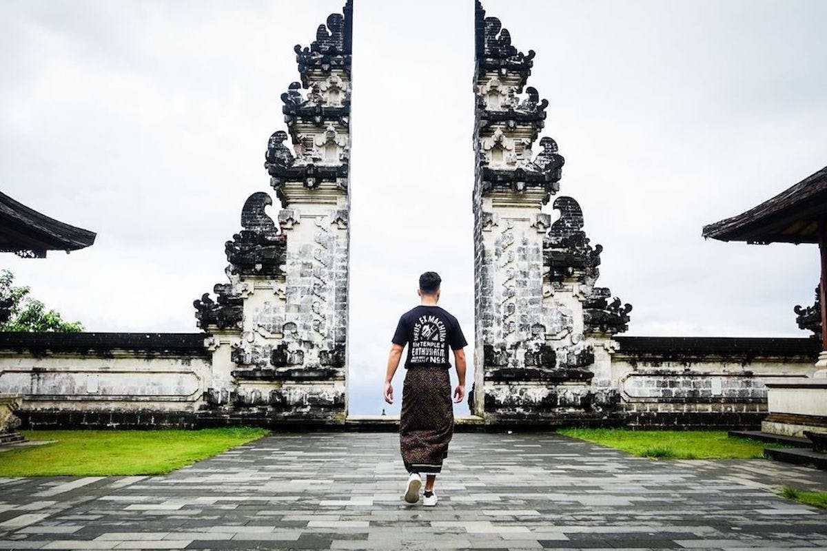
The Most Famous Spots in Bali Instagram Tour – Guided Tour Indonesia The most famous spots in Bali Instagram tour is a convenient way to add structure, local context and purposeful sightseeing to the itinerary. Check current availability, inclusions and booking details before you go.
Sydney: Discover Scuba Dive at Australia's most Iconic Beach Australia Explore the world of diving with PADI Discover Scuba Diving Experience at Dive Centre Bondi. Basic theory, guided dive, and marine life. See what lives under the waves in an exciting day!
Kolymbia Harbour is a small, picturesque harbour on the eastern coast of Rhodes, surrounded by clear blue water, rocky hills and the relaxed atmosphere that makes Kolymbia such an appealing holiday destination.
Also known as Limanaki Harbour, this sheltered little port is considerably quieter than the major harbours of Rhodes. Fishing boats, excursion vessels and small pleasure craft gather around the waterfront, while a sand-and-shingle beach curves beside the harbour.
Whether you come for a swim, take photographs, watch the boats or depart on a cruise along the Rhodes coastline, Kolymbia Harbour is well worth including in a visit to the resort.
Kolymbia Harbour at a Glance
Location: Kolymbia, east coast of Rhodes, Greece
Also known as: Limanaki Harbour
Best for: coastal scenery, swimming, photography and boat excursions
Beach: sand and fine shingle
Atmosphere: small, relaxed and scenic
Swimming: generally sheltered water around the bay
Boat trips: excursions operate from Kolymbia towards destinations including Lindos
A Small Harbour Surrounded by Dramatic Scenery
Part of the charm of Kolymbia Harbour comes from its setting. Rocky headlands partially surround the water, creating a naturally sheltered little bay that feels very different from Rhodes’ larger commercial ports.
The harbour itself is compact. Small boats sit in the clear water while whitewashed buildings and rugged hills provide a distinctly Greek island backdrop.
There is no need to come here with a detailed sightseeing plan. Kolymbia Harbour is one of those places where simply strolling around the waterfront, sitting near the sea and watching the boats can be part of the experience.
Kolymbia’s Two Harbours
Visitors may occasionally see different locations described as Kolymbia Harbour. This is because Kolymbia actually has two small harbours.
Limanaki Harbour is the main small harbour where many of Kolymbia’s excursion and pleasure boats are based. This is generally the harbour visitors mean when referring simply to Kolymbia Harbour.
Nisaki Harbour is another small harbour situated towards the end of Kolymbia Beach.
If you have booked a boat excursion, check your ticket carefully to make sure you know exactly which departure point your operator uses.
The Harbour Beach
Beside Kolymbia Harbour is a small beach consisting of a mixture of sand and shingle. The rocky surroundings help give the beach a secluded appearance, while the sheltered setting can make the water particularly inviting on calm summer days.
The beach is much smaller than Kolymbia’s main beach and should not be thought of as a large resort beach. Its appeal is the intimate location beside the harbour.
Bring swimming shoes if you prefer extra protection on pebbles and shingle, particularly when entering and leaving the water.
Swimming at Kolymbia
Swimming is one of the easiest ways to enjoy this part of Rhodes. The eastern coast of the island is known for clear Mediterranean water, and Kolymbia’s bays are popular with both families and recreational swimmers.
Always take normal care around harbour entrances and boat traffic. If boats are manoeuvring nearby, use the designated swimming areas rather than swimming through channels used by vessels.
Take a Boat Trip from Kolymbia Harbour
One of the best reasons to visit the harbour is to take to the water.
Boat operators run cruises and excursions from Kolymbia along the eastern coastline of Rhodes. Lindos is one of the best-known destinations, and some cruises combine time ashore with opportunities to swim in secluded bays along the way.
Other excursions concentrate on swimming, snorkelling and exploring the coastline rather than visiting a particular town.
The availability, departure times and routes of boat trips can change according to season and weather, so it is worth checking locally or booking before your planned trip.
Why See Rhodes from the Sea?
Rhodes looks completely different from offshore. Travelling by boat reveals cliffs, small coves and sections of coastline that can be difficult to appreciate from the road.
During the warmer months, many cruises also include swimming stops where passengers can enter the clear Aegean water directly from the boat.
Kolymbia Beach
The main Kolymbia Beach is only a short distance from the harbour and offers a much larger area for swimming and sunbathing.
The beach combines sand and fine shingle and is lined in places with sunbeds and parasols. Its generally clear, shallow water makes it particularly popular with families.
Visitors wanting a full beach day may prefer the main beach, while the harbour area is better suited to a shorter visit, waterfront stroll or boat excursion.
Walk Around the Harbour
You do not need to take a cruise to enjoy Kolymbia Harbour. A simple walk around the waterfront offers excellent views across the bay.
Early morning is particularly attractive when the harbour is quieter and boats are preparing to leave. Later in the day, returning excursion boats add more activity to the waterfront.
For photographers, the combination of colourful boats, turquoise water, white buildings and the rocky landscape produces some of the most attractive coastal scenes in Kolymbia.
Visit the Small Harbour Chapel
One of the harbour’s most photogenic features is the small traditional Greek chapel positioned beside the sea.
Its white walls and blue detailing create the classic colour combination associated with the Greek islands, particularly when viewed against the deep blue Aegean.
Even visitors who are not taking a boat trip should walk towards this part of the harbour for the views.
Nearby: Tsambika Beach
For another beach experience, Tsambika Beach is only a few kilometres from Kolymbia. It is considerably larger and is known for its broad stretch of golden sand beneath the dramatic Tsambika hillside.
It makes an excellent addition to a day around Kolymbia if you have access to a car, taxi or other local transport.
Nearby: Tsambika Monastery
High above the coastline is Tsambika Monastery, one of the area’s best-known viewpoints.
Reaching the upper monastery involves a substantial climb, including hundreds of steps, but visitors who make the ascent are rewarded with sweeping views across Rhodes’ eastern coastline.
The combination of Kolymbia Harbour, the beach and Tsambika’s elevated viewpoint can make a particularly enjoyable day in this part of Rhodes.
Where Is Kolymbia?
Kolymbia lies on the eastern side of Rhodes between Rhodes Town and Lindos. It is approximately 25 kilometres from each, making the resort a convenient base for exploring both northern and southern parts of the island.
The location is one reason Kolymbia has become popular with visitors who want a relatively relaxed seaside resort without being isolated from Rhodes’ major attractions.
Getting to Kolymbia Harbour
By Car
Hiring a car is one of the easiest ways to reach Kolymbia and explore the surrounding coastline. Roads connect the resort with Rhodes Town, Lindos and other east-coast destinations.
By Taxi
Taxis are another convenient option, particularly if you are staying elsewhere in Kolymbia or in one of the nearby resorts.
On Foot
If you are staying in Kolymbia itself, the harbour may be within comfortable walking distance. Kolymbia is relatively compact, although walking time will depend considerably on the location of your accommodation.
Best Time to Visit Kolymbia Harbour
The main tourism season in Rhodes runs through the warmer months when beach facilities, restaurants and boat excursions are most active.
Morning is excellent if you want quieter photographs and the atmosphere of boats preparing for the day.
Late afternoon can also be particularly pleasant once the strongest heat of the day begins to ease.
If you plan to take a cruise, however, your visit will obviously need to be coordinated with the operator’s departure time.
What to Bring
Swimwear
Towel
Sun protection
Hat
Drinking water
Comfortable walking shoes
Swimming shoes if you dislike walking on pebbles
Camera or phone for harbour photographs
Snorkelling equipment if you plan to explore the water
Is Kolymbia Harbour Suitable for Families?
Yes. Kolymbia is generally popular with families and couples looking for a quieter alternative to some of Rhodes’ livelier resorts.
The harbour itself is small enough to explore without requiring a long walk, while beaches, cafés and other resort facilities are nearby.
Parents should, of course, supervise children closely around harbour walls, boats and deeper water.
Is Kolymbia Harbour Worth Visiting?
Yes, particularly if you are already staying in Kolymbia. It is not a huge sightseeing attraction and that is part of its appeal.
Kolymbia Harbour offers a peaceful slice of Rhodes: colourful boats, clear water, a small beach, rocky scenery and opportunities to head out onto the Aegean Sea.
Visitors travelling around Rhodes specifically to see major archaeological sites may only spend a short time here. But for anyone enjoying a relaxed holiday in Kolymbia, an evening walk around the harbour or a morning boat departure can become one of the most memorable parts of the stay.
Frequently Asked Questions
Where is Kolymbia Harbour?
Kolymbia Harbour is on the eastern coast of Rhodes in the resort of Kolymbia, roughly halfway between Rhodes Town and Lindos.
Is Kolymbia Harbour the same as Limanaki Harbour?
Yes. Limanaki is the principal small harbour in Kolymbia and is normally the location people mean when referring to Kolymbia Harbour. Kolymbia also has another small harbour known as Nisaki.
Can you swim at Kolymbia Harbour?
There is a small sand-and-shingle harbour beach. Swimmers should stay clear of areas used by moving boats and follow any locally marked swimming zones.
Can you take boat trips from Kolymbia?
Yes. Excursion boats operate from Kolymbia, including cruises along Rhodes’ eastern coastline and trips towards Lindos.
Is Kolymbia Harbour free to visit?
There is no general admission fee simply to walk around the harbour or visit the adjoining public coastal area. Boat excursions, sunbeds and other commercial activities are charged separately.
How long should I spend at Kolymbia Harbour?
Allow around 30–60 minutes for a relaxed walk and photographs. Stay longer if you want to swim, eat nearby or take a boat trip.
Final Thoughts
Kolymbia Harbour may be small, but its combination of clear Aegean water, traditional boats, rocky scenery and relaxed atmosphere captures much of what travellers come to Rhodes to experience.
Come early to watch the excursion boats preparing to leave, stop for a swim, photograph the waterfront or use the harbour as your starting point for exploring the coast by sea.
For visitors staying in Kolymbia, it is an easy place to return to more than once during a holiday—and a particularly pleasant location when you simply want to slow down and enjoy the Rhodes coastline.
I verified that the harbour beach is described as **sand and shingle**, about **0.3 km from the main Kolymbia Beach**, while Kolymbia Beach itself has clear, generally calm water and organised beach facilities. ([Jet2holidays][2]) Boat operators are also currently advertising departures directly from the small Kolymbia harbour, including cruises to **Lindos**. ([kolymbiaexpress.travelotopos.com][3])
[1]: https://kolymbia.gr/?utm_source=chatgpt.com “Kolymbia Guide”
[2]: https://www.jet2holidays.com/poi/rhodes/kolymbia-beach “Kolymbia Beach (Rhodes) 2026/2027 | Jet2holidays”
[3]: https://kolymbiaexpress.travelotopos.com/?utm_source=chatgpt.com “Kolymbia Express | Sea Cruises to Lindos | Rhodes”
Sponsored Popular Items
Quick take: Musement.com offers a worldwide selection of tours and attractions
Fethiye City with Levissi Guided Tour from Rhodes Turkey Plan Fethiye City with Levissi Guided Tour from Rhodes, a guided sightseeing experience, with practical tips on timing, inclusions and what to check before booking. Compare current availability, prices and booking conditions before you go.
Nusa Penida is the largest of the three Nusa islands lying southeast of mainland Bali and one of Indonesia’s most dramatic coastal destinations. Towering limestone cliffs, brilliant-blue water, white-sand coves, offshore rock formations and rich marine life make it look remarkably different from the resort areas of southern Bali.
The island is home to some of Bali’s most photographed places, including Kelingking Beach, Diamond Beach, Broken Beach, Angel’s Billabong and Crystal Bay. Offshore, the protected waters surrounding Nusa Penida, Nusa Lembongan and Nusa Ceningan are internationally known for reef manta rays and seasonal sightings of mola-mola, or ocean sunfish.
A day trip from Bali is possible, but Nusa Penida is much larger and slower to travel around than many first-time visitors expect. Two nights is a much better choice if you want to see both the western and eastern sides without spending most of your visit rushing between viewpoints.
Nusa Penida at a Glance
Visitor Information
Details
Location
Southeast of mainland Bali, Indonesia
Main access
Passenger fast boat
Main Bali departure point
Sanur
Other Bali departure points
Kusamba and Padang Bai
Typical fast-boat crossing
About 30–45 minutes in normal conditions
Main visitor harbours
Banjar Nyuh/Toyapakeh and Sampalan/Buyuk area
Best-known landmark
Kelingking Beach
Best eastern-coast scenery
Diamond Beach and Atuh Beach
Marine highlight
Manta rays
Mola-mola season
Most associated with July–October
Best general weather period
April–October
Day-trip minimum
One full day
Recommended stay
2–3 nights
Best transport
Private car with local driver for most visitors
Best for
Scenery, photography, snorkelling, diving and adventure
Why Nusa Penida Is Different From Mainland Bali
Nusa Penida is not primarily a resort island. Its appeal comes from a rugged landscape where roads twist across hilly limestone terrain before suddenly reaching enormous sea cliffs and hidden beaches.
Indonesia’s Ministry of Tourism specifically warns that the island’s terrain is hilly and that some access roads and paths remain rocky and challenging. It recommends using a suitable vehicle in good condition.
This means distances on a map can be misleading. A destination that appears only a modest distance away may require a slow drive along narrow roads.
1. Kelingking Beach
Kelingking Beach is the defining image of Nusa Penida.
The viewpoint overlooks a gigantic green limestone headland projecting into intensely blue water, with a white-sand beach enclosed at its base. The unusual formation is frequently compared with the shape of a Tyrannosaurus rex.
You do not need to descend to the sand to understand why Kelingking is famous. In fact, for most day visitors, the cliff-top viewpoint is the main attraction.
Think Carefully Before Hiking Down Kelingking
The Indonesian Ministry of Tourism explicitly describes access to the beach as steep and dangerous.
The descent is not comparable with walking down a normal staircase to a beach. Parts are very steep, exposed and physically demanding, and after reaching the sand you still have to climb all the way back up.
Do not descend simply because you see other tourists doing it.
Stay at the Viewpoint If:
You have knee or balance problems
You dislike exposed heights
The ground is wet
You have limited time
You are wearing unsuitable footwear
You are not confident you can complete the return climb
The view from above is already exceptional and is the photograph most visitors actually come to see.
When to Visit Kelingking
Early morning is considerably better than the middle of a typical day-trip period. Many organised groups arrive after the first boats from Sanur have unloaded, so the narrow photo areas can become extremely busy.
If you stay overnight on Nusa Penida, Kelingking is one of the places where you gain the greatest advantage over day-trippers.
2. Broken Beach
Broken Beach is not really a swimming beach. It is a remarkable circular coastal inlet created in the limestone, with seawater entering beneath a huge natural rock arch.
The surrounding cliff-top path lets you look into the turquoise cove and towards the natural bridge connecting the two sides of the formation.
It is one of the island’s easiest major sights to appreciate without undertaking a serious beach descent.
3. Angel’s Billabong
Angel’s Billabong lies beside the Broken Beach area and is normally visited during the same stop.
It is a natural rock pool beside the ocean. Although photographs sometimes show people inside the pool, conditions can change quickly when waves break across the outer rocks.
Do not enter the water merely because other visitors are doing so. Follow local restrictions and remain out when waves or swell make the area unsafe.
Broken Beach and Angel’s Billabong Work Well Together
The two attractions are close enough that they are normally combined rather than treated as separate journeys.
A typical western-island itinerary therefore becomes:
Crystal Bay provides a very different experience from the cliff viewpoints.
Indonesia’s Ministry of Tourism highlights its clear water, sunset scenery and popularity with divers and snorkellers because of the area’s marine biodiversity.
It is a useful final stop after a day spent looking down at beaches from cliffs because you can actually reach the shoreline easily.
Sea conditions should still determine whether you enter the water. Nusa Penida is surrounded by powerful currents and is not a place to assume that every attractive-looking beach is safe for swimming.
5. Diamond Beach
Diamond Beach is one of the great sights of eastern Nusa Penida.
The viewpoint looks across brilliant turquoise water towards white limestone pinnacles rising offshore. A stairway cut into the cliff provides access towards the beach below.
The Ministry of Tourism lists Diamond Beach as one of Nusa Penida’s major natural attractions alongside Atuh Beach.
Do You Need to Walk Down to Diamond Beach?
No. The upper viewpoint is worthwhile even if you do not want to tackle the staircase.
The descent is steep and exposed in places. Going down also commits you to climbing back up in tropical heat, so consider your fitness, footwear and the amount of time available.
For travellers with reduced mobility, the best strategy is usually to enjoy the spectacular upper views rather than trying to reach the sand.
Swimming at Diamond Beach
Do not assume Diamond Beach is a conventional swimming beach. It faces open ocean and can experience significant surf and currents.
Treat swimming as dependent entirely on conditions on the day rather than as a guaranteed part of the visit.
6. Atuh Beach
Atuh Beach lies in the same eastern section of the island as Diamond Beach, making the two an obvious combination.
The setting consists of steep limestone cliffs, a small beach and dramatic offshore rock formations.
Visitors with only one eastern-island day can see both without crossing the island twice.
7. Manta Point
For many travellers, the best reason to visit Nusa Penida is underwater.
Reef manta rays are present around Nusa Penida throughout the year. The Coral Triangle Center reports more than 600 individual reef manta rays identified in the protected area since monitoring began.
Manta Point is one of the principal sites where boats take divers and snorkellers hoping to encounter them.
Manta Rays Are Wild Animals
A manta sighting is never guaranteed.
This is a natural marine environment, not an aquarium. Weather, currents, visibility and the movement of the animals determine what you see.
Choose an operator that follows marine-protected-area codes of conduct rather than one that promises guaranteed close contact.
Respect the Manta Rays
The Nusa Penida Marine Protected Area uses codes of conduct developed with dive operators and conservation organisations to reduce the impact of tourism on manta rays and mola-mola.
A responsible encounter means:
Do not touch manta rays
Do not chase them
Do not block their direction of travel
Follow your guide’s positioning instructions
Avoid standing on coral
Keep fins away from the reef
The objective is to watch normal animal behaviour rather than force an interaction.
8. Mola-Mola – Ocean Sunfish
Nusa Penida is also internationally known among divers for mola-mola.
The Coral Triangle Center explains that nutrient-rich upwelling becomes particularly important from July through October, when mola-mola are attracted towards cleaning stations around the islands.
Seeing one is still never guaranteed, and many of the dive sites where they occur can experience strong currents. Choose an appropriately qualified dive operator and be accurate about your experience level.
9. Goa Giri Putri
Nusa Penida is not only about beaches.
Goa Giri Putri is a Hindu temple complex inside a huge cave and is one of the island’s most distinctive cultural attractions. Indonesia’s Ministry of Tourism specifically recommends it for visitors interested in the island’s spiritual life.
The unusual aspect is the entrance: visitors pass through a relatively small opening before emerging into a surprisingly large cavern used for worship.
This remains an active sacred place, not simply a tourist cave. Dress appropriately, follow temple etiquette and avoid disrupting ceremonies.
10. Teletubbies Hill
Teletubbies Hill provides a change from the coastline. The landscape is composed of rounded hills that become particularly green during and after wetter periods.
The Ministry of Tourism includes it among the island’s recognised trekking and scenic attractions.
It fits most naturally into an eastern or central-island itinerary rather than a rushed western day trip.
How to Get to Nusa Penida From Bali
There is no road bridge from Bali.
Passenger fast boats operate from Sanur, Kusamba and Padang Bai. Indonesia’s Ministry of Tourism gives the normal crossing time as approximately 30–45 minutes, depending on weather and the harbour used.
Sanur is the most convenient departure point for many travellers staying around southern Bali because it has a large purpose-built fast-boat terminal and numerous daily departures.
Current Sanur Fast-Boat Schedule Example
Schedules vary by company, so there is no single universal Nusa Penida timetable.
As of August 2026, Angel Billabong Fast Cruise, for example, publishes Sanur departures at:
Sanur → Nusa Penida
7:30 am
8:30 am
10:00 am
2:15 pm
5:00 pm
Its currently published Nusa Penida → Sanur departures are 7:20 am, 9:00 am, 1:00 pm, 4:00 pm and 5:00 pm.
Do not build a trip around these times without reconfirming. Boat schedules can change because of weather, sea conditions and operational requirements.
How Early Should You Arrive at Sanur Harbour?
Allow substantially more time than the 30–45 minute boat crossing itself.
Sanur can be busy, particularly during summer and holiday periods. A sensible approach is to arrive approximately 45–60 minutes before departure unless your operator gives different instructions.
You need time to find the correct company desk, check in, deal with luggage and reach the boarding area.
The Boat Can Be Rough
The stretch of sea between Bali and Nusa Penida can be choppy.
If you are prone to seasickness, take appropriate precautions before boarding and choose a morning sailing when practical. Weather conditions can also delay or cancel boats.
Do not schedule an extremely tight international flight connection immediately after returning from Nusa Penida.
Where Do Boats Arrive?
Different operators use different ports.
Indonesia’s Ministry of Tourism specifically mentions Toyapakeh and Sampalan as important arrival points.
Current services also commonly use the Banjar Nyuh and Buyuk harbour areas.
Check the exact arrival harbour before arranging your hotel transfer because “Nusa Penida ferry ticket” does not always mean every company lands at the same pier.
Current Bali Foreign Tourist Levy
International visitors to Bali are currently subject to the province’s Rp150,000 foreign tourist levy per person.
The official Love Bali system states that the levy is normally paid once during the visitor’s Bali trip, rather than every time you travel between mainland Bali and Nusa Penida.
If you have already paid the Bali levy when entering the province, keep the QR-code voucher that was issued to you.
Local Nusa Penida Charges
Separate local retribution, attraction and parking charges can also apply on Nusa Penida. Current 2026 visitor information commonly reports a small island arrival levy and individual site or parking fees, but implementation and attraction tariffs have been changing during 2026.
Carry Indonesian rupiah in small denominations and confirm the actual amount at official ticket booths rather than relying on an old online list.
This is especially important because some tour prices include local admission while cheap transport-only packages may not.
Getting Around Nusa Penida
Once you land, the principal choices are:
Private car with driver
Rental car
Scooter
Organised tour vehicle
Indonesia’s Ministry of Tourism confirms that motorbikes and cars are the primary ways of exploring the island but cautions that the terrain is hilly and some roads and access tracks are challenging.
Should You Rent a Scooter?
Only if you are genuinely experienced riding scooters in difficult conditions.
Nusa Penida is not a sensible place to learn.
You may encounter:
Steep gradients
Narrow roads
Sharp corners
Uneven surfaces
Loose gravel
Heavy tourist traffic
Large vehicles sharing narrow roads
For most first-time visitors, a local driver is the safer and more relaxing option.
Private Driver Versus Group Tour
Private Driver
Best overall choice.
You determine the pace, can leave a crowded viewpoint earlier and can change the route according to road and weather conditions.
Group Tour
Usually cheaper but more rigid. Much of the day can be spent waiting for other passengers and following a fixed photography schedule.
Scooter
Provides freedom but brings considerably greater road risk and physical exposure.
West Nusa Penida or East Nusa Penida?
West
East
Kelingking Beach
Diamond Beach
Broken Beach
Atuh Beach
Angel’s Billabong
Thousand Islands viewpoints
Crystal Bay
More remote cliff scenery
Best-known first visit
Excellent second-day route
If You Have Only One Day
Choose either the west or east rather than trying to see everything.
Many tours advertise an east-and-west combination in a single day, but that usually means considerable time in a vehicle and very short stops.
For a first visit, the western route is the classic choice because it includes Kelingking, Broken Beach and Crystal Bay.
A Good One-Day Western Route
Early Morning – Fast Boat From Sanur
Use one of the first practical departures.
Kelingking Beach
See the cliff-top panorama. Do not attempt the beach descent on a short day trip.
Broken Beach and Angel’s Billabong
Explore both during the same stop.
Lunch
Use a local restaurant rather than spending time returning to the harbour area.
Crystal Bay
Finish beside the sea before returning towards your departure harbour.
Afternoon – Return Boat
Allow plenty of road time to the port. Missing your booked final fast boat is a much bigger problem than shortening a beach stop.
A Good Eastern Day
A logical east-coast itinerary is:
Diamond Beach → Atuh Beach → surrounding viewpoints → Teletubbies Hill or Goa Giri Putri.
Trying to add Kelingking to the same day makes the itinerary far more rushed.
Two-Day Nusa Penida Itinerary
Day 1 – Western Penida
Early boat from Bali
Check in or leave luggage
Kelingking viewpoint
Broken Beach
Angel’s Billabong
Crystal Bay
Overnight on Nusa Penida
Day 2 – Eastern Penida
Early start before day-trip groups arrive
Diamond Beach
Atuh Beach
Eastern viewpoints
Goa Giri Putri if time permits
Late-afternoon fast boat to Bali
This is substantially more enjoyable than compressing both coasts into one frantic day.
Three-Day Nusa Penida Itinerary
Three days is ideal if marine activities matter to you.
Day 1
Western-landscape circuit.
Day 2
Eastern-landscape circuit.
Day 3
Morning manta snorkelling or diving, followed by a relaxed afternoon before returning to Bali.
This also gives you a weather buffer if a boat excursion is cancelled because of sea conditions.
Snorkelling or Land Tour First?
If you are staying overnight, consider putting snorkelling early in the morning and land sightseeing later.
Morning seas can sometimes be more comfortable, while visiting the famous land attractions outside the central day-trip rush can produce a better experience.
Never assume a planned manta trip will operate regardless of weather. A responsible operator should be willing to cancel when conditions are unsafe.
The Nusa Penida Marine Protected Area
The waters around Nusa Penida form a major marine protected area containing coral reefs, mangroves and seagrass habitats.
The Coral Triangle Center records 296 coral species from surveys in the protected area and describes its waters as an important migration corridor for manta rays, dolphins, turtles, dugongs and whales.
Strong currents are also a defining feature. They carry nutrient-rich water through the channels between the islands, creating remarkable marine productivity but also making some dive and snorkel sites demanding.
Do Not Underestimate the Currents
This is particularly important for travellers who see beautiful clear water and assume every snorkelling site is easy.
Nusa Penida’s marine environment contains areas of strong tidal current. Always snorkel or dive with an experienced operator who chooses locations according to conditions and participant ability.
If a boat crew tells you a site is unsuitable that day, treat the change as good safety management rather than a disappointing service.
Where to Stay
Banjar Nyuh / Toyapakeh Area
Best for first-time visitors and transport convenience.
This northwestern part of Nusa Penida is close to major fast-boat arrival points and provides practical access for western sightseeing and marine trips.
Batununggul / Sampalan Area
Best for eastern-island access and local services.
Staying farther east reduces some of the driving required for Diamond Beach, Atuh Beach and Goa Giri Putri.
The best choice depends on which harbour your fast boat uses and which side of the island you intend to explore first.
Should You Stay on Nusa Penida or Nusa Lembongan?
Nusa Penida is the better choice if dramatic land scenery is your priority.
Nusa Lembongan tends to feel more compact and resort-oriented, while Penida requires more driving and rewards travellers with larger landscapes and more remote viewpoints.
If you have enough time, the islands work well together rather than competing with one another.
Best Time of Year
The Indonesian Ministry of Tourism recommends the April–October dry season for generally more favourable Nusa Penida travel conditions.
April–June
Generally an excellent balance of drier weather and landscapes that may retain more greenery after the wet season.
July–August
Popular, generally dry and excellent for sightseeing. It is also peak travel season, so boats, drivers and accommodation should be booked ahead.
August additionally falls within the period when nutrient-rich upwelling around Nusa Penida is associated with increased mola-mola activity.
September–October
Still generally favourable for sightseeing and part of the main mola-mola period.
November–March
The wetter season can bring heavier rainfall, rougher sea conditions and slippery cliff paths. Travel remains possible, but itineraries need greater flexibility.
August 2026: Is It a Good Time to Visit?
Yes. August sits within the dry season recommended by Indonesia’s tourism authority and is one of the most popular months for Nusa Penida.
The disadvantages are crowds and high demand. Book your fast boat and accommodation ahead and start sightseeing earlier than the organised day-tour traffic when staying overnight.
What to Wear
For a sightseeing day, bring:
Secure walking shoes or good sandals with grip
Lightweight clothing
Hat
Sunscreen
Plenty of water
Swimwear if visiting an appropriate swimming location
Light rain protection outside the dry season
Sarong or suitable clothing for temple visits
Flip-flops are acceptable around many viewpoints but are a poor choice for steep cliff descents.
Visiting With Children
Nusa Penida can be enjoyable for children, but choose the itinerary carefully.
The main problems are:
Long drives on winding roads
Exposed cliff edges
Steep beach staircases
Heat
Rough fast-boat crossings
A family day is usually better when it concentrates on viewpoints and an accessible beach rather than attempting every dramatic descent.
Accessibility and Reduced Mobility
Nusa Penida is not an easy accessibility destination.
Some cliff-top viewpoints can be enjoyed with relatively little walking from vehicle parking areas, but many famous beaches involve steep steps, uneven paths and difficult terrain.
Indonesia’s tourism authority itself describes the island’s roads and routes as challenging and Kelingking’s beach descent as steep and dangerous.
A private car and driver is the best option for someone who wants to minimise walking and still see the major landscapes.
Photography Tips
Kelingking
Arrive early. Crowds can make finding a clean composition more difficult than the photography itself.
Diamond Beach
The upper stairway provides excellent angles showing the offshore limestone pinnacles and turquoise water.
Broken Beach
Walk around the rim to change the angle of the natural rock arch rather than taking the first photograph from the arrival path.
Protect Your Equipment
Dust, sea spray and sudden tropical rain can all affect cameras and phones. A simple waterproof pouch is useful even on land-tour days.
Do You Need a Tour?
No. Independent travel is possible.
However, for a first visit, booking a car and driver solves several logistical problems at once:
Navigation
Road conditions
Parking
Timing the return boat
Choosing an achievable route
The advantage of independence is greater freedom; the disadvantage is that Penida is a difficult place to underestimate travel times.
Day Trip or Overnight?
Choose a Day Trip If:
You have very limited Bali time
You mainly want Kelingking and western highlights
You are happy with a fast-paced itinerary
You do not mind returning by boat the same afternoon
Stay Overnight If:
You want both east and west
You want fewer crowds
You want sunrise or sunset viewpoints
You want manta snorkelling or diving
You dislike rushing
For most travellers genuinely interested in Nusa Penida, staying at least two nights is the better experience.
Common Mistakes to Avoid
Trying to See the Whole Island in One Day
Road travel is slower than the map suggests.
Renting a Scooter Without Real Experience
The Ministry of Tourism warns that terrain and road conditions can be challenging.
Descending Kelingking Just Because Everyone Else Is
The official tourism authority describes the route as steep and dangerous.
Assuming Every Beautiful Beach Is Safe for Swimming
Ocean swell and currents can be powerful.
Expecting Guaranteed Manta Rays
The rays are wild animals in a protected marine ecosystem.
Booking the Last Possible Return Before a Flight
Sea conditions can delay fast boats.
Carrying No Cash
Small local entry and parking charges are common.
Choosing a Tour Solely by the Number of Attractions
A tour advertising eight stops is not necessarily better than one providing enough time at four.
Practical Tips
Stay two nights if your Bali itinerary allows it.
Use an early fast boat from Sanur.
Book boats ahead during July and August.
Use a private driver unless you are a confident and experienced scooter rider.
Do west and east Nusa Penida on separate days.
Enjoy Kelingking from above unless you are genuinely prepared for the descent.
Never assume ocean conditions are safe based on appearance alone.
Choose responsible manta-ray operators.
Carry small-denomination Indonesian rupiah.
Keep your Bali tourist-levy QR voucher.
Allow a generous buffer before the return fast boat.
Is Nusa Penida Worth Visiting?
Yes. Nusa Penida contains some of the most spectacular coastal scenery anywhere in Bali.
The extraordinary appeal comes from variety. At Kelingking you stand hundreds of metres above a tiny beach enclosed by monumental cliffs. At Broken Beach, the sea enters a circular limestone basin through a natural arch. On the eastern side, Diamond Beach combines turquoise water, pale cliffs and offshore rock pinnacles. Offshore, a protected marine ecosystem supports reef manta rays throughout the year and attracts mola-mola particularly during the July–October upwelling period.
It is also remarkably easy to reach in geographical terms. Fast boats from Bali normally take only around 30–45 minutes, and current operators run multiple departures between Sanur and Nusa Penida each day.
The mistake is assuming that the short boat crossing means the island itself can be seen quickly. It cannot. Nusa Penida’s hills, winding roads and widely separated coastlines make rushing frustrating, and several of the best-known beaches require steep physical descents.
For a first visit, spend one day exploring western Penida, one day exploring the east and, if possible, a third morning on the water. That gives you time to enjoy the landscape rather than simply queue for photographs before racing back to the harbour.
Nusa Penida is at its best when treated as an island to explore rather than an attraction to tick off. Give it two or three days, start early, respect the cliffs and currents, and it becomes one of the outstanding experiences of a Bali trip.
Sponsored Popular Items
Quick take: Musement.com offers a worldwide selection of tours and attractions
Bali: Private Yacht Cruise to Nusa Penida & Nusa Lembongan Indonesia Cruise from Bali to Nusa Penida and Nusa Lembongan on a private yacht. Snorkel, fish, and relax on deck or at a beach club. Add an optional land tour of Nusa Penida to explore the island.
2-Day All-Inclusive Nusa Lembongan & Nusa Penida Tour – Guided Tour 2-Day All-Inclusive Nusa Lembongan & Nusa Penida Tour brings several elements of the destination together in one organised experience. Check current availability, inclusions and booking details before you go.
From Bali: Private Half-Day Snorkeling Tour to Nusa Penida Indonesia Our half-day tour offers guided, supervised private boat snorkeling from Sanur to Nusa Penida’s top sites, including Manta Point, with observation only and a flexible itinerary based on sea conditions
Isla Mujeres is a small Caribbean island just off the coast of Cancún in Quintana Roo, Mexico. It is best known for the shallow turquoise water of Playa Norte, the cliffs and Maya heritage of Punta Sur, excellent snorkelling and diving, the underwater sculptures of MUSA and seasonal encounters with whale sharks.
Despite being so close to Cancún, Isla Mujeres feels quite different. The island is compact, low-rise and easy to explore, with most visitors arriving by passenger ferry in the northern town. Mexico’s official tourism service describes the crossing from Cancún as taking around 20 minutes. :contentReference[oaicite:2]{index=2}
Isla Mujeres works as a day trip, but staying for one or two nights gives you a much better experience. Day visitors concentrate heavily around Playa Norte and the ferry terminal; early mornings and evenings are noticeably more relaxed.
Isla Mujeres at a Glance
Visitor Information
Details
Location
Off Cancún, Quintana Roo, Mexico
Approximate length
7 km
Approximate maximum width
650 metres
Ferry journey from Cancún
About 20 minutes
Main ferry gateway
Puerto Juárez, Cancún
2026 Ultramar adult ferry
MXN 290 one way / MXN 580 return
2026 Ultramar child ferry
MXN 220 one way / MXN 440 return
Best-known beach
Playa Norte
Historic/scenic highlight
Punta Sur
Marine highlight
MUSA and Manchones Reef
Whale-shark season
Generally May–September
Day-trip minimum
6–8 hours
Better stay
1–2 nights
Best for
Beaches, swimming, snorkelling, diving and relaxed island sightseeing
The island is approximately seven kilometres long and about 650 metres wide at its widest point, making it practical to explore without long road journeys. :contentReference[oaicite:3]{index=3}
Why Visit Isla Mujeres?
Isla Mujeres offers a useful contrast to Cancún. You can arrive in the morning, walk from the ferry terminal to one of Mexico’s best-known beaches, hire transport to explore the southern half of the island, snorkel over reefs and return to the mainland in the evening.
Mexico’s national tourism site highlights Playa Norte, Punta Sur, the sanctuary associated with the Maya goddess Ixchel, underwater art, snorkelling, diving and seasonal whale sharks as principal reasons to visit. :contentReference[oaicite:4]{index=4}
1. Spend Time at Playa Norte
Playa Norte is the island’s signature beach and is within walking distance of the passenger ferry terminal.
The beach is known for pale sand and unusually shallow, clear Caribbean water. Official regional tourism information describes its water as calm and shallow, making it particularly attractive for relaxed swimming. :contentReference[oaicite:5]{index=5}
You will find sections where you can simply place a towel on the beach as well as beach clubs renting loungers and umbrellas.
Why Playa Norte Works Well for Families
The relatively shallow water makes Playa Norte one of the more approachable swimming beaches in the area, although normal supervision of children is still essential and conditions can change with weather and wind. :contentReference[oaicite:6]{index=6}
If your only purpose in visiting Isla Mujeres is swimming and relaxing, it is perfectly reasonable to spend most of your day here rather than attempting to tour the entire island.
2. Walk Through El Centro
The compact town at the northern end of Isla Mujeres contains the ferry terminal, restaurants, cafés, souvenir shops and accommodation.
It is easy to explore on foot and makes a practical base if you stay overnight. The northern end is also the most convenient area for travellers who do not want to hire a golf cart or scooter.
Avenida Hidalgo
Avenida Hidalgo forms part of the island’s main pedestrian-oriented restaurant and shopping area. In the evening it becomes one of the liveliest parts of town, particularly after many day-trippers have returned to Cancún.
Staying nearby allows you to walk to dinner and reach Playa Norte without transport.
3. Explore Punta Sur
Punta Sur occupies the southern tip of Isla Mujeres and provides a completely different landscape from Playa Norte.
Instead of a shallow sandy beach, you find rocky cliffs, open Caribbean views, sculpture, walking paths and archaeological remains associated with the Maya worship of Ixchel. Mexico’s official tourism service describes Punta Sur as the southernmost point of the island and one of Mexico’s easternmost locations. :contentReference[oaicite:7]{index=7}
The area is particularly attractive early in the morning because of its eastern position. It is one of the most popular locations on the island for watching sunrise.
The Maya History of Isla Mujeres
Before Spanish contact, the island had religious importance connected with the Maya goddess Ixchel. Mexican government historical material records that Isla Mujeres was a sanctuary dedicated to Ixchel in the early 16th century. :contentReference[oaicite:8]{index=8}
When the expedition led by Francisco Hernández de Córdoba reached the island in 1517, Spaniards encountered female religious figures and gave the island the name Isla Mujeres – Island of Women. :contentReference[oaicite:9]{index=9}
Temple Remains at Punta Sur
Visitors should not expect a large archaeological complex comparable with Tulum or Chichén Itzá. The surviving structure is modest, but its location on a high Caribbean headland gives the site considerable atmosphere.
The combination of Maya history, cliffs and open-sea views makes Punta Sur worthwhile even for travellers who have already visited much larger archaeological sites elsewhere in the Yucatán Peninsula.
Current Punta Sur Admission
Punta Sur’s cliffside sculpture and heritage area normally charges a separate entrance fee. A recent April 2026 visitor report quoted approximately MXN 120, but a reliable current official tariff page was not available when this guide was checked, so treat this only as a reference and confirm the price locally before visiting. :contentReference[oaicite:10]{index=10}
4. Snorkel Around the Island
Snorkelling is one of the major reasons to leave Playa Norte and explore farther south.
The waters west of Isla Mujeres form part of the protected Costa Occidental de Isla Mujeres, Punta Cancún y Punta Nizuc marine area, which protects coral reefs, seagrass beds, mangroves and associated marine life. :contentReference[oaicite:11]{index=11}
Conditions and visibility vary, so use a reputable operator and follow marine-park rules rather than walking over coral or attempting to touch wildlife.
5. Visit MUSA – The Underwater Museum of Art
MUSA, the Museo Subacuático de Arte, is one of the area’s most unusual attractions.
The museum consists of hundreds of sculptures installed underwater around Cancún and Isla Mujeres. The official MUSA site currently describes a collection of more than 500 life-size sculptures. :contentReference[oaicite:12]{index=12}
The works are not simply decorative. They are constructed and positioned as part of a wider marine-conservation project, providing surfaces that can become incorporated into the underwater ecosystem.
MUSA at Manchones Reef
The Manchones gallery off Isla Mujeres contains hundreds of underwater figures, including the large installation The Silent Evolution.
MUSA states that its Manchones area contains 473 sculptures and lies roughly eight to ten metres below the surface. :contentReference[oaicite:13]{index=13}
Snorkelling MUSA From Isla Mujeres
MUSA currently sells a Manchones snorkelling excursion departing directly from Isla Mujeres. As of August 2026, the published price is US$70, plus a stated US$20 dock/marine-park charge. The approximately four-hour excursion includes snorkelling equipment, a life jacket, water, around 30 minutes at MUSA and another 30 minutes at Manchones Reef. :contentReference[oaicite:14]{index=14}
The operator currently lists a minimum age of four and other health and age restrictions, so check the exact conditions before booking. :contentReference[oaicite:15]{index=15}
Scuba Diving MUSA
Certified divers can see the underwater installations much more closely. MUSA currently lists its certified-diver excursion from Isla Mujeres at US$157. Prices can change, so treat this as an August 2026 reference rather than a permanent rate. :contentReference[oaicite:16]{index=16}
6. Visit the Garrafón Area
The southern part of Isla Mujeres is also known for the Garrafón reef area, where clear water and reef habitat make snorkelling a major attraction.
The Mexican Caribbean tourism authority includes Garrafón among the island’s principal snorkelling and water-activity destinations. :contentReference[oaicite:17]{index=17}
Several commercial facilities operate in the area, so compare exactly what is included before buying a package. Some products combine reef access with pools, kayaking, zip lines, meals and other activities.
7. Swim With Whale Sharks – Seasonal
One of the most extraordinary seasonal experiences around Isla Mujeres is travelling offshore to encounter whale sharks.
These enormous filter-feeding sharks gather in the waters north and northeast of the Yucatán Peninsula during the warmer months. Mexico’s tourism service describes May through September as the general Isla Mujeres whale-shark period. :contentReference[oaicite:18]{index=18}
The protected Whale Shark Biosphere Reserve was established specifically to protect aggregations occurring north of the Yucatán Peninsula. :contentReference[oaicite:19]{index=19}
2026 Whale-Shark Season
Mexico’s environmental authorities have published a specific 2026 whale-shark season notice and management framework for the Mexican Caribbean, so this is a regulated wildlife activity rather than unrestricted swimming with animals. :contentReference[oaicite:20]{index=20}
Book only with an authorised operator and follow instructions on approach distance, entry into the water and the number of swimmers allowed with an animal.
Wildlife sightings are never guaranteed. Even during peak season, weather, sea conditions and the natural movement of whale sharks determine what you see.
Is August a Good Month for Whale Sharks?
Yes. August falls within the normal May–September period highlighted by Mexico’s tourism and environmental authorities. :contentReference[oaicite:21]{index=21}
However, this is an open-ocean excursion. The boat journey can be uncomfortable for travellers prone to seasickness, so consider preventative measures before departure.
8. Take a Boat Trip
Boat excursions around Isla Mujeres range from simple snorkelling outings to private sailing trips and full-day catamaran excursions from Cancún.
If you are already staying on Isla Mujeres, local departures often make more sense than returning to Cancún simply to join another boat.
Check whether quoted prices include:
Marine-park fees
Dock fees
Snorkelling equipment
Life jackets
Food and drinks
Hotel transfers
Photography
Extra environmental and dock charges are common around protected marine areas. For example, MUSA’s current Isla Mujeres snorkelling product separately lists a US$20 dock/marine-park charge. :contentReference[oaicite:22]{index=22}
Getting to Isla Mujeres From Cancún
Most independent visitors use the passenger ferry.
Puerto Juárez is the principal mainland departure point and is usually the most practical option because of its frequent service and dedicated ferry terminal.
Ultramar also currently operates Isla Mujeres services from Playa Tortugas and Playa Caracol in Cancún’s Hotel Zone. :contentReference[oaicite:23]{index=23}
Current 2026 Ultramar Ferry Prices
Passenger
One Way
Return
Adult
MXN 290
MXN 580
Child
MXN 220
MXN 440
These fares are currently published for Puerto Juárez, Playa Tortugas and Playa Caracol. Playa Caracol has an additional pier fee that is not included in the ferry fare. :contentReference[oaicite:24]{index=24}
Ultramar defines its child fare by age/height rather than simply by school age: infants under one year travel free with a boarding pass, while children over 1.20 metres are charged the adult fare. :contentReference[oaicite:25]{index=25}
How Long Is the Ferry?
Mexico’s national tourism service describes Isla Mujeres as approximately 20 minutes by ferry from Cancún. :contentReference[oaicite:26]{index=26}
Allow additional time for ticketing, queuing and boarding.
Arrive Early for the Ferry
Ultramar currently advises passengers to arrive at the terminal 30 minutes before departure. Schedules and fares can change without notice. :contentReference[oaicite:27]{index=27}
Open tickets are currently valid for six months on an available sailing on the purchased route, but are non-refundable under the operator’s published conditions. :contentReference[oaicite:28]{index=28}
Luggage on the Ferry
Ultramar’s current passenger conditions include one piece of luggage weighing up to 25 kg, subject to stated size limits. :contentReference[oaicite:29]{index=29}
If you are staying overnight, travelling with a normal suitcase is therefore possible, although rolling luggage through sandy or uneven island streets can still be inconvenient.
Getting Around Isla Mujeres
Because the island is small, transport is part of the experience.
Popular options include:
Walking around the northern town
Taxi
Golf cart
Bicycle
Scooter
Mexico’s national tourism service specifically identifies bicycles, golf carts and scooters as common ways to explore Isla Mujeres. :contentReference[oaicite:30]{index=30}
Should You Rent a Golf Cart?
A golf cart is useful if you want to see the whole island in a day.
It allows you to travel from the ferry terminal and Playa Norte down towards Garrafón and Punta Sur while stopping at viewpoints along the way.
Rental prices vary considerably by season, cart type and duration. Rather than relying on a quoted online price, compare several established rental companies after checking what is included, particularly insurance, fuel/charging arrangements, deposit requirements and return time.
Do You Need a Golf Cart for Playa Norte?
No.
If your plan is simply ferry terminal → town → Playa Norte → restaurants → ferry, walking is easier.
A cart becomes worthwhile when Punta Sur and the southern island are part of the itinerary.
Driving a Golf Cart Safely
Remember that a golf cart is still a road vehicle. Follow local traffic rules, do not drink and drive, keep valuables secured and park only where permitted.
The driver should confirm licence requirements directly with the rental company before accepting the vehicle.
A Good Isla Mujeres Day Trip From Cancún
7:30–8:00 am – Travel to Puerto Juárez
Arrive early enough to buy or validate ferry tickets without rushing.
Morning – Ferry to Isla Mujeres
The crossing itself takes roughly 20 minutes. :contentReference[oaicite:31]{index=31}
9:00 am – Playa Norte
Spend an hour or two swimming before the beach becomes busier.
11:00 am – Hire a Golf Cart or Taxi
Travel south through the island.
Noon – Punta Sur
Walk the cliffside paths, see the sculpture area and explore the Maya heritage site.
1:30 pm – Lunch
Stop for seafood or Mexican food away from the busiest ferry-terminal area.
3:00 pm – Snorkelling or Island Exploration
Choose a reef activity or slowly return north with stops along the coast.
5:00 pm – Return to El Centro
Walk through the shops and waterfront before heading back to Cancún.
Evening – Ferry to the Mainland
Check the current same-day sailing schedule rather than assuming a particular last departure. Ultramar’s timetable is date-dependent and can change. :contentReference[oaicite:32]{index=32}
A Better Two-Day Isla Mujeres Itinerary
Day 1
Morning ferry from Cancún
Check into accommodation
Playa Norte
Explore El Centro
Late-afternoon beach time
Dinner around Avenida Hidalgo
Day 2
Early trip to Punta Sur
Southern-island exploration
Snorkelling or MUSA excursion
Lunch
Final swim at Playa Norte
Late ferry to Cancún
This arrangement is less rushed and allows you to enjoy the island before and after the main day-trip crowds.
Three Days on Isla Mujeres
Three days is worthwhile if you want a genuine beach break rather than simply sightseeing.
A third day allows time for a longer marine activity such as:
Whale-shark excursion in season
Scuba diving
MUSA
Private boat trip
Long beach day
Where to Stay on Isla Mujeres
Playa Norte
Best for beach lovers.
You can walk directly to one of the island’s best swimming areas and remain close to restaurants and the ferry terminal.
The trade-off is that it is also the island’s busiest tourist zone.
El Centro
Best for first-time visitors without a vehicle.
You are close to:
Ferry terminal
Restaurants
Shops
Playa Norte
Taxi services
Mid-Island
Best for a more residential atmosphere.
Accommodation tends to feel farther removed from day-trip traffic, although you will rely more on taxis, bicycles or a golf cart.
Southern Isla Mujeres
Best for quiet resorts, sea views and a slower stay.
This area suits travellers who value privacy and scenery more than being able to walk to Playa Norte every morning.
Stay on Isla Mujeres or Cancún?
Stay on Isla Mujeres If You Want:
Easy beach access
A slower evening atmosphere
Early access to Playa Norte
Multiple snorkelling or diving trips
A small-island holiday
Stay in Cancún If You Want:
Large resorts
Extensive nightlife
More restaurants and shopping
Easy mainland excursions
Only one day on Isla Mujeres
A particularly good compromise is to spend several nights in Cancún and then one or two nights on Isla Mujeres.
Is Isla Mujeres Good for Children?
Yes. Playa Norte’s shallow water is one of the main reasons families enjoy the island. :contentReference[oaicite:33]{index=33}
Families can also combine beach time with a short golf-cart tour, although very young children may find a full day of snorkelling and island sightseeing tiring.
Marine excursions have individual age restrictions. MUSA’s current snorkelling tour from Isla Mujeres, for example, lists a minimum age of four. :contentReference[oaicite:34]{index=34}
Accessibility
The flat streets around the ferry terminal and northern town are easier to navigate than some other island destinations, but accessibility becomes more variable at beaches, boats and the rocky paths of Punta Sur.
Travellers who use wheelchairs or have substantial mobility limitations should check accessibility with their chosen ferry, hotel and excursion operator before booking marine activities.
Best Time of Year to Visit
December–April
Popular for generally drier Caribbean holiday conditions and cooler temperatures than midsummer. This is also peak tourism season, so accommodation may cost more.
May–September
Warmer and more humid, but this is the important seasonal period for whale-shark encounters. Mexico’s official tourism service identifies May through September as the general whale-shark period around Isla Mujeres. :contentReference[oaicite:35]{index=35}
Summer and Early Autumn
Hot weather and tropical rainfall are possible, and the wider Caribbean hurricane season must be considered when planning travel.
Travel insurance and flexible arrangements become especially valuable if travelling during the tropical-storm season.
What About Sargassum?
Sargassum conditions around the Mexican Caribbean vary considerably from day to day and beach to beach.
Do not assume that a regional seaweed forecast applies equally to every side of Isla Mujeres. Wind direction, currents and beach orientation can produce very different conditions around the island.
If beach quality is especially important, check recent local conditions shortly before travelling rather than relying on photographs taken months earlier.
What to Eat
Seafood is an obvious choice on Isla Mujeres.
Mexico’s tourism service particularly mentions local seafood and Tikin Xic, a regional preparation in which fish is seasoned with achiote and citrus before cooking. :contentReference[oaicite:36]{index=36}
Other easy island choices include:
Ceviche
Grilled fish
Shrimp tacos
Fish tacos
Mexican breakfast dishes
Fresh fruit and juices
What Should You Bring?
Reef-conscious sun protection
Hat
Swimwear
Quick-drying towel
Water
Secure sandals or walking shoes
Waterproof phone pouch
Cash and card
Motion-sickness medication if taking an offshore boat
Is Isla Mujeres Good for Cruise Passengers?
It can be, but most cruise passengers arriving elsewhere in the region must factor in transport to the ferry, the ferry crossing and a safe buffer before returning to their ship.
Do not plan your return around the final possible ferry. Allow substantial contingency for queues, weather and traffic on the Cancún side.
Is Isla Mujeres Better as a Day Trip or Overnight Stay?
Day Trip
Best if your main holiday is based in Cancún.
You can comfortably see Playa Norte and tour the island in one full day.
One Night
Much better for atmosphere.
You experience the island after many mainland visitors leave and can visit Playa Norte early the next morning.
Two Nights
Best balance for most travellers.
You have time for a beach day and a separate snorkelling, diving or island-exploration day.
Common Mistakes to Avoid
Spending the Entire Day in Transit and Queues
Leave Cancún early and arrive at the ferry terminal ahead of departure.
Hiring a Golf Cart When You Only Want Playa Norte
It is unnecessary if you plan to stay in the north.
Trying to See Everything in Four Hours
A rushed visit often means barely experiencing Playa Norte before driving quickly to Punta Sur and returning to the ferry.
Assuming Every Snorkelling Price Includes All Fees
Marine-park and dock charges can be separate. MUSA’s current Manchones snorkelling excursion is one example. :contentReference[oaicite:37]{index=37}
Assuming Whale Sharks Are Guaranteed
They are wild animals in open water.
Forgetting the Return Ferry
Check the day’s actual sailing timetable and leave a comfortable buffer. Ultramar states that schedules can change without prior notice. :contentReference[oaicite:38]{index=38}
Practical Tips
Take an early ferry if visiting for one day.
Use Puerto Juárez unless a Hotel Zone departure is more convenient.
Allow 30 minutes before ferry departure.
Walk to Playa Norte rather than immediately hiring transport.
Rent a golf cart only if you want to explore the whole island.
Visit Punta Sur earlier in the day for cooler conditions.
Book an authorised operator for protected marine activities.
Check extra dock and marine-park fees.
Stay overnight if your itinerary allows it.
Check current weather, ferry and marine conditions immediately before travelling.
Is Isla Mujeres Worth Visiting?
Yes. Isla Mujeres is one of the easiest ways to add a genuine island experience to a Cancún holiday.
The journey is short—Mexico’s tourism authority describes the island as about 20 minutes from Cancún by ferry—yet the atmosphere changes quickly once you arrive. :contentReference[oaicite:39]{index=39}
Playa Norte provides the classic Caribbean beach experience, while Punta Sur introduces a rocky coastline, contemporary sculpture and the island’s Maya connection to Ixchel. Offshore, protected reefs and the MUSA underwater sculpture galleries provide excellent reasons to snorkel or dive. :contentReference[oaicite:40]{index=40}
From May through September there is another compelling reason to visit: seasonal whale-shark activity in protected waters north of the island. :contentReference[oaicite:41]{index=41}
As of August 2026, the principal Ultramar passenger ferry from Cancún costs MXN 290 one way or MXN 580 return for adults, making an independent visit straightforward without purchasing a packaged tour. :contentReference[oaicite:42]{index=42}
A day trip is enough to understand why Isla Mujeres is popular, but an overnight stay is better. Once the main afternoon ferries carry many visitors back to Cancún, the island becomes a much more relaxed place to enjoy dinner, walk the waterfront and return to Playa Norte the following morning.
For the best first visit, combine Playa Norte, the northern town and Punta Sur, then add either a reef snorkel, MUSA excursion or whale-shark experience according to the season.
Sponsored Popular Items
Quick take: Musement.com offers a worldwide selection of tours and attractions
Isla Mujeres full-day sailing tour Mexico Plan Isla Mujeres full-day sailing tour, a water-based experience, with practical tips on timing, inclusions and what to check before booking. Compare current availability, prices and booking conditions before you go.
Isla Mujeres Pleasure Ticket Only – Attraction Entry Mexico Isla Mujeres Pleasure Ticket Only USD 89 provides a structured way to visit a notable attraction or cultural site. Check current availability, inclusions and booking details before you go.
Sommarøy is one of the most beautiful coastal destinations within easy reach of Tromsø, combining brilliant white beaches, clear turquoise water, rocky islands, fishing boats and rugged Arctic mountains.
Often described as the “Caribbean of Northern Norway”, Sommarøy looks surprisingly tropical on a sunny summer day. The difference becomes obvious when you touch the water: this is still the Norwegian Sea, well above the Arctic Circle.
Sommarøy is both a small island and a working fishing community. The neighbouring island of Hillesøy forms part of the same settlement, while bridges connect the islands with larger Kvaløya. This means you can drive all the way from Tromsø without taking a ferry. :contentReference[oaicite:2]{index=2}
The destination works equally well as a scenic day trip or an overnight escape. Summer brings white beaches and the midnight sun, while the darker months provide opportunities for northern lights, winter landscapes, snowshoeing and other Arctic activities. :contentReference[oaicite:3]{index=3}
Sommarøy at a Glance
Visitor Information
Details
Location
West of Kvaløya, Tromsø Municipality, Northern Norway
From Tromsø
Approximately 1 hour by car
Arctic Route bus
Approximately 1½ hours each way
Summer 2026 self-guided bus trip
Approximately 590 NOK return
Main attractions
White beaches, turquoise water, fishing village and island scenery
Popular activities
Walking, hiking, kayaking, wildlife watching and photography
Midnight sun season
Approximately 20 May–22 July in the Tromsø region
Northern lights season
Approximately late August–early April
Best length of visit
Full day or 1–2 nights
Ferry required from Tromsø?
No
Best for
Scenery, photography, beaches, hiking, kayaking and Arctic nature
Driving time is typically around an hour from Tromsø, while the current direct Arctic Route service takes around 1½ hours each way. :contentReference[oaicite:4]{index=4}
Sommarøy or Sommarøy Islands?
Travellers frequently refer to the destination as the Sommarøy Islands because the landscape is made up of numerous small islands, skerries and shallow channels.
The principal inhabited island is Sommarøy itself. Immediately beside it is Hillesøy, connected by a low bridge. Sommarøy is then connected by the larger Sommarøy Bridge to Kvaløya and the road back towards Tromsø. :contentReference[oaicite:5]{index=5}
From viewpoints above the village, the surrounding geography becomes one of the highlights: instead of one large island, you see countless small rocky outcrops and pale-green sandbanks scattered across the sea.
A Working Arctic Fishing Village
Sommarøy is not simply a resort created for tourists. It remains an active fishing community of around 300 residents and is one of the busier fishing villages in Troms. Herring is an important local product and is processed for export. :contentReference[oaicite:6]{index=6}
Walking through the settlement, you will see fishing boats, harbour facilities, colourful houses and modern homes rather than a preserved historical village.
This is worth remembering when exploring: people live and work here. Stay on public roads and paths, do not walk across private gardens to reach beaches, and keep noise down near homes, particularly late at night during the endless summer daylight. :contentReference[oaicite:7]{index=7}
Why Is Sommarøy Famous?
The scenery is the main attraction.
Sommarøy combines:
White sandy beaches
Clear turquoise and blue-green water
Rocky islets
Small sheltered coves
Distant mountain ranges
Traditional fishing scenery
Open views towards the Norwegian Sea
Official Northern Norway tourism information describes numerous shallow coves and unusually pale beaches around Sommarøy, while Visit Norway highlights the island for its beaches, clear water, kayaking and easy hiking. :contentReference[oaicite:8]{index=8}
The White Beaches of Sommarøy
The beaches are the signature attraction.
On a clear summer day, the combination of white sand and shallow turquoise water can look more like the Mediterranean than Arctic Norway.
Several small beaches and coves are scattered around Sommarøy and Hillesøy rather than concentrated into one enormous resort beach.
This makes exploring on foot particularly rewarding: around another bend in the road, you may discover a small crescent of pale sand framed by rocks and mountains.
The shallow coves can warm somewhat during fine weather, but official regional tourism guidance still warns that the sea cannot generally be described as warm. Beach walking is considerably more common than prolonged swimming. :contentReference[oaicite:9]{index=9}
Can You Swim at Sommarøy?
Yes, but expect cold water.
Visitors do swim from Sommarøy’s beaches during summer, especially during calm, sunny weather, but this remains an Arctic marine environment.
If you decide to swim:
Enter cold water gradually
Stay close to shore
Do not underestimate cold-water shock
Avoid swimming alone
Watch currents and changing weather
Keep warm clothing ready for afterwards
The clear appearance of the water should not be mistaken for tropical temperatures.
Walk Around Sommarøy Village
One of the simplest activities is simply walking around the village.
Small roads wind between houses, harbour areas and sections of coastline. Official regional guidance encourages visitors to slow down and appreciate the character of the community rather than treating it as merely a series of photographic stops. :contentReference[oaicite:10]{index=10}
Look for the small Kongeparken, or Royal Park, where a commemorative stone bears the signatures of King Harald and Queen Sonja following their visit in 1992. :contentReference[oaicite:11]{index=11}
Låvhaugen Local Museum
Sommarøy also has a tiny local museum at Låvhaugen.
The modest house dates from around 1890 and illustrates the living conditions of fishing families during the early period when Sommarøy was developing as an important fishing settlement. :contentReference[oaicite:12]{index=12}
Opening arrangements can be irregular, so treat this as an interesting bonus rather than the main reason for visiting.
Hillesøy
Hillesøy is immediately beside Sommarøy and connected by a bridge.
Historically, more people lived on Hillesøy, while Sommarøy was used seasonally for grazing animals. The growth of motorised fishing and the need for a better harbour contributed to Sommarøy developing into the main fishing settlement during the 20th century. :contentReference[oaicite:13]{index=13}
Today, Hillesøy is particularly attractive to walkers because its hills provide some of the best elevated views over the archipelago.
Hike Above the Islands
You do not need to climb a major Arctic mountain to obtain a spectacular view.
Several relatively modest hills overlook the islands, beaches and surrounding sea.
Visit Tromsø’s current self-guided Sommarøy information specifically recommends hiking Sørkollen or Nordkollen on Hillesøy. :contentReference[oaicite:14]{index=14}
Regional tourism information also highlights Hillesøytoppen and Ørnfløya as excellent short hikes. :contentReference[oaicite:15]{index=15}
Hillesøytoppen
Hillesøytoppen rises to approximately 214 metres.
That does not sound particularly high, but the hill rises immediately above the low-lying islands, creating panoramic views over Sommarøy, the surrounding skerries and the open sea.
Several paths lead towards the summit. From above, you get a much clearer impression of the extraordinary geography: dozens of islands, rocks and pale-green shallows extending across the water. :contentReference[oaicite:16]{index=16}
Ørnfløya Viewpoint
Another excellent option is Ørnfløya on Kvaløya, near the approach to Sommarøy.
The summit is only around 154 metres high, but the viewpoint looks directly towards the elegant curve of Sommarøy Bridge and across the surrounding sandbanks, islands and coastline towards Senja. :contentReference[oaicite:17]{index=17}
If you are driving from Tromsø, this is a particularly worthwhile stop either shortly before reaching Sommarøy or on your return journey.
Summer Hiking Safety
Even short Arctic hikes deserve preparation.
Weather around Tromsø can change rapidly, and official tourism advice recommends carrying layers even during summer. Conditions near the sea and on exposed hills can feel much colder than the temperature in sheltered areas suggests. :contentReference[oaicite:18]{index=18}
Bring:
Walking shoes with good grip
Windproof outer layer
Warm layer
Water
Phone
Sun protection in summer
Winter Hiking Requires More Caution
Conditions are very different in winter.
Regional tourism advice specifically warns that short hills such as Hillesøytoppen and Ørnfløya can become unsuitable when trails are icy. Proper traction equipment may be necessary, and visitors without winter mountain experience should not assume a low elevation makes a trail safe. :contentReference[oaicite:19]{index=19}
Sea Kayaking Around Sommarøy
Kayaking is one of the best ways to experience the archipelago.
The sheltered channels, tiny islands, white beaches and unusually clear water make the coastline especially attractive from sea level.
Sommarøy Adventure currently operates guided kayaking throughout the year, including summer, autumn and winter experiences. :contentReference[oaicite:20]{index=20}
Current Guided Kayaking Experience
A current guided morning kayak tour with return transport from Tromsø is advertised from approximately 1,690 NOK per person. Participants travel to Sommarøy, receive equipment and a safety briefing, then paddle through bays and around small islands, with a beach stop included. :contentReference[oaicite:21]{index=21}
The experience is currently suitable for both beginners and experienced paddlers. Stable tandem kayaks are used for many participants, certified local instructors lead the tour, and no previous kayaking experience is required. :contentReference[oaicite:22]{index=22}
The current minimum age is 10 years, and the tour is weather-dependent. :contentReference[oaicite:23]{index=23}
Wildlife Around Sommarøy
The coastal environment supports a variety of Arctic wildlife.
Depending on season and luck, visitors may encounter:
White-tailed sea eagles
Seabirds
Seals
Reindeer
Moose on Kvaløya
Other marine wildlife
Guided tours around Kvaløya and Sommarøy also encourage visitors to watch for whales, seals, foxes, moose, reindeer and sea eagles, although sightings can never be guaranteed. :contentReference[oaicite:24]{index=24}
Sea Eagle Trips
The outer islands are particularly good territory for white-tailed sea eagles.
Seasonal boat trips can travel towards places such as Hekkingen and the dramatic offshore island of Håja. Regional tourism information identifies spring and summer as periods when these boat excursions can include sea-eagle watching. :contentReference[oaicite:25]{index=25}
Håja – The Dramatic Island on the Horizon
One of the most distinctive landmarks visible from Sommarøy is Håja.
The island rises approximately 486 metres from the sea and forms a striking silhouette on the horizon. It is one of the region’s favourite photographic subjects. :contentReference[oaicite:26]{index=26}
From Sommarøy, you can often see Håja without needing to take a boat trip.
The Midnight Sun
Summer is an extraordinary time to stay overnight because darkness essentially disappears.
In the Tromsø region, the midnight sun normally lasts from around 20 May until 22 July. During this period, the sun remains above the horizon throughout the night. :contentReference[oaicite:27]{index=27}
Sommarøy is particularly well positioned for the experience because of its open western horizon over the sea.
Instead of going to bed after dinner, you can walk along a beach or climb a viewpoint near midnight while the landscape remains illuminated by warm, low-angle sunlight.
Best Places for Midnight Sun Views
Good options include:
West-facing beaches on Sommarøy
Hillesøy viewpoints
Hillesøytoppen
Ørnfløya
Open shoreline facing Håja
Hillesøytoppen and Ørnfløya are both specifically recommended by regional tourism sources for summer midnight-sun hiking. :contentReference[oaicite:28]{index=28}
Remember: Midnight Sun Does Not Mean Guaranteed Sunshine
The sun may remain above the horizon, but clouds can still hide it.
Weather along the Arctic coast changes quickly. Even during the midnight-sun period, conditions can range from brilliant sunshine to rain, fog, wind and low cloud. :contentReference[oaicite:29]{index=29}
If you stay overnight, you gain more flexibility to wait for clearer weather than visitors confined to a short day tour.
Northern Lights at Sommarøy
Sommarøy becomes a very different destination as summer ends.
The Tromsø region’s northern lights season generally extends from late August until early April, whenever skies are sufficiently dark and clear. :contentReference[oaicite:30]{index=30}
Sommarøy can be particularly attractive for aurora photography because the surrounding sea, beaches and mountains provide much more dramatic foregrounds than a simple dark roadside location.
Are the Northern Lights Guaranteed?
No.
You need both auroral activity and sufficiently clear skies. Cloud can completely obscure a strong display.
Visit Tromsø notes that aurora can appear at any time during darkness, although activity is commonly seen between approximately 8:00 pm and 2:00 am. :contentReference[oaicite:31]{index=31}
An overnight stay gives you the advantage of being able to check the sky repeatedly rather than depending on a single short visit.
The Polar Night
During the darkest part of winter, the sun remains below the horizon in the Tromsø region from roughly mid-November to mid-January.
This does not mean complete darkness for 24 hours. There are still periods of colourful twilight, often producing remarkable pink and blue Arctic light around the middle of the day. :contentReference[oaicite:32]{index=32}
Winter visitors should plan activities around limited daylight, snow conditions and rapidly changing weather.
Best Time to Visit Sommarøy
Late May to July
Best for midnight sun, hiking, beaches and kayaking.
This is the most popular period for enjoying the island’s famous bright-night landscapes. The midnight sun normally lasts until around 22 July in the Tromsø region. :contentReference[oaicite:33]{index=33}
August
Excellent for hiking and long daylight.
The midnight sun has ended, but nights remain light at first. By late August, sufficiently dark conditions begin returning for possible northern-light sightings. :contentReference[oaicite:34]{index=34}
September and October
Excellent for autumn landscapes and aurora.
Days become noticeably shorter and northern-light opportunities increase.
November to March
Best for a true Arctic winter experience.
Expect snow, darkness, winter storms and the possibility of northern lights. Activities can include snowshoeing, winter kayaking and other guided Arctic experiences. :contentReference[oaicite:35]{index=35}
April and Early May
Increasing daylight transforms the landscape quickly. Late winter can still offer snow in the mountains while longer days make outdoor exploration easier.
How to Get From Tromsø to Sommarøy by Car
Driving gives you the greatest flexibility.
The direct route from Tromsø travels across Kvaløya towards the western coast and reaches Sommarøy entirely by road and bridge. No ferry is required. Regional tourism information recommends the direct Route 862 approach through Eidkjosen and Sjøtun. :contentReference[oaicite:36]{index=36}
Allow approximately one hour under normal conditions, but considerably more if you stop repeatedly for photographs.
Turn the Drive Into a Scenic Loop
Rather than travelling out and back on exactly the same road, drivers can create a longer loop through Kvaløya.
Regional tourism information describes an alternative route through areas including Larseng, Straumsbukta and Buvika. It is longer and narrower but allows you to see considerably more of the island landscape. :contentReference[oaicite:37]{index=37}
This is an excellent option in summer when daylight is long and road conditions are good.
Driving in Winter
Winter driving should not be treated like summer sightseeing.
Expect possible:
Snow
Ice
Strong wind
Poor visibility
Rapidly changing conditions
If you are uncomfortable driving on Arctic winter roads, use an organised tour or scheduled transport instead.
Public Bus 420
Sommarøy is served by the regional public bus network. Route 420 operates between Tromsø, Straumsbukta and Sommarøy, and the official Svipper timetable currently lists a schedule valid from 20 June to 31 December 2026. :contentReference[oaicite:38]{index=38}
Public transport is inexpensive, but the timetable is designed for local transport needs rather than sightseeing. Regional visitor information specifically warns that some public-bus timings can be inconvenient for a same-day tourist excursion. :contentReference[oaicite:39]{index=39}
Check the Svipper journey planner shortly before travelling because departure times can change. :contentReference[oaicite:40]{index=40}
Arctic Route Bus From Tromsø
For visitors without a car, the seasonal Arctic Route provides a much easier sightseeing option.
The direct shuttle runs between Tromsø and Sommarøy with a journey time of approximately 1½ hours each way. It departs Tromsø from Prostneset Harbour Terminal and uses Sommarøy Arctic Hotel as its Sommarøy stop. :contentReference[oaicite:41]{index=41}
Summer 2026 Self-Guided Sommarøy Trip
For summer 2026, Visit Tromsø lists a self-guided Arctic Route excursion at around 590 NOK return per person. :contentReference[oaicite:42]{index=42}
The current half-day itinerary includes:
11:30 am: Departure from Tromsø Prostneset
1:10 pm: Arrival at Sommarøy
Approximately 1 hour: Independent exploration
2:15 pm: Return departure
4:00 pm: Arrival in Tromsø
The total experience is approximately 4½ hours. :contentReference[oaicite:43]{index=43}
This is convenient and inexpensive, although one hour on Sommarøy is relatively brief. If hiking, kayaking or a relaxed beach walk is important, choose a longer day-trip schedule or stay overnight.
Organised Day Tours From Tromsø
Another option is a guided scenic tour covering both Kvaløya and Sommarøy.
Current programmes typically include scenic driving, photography stops and time around the coastal settlements. Some last about five hours and may include lunch. :contentReference[oaicite:44]{index=44}
Choose an organised tour if:
You do not want to drive
You want frequent photography stops
You are visiting in winter
You want local commentary
You have limited time
Continue to Senja
Sommarøy can also form part of a much larger Northern Norway road trip.
From nearby Brensholmen, a ferry crosses to Botnhamn on Senja. The route operates with several departures and provides access to Senja and its Norwegian Scenic Route. :contentReference[oaicite:45]{index=45}
This creates an excellent itinerary:
Tromsø → Kvaløya → Sommarøy → Brensholmen → Senja
If using the ferry, always check the current timetable before travelling rather than relying on an older itinerary.
Where to Stay
Sommarøy
Best for midnight sun, northern lights and a relaxed coastal stay.
Staying on the island allows you to experience the beaches after most day visitors leave and gives you much greater flexibility for photography.
Sommarøy Arctic Hotel currently offers hotel rooms, seaside cabins, restaurant facilities and outdoor activities, including seasonal kayaking and winter experiences. :contentReference[oaicite:46]{index=46}
Hillesøy
Best for a quiet island atmosphere and easy access to local hikes.
Holiday houses and smaller accommodation options can provide a more independent stay.
Tromsø
Best if Sommarøy is only one day trip during a broader Arctic holiday.
Tromsø provides far more restaurants, hotels and organised tours while remaining close enough for a full-day excursion. Visit Norway describes Sommarøy as approximately an hour’s drive from Tromsø. :contentReference[oaicite:47]{index=47}
Day Trip or Overnight?
Half-Day Trip
Suitable if you mainly want scenery and photographs.
The current Arctic Route half-day product gives only about one hour for exploring the island itself. :contentReference[oaicite:48]{index=48}
Full-Day Trip
Good for most visitors.
You can explore beaches, walk through the village and complete a short hike without rushing.
One Night
Much better for photography.
In summer, you can experience the midnight sun; during aurora season, you can watch the skies after dark without worrying about immediately driving back to Tromsø.
Two Nights
Best for kayaking and a relaxed Arctic escape.
You gain enough time to add a guided sea activity, hiking and beach exploration while retaining some protection against poor weather.
A Good One-Day Sommarøy Road Trip
Morning – Leave Tromsø
Depart after breakfast and cross Kvaløya towards the coast.
Late Morning – Ørnfløya
Stop for the short walk to the viewpoint overlooking Sommarøy Bridge and the surrounding islands.
Midday – Sommarøy
Cross the bridge and explore the fishing village on foot.
Lunch
Have lunch locally or bring food for a picnic in an appropriate public area.
Afternoon – Beaches
Spend time walking along the coast and exploring the shallow white-sand coves.
Late Afternoon – Hillesøy
Cross to neighbouring Hillesøy and, if weather and conditions are suitable, complete a short viewpoint walk.
Evening
Return to Tromsø or remain overnight for sunset, midnight sun or northern-light opportunities according to season.
A Better Two-Day Sommarøy Itinerary
Day 1 – Scenic Drive and Island Exploration
Drive from Tromsø through Kvaløya
Stop at Ørnfløya
Cross Sommarøy Bridge
Walk around the village
Explore the beaches
Visit Hillesøy
Stay overnight
Day 2 – Choose an Arctic Activity
Summer: kayaking, hiking or wildlife boat trip.
Autumn: hiking, photography and northern-light watching.
Winter: guided snowshoeing, winter kayaking or aurora activities.
Sommarøy Adventure currently operates outdoor experiences throughout the year, adapting activities to the season. :contentReference[oaicite:49]{index=49}
Sommarøy With Children
Sommarøy can be excellent for families because the attraction is primarily the landscape rather than a strict sightseeing programme.
Good family activities include:
Beach walks
Shell collecting
Short village walks
Picnics
Easy viewpoints
Wildlife spotting
The current Arctic Route service is family-friendly and has booster seats available; baby seats need to be requested in advance or provided by the family.
Current guided kayak tours with transport have a minimum age of 10. :contentReference[oaicite:51]{index=51}
Accessibility
The easiest parts of Sommarøy for visitors with reduced mobility are the scenic drive, village roads and viewpoints reached by vehicle.
Beaches naturally involve sand and uneven surfaces, while hill walks are not suitable for everyone.
The current Arctic Route service is listed as adapted for visitors with disabilities, although anyone requiring specific assistance should confirm arrangements before booking.
Facilities Are Limited
Sommarøy is a small village rather than a large tourism centre.
Regional visitor information specifically notes that there are no general public toilets in the village. Facilities are available to customers at places such as the local café and hotel. :contentReference[oaicite:53]{index=53}
This is worth knowing before beginning a long beach walk or hike.
What to Bring
Even during summer, pack for rapidly changing Arctic weather.
Windproof jacket
Warm mid-layer
Comfortable walking shoes
Hat
Sunglasses
Sunscreen
Water
Camera
Portable phone charger
Swimsuit if you are determined to try the water
Visit Tromsø specifically recommends layers during the midnight-sun season because temperatures can vary and exposed coastal locations may feel cool even on sunny days. :contentReference[oaicite:54]{index=54}
Photography Tips
Sommarøy is one of the easiest places near Tromsø to photograph classic Arctic coastal scenery.
Good subjects include:
Sommarøy Bridge
White beaches
Turquoise shallows
Fishing boats
Håja Island
Midnight sun
Northern lights
Hillesøy viewpoints
In summer, the long period of low-angle evening light can produce particularly attractive colours and shadows. Visit Tromsø specifically highlights the warm tones and long shadows of the midnight-sun period for photographers. :contentReference[oaicite:55]{index=55}
Respect the Local Community
Tourism has grown considerably, but Sommarøy remains a small residential community.
Regional tourism authorities ask visitors to avoid entering private gardens, avoid photographing children without permission, keep noise under control and remove everything they bring to the beach. :contentReference[oaicite:56]{index=56}
Supporting local cafés, accommodation and activity providers is also one of the simplest ways to ensure tourism contributes to the community.
The “Time-Free Zone” Story
You may see Sommarøy described online as a place that has abolished time or removed clocks during summer.
This should not be interpreted literally as a different legal time system.
The idea grew from a playful tourism campaign reflecting the strange experience of living through weeks of continuous daylight. Visit Norway has described Sommarøy’s desire for a “time-free zone” in connection with the midnight sun and the relaxed summer lifestyle. :contentReference[oaicite:57]{index=57}
Your bus, hotel checkout and restaurant booking will still operate according to normal Norwegian time.
Sommarøy or Tromsø?
Choose Tromsø If You Want:
Restaurants and nightlife
Museums
Large choice of hotels
Many organised activities
Easy airport access
Choose Sommarøy If You Want:
Beaches
Quiet coastal scenery
Fishing-village atmosphere
Kayaking
Midnight-sun photography
Dark skies for aurora
A slower Arctic experience
The destinations work particularly well together because Sommarøy is close enough to Tromsø to combine city and nature within the same trip. :contentReference[oaicite:58]{index=58}
Sommarøy or Senja?
Sommarøy is easier for a short excursion from Tromsø.
Senja is vastly larger and deserves several days if you want to drive its scenic route and explore its mountains and coastal villages.
A good extended road trip combines both by travelling from Sommarøy to nearby Brensholmen and taking the ferry to Botnhamn on Senja. :contentReference[oaicite:59]{index=59}
Practical Tips for Visiting Sommarøy
Rent a car if possible. It gives you much more freedom for beaches and viewpoints.
Allow a full day. A short bus stop barely scratches the surface.
Stay overnight for the midnight sun or aurora.
Bring layers even in July.
Check the weather before hiking or kayaking.
Expect cold sea water despite the tropical-looking beaches.
Use the Svipper app for current Route 420 information. :contentReference[oaicite:60]{index=60}
Consider the Arctic Route if you do not have a car. :contentReference[oaicite:61]{index=61}
Do not enter private gardens to reach photographs. :contentReference[oaicite:62]{index=62}
Take all rubbish away from beaches.
Is Sommarøy Worth Visiting From Tromsø?
Absolutely.
Sommarøy is one of the easiest ways to experience the wild coastal landscapes surrounding Tromsø without committing to a multi-day road trip through Northern Norway.
Within roughly an hour of the city by car, the scenery changes to white beaches, turquoise shallows, fishing harbours and dozens of rocky islands. Sommarøy and neighbouring Hillesøy remain connected to Kvaløya by bridges, so there is no ferry complication when travelling from Tromsø. :contentReference[oaicite:63]{index=63}
Summer is particularly memorable. The Tromsø region normally experiences the midnight sun from around 20 May to 22 July, allowing you to walk a beach or climb a viewpoint near midnight in full natural light. :contentReference[oaicite:64]{index=64}
From late August into early April, the experience changes again as sufficiently dark nights return and the northern lights become possible. :contentReference[oaicite:65]{index=65}
If you have no car, visiting has also become easier. The current summer 2026 self-guided Arctic Route trip costs about 590 NOK return and connects central Tromsø directly with Sommarøy, although the half-day version allows only around an hour on the island. :contentReference[oaicite:66]{index=66}
For a much better experience, give Sommarøy a full day. Walk the beaches, explore Hillesøy and climb a short viewpoint. If your itinerary allows it, stay overnight and add kayaking or another coastal activity the following morning.
The turquoise water may create the first impression, but it is the combination of Arctic light, fishing-village life, mountains, beaches and dozens of tiny islands that makes Sommarøy genuinely special.
Sponsored Popular Items
Quick take: Musement.com offers a worldwide selection of tours and attractions
Northern Lights Bus Tour with Photoshoot from Tromsø Norway Plan Northern Lights Bus Tour with Photoshoot from Tromsø, a guided sightseeing experience, with practical tips on timing, inclusions and what to check before booking. Compare current availability, prices and booking conditions before you go.
Fjords and Sommarøy Islands Tour with Salmon Picnic from Tromsø Norway Plan Fjords and Sommarøy Islands Tour with Salmon Picnic from Tromsø, a guided sightseeing experience, with practical tips on timing, inclusions and what to check before booking. Compare current availability, prices and booking conditions before you go.
Northern Lights Safari from Tromsø with Expert Guides Norway Plan Northern Lights Safari from Tromsø with Expert Guides, a outdoor experience, with practical tips on timing, inclusions and what to check before booking. Compare current availability, prices and booking conditions before you go.