The Gold Coast is one of Australia’s best-known holiday destinations, famous for its long sandy beaches, surf culture, theme parks, high-rise skyline and subtropical hinterland.
Located in south-east Queensland, the Gold Coast stretches from the beaches around Southport and Surfers Paradise south towards Coolangatta and the New South Wales border. Inland, the landscape changes quickly from city and coastline to rainforest, waterfalls and mountain villages.
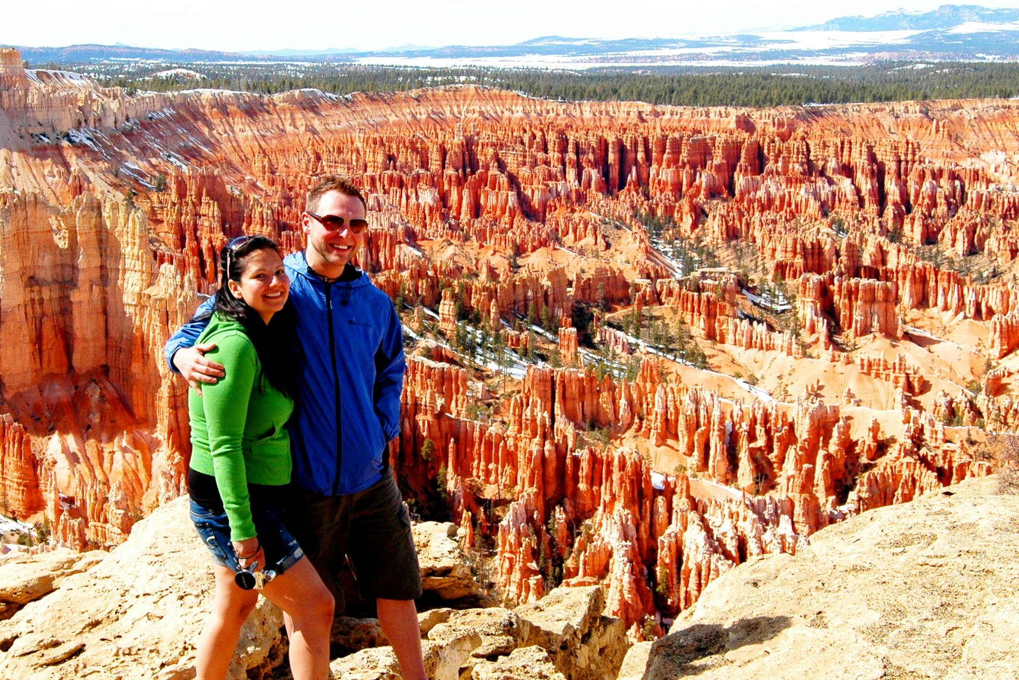
Gold Coast and Surfers Paradise, Queensland. Photo: GrieSeb / Wikimedia Commons. Public domain.
About the Gold Coast
The Gold Coast combines more than 50 kilometres of beaches with shopping centres, restaurants, nightlife, wildlife attractions and some of Australia’s largest theme parks.
Popular areas include:
Surfers Paradise
Broadbeach
Main Beach
Southport
Burleigh Heads
Currumbin
Coolangatta
Kirra
Tamborine Mountain
Springbrook National Park
Surfers Paradise
Surfers Paradise is the Gold Coast’s best-known tourism district.
The area is centred around a wide sandy beach backed by high-rise apartments, hotels, restaurants and entertainment venues.
Visitors can swim, surf, walk along the beachfront, shop around Cavill Avenue or enjoy views across the region from the Q1 building.
Surfers Paradise Beach
Surfers Paradise Beach is one of Australia’s most recognisable city beaches.
The beach stretches for kilometres and is patrolled by surf lifesavers at designated locations.
Always swim between the red and yellow flags and follow surf lifesaving advice because currents and surf conditions can change quickly.
SkyPoint Observation Deck
The SkyPoint Observation Deck is located near the top of the Q1 building in Surfers Paradise.
The observation deck provides panoramic views across the Gold Coast beaches, Broadwater and hinterland.
On clear days, visitors can see far along the coastline and west towards the mountains.
Broadbeach
Broadbeach offers a slightly more relaxed atmosphere than central Surfers Paradise while still providing easy access to beaches, restaurants, cafés and shopping.
The area is also home to Pacific Fair Shopping Centre and The Star Gold Coast.
Burleigh Heads
Burleigh Heads is popular for surfing, swimming, coastal walks and its relaxed beachfront atmosphere.
The headland is protected within Burleigh Head National Park, where walking tracks provide views across the coastline.
The foreshore parklands are also popular for picnics and sunset walks.
Coolangatta
Coolangatta sits at the southern end of the Gold Coast near the New South Wales border.
The area has a more relaxed beach-town atmosphere and is close to several famous surf breaks, including Kirra and Snapper Rocks.
Coolangatta is also convenient for travellers using Gold Coast Airport.
Kirra Beach
Kirra Beach is known for its broad sandy beach and strong surfing heritage.
It is generally quieter than Surfers Paradise and can be a good choice for visitors wanting a relaxed coastal base close to Coolangatta.
Theme Parks
The Gold Coast is home to several major theme parks and family attractions.
Popular options include:
Warner Bros. Movie World
Sea World
Wet’n’Wild
Dreamworld
WhiteWater World
Visitors interested in several parks may want to allow multiple days rather than trying to combine them into a single visit.
Sea World
Sea World is located at Main Beach and combines rides, attractions and marine animal exhibits.
The park is particularly convenient for visitors staying around Surfers Paradise, Broadbeach and Southport.
Warner Bros. Movie World
Warner Bros. Movie World is a movie-themed amusement park featuring roller coasters, family rides, entertainment and character experiences.
It is located inland at Oxenford, north-west of Surfers Paradise.
Dreamworld
Dreamworld is another major Gold Coast theme park, with thrill rides, family attractions and wildlife experiences.
WhiteWater World is located alongside Dreamworld.
Currumbin Wildlife Sanctuary
Currumbin Wildlife Sanctuary is one of the Gold Coast’s best-known wildlife attractions.
Visitors can see Australian animals including koalas, kangaroos, crocodiles and native birds.
The sanctuary also has strong links with wildlife conservation and rehabilitation.
Gold Coast Hinterland
The Gold Coast is not just a beach destination. Less than an hour inland, visitors can explore rainforest, waterfalls and mountain scenery.
Popular hinterland destinations include:
Tamborine Mountain
Springbrook National Park
Lamington National Park
Natural Bridge
O’Reilly’s Rainforest Retreat
Springbrook National Park
Springbrook National Park contains rainforest, waterfalls, lookouts and walking tracks within the Gondwana Rainforests of Australia World Heritage Area.
Popular places include:
Natural Bridge
Purling Brook Falls
Best of All Lookout
Canyon Lookout
Tamborine Mountain
Tamborine Mountain is a popular day trip from the coast.
The mountain area contains rainforest walks, waterfalls, cafés, wineries, galleries and small shops.
Gallery Walk is one of the best-known visitor areas.
Lamington National Park
Lamington National Park protects extensive subtropical rainforest and forms part of the Gondwana Rainforests of Australia World Heritage Area.
The park contains an extensive network of walking tracks, waterfalls and lookouts.
Gold Coast Beaches
The Gold Coast has a long chain of beaches extending from the northern suburbs to the New South Wales border.
Popular beaches include:
Surfers Paradise Beach
Main Beach
Broadbeach
Mermaid Beach
Miami Beach
Burleigh Heads
Palm Beach
Currumbin Beach
Tugun Beach
Kirra Beach
Coolangatta Beach
Surfing
The Gold Coast is one of Australia’s major surfing destinations.
Well-known surf areas include:
Snapper Rocks
Kirra
Burleigh Heads
Currumbin Alley
Beginners can also find surf schools operating at several beaches.
Gold Coast Broadwater
The Broadwater is a sheltered waterway extending north from Southport.
It is popular for boating, kayaking, fishing, swimming and waterfront picnics.
The Broadwater Parklands at Southport provide playgrounds, walking paths and open grassy areas close to the water.
Shopping
The Gold Coast has several major shopping areas.
Popular options include:
Pacific Fair Shopping Centre
Harbour Town Premium Outlets
Robina Town Centre
Australia Fair
Cavill Avenue
Things to Do on the Gold Coast
Swim at Surfers Paradise Beach
Walk along the beachfront
Visit SkyPoint Observation Deck
Spend a day at a theme park
Explore Burleigh Head National Park
Visit Currumbin Wildlife Sanctuary
Surf at one of the famous beaches
Visit Tamborine Mountain
Walk through Springbrook National Park
Shop at Pacific Fair
Explore the Broadwater
Take a whale-watching cruise in season
Whale Watching
Humpback whales migrate past the Gold Coast each year during their journey along Australia’s east coast.
Whale-watching cruises generally operate during the migration season from approximately June to November.
Best Time to Visit the Gold Coast
The Gold Coast can be visited throughout the year.
Spring and autumn usually provide warm temperatures with lower humidity than summer.
Summer is popular for beach holidays but can be hot and humid, with occasional thunderstorms.
Winter days are generally mild and are excellent for walking, sightseeing and outdoor activities.
Getting to the Gold Coast
The Gold Coast is located in south-east Queensland, immediately north of the New South Wales border.
Gold Coast Airport is located near Coolangatta and provides domestic and international flights.
The Gold Coast is also approximately one hour south of Brisbane by road, although travel times vary with traffic.
Getting Around
The Gold Coast has buses, trains and the G:link light rail.
The light rail connects several major areas including:
Broadbeach
Surfers Paradise
Southport
Griffith University
A car is particularly useful if you want to explore the hinterland, national parks and areas away from the main coastal strip.
How Long Should You Spend on the Gold Coast?
A stay of 4 to 7 days provides enough time to combine beaches, theme parks, wildlife attractions and at least one hinterland day trip.
Visitors interested primarily in relaxing on the beach may prefer to stay longer.
Suggested 5-Day Gold Coast Itinerary
Day 1: Surfers Paradise, SkyPoint and the beachfront
Day 2: Burleigh Heads, Currumbin and Coolangatta
Day 3: Visit one of the major theme parks
Day 4: Explore Springbrook National Park or Tamborine Mountain
Day 5: Broadbeach, shopping and the Broadwater
Travel Tip
Do not spend your entire visit around Surfers Paradise. Some of the Gold Coast’s most attractive areas are farther south around Burleigh Heads, Currumbin, Kirra and Coolangatta, while the hinterland provides a completely different rainforest and mountain experience.
If you are swimming at Gold Coast beaches, always use patrolled areas and stay between the red and yellow flags.
Image credit: GrieSeb, via Wikimedia Commons. Released into the public domain.
Sponsored Popular Items
Quick take: Musement.com offers a worldwide selection of tours and attractions
Byron Bay, Gold Coast, Brisbane, Noosa Hop-On Hop-Off Pass Australia Hop-on hop-off along Australia’s East Coast! Travel Byron Bay, Brisbane, Gold Coast, Noosa & Rainbow Beach at your pace, with local tips, must-see spots & exclusive discounts.
'Farm to Bottle' Rum Tour & Tastings: The Tweed/Gold Coast Australia Join us at Husk Farm Distillery for an immersive farm-to-glass experience. With a cocktail in one hand and a cane knife in the other, delve into the sustainable farming processes behind Husk Rum.
Mossman Gorge is one of the most popular places to experience the Daintree Rainforest in Tropical North Queensland. Located near the town of Mossman, the gorge is known for clear rainforest streams, huge granite boulders, walking tracks and dense tropical vegetation.
The area forms part of Daintree National Park and the Wet Tropics of Queensland World Heritage Area. It is also an important cultural landscape for the Eastern Kuku Yalanji people.
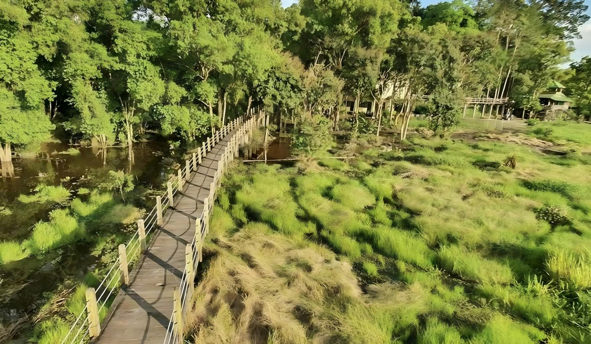
Mossman Gorge in Daintree National Park. Photo: Bernard Gagnon / Wikimedia Commons, CC BY-SA 4.0.
About Mossman Gorge
Mossman Gorge lies within the southern section of Daintree National Park and provides relatively easy access to tropical rainforest.
The Mossman River flows through the gorge between large granite boulders, creating cascades, pools and scenic viewpoints surrounded by dense forest.
Visitors generally begin at the Mossman Gorge Cultural Centre, which provides parking, visitor information, a café, toilets, a gift shop and shuttle transport to the gorge.
Mossman Gorge Cultural Centre
The Mossman Gorge Cultural Centre is the main visitor gateway to the gorge.
Facilities include:
Visitor information
Car parking
Shuttle bus service
Mayi Café
Gift shop
Indigenous art gallery
Toilets and showers
Free Wi-Fi
The centre is also the departure point for guided cultural experiences.
Shuttle Bus to Mossman Gorge
Visitors are strongly encouraged to use the shuttle bus between the Mossman Gorge Cultural Centre and the gorge.
There is no safe pedestrian footpath along the access road, which is narrow and passes through the local community.
The shuttle normally operates every 15 minutes between 8:00 am and 5:00 pm, with the last bus leaving the gorge at approximately 4:30 pm.
Current shuttle prices should be checked before visiting because fares may change.
Walking Tracks
Mossman Gorge contains several walking tracks ranging from short rainforest boardwalks to longer circuits.
Baral Marrjanga
The Baral Marrjanga boardwalk is a short rainforest walk that leads towards views of the Mossman River.
It is a good introduction to the rainforest and suitable for visitors who do not want to undertake a longer walk.
Lower River Track
The Lower River Track follows sections of the Mossman River and provides views of granite boulders, rainforest vegetation and flowing water.
Rainforest Circuit Track
The Rainforest Circuit Track takes visitors deeper into the forest, passing vines, buttress roots, palms and towering rainforest trees.
Allow around 1 to 1.5 hours for a relaxed walk, depending on stops and conditions.
Rex Creek Suspension Bridge
The Rex Creek Suspension Bridge is one of the landmarks along the walking tracks at Mossman Gorge.
The bridge crosses a rainforest creek and provides a scenic point along the longer walking routes.
Ngadiku Dreamtime Walk
One of the most distinctive experiences at Mossman Gorge is the Ngadiku Dreamtime Walk.
These guided walks are conducted by local Indigenous guides and introduce visitors to the culture, traditions and rainforest knowledge of the Eastern Kuku Yalanji people.
Experiences may include stories, traditional plant uses and visits to culturally significant parts of the rainforest.
Swimming at Mossman Gorge
The clear water of the Mossman River can look inviting, but conditions can change rapidly.
Strong currents, submerged rocks and rapidly rising water can create hazards, particularly after heavy rain.
Visitors should always obey signs and current safety advice and should not enter the water when conditions are unsafe.
Wildlife
The rainforest around Mossman Gorge supports a wide variety of wildlife.
Animals that may be seen include:
Butterflies
Rainforest birds
Boyd’s forest dragons
Possums
Frogs
Goannas
Southern cassowaries
Wildlife should never be fed or approached closely.
Things to Do at Mossman Gorge
Walk through tropical rainforest
See the Mossman River and granite boulders
Cross the Rex Creek Suspension Bridge
Join a Ngadiku Dreamtime Walk
Visit the Indigenous art gallery
Learn about Eastern Kuku Yalanji culture
Photograph rainforest scenery
Enjoy lunch or coffee at the Cultural Centre
Continue north towards the Daintree River and Cape Tribulation
Best Time to Visit Mossman Gorge
Mossman Gorge can be visited throughout the year.
The period from approximately May to October generally brings lower humidity and less rainfall, making it particularly comfortable for walking.
The summer wet season is hotter and more humid, with heavier rainfall and an increased possibility of high river levels.
Getting to Mossman Gorge
Address:
Mossman Gorge Cultural Centre
212r Mossman Gorge Road
Mossman QLD 4873
Australia
Mossman Gorge is approximately 75 kilometres north of Cairns.
The drive from Cairns usually takes around 1 hour and 15 minutes, depending on traffic.
From Port Douglas, Mossman Gorge is considerably closer and makes an easy half-day or full-day excursion.
How Long Should You Spend?
Allow at least 2 to 3 hours to explore the Cultural Centre and complete some of the shorter rainforest walks.
Allow around half a day if you plan to complete a longer walking circuit or join a Dreamtime Walk.
Mossman Gorge can also be combined with a full-day drive to the Daintree River and Cape Tribulation.
Suggested Mossman Gorge Visit
A good visit could include:
Arrive at the Mossman Gorge Cultural Centre
Take the shuttle to the gorge
Walk along the river tracks
Cross the Rex Creek Suspension Bridge
Complete part of the Rainforest Circuit
Return to the Cultural Centre
Visit the Indigenous art gallery
Enjoy lunch or coffee at Mayi Café
Travel Tip
Wear comfortable walking shoes and take drinking water, insect repellent and rain protection.
Use the official shuttle rather than walking along the access road, and check current river, weather and park conditions before entering the gorge.
Image credit: Bernard Gagnon, via Wikimedia Commons. Licensed under Creative Commons Attribution-ShareAlike 4.0.
Sponsored Popular Items
Quick take: Musement.com offers a worldwide selection of tours and attractions
Mossman Gorge: Day Tour with River Drift Experience Australia Immerse yourself in a rainforest experience like no other. Explore Mossman Gorge by wandering through the back country and floating down the river, and enjoy a freshly prepared lunch… Check current availability, inclusions and booking conditions.
Port Douglas: Mossman Gorge Cultural Walk with Transfers Australia Explore the Mossman Gorge Daintree Rainforest on a guided walk with a Kuku Yalanji guide. Learn about bush foods, rainforest medicines, and traditional practices, visit culturally… Check current availability, inclusions and booking conditions.
Port Douglas: Daintree Rainforest & Mossman Gorge Tour Australia Journey through the lush Daintree Rainforest, discover the remote beauty of Cape Tribulation, and explore the pristine waters of Mossman Gorge, all in one unforgettable day of adventure. Check current availability, inclusions and booking conditions.
The Daintree Rainforest in Tropical North Queensland is one of Australia’s most remarkable natural attractions. Dense tropical forest, clear rivers, mountain ranges and secluded beaches combine to create a landscape unlike almost anywhere else in the country.
The Daintree forms part of the Wet Tropics of Queensland World Heritage Area and contains exceptionally ancient rainforest, an extraordinary variety of plants and wildlife, and places of great cultural importance to the Eastern Kuku Yalanji people.
Daintree Rainforest, Queensland. Photo: Robert Linsdell / Wikimedia Commons, CC BY 2.0.
About the Daintree Rainforest
Daintree National Park is generally explored in two main areas: Mossman Gorge in the south and the coastal rainforest around Cape Tribulation north of the Daintree River.
The region is particularly unusual because tropical rainforest extends towards the coastline, bringing two World Heritage-listed environments — the Wet Tropics and the Great Barrier Reef — remarkably close together.
Mossman Gorge
Mossman Gorge is one of the easiest places to experience the Daintree Rainforest and is approximately 75 kilometres north of Cairns.
The Mossman River flows through the rainforest between huge granite boulders, creating attractive cascades and clear pools surrounded by dense vegetation.
Visitors normally begin at the Mossman Gorge Centre, where shuttle buses provide transport to the main walking tracks.
Walks at Mossman Gorge
Several walking tracks allow visitors to explore different sections of the rainforest.
Baral Marrjanga
The Baral Marrjanga boardwalk is approximately 270 metres one way and leads through the lower rainforest canopy to views over the Mossman River.
Lower River Track
The Lower River Track follows the Mossman River through rainforest and provides views of granite boulders and cascading water.
Rainforest Circuit Track
The Rainforest Circuit Track is approximately 2.4 kilometres and usually takes around 1 to 1.5 hours.
The track travels deeper into the forest past huge strangler figs, vines and buttress roots.
Ngadiku Dreamtime Walk
Visitors interested in learning more about the area’s Aboriginal heritage can join a Ngadiku Dreamtime Walk at Mossman Gorge.
Guided by local Indigenous guides, these experiences introduce visitors to Eastern Kuku Yalanji culture, traditional plant uses, rainforest knowledge and the cultural significance of the landscape.
Crossing the Daintree River
To continue towards Cape Tribulation, visitors cross the Daintree River by vehicle ferry.
Once across the river, the road travels through increasingly dense rainforest with beaches, walking tracks and viewpoints located along the route.
The ferry is an important part of the Daintree experience and is the main road access to communities north of the river.
Daintree River Cruises
A wildlife cruise on the Daintree River is one of the most popular activities in the region.
Guided cruises explore the river and mangrove-lined waterways while looking for wildlife.
Animals that may be seen include:
Estuarine crocodiles
Tree snakes
Kingfishers
Herons
Frogs
Butterflies
Other tropical birds
Wildlife sightings can never be guaranteed, but experienced guides know many of the locations where crocodiles and other animals are regularly seen.
Alexandra Lookout
Alexandra Lookout provides one of the best roadside views in the Daintree.
The lookout offers panoramic views across the rainforest towards the Daintree River, surrounding coastline and Coral Sea.
It makes a convenient stop when travelling between the Daintree River and Cape Tribulation.
Rainforest Boardwalks
Several short boardwalks allow visitors to explore the rainforest without undertaking a long hike.
These walks pass through different environments including lowland rainforest, mangroves and swamp forest.
They are excellent places to look for tropical plants, butterflies, lizards and rainforest birds.
Cape Tribulation
Cape Tribulation is one of the most famous destinations within the Daintree region.
Here, forest-covered mountains descend towards beaches and the Coral Sea, creating one of Australia’s most distinctive tropical landscapes.
Visitors can explore beaches, rainforest walks and coastal viewpoints or join guided rainforest and adventure tours.
Cape Tribulation Beach
Cape Tribulation Beach is backed by dense tropical vegetation and offers impressive views of the surrounding rainforest-covered mountains.
Although the beaches are beautiful, visitors should follow local swimming advice because marine stingers and crocodiles can occur in tropical North Queensland waters.
Wildlife in the Daintree
The Daintree supports an exceptional range of wildlife, including several species found in very few other places.
Animals that may be encountered include:
Southern cassowaries
Musky rat-kangaroos
Boyd’s forest dragons
Daintree River ringtail possums
Ulysses butterflies
Wompoo fruit-doves
Victoria’s riflebirds
Estuarine crocodiles
Southern Cassowary
The endangered southern cassowary is one of the Daintree’s most famous residents.
These large flightless birds play an important role in maintaining the rainforest by eating fruit and spreading seeds.
If you encounter a cassowary, keep your distance, never feed it and follow national park safety advice.
Things to Do in the Daintree Rainforest
Explore Mossman Gorge
Join a Ngadiku Dreamtime Walk
Take a Daintree River wildlife cruise
Cross the Daintree River by ferry
Visit Alexandra Lookout
Walk through tropical rainforest
Look for cassowaries and other wildlife
Visit Cape Tribulation
Explore rainforest boardwalks
Photograph rainforest-covered mountains and beaches
Best Time to Visit the Daintree
The Daintree Rainforest can be visited throughout the year.
The period from approximately May to October generally brings lower humidity, cooler temperatures and less rainfall, making it particularly popular for sightseeing and walking.
The warmer wet season brings higher humidity and heavier tropical rainfall, but the rainforest becomes especially lush and waterfalls and streams can be more impressive.
Getting to the Daintree Rainforest
The Daintree is north of Cairns and Port Douglas in Tropical North Queensland.
Mossman Gorge is approximately 75 kilometres north of Cairns and is easily reached by road via the Captain Cook Highway.
From Port Douglas, Mossman Gorge is considerably closer and can be visited as part of a day trip.
Travellers continuing to Cape Tribulation cross the Daintree River by ferry before following the road north through the rainforest.
Great Barrier Reef Drive
The journey north from Cairns towards the Daintree follows sections of the spectacular Great Barrier Reef Drive.
The coastal road passes beaches, rainforest-covered mountains and views of the Coral Sea, making the journey part of the attraction.
How Long Should You Spend in the Daintree?
The Daintree can be visited on a full-day trip from Cairns or Port Douglas, but this provides only a brief introduction to the region.
Spending 2 to 3 days allows more time to explore Mossman Gorge, take a river cruise, walk the rainforest boardwalks and stay around Cape Tribulation.
Suggested Daintree Day Trip
A good one-day itinerary could include:
Leave Cairns or Port Douglas early in the morning
Visit Mossman Gorge
Continue to the Daintree River
Join a wildlife cruise
Cross the river by ferry
Stop at Alexandra Lookout
Complete a rainforest boardwalk
Visit Cape Tribulation
Return in the late afternoon
Travel Tip
Take insect repellent, drinking water, sun protection, comfortable walking shoes and lightweight rain protection when exploring the Daintree.
Tropical weather can change quickly, particularly during the wet season. Check current road conditions and Queensland Parks alerts before travelling north of the Daintree River.
Never swim in rivers, creeks or beaches unless the location is specifically identified as safe, and always obey crocodile and marine stinger warning signs.
Image credit: Robert Linsdell, via Wikimedia Commons. Licensed under Creative Commons Attribution 2.0.
Sponsored Popular Items
Quick take: Musement.com offers a worldwide selection of tours and attractions
Southern Daintree Explorer Tour - Half Day Australia Join our experienced guides as they take you through the most amazing locations of the Southern Daintree Rainforest on this exclusive small group experience. Check current availability, inclusions and booking conditions.
Private Daintree Rainforest and Wildlife Half-Day Tour Australia Discover the essence of the Daintree on a private half-day tour. Enjoy a guided rainforest walk in Mossman Gorge and a private Daintree River crocodile cruise. Check current availability, inclusions and booking conditions.
Port Douglas: Daintree Rainforest Canopy Ziplining Tour Australia Explore the rainforest canopy of the ancient Daintree Rainforest with this ziplining adventure in Cape Tribulation. Soar at heights of up to 15 meters on a fully-guided 2-hour zipline… Check current availability, inclusions and booking conditions.
Kosciuszko National Park is one of Australia’s most spectacular alpine destinations and home to Mount Kosciuszko, the highest mountain on the Australian mainland at 2,228 metres above sea level.
Located in the Snowy Mountains of southern New South Wales, the park offers hiking, skiing, mountain biking, scenic drives, alpine lakes, wildflowers and dramatic high-country landscapes.
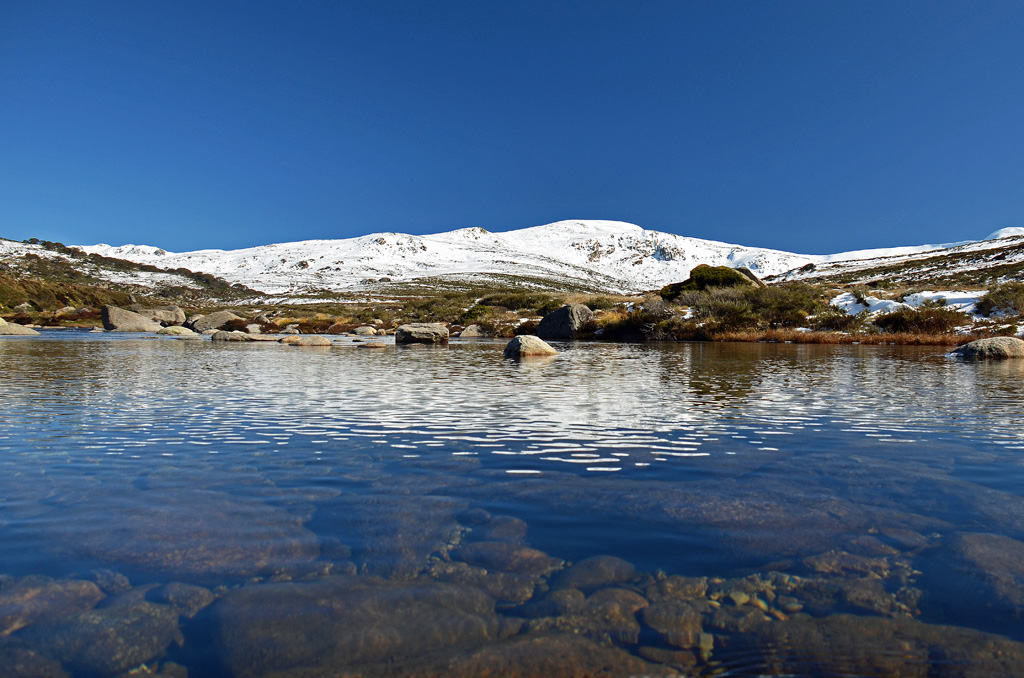
Mount Kosciuszko from the Snowy River in Kosciuszko National Park.
About Kosciuszko National Park
Kosciuszko National Park is the largest national park in New South Wales and protects much of Australia’s alpine environment.
The park includes snow-covered peaks, granite landscapes, alpine meadows, rivers, wetlands, forests and important habitats for native wildlife.
Popular visitor areas include Thredbo, Perisher, Charlotte Pass, Jindabyne, Selwyn and the high alpine country surrounding Mount Kosciuszko.
Mount Kosciuszko
Mount Kosciuszko is the highest mountain on mainland Australia and one of the main attractions in the national park.
Unlike many of the world’s highest mountains, reaching the summit does not require technical climbing during suitable summer conditions.
There are several walking routes to the summit, with popular approaches beginning from Thredbo and Charlotte Pass.
Kosciuszko Walk from Thredbo
One of the most popular ways to reach Mount Kosciuszko is from Thredbo.
Visitors can take the Kosciuszko Express chairlift up the mountain and then follow the walking track towards the summit.
The route passes through alpine landscapes and provides extensive views across the Snowy Mountains.
Conditions can change quickly at high altitude, so walkers should carry warm clothing, water and suitable footwear even during summer.
Mount Kosciuszko Summit Walk from Charlotte Pass
Another option is the Mount Kosciuszko Summit Walk from Charlotte Pass.
The official NSW National Parks route is approximately 18.6 kilometres return and usually takes around 6 to 8 hours.
The track is graded Grade 3 and follows a formed route through the high alpine landscape.
Main Range Walk
The Main Range Walk is one of the most impressive longer hikes in Kosciuszko National Park.
It explores some of Australia’s highest country and passes alpine lakes, ridges and extensive mountain scenery.
This walk is best suited to experienced and well-prepared hikers because alpine weather can change rapidly.
Thredbo
Thredbo is one of Australia’s best-known alpine villages and provides year-round access to Kosciuszko National Park.
During winter, it operates as a major ski resort.
During the warmer months, visitors come for hiking, mountain biking, sightseeing and access to the Mount Kosciuszko walking tracks.
Perisher
Perisher is another major alpine resort within Kosciuszko National Park.
It is best known for skiing and snowboarding during winter but also provides access to walking tracks and alpine scenery during the warmer months.
Charlotte Pass
Charlotte Pass is Australia’s highest alpine village and provides access to several important walking tracks.
During summer, visitors can drive to Charlotte Pass via Kosciuszko Road.
During winter, the road between Perisher and Charlotte Pass is closed to normal vehicles, and access is generally by oversnow transport.
Winter Activities
Kosciuszko National Park is Australia’s premier snow-sports destination.
Winter activities include:
Skiing
Snowboarding
Cross-country skiing
Snowshoeing
Tobogganing in designated areas
Snow sightseeing
Major ski areas include Thredbo, Perisher, Charlotte Pass and Selwyn.
Summer Activities
During the warmer months, the national park becomes an excellent destination for walking, cycling and sightseeing.
Popular summer activities include:
Walking to Mount Kosciuszko
Mountain biking
Scenic chairlift rides
Photography
Wildflower viewing
Fishing
Camping
Scenic drives
Alpine Wildflowers
During summer, sections of the high country are covered with alpine wildflowers.
The flowering season varies depending on weather and snow conditions, but December through February is generally an excellent period for seeing alpine vegetation.
Visitors should remain on marked tracks to protect fragile alpine plants.
Wildlife
Kosciuszko National Park provides habitat for a variety of native wildlife.
Animals that may be seen include:
Kangaroos
Wallabies
Wombats
Echidnas
Possums
Native birds
The park is also home to the endangered mountain pygmy-possum, one of Australia’s rarest small mammals.
Things to Do in Kosciuszko National Park
Walk to the summit of Mount Kosciuszko
Visit Thredbo
Explore Charlotte Pass
Ski or snowboard in winter
Walk the Main Range
See alpine wildflowers
Go mountain biking
Enjoy scenic drives
Visit alpine lookouts
Explore the Snowy River headwaters
Best Time to Visit
Kosciuszko National Park can be visited throughout the year.
December to March is generally the best period for hiking in the high alpine areas.
June to October is the main snow season, although exact conditions vary each year.
Spring can still bring snow and icy conditions at higher elevations.
Getting to Kosciuszko National Park
The main gateway town is Jindabyne.
From Canberra, the drive to Jindabyne is approximately two hours, depending on traffic and road conditions.
From Jindabyne:
Thredbo is approximately 33 kilometres away
Perisher is approximately 33 kilometres away
Charlotte Pass is around 40 kilometres away
Park entry fees apply on major access roads into the alpine areas.
Winter Driving
Winter driving in Kosciuszko National Park requires additional preparation.
Between the June and October long weekends, two-wheel-drive vehicles travelling on specified alpine roads are required to carry snow chains.
Roads may also close temporarily because of snow, ice or severe weather.
Always check current road conditions and park alerts before travelling.
How Long Should You Spend?
A single day is enough to visit Thredbo and complete a shorter alpine walk.
Allow 2 to 4 days if you want to explore several areas of the park, climb Mount Kosciuszko and visit Jindabyne, Charlotte Pass and other alpine locations.
A longer stay is recommended during winter if skiing or snowboarding is your main reason for visiting.
Suggested Summer Day
A good summer itinerary could include:
Start the morning in Thredbo
Take the chairlift into the alpine area
Walk towards Mount Kosciuszko
Reach the summit and enjoy the mountain views
Return to Thredbo in the afternoon
Finish the day with dinner in Thredbo or Jindabyne
Travel Tip
Alpine weather can change very quickly, even during summer. Carry warm and waterproof clothing, adequate water, sun protection and suitable walking shoes.
Before starting any longer walk, check the latest weather forecast, road conditions and NSW National Parks alerts.
Sponsored Popular Items
Quick take: Musement.com offers a worldwide selection of tours and attractions
Blue Mountains: Inside a World Heritage National Park Australia Immerse yourself in the beauty of the World-Heritage Blue Mountains NP. Experience the magnificent valleys, falls and gorges of this spectacular wilderness with a small group of max. of 10 guests.
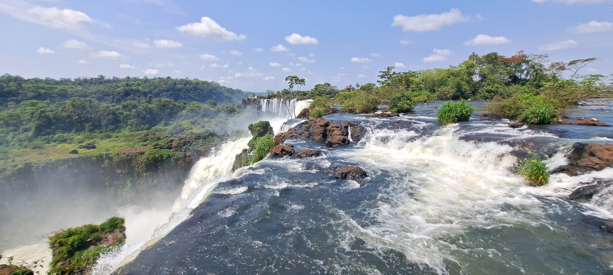
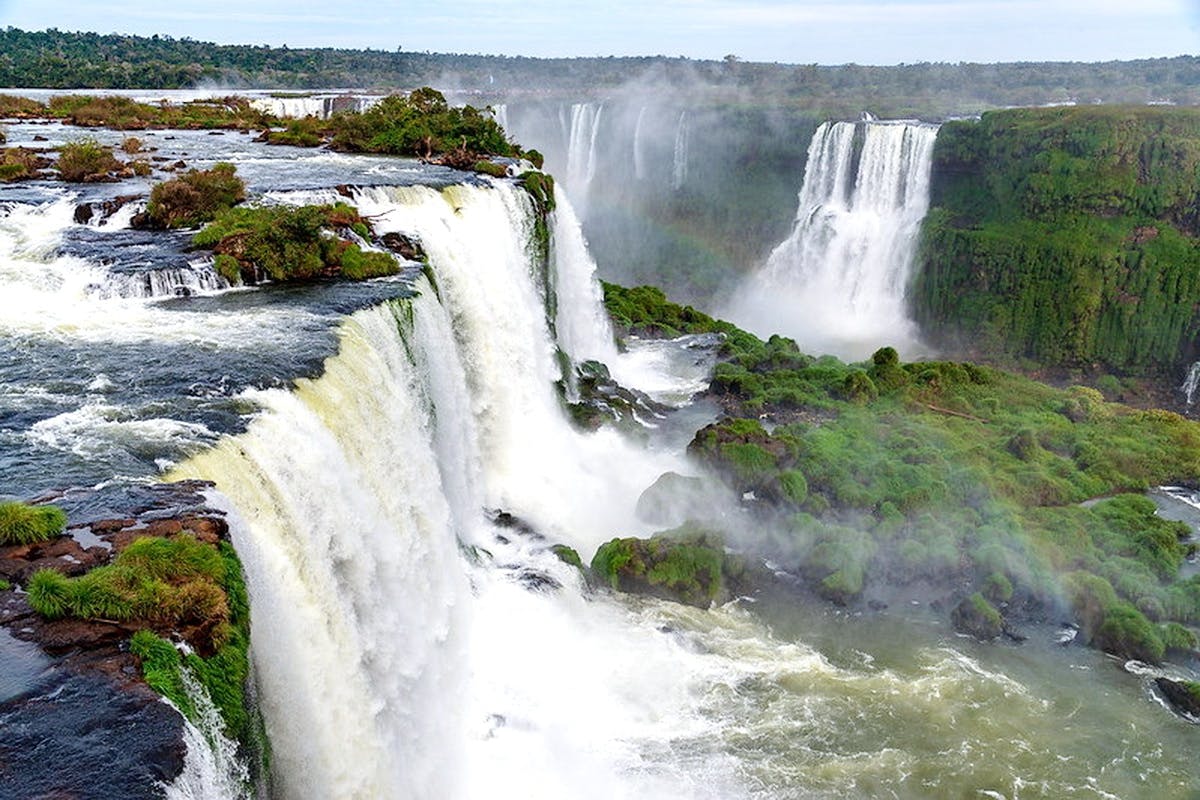
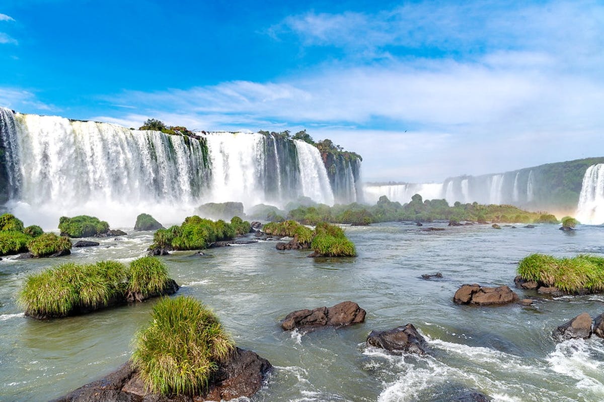
Iguazu Falls is one of South America’s great natural experiences: an immense system of waterfalls cutting through subtropical rainforest on the border between Argentina and Brazil. Rather than one single waterfall, Iguazu is a vast semicircular complex of cascades spread across roughly 2.7 kilometres, with major drops reaching about 80 metres.
The waterfalls are protected by two adjoining national parks: Iguazú National Park in Argentina and Iguaçu National Park in Brazil. Argentina’s park became a UNESCO World Heritage Site in 1984 and Brazil’s neighbouring park followed in 1986. Together they protect one of the most significant surviving areas of the Interior Atlantic Forest.
If your itinerary allows it, visit both countries. The experiences are genuinely different. Argentina provides the longer and more immersive visit, with extensive walkways taking you above and close to the waterfalls. Brazil provides the great panoramic view, allowing you to stand back and appreciate the extraordinary scale of the entire landscape.
Important August 2026 Devil’s Throat Update
As of 17 August 2026, the Argentine Circuito Garganta del Diablo is temporarily CLOSED. The official Iguazú Argentina visitor page currently states that the circuit has been closed preventively because of increased flow in the Iguazú River.
This is a temporary safety measure and can change quickly. The Argentine Upper and Lower Circuits remain separate attractions, so a visit to the Argentine park is still worthwhile even when the Devil’s Throat walkway is unavailable. Check the official circuit status immediately before travelling.
On the Brazilian side, the official park reported on 5 August 2026 that its main Cataratas walkway remained open for visitors and that conditions were being continually monitored. River conditions can change rapidly, so the same advice applies: verify the latest status before setting out.
Iguazu Falls at a Glance
Visitor Information
Details
Countries
Argentina and Brazil
Main gateway towns
Puerto Iguazú, Argentina and Foz do Iguaçu, Brazil
Waterfall frontage
About 2.7 km
Major drop height
Up to approximately 80 m
Commonly quoted number of cascades
About 275, varying with water conditions and definition
Argentina UNESCO status
1984
Brazil UNESCO status
1986
Argentina 2026 international admission
AR$60,000
Brazil 2026 international/full admission
R$134
Argentina visit
Allow most of a day
Brazil traditional visit
Approximately 2 hours
Recommended total stay
2 full days; 3 nights is comfortable
Best overall plan
One day Argentina + half to full day Brazil
Why Iguazu Falls Is So Impressive
The scale is difficult to appreciate from photographs. The Iguazú River reaches a broad basaltic escarpment and breaks into numerous channels, islands and cascades before plunging into the gorge below.
Official Argentine information commonly describes the system as containing approximately 275 separate falls, while UNESCO describes the main semicircular waterfall system as roughly 2,700 metres across and up to about 80 metres high.
The surrounding rainforest is equally important. UNESCO records more than 2,000 species of vascular plants and wildlife including tapirs, howler monkeys, ocelots, jaguars and caimans within the protected ecosystem.
Argentina or Brazil: Which Side Is Better?
The best answer is both.
The two sides are complementary rather than repetitive.
Argentina
Brazil
Longer visit
Shorter visit
Extensive walking circuits
Outstanding panoramic views
Walk above and close to numerous falls
Look across towards a broad wall of waterfalls
Eco-train inside the park
Internal park transport from visitor centre
Upper and Lower Circuits
Approximately 1 km traditional waterfall trail
Usually needs most of a day
Traditional experience approximately 2 hours
Best for exploring
Best for appreciating overall scale
If You Have Only One Day
If you must choose only one side, the decision depends on what you want from the experience.
Choose Argentina If:
You want the longest waterfall experience.
You enjoy walking.
You want several different viewpoints.
You want to move through the rainforest rather than simply view the falls from a distance.
You have most of the day available.
Choose Brazil If:
You have limited time.
You want the strongest overall panoramic view.
You prefer less walking.
You have reduced mobility.
You want to combine the falls with another Foz do Iguaçu activity.
Argentina: Parque Nacional Iguazú
The Argentine side provides the most extensive network of visitor trails and walkways.
Current admission includes access to the Upper Circuit, Lower Circuit, Green Trail, Ecological Train, Devil’s Throat Circuit when open, Macuco Trail and visitor facilities.
Iguazú National Park protects more than 67,000 hectares of the Selva Paranaense ecosystem in Misiones Province.
Argentina 2026 Admission Prices
Current official rates have applied since 1 June 2026.
Category
Current Admission
General / international visitor
AR$60,000
Argentine resident
AR$25,000
Misiones provincial resident
AR$8,000
Student qualifying for concession
AR$15,000
Children age 0–6
Free
Other exemptions apply to specified categories such as qualifying visitors with disabilities and certain Argentine resident groups. Bring appropriate documentation if claiming a concession.
50% Discount for a Second Argentine National Park Day
Argentina’s current National Parks tariff system provides a 50% reduction for a second visit under its applicable repeat-visit arrangements. This can make a second day particularly attractive if you want to explore Iguazú without rushing.
Confirm the validation procedure when buying the first ticket so that your return visit qualifies correctly.
Argentina Opening Hours
The Argentine Cataratas area is normally open:
Every day: 8:00 am–6:00 pm
including public holidays and rainy days.
General entry to the park is currently permitted until 4:00 pm. You should not arrive anywhere near that late if this is your first visit.
Arrive close to 8:00 am. There is enough to see that the Argentine side deserves most of the day.
The Ecological Jungle Train
The Tren Ecológico de la Selva connects the principal visitor areas inside the Argentine park and is included with admission.
The normal timetable currently begins with the first train at about 8:20 am. The final scheduled train towards the Devil’s Throat area is around 3:30 pm, although the Devil’s Throat circuit is currently closed because of river conditions.
Trains normally operate at intervals of roughly 30–40 minutes.
Do not assume the train is always the fastest option. The short Green Trail can be an enjoyable walking alternative between the main visitor services and Cataratas Station.
The Green Trail
Sendero Verde is a straightforward rainforest path connecting the service area with Cataratas Station.
Current details are:
Length: 650 metres one way
Walking time: approximately 15 minutes
Difficulty: low
Wheelchair accessibility: 100%
It is a pleasant way to begin the day and gives you a better feeling for the forest than spending every internal journey on the train.
The Upper Circuit
Circuito Superior provides broad views from above the waterfalls.
The newly expanded current route is approximately:
3.7 km return
About 90 minutes
Low difficulty
100% wheelchair accessible
The circuit provides viewpoints over falls including Dos Hermanas, Ramírez and Bossetti as well as wider panoramas over the San Martín area.
This is one of the best sections for photography because you look across and down onto the water rather than constantly standing within heavy spray.
The Lower Circuit
Circuito Inferior takes you closer to the base and sides of several cascades and consequently feels more physical and immersive.
Current official information gives:
Length: approximately 2.9 km return
Duration: around 90 minutes
Difficulty: medium
Wheelchair accessible: approximately 70%
Parts of the circuit involve steep stairs, although an adapted alternative path is available for some sections.
If you have enough mobility, do both the Upper and Lower Circuits. They present the same waterfall system from completely different levels.
Devil’s Throat – Garganta del Diablo
Garganta del Diablo, or Devil’s Throat, is the most powerful and famous section of Iguazu Falls.
The main drop is approximately 80 metres and funnels enormous volumes of water into a horseshoe-shaped gorge, producing a continuous cloud of spray.
Under normal conditions, the Argentine experience involves travelling towards Garganta Station and then following a long raised walkway across islands and channels of the upper Iguazú River until suddenly reaching the edge of the chasm.
The official circuit is approximately 2.2 km return and normally fully wheelchair accessible.
Current Devil’s Throat Closure
Do not plan your August 2026 itinerary assuming this circuit is open.
At the time of writing, the official operator marks it:
“CERRADO – Cierre preventivo por aumento del caudal del Río Iguazú.”
High water is part of the natural behaviour of Iguazu. Walkways on both sides can be temporarily restricted when river volume reaches safety thresholds.
Check again on the morning of your visit because conditions can improve or deteriorate quickly.
Macuco Trail
Visitors wanting more rainforest and fewer crowds can consider Sendero Macuco.
The current route is approximately:
7.6 km return
About 3 hours
Medium difficulty
Natural trail without normal visitor services
The trail finishes at Salto Arrechea, a 23-metre rainforest waterfall. Opening depends on weather and trail conditions and is decided by park rangers.
Do not add Macuco to a first one-day visit unless you are a keen walker and have already allowed enough time for the principal waterfall circuits.
Brazil: Parque Nacional do Iguaçu
The Brazilian side gives the great panoramic experience.
Instead of spending hours moving between numerous separate circuits, the traditional visit is more linear. Internal park transport takes visitors from the entrance area into the protected zone, after which a waterfall trail passes a succession of viewpoints before reaching the most dramatic section close to Devil’s Throat.
Brazil’s Iguaçu National Park covers approximately 169,696 hectares and has been a UNESCO World Heritage Site since 1986.
Brazil 2026 Admission Prices
Current official 2026 admission is:
Ticket
Current Price
Full / international admission
R$134
Brazil / Mercosur tariff
R$121
Local Community Pass
R$26
Children up to age 6
Free
The published R$134 full price includes R$131 admission plus a R$3 voluntary contribution to Fundo Iguaçu.
Book the Brazilian Side Ahead
The park strongly recommends purchasing tickets online and selecting your day and entry time when booking. Availability is controlled by time period, making advance booking particularly sensible during busy weekends and holiday seasons.
Brazil Opening Hours
Current normal opening times are:
Day
Current Entry Hours
Monday–Friday
9:00 am–4:00 pm
Saturday–Sunday
8:30 am–4:00 pm
Your booking time is an entry time rather than a compulsory exit time. Once admitted, visitors can currently remain inside until the park’s full closing time of approximately 5:30 pm.
What Is Included on the Brazilian Side?
Regular admission currently includes:
Internal transport between the Visitor Centre and waterfall area
Approximately 12 km of internal park transport each way
Access to the traditional Cataratas Trail
Approximately 1 km of waterfall walking trail
Main walkways and viewpoints
Elevator access in the principal visitor area
Additional included nature trails within the park
The park estimates about two hours for the standard waterfalls experience.
The Brazilian Cataratas Trail
The traditional Brazilian walkway is roughly 1 kilometre long.
It begins with more distant views and gradually becomes increasingly dramatic as you approach the principal viewing areas.
This progressive reveal is one of the strengths of the Brazilian side. Instead of immediately reaching the biggest waterfall, the view expands as you walk.
Prepare to Get Wet
At the principal Brazilian walkway near Devil’s Throat, mist can become heavy enough to soak clothing.
Bring:
A lightweight rain jacket or poncho
Water-resistant bag or phone pouch
Comfortable shoes with grip
Quick-drying clothing where possible
A bright sunny day does not mean you will remain dry beside Iguazu Falls.
Additional Brazil Nature Trails
The Brazilian park has expanded considerably beyond the traditional one-kilometre waterfall walk.
Current regular admission also provides access to several longer routes, including the Caminho do Poço Preto, Caminho das Bananeiras, Circuito São João and other nature trails.
For example, the Caminho do Poço Preto extends approximately nine kilometres into Atlantic Forest, while Caminho das Bananeiras covers about 2.6 kilometres return.
These additions make the Brazilian park much more suitable for a full-day nature visit than older travel guides suggest.
Boat Trips
Both sides offer optional adventure experiences associated with the falls, including boat trips that take passengers into the river below the cascades.
Expect to become extremely wet on the more adventurous versions.
Boat excursions cost extra and operate separately from the normal national-park admission. Availability and safety conditions depend on water levels, so check the day’s operation before committing to the experience.
Should You Do a Boat Ride?
Yes, if you enjoy adventure and do not mind getting soaked.
A waterfall walkway shows you Iguazu. A river boat gives you a much stronger feeling for the sheer force of the water.
However, skip it if:
You dislike rough boat rides.
You have a relevant back or neck problem.
You need to keep cameras or medical equipment dry.
You have limited time and have not yet walked the main circuits.
Wildlife
Iguazu is not only about waterfalls.
The surrounding Atlantic Forest supports exceptional biodiversity, and wildlife commonly seen around the visitor areas can include:
Coatis
Toucans
Monkeys
Butterflies
Lizards
Numerous forest birds
Much rarer animals protected within the wider national parks include jaguars, tapirs and ocelots.
Do Not Feed the Coatis
Coatis frequently approach areas where tourists eat.
Do not feed them and do not encourage them to approach for photographs.
Keep food securely packed away and maintain distance from wildlife. Animals that appear accustomed to people are still wild animals and can bite or scratch.
Accessibility on the Argentine Side
The Argentine park has made significant sections accessible.
Current official information states that:
Upper Circuit: 100% wheelchair accessible
Devil’s Throat Circuit: normally 100% accessible when open
Green Trail: 100% accessible
Lower Circuit: approximately 70% accessible with some stairs
Conventional wheelchairs are available free at train stations and need to be pushed by a companion. A free golf-cart transfer is also available for qualifying visitors with reduced mobility between the entrance area and Central Station.
Accessibility on the Brazilian Side
The Brazilian park provides accessible internal transport and access at its principal viewpoints.
Conventional wheelchairs can currently be borrowed free from the Visitor Centre, and elevators form part of the traditional waterfall visit.
For travellers with substantially reduced mobility, the Brazilian side is often the easier of the two experiences to manage because the traditional itinerary is shorter.
Visiting With Children
Iguazu works very well for families, although young children may become tired during a full Argentine day.
Useful strategies include:
Start early.
Do not attempt every optional jungle trail.
Carry water and snacks where permitted.
Use the train when children become tired.
Keep children close around wildlife.
Bring a waterproof layer.
The Argentine park currently offers stroller rental for children up to about two years old, and many main walkways are suitable for pushchairs.
Where Should You Stay?
Puerto Iguazú, Argentina
Best if your priority is the extensive Argentine park.
Puerto Iguazú has a broad range of hotels, restaurants and tour services and provides easy access to the Argentine national-park entrance.
Foz do Iguaçu, Brazil
Best for a larger city base and the Brazilian park.
Foz has a wider urban infrastructure and straightforward road access towards the national park and airport.
Stay Close to the Parks
Several accommodation options lie closer to the protected areas for travellers who value rainforest surroundings and early access more than nightlife and town restaurants.
Do You Need to Change Hotels to See Both Countries?
No.
Many travellers stay entirely in either Puerto Iguazú or Foz do Iguaçu and cross the international border for the other park.
Changing hotels for a two-night visit usually creates unnecessary luggage handling.
The important issue is allowing enough time for immigration and border procedures. Crossing between Argentina and Brazil is an international border journey, so carry the required travel documents and verify entry requirements applying to your nationality before travelling.
Puerto Iguazú or Foz do Iguaçu?
Puerto Iguazú Is Particularly Good For:
Immediate focus on the Argentine falls
A smaller tourism-oriented town
Restaurants and hotels within a compact centre
Foz do Iguaçu Is Particularly Good For:
Larger choice of urban services
Easy Brazilian park access
Longer stays in the wider Triple Frontier region
For a short waterfall-focused trip, either makes a perfectly practical base.
Getting to the Brazilian Falls
The Brazilian park lies on BR-469 outside central Foz do Iguaçu.
The current official visitor information identifies local bus 120 – Parque Nacional/Aeroporto as the public bus linking the urban terminal with the national park.
Taxi, ride-hailing services and organised transfers are also practical.
Driving to the Brazilian Park
Private vehicles are left at the Visitor Centre because normal visitor cars do not continue into the protected waterfall area. Internal transport is included with the admission ticket.
Current public parking for cars and motorcycles is approximately R$65 per day.
How Many Days Do You Need?
One Day
Possible but compromised.
Choose one country rather than trying to race through both parks unless you have a private transfer and are comfortable with a tightly scheduled day.
Two Days
Best minimum.
Devote one day to Argentina and the second to Brazil.
Three Days
Best for a relaxed visit.
You gain flexibility for weather, border delays, a boat activity or additional forest walking.
A Sensible Two-Day Strategy
Day 1 – Argentina
Arrive at opening and concentrate on the main circuits.
With the current August 2026 Devil’s Throat closure, devote additional time to the Upper and Lower Circuits and rainforest areas rather than rushing through the park.
Day 2 – Brazil
Book an early entry time for the Brazilian park and take the traditional waterfall route at a relaxed pace.
If you still have energy, add one of the park’s newer forest trails or another local activity afterwards.
What Is the Best Time of Year?
Iguazu can be visited throughout the year.
The region has a warm, humid subtropical climate without a strongly defined dry season. Official Argentine park information gives average temperatures of approximately 24°C in summer and 14°C in winter, with around 1,800 mm of annual rainfall and heavier precipitation generally concentrated in summer.
December–February
Hot, humid and generally wetter.
High rainfall can produce spectacular water volumes, but also increases the possibility of weather-related walkway restrictions.
March–May
Often a good compromise between warmth, greenery and walking conditions.
June–August
Cooler and generally pleasant for walking. August conditions can be excellent, although—as the current 2026 Devil’s Throat closure demonstrates—river levels do not always follow a simple seasonal pattern.
September–November
Warmer spring conditions return and the forest remains intensely green.
High Water or Lower Water?
There is no single “perfect” river level.
High Water
Provides astonishing power, noise and spray.
The disadvantage is that extreme river levels can force temporary closure of exposed walkways.
Moderate Water
Often provides the best balance between strong cascades and full visitor access.
Lower Water
Exposes more individual rock faces and separates the falls into clearer individual cascades.
Each condition produces a different landscape.
Rain Is Not Necessarily Bad
The Argentine park remains open during normal rainy weather and specifically advises visitors to carry waterproof clothing and use suitable footwear.
Heavy storms and exceptional river flows are different: individual circuits can be closed temporarily for safety.
Do not cancel automatically because your forecast shows showers. Iguazu is a rainforest waterfall destination; getting wet is part of the experience.
What to Wear
Comfortable walking shoes with grip
Quick-drying clothes
Light rain jacket or poncho
Hat
Sunscreen
Insect repellent
Water-resistant protection for phone and camera
Avoid footwear that becomes dangerously slippery when wet.
Protect Your Camera and Phone
Mist can behave like heavy rain around some platforms.
A simple waterproof phone pouch is extremely useful. If carrying a large camera, bring a rain cover or dry bag rather than assuming you can keep the equipment beneath your shirt.
Lockers and Luggage
The Argentine visitor area currently provides lockers and larger supervised luggage storage for items that do not fit normal lockers.
The Brazilian park also has visitor lockers. Current Brazilian information lists a large locker at approximately R$45.
Even so, visiting the falls with a suitcase is inconvenient. Leave luggage at your hotel whenever possible.
Full-Moon Visits in Argentina
The Argentine side operates a special Full Moon Walk on only a handful of nights around each full moon.
The experience takes place after normal daytime visiting hours and has limited capacity.
If your trip happens to coincide with the moon schedule, book ahead rather than assuming tickets will remain available.
Brazilian Sunrise and Sunset Experiences
The Brazilian park also operates separately ticketed special experiences outside normal opening hours, including sunrise and sunset programmes on selected days.
These can be attractive for photographers because they provide access when light is softer and visitor numbers are more controlled.
Is Paraguay Part of Iguazu Falls?
The wider area is known as the Triple Frontier because Argentina, Brazil and Paraguay meet nearby.
The waterfalls themselves, however, lie on the Argentina–Brazil border, not in Paraguay.
Photography Tips
Argentina
Use the Upper Circuit for wider compositions and the Lower Circuit for more dramatic close-range photographs.
Brazil
The Brazilian side is generally stronger for broad panoramas showing multiple waterfall sections within one frame.
Mist
Clean your lens regularly. Fine spray can cover a camera lens within seconds without you noticing.
Rainbows
Sunlight interacting with enormous quantities of mist frequently produces rainbows, so watch areas opposite the sun rather than staring only at the waterfall itself.
Do You Need a Guided Tour?
No, the parks can be visited independently.
Trails are organised and clearly established, while internal transport makes navigation relatively straightforward.
A guide becomes more useful if:
You want help crossing the international border.
You have limited time.
You are particularly interested in wildlife.
You want transport arranged from your hotel.
You prefer not to manage tickets and logistics yourself.
Can You Visit Both Sides in One Day?
Technically yes, but it is not the best plan.
The Argentine circuits alone deserve most of a day. Add an international border crossing and the Brazilian park and you risk spending too much of the day looking at the clock.
If one day is genuinely all you have, a private tour or transfer can make a two-country itinerary more realistic, but you will sacrifice the slower rainforest experience.
Common Mistakes
Visiting Only One Side When You Have Time for Both
The second country is not simply a duplicate viewpoint.
Arriving Late in Argentina
The park is far larger than first-time visitors expect.
Assuming Devil’s Throat Is Always Open
River conditions can force temporary closures. This is particularly relevant in August 2026, with the Argentine Devil’s Throat circuit currently closed.
Not Protecting Electronics
The spray can soak a phone surprisingly quickly.
Feeding Wildlife
Do not turn coatis or monkeys into part of your lunch stop.
Trying to Complete Every Trail
A first visit should concentrate on the waterfalls. Save long rainforest trails for additional time.
Forgetting the Border
Argentina and Brazil are separate countries. Allow time for immigration and carry appropriate travel documents.
Practical Tips
Give Iguazu at least two days.
Visit both Argentina and Brazil if possible.
Use Argentina for close-up exploration and Brazil for panoramas.
Book the Brazilian side ahead with an entry time.
Arrive at the Argentine side near 8:00 am.
Check live circuit status before leaving your hotel.
The Argentine Devil’s Throat Circuit is currently closed as of 17 August 2026.
Wear shoes with good grip.
Carry waterproof protection for electronics.
Do not feed wildlife.
Carry the correct documents when crossing between Argentina and Brazil.
Is Iguazu Falls Worth Visiting?
Absolutely. Iguazu is one of the world’s great waterfall landscapes and deserves far more than a hurried photograph.
UNESCO describes a waterfall system roughly 2.7 kilometres across and up to about 80 metres high, surrounded by an internationally important subtropical rainforest ecosystem.
The strongest itinerary combines both countries. Spend most of one day exploring the Argentine Upper and Lower Circuits and then devote another visit to Brazil’s panoramic walkway.
Current 2026 admission is AR$60,000 for a general international visitor on the Argentine side and R$134 for standard international/full admission on the Brazilian side.
The Argentine park normally operates from 8:00 am to 6:00 pm every day, while the Brazilian park currently admits visitors from 9:00 am on weekdays and 8:30 am on weekends, with normal entry ending at 4:00 pm.
At present, travellers need to be particularly flexible. The Argentine Garganta del Diablo circuit is temporarily closed because of increased river flow, while the Brazilian principal walkway was reported open by its operator in early August. These conditions can change quickly.
Do not let a temporary closure convince you that the entire trip is wasted. Iguazu is far larger than one viewing platform. The Upper and Lower Circuits, rainforest, wildlife and Brazilian panoramas still provide an extraordinary experience.
The best way to appreciate Iguazu Falls is not to ask whether Argentina or Brazil is better. Stand beside the water in Argentina, then cross the border and look back at the enormous panorama from Brazil. Only after seeing both perspectives does the true scale of Iguazu become clear.
Sponsored Popular Items
Quick take: Musement.com offers a worldwide selection of tours and attractions
Full-Day Guided Tour Through Iguazu Falls Argentina Plan Full-Day Guided Tour Through Iguazu Falls, a guided sightseeing experience, with practical tips on timing, inclusions and what to check before booking. Compare current availability, prices and booking conditions before you go.
Full-Day Tour of the Argentine Side of Iguazu Falls Argentina Full-day tour of the Argentine side of Iguazu Falls is a convenient way to add structure, local context and purposeful sightseeing to the itinerary. Check current availability, inclusions and booking details before you go.
Full-Day Tour of the Brazilian Side of Iguazu Falls Brazil Full-day tour of the Brazilian side of Iguazu Falls brings several elements of the destination together in one organised experience. Check current availability, inclusions and booking details before you go.
Nam Cat Tien National Park is one of southern Vietnam’s best destinations for rainforest trekking, wildlife watching, cycling and nature-based travel. Located roughly midway between Ho Chi Minh City and Da Lat, the park protects a vast landscape of tropical forest, wetlands, rivers and grasslands.
The name Nam Cat Tien is commonly used for the southern section and principal visitor area of the larger Cat Tien National Park. For most travellers, this is the part of the park they will visit.
Cat Tien is particularly rewarding because it is a genuine protected wilderness rather than a landscaped wildlife attraction. Visitors may hear yellow-cheeked gibbons calling through the forest at dawn, see deer during an evening wildlife drive, search for colourful tropical birds, walk beneath enormous ancient trees and trek deep into the forest to Bàu Sấu, or Crocodile Lake, where Siamese crocodiles have been successfully re-established.
For the best experience, stay for at least two days and one night. Three days gives considerably more time for wildlife watching and allows you to explore the park without rushing.
Nam Cat Tien National Park at a Glance
Visitor Information
Details
Official name
Cat Tien National Park
Main visitor area
Nam Cat Tien
Park area
Approximately 71,188 hectares
From Ho Chi Minh City
Approximately 150 km
Typical travel time
About 3–4 hours
From Da Lat
Approximately 175 km
Best season
December to July
Major attraction
Bàu Sấu / Crocodile Lake
Popular activities
Trekking, cycling, birdwatching, wildlife watching and night safari
Recommended stay
2 nights if possible
Best for
Nature, wildlife, hiking, photography and eco-tourism
Why Cat Tien National Park Is Important
Cat Tien protects one of southern Vietnam’s most important remaining areas of tropical forest.
The national park currently states that it covers approximately 71,187.9 hectares, with more than 80 kilometres of the Đồng Nai River surrounding parts of the protected landscape.
The park records more than 1,600 plant species and an exceptionally diverse wildlife population.
Its habitats include:
Evergreen tropical forest
Bamboo forest
Mixed forest
Wetlands
Grasslands
River habitats
Lakes and ponds
UNESCO, Ramsar and IUCN Recognition
Cat Tien has several important international conservation designations, although they are sometimes confused.
The former Cat Tien Biosphere Reserve was designated by UNESCO in 2001. The larger biosphere reserve is now known as the Dong Nai Biosphere Reserve.
This does not mean Cat Tien National Park is currently a UNESCO World Heritage Site. Cat Tien appears on Vietnam’s UNESCO World Heritage Tentative List, which is different from full inscription.
The Bàu Sấu wetland was recognised as a Ramsar Wetland of International Importance in 2005.
In April 2024, Cat Tien National Park was also recognised on the IUCN Green List for protected and conserved areas.
Wildlife in Cat Tien National Park
Wildlife is the main reason many people visit Cat Tien, but expectations should be realistic.
This is a wild forest, not a safari park. Animals are not positioned beside tourist trails, and sightings are never guaranteed.
Species associated with the park include:
Yellow-cheeked gibbons
Silvered langurs
Macaques
Sambar deer
Wild boar
Gaur
Asian elephants
Civets
Porcupines
Siamese crocodiles
Numerous reptiles and amphibians
Hundreds of bird species
The park reports a population of more than 500 yellow-cheeked black gibbons, making these remarkable primates one of Cat Tien’s signature species.
Listen for Gibbons at Dawn
One of Cat Tien’s most memorable experiences may happen before breakfast.
Yellow-cheeked gibbons are famous for their loud morning calls, which can travel a considerable distance through the forest.
Staying inside or immediately beside the park gives you a much better opportunity to experience the forest early in the morning, when wildlife tends to be more active and temperatures are cooler.
You may hear gibbons without actually seeing them, which is still an extraordinary way to begin the day.
Bàu Sấu – Crocodile Lake
Bàu Sấu, usually translated as Crocodile Lake, is one of the great highlights of Cat Tien National Park.
The wetland lies deep within the forest and is internationally important for conservation.
It is particularly significant because of a successful programme to restore the Siamese crocodile population.
From 2001 to 2005, 60 crocodiles were released as part of the restoration programme. Successful breeding was subsequently recorded, helping re-establish a wild population within the wetland.
Getting to Crocodile Lake Requires a Real Hike
Visitors should understand what a trip to Bàu Sấu involves before booking.
The lake is approximately 14 kilometres from the main park headquarters.
The journey is divided into:
First 9 km: travel by park vehicle or bicycle
Final 5 km: compulsory walking through the forest
There is no vehicle alternative for the final five-kilometre trail.
If returning on the same day, this means approximately 10 kilometres of walking in addition to the vehicle or bicycle section.
The park recommends starting in the morning for a same-day visit.
How Difficult Is the Crocodile Lake Walk?
The trail is manageable for reasonably fit visitors, but tropical conditions make it more demanding than the distance alone suggests.
Expect:
Heat
Humidity
Uneven forest trails
Mud after rain
Insects
Leeches during wetter conditions
The park itself sells or rents anti-leech socks and repellent, which gives a good indication of what walkers may encounter during wetter periods.
Current Reference Price for Crocodile Lake
The latest detailed official tariff sheet I could verify is the park’s domestic visitor price schedule. It states that the tariff became effective on 1 June 2024 and remains valid until replaced.
That schedule lists the Bàu Sấu admission component at:
250,000 VND per person
This does not include optional park transport or a private guide.
Because the published sheet is specifically marked for domestic visitors, international travellers should confirm the applicable 2026 rate directly with Cat Tien National Park before relying on these figures.
Stay Overnight at Crocodile Lake
For a deeper wilderness experience, limited accommodation is available at Bàu Sấu.
The official tariff lists basic rooms and simple wooden bungalows near the wetland.
This can provide a very different experience from making the long return hike on the same day.
The area is isolated, accommodation is basic and capacity is extremely limited.
Camping at Bàu Sấu is not permitted.
Night Wildlife Safari
A night wildlife drive is one of the easiest activities to add to a Cat Tien visit.
After dark, visitors travel through part of the park in a specialised open vehicle while staff use a spotlight to search for animals.
Possible sightings can include:
Sambar deer
Wild boar
Porcupines
Civets
Nocturnal birds
Other small mammals
Wildlife sightings vary enormously from one evening to another.
The latest official service schedule describes the drive as approximately six kilometres and 50 minutes. Departure time is confirmed when the activity is booked.
Night Safari Reference Prices
The official domestic tariff currently published by the park lists the following reference prices:
Group Size
Published Price
4 or more people
180,000 VND per person
3 people
300,000 VND per person
2 people
500,000 VND per person
1 person
900,000 VND
The park notes that places are limited and advance booking is required. These figures come from the currently published domestic visitor tariff, so international visitors should verify their applicable price.
Đảo Tiên Primate Rescue Centre
The Đảo Tiên Primate Rescue Centre provides another perspective on Cat Tien’s conservation work.
The centre has been involved in rescuing and rehabilitating threatened primates, including lorises and yellow-cheeked gibbons, with animals released back into appropriate natural habitat when possible.
According to the latest detailed park service schedule, the visitor programme:
Operates once each morning at 8:30 am
Has a maximum of 30 visitors
Includes a short boat journey
Includes approximately 700 metres of walking
Takes about two hours
Advance reservation is advisable because of the limited capacity.
Nature Museum and Wildlife Rescue Centre
Closer to park headquarters is the Nature Museum and Wildlife Rescue Centre.
The park’s current detailed service sheet lists approximately 45-minute visits beginning at:
8:30 am
10:00 am
1:30 pm
3:00 pm
This can be an easy activity to fit around your arrival or departure day.
Walk Among Ancient Tropical Trees
Not every Cat Tien experience needs to involve difficult wildlife trekking.
Several routes close to the main visitor area lead through tropical forest to enormous old trees and river landscapes.
One of the best-known is the ancient Tung tree, estimated by the park to be more than 400 years old.
Its enormous buttress roots demonstrate the scale tropical trees can achieve when forests are allowed to mature.
Forest Routes Near Park Headquarters
The park’s latest detailed route schedule lists several options combining specialised park vehicles with short walks.
Examples include:
Route
Approximate Distance
Approximate Time
Ancient Tung Tree – Gõ Tree – Bến Cự Rapids
3 km
1 hour
Tung Tree – Bến Cự – Bác Đồng Tree – Lộc Giao Banyan
5 km
1½ hours
Tung Tree – Bác Đồng Tree – Thác Trời – Bằng Lăng Forest
8 km
2 hours
These routes are useful for visitors who want to experience Cat Tien’s tropical vegetation without committing to the long Crocodile Lake trek.
Explore Cat Tien by Bicycle
Cycling is one of the most enjoyable ways to explore the relatively flat roads and tracks around the main section of the park.
You can cover more ground than on foot while remaining quiet enough to hear birds and other wildlife.
The park’s latest detailed tariff lists bicycle hire at approximately:
30,000 VND per hour
100,000 VND for four hours
150,000 VND for up to eight hours
These are reference rates from the domestic visitor schedule and should be confirmed for your travel date.
Tà Lài Village
Another park excursion leads towards Tà Lài and the surrounding rice fields.
The area is associated with communities including the Mạ people and provides an opportunity to experience something beyond forest and wildlife.
The park’s published route schedule lists a Tà Lài village and rice-field excursion covering approximately 12 kilometres and 2½ hours, although the appearance of the rice fields naturally depends on the agricultural season.
Birdwatching in Cat Tien
Cat Tien is one of southern Vietnam’s important birdwatching destinations.
The broader biosphere reserve supports hundreds of bird species, and the variety of forest, wetland and grassland habitats creates opportunities to see very different birds within a relatively compact region.
The best birdwatching is normally:
Early morning
Late afternoon
Away from noisy groups
With a knowledgeable local guide
Bring binoculars if birding is an important part of your visit.
Best Time of Year to Visit Cat Tien
December to March
Excellent overall period.
Conditions are generally drier, making forest trails easier to walk and cycle.
April to July
Still considered part of the better visiting season by Vietnam’s official tourism authority, although temperatures and humidity can be high.
August to November
This is the wetter part of the year.
Heavy rain can turn tracks muddy and make some journeys significantly slower.
The forest is particularly lush, but hikers should be prepared for rain, wet trails and leeches.
August therefore falls within the wetter season at Cat Tien.
What Should You Wear?
Dress for a humid tropical forest rather than a city sightseeing trip.
Bring:
Comfortable walking or hiking shoes
Lightweight long trousers
Breathable shirt
Rain jacket or poncho
Hat
Insect repellent
Sunscreen
Reusable water bottle
Small backpack
Binoculars
Flashlight or headlamp
Anti-leech socks during wet conditions
Avoid unnecessarily bright clothing if wildlife observation is one of your priorities.
How to Get to Cat Tien From Ho Chi Minh City
Cat Tien National Park is approximately 150 kilometres from Ho Chi Minh City.
Allow roughly three to four hours depending on traffic and transport arrangements.
Your main options are:
Private car and driver
Organised tour
Long-distance bus combined with local transfer
Motorcycle for experienced riders
For travellers with limited time, a private transfer or organised two-day excursion is generally the easiest option.
Getting From Da Lat to Cat Tien
Cat Tien is also conveniently positioned between the southern lowlands and Da Lat.
The park lists Da Lat at approximately 175 kilometres away, while Vietnam’s tourism authority suggests allowing around three to four hours from either Da Lat or Ho Chi Minh City.
This means Cat Tien can fit naturally into an overland itinerary:
Ho Chi Minh City → Cat Tien National Park → Da Lat
Rather than returning to Ho Chi Minh City after your visit, you can continue north towards the Central Highlands.
Entering the Park
The principal visitor facilities lie across the Đồng Nai River from the road-access side of Nam Cat Tien.
The official park tariff states that the standard entrance ticket includes one ferry or boat transfer into the park and the return crossing.
This river crossing makes the arrival feel appropriately different from entering an ordinary tourist attraction.
Current Entrance Fee
The latest detailed official price sheet currently available through the park is specifically labelled for domestic visitors. It states that the prices became effective from 1 June 2024 and continue until superseded.
It lists:
Visitor
Published Domestic Rate
Adult aged 16+
60,000 VND
Senior over 60 with eligible ID
30,000 VND
Student with qualifying ID
20,000 VND
Child under 16
10,000 VND
International visitors should confirm the applicable 2026 entrance price directly with the park, as the detailed tariff document available online is explicitly marked as a domestic price schedule.
Where to Stay in Cat Tien National Park
Inside the Main Park Area
Best for wildlife and early starts.
The national park operates accommodation around its main headquarters, ranging from simple rooms and dormitory-style accommodation to air-conditioned rooms and small bungalows.
Staying inside makes it much easier to:
Join an evening wildlife safari
Wake early for birdwatching
Listen for gibbons at dawn
Begin Crocodile Lake trips early
Avoid repeating the river crossing each day
Kơ Nia Area
The park also operates simpler accommodation around Kơ Nia, approximately six kilometres from park headquarters.
This provides a more isolated forest experience than sleeping at the main visitor centre.
Bàu Sấu
Best for a genuine wilderness overnight.
Only a handful of rooms are available at Crocodile Lake, so reservations are important.
Expect simple conditions rather than luxury accommodation.
Nam Cat Tien Village Outside the Park
Best for a wider choice of guesthouses and eco-lodges.
Accommodation is available close to the park entrance on the opposite side of the river.
This can provide greater comfort and more dining choices while keeping you within easy reach of the park.
One Day or Overnight?
One-Day Visit
A day trip is possible, but travelling from Ho Chi Minh City and back on the same day means spending a large part of the day in a vehicle.
You will also miss the best early-morning and evening wildlife periods.
Two Days and One Night
Good minimum.
This gives you time for a forest walk, night safari and another activity the following morning.
Three Days and Two Nights
Best overall choice.
You can add the Crocodile Lake trek without squeezing every activity into one exhausting schedule.
A Good Two-Day Cat Tien Itinerary
Day 1 – Arrive and Explore the Forest
Travel from Ho Chi Minh City in the morning and reach Nam Cat Tien around midday.
Cross the river, check into your accommodation and have lunch.
During the afternoon, choose a forest route to the ancient Tung tree and other giant tropical trees.
Return before dark, have dinner and join the night wildlife drive.
Day 2 – Primates and Forest
Wake early and listen for gibbons.
If booked, join the morning Đảo Tiên primate conservation visit.
Have lunch before returning to Ho Chi Minh City or continuing towards Da Lat.
A Better Three-Day Cat Tien Itinerary
Day 1
Travel from Ho Chi Minh City
Check in
Ancient tree walk
Night wildlife safari
Day 2
Early breakfast
Travel towards Bàu Sấu
Walk the final 5 km through the forest
Explore Crocodile Lake
Walk 5 km back
Return to park headquarters
Day 3
Early birdwatching or gibbon listening
Primate rescue-centre visit if booked
Nature museum
Lunch
Return to Ho Chi Minh City or continue to Da Lat
This itinerary provides a much better balance between wildlife, trekking and travel time.
Is Cat Tien Suitable for Children?
Yes, provided activities are chosen according to age and fitness.
Good family options include:
Short forest walks
Cycling
Nature museum
Wildlife rescue facilities
Night safari
The Crocodile Lake trip is much more demanding because the final five kilometres must be walked in each direction.
The park’s own two-day Crocodile Lake itinerary specifically warns that the 10-kilometre return walk may not be suitable for very young children or older travellers with limited fitness.
Accessibility
Cat Tien is a natural forest environment, so accessibility is more limited than at a conventional urban attraction.
Visitors may encounter:
Boat or ferry boarding
Uneven trails
Mud
Roots
Gravel roads
Steps
Long walking distances
Visitors with restricted mobility should contact the park before travelling and concentrate on activities near headquarters or those using park vehicles.
Important Wildlife Rules
The park asks visitors to minimise their impact on the forest.
Good practice includes:
Keep voices low
Do not disturb wildlife
Do not feed animals
Do not remove plants, rocks or other natural objects
Do not carve names into trees
Take rubbish back to designated disposal areas
Reduce single-use plastic
Remain on approved routes
Follow instructions from rangers and guides
The simple principle promoted by the park is particularly appropriate here: take photographs and leave only footprints.
Should You Hire a Guide?
A guide is not essential for every forest route, and the park notes that some trails are straightforward enough to follow independently.
However, a knowledgeable guide can dramatically improve a wildlife-focused visit.
Guides know:
Where particular birds are commonly found
Which animal calls to listen for
How to identify tracks and signs
Where gibbon groups are active
How the forest ecosystem works
Which plants and trees are significant
If seeing wildlife is more important than simply walking through the forest, hiring a guide is worthwhile.
What Not to Expect
Do not arrive expecting an African-style safari with large mammals constantly visible beside the road.
Cat Tien is dense tropical forest.
You may spend an hour walking without seeing a large mammal, then suddenly hear gibbons above the canopy, spot a hornbill crossing the sky or see deer emerging during a night drive.
The forest itself is part of the attraction.
Is Nam Cat Tien National Park Worth Visiting?
Yes, particularly if you enjoy wildlife, hiking and natural environments.
Cat Tien provides a side of southern Vietnam that is completely different from the traffic and high-rise buildings of Ho Chi Minh City or the beaches of the coast.
Within a few hours of leaving the city, you can be cycling beneath tropical trees, listening to gibbons, travelling through the forest after dark or hiking towards a Ramsar wetland inhabited by Siamese crocodiles.
The biggest mistake is trying to visit too quickly.
Although Cat Tien is only around 150 kilometres from Ho Chi Minh City, road travel takes approximately three to four hours. A rushed day trip means missing the two best wildlife periods: early morning and evening.
For most visitors, two nights is ideal. Spend the first afternoon exploring the tropical forest, take a night wildlife safari, use the next day for Bàu Sấu and keep your final morning for primates or birdwatching.
If you are physically active and enjoy hiking, make Crocodile Lake a priority. Just remember that the final five kilometres must be walked both in and out, making it a genuine 10-kilometre rainforest trek rather than a simple roadside attraction.
Visitors travelling in the wetter months should also come prepared for mud, heavy rain and leeches. Vietnam’s official tourism authority identifies December through July as the generally better period for visiting.
With realistic expectations, enough time and an early start, Nam Cat Tien can provide one of the most rewarding nature experiences in southern Vietnam.
Sponsored Popular Items
Quick take: Musement.com offers a worldwide selection of tours and attractions
Nam Cat Tien National Park Guided Tour Vietnam Plan Nam Cat Tien National Park Guided Tour, a ticket or attraction experience, with practical tips on timing, inclusions and what to check before booking. Compare current availability, prices and booking conditions before you go.
From Ho Chi Minh City: 2-Day Cat Tien National Park Tour Vietnam Escape to Cat Tien National Park on a 2-day adventure featuring rainforest trekking, a night safari, Crocodile Lake, wildlife spotting, and an overnight stay in the heart of nature
Ho Chi Minh: Exploring Cat Tien national park Vietnam Discover the lush landscapes of Cat Tien National Park on a day trip from Ho Chi Minh City. Trek through the jungle, enjoy the lunch. Visit the Giant Tung Tree, Thac Troi waterfall and more
Zion National Park and Bryce Canyon National Park are two of the great natural attractions of the American Southwest. They are close enough to combine into one road trip, yet their landscapes are completely different.
At Zion, enormous sandstone cliffs rise above the Virgin River while narrow canyons, hanging gardens and high viewpoints create some of the most dramatic scenery in Utah. Bryce Canyon sits much higher in the mountains and is famous for thousands of orange, pink and white rock spires known as hoodoos.
The two parks are separated by an exceptionally scenic drive of roughly 85 miles (137 kilometres) between Springdale and Bryce Canyon. The route passes through eastern Zion, the Zion–Mount Carmel area, US-89 and Utah Highway 12.
If your itinerary allows it, spend at least two days at Zion and one full day at Bryce Canyon. Four or five days between the two parks provides a much more relaxed visit.
Zion and Bryce Canyon at a Glance
Feature
Zion National Park
Bryce Canyon National Park
Landscape
Deep canyon, towering sandstone cliffs and the Virgin River
High plateau filled with hoodoos and natural amphitheatres
Best base
Springdale
Bryce Canyon City or Tropic
Suggested stay
2–3 days
1–2 days
Famous experiences
The Narrows, Angels Landing, Zion Canyon
Bryce Amphitheatre, Navajo Loop, Sunrise Point
Altitude
Generally much lower and warmer
Around 8,000 feet at the main visitor area and over 9,000 feet at the highest points
Park shuttle
Essential for Zion Canyon during much of the busy season
Optional seasonal shuttle
Zion National Park
Zion National Park lies in southwestern Utah beside the small town of Springdale.
The park is dominated by Zion Canyon, a deep valley carved by the Virgin River through massive layers of sandstone. In places the cliffs rise thousands of feet above the canyon floor.
One of the unusual things about Zion is that many of its best views begin from the bottom of the canyon looking upward. Huge rock walls surround you, while cottonwoods and the Virgin River create a ribbon of green through the otherwise dry landscape.
What to See in Zion National Park
Zion Canyon
For a first visit, concentrate on Zion Canyon.
The scenic canyon contains many of the park’s best-known trailheads and viewpoints, including access to Angels Landing, Emerald Pools and the Riverside Walk leading towards The Narrows.
During the main shuttle season, private vehicles are generally not permitted on Zion Canyon Scenic Drive beyond Canyon Junction. Visitors normally park near the Zion Canyon Visitor Center or in Springdale and use the park shuttle.
The shuttle itself does not require a separate reservation or ticket, although normal park entrance requirements still apply.
The Narrows
The Narrows is one of Zion’s most unusual adventures.
Instead of following a conventional trail, visitors walk through the Virgin River between towering canyon walls.
The popular bottom-up route begins beyond the Temple of Sinawava after walking the Riverside Walk.
The experience can range from walking through ankle-deep water to wading through considerably deeper sections depending on river conditions.
Always check conditions before entering The Narrows. Flash floods are a serious hazard in slot canyons, and water levels can change rapidly after storms elsewhere in the watershed.
Angels Landing
Angels Landing is Zion’s most famous high-level hike.
The trail climbs from the canyon floor through Refrigerator Canyon and the tight switchbacks known as Walter’s Wiggles before reaching Scout Lookout.
From there, the final route to Angels Landing follows a narrow exposed ridge with chains installed for assistance.
This final section involves considerable exposure and is not appropriate for everyone, particularly visitors uncomfortable with heights.
A permit is required to hike the Angels Landing chain section. Permits are required every day and at all times. A seasonal advance lottery and a day-before lottery are used to allocate permits.
You do not need an Angels Landing permit simply to hike to Scout Lookout on the West Rim Trail.
Emerald Pools
The Emerald Pools area offers a good alternative for visitors wanting impressive Zion scenery without attempting Angels Landing or The Narrows.
Trails lead towards pools, sandstone cliffs and seasonal waterfalls.
Trail closures can occur because of rockfalls, weather and maintenance, so check current park conditions before setting out.
Canyon Overlook Trail
The Canyon Overlook Trail begins near the eastern side of the Zion–Mount Carmel Tunnel.
It is relatively short but provides an impressive elevated view across the Zion landscape.
Parking around the trailhead is limited, so arriving early is helpful.
Pa’rus Trail
The Pa’rus Trail is one of Zion’s easier walks.
It follows the Virgin River near the visitor centre and is particularly attractive towards sunset when the surrounding cliffs begin changing colour.
It is a useful choice for visitors wanting scenery without a major climb.
Kolob Canyons
If you have an extra day, consider visiting Kolob Canyons in the northwestern part of Zion National Park.
This separate section receives fewer visitors than Zion Canyon and offers another perspective on Zion’s towering red sandstone landscapes.
The Zion Canyon Shuttle
Understanding the shuttle system is important when planning Zion.
During much of the busy season, private vehicles are not allowed along Zion Canyon Scenic Drive north of Canyon Junction.
The free park shuttle transports visitors between major stops and trailheads throughout Zion Canyon.
You do not need a separate shuttle reservation.
If the visitor-centre parking area is full, another practical option is to park in Springdale and use the town shuttle towards the park entrance.
Where to Stay for Zion National Park
Springdale
Springdale is the best base for most first-time visitors.
The town sits immediately outside Zion’s main south entrance and contains hotels, restaurants, cafés, shops and transport connections.
Staying here can be particularly convenient during shuttle season because you may be able to leave your vehicle at your accommodation and use local transport to reach the park.
Zion Lodge
Zion Lodge is the only hotel-style lodging located inside Zion National Park.
It sits directly within Zion Canyon and provides exceptional access to scenery and nearby trailheads.
The lodge has hotel rooms, suites and historic cabins, but accommodation can book well ahead during popular periods.
Rockville
Rockville is a small community just west of Springdale.
It can be a useful alternative if Springdale accommodation is expensive or unavailable.
Hurricane
Hurricane is farther from Zion but offers a wider range of accommodation, restaurants and everyday services.
It can suit road-trip travellers who prefer lower accommodation prices and do not mind driving to the park each morning.
St George
St George is the largest city in the surrounding region.
It is farther from Zion than Springdale, but it has extensive accommodation, restaurants, shopping and other services.
St George is particularly useful if Zion forms part of a larger southwest Utah or Las Vegas road trip.
Bryce Canyon National Park
Drive from Zion to Bryce Canyon and the scenery changes dramatically.
Bryce Canyon is not actually one enormous canyon. It consists largely of natural amphitheatres eroded into the edge of the Paunsaugunt Plateau.
The park is famous for its extraordinary concentration of hoodoos — tall, irregular columns of rock created by weathering and erosion.
Bryce Canyon has the largest concentration of hoodoos in the world.
Its elevation is another major difference from Zion. The main visitor areas are around 8,000 feet (2,438 metres) above sea level, while the highest parts of the park exceed 9,000 feet.
This makes Bryce considerably cooler than Zion and means snow can arrive early and remain late into the year.
What to See at Bryce Canyon
Bryce Amphitheatre
If you have limited time, concentrate on the spectacular Bryce Amphitheatre.
Many of the park’s most famous viewpoints are concentrated within the first few miles of the park road.
These include:
Sunrise Point
Sunset Point
Inspiration Point
Bryce Point
Each gives a different perspective over the dense landscape of hoodoos.
Sunrise Point
Sunrise Point is understandably popular early in the morning.
The first sunlight can transform the hoodoos into brilliant shades of orange and gold.
However, the viewpoint remains worthwhile throughout the day.
Sunset Point
Sunset Point is another essential stop and provides access to the Navajo Loop Trail.
The walk between Sunrise Point and Sunset Point along the Rim Trail is relatively easy and gives excellent amphitheatre views.
Navajo Loop and Queen’s Garden
Looking down from the rim is impressive, but walking among the hoodoos provides a completely different experience.
The Queen’s Garden and Navajo Loop routes can be combined into one of Bryce Canyon’s classic hikes.
The important thing to remember is that Bryce operates in reverse compared with many mountain hikes.
You begin at the top, descend into the amphitheatre and then have to climb back to the rim at the end.
The high altitude can make the return climb more tiring than expected.
Inspiration Point
Inspiration Point provides broad views across multiple levels of hoodoos and is particularly good for photography.
There are several viewing areas at different heights.
Bryce Point
Bryce Point provides another sweeping panorama of the amphitheatre.
Changing light and shadows across the formations mean that revisiting a viewpoint at another time of day can produce a surprisingly different landscape.
Drive the Southern Scenic Road
Do not assume Bryce Canyon ends at the main amphitheatre.
The park road continues south through forests and high-country scenery towards Rainbow Point and Yovimpa Point.
Along the way are viewpoints including:
Natural Bridge
Farview Point
Swamp Canyon
Agua Canyon
Ponderosa Canyon
Rainbow Point
Yovimpa Point
This scenic drive is an excellent option for visitors who prefer sightseeing from shorter walks and viewpoints rather than undertaking a long hike.
Bryce Canyon Shuttle
Bryce Canyon operates a free seasonal shuttle that serves many of the main amphitheatre viewpoints and visitor areas.
Unlike Zion, using the shuttle is not compulsory for ordinary private vehicles.
You can generally drive into Bryce Canyon yourself, although parking at popular viewpoints can become busy.
The shuttle can therefore be a convenient way to avoid repeatedly searching for parking.
Stay for the Stars
Bryce Canyon is particularly impressive after dark.
Its high elevation, relatively remote location and dark skies make it an excellent place for stargazing.
On a clear moonless night, the difference between Bryce Canyon and a brightly illuminated city can be dramatic.
This is one reason I recommend staying overnight rather than treating Bryce as a quick daytime stop between other destinations.
Where to Stay for Bryce Canyon
The Lodge at Bryce Canyon
The Lodge at Bryce Canyon is located inside the park only a short walk from the Bryce Amphitheatre.
It offers lodge rooms, motel-style accommodation and cabins.
This is the most convenient option for visitors who want to experience sunrise, sunset and the night sky without driving back to another town.
Reservations are strongly recommended.
Bryce Canyon City
Bryce Canyon City is immediately outside the park and is the easiest external base.
It has accommodation, restaurants and visitor services and is served by the seasonal Bryce Canyon shuttle.
For a one-night Bryce stay, this is often the most practical choice.
Tropic
Tropic is a small town east of Bryce Canyon and another good accommodation base.
It has a quieter small-town atmosphere than the immediate park entrance area and is convenient for travellers continuing along Scenic Byway 12.
Panguitch
Panguitch is farther from Bryce Canyon but is a larger community with accommodation, restaurants, fuel and other services.
It can be useful when rooms close to the park are unavailable.
Driving From Zion to Bryce Canyon
The drive between Springdale and Bryce Canyon is approximately 85 miles (137 kilometres).
Allow around two hours of driving under normal conditions, but considerably longer if you stop for photographs and short walks.
And you should stop.
This is one of the most scenic transfer days of a Utah road trip.
The usual route travels:
Springdale → Zion National Park → Zion–Mount Carmel Highway → East Zion → US-89 → Utah Highway 12 → Bryce Canyon
Zion–Mount Carmel Highway
The road climbs dramatically from Zion Canyon through switchbacks and the historic Zion–Mount Carmel Tunnel before reaching the higher eastern side of the park.
The scenery is very different from the main canyon, with rounded sandstone formations and open high-country landscapes.
Checkerboard Mesa
Checkerboard Mesa is one of the easiest scenic stops on Zion’s eastern side.
The pale sandstone has distinctive horizontal and vertical lines that resemble a giant grid.
Large Vehicles
Motorhomes, buses and other large vehicles need to check Zion’s current vehicle restrictions carefully.
From June 2026, new size limits apply to vehicles using the Zion–Mount Carmel Highway between Canyon Junction and the East Entrance.
If travelling with an RV, trailer or oversized vehicle, check the official Zion National Park vehicle information before planning this route.
How Many Days Do You Need?
Three Days
A useful minimum:
Day 1: Zion Canyon
Day 2: More Zion, then drive towards Bryce Canyon
Day 3: Bryce Canyon
Four Days
A much better first visit:
Day 1: Zion Canyon and easier trails
Day 2: Angels Landing, The Narrows or another major Zion hike
Day 3: Scenic drive from Zion to Bryce and sunset viewpoints
Day 4: Bryce Amphitheatre and Scenic Drive
Five Days
Ideal if you enjoy walking, photography and slower travel.
You can explore both parks without turning every day into a race between trailheads.
A Good Four-Day Zion and Bryce Itinerary
Day 1 – Zion Canyon
Start early and use the Zion Canyon shuttle.
Choose several of the main canyon stops and undertake a moderate walk such as Emerald Pools or the Pa’rus Trail.
Day 2 – Zion Hiking
Choose one major experience.
Options include:
The Narrows
Angels Landing if you have a permit
Scout Lookout
West Rim Trail
Canyon Overlook
Do not attempt to fit every famous hike into one day.
Day 3 – Zion to Bryce Canyon
Drive east through Zion and stop around Checkerboard Mesa before continuing towards Bryce Canyon.
After checking into your accommodation, visit Sunset Point, Sunrise Point or Inspiration Point in the late afternoon.
Stay after dark if skies are clear.
Day 4 – Bryce Canyon
Start around sunrise if you are an early riser.
Walk part of the Rim Trail or descend into the amphitheatre on the Queen’s Garden/Navajo Loop area.
During the afternoon, drive towards Rainbow Point and stop at the viewpoints along the Southern Scenic Drive.
Best Time of Year to Visit
Spring
Spring can be an excellent time for Zion because temperatures are generally more comfortable than in midsummer.
Bryce Canyon is much higher, however, so snow and icy trail conditions can persist considerably later than visitors expect.
Summer
Summer brings long days but also crowds and significant heat in Zion.
Temperatures in Zion Canyon can become extremely hot, making early morning hiking particularly important.
Summer also overlaps with the monsoon period, when thunderstorms can increase the danger of flash floods in narrow canyons.
Bryce Canyon is usually considerably cooler because of its elevation.
Autumn
Autumn is one of the best periods for combining the two parks.
Zion begins cooling from its summer extremes while Bryce often has crisp mountain weather.
Cold nights can arrive early at Bryce, so carry warm clothing.
Winter
Winter creates a completely different experience.
Snow covering Bryce Canyon’s orange hoodoos can be spectacular.
Zion’s lower elevations may remain relatively accessible, although snow and ice can affect high trails.
Some roads, trails and visitor services may operate differently in winter.
Why Bryce Canyon Feels Much Colder Than Zion
Visitors are sometimes surprised by the temperature difference between the parks.
The reason is altitude.
Bryce Canyon averages around 8,000 feet above sea level and reaches above 9,000 feet.
It can therefore be cool in Bryce when Zion feels hot.
If visiting both parks on the same trip, pack layers rather than assuming one set of desert clothing will suit every day.
Altitude at Bryce Canyon
The elevation also means some visitors notice the thinner air.
Take your time when climbing back from below the rim, drink plenty of water and do not assume that a relatively short trail will feel the same as it would at sea level.
Visitors with significant heart, lung or other medical conditions should consider the effect of high altitude when planning strenuous activity.
Entrance Fees in 2026
The standard private-vehicle entrance fee at both Zion and Bryce Canyon is currently US$35 per vehicle, with a standard pass valid for up to seven days at the individual park.
Important for international visitors: in 2026, the National Park Service also requires non-US residents aged 16 and over visiting Zion or Bryce Canyon to pay an additional US$100 per person nonresident fee unless they are admitted under a qualifying Annual or America the Beautiful Pass.
For international travellers visiting several US national parks, it is therefore worth comparing the cost of individual entrance charges with the current non-resident America the Beautiful annual pass before travelling.
National park fee policies can change, so always check the official National Park Service fee pages before your trip.
Important Zion Safety Advice
Flash Floods
Never enter a narrow canyon simply because the weather directly overhead looks clear.
Rain falling many kilometres away can send floodwater through a slot canyon.
Check the official flash-flood forecast before entering The Narrows or other narrow canyons.
Heat
Zion can become extremely hot in summer.
Start strenuous hikes early, carry more water than you think you will need and protect yourself from direct sun.
Angels Landing
The final chain section is exposed and involves serious fall hazards.
Do not attempt it merely because it appears on a list of “must-do” attractions.
Scout Lookout provides excellent scenery without continuing onto the narrow chain route.
Practical Bryce Canyon Safety Advice
High Altitude
Allow your body time to adjust and expect uphill walking to feel harder than it does at lower elevations.
Lightning
Summer thunderstorms can develop quickly.
Exposed viewpoints and the rim are not good places to remain during nearby lightning.
Ice and Snow
Bryce can experience snow and ice well outside what many travellers would consider the normal winter season.
Check trail conditions and use appropriate footwear.
What Should You Pack?
Comfortable walking shoes or hiking boots
Refillable water bottles
Sun hat
Sunscreen
Sunglasses
Lightweight layers
A warm jacket for Bryce Canyon mornings and evenings
Rain protection during storm season
Camera or phone
Binoculars if you enjoy wildlife
Walking poles for steep Bryce Canyon trails if useful
Which Park Is Better?
Trying to choose a winner between Zion and Bryce Canyon misses the point.
They provide completely different experiences.
Choose Zion if you prefer:
Dramatic high cliffs
River canyons
Longer hikes
Adventurous trails
Large-scale scenery
Choose Bryce Canyon if you prefer:
Extraordinary rock formations
Sunrise and sunset photography
Easy access to spectacular viewpoints
Shorter hikes
Cooler high-altitude scenery
For most travellers, the best answer is simple: visit both.
Is a Zion and Bryce Canyon Road Trip Worth Doing?
Absolutely.
Few short drives connect two landscapes that look so completely different.
At Zion you can stand beside the Virgin River while sandstone walls rise thousands of feet above you. You can walk towards The Narrows, climb towards Scout Lookout or simply travel through Zion Canyon beneath immense cliffs.
Only a few hours away, you can stand on the rim at Bryce Canyon and look across thousands of strange orange hoodoos before descending among them on foot.
The drive connecting the parks is part of the experience, passing through Zion’s eastern sandstone country before continuing towards Utah Highway 12.
For the best first trip, spend at least two nights around Springdale and one night near Bryce Canyon. If time permits, add another night at each park.
Most importantly, do not treat Bryce Canyon as a quick photograph on the way somewhere else and do not try to see Zion entirely from a vehicle.
Walk into both landscapes.
That is when the enormous difference between Zion and Bryce Canyon becomes clear — and why visiting them together creates one of the finest national-park road trips in the American Southwest.
Sponsored Popular Items
Quick take: Musement.com offers a worldwide selection of tours and attractions
Zion and Bryce National Park with Camping United States Plan Zion and Bryce National Park with Camping, a ticket or attraction experience, with practical tips on timing, inclusions and what to check before booking. Compare current availability, prices and booking conditions before you go.
Explore the Te Anau Glowworm Caves by lake cruise, guided cave walk and silent small-boat ride beneath the glowworms.
The Te Anau Glowworm Caves are one of the most memorable things to do in Fiordland, especially for travellers staying in Te Anau before or after visiting Milford Sound or Doubtful Sound. The experience combines a scenic cruise across Lake Te Anau, a guided walk through limestone caves and a quiet small-boat ride through a dark grotto lit by native New Zealand glowworms.
This is a good activity for visitors who want a short Fiordland experience without committing to a full-day hike or long road trip. It works well for couples, families with older children, first-time visitors to New Zealand, nature lovers, photographers outside the cave, Milford Sound travellers and anyone interested in glowworms, geology and underground rivers.
Book Te Anau Glowworm Caves Tours
Compare Te Anau Glowworm Caves tickets, guided cave tours, Fiordland day trips, Milford Sound combinations and multi-day South Island itineraries. Check live prices, availability, departure times, cancellation terms, review scores and whether your preferred tour departs from Te Anau, Queenstown or another South Island location.
The Te Anau Glowworm Caves are limestone caves on the western shore of Lake Te Anau in Fiordland, New Zealand. Visitors reach the caves by boat from Te Anau, then join a guided underground experience through narrow passages, flowing water, sculpted rock formations and a glowworm grotto.
The glowworms create a blue-green bioluminescent display on the cave roof, often described as looking like a night sky. The most atmospheric part of the tour is the silent boat ride through the grotto, where visitors sit quietly while their eyes adjust to the darkness and the glowworms become visible above.
What to Expect on the Tour
Lake Te Anau Cruise
The experience usually begins with a scenic boat trip across Lake Te Anau. This is part of the appeal of the tour, not just transport. On clear days, the lake crossing can include views of forested shoreline, mountains and Fiordland scenery.
Cavern House Introduction
After arriving across the lake, guests usually spend time at Cavern House, where guides introduce the cave system, glowworms, local geology and the formation of the underground environment before leading visitors into the caves.
Guided Cave Walk
Inside the caves, the guide leads visitors along paths and steps through limestone passages. Expect dim light, moving water, wet walkways, rock formations, narrow sections and the sound of underground streams.
Underground Waterfall and River
One of the memorable features of the caves is the rushing underground water. The cave is still being shaped by water, so this is not a dry, still cave environment. Wear shoes with good grip and bring a warm layer.
Silent Boat Ride Beneath the Glowworms
The highlight is the small-boat section through the glowworm grotto. Visitors remain quiet and still while the boat glides through darkness beneath the glowworms. Phones, flashes and photography are not permitted inside the cave so everyone can enjoy the glowworm display properly.
Why Visit the Te Anau Glowworm Caves?
Unique Fiordland experience: It combines lake scenery, cave geology, underground rivers and native glowworms in one short tour.
Good before or after Milford Sound: Te Anau is a common overnight base for Milford Sound, so the caves fit well into a Fiordland itinerary.
Short activity length: The tour is much easier to fit into a travel day than a full-day hike or long scenic drive.
All-weather appeal: Because much of the experience is underground, it can be a useful option when Fiordland weather is wet or changeable.
Memorable glowworm viewing: The silent boat ride through the dark grotto is the part most travellers remember.
Good educational value: Guides explain glowworms, cave formation, the underground river and Fiordland’s natural environment.
Best Time to Visit
The glowworms can be seen because the cave is dark, so the experience is not dependent on bright daylight. Daytime tours can be easier to combine with lake views and other Te Anau activities, while evening tours can feel more atmospheric if you want a darker, quieter Fiordland experience.
Summer and holiday periods can be busier, especially when travellers are using Te Anau as a Milford Sound base. Winter and shoulder seasons may be quieter, but Fiordland weather can be cold and wet, so warm clothing is important year-round.
How to Get There
From Te Anau
The easiest option is to stay in Te Anau and join a tour from the lakefront. This is the most convenient choice if you are already overnighting in Te Anau before or after Milford Sound.
From Queenstown
Queenstown is a longer drive from Te Anau, so the glowworm caves are better as part of a full Fiordland day, a Te Anau overnight stay, or a multi-day South Island tour. Self-driving visitors should allow enough time for the return journey and avoid underestimating South Island driving distances.
From Milford Sound
Te Anau is a practical stop before or after Milford Sound. Many travellers visit Milford Sound during the day and then return to Te Anau for the evening, or stay in Te Anau first and do the glowworm caves before continuing their Fiordland itinerary.
Who Is This Tour Best For?
First-time Fiordland visitors: A good short activity that adds variety to a Milford Sound or Te Anau itinerary.
Couples: The lake cruise and quiet glowworm grotto make it a memorable soft-adventure experience.
Families with older children: The tour can be fascinating for children who are comfortable in darkness, silence and cave environments.
Nature lovers: The caves combine glowworms, limestone, water, forested lake scenery and Fiordland geology.
Rainy-day travellers: Fiordland weather can change quickly, and this is a useful activity when outdoor plans are affected by rain.
Milford Sound travellers: Te Anau is a common staging point for Milford Sound, making the caves easy to add to an overnight stay.
Who Should Think Carefully Before Booking?
This tour may not suit everyone. The cave entrance requires bending, there are steps, walkways can be wet, the cave is dark and visitors need to stay silent for part of the glowworm section. It may not be ideal for people with significant mobility limitations, claustrophobia, strong fear of darkness, or very young children who may struggle to remain quiet in the cave.
What to Wear and Bring
Non-slip shoes: Walkways can be damp and cave surfaces may be uneven.
Warm layer: The cave can be cool even when the weather outside is mild.
Waterproof jacket: Useful for the lake crossing, rain and Fiordland’s changeable weather.
Insect repellent: Helpful around Fiordland lake and bush areas.
Camera for outside only: Photography is not permitted inside the cave, but you may want photos around Lake Te Anau.
Medication if needed: Bring personal medication, especially if you may need it during a boat or cave-based activity.
Booking Tips
Book ahead in peak season: Summer, school holidays and busy Milford Sound travel periods can sell out.
Check departure location: Some tours depart directly from Te Anau, while multi-day tours may start in Queenstown, Christchurch, Dunedin or Auckland.
Compare tour duration: A dedicated cave tour is short, while multi-day tours may include the caves as one activity among many.
Check cancellation terms: Weather, travel plans and Fiordland driving times can affect your schedule.
Allow buffer time: Do not schedule the tour too tightly after a long drive or before another fixed departure.
Consider your child’s comfort: The dark, quiet grotto is magical for many families, but not all young children will enjoy it.
Nearby Things to Do
Lake Te Anau
Lake Te Anau is part of the experience and also worth enjoying before or after the tour. Allow time for lakefront walks, photos, cafés and views across the water.
Milford Sound
Milford Sound is the major Fiordland day-trip draw and pairs naturally with a night in Te Anau. Many travellers use Te Anau as the calmer base before the final drive to Milford Sound.
Doubtful Sound
Doubtful Sound is more remote and often quieter than Milford Sound. It works well for travellers spending more time in Fiordland and wanting a deeper wilderness experience.
Fiordland National Park
Te Anau is a gateway to Fiordland National Park, including lake scenery, forest walks, great walks, birdlife, mountain views and cruises.
Kepler Track
The Kepler Track begins near Te Anau and is ideal for walkers who want a taste of Fiordland’s forest, lake and mountain landscapes.
Suggested Itinerary Ideas
Short Te Anau Stay
Arrive in Te Anau, walk along the lakefront, join the Te Anau Glowworm Caves tour, stay overnight, then travel to Milford Sound the next day.
Milford Sound Combination
Spend one night in Te Anau, visit Milford Sound by coach, car or tour, and book the glowworm caves either the evening before or the evening after your Milford trip.
Relaxed Fiordland Base
Stay two or three nights in Te Anau, combining the glowworm caves with Lake Te Anau, Milford Sound, local walks, the bird sanctuary and a slower Fiordland itinerary.
Te Anau Glowworm Caves FAQ
Are the Te Anau Glowworm Caves worth visiting?
Yes, especially if you are staying in Te Anau or travelling to Milford Sound. The combination of a Lake Te Anau cruise, guided limestone cave walk and silent glowworm boat ride makes it one of the most distinctive short activities in Fiordland.
How long does the Te Anau Glowworm Caves tour take?
The full experience usually takes around 2 to 2.5 hours, including the boat ride across Lake Te Anau, guided cave visit, glowworm grotto boat section and return to Te Anau.
Can you visit the caves without a guided tour?
No. The caves are reached by boat and are visited as part of a guided experience.
Can I take photos inside the Te Anau Glowworm Caves?
No. Photography and video are not permitted inside the cave because light affects the glowworm-viewing experience and disturbs the darkness needed for visitors’ eyes to adjust.
Is the tour suitable for children?
It can suit older children who are comfortable with darkness, caves, boats and quiet periods. It may not be ideal for very young children or children who may be frightened by dark spaces.
Is the Te Anau Glowworm Caves tour wheelchair accessible?
The cave environment includes bending, steps and natural cave conditions, so it is not generally suitable for wheelchair users or visitors with significant mobility limitations.
What should I wear?
Wear comfortable non-slip shoes, warm clothing and a waterproof jacket. The cave is cool and damp, and Fiordland weather can change quickly.
Should I book in advance?
Booking ahead is recommended during summer, holidays and busy Fiordland travel periods. Spaces can be limited because visitors enter the cave in small guided groups.
Can I do the glowworm caves and Milford Sound on the same day?
It may be possible depending on departure times, but it can make for a long day. A more relaxed option is to stay overnight in Te Anau and do the caves before or after your Milford Sound trip.
Where do tours depart from?
Dedicated Te Anau Glowworm Caves tours usually depart from the Te Anau lakefront area. Multi-day tours may include the caves as part of a wider itinerary from Queenstown, Christchurch, Dunedin or Auckland.
Ready to Visit the Te Anau Glowworm Caves?
Search live Te Anau Glowworm Caves tour options, compare guided cave experiences, Fiordland day trips, Milford Sound combinations and South Island itineraries, and choose the best tour for your Te Anau stay, Milford Sound stopover or New Zealand road trip.
Kepler Heli Hike from Te Anau | 4-Hour Self-Guided Tour New Zealand Fly from Te Anau on a scenic helicopter to the Kepler Track, then enjoy a self-guided hike through pristine alpine landscapes. A unique Fiordland adventure for independent explorers
Te Anau: Guided Farm Tour with Sheep Shearing & Dog Show New Zealand Experience authentic farm life on a guided tour in Te Anau. Watch a sheep shearing demonstration, see a working dog show, and enjoy the chance to interact with friendly farm animals
Paiva River canyoning offers one of northern Portugal’s most exciting outdoor experiences. Participants travel through steep mountain streams, descend waterfalls by rope, swim across natural pools, scramble over boulders and slide along rock shaped by centuries of flowing water.
The activity takes place within and around Arouca UNESCO Global Geopark, a mountainous region approximately 50 kilometres from Porto. The landscape combines granite plateaus, narrow schist valleys, abandoned mining settlements, clear waterways and the wild Paiva River.
Sponsored Popular Items
Quick take: Musement.com offers a worldwide selection of tours and attractions
Paiva River Six-Hour Canyoning Experience from Arouca Portugal Paiva river six-hour canyoning experience from Arouca is for travellers who want movement, scenery and a more active element in their itinerary. Check current availability, inclusions and booking details before you go.
Despite the popular name, most canyoning trips do not descend the principal channel of the Paiva River itself. Commercial canyoning normally takes place in its tributaries and nearby mountain streams, including Rio de Frades, Ribeira do Fontão and other canyons within the geopark. The main Paiva is better known for white-water rafting, canoe-rafting and river trekking.
Routes range from gentle family introductions with optional jumps to full adventure descents involving sustained swimming, rappels and higher waterfalls. Choosing the correct programme is therefore more important than simply booking the least expensive tour.
This guide explains where Paiva canyoning takes place, what the activity involves, current tour examples, minimum ages, safety requirements, seasonal conditions, transport from Porto and how to combine the experience with the Paiva Walkways and 516 Arouca suspension bridge.
Paiva River Canyoning Quick Facts
Visitor information
Details
Country
Portugal
Region
Arouca, northern Portugal
Natural area
Arouca UNESCO Global Geopark
Distance from Porto
Approximately 50 kilometres, with longer road travel depending on the canyon
Main advanced canyon
Rio de Frades
Family locations
Smaller streams such as Ribeira de Vessadas or similar guide-selected routes
Official canyoning network
Eleven recognised routes with different difficulty levels
Typical activity duration
3½–6 hours
Typical operating season
May to September or October
Current beginner price example
From €70 per person
Current adventure price example
From €70 per person for larger groups
Minimum age
From five or six on selected family routes; approximately 16 on some adventure routes
Previous experience
Not usually required for introductory guided routes
Swimming
Required or strongly expected on most routes
Equipment
Normally wetsuit, helmet, harness and technical rope equipment
Best base
Arouca town, Alvarenga or rural accommodation within the geopark
Nearest major city
Porto
Important: Prices, routes, minimum ages and operating seasons differ between operators. The guide selects the canyon according to water levels, participant ability, weather and group composition.
Where Does Paiva River Canyoning Take Place?
Paiva canyoning takes place in the mountains and tributary valleys surrounding the Paiva River in Arouca.
The river crosses a rugged landscape between the Serra da Freita, Arada and Montemuro mountain areas. Smaller streams descend from these uplands through narrow valleys, waterfalls and polished-rock channels before joining the Paiva or its tributaries.
These steep waterways provide the essential features required for canyoning:
Waterfalls suitable for rappelling.
Natural pools deep enough for swimming.
Narrow rocky corridors.
Water-smoothed slides.
Boulders and scrambling sections.
Safe access and exit points known to local guides.
The precise canyon may not be confirmed until shortly before the activity. Operators sometimes change routes when rainfall, low water, fire risk, road access or group ability makes the original choice unsuitable.
Is the Canyoning Actually in the Paiva River?
Usually not.
“Paiva River canyoning” is a useful tourism description for canyoning within the Paiva Valley and Arouca Geopark. However, true canyoning generally occurs in smaller and steeper tributaries.
The main Paiva River is more suitable for:
White-water rafting.
Canoe-rafting.
Kayaking.
River trekking.
Swimming in approved recreational areas.
Well-known canyoning locations include Rio de Frades and several mountain streams flowing towards the Paiva.
This distinction matters when booking. A river-trekking trip on the main Paiva usually involves swimming, walking and optional rock jumps but little or no technical rappelling. A canyoning trip normally includes a harness, ropes and waterfall descents.
What Is Canyoning?
Canyoning is the guided descent of a steep river, mountain stream or narrow gorge using a combination of outdoor techniques.
A typical route may include:
Walking through flowing water.
Scrambling over wet rocks.
Swimming through natural pools.
Descending waterfalls by rope.
Sliding down smooth rock channels.
Jumping into deep pools where conditions allow.
Crossing rock faces using fixed or temporary safety ropes.
Canyoning differs from ordinary hiking because the waterway itself forms the route. Once participants enter a narrow section, leaving the canyon may not be possible until the next established exit.
This is why canyoning should be undertaken with a qualified local guide unless participants have specialist training, technical equipment and detailed knowledge of the canyon.
Arouca UNESCO Global Geopark
Arouca Geopark covers approximately 328 square kilometres of mountains, river valleys and traditional villages.
The territory is recognised for geological features including:
Giant trilobite fossils.
The unusual “birthing stones” of Castanheira.
Granite plateaus.
Waterfalls.
Mining landscapes.
Metamorphic rock formations.
The Paiva Gorge.
The geopark’s waterways are closely connected with its geology. Hard granite, fractured rock and softer schist have produced waterfalls, narrow gorges and deep pools suitable for canyoning.
Visitors may encounter alder, ash and willow near the rivers, together with kingfishers, salamanders, lizards, butterflies and dragonflies.
These are not interchangeable visitor attractions.
Differences may include:
Waterfall height.
Length of rappels.
Number of compulsory obstacles.
Water temperature.
Swimming distance.
Approach and exit walks.
Technical rope requirements.
Seasonal water flow.
Beginners should book a programme described specifically as discovery, introduction or family canyoning rather than choosing a canyon name independently.
Rio de Frades
Rio de Frades is Arouca’s best-known canyoning destination.
The stream descends through a wild valley connected with historic tungsten and tin mining. Clear water, rock walls, waterfalls and former mining galleries give the route an unusual combination of natural scenery and industrial history.
Commercial descents may include:
Rappelling beside or through waterfalls.
Swimming in clear pools.
Rock jumps.
Natural slides.
Scrambling through narrow channels.
A finish near the Vale da Cerdeira mining gallery.
Rio de Frades is divided into upper and lower canyoning sections. The route chosen depends on experience, water level and the operator’s programme.
Mining History
The surrounding region experienced intensive tungsten mining during the Second World War.
Ruined buildings, paths and galleries remain in the valley. Some old underground spaces now provide habitat for bats and should not be entered without permission and specialist guidance.
Who Is Rio de Frades For?
It is most appropriate for:
Active adults.
Teenagers meeting the operator’s age requirement.
Beginners booking a professionally adapted descent.
People comfortable with water and heights.
Groups seeking a full half-day or day adventure.
Families with very young children are normally directed to a smaller, easier stream.
Family and Beginner Canyoning
Family canyoning uses shorter and less technical waterways.
A typical beginner programme may feature:
Small waterfalls.
Simple rope descents.
Short swims.
Low natural slides.
Optional jumps.
Easy escape routes.
A guide positioned closely beside children.
Ribeira de Vessadas and smaller waterways around rural villages are among the locations associated with family experiences.
Current commercial programmes accept children from approximately five or six years old, but age alone does not determine suitability.
The child should also be able to:
Follow instructions.
Remain calm in cold water.
Walk over uneven ground.
Wear the required safety equipment correctly.
Be separated briefly from a parent while a guide manages a rope descent.
Ribeira do Fontão and Vau
Ribeira do Fontão enters the Paiva near Vau, approximately midway along the Paiva Walkways.
The stream follows a fractured valley before dropping in a waterfall close to the river. The lower section provides terrain used for canyoning and introductory activities.
Vau is also important because it is:
A rest point along the Paiva Walkways.
Close to a small suspension crossing.
A starting or finishing point for some white-water activities.
A useful location for observing the Paiva’s riverside vegetation.
Access arrangements should be organised through the operator because normal walkway admission does not authorise independent canyoning.
Aguieiras Waterfall
Aguieiras Waterfall consists of several drops along the Chieira stream, a tributary of the Paiva.
The complete formation descends approximately 140 metres through fractured granite.
The waterfall can be seen from the 516 Arouca suspension bridge and sections of the Paiva Walkways.
It is associated with technical canyoning, but it should not be approached as an unsupervised swimming waterfall. The height, exposed rock and multiple drops demand specialist knowledge and equipment.
Other Arouca Canyons
Mizarela and Castanheira
The Serra da Freita contains steep waterways around Mizarela and Castanheira. Seasonal flow strongly affects these routes.
Côto do Boi
Upper and lower sections of Côto do Boi form after significant rainfall and may be particularly associated with the wetter months.
Pena Amarela
The Pena Amarela waterways run through the Rio de Frades mining region and provide technical upper and lower sections.
Rio Pequenino
This smaller canyon offers another route within the geopark’s extensive adventure network.
Visitors should not select one of these routes solely from photographs. The guide must assess whether its water level and technical features are appropriate for the group.
Current Tour Examples
The following examples illustrate the range available in 2026. They are not the only operators or programmes, and prices should be rechecked before booking.
Programme example
Duration
Minimum age
Season
Current advertised price
Family or Discovery Canyoning
Approximately 3½ hours
6 years
May–October
From €70 per person
Adventure Canyoning
Approximately 4 hours
16 years
May–October
From €70 per person for groups above three; higher for smaller groups
Rio de Frades or group-adjusted canyoning
Approximately 6 hours
From 5 years on selected family routes
May–September
Price supplied during booking enquiry
Inclusions commonly cover:
Qualified guides.
Wetsuit.
Helmet.
Harness and ropes.
Personal-accident insurance.
Liability insurance.
Transfer from the meeting point to the canyon.
Water or a small snack.
Photographs or video.
Confirm every inclusion in writing. Porto pickup, lunch, specialist footwear and hotel transfers may cost extra.
What Happens on a Canyoning Tour?
1. Meeting and Registration
Participants meet in Arouca town, Alvarenga, the operator’s base or another confirmed location.
The guide checks:
Booking details.
Age and group composition.
Medical information.
Clothing and footwear.
Transport arrangements.
2. Transfer to the Canyon
The operator may provide a minibus or four-wheel-drive transfer. Some programmes require guests to follow the guide in their own car.
The road to the canyon can be narrow, steep and remote.
3. Equipment Fitting
Participants receive a wetsuit, helmet, harness and other required gear.
Correct fit is important. A loose helmet or oversized harness should be reported before entering the canyon.
4. Safety Briefing
The guide explains:
How to move over wet rock.
Rope signals.
Safe jumping posture.
How to use natural slides.
Where to place hands and feet.
What to do after entering a pool.
Emergency instructions.
5. Approach Walk
There is normally a walk from the vehicle to the canyon entrance.
This may involve steep tracks, forest, old mining paths or loose stone.
6. Canyon Descent
The group progresses through a sequence of pools, waterfalls and rock obstacles.
The guide installs or checks ropes and assists each participant individually where necessary.
7. Exit and Return
After leaving the water, participants walk back to a vehicle or collection point.
Dry clothes, food and drinking water are especially welcome after a long route.
Rappelling Down Waterfalls
Rappelling, also called abseiling, is the controlled descent of a rock face using a rope.
During canyoning, the rope may run beside or directly through flowing water.
The guide normally controls the safety system while the participant:
Sits back into the harness.
Keeps feet against the rock.
Moves down in small steps.
Follows instructions from above or below.
No previous climbing experience is normally required on beginner tours.
Participants uncomfortable with heights should tell the operator before booking. Some routes contain unavoidable rope descents and cannot be completed by walking around every waterfall.
Are the Jumps Compulsory?
On introductory routes, jumps are frequently optional or can be replaced with a rope descent.
However, this is not guaranteed for every canyon.
Ask the operator:
What is the highest jump?
Can every jump be bypassed?
Are any slides compulsory?
What happens if a participant refuses an obstacle?
Is there an early exit?
Never jump before the guide has checked the pool and given a clear instruction.
Natural pools change after storms. A location used safely on a previous tour may contain new debris or altered depth.
Natural Slides and Swimming
Water flowing over smooth rock can create natural slides.
The guide demonstrates the correct position, commonly involving:
Feet together.
Arms close to the body.
Head protected.
No attempt to stand before reaching calm water.
Swimming sections may be short, but a wetsuit, helmet and harness make movement different from ordinary pool swimming.
Participants should be comfortable floating and moving through deep water.
How Difficult Is Paiva Canyoning?
Difficulty ranges from low to highly technical.
Introductory Difficulty
Suitable for active beginners and families, with:
Short approach.
Small waterfalls.
Simple rappels.
Optional obstacles.
Limited swimming.
Moderate Difficulty
May involve:
Longer time in the water.
Several rappels.
Higher jumps.
Slippery scrambling.
Greater physical effort.
Advanced Difficulty
Can include:
Long or exposed rappels.
Strong water.
Few escape routes.
Sustained technical movement.
Long approaches and exits.
Cold-water endurance.
A person can be physically fit but still find canyoning difficult because of fear of heights, cold water or loss of control on slippery terrain.
Fitness and Swimming Requirements
Introductory canyoning does not require elite fitness, but participants should normally be able to:
Walk for several hours.
Climb uneven steps.
Balance on wet rock.
Swim or remain calm in deep water.
Support their body while using a rope.
Follow instructions quickly.
Adventure programmes may require considerably more endurance.
Tell the operator honestly about swimming ability. A life jacket improves buoyancy but does not remove the need to remain calm in moving water.
Minimum Age
There is no single minimum age covering every Arouca canyon.
Current examples include:
Five years for selected family canyoning.
Six years for a discovery programme.
Sixteen years for a more demanding adventure programme.
The operator may also consider:
Child height and weight.
Equipment fit.
Water temperature.
Current flow.
Group size.
Confidence around water.
Do not book a young child onto an adult adventure route merely because another company accepts the same age on a family route.
Health and Medical Considerations
Participants should disclose any condition that could affect safe movement, temperature control or emergency treatment.
Discuss the activity with the operator before booking when a participant has:
Heart or circulatory problems.
Serious breathing difficulties.
Epilepsy or unexplained loss of consciousness.
Recent surgery.
Major joint or spinal problems.
Severe fear of water or heights.
Pregnancy.
A serious allergy requiring emergency medication.
Bring essential medication in a waterproof arrangement approved by the guide.
The operator, rather than a general travel article, must make the final participation decision based on the route and current conditions.
The Canyoning Season
Most general visitor programmes operate from May until September or October.
This period normally offers:
Warmer air temperatures.
More manageable water flow.
Longer daylight.
Lower risk of severe winter floods.
Some individual streams can be used outside the main summer season when conditions are appropriate. Conversely, a route may be impossible in summer if water becomes too low.
May and June
These months may provide strong water flow and green scenery. The water remains cold.
July and August
Warm air makes immersion more comfortable, although routes and roads are busier.
September and October
Conditions can remain excellent, but shorter days and early autumn rain require closer assessment.
Winter
Heavy rainfall may create dangerous flow in major canyons. Specialist winter routes should only be attempted with guides who have selected them specifically for the conditions.
Weather and River Conditions
Canyoning is controlled by conditions throughout the drainage area, not only by the weather at the meeting point.
A canyon may be cancelled because of:
Heavy rain upstream.
Thunderstorms.
Rapidly rising water.
Cold conditions.
Fire closures.
Fallen trees or rock damage.
Unsafe road access.
Sudden water-level changes are particularly dangerous in narrow channels.
A professional operator may change the canyon, delay the start or cancel the activity. This should be treated as a safety decision rather than poor service.
Safety and Licensed Operators
Use a registered Portuguese tourist-animation company with qualified canyoning guides.
Before Booking, Confirm:
The company’s Turismo de Portugal registration.
Personal-accident insurance.
Public-liability insurance.
Guide qualifications.
Technical equipment included.
Emergency procedures.
Maximum group size.
Cancellation policy for unsafe weather.
During the Activity
Follow the guide’s instructions immediately.
Do not move ahead of the group.
Never jump without permission.
Keep the helmet fastened.
Report loose equipment.
Tell the guide when cold, tired or frightened.
Do not consume alcohol before the trip.
Independent canyoning is unsuitable for ordinary visitors. Technical rescue from a remote gorge can be difficult and slow.
Equipment Provided
A standard guided trip normally provides:
Full wetsuit.
Thermal top where necessary.
Helmet.
Canyoning harness.
Carabiners and rope equipment.
Life jacket on routes where required.
Group ropes and rescue equipment.
Some companies provide canyoning shoes, while others require participants to bring old trainers.
Ask whether wetsuits and shoes are washed and dried between uses, particularly when booking for children or during a busy summer period.
What to Bring
Swimwear: Wear it underneath the wetsuit.
Secure footwear: Old trainers with grip unless specialist shoes are supplied.
Towel: Leave it with dry clothes at the vehicle or base.
Complete change of clothes: Include underwear and warm layers.
Water: Drink before and after the canyon.
Snack: Useful after a long descent.
Sun protection: Needed during approach and exit walks.
Hair tie: Secure long hair beneath the helmet.
Medication: Inform the guide and protect it from water.
Small amount of cash: Useful for food or additional services.
Leave jewellery, watches and valuable electronics at the accommodation.
What Shoes Should You Wear?
Footwear is one of the most important personal items.
Suitable shoes should have:
A closed toe.
Secure laces.
Good wet-rock grip.
A sole that will not detach when soaked.
Enough room for neoprene socks if provided.
Avoid:
Flip-flops.
Open sandals.
Bare feet.
New fashion trainers with smooth soles.
Heavy hiking boots that retain large amounts of water.
The shoes will become completely wet and may be scratched or stained.
Photographs and Personal Belongings
Many operators include a photo report because carrying a personal phone through the canyon is risky.
Potential problems include:
Water damage.
Dropping the device into a deep pool.
Impact against rock.
Loose straps becoming caught in ropes.
Distraction during technical obstacles.
Use a personal action camera only with the guide’s permission and a secure mounting system.
Handheld selfie sticks should not be used during canyoning.
Canyoning Versus River Trekking
Feature
Canyoning
River trekking
Typical location
Steep tributary or narrow canyon
Main river or gentler river section
Ropes
Normally required
Usually limited or unnecessary
Harness
Normally worn
Often not required
Waterfall rappels
Central part of the experience
Usually absent
Swimming
Common
Common
Rock jumps
Possible
Possible
Beginner suitability
Depends strongly on route
Often easier
River trekking is a better choice for visitors who enjoy swimming and rock jumps but do not want to rappel from waterfalls.
Canyoning Versus Rafting
Rafting takes place in an inflatable boat on the Paiva River’s rapids.
Canyoning involves travelling on foot and by rope through a narrow tributary.
Choose Canyoning For:
Individual physical challenges.
Waterfalls and rappelling.
Close contact with rock and water.
Small-group adventure.
Choose Rafting For:
Team paddling.
Longer movement along the main river.
White-water rapids.
Participants uncomfortable with heights.
Rafting is commonly strongest during the wetter months, while mainstream canyoning programmes are concentrated in summer.
Getting to Arouca
Arouca lies inland from Porto and Aveiro in northern Portugal.
The easiest transport is:
Rental car.
Private transfer.
Operator pickup.
Organised excursion from Porto.
There is no convenient direct railway connection to the canyoning areas.
Public buses can reach Arouca town, but their timetables may not match an early activity start or a remote canyon meeting point.
Paiva Canyoning from Porto
Arouca is roughly one hour from Porto by road under favourable conditions, although the final mountain journey can make total travel longer.
A day from Porto commonly involves:
Early hotel pickup or departure.
Road transfer to Arouca.
Equipment fitting and briefing.
Three to six hours of canyoning.
Lunch or snack.
Return to Porto in late afternoon or evening.
Some operators offer Porto pickup for an additional charge or as part of a full-day package.
Confirm whether the pickup is:
From the hotel.
From a central meeting point.
Private or shared.
Included in the quoted activity price.
Meeting Points and Transfers
Meeting arrangements differ considerably.
Possible meeting locations include:
Central Arouca near the monastery.
An operator’s base in Alvarenga.
A rural village near the selected canyon.
A hotel.
A Porto pickup point.
One current operator asks participants to meet in Arouca and follow the guide in their own vehicle to the mountain start unless a transfer has been arranged.
Ask for:
A map pin.
Parking instructions.
Required arrival time.
A contact number.
What to do when delayed.
Do not rely only on the canyon name in a navigation application.
Driving and Parking
Roads within Arouca Geopark can be narrow, steep and winding.
Driving conditions may include:
Blind corners.
Single-lane village sections.
Farm vehicles.
Loose gravel near trailheads.
Limited mobile reception.
Animals on the road.
Use the operator’s meeting location rather than attempting to drive independently to Rio de Frades or another canyon entrance.
Parking is normally arranged at the base, meeting point or activity transfer location.
Do not leave luggage visible in unsupervised rural car parks.
Where to Stay
Arouca Town
Best for:
Restaurants and shops.
Meeting points.
The monastery and historic centre.
A choice of hotels and guesthouses.
Access to Serra da Freita.
Alvarenga
Best for:
Paiva Walkways and 516 Arouca.
River activities.
Rural guesthouses.
Traditional restaurants.
Espiunca
Best for the eastern entrance to the Paiva Walkways and quiet rural accommodation.
Serra da Freita
Best for hiking, waterfalls and a remote mountain atmosphere.
Porto
Best for travellers with limited time who book a transfer-inclusive canyoning day trip.
Staying in Arouca is less rushed and allows a second day for the bridge, walkways and geopark.
Paiva Walkways
The Passadiços do Paiva follow the left bank of the Paiva River between Areinho and Espiunca.
The wooden route provides views of:
Paiva Gorge.
Aguieiras Waterfall.
Vau.
River rapids.
Riparian forest.
Geological formations.
The traditional complete route is approximately eight kilometres and includes many stairs.
Storms, fires, repair work or river conditions can close individual sections. Check the live access status rather than assuming the entire route is available.
Combining the Walkways with Canyoning
A complete walkway hike and a six-hour canyoning descent are too much for most visitors on the same day.
Better combinations include:
Short morning canyoning and a brief Vau or Areinho walk.
Canyoning on day one and the complete walkway on day two.
The bridge and partial walkway before an afternoon activity only when timings are confirmed.
516 Arouca Suspension Bridge
516 Arouca crosses the Paiva Gorge near Aguieiras Waterfall.
The bridge is:
516 metres long.
Approximately 175 metres above the river at its highest point.
Fitted with a transparent metal-grid deck.
Crossed as part of a timed guided visit.
Bridge tickets are limited and are not normally sold at the bridge entrance. Advance booking is essential.
The ticket includes access to the Areinho–Vau section of the Paiva Walkways on the same day under current arrangements.
Important Rules
Minimum age is six.
Children and teenagers must be accompanied.
Suitable closed footwear is required.
Dogs are not permitted.
Visits may be cancelled because of wind or storms.
Arrive before the selected time.
The bridge can be uncomfortable for visitors with severe fear of heights because the grid floor allows views directly into the gorge.
Rio de Frades Mines
The abandoned mines around Rio de Frades add historical interest to the canyoning landscape.
Tungsten and tin were extracted in the region, with activity increasing dramatically during the Second World War.
Today visitors may see:
Ruined mining structures.
Old tracks.
Gallery entrances.
Stone remains hidden by vegetation.
Interpretive walking routes.
Never enter an abandoned gallery independently. Risks include collapse, deep water, poor air, hidden shafts and disturbance of bat colonies.
Other Attractions Near Arouca
Frecha da Mizarela
This high waterfall drops from the Serra da Freita plateau and is most impressive after rain.
Pedras Parideiras
The “birthing stones” of Castanheira are a rare geological phenomenon in which dark nodules weather out of the surrounding granite.
Giant Trilobites of Canelas
A local interpretation centre displays unusually large trilobite fossils found in the region’s slate.
Drave
Drave is an isolated slate village reached on foot. It requires a separate half-day or longer excursion.
Senhora da Mó
This hilltop viewpoint overlooks Arouca town and the surrounding mountain landscape.
Arouca Monastery
The historic monastery stands in the town centre and provides a cultural contrast with the region’s adventure activities.
Food to Try
Arouquesa Veal
Arouquesa beef is the region’s best-known speciality. Roasted veal is commonly served with potatoes and seasonal vegetables.
Posta Arouquesa
This thick grilled beef steak is a substantial meal after an outdoor activity.
Convent Sweets
Arouca’s monastery tradition produced rich sweets based on egg yolk, sugar and almonds.
Other Local Foods
Regional cheeses.
Smoked meats.
Traditional bread.
Chestnut dishes.
Honey.
Vinho Verde and Douro-region wines.
Do not drink alcohol before canyoning. Save wine or local spirits for the evening after the activity.
Suggested One-Day Canyoning Itinerary
7:30 am: Leave Porto
Drive or meet the arranged transfer.
9:00 am: Meet in Arouca
Complete registration, equipment fitting and the safety briefing.
9:45 am: Transfer to the Canyon
Travel with the guide to Rio de Frades or the route selected for the group.
10:30 am–2:30 pm: Canyoning
Descend waterfalls, swim through pools and complete the canyon exit.
3:00 pm: Change and Late Lunch
Eat Arouquesa veal or another regional meal.
4:30 pm: Short Geopark Stop
Choose Senhora da Mó, Arouca’s historic centre or a short Paiva viewpoint.
6:00 pm: Return to Porto
Allow additional time on weekends and during summer.
Suggested Two-Day Arouca Adventure Itinerary
Day One: Canyoning and Arouca
Arrive in Arouca the previous evening or early morning.
Complete a discovery or adventure canyoning tour.
Have a late lunch.
Explore Arouca town and monastery.
Stay in Arouca or Alvarenga.
Day Two: 516 Arouca and Paiva Walkways
Attend a pre-booked morning bridge visit.
Walk the available Paiva Walkways section.
Stop at Vau or Areinho.
Have lunch in Alvarenga.
Visit a geopark viewpoint before departure.
This two-day schedule is safer and more enjoyable than attempting a major canyon descent, the full walkway and the bridge in one day.
Canyoning with Children
Arouca offers genuine family canyoning, but the correct product must be selected.
Before Booking, Ask:
What is the minimum age for this exact route?
What is the coldest and deepest swimming section?
Are all jumps optional?
How high is the longest rappel?
Does the guide provide child-sized equipment?
Can a nervous child leave early?
How many children are assigned to each guide?
Prepare Children By Explaining:
The water will feel cold initially.
The helmet must remain fastened.
They may need to wait while others descend.
The guide’s instruction overrides peer pressure.
Refusing an optional jump is acceptable.
Do not surprise a child with canyoning when they believe they are attending an ordinary swimming trip.
Older Travellers
There is no universal maximum age. Physical condition is more relevant than age alone.
Older active travellers may enjoy introductory canyoning when they have:
Good balance.
Healthy knees and hips.
Confidence in water.
Enough strength to manage slippery rocks.
No uncontrolled health condition.
A long Rio de Frades route may be unsuitable for someone who comfortably walks on level ground but struggles with repeated squatting, climbing and wet-rock balance.
Discuss the precise route with the operator rather than relying on a general description such as “beginner friendly.”
Responsible Canyoning
Canyons are sensitive habitats rather than permanent adventure parks.
Use established operators and access routes.
Do not leave litter.
Avoid sunscreen immediately before entering small pools when practical.
Do not remove rocks, plants or fossils.
Do not enter bat galleries.
Keep noise low near wildlife and villages.
Use toilets before entering the canyon.
Follow fire restrictions.
Do not damage anchors or safety equipment.
Support local accommodation, restaurants and guides.
Small groups generally reduce congestion and environmental impact inside narrow canyons.
Is Paiva River Canyoning Worth It?
Paiva canyoning is highly worthwhile for active travellers who want more involvement than an ordinary sightseeing trip.
Main Advantages
Clear mountain water.
Waterfalls and natural pools.
Routes for families, beginners and experienced participants.
Professional local operators.
Unusual mining history at Rio de Frades.
Easy combination with 516 Arouca and the Paiva Walkways.
Approximately one hour from Porto.
Equipment and insurance normally included.
Possible Drawbacks
Cold water.
Slippery rock.
Fear of heights.
Weather-related cancellation.
Limited independent public transport.
Long approach or exit walks.
Routes that cannot be left easily.
Minimum age and health restrictions.
The strongest experience comes from choosing a route that matches the least-confident member of the group. A well-run introductory descent is more enjoyable than struggling through a canyon that is too technical.
Frequently Asked Questions About Paiva River Canyoning
Where is Paiva River canyoning?
It takes place around Arouca in northern Portugal, within Arouca UNESCO Global Geopark.
Is it close to Porto?
Yes. Arouca is approximately 50 kilometres from Porto, although mountain-road travel can take more than an hour.
Does canyoning take place in the main Paiva River?
Usually not. Most canyoning takes place in steep tributaries such as Rio de Frades. The main Paiva is more commonly used for rafting and river trekking.
What is the best-known canyon?
Rio de Frades is the region’s best-known canyoning location.
How many canyoning routes are there?
Arouca Geopark identifies eleven established canyoning routes with different difficulty levels.
What does canyoning involve?
It combines walking, swimming, scrambling, natural slides, rock jumps and waterfall rappelling.
Do I need previous experience?
No previous experience is usually required for discovery and beginner tours.
Do I need to know how to swim?
Most programmes expect participants to be able to swim or remain calm in deep water. Confirm the exact requirement with the operator.
How long does a tour take?
Commercial tours commonly last between 3½ and 6 hours, including briefing and transfers.
How much does canyoning cost?
Current introductory examples begin around €70 per person. Prices vary with group size, route, transfer and inclusions.
What is normally included?
Wetsuit, helmet, harness, technical equipment, guide, insurance, local transfer and photographs are commonly included.
Is transport from Porto included?
Not always. Some operators provide Porto pickup at additional cost or within a full-day package.
What is the minimum age?
Selected family tours accept children from five or six. More demanding programmes may require participants to be at least 16.
Is there a maximum age?
There is normally no simple maximum age, but the operator assesses health, mobility and fitness.
Are the jumps compulsory?
Many introductory-route jumps are optional, but not every obstacle in every canyon can be bypassed.
What is the highest jump?
It depends on the route and current water depth. Ask the operator for the specific programme.
Do I have to rappel?
Yes on most true canyoning routes. River trekking may be a better alternative when you do not want to use ropes.
Is canyoning frightening?
It can feel intimidating because of cold water, heights and slippery rock. Beginner routes are designed to introduce the techniques gradually.
Is canyoning safe?
Guided canyoning uses specialised equipment and risk management, but it remains an adventure activity. Use a licensed and insured operator.
Can I go independently?
Independent canyoning is unsuitable without specialist training, rescue knowledge, technical equipment and detailed route information.
When is the canyoning season?
Most visitor programmes operate from May until September or October.
Can canyoning be cancelled?
Yes. Heavy rain, thunderstorms, unsafe water levels, fire restrictions or damaged access can cause cancellation.
What happens if it rains?
Light rain may not stop the activity, but upstream rainfall or storms can make a narrow canyon dangerous.
Is the water cold?
Yes. Mountain streams remain cool even during summer, which is why wetsuits are provided.
What should I wear under the wetsuit?
Wear swimwear.
What shoes do I need?
Use secure closed trainers with good wet-rock grip unless canyoning shoes are supplied.
Can I wear sandals?
Open sandals and flip-flops are normally unsuitable.
Will my shoes get wet?
Yes. They will be fully submerged.
Should I bring a towel?
Yes, together with a complete change of dry clothes.
Can I carry my phone?
It is better to leave it in a secure dry location and use the operator’s included photo service.
Are photographs included?
Many current tours include photographs or video, but this should be confirmed when booking.
Can I use an action camera?
Only with the guide’s approval and a secure mount.
Is food included?
Some tours include water and a snack. Lunch may be optional or part of a larger package.
Are toilets available in the canyon?
No. Use facilities before the transfer to the route.
Can pregnant visitors participate?
Canyoning is normally unsuitable during pregnancy. Discuss this directly with the operator.
Can someone with a heart condition participate?
Medical conditions must be disclosed. The route operator should determine suitability before booking.
Can non-swimmers participate?
Some extremely gentle family programmes may use buoyancy equipment, but non-swimmers must obtain explicit approval from the operator.
Is canyoning suitable for families?
Yes, when booking a dedicated family or discovery route rather than an adult adventure descent.
Is Rio de Frades suitable for children?
Selected adapted programmes may be suitable for older children, while very young families are normally taken to a smaller stream.
What is river trekking?
River trekking involves moving along the river by walking, swimming and jumping without the extensive rope work used in canyoning.
What is rafting?
Rafting is a group descent of the Paiva River’s rapids in an inflatable boat.
Which is easier, rafting or canyoning?
It depends on the programme. Introductory rafting is often less demanding for people uncomfortable with heights, while family canyoning can be suitable for young children.
Can I combine canyoning with the Paiva Walkways?
Yes, but a long canyon and the complete walkway are usually better spread over two days.
Can I combine canyoning with 516 Arouca?
Yes, provided the bridge time and activity schedule are coordinated carefully.
Do I need to book 516 Arouca in advance?
Yes. Visits are timed, capacity is limited and tickets are not normally sold at the bridge entrance.
How high is 516 Arouca?
Its highest point is approximately 175 metres above the Paiva River.
How long is the bridge?
It is 516 metres long.
What is the minimum bridge age?
Children must be at least six years old.
Where should I stay?
Arouca is the most convenient all-round base, while Alvarenga is useful for river activities, the bridge and walkways.
Can I visit from Porto in one day?
Yes. A transfer-inclusive canyoning excursion makes this straightforward.
Is there a train to Arouca?
No convenient direct rail service reaches the canyoning area.
Can I use public buses?
Buses may reach Arouca town, but schedules and remote meeting points make a car or arranged transfer more practical.
What food should I try afterwards?
Arouquesa veal, regional cheese and Arouca’s convent sweets are popular choices.
Is Paiva canyoning suitable in winter?
Mainstream commercial programmes are usually seasonal. High flow can make winter canyons unsafe, although specialists may use selected routes.
What is the biggest booking mistake?
Booking an adventure route without checking whether every participant is comfortable with swimming, heights and rappelling.
What is the most important safety rule?
Never jump, slide or descend until the guide gives a clear instruction.
Sponsored Popular Items
Quick take: Musement.com offers a worldwide selection of tours and attractions
Paiva River rafting experience in Arouca – Outdoor Adventure Portugal Paiva River rafting experience in Arouca adds movement, scenery and a more active element to the itinerary. Check current availability, inclusions and booking details before you go.
Final Thoughts
Paiva River canyoning provides a much closer experience of Arouca’s landscape than viewing the valley from a road or footbridge.
Participants enter the mountain waterways themselves, moving through waterfalls, narrow rock channels and clear pools that cannot be seen from ordinary walking routes.
The name can be slightly misleading. The best canyoning normally occurs in tributaries such as Rio de Frades rather than in the main Paiva River. This distinction helps travellers choose between canyoning, rafting and river trekking.
Families and first-time participants should select a discovery programme with optional obstacles. Stronger and more confident travellers can choose a longer Rio de Frades descent involving sustained swimming and multiple rappels.
Stay overnight when possible and add the Paiva Walkways or 516 Arouca on a second day. Together, the canyon, river gorge, suspension bridge and mountain villages create one of northern Portugal’s most rewarding outdoor itineraries.
Sponsored Popular Items
Quick take: Musement.com offers a worldwide selection of tours and attractions
Paiva River Six-Hour Canyoning Experience from Arouca Portugal Paiva river six-hour canyoning experience from Arouca is for travellers who want movement, scenery and a more active element in their itinerary. Check current availability, inclusions and booking details before you go.
Paiva River rafting experience in Arouca – Outdoor Adventure Portugal Paiva River rafting experience in Arouca adds movement, scenery and a more active element to the itinerary. Check current availability, inclusions and booking details before you go.
Lovćen National Park rises directly behind Montenegro’s Adriatic coast, creating one of the country’s most dramatic transitions between sea and mountain.
From the lower slopes above Kotor, narrow roads climb through bare limestone, forest and traditional villages to high viewpoints overlooking the Bay of Kotor, the Adriatic coast and Montenegro’s rugged interior. At the centre of the park is Jezerski Vrh, where the monumental mausoleum of Petar II Petrović-Njegoš stands at approximately 1,657 metres above sea level.
Sponsored Popular Items
Quick take: Musement.com offers a worldwide selection of tours and attractions
Lovćen National Park & Budva Full-Day Private Tour Montenegro Lovćen national park and Budva city full-day private tour places landscapes, habitats or wildlife at the centre of the experience. Check current availability, inclusions and booking details before you go.
Lovćen is much more than a single viewpoint. Visitors can walk through beech forest at Ivanova Korita, explore traditional food culture in Njeguši, drive the historic Kotor Serpentine, cycle mountain roads, follow marked hiking trails or combine the park with Cetinje, Montenegro’s former royal capital.
The park is close to Kotor and Budva on a map, but mountain roads, weather and seasonal traffic can make travel slow. A successful visit requires realistic timing, suitable footwear and an understanding that the national-park ticket, mausoleum ticket and Kotor–Lovćen cable-car ticket are separate charges.
This guide explains what to see, how to reach the park, which road to choose, how demanding the mausoleum stairs are and how to plan a practical day trip from Kotor, Budva or Cetinje.
Lovćen National Park Quick Facts
Visitor information
Details
Country
Montenegro
Location
Between Kotor, Cetinje and the Adriatic coast
National-park status
Protected since 1952
Area
Approximately 6,220 hectares
Elevation range
Approximately 939–1,749 metres
Highest peak
Štirovnik, 1,749 metres
Mausoleum peak
Jezerski Vrh, approximately 1,657 metres
Main attraction
Njegoš Mausoleum
Steps to mausoleum
461
Current park entrance
€3 per person per day
Current mausoleum adult ticket
€8, currently combined with Njegoš’s birthplace
Student mausoleum ticket
€4 with appropriate identification
Mausoleum season
Normally 15 April–15 November
Main visitor area
Ivanova Korita
Nearest cultural centre
Cetinje
Best general season
May to October
Recommended visit
One full day
Important: The national-park entrance, mausoleum entrance and Kotor–Lovćen cable car are separate charges. The cable car does not deliver passengers directly to the mausoleum.
What Is Lovćen National Park?
Lovćen is a coastal mountain massif forming part of the southern Dinaric Alps.
Its position between the Adriatic Sea and Montenegro’s interior produces an unusual combination of:
Karst limestone peaks.
Deep rock depressions.
Beech and pine forest.
High meadows.
Traditional stone settlements.
Views towards the Bay of Kotor.
Mountain weather influenced by the nearby Mediterranean.
The park’s two most prominent summits are Štirovnik and Jezerski Vrh.
Štirovnik is the highest point at 1,749 metres, but its summit is associated with communications infrastructure and is not the normal tourist destination.
Jezerski Vrh is slightly lower but far more important to visitors because it contains the Njegoš Mausoleum and panoramic viewing platform.
Why Is Lovćen Important to Montenegro?
Lovćen is one of Montenegro’s principal national symbols.
The country’s name, Crna Gora or “Black Mountain,” is traditionally associated with the appearance of forested mountains such as Lovćen when viewed from the coast.
The mountain has played several roles in Montenegrin history:
A natural defensive barrier.
A refuge during periods of conflict.
A route between coastal settlements and Cetinje.
A landscape connected with the Petrović-Njegoš dynasty.
A source of national poetry, folklore and identity.
The burial place of Petar II Petrović-Njegoš.
For many Montenegrins, visiting the mausoleum is not simply a scenic excursion. It is a journey to a monument associated with national history, language, literature and statehood.
Landscape, Geology and Wildlife
Lovćen’s pale limestone has been shaped by rain, frost and underground water.
Typical karst features include:
Sinkholes.
Rock fissures.
Dry valleys.
Uneven limestone pavements.
Small caves and underground drainage.
The lower and more sheltered parts of the park contain forest, while the higher slopes become increasingly rocky and exposed.
Plants
Depending on altitude and location, visitors may see:
Beech forest.
Black pine.
Mountain grasslands.
Mediterranean shrubs on warmer slopes.
Wildflowers during spring and early summer.
Plants adapted to exposed limestone.
Animals
The wider mountain environment supports:
Foxes.
Wild boar.
Wolves.
Brown bears in the broader region.
Small mammals.
Birds of prey.
Woodland birds.
Reptiles and insects.
Large mammals avoid busy visitor areas and are rarely seen during ordinary daytime trips.
Do not feed wildlife or leave food waste at picnic areas.
Njegoš Mausoleum
The Njegoš Mausoleum stands along the rocky summit ridge of Jezerski Vrh.
Its austere stone exterior is deliberately monumental and closely integrated with the exposed mountain environment.
The complete visit includes:
The lower ticket and parking area.
A long enclosed stair tunnel.
An open approach across the summit ridge.
The mausoleum entrance.
Monumental sculptures.
The tomb chamber.
A circular panoramic viewpoint beyond the building.
The mausoleum is the park’s busiest attraction. Tour groups commonly arrive from Kotor cruise ships, Budva and Cetinje between late morning and mid-afternoon.
Arrive near opening time or later in the afternoon for a quieter experience.
Who Was Petar II Petrović-Njegoš?
Petar II Petrović-Njegoš lived from 1813 to 1851.
He was a prince-bishop, ruler, poet and philosopher during a period when Montenegro was governed by members of the Petrović dynasty who combined political and religious authority.
Njegoš is remembered for:
Strengthening central government.
Developing state institutions.
Promoting education.
Building diplomatic relationships.
Writing influential poetry and philosophy.
Contributing to Montenegrin and South Slavic literary culture.
His most famous work is The Mountain Wreath, a dramatic poem examining identity, conflict, freedom and moral responsibility.
Historical interpretations of Njegoš and his work differ across Montenegro and the wider Balkans. Visitors should approach simplified nationalist narratives with care and use museum interpretation to understand the period’s complexity.
History of the Mausoleum
Njegoš expressed a wish to be buried on Lovćen.
During his lifetime, he had a small chapel constructed on Jezerski Vrh and intended it to become his burial place.
The exposed summit suffered damage during later conflicts, and the chapel was rebuilt during the early 20th century.
In 1951, a decision was taken to construct a new monumental mausoleum in Njegoš’s honour.
The present structure was designed by Ivan Meštrović, one of the most prominent sculptors and architects associated with the former Yugoslavia.
Construction took place during the early 1970s, and the mausoleum opened in 1974.
The replacement of the chapel was controversial and remains a sensitive historical and religious issue for some people.
The 461-Step Climb
Visitors reach the mausoleum by climbing 461 steps.
A substantial portion of the route passes through a long, inclined tunnel cut through the mountain.
What the Climb Is Like
The stairway is:
Continuous and uphill.
Cooler inside the tunnel.
Potentially damp.
Busy when tour groups arrive.
Without lift or escalator access.
More demanding at high altitude than the number of steps may suggest.
Benches or stopping places are limited within the narrow sections. Allow faster visitors to pass where safe.
Who May Find It Difficult?
The climb may be unsuitable for visitors with:
Serious heart or respiratory conditions.
Severe knee or hip problems.
Balance limitations.
Claustrophobia affecting tunnel use.
Heat-related illness.
Move slowly and do not treat the stairs as a race.
After the Tunnel
Emerging from the tunnel does not mark the end of the climb.
An exposed paved route continues across the ridge to the mausoleum. Wind can be strong even when conditions at the parking area feel calm.
What to See Inside the Mausoleum
Stone Guardians
Two monumental female figures in traditional Montenegrin dress guard the entrance.
The sculptures are carved from dark stone and create a strong contrast with the pale exterior masonry.
Njegoš Statue
Inside is a monumental seated figure of Njegoš holding an open book.
The sculpture was created according to Ivan Meštrović’s design and weighs many tonnes.
Golden Mosaic Ceiling
The vaulted ceiling is covered with a mosaic made from approximately 200,000 gilded tiles.
The gold surface reflects limited interior light and gives the chamber a ceremonial atmosphere.
Tomb Chamber
A lower chamber contains the marble sarcophagus associated with Njegoš’s remains.
Visitors should behave respectfully. This is both a national monument and a burial place.
The Summit Viewpoint
A stone path continues behind the mausoleum to a circular viewpoint.
On a clear day, the panorama may include:
The Bay of Kotor.
Montenegro’s Adriatic coast.
Cetinje and the surrounding plateau.
Lake Skadar in the distance.
Montenegro’s interior mountains.
Parts of neighbouring countries under exceptional visibility.
The view is highly dependent on weather.
Summer haze can obscure the coastline, while clouds may surround the summit within minutes.
Safety at the Viewpoint
Remain behind walls and barriers.
Do not climb onto exposed masonry.
Hold children closely.
Secure hats and loose belongings.
Leave immediately when lightning approaches.
Current Entrance Fees
Several separate tickets may apply during a Lovćen visit.
Ticket or service
Current price or arrangement
Lovćen National Park entrance
€3 per person for one day
Njegoš Mausoleum adult ticket
€8, currently including Njegoš’s birthplace in Njeguši
Mausoleum student or school ticket
€4 with appropriate identification
Park bicycle rental
Approximately €3 per hour or €8 per day
Walking-pole rental
Approximately €3 per day
Snowshoe rental
Approximately €4 per day when available
Kotor–Lovćen cable car
Separate commercial ticket
Parking, camping, guiding and special activities may involve additional charges.
Carry cash because card acceptance can vary at remote ticket points and small businesses.
Mausoleum Opening Season and Hours
The mausoleum is a seasonal attraction rather than a guaranteed year-round monument.
Current Published Season
15 April–15 November: Open daily.
16 November–14 April: Closed to ordinary visitors.
The National Museum’s general working-hours page currently lists daytime operation from 9:00 am until 4:00 pm, with final groups accepted approximately 30 minutes before closing.
Another official mausoleum page displays a later closing time. Because the official pages are not completely consistent, confirm the current closing hour on the day of travel.
Why Can Hours Change?
Snow or ice.
Strong wind.
Fog.
Road conditions.
Staffing.
Maintenance.
Official ceremonies.
Do not drive to the summit late in the day without checking that entry remains available.
Ivanova Korita
Ivanova Korita is the principal recreation and visitor area within Lovćen National Park.
It lies on a high plateau approximately ten to fourteen kilometres from Cetinje, depending on the route and measurement point.
The landscape combines grassy clearings with mature beech forest and limestone hills.
Activities
Picnicking.
Easy woodland walks.
Longer hikes.
Cycling.
Children’s activities.
Winter snow recreation.
Eating at local restaurants.
Staying in mountain accommodation.
Ivanova Korita is considerably cooler than the coast during summer and is popular with Montenegrin families as well as international visitors.
Water Spring
The name refers to a spring traditionally associated with Ivan Crnojević.
Do not drink from an untreated natural water source unless current local information confirms that it is safe.
Visitor Centre and Park Services
The visitor centre at Ivanova Korita is the best place to ask about:
Current trail conditions.
Park maps.
Weather.
Guided walks.
Bicycle rental.
Equipment rental.
Rules concerning fires and camping.
Seasonal closures.
Operating hours can vary outside summer. Contact the park before travelling when equipment rental or a ranger service is essential.
Picnic Areas
Use established picnic areas rather than creating a fire site in the forest.
Barbecue and fire restrictions may apply during hot, dry or windy periods.
Guides
Park guiding can be arranged for shorter or full-day activities.
Advance booking is advisable, particularly for groups or specialist hiking routes.
Njeguši Village
Njeguši lies on the historic road between Kotor and Cetinje, close to the western side of Lovćen.
The village is closely associated with the Petrović-Njegoš dynasty and traditional Montenegrin food production.
Njegoš’s Birthplace
The house associated with Petar II Petrović-Njegoš operates as a small museum during the visitor season.
Its displays explain:
The ruler’s early life.
Traditional domestic architecture.
The Petrović family.
Household life in Njeguši.
The cultural relationship between the village and Lovćen.
The current combined mausoleum ticket includes admission to the birthplace, but the two attractions are in different locations and require separate travel.
Village Character
Njeguši contains:
Stone houses.
Smokehouses.
Roadside food producers.
Restaurants.
Mountain views.
Historic links with the old royal capital.
Some businesses are aimed heavily at tour groups. Ask about product origin and prices before purchasing.
Njeguši Food and Mountain Cuisine
Njeguški Pršut
Njeguški pršut is cured and smoked ham produced using mountain air and traditional drying methods.
It is commonly served in thin slices with cheese, olives and bread.
Njeguški Cheese
Local cheeses vary in age, texture and intensity.
They may be served fresh, matured or stored in oil.
Other Foods to Try
Smoked meat.
Lamb.
Kačamak, made with potatoes or cornmeal and dairy products.
Cicvara, a rich cheese-and-flour dish.
Homemade bread.
Honey.
Medovina, or honey drink.
Rakija fruit spirit.
Buying Food
When purchasing directly from a producer, ask:
Whether the product was made on the property.
How it should be stored.
Whether it can be carried across an international border.
Whether the price is per portion, item or kilogram.
Hiking in Lovćen National Park
Lovćen offers walking routes through forest, meadow and rocky mountain terrain.
Trail conditions vary. Some paths are clearly marked, while junctions can be confusing where forestry roads and older tracks meet.
General Hiking Conditions
Expect:
Uneven limestone.
Loose rock.
Forest shade followed by exposed slopes.
Rapidly changing weather.
Few water sources.
Limited mobile coverage in some areas.
Obtain a current map from the visitor centre and avoid depending solely on a phone application.
Wolf Trail and Babina Glava
The Wolf Trail, commonly identified as Staza Vukova, is one of the park’s best-known walking routes.
It normally begins around Ivanova Korita and passes through beech forest and open mountain countryside.
Approximate Route
The basic loop is often described as approximately seven kilometres.
An extension towards the Babina Glava viewpoint can increase the route to roughly ten kilometres or more, depending on the selected tracks.
Why Walk It?
Forest scenery.
Relative shade.
Views towards the Adriatic coast.
Karst landscape.
A quieter experience than the mausoleum.
A manageable half-day outing for fit walkers.
Difficulty
The trail is often described as moderate, but weather, navigation and extensions affect its difficulty.
Ask the visitor centre for the current route and markings before starting.
Hiking to the Mausoleum
It is possible to walk from Ivanova Korita towards Jezerski Vrh rather than driving to the upper parking area.
Routes vary but may involve approximately nine kilometres, significant elevation gain and five or more hours of walking.
The final 461 mausoleum steps are additional to the mountain hike.
Suitable For
This option suits walkers who:
Have good fitness.
Carry adequate water.
Have a reliable map.
Begin early.
Understand the return route.
Have checked the mausoleum closing time.
Do not begin late in the afternoon expecting to obtain transport back from the summit.
Hiking from Kotor
The historic mountain route above Kotor is commonly called the Ladder of Kotor.
It climbs steeply from near the Bay of Kotor through a series of stone switchbacks towards the Krstac and Njeguši area.
Important Warning
Walking all the way from Kotor to the Lovćen highlands is a serious full-day mountain undertaking.
Challenges include:
Very large elevation gain.
Intense summer heat.
Limited water.
Long exposed sections.
Navigation beyond the historic switchbacks.
Road walking.
Difficulty returning after dark.
The Ladder of Kotor should not be treated as a casual alternative to driving.
Many visitors complete only a shorter section for views over Kotor Bay before returning by the same route.
Cycling and Mountain Biking
Lovćen’s roads and tracks attract road cyclists and mountain bikers.
Road Cycling
The Kotor Serpentine is famous but demanding.
Cyclists must contend with:
Steep climbing.
Narrow bends.
Tour buses.
Cars stopping for photographs.
Heat.
Limited road shoulders.
Mountain Biking
Forest roads around Ivanova Korita provide less traffic but may include loose rock, mud and unmarked junctions.
Equipment Rental
Bicycles may be rented through park services when available.
Confirm bicycle type, helmet availability, return time and whether technical support is provided.
Kotor Serpentine Road
The historic Kotor Serpentine climbs from the Bay of Kotor towards Njeguši through numerous tight hairpin bends.
It is one of Montenegro’s most famous scenic roads.
Views
Higher bends provide views over:
Kotor Old Town.
The inner Bay of Kotor.
Tivat Bay.
Vrmac peninsula.
Surrounding limestone mountains.
Driving Conditions
The road is narrow and may become effectively single lane in places.
Drivers should expect:
Sharp blind bends.
Coaches using much of the roadway.
Vehicles stopping illegally.
Cyclists.
Motorcycles overtaking.
Limited barriers on exposed sections.
Who Should Avoid It?
Consider using the Cetinje road, cable car or a guided tour when:
You are uncomfortable reversing on narrow mountain roads.
You are driving a large motorhome.
Weather is foggy or icy.
Traffic is exceptionally heavy.
You have little mountain-driving experience.
Best Time to Drive
Early morning generally provides lighter traffic and clearer conditions.
Do not stop in the traffic lane for photographs. Use only proper pull-offs.
Kotor–Lovćen Cable Car
The Kotor–Lovćen cable car provides a rapid journey from the coastal area near Kotor to Kuk on the Lovćen highlands.
The approximately four-kilometre route rises from near sea level to around 1,348 metres in about 11 minutes.
What Is at the Upper Station?
The Kuk complex includes seasonal facilities such as:
Panoramic viewpoints.
Restaurants and bars.
Walking areas.
A children’s playground.
An alpine coaster.
Shops and visitor services.
Current 2026 Ticket Information
For tickets valid from 21 June 2026, the official booking system currently lists an adult return fare of €25.
Discounts and promotional prices may apply to children, people with disabilities, families, groups or particular online payment methods.
Prices can vary by period, so check the live booking page.
Weather
The cable car can suspend operations because of strong wind, lightning or other adverse conditions.
Check its operating status before leaving accommodation.
Does the Cable Car Reach the Mausoleum?
No. This is one of the most common Lovćen planning misunderstandings.
The cable car arrives at Kuk, while the Njegoš Mausoleum stands on Jezerski Vrh in another part of the park.
After reaching the upper station, visitors still require:
Onward road transport.
A prearranged tour or transfer.
A long and properly planned hike.
Do not purchase a cable-car ticket assuming the mausoleum is a short walk from the upper station.
A cable-car excursion can be enjoyed independently for its Bay of Kotor views, food and activities without visiting the mausoleum.
Driving from Cetinje
Cetinje provides the simplest road approach for many visitors.
The road climbs gradually through the park towards Ivanova Korita and then continues towards the mausoleum.
Advantages
Generally easier than the Kotor Serpentine.
Convenient combination with Cetinje museums.
Access to Ivanova Korita.
Suitable for a circular route through Njeguši.
Driving Conditions
The road is surfaced but becomes narrow near the upper mausoleum section.
Expect:
Tour coaches.
Sharp bends.
Animals near the road.
Fog.
Occasional roadside parking.
Drive slowly and avoid travelling after dark when unfamiliar with the route.
Travelling from Budva
From Budva, the most straightforward route usually passes through Cetinje before entering Lovćen National Park.
The direct map distance appears short, but mountain roads and seasonal congestion increase journey time.
Suggested Route
Leave Budva early.
Drive to Cetinje.
Continue to Ivanova Korita.
Visit the mausoleum.
Return through Njeguši and the Kotor road when comfortable with narrow mountain driving.
Alternatively, return through Cetinje.
A circular route offers greater variety, but it is considerably more demanding than returning along the easier road.
Public Transport and Guided Tours
Do not rely on a regular public bus reaching the mausoleum or Ivanova Korita.
Normal intercity buses connect Kotor, Budva and Cetinje, but the national park’s principal visitor sites require separate transport.
Practical Options
Rental car.
Prearranged taxi.
Private driver.
Small-group tour.
Cruise excursion.
Cable car combined with an organised onward transfer.
Taxi Advice
When hiring a taxi for Lovćen, agree in advance on:
Total price.
Waiting time.
Whether park and mausoleum tickets are included.
Stops in Njeguši or Cetinje.
The return destination.
What happens if the mausoleum is closed.
Tour Advice
Some tours allow only a brief mausoleum stop.
Check whether the itinerary includes enough time to climb the stairs, enter the monument and reach the viewpoint.
Parking at the Mausoleum
The final road ends at a small circular parking and turnaround area below the mausoleum steps.
Parking capacity is limited.
Peak-Time Problems
Tour buses manoeuvring.
Cars parking along the approach road.
Pedestrians in the roadway.
Drivers waiting for spaces.
Difficulty turning large vehicles.
Arrive early and follow staff instructions.
Do not block the turnaround area or emergency access.
Motorhomes
Large motorhomes may find the final approach and summit parking difficult.
Consider parking lower and using a transfer or visiting as part of an organised trip.
Weather and Seasonal Conditions
Lovćen’s weather can be completely different from Kotor or Budva.
A hot, sunny day beside the sea can become cool, cloudy and windy at Jezerski Vrh.
Common Conditions
Strong summit wind.
Rapid cloud development.
Fog.
Sudden rain.
Thunderstorms.
Summer heat on exposed limestone.
Snow and ice during winter.
Temperature
Expect the summit to be significantly cooler than the coast.
Carry a windproof layer even during summer.
Lightning
The exposed ridge is dangerous during thunderstorms.
Do not remain at the circular viewpoint or continue along the summit path when lightning is approaching.
Visiting in Winter
Lovćen receives snow and ice, and winter conditions can affect roads for extended periods.
The mausoleum is normally closed from mid-November until mid-April.
Winter Activities
Depending on snowfall and local operation, visitors may find:
Snowshoeing.
Sledding.
Cross-country-style recreation.
Winter walking around Ivanova Korita.
Mountain restaurants and accommodation.
Winter Driving
Check road reports.
Carry legally required winter equipment.
Use winter tyres.
Carry snow chains when conditions require them.
Avoid the Kotor Serpentine during ice or heavy fog.
Do not drive past road closures.
Rental companies may restrict driving in snow or require particular equipment.
The Best Time to Visit
April
The mausoleum normally reopens in mid-April, but snow or unstable weather may remain.
May and June
These are excellent months for:
Wildflowers.
Clearer views.
Comfortable hiking.
Lower temperatures than the coast.
Moderate visitor numbers.
July and August
Summer provides the most reliable general access but also the largest crowds.
Visit early to avoid:
Tour coaches.
Summit parking problems.
Afternoon thunderstorms.
Heat on hiking trails.
September
September offers warm conditions, good hiking and fewer families after the main European holiday period.
October
October can provide excellent forest colour and clear air.
Days become shorter and weather less predictable.
November to March
The park remains a mountain environment, but the mausoleum is normally closed and winter-road planning is essential.
Visiting with Children
Lovćen can be a strong family destination when activities match the children’s age and fitness.
Good Family Activities
Picnicking at Ivanova Korita.
Short woodland walks.
Visiting Njeguši.
Cable-car journey.
Upper-station playground and activities.
Easy cycling.
Seeing the mausoleum with older children.
Mausoleum Considerations
Children must climb all 461 steps and continue across the exposed ridge.
Parents should consider:
Whether the child can complete the return climb independently.
Wind.
Steep steps.
Crowds.
Open viewpoints.
Lack of pushchair access.
A child carrier may help with a small child, but carrying additional weight on hundreds of stairs can be demanding.
Accessibility and Reduced Mobility
The Njegoš Mausoleum is not fully accessible.
The 461-step stairway has no lift, and the summit route contains further slopes and exposed surfaces.
Visitors Unable to Climb
The lower parking area still provides:
Mountain scenery.
Views along the approach road.
Fresh air.
Access to lower visitor facilities when open.
Ivanova Korita and the cable-car upper station may provide more practical mountain experiences, although exact step-free access should be confirmed directly.
Cable Car
The official cable-car system offers a reduced fare for people with disabilities, but this does not automatically mean every upper-station activity is fully accessible.
Confirm:
Wheelchair dimensions.
Boarding arrangements.
Accessible toilets.
Terrain around the upper station.
Transport beyond Kuk.
Photography
Lovćen provides some of Montenegro’s strongest landscape photography.
Best Locations
Kotor Serpentine viewpoints.
The mausoleum approach.
The circular summit platform.
Ivanova Korita forests.
Njeguši stone buildings.
Kotor–Lovćen cable car.
Best Light
Morning commonly provides clearer air over the Bay of Kotor.
Late afternoon brings warmer light across the limestone ridges but may also coincide with haze or cloud.
Drones
Do not fly a drone without the required national-park, aviation and monument permissions.
The mausoleum, cable car, communications installations and protected natural areas create multiple restrictions.
Inside the Mausoleum
Follow all signs and staff instructions regarding interior photography, flash and tripods.
Where to Stay
Cetinje
Best for:
The easiest road access.
Museums and royal history.
Combining Lovćen with Lipa Cave.
A quieter atmosphere than the coast.
Early access to the park.
Ivanova Korita
Best for:
Hiking.
Forest and mountain atmosphere.
Family recreation.
Cool summer evenings.
A slow national-park stay.
Food and accommodation choices are limited compared with the coast.
Njeguši
Best for traditional food, rural accommodation and a location between Kotor and Cetinje.
Kotor
Best for visitors combining Lovćen with the Bay of Kotor.
The Kotor approach is scenic but traffic and the serpentine road can make the excursion tiring.
Budva
Best for travellers wanting beaches and nightlife as well as a day trip into the mountains.
Places to Visit Near Lovćen
Cetinje
Montenegro’s former royal capital contains:
Cetinje Monastery.
King Nikola’s Museum.
Biljarda.
Former embassy buildings.
Art and ethnographic collections.
Tree-lined streets and cafés.
Njeguši
Visit the Njegoš birthplace and sample smoked ham and cheese.
Kotor
Kotor offers a fortified Old Town, cathedral, maritime history and walks along the Bay of Kotor.
Budva
Budva combines a walled Old Town with beaches and coastal transport.
Lipa Cave
Lipa Cave near Cetinje operates guided underground tours during its visitor season.
Check tour times before planning it after Lovćen.
Lake Skadar
Lake Skadar can be added to a longer road trip through Cetinje and Rijeka Crnojevića.
Combining the lake, mausoleum, Kotor and Budva in one day is unrealistic.
Suggested One-Day Lovćen Itinerary from Kotor
7:30 am: Leave Kotor
Begin before tour traffic increases.
8:00 am: Kotor Serpentine
Use legal pull-offs for photographs of the bay.
9:00 am: Njeguši
Stop for breakfast, smoked ham and cheese.
10:00 am: Drive Through Lovćen
Continue towards Ivanova Korita and the mausoleum road.
11:00 am: Njegoš Mausoleum
Climb the stairs, see the monument and continue to the summit viewpoint.
1:00 pm: Ivanova Korita
Have lunch or take a short forest walk.
3:00 pm: Cetinje
Visit the monastery, Biljarda or King Nikola’s Museum.
5:30 pm: Return to Kotor
Return through Budva or use the same mountain route only when daylight and conditions are suitable.
Suggested One-Day Lovćen Itinerary from Budva
8:00 am: Leave Budva
Drive towards Cetinje before coastal traffic increases.
9:00 am: Cetinje
Walk through the historic centre and visit one principal museum.
11:00 am: Ivanova Korita
Stop at the visitor centre and take a short walk.
12:30 pm: Njegoš Mausoleum
Allow approximately 90 minutes for parking, stairs, the monument and views.
2:30 pm: Njeguši
Eat a late lunch and visit Njegoš’s birthplace when open.
4:30 pm: Scenic Return
Experienced drivers can descend the Kotor Serpentine and return to Budva along the coast.
Other visitors should return through Cetinje.
Suggested One-Day Itinerary from Cetinje
9:00 am: Leave Cetinje
Travel directly towards Jezerski Vrh.
10:00 am: Mausoleum
Visit before the main tour coaches arrive.
12:00 pm: Ivanova Korita
Have lunch or a picnic.
1:30 pm: Wolf Trail
Complete part or all of the route according to fitness, weather and daylight.
5:00 pm: Return to Cetinje
Finish with a walk through the former royal capital.
This is the easiest itinerary for travellers who want meaningful time in the national park rather than spending much of the day driving from the coast.
Suggested Two-Day Lovćen Itinerary
Day One: History and Summit
Explore Cetinje in the morning.
Drive through Ivanova Korita.
Visit the mausoleum.
Stay at Ivanova Korita, Njeguši or Cetinje.
Eat traditional mountain food.
Day Two: Hiking and Scenic Roads
Begin early at Ivanova Korita.
Walk the Wolf Trail or another current marked route.
Visit Njeguši.
Descend towards Kotor by the serpentine road.
Finish beside the Bay of Kotor.
Reverse the itinerary when summit weather is clearer on the second morning.
What to Bring
Walking shoes: Needed for stairs, limestone and trails.
Windproof layer: Essential near the summit.
Warm clothing: Useful even during summer mornings.
Sun protection: Exposed limestone reflects sunlight.
Drinking water: Carry enough for the complete visit.
Snacks: Services are limited outside visitor hubs.
Cash: Useful for tickets and small food producers.
Identification: Required for student or age-based discounts.
Offline maps: Mobile coverage may be inconsistent.
Small torch: Useful during late walks, but not a substitute for proper daylight planning.
Motion-sickness preparation: Helpful for passengers affected by winding roads.
Rain protection: Mountain showers can develop rapidly.
Safety and Responsible Visiting
Check the weather before travelling to Jezerski Vrh.
Do not climb exposed walls or rocks.
Leave summit areas during lightning.
Drive slowly on narrow mountain roads.
Use only proper roadside pull-offs.
Carry water on every hike.
Do not rely solely on a mobile navigation application.
Do not light fires outside authorised areas.
Remove all rubbish.
Do not disturb animals or collect plants.
Keep dogs under control and confirm local monument rules.
Respect the mausoleum as a burial place.
Do not enter communications or restricted summit areas.
Follow national-park signs and ranger instructions.
Is Lovćen National Park Worth Visiting?
Lovćen is one of Montenegro’s most worthwhile day trips, particularly for visitors staying in Kotor, Budva or Cetinje.
Main Advantages
Exceptional views over the Bay of Kotor.
One of Montenegro’s most important monuments.
Mountain scenery close to the coast.
Traditional food in Njeguši.
Forest walks at Ivanova Korita.
Several scenic approach routes.
Low national-park entrance fee.
Easy combination with Cetinje.
Possible Drawbacks
461 steps to the mausoleum.
Narrow roads.
Limited summit parking.
Frequent cloud and wind.
No dependable regular public transport to the main attractions.
Separate park, mausoleum and cable-car charges.
Winter mausoleum closure.
Heavy tour traffic during summer.
The park is most rewarding when visitors do more than drive directly to the mausoleum. Add Ivanova Korita, Njeguši or Cetinje to understand the mountain’s natural and cultural importance.
Frequently Asked Questions About Lovćen National Park
Where is Lovćen National Park?
It lies in southwestern Montenegro between Cetinje, Kotor and the Adriatic coast.
How large is the park?
It covers approximately 6,220 hectares.
When did Lovćen become a national park?
It was declared a national park in 1952.
What is the highest point?
Štirovnik is the highest peak at 1,749 metres.
Is the mausoleum on the highest peak?
No. It is on Jezerski Vrh, the second-highest major peak, at approximately 1,657 metres.
Can tourists climb Štirovnik?
The summit has communications and restricted installations and is not the park’s normal visitor peak.
What is Lovćen famous for?
It is famous for the Njegoš Mausoleum, views over the Bay of Kotor and its importance to Montenegrin national identity.
How much is the park entrance?
The current fee is €3 per person for one day.
Is the mausoleum included in the park ticket?
No. It requires a separate ticket.
How much is the mausoleum?
The current adult ticket is €8 and presently includes Njegoš’s birthplace in Njeguši.
How much is the student ticket?
The current student and school rate is €4 with identification.
Are children free?
Age-based exemptions may apply under National Museum rules. Carry identification and confirm the current policy.
How many steps lead to the mausoleum?
There are 461 steps.
Is there a lift?
No.
Are all the steps outside?
No. Much of the climb passes through an enclosed tunnel.
How long does the climb take?
Many visitors take 15–25 minutes each way, but fitness, crowds and rest stops make the timing highly variable.
Is the mausoleum open all year?
No. It normally opens from 15 April to 15 November and closes during winter.
What time does it open?
The current published opening time is 9:00 am.
What time does it close?
The National Museum’s general hours page currently shows 4:00 pm, although another official monument page displays a later time. Confirm before travelling.
Can the mausoleum close because of weather?
Yes. Snow, ice, fog, wind or road conditions can affect access.
Who was Njegoš?
He was a 19th-century Montenegrin prince-bishop, ruler, poet and philosopher.
Who designed the mausoleum?
Ivan Meštrović designed the monument and its major sculptures.
When was it completed?
The present mausoleum opened in 1974.
What was on the summit before it?
A chapel associated with Njegoš’s burial wish previously stood there.
What is inside the mausoleum?
It contains monumental sculptures, a gilded mosaic ceiling and Njegoš’s sarcophagus.
Is photography allowed?
Outdoor photography is generally possible. Follow current staff instructions inside the monument.
Can I fly a drone?
Not without the required national-park, aviation and monument permissions.
What can I see from the summit?
In clear conditions, visitors can see the Bay of Kotor, Adriatic coast, Cetinje plateau and interior mountain ranges.
Are the views guaranteed?
No. Fog, cloud and haze are common.
What is Ivanova Korita?
It is the park’s main visitor and recreation area, with forest, meadows, restaurants and walking trails.
Is there a visitor centre?
Yes, at Ivanova Korita, although seasonal hours apply.
Can I rent bicycles?
Park bicycle rental is available when operating, currently listed at approximately €3 per hour or €8 per day.
What is the Wolf Trail?
It is a popular loop walk beginning around Ivanova Korita and passing through forest and mountain countryside.
How long is the Wolf Trail?
The main loop is commonly described as approximately seven kilometres, with longer viewpoint extensions available.
Can I hike to the mausoleum?
Yes. Routes from Ivanova Korita are possible but require several hours, navigation and good fitness.
Can I hike from Kotor?
Yes, but it is a demanding full-day mountain route with very large elevation gain.
What is the Ladder of Kotor?
It is a historic switchback trail climbing from above Kotor towards the Njeguši and Lovćen highlands.
Is the Ladder of Kotor easy?
No. It is steep, exposed and hot during summer.
Can I reach Lovćen by cable car?
The Kotor–Lovćen cable car reaches Kuk at approximately 1,348 metres.
Does the cable car reach the mausoleum?
No. Onward road transport or a substantial hike is still required.
How long is the cable-car journey?
Approximately 11 minutes each way.
How much is the cable car?
The official booking system currently lists a €25 adult return fare for tickets valid from 21 June 2026.
Can the cable car close?
Yes. Strong wind, lightning and other adverse weather can suspend operations.
Is there parking at the cable car?
Yes. The lower Dub station has a large paid car park.
Can I drive from Kotor?
Yes, using the Kotor Serpentine through Njeguši.
Is the Kotor Serpentine dangerous?
It is surfaced but narrow, steep and demanding, particularly when meeting buses.
How many hairpins does it have?
The road is commonly described as having approximately 25 major switchbacks.
What is the easiest driving route?
The road from Cetinje through Ivanova Korita is generally easier than the Kotor Serpentine.
Can I drive from Budva?
Yes. The simplest route normally passes through Cetinje.
Is there a public bus to the mausoleum?
Do not rely on one. A car, taxi, driver or organised tour is normally required.
Can I take a taxi from Cetinje?
Yes. Agree on the complete return fare and waiting time before departure.
Can I visit from a Kotor cruise ship?
Yes, but use a tour or prearranged driver and leave a substantial margin before the ship’s all-aboard time.
How long should a Lovćen day trip take?
Allow six to eight hours when combining the mausoleum with Njeguši, Ivanova Korita or Cetinje.
Can I combine Lovćen and Kotor in one day?
Yes, but begin early and keep the Kotor visit focused.
Can I combine Lovćen and Budva?
Yes. Budva can be visited before or after the park, although summer traffic may make the day long.
Can I combine Lovćen and Cetinje?
Yes. This is the most logical and efficient combination.
What is Njeguši known for?
It is known for Njegoš’s birthplace, smoked ham, cheese and connections with the Petrović dynasty.
What food should I try?
Try Njeguški pršut, local cheese, kačamak, cicvara, lamb, honey and homemade bread.
Is Lovćen suitable for children?
Ivanova Korita and the cable car are family-friendly. The mausoleum suits children able to manage 461 stairs safely.
Can I take a pushchair to the mausoleum?
No. The stairway and summit route are unsuitable for pushchairs.
Is the mausoleum wheelchair accessible?
No. There is no step-free route to the monument.
Are there toilets?
Visitor facilities are available at principal areas such as Ivanova Korita and around commercial visitor points, but availability at the summit can vary.
Are there restaurants?
Restaurants operate around Ivanova Korita, Njeguši and the cable-car complex.
Can I camp in the park?
Camping is subject to park rules and designated-area charges. Confirm approved locations before setting up.
Can I light a fire?
Only where explicitly permitted. Fire bans can apply during dry or windy conditions.
Does it snow?
Yes. Snow and ice are normal possibilities during winter.
Is the park open in winter?
The natural park remains present and selected areas may be visited, but roads can be difficult and the mausoleum is normally closed.
What is the best month?
June and September offer a strong balance of access, hiking weather and manageable visitor numbers.
Is August too crowded?
The mausoleum and mountain roads can become crowded, especially when several cruise ships are in Kotor.
What time should I arrive?
Arrive near the mausoleum’s opening time for easier parking and fewer groups.
What should I wear?
Wear strong walking shoes and carry warm, windproof and waterproof layers.
Is it colder than Kotor?
Yes. The summit can be much colder and windier than the coast.
Is mobile reception available?
Reception exists in many areas but should not be assumed on every hiking trail.
What is the biggest planning mistake?
Assuming the cable car arrives at the mausoleum or that the coastal weather will be the same at the summit.
Sponsored Popular Items
Quick take: Musement.com offers a worldwide selection of tours and attractions
Lovćen National Park & Budva Full-Day Private Tour Montenegro Lovćen national park and Budva city full-day private tour places landscapes, habitats or wildlife at the centre of the experience. Check current availability, inclusions and booking details before you go.
Final Thoughts
Lovćen National Park provides one of Montenegro’s most complete combinations of scenery, culture and history.
The Njegoš Mausoleum is the obvious focal point, but its meaning becomes clearer when the visit also includes the forests of Ivanova Korita, the traditional village of Njeguši and the former royal capital of Cetinje.
The mountain’s proximity to Kotor and Budva can be deceptive. Roads are slow, the mausoleum climb is physically demanding and summit weather changes rapidly.
Begin early, carry a warm layer and treat the national-park, mausoleum and cable-car arrangements as separate parts of the day.
Visitors who plan realistically are rewarded with far more than a panoramic photograph. Lovćen offers insight into Montenegro’s national identity, traditional food, mountain ecology and extraordinary geography between the Adriatic Sea and the Dinaric Alps.
Sponsored Popular Items
Quick take: Musement.com offers a worldwide selection of tours and attractions
Lovćen National Park & Budva Full-Day Private Tour Montenegro Lovćen national park and Budva city full-day private tour places landscapes, habitats or wildlife at the centre of the experience. Check current availability, inclusions and booking details before you go.
The Troodos Mountains reveal a side of Cyprus that feels completely different from the island’s beach resorts. Pine-covered peaks give way to deep valleys filled with stone houses, tiled roofs, orchards, vineyards, monasteries and small churches whose modest exteriors conceal remarkable medieval paintings.
Sponsored Popular Items
Quick take: Musement.com offers a worldwide selection of tours and attractions
Troodos Mountain Villages & Wineries Tour with Tasting Cyprus Troodos mountain villages and wineries tour with tasting is a convenient way to add structure, local context and purposeful sightseeing to the itinerary. Check current availability, inclusions and booking details before you go.
There is no single village called “Troodos village” that represents the entire region. The mountains contain dozens of communities divided among several valleys and cultural areas. Kakopetria and Galata lie in the green Solea Valley; Kalopanayiotis, Moutoullas and Pedoulas occupy the Marathasa Valley; Agros and Kyperounta belong to Pitsilia; while Omodos, Arsos and Lofou form part of the southern wine-village landscape.
Most visitors explore the villages by car on a day trip from Limassol, Nicosia, Paphos or Larnaca. A longer stay is more rewarding. Mountain roads are slow, historic churches may have restricted opening arrangements and the best village experiences often involve an unplanned meal, a short woodland walk or a conversation in a local workshop.
This guide explains which villages to prioritise, how to organise logical driving routes, where to find UNESCO-listed painted churches, what regional food to try and what winter travellers should know about mountain road conditions.
Troodos Mountain Villages Quick Facts
Visitor information
Details
Country
Cyprus
Location
Central and western interior of the island
Highest mountain
Mount Olympus, approximately 1,952 metres
Main village regions
Solea, Marathasa, Pitsilia and the southern wine villages
UNESCO attraction
Ten Painted Churches in the Troodos Region
Best-known villages
Kakopetria, Kalopanayiotis, Pedoulas, Omodos, Platres and Agros
Best transport
Hire car or organised tour
Driving side
Left
Recommended stay
Two or three nights
Best general seasons
April to June and September to November
Summer advantage
Cooler temperatures than the coast
Winter conditions
Cold, with possible snow and ice at higher elevations
Regional products
Wine, Commandaria, fruit, rose products, nuts, honey and preserved meats
Typical road conditions
Narrow, winding and slow through village centres
Important: Small museums, wineries and painted churches may close outside their advertised hours or open only by appointment. Telephone ahead when a particular interior is essential to the trip.
Understanding the Troodos Region
Troodos is a mountain range rather than one compact visitor district. The villages are spread across different valleys, and driving between them can take considerably longer than the map distance suggests.
Solea Valley
Solea is one of the easiest areas to reach from Nicosia.
Its principal villages include:
Kakopetria.
Galata.
Evrychou.
Spilia and Kourdali.
The valley is green and relatively fertile, with streams, fruit trees, traditional houses and several painted churches.
Marathasa Valley
Marathasa is a steep mountain valley associated with orchards, sulphur springs and important Byzantine churches.
Its principal visitor villages include:
Kalopanayiotis.
Moutoullas.
Pedoulas.
Prodromos.
Lemithou.
Kykkos Monastery lies beyond the main village chain on a remote mountain road.
Pitsilia
Pitsilia occupies the eastern and southeastern Troodos slopes.
It includes:
Agros.
Kyperounta.
Palaichori.
Fikardou.
Alona.
Pelendri.
This region is known for rose cultivation, fruit, cured meats, Commandaria-related traditions and hillside villages.
Wine Villages
The southern and southwestern slopes contain the traditional wine villages, known as the Krassochoria.
Popular stops include:
Omodos.
Arsos.
Vasa Koilaniou.
Koilani.
Lofou.
Vouni.
These villages are generally easier to combine with Limassol than with the northern valleys.
Why Visit the Troodos Mountain Villages?
The villages offer a mixture of scenery, architecture, food, religion and everyday rural culture.
Visitors can experience:
Stone and mud-brick houses with wooden balconies.
Cobbled lanes and shaded village squares.
Medieval churches covered in frescoes.
Traditional wineries.
Waterfalls and woodland trails.
Fruit orchards and vineyards.
Small folk museums.
Monasteries and chapels.
Cooler summer weather.
Mountain food and village tavernas.
The most attractive villages remain living communities rather than reconstructed open-air museums. Modern houses, parked cars and ordinary shops sit beside protected historic quarters.
Visitors who expect every lane to be untouched and picturesque may be disappointed. Those who appreciate the mixture of old architecture and present-day village life generally find the region much more rewarding.
The Best Troodos Villages at a Glance
Village
Best for
Allow
Kakopetria
Old-quarter walks, streams and restaurants
2–3 hours
Galata
Painted churches and traditional houses
1–2 hours
Kalopanayiotis
Architecture, spa atmosphere and UNESCO heritage
3–5 hours
Moutoullas
Quiet village scenery and a UNESCO chapel
1 hour
Pedoulas
Cherry orchards, museums and painted church
2–3 hours
Omodos
Wine, cafés, monastery and shopping
2–4 hours
Platres
Forest walks, accommodation and waterfalls
Half or full day
Lofou
Stone architecture and quiet lanes
1–2 hours
Agros
Rose products, food and mountain views
2–3 hours
Fikardou
Preserved folk architecture
1–2 hours
Kakopetria
Kakopetria is one of the most popular and easiest Troodos villages for a first-time visitor.
It lies in the Solea Valley, where the Karkotis and Garillis streams meet. Trees, running water and mountain shade have made the village a long-established summer retreat.
Old Kakopetria
The preserved old quarter contains:
Narrow stone lanes.
Traditional two-storey houses.
Wooden balconies.
Tiled roofs.
Small courtyards.
Restored guesthouses.
The quarter is best explored on foot. Some lanes are too narrow for normal visitor traffic and are more enjoyable without a car.
Church of Agios Nikolaos tis Stegis
A short drive outside Kakopetria stands the UNESCO-listed Church of Saint Nicholas of the Roof.
The church takes its English name from its steep timber roof, which was built to protect the structure from mountain rain and snow.
Inside are layers of wall paintings from different periods. Modest clothing and quiet behaviour are expected.
Restaurants and Accommodation
Kakopetria has one of the strongest selections of:
Tavernas.
Cafés.
Bakeries.
Small hotels.
Traditional guesthouses.
It is a practical base for visitors who want village atmosphere without giving up basic services.
Parking
Park in designated areas outside the tightest part of the old quarter. Driving into narrow historic lanes can be stressful and may block residents.
Galata
Galata lies only a few kilometres from Kakopetria but receives fewer casual visitors.
The village is particularly important for its concentration of painted churches.
Panagia Podithou
Panagia Podithou is included in the UNESCO World Heritage property.
The church was once part of a monastery and contains early 16th-century paintings influenced by both Byzantine and Italian Renaissance traditions.
Other Painted Churches
Galata also contains or is associated with:
Agios Sozomenos.
Archangelos Michael or Panagia Theotokos.
Agia Paraskevi.
Not all are permanently staffed. Some open by appointment through a local keeper.
Village Walk
Galata has traditional houses, tiled roofs and several small bridges. It works particularly well as a quieter cultural addition to Kakopetria.
A practical half-day combines Kakopetria’s old quarter, lunch and one or two churches in Galata.
Kalopanayiotis
Kalopanayiotis, also written Kalopanagiotis, is one of the most attractive villages in the Marathasa Valley.
Traditional stone houses cover the steep valley slopes, linked by lanes, steps and terraces. The Setrachos River runs through the lower village.
Monastery of Agios Ioannis Lampadistis
The village’s principal cultural attraction is the Monastery of Saint John Lampadistis.
The complex contains several connected churches beneath a large protective timber roof. It is included among the UNESCO Painted Churches of the Troodos Region.
Visitors should allow time to examine the frescoes rather than treating the monastery as a quick photograph stop.
Venetian Bridge
A small stone bridge crosses the river near the lower village. It forms part of an attractive pedestrian area linking the monastery, traditional houses and water.
Sulphur Springs
Kalopanayiotis has long been associated with mineral springs. Modern accommodation and wellness businesses have built upon this tradition.
Village Lift
A lift assists movement between the higher road level and the lower heritage area. It reduces part of the steep climb but does not make the entire village level or step-free.
How Long to Stay
Kalopanayiotis is a strong overnight choice. Staying allows visitors to enjoy its lanes and restaurants after day-trippers leave.
Moutoullas
Moutoullas lies close to Kalopanayiotis on the steep slopes of the Marathasa Valley.
It is quieter and less developed for tourism, making it a useful stop for travellers who prefer an ordinary mountain village to a polished resort.
Panagia tou Moutoulla
The small 13th-century church of Panagia tou Moutoulla is one of the earliest surviving examples of the steep-roofed Troodos church type.
It is included in the UNESCO group because of its architecture and paintings.
The church may be locked outside arranged visiting times. Confirm access before making a special journey.
Village Character
Expect:
Steep streets.
Traditional houses mixed with newer buildings.
Valley views.
Small local cafés rather than a major tourist precinct.
Pedoulas
Pedoulas sits at approximately 1,100 metres in the Marathasa Valley.
The village is surrounded by orchards and is particularly associated with cherries.
Archangelos Michael Church
The small Church of the Archangel Michael dates from 1474 and is included in the UNESCO property.
Its plain timber-roofed exterior contrasts sharply with the painted interior.
Byzantine Museum
Pedoulas has a local museum displaying icons and church objects from the valley.
Opening arrangements should be checked before arrival.
Folkloric Museum
A separate village museum explains rural life, agriculture, domestic tools and local traditions.
Holy Cross Church
The large modern church above the village is visible across the valley and provides a strong contrast with the tiny medieval chapel below.
Food and Fruit
Seasonal products include:
Fresh cherries.
Cherry preserves.
Fruit sweets.
Nuts.
Local honey.
Pedoulas is a practical lunch or overnight stop when exploring Marathasa and Kykkos Monastery.
Omodos
Omodos is one of Cyprus’s most visited wine villages.
It sits at approximately 800 metres in the southern Troodos foothills, surrounded by vineyards.
Village Square
A broad cobbled square forms the centre of the village.
It is lined with:
Cafés.
Tavernas.
Wine shops.
Craft and souvenir businesses.
Traditional buildings.
Monastery of the Holy Cross
The monastery complex dominates the square and contains religious art and objects associated with local Christian traditions.
Visitors should dress respectfully and remember that it is a religious site rather than simply a tourism attraction.
Wine and Traditional Products
Omodos is a convenient place to sample:
Local red and white wines.
Commandaria.
Zivania.
Grape sweets.
Olive products.
Bread and pastries.
Crowds
Omodos can become very busy during weekends and coach-tour hours.
Arrive before 10:00 am or remain into the late afternoon for a quieter visit.
Platres
Platres sits at approximately 1,100 metres and has long served as a mountain resort.
Its hotels, villas and shaded roads reflect the period when residents and visitors escaped the summer heat of the lowlands.
Nature and Walking
Platres is a useful base for:
Caledonia Waterfall.
Millomeris Waterfall.
Forest walking routes.
Trips to Troodos Square.
Mount Olympus trails.
Caledonia Waterfall
The walk follows a stream through forest and can be muddy or slippery.
The waterfall is more impressive after rain and may be reduced during dry periods.
Millomeris Waterfall
Millomeris is reached by a shorter access route, although the road and parking area can become congested.
Village Atmosphere
Platres is more of a mountain resort than a perfectly preserved traditional village. Its strength lies in accommodation, forest access and cooler summer weather.
Foini
Foini lies near Platres at approximately 920 metres.
The village is associated with forest scenery, pottery, furniture making and loukoumi sweets.
Traditional Pottery
Foini developed a distinctive pottery tradition using local clay.
Workshops and displays may operate irregular hours, so visitors interested in purchasing directly from a maker should arrange ahead.
Chantara Waterfall
The nearby waterfall is reached through forest country.
Road and track conditions vary, particularly after rain.
Combining Foini and Platres
The villages are close enough to combine with:
A waterfall walk.
A pottery stop.
Lunch.
A visit to Trooditissa Monastery, subject to access rules.
Lofou
Lofou is a compact hilltop village south of the central Troodos range.
Its winding lanes, stone houses and restored accommodation make it one of the best villages for architecture and a quiet overnight stay.
What to See
Traditional stone houses.
Wooden doors and balconies.
Narrow cobbled streets.
The village church.
Small squares and fountains.
Views over the surrounding hills.
Parking
Use parking at the village edge and explore on foot.
Historic lanes are narrow, steep and shared with residents.
Who Will Enjoy Lofou?
Lofou suits travellers seeking:
A less commercial village.
Traditional accommodation.
Photography.
Quiet evenings.
Easy access from Limassol.
Arsos
Arsos is a long-established wine-producing village on the slopes of Laona mountain.
It receives fewer large tours than Omodos while preserving strong links with viticulture.
Village Attractions
Traditional houses.
Stone fountains.
Village churches.
A folk-art museum.
Wine-related displays.
Walking paths through surrounding countryside.
Food Traditions
Grape products may include:
Palouze, a grape-juice pudding.
Soutzoukos, nuts coated in thickened grape juice.
Raisins.
Wine.
Zivania spirit.
Arsos is an effective alternative for visitors who find Omodos too crowded.
Agros
Agros spreads across a mountainside in the Pitsilia region.
Its layout resembles an amphitheatre, with houses and roads curving around the slopes.
Rose Products
Agros is famous for the cultivation of fragrant roses and the production of:
Rosewater.
Rose oil.
Rose sweets.
Cosmetics.
Liqueurs.
The rose harvest normally occurs during spring, with timing depending on weather.
Food Production
The village is also known for:
Smoked and cured pork.
Loukanika sausages.
Hiromeri ham.
Fruit preserves.
Spoon sweets.
Agros Festival Visits
Seasonal festivals can make the village lively but also produce parking pressure and crowded roads. Verify dates before planning a quiet visit.
Kyperounta
Kyperounta is one of the highest substantial villages in Cyprus.
It has a cooler climate, orchards, mountain views and a stronger everyday-community atmosphere than heavily visited Omodos.
Attractions
Agia Marina Church.
Local folk and history collections.
Nearby nature trails.
Regional winery visits.
Access towards Madari mountain routes.
Who Should Visit?
Kyperounta suits travellers exploring Pitsilia, wine enthusiasts and hikers using the village as a practical base.
Fikardou
Fikardou is one of Cyprus’s best-preserved traditional villages.
The village declined substantially in population, leaving an unusually intact collection of historic rural buildings.
Protected Architecture
The village is protected as an ancient monument and contains restored houses with:
Stone ground floors.
Mud-brick upper levels.
Wooden balconies.
Traditional roof structures.
Domestic and agricultural spaces.
Ethnological Museum
The Houses of Katsinioros and Achilleas Dimitri operate as a museum explaining rural domestic life and architecture.
Check opening times before making the long drive.
Practical Limitations
Fikardou is small and quiet. Restaurant and café choices can be limited, especially outside weekends and holidays.
Bring water and do not assume every service shown online remains open year-round.
Palaichori
Palaichori is a larger Pitsilia village occupying slopes on both sides of a valley.
Metamorfosis tou Sotiros
The Church of the Transfiguration of the Saviour is included in the UNESCO Painted Churches property.
Its early 16th-century interior contains one of Cyprus’s most complete post-Byzantine mural cycles.
Village Museums
Palaichori has museums and memorial sites connected with Byzantine heritage and modern Cypriot history.
Combining the Area
Palaichori can be combined with:
Fikardou.
Agros.
Askas.
Nearby Pitsilia food producers.
The roads are winding, so combining every village in one day is unrealistic.
Is Lefkara Part of Troodos?
Lefkara lies in the southeastern foothills of the broader Troodos mountain system rather than the central high mountains.
It is commonly included in wider mountain-village itineraries because of its traditional architecture and crafts.
Why Visit?
Lefkaritika lace embroidery.
Silver filigree.
Stone houses and narrow streets.
The Church of the Holy Cross.
Craft museums and workshops.
Lefkara is best combined with Larnaca, Nicosia or the southeastern foothills. It does not combine efficiently with Pedoulas, Kykkos or Kakopetria during a short day.
UNESCO Painted Churches of the Troodos Region
Ten churches form the UNESCO World Heritage property known as the Painted Churches in the Troodos Region.
The buildings are scattered across several valleys rather than gathered in one complex.
The Ten UNESCO Churches
Agios Nikolaos tis Stegis near Kakopetria.
Panagia Phorviotissa, commonly called Panagia Asinou, near Nikitari.
Panagia tou Arakou at Lagoudera.
Agios Ioannis Lampadistis at Kalopanayiotis.
Panagia tou Moutoulla at Moutoullas.
Archangelos Michael at Pedoulas.
Timios Stavros at Pelendri.
Panagia Podithou at Galata.
Stavros tou Agiasmati near Platanistasa.
Metamorfosis tou Sotiros at Palaichori.
Why the Churches Have Large Roofs
Many have steep wooden roofs covered with flat tiles.
These protect the masonry and paintings from mountain rain and snow. From outside, some resemble barns or rural houses more than monumental churches.
Opening Arrangements
Access varies.
Churches may be:
Open during published daytime hours.
Closed for public holidays.
Opened by a local caretaker.
Available only by appointment.
Temporarily closed for worship or conservation.
Telephone ahead when planning an itinerary around a specific church.
Church Etiquette
Dress with shoulders and knees covered.
Speak quietly.
Do not use flash.
Do not touch paintings or icon screens.
Do not enter restricted sanctuary areas.
Follow photography signs.
Leave a donation where appropriate.
Kykkos Monastery
Kykkos is one of Cyprus’s best-known and wealthiest monasteries.
It stands in a remote part of the western Troodos mountains, around 13 kilometres by winding road from Pedoulas.
What to See
Decorated courtyards.
Mosaics and frescoes.
The monastery church.
A museum of icons and religious objects.
Mountain views.
Makarios III Tomb
The tomb of Archbishop Makarios III lies at Throni on a nearby mountain ridge.
A separate road and walk are required.
Planning Warning
Kykkos looks close to other villages on a map but takes time to reach.
Do not combine it casually with Omodos, Platres, Kakopetria and several churches in one day.
Troodos Geopark
The Troodos range is internationally important for geology because erosion exposes sections of ancient oceanic crust.
Rocks that once formed beneath an ocean can now be examined high in the mountains.
Troodos Geopark Visitor Centre
The visitor centre is located in the former Amiantos asbestos-mine area.
Displays explain:
The formation of Troodos.
Oceanic crust.
Mining history.
Minerals and rocks.
Local plants and habitats.
Current general hours are usually 9:00 am to 4:00 pm, with admission listed at €3 for adults and €2 for children. Holiday closures and changes should be checked before arrival.
Troodos Botanic Garden
The nearby garden focuses on native and traditionally cultivated plants.
It also provides interpretation of the former mine landscape and environmental restoration.
Walking, Waterfalls and Nature
The villages can be combined with forest trails, but walking conditions change considerably with elevation and season.
Artemis Trail
The Artemis Trail circles part of Mount Olympus near the highest areas of Troodos.
It provides forest scenery, geological interest and broad views without requiring a summit climb.
Atalanti Trail
The longer Atalanti Trail follows the high slopes around Mount Olympus.
It suits experienced walkers with sufficient water and daylight.
Caledonia Trail
This forest route near Platres follows a stream towards Caledonia Waterfall.
Expect wet rocks, roots and slippery sections.
Millomeris Waterfall
Millomeris can be visited by a relatively short walk, although parking near the access area is limited.
Madari Region
Trails near Kyperounta, Spilia and Madari provide ridge views and access to quieter forest landscapes.
Summer Heat
Mountain temperatures are cooler than the coast but can still become hot. Begin longer walks early and carry adequate water.
Food and Drink
The mountain villages are excellent places to try traditional Cypriot food.
Common Taverna Dishes
Kleftiko, slow-cooked lamb or goat.
Souvla, large pieces of meat cooked over charcoal.
Sheftalia sausages.
Halloumi.
Village salad.
Pourgouri cracked wheat.
Legumes and seasonal vegetables.
Meze selections.
Mountain Specialities
Loukanika wine sausages.
Lountza cured pork loin.
Hiromeri smoked ham.
Fresh and preserved fruit.
Walnuts and almonds.
Honey.
Spoon sweets.
Grape products.
Ordering Meze
A full meze may contain many dishes and can take considerable time.
Ask:
How many people must order it.
Whether the price is per person.
Whether it includes meat, fish or both.
How long service normally takes.
Wine Villages and Tastings
Cyprus has one of the world’s oldest continuous wine traditions.
Commandaria
Commandaria is a sweet fortified or naturally strong dessert wine made from sun-dried grapes.
Its protected production area lies on the southern slopes of Troodos.
Local Grape Varieties
Wineries may offer wines made from varieties such as:
Xynisteri.
Mavro.
Maratheftiko.
Yiannoudi.
Booking Tastings
Smaller wineries may require advance reservations, particularly on Sundays or outside the main visitor season.
Driving and Wine
Mountain roads require concentration. Use a designated driver or book an organised wine tour when visiting multiple wineries.
Traditional Crafts
Different villages developed specialist crafts based on local materials and trade.
Examples
Foini pottery.
Lefkara lace and silver filigree.
Wood carving.
Basket making.
Weaving.
Icon painting.
Traditional food production.
Not every business presented as a workshop makes its goods locally. Ask where items were produced when authenticity matters.
Photography inside workshops should be requested rather than assumed.
Getting to the Troodos Villages
From Limassol
Limassol is the most convenient base for:
Omodos.
Lofou.
Vouni.
Platres.
Foini.
Troodos Square.
Omodos is approximately 42 kilometres from Limassol, while Lofou is closer at roughly 26 kilometres.
From Nicosia
Nicosia is best placed for:
Kakopetria.
Galata.
Fikardou.
Palaichori.
Kalopanayiotis.
Pedoulas.
From Paphos
Paphos can be combined with:
Omodos and the western wine villages.
Kykkos Monastery.
Marathasa Valley.
Statos–Agios Fotios.
Mountain travel from Paphos involves long winding roads. Allow more time than the distance suggests.
From Larnaca
Larnaca is practical for Lefkara and the southeastern foothills.
A day trip to central Troodos is possible but involves a longer drive.
Public Transport
Buses reach selected Troodos communities, but services are designed partly around residents rather than a full sightseeing circuit.
Limitations include:
Low frequency.
Few evening services.
Different operators or connections.
No direct access to many churches and trailheads.
Schedules that vary by weekday.
A public-transport trip may work for spending most of a day in one place such as Kakopetria. It is not an efficient method for visiting Omodos, Platres, Pedoulas and Kalopanayiotis in one day.
Use the current Cyprus Public Transport journey planner or Pame application rather than relying on an old blog timetable.
Driving and Parking
Cyprus drives on the left.
Mountain-Road Conditions
Expect:
Sharp bends.
Narrow lanes.
Steep gradients.
Limited overtaking.
Slow agricultural vehicles.
Pedestrians in village streets.
Occasional fallen rocks after rain.
Navigation
Download offline maps before entering remote valleys.
Navigation applications may choose a very narrow local road simply because it is slightly shorter.
When possible, follow signed regional roads rather than unverified shortcuts.
Parking
Use designated village car parks and walk into old quarters.
Do not:
Block house entrances.
Park across narrow bends.
Occupy spaces reserved for residents.
Stop in the road for photographs.
Drive into pedestrian lanes.
Fuel
Fuel is available in larger villages and on main approaches, but stations may close earlier than those in coastal cities.
Refuel before a long Marathasa or Kykkos route.
Winter Road Conditions
Troodos can receive snow between roughly December and March, particularly near Mount Olympus.
Conditions may include:
Ice.
Fog.
Slush.
Snow-covered roads.
Falling rocks.
Temporary road closures.
Police may restrict higher roads to four-wheel-drive vehicles or vehicles fitted with snow chains.
Before Driving in Winter
Check live road conditions.
Confirm whether the rental company permits snow-chain use.
Carry warm clothes.
Avoid leaving the mountains after dark.
Do not stop in traffic lanes to play in snow.
Expect heavy local traffic after fresh snowfall.
A normal small rental car should not be taken past a police restriction.
The Best Time to Visit
March to May
Spring brings wildflowers, flowing streams and comfortable walking weather.
Higher routes may remain cool, wet or occasionally affected by late snow.
June
June offers long daylight and temperatures cooler than the coast.
Fruit and village dining make this an excellent touring month.
July and August
The mountains provide relief from intense coastal heat.
Popular villages and picnic areas become busy on weekends and public holidays.
September and October
These months are excellent for wine, harvest products and walking.
Rain becomes more likely later in autumn.
November
November is quieter, with cooler weather and autumn colour in selected valleys.
Some tourism businesses reduce their hours.
December to February
Winter offers fireside accommodation, Christmas events and possible snow.
Driving and attraction access require greater flexibility.
Where to Stay
Kakopetria
Best for restaurants, services, streams and easy access from Nicosia.
Kalopanayiotis
Best for traditional architecture, wellness accommodation and a scenic valley stay.
Pedoulas
Best for orchards, UNESCO heritage and access towards Kykkos.
Platres
Best for forest walks, hotels and access to Mount Olympus.
Omodos
Best for wine, dining and an active village atmosphere.
Lofou or Arsos
Best for quiet stone-village accommodation.
Agros
Best for Pitsilia food, rose products and mountain views.
Suggested One-Day Route from Limassol
8:30 am: Leave Limassol
Travel into the southern Troodos foothills before the tour buses arrive.
9:15 am: Lofou
Walk through the stone lanes and have coffee.
11:00 am: Omodos
Visit the square, monastery, craft shops and a winery or tasting room.
1:00 pm: Lunch
Eat in Omodos or continue towards Platres.
3:00 pm: Platres or Foini
Choose a waterfall walk, pottery stop or forest café.
5:30 pm: Return to Limassol
Descend before dark, especially during winter.
Suggested One-Day Route from Nicosia
8:00 am: Leave Nicosia
Travel towards the Solea Valley.
9:15 am: Galata
Visit Panagia Podithou or another prearranged painted church.
10:45 am: Kakopetria
Walk through the old quarter and beside the streams.
12:30 pm: Lunch
Choose a village taverna.
2:00 pm: Agios Nikolaos tis Stegis
Visit the UNESCO church outside Kakopetria.
3:30 pm: Optional Extension
Choose Evrychou and its railway museum or return slowly through the valley.
Do not add Kalopanayiotis and Pedoulas unless prepared for a substantially longer day.
Suggested Two-Day Troodos Village Route
Day One: Solea and Marathasa
Begin in Kakopetria.
Visit Galata’s painted churches.
Continue to Kalopanayiotis.
See Agios Ioannis Lampadistis.
Stay in Kalopanayiotis or Pedoulas.
Day Two: Pedoulas, Kykkos and Southern Villages
Visit Archangelos Michael in Pedoulas.
Drive to Kykkos Monastery.
Return through the mountains.
Finish in Platres or Omodos.
This route involves substantial mountain driving. A slower alternative is to spend both nights within Marathasa and leave the southern wine villages for a separate day.
Visiting with Children
The villages can work well for families when the day is not overloaded.
Good Family Experiences
Kakopetria’s streams and old quarter.
Short waterfall walks near Platres.
Troodos Geopark Visitor Centre.
Fruit and sweet shops.
Village playgrounds and picnic areas.
Snow play when roads are officially safe.
Possible Difficulties
Long winding drives.
Carsickness.
Steep cobbled streets.
Quiet religious sites.
Limited public toilets.
Few late-opening shops.
Avoid scheduling more than three villages with younger children.
Troodos Square, parts of Platres and central Omodos are generally easier than the steep lower lanes of Kalopanayiotis or Moutoullas.
Kalopanayiotis has a public lift linking levels, but movement within the heritage area still involves slopes and uneven surfaces.
Contact accommodation and individual museums directly when step-free access is essential.
What to Bring
Walking shoes: Cobbles and forest tracks can be slippery.
Warm layer: Mountain temperatures can be far below coastal temperatures.
Rain jacket: Weather changes quickly at elevation.
Water: Carry it between villages and on trails.
Sun protection: Mountain sunlight remains strong.
Offline maps: Useful in valleys with weak reception.
Cash: Helpful in small cafés, churches and workshops.
Modest clothing: Needed for churches and monasteries.
Motion-sickness preparation: Useful for passengers affected by winding roads.
Church contact details: Keep appointment numbers available offline.
Responsible Village Tourism
Park without blocking residents.
Keep noise low in residential lanes.
Ask before photographing people or workshops.
Buy locally made products where possible.
Dress respectfully in churches.
Do not touch frescoes or icons.
Do not enter private courtyards.
Use marked walking trails.
Take rubbish away.
Do not collect plants, rocks or archaeological material.
Support village tavernas, bakeries and accommodation.
Are the Troodos Mountain Villages Worth Visiting?
The Troodos villages are highly worthwhile for travellers interested in architecture, food, wine, religion, walking and rural culture.
Main Advantages
A dramatic contrast with coastal Cyprus.
UNESCO-listed medieval churches.
Traditional stone architecture.
Excellent local food and wine.
Cooler summer weather.
Forest and waterfall walks.
Good agrotourism accommodation.
Enough variety for several days.
Possible Drawbacks
Slow mountain roads.
Limited public transport.
Irregular attraction hours.
Difficult accessibility.
Winter ice and snow.
Weekend crowding in popular villages.
Some villages have few restaurants or services.
The greatest planning mistake is attempting to cover the entire mountain range in one day. Choose one valley or one wine-village circuit and explore it properly.
Frequently Asked Questions About the Troodos Mountain Villages
Where are the Troodos Mountains?
They occupy much of the central and western interior of Cyprus.
What is the prettiest Troodos village?
Kalopanayiotis is one of the most scenic overall, Kakopetria has the strongest old-quarter atmosphere and Lofou is particularly attractive for stone architecture.
Which village is best for a first visit?
Kakopetria is an easy introduction because it combines traditional architecture, food, accommodation and nearby heritage sites.
Which village is best for wine?
Omodos is the best-known and most visitor-friendly wine village. Arsos provides a quieter alternative.
Which village is best for an overnight stay?
Kalopanayiotis, Kakopetria, Platres, Omodos and Lofou all have good accommodation options.
How many villages can I visit in one day?
Two or three nearby villages are realistic. More usually means spending most of the day driving.
Do I need a car?
A car is strongly recommended for visiting several villages, churches or trails.
Can I visit by bus?
Yes, selected villages have bus connections, but schedules are limited and unsuitable for a broad sightseeing loop.
Does Cyprus drive on the left?
Yes.
Are mountain roads difficult?
They are generally surfaced but often narrow, winding and steep.
Do I need a four-wheel drive?
Not during normal dry conditions on principal village roads. Snow or ice may bring temporary winter restrictions.
Does it snow in Troodos?
Yes, particularly around Mount Olympus and Troodos Square during winter.
Are snow chains required?
Police may require snow chains or four-wheel drive on selected high roads during severe conditions.
What is the best month to visit?
May, June, September and October generally offer comfortable weather and good driving conditions.
Are the villages cooler than the coast?
Yes. Temperatures fall with elevation, and evenings may be cool even in summer.
What should I wear?
Wear comfortable shoes and carry a warm layer. Bring modest clothing for churches.
Are the UNESCO churches free?
Many have free admission, although donations are welcomed. Opening arrangements vary.
Why are some painted churches locked?
They are small protected religious monuments without permanent staff and may rely on local key holders.
Should I telephone before visiting a church?
Yes, especially when it is the main reason for your journey.
Can I photograph the frescoes?
Rules vary. Flash is normally prohibited, and some churches prohibit all interior photography.
How many UNESCO painted churches are there?
Ten churches form the listed World Heritage property.
Can I see all ten churches in one day?
No. They are spread across several valleys and have different opening arrangements.
Which UNESCO church is near Kakopetria?
Agios Nikolaos tis Stegis.
Which UNESCO church is in Kalopanayiotis?
The monastery complex of Agios Ioannis Lampadistis.
Which UNESCO church is in Pedoulas?
Archangelos Michael.
Which UNESCO church is in Moutoullas?
Panagia tou Moutoulla.
Is Kykkos Monastery a UNESCO painted church?
No. It is an important separate monastery and museum.
How far is Kykkos from Pedoulas?
It is approximately 13 kilometres away, but the winding road makes the journey slower than the distance suggests.
Is Omodos in central Troodos?
It lies on the southern slopes in the wine-village region rather than near the highest summit area.
Is Lefkara a Troodos village?
It lies in the southeastern foothills of the wider mountain system and is often included in broader mountain-village routes.
What is Kakopetria known for?
Its preserved old quarter, streams, traditional houses and nearby painted churches.
What is Kalopanayiotis known for?
Its traditional architecture, mineral springs, valley scenery and Agios Ioannis Lampadistis monastery.
What is Pedoulas known for?
Cherry orchards, museums and the Archangelos Michael church.
What is Agros known for?
Roses, rosewater, fruit preserves and cured meats.
What is Foini known for?
Traditional pottery, loukoumi sweets and nearby forest scenery.
What is Fikardou known for?
Its protected traditional houses and ethnological museum.
Are there wineries in the mountains?
Yes. Numerous small and larger wineries operate around the southern slopes and Pitsilia.
Do wineries require reservations?
Many small producers do, particularly for guided tastings.
What is Commandaria?
It is a historic sweet Cypriot wine made from sun-dried grapes within a protected production region.
What food should I try?
Try mountain cured meats, halloumi, kleftiko, village bread, fruit preserves, spoon sweets and grape products.
Are vegetarian meals available?
Yes. Cypriot cuisine includes many vegetable, pulse, cheese and grain dishes, although a meat meze is not vegetarian.
Are the villages busy in summer?
Popular villages become busy on weekends because local residents also escape the coastal heat.
Are shops open on Sundays?
Some tourism businesses open, but small museums, workshops and ordinary shops may close or use reduced hours.
Can I visit in winter?
Yes. Winter offers mountain scenery and possible snow, but road conditions and opening hours need checking.
Are there Christmas villages?
Selected villages host seasonal Christmas programmes, but participating locations and dates change annually.
Can I hike from village to village?
Some communities are linked by trails or old paths, but road walking and steep terrain make careful route planning essential.
Are the waterfalls always flowing?
No. Flow is strongest after winter and spring rain and may decline considerably in summer.
Is Troodos suitable for children?
Yes, especially for short walks, streams, food stops and visitor centres. Limit long winding drives.
Are the villages wheelchair accessible?
Accessibility is limited by steep streets, cobbles and steps. Central Omodos and selected resort areas are among the easier options.
Can I combine Troodos and a beach in one day?
Yes from Limassol or Paphos, but the village portion should be limited to one compact area.
Can I visit Troodos from a cruise ship?
Yes, especially from Limassol, but use an organised excursion or private driver because public transport is too slow for a short port call.
What is the best day trip from Limassol?
Lofou, Omodos and Platres form a logical route.
What is the best day trip from Nicosia?
Galata and Kakopetria form the easiest compact route.
What is the best two-day route?
Combine the Solea Valley with Kalopanayiotis and Pedoulas, staying overnight in Marathasa.
What is the most important planning advice?
Choose one valley, confirm church opening arrangements and allow much more driving time than the distance suggests.
Sponsored Popular Items
Quick take: Musement.com offers a worldwide selection of tours and attractions
Troodos Mountain Villages Food and Wine Tour Cyprus Troodos mountain villages food and wine tour is suited to travellers who enjoy combining sightseeing with local cuisine and conversation. Check current availability, inclusions and booking details before you go.
Final Thoughts
The Troodos mountain villages offer a richer experience than a rapid drive through the central square at Troodos.
The true character of the region is found in the shaded lanes of Kakopetria, the valley terraces of Kalopanayiotis, the tiny painted church at Moutoullas, the orchards of Pedoulas and the wine cellars of Omodos and Arsos.
No single village contains every aspect of Troodos. Solea is strongest for streams and painted churches, Marathasa for steep valley scenery and Byzantine heritage, Pitsilia for food and agricultural traditions, and the southern slopes for wine and stone-built villages.
Travel slowly, park outside historic centres and confirm access before making a long journey to a small church or museum.
With two or three days, the Troodos villages become one of the most memorable parts of Cyprus: cooler, quieter and deeply connected to the island’s religious art, agriculture and rural life.
Sponsored Popular Items
Quick take: Musement.com offers a worldwide selection of tours and attractions
Troodos Mountain Villages & Wineries Tour with Tasting Cyprus Troodos mountain villages and wineries tour with tasting is a convenient way to add structure, local context and purposeful sightseeing to the itinerary. Check current availability, inclusions and booking details before you go.
Troodos Mountain Villages Food and Wine Tour Cyprus Troodos mountain villages food and wine tour is suited to travellers who enjoy combining sightseeing with local cuisine and conversation. Check current availability, inclusions and booking details before you go.
Tamborine Mountain rises above the Gold Coast hinterland as a cool, green retreat filled with rainforest, waterfalls, gardens, mountain views, wineries, galleries and locally owned food businesses.
It is close enough to Brisbane and the Gold Coast for an easy day trip, yet the mountain feels very different from the coastal resorts below. The plateau is more than 500 metres above sea level, and its elevation brings cooler temperatures, higher rainfall and pockets of subtropical rainforest.
Sponsored Popular Items
Quick take: Musement.com offers a worldwide selection of tours and attractions
Tamborine Mountain: High Ropes and Zipline Adventure Park Australia Enjoy a day of adventure at the Adventure Park at Tamborine Mountain. Test your limits on 8 courses with 140 activities and 13 ziplines. Check current availability, inclusions and booking conditions.
Many visitors arrive expecting one compact mountain village. In reality, Tamborine Mountain is spread across several residential and commercial areas, including North Tamborine, Eagle Heights and Mount Tamborine. Waterfalls, lookouts, shops, gardens and cellar doors are separated by winding roads, so a car or organised tour is normally the most practical way to explore.
The best day combines one or two nature walks with Gallery Walk, a relaxed meal and a lookout. Trying to visit every waterfall, paid attraction, winery and shop in one day usually leads to more time in the car than in the forest.
Tamborine Mountain Quick Facts
Visitor information
Details
Location
Scenic Rim, Gold Coast hinterland, Queensland
Distance from Brisbane
Approximately 80 kilometres
Distance from Southport
Approximately 36 kilometres
Distance from Nerang
Approximately 28 kilometres
Elevation
More than 500 metres above sea level
Recommended visit
One full day or one to two nights
Best transport
Car, organised day tour or winery transfer
Main shopping area
Gallery Walk on Long Road
Main natural attractions
Rainforest tracks, waterfalls, gardens and lookouts
National park admission
Free
Paid attractions
Rainforest Skywalk, Glow Worm Caves and private adventure parks
Best seasons
Autumn and spring
Busiest periods
Weekends, school holidays and public holidays
Current warning
Some national park tracks remain partly or fully closed after severe weather
Tamborine Mountain or Mount Tamborine?
Tamborine Mountain is the accepted name for the wider plateau, community and visitor destination.
The term Mount Tamborine is also widely used in conversation, accommodation names, older travel guides and business listings. Visitors may see both names on signs and websites.
Tamborine is spelt without the letter “u.” It is not named after the musical instrument.
When using a navigation app, enter the exact attraction rather than simply selecting Tamborine Mountain. The plateau covers a broad area, and two places described as being “on the mountain” may be several kilometres apart.
Why Visit Tamborine Mountain?
Tamborine Mountain is popular because it combines nature, food, shopping and family attractions without requiring a long journey from Brisbane or the Gold Coast.
A typical visit can include:
A short rainforest walk.
A waterfall viewpoint.
A winery, brewery or distillery.
Local coffee or lunch.
Gallery and craft shopping.
A garden or glow-worm tour.
A sunset lookout.
The mountain is also cooler than the coastal lowlands. This makes it attractive during hot and humid weather, although summer storms and heavy rain can make tracks slippery.
It suits visitors who want rainforest scenery without committing to a long wilderness hike. Most national park tracks can be completed in less than two hours, while many viewpoints and commercial attractions require only short walks.
Understanding the Mountain
Tamborine Mountain is not one pedestrian village.
The main areas include:
North Tamborine: Main Street, the visitor information centre, cafés, shops and access towards Witches Falls.
Eagle Heights: Gallery Walk, restaurants, shops and access towards Curtis Falls.
Mount Tamborine: Accommodation, western lookouts and rural properties.
Natural attractions are located in separate sections of Tamborine National Park, each with its own car park and track entrance.
Walking between Curtis Falls, Cedar Creek Falls, Gallery Walk and the Botanic Gardens is impractical for most visitors. Driving remains the easiest option.
Tamborine National Park
Tamborine National Park is divided into several separate forest sections rather than one continuous reserve.
The Witches Falls section was declared in 1908 and is recognised as Queensland’s first national park.
The park protects:
Subtropical rainforest.
Piccabeen palm groves.
Wet eucalypt forest.
Open forest.
Creeks and waterfalls.
Native wildlife habitat.
The mountain landscape was shaped by ancient volcanic activity. Basalt soils helped support fertile rainforest and farming areas, while erosion created cliffs, gullies and waterfalls.
National Park Rules
Stay on marked tracks.
Do not enter fenced waterfall pools.
Take all rubbish away because bins are generally not provided.
Do not feed wildlife.
Do not remove plants, rocks or fungi.
Fires are prohibited.
Dogs and other domestic pets are not permitted.
Bicycles are not permitted on walking tracks.
Current National Park Closures
Severe weather linked to Tropical Cyclone Alfred caused damage in Tamborine National Park.
At the time of writing, current restrictions include:
The Jenyns circuit in Palm Grove is closed because of washouts.
Part of the Sandy Creek circuit between Cameron Falls and Cameron Falls lookout is closed because of a landslide.
Visitors using the open part of Sandy Creek must return by the same route.
Tracks currently listed as available include:
Curtis Falls track.
Lower Creek circuit.
MacDonald Rainforest circuit.
Palm Grove circuit.
Witches Falls circuit.
Witches Chase track.
Cedar Creek Falls lookout track.
Selected facilities at The Knoll.
Closures can be extended beyond the date first published. Check the Queensland Parks alert on the morning of the visit.
Curtis Falls
Curtis Falls is the best-known waterfall on Tamborine Mountain.
The track begins in the Joalah section of Tamborine National Park near Dapsang Drive and Eagle Heights Road.
Curtis Falls Track
Distance: 1.1 kilometres return.
Time: Approximately 30 minutes.
Grade: 3.
The route descends through wet eucalypt forest into subtropical rainforest. Visitors pass flooded gums, strangler figs, vines, palms and large ferns.
The waterfall is viewed from a fenced platform above the pool.
Can You Swim at Curtis Falls?
No. Swimming and entry to the rock pool are prohibited.
The restrictions protect visitors and sensitive glow-worm and platypus habitat.
Remain behind the barrier even when the water appears calm.
Lower Creek Circuit
Visitors wanting a longer walk can add the Lower Creek circuit.
Distance: 2.5 kilometres return.
Time: Approximately one hour.
Grade: 4.
This extension includes rougher terrain, creek crossings and rock hopping. It can be muddy and slippery after rain.
Cedar Creek Falls
Cedar Creek Falls offers one of the mountain’s easiest lookout walks.
The day-use area has picnic facilities and toilets, although parking is limited.
Waterfall Lookout Track
Distance: 500 metres return.
Time: Approximately 15 minutes.
Grade: 1.
The path is suitable for strollers and assisted wheelchair access.
Rock Pool Track
A steeper 1.1-kilometre return route normally descends towards the lower pool area.
Current alerts should be checked before walking beyond the lookout, because access and swimming conditions can change after rain or track damage.
Swimming Safety
Some areas near the waterfall are permanently closed.
Where swimming is permitted:
There are no lifeguards.
Water depth changes quickly.
Submerged rocks may be hidden.
Currents become dangerous after rain.
Jumping and diving are unsafe.
Serious accidents have occurred at natural swimming areas. Follow signs rather than copying other visitors who ignore barriers.
Witches Falls
Witches Falls is historically important because it lies within Queensland’s oldest national park section.
Witches Falls Circuit
Distance: 3.6 kilometres return.
Time: Approximately one hour.
Grade: 4.
The track passes open forest, rainforest and seasonal wet areas.
The waterfall depends heavily on rainfall. During dry weather, it may be reduced to a light trickle.
Witches Chase Track
Distance: 2.6 kilometres return.
Time: Approximately one hour.
Grade: 4.
This route passes large red cedars, rainforest and eucalypt forest.
Witches Falls is a better choice for visitors interested in forest ecology and walking than for anyone expecting a guaranteed large waterfall.
MacDonald Rainforest Circuit
The MacDonald section protects a compact area of subtropical rainforest.
Distance: 1.4 kilometres return.
Time: Approximately 30 minutes.
Grade: 3.
The walk features large strangler figs, yellow carabeens and piccabeen palms.
It is often quieter than Curtis Falls and makes a useful alternative when the major car parks are full.
There are picnic tables and a small shelter, but no toilets.
Palm Grove
Palm Grove provides one of Tamborine Mountain’s most immersive rainforest walks.
Palm Grove Circuit
Distance: 2.7 kilometres.
Time: Approximately one hour.
Grade: 4.
The route passes dense palm forest, roots, vines and damp gullies.
It can remain muddy after rain, even when the weather has cleared.
Jenyns Circuit
The longer Jenyns circuit is currently closed because of washouts.
Do not follow old online maps or GPS files into the closed section.
The Knoll and Cameron Falls
The Knoll offers picnic facilities, forest walks and views towards the Scenic Rim and Brisbane region.
The normal Sandy Creek circuit is 2.6 kilometres and takes approximately one hour.
A landslide currently affects the section between Cameron Falls and Cameron Falls lookout. Visitors must obey temporary signs and return along the open route.
The day-use area remains a good location for a picnic, especially when Cedar Creek is crowded.
Tamborine Rainforest Skywalk
Tamborine Rainforest Skywalk is a privately operated attraction on 30 acres of rainforest beside Cedar Creek.
The 1.5-kilometre experience combines:
Forest-floor trails.
Approximately 300 metres of elevated steel walkways.
A 40-metre cantilevered platform.
Views from around 30 metres above the creek and forest.
An eco-gallery with wildlife and rainforest displays.
Allow approximately 45 minutes to one hour.
Current Hours and Prices
Opening: Daily from 9:30 am to 5:00 pm.
Last ticket sale: 4:00 pm.
Adult: $21.50.
Child aged 6–17: $10.50.
Children aged 0–5: Free with an adult.
Senior and eligible student: $18 with identification.
Normal family groups do not need to reserve, but large groups should contact the attraction.
Skywalk or National Park?
The Skywalk offers interpretation, elevated structures and easier navigation.
The national park provides free, less-developed bushwalking.
They are different experiences rather than direct substitutes.
Glow Worm Caves
The Glow Worm Caves at Cedar Creek Estate are a purpose-built conservation attraction rather than a naturally formed public cave.
The controlled environment allows visitors to see glow worms during daylight throughout the year.
What the Visit Includes
A guided 30-minute tour.
An explanation of glow-worm biology.
A dark chamber containing the colony.
Access to the Frog Hollow insect and frog display.
Important Rules
Photography and video are not allowed inside.
Phones and electronic lights must remain off.
Light-up shoes are not permitted.
Visitors must keep noise low.
Entry is by guided tour only.
Opening
The attraction currently operates from 10:00 am to 4:00 pm, seven days a week, with closure on Good Friday and Christmas Day.
Advance booking is recommended because time slots can sell out.
Accessibility
The approach is mostly level, but steps prevent normal wheelchair and pram access.
Visitors with mobility needs should contact the attraction before booking.
Gallery Walk
Gallery Walk is the mountain’s main shopping and café precinct.
It runs along Long Road in Eagle Heights and contains a dense collection of:
Art galleries.
Jewellery shops.
Craft stores.
Confectionery and fudge shops.
Tea and coffee businesses.
Speciality food retailers.
Fashion and gift shops.
Cafés and restaurants.
Cellar doors and tasting venues.
The area becomes extremely busy from late morning on weekends.
Best Time to Visit
Arrive before 10:00 am or after 3:00 pm for easier parking and quieter footpaths.
Individual businesses set their own opening days and hours, so not every shop opens early or trades every weekday.
How Long to Allow
Allow at least 90 minutes for casual browsing. A meal and several specialty shops can easily extend the visit to three hours.
Tamborine Mountain Botanic Gardens
Tamborine Mountain Regional Botanic Gardens combine temperate and subtropical planting in a sheltered setting.
The gardens are developed and maintained largely by volunteers.
Features include:
A central lake.
Japanese garden.
Camellia and magnolia collections.
Rose and perennial gardens.
Orchid areas.
Rainforest walk.
Picnic spaces.
Waterbirds, frogs and occasional turtles.
The gardens are open every day from dawn until dusk.
Admission is free, although donations support maintenance.
Most paths are easy, but the rainforest section is steeper and less suitable for visitors with reduced mobility.
Lookouts and Sunset Views
Tamborine Mountain offers views towards the Scenic Rim, Brisbane outskirts, the Gold Coast and the Pacific Ocean.
Rotary Lookout and Western Lookouts
Western-facing viewpoints are popular at sunset.
They overlook rural valleys and distant mountain ranges rather than the Gold Coast skyline.
Parking is limited and can fill shortly before sunset.
The Knoll
The Knoll provides picnic space and views towards Flinders Peak and Brisbane on clear days.
Eastern Views
Selected roads, accommodation properties and lookouts provide views towards the Gold Coast skyline and ocean.
Haze, smoke and cloud can reduce visibility.
Lookout Etiquette
Park only in legal spaces.
Keep clear of hang-glider launch areas.
Keep children away from cliff edges.
Take rubbish away.
Avoid blocking roads while taking photographs.
Food, Wineries and Distilleries
Tamborine Mountain has developed a strong food-and-drink scene.
Visitors can find:
Winery cellar doors.
Gin, vodka, schnapps and liqueur tastings.
Craft beer.
Coffee plantations and roasters.
Cheese and grazing plates.
Local fruit and preserves.
Bakeries and cafés.
Country pubs.
Fine-dining restaurants.
Well-known producers include Cedar Creek Estate, Witches Falls Winery, Hampton Estate Wines, Tamborine Mountain Distillery, Cauldron Distillery and Fortitude Brewing Company.
Opening days and tasting arrangements vary. Book weekend lunches and structured tastings in advance.
Driving and Alcohol
Mountain roads are steep and winding.
Use a designated driver, private transfer or organised wine tour when visiting several tasting venues.
Do not underestimate the concentration of alcohol in tasting samples.
Markets
Tamborine Mountain hosts several regular markets selling produce, plants, crafts, food and second-hand goods.
Market schedules may include:
A local producers market at the Green Shed.
Country markets.
School or community markets.
Special seasonal garden and craft events.
Dates and locations can change, so verify the current calendar before travelling specifically for a market.
Market mornings create additional traffic around Main Western Road, Long Road and surrounding streets.
Things to Do with Children
Tamborine Mountain works well for families because activities range from easy garden walks to adventure courses.
Good Options for Younger Children
Botanic Gardens.
Cedar Creek Falls lookout.
Glow Worm Caves.
Gallery Walk treats and shops.
Short MacDonald rainforest circuit.
Picnic areas.
Good Options for Older Children
Rainforest Skywalk.
Curtis Falls.
Palm Grove circuit.
Witches Falls.
TreeTop Challenge and zipline activities.
Thunderegg and crystal-related activities at private attractions.
Family Planning Tips
Do not plan several paid attractions back-to-back.
Carry water and snacks.
Use toilets before starting a national park walk.
Keep children behind waterfall barriers.
Bring spare shoes after rain.
Check minimum ages for adventure activities.
Wildlife and Rainforest
The mountain protects rainforest and wet forest habitat within an increasingly developed region.
Possible wildlife sightings include:
Australian brush-turkeys.
Red-necked pademelons.
Land mullets.
Possums.
Scrubwrens.
Noisy pittas.
Glossy black-cockatoos.
Albert’s lyrebirds.
Frogs.
Freshwater eels.
Albert’s lyrebirds are more often heard than seen. Their calls may imitate other birds and sounds in the forest.
Walk quietly, keep music off and never feed wildlife.
Getting to Tamborine Mountain
From Brisbane
Tamborine Mountain is around 80 kilometres south of Brisbane.
Common approaches include:
The Pacific Motorway to Oxenford, followed by Tamborine–Oxenford Road.
Beenleigh and Tamborine Village via inland roads.
Travel commonly takes around one to one and a half hours, depending on traffic and the starting suburb.
From the Gold Coast
Visitors can approach from:
Oxenford.
Nerang.
Canungra.
The mountain roads are winding and can be steep.
Large Vehicles
The steep roads from Nerang and Canungra are unsuitable for buses, caravans, trailers and trucks.
Drivers of large vehicles should use recommended routes rather than relying on the shortest navigation-app option.
Without a Car
Options include:
Organised sightseeing tours.
Wine and distillery tours.
Private transfers.
Selected hop-on-hop-off services.
There is no simple frequent public bus linking every waterfall, winery and shopping area.
Getting Around
A car is the most flexible option.
Distances are moderate, but separate national park sections and scattered attractions make walking between them inefficient.
Navigation Tips
Enter the full address of each attraction.
Download an offline map.
Collect a local visitor map.
Allow extra time for winding roads.
Watch for cyclists, pedestrians and wildlife.
Do not confuse Cedar Creek Falls with privately operated Cedar Creek attractions.
Parking and Crowds
Parking is one of the main practical problems on busy days.
Cedar Creek Falls
The car park is small and often fills during summer weekends and public holidays.
Illegal roadside parking can attract fines.
Curtis Falls
Dapsang Drive can become congested from late morning.
Arrive early or choose another walk when legal parking is unavailable.
Gallery Walk
Parking is distributed around the precinct.
Traffic moves slowly, and pedestrians frequently cross Long Road.
Lookouts
Sunset produces a short, intense demand for limited spaces.
Best Parking Strategy
Visit the most popular waterfall before 9:00 am, then move to commercial attractions later.
The Best Time to Visit
Summer
Summer is warm, humid and storm-prone.
Rainforest shade is pleasant, but tracks can be slippery and waterfalls can rise quickly after heavy rain.
Autumn
Autumn often provides comfortable walking conditions and good garden displays.
Heavy rainfall events can still occur.
Winter
Winter brings cool days and cold evenings.
It is a good season for fireplaces, accommodation stays and hearing Albert’s lyrebirds.
Bring warm clothing even when the Gold Coast forecast appears mild.
Spring
Spring is excellent for gardens, outdoor meals and forest walks.
Later spring can become hot and dry.
Best Time of Day
Early morning is best for:
Parking.
Cooler walking.
Bird activity.
Quieter waterfalls.
Late afternoon is best for lookouts and sunset.
Bushwalking and Waterfall Safety
Check park alerts before departure.
Wear shoes with good grip.
Carry drinking water.
Remain on the track.
Never cross a closure barrier.
Do not climb above waterfalls.
Do not dive into natural pools.
Supervise children continuously.
Turn back when creeks are flooded.
Leave exposed areas when thunder is heard.
Tell someone which track you are using.
Carry a charged phone.
Leeches can be present after rain. Long socks and insect repellent can help.
Accessibility
Accessibility varies between attractions.
Cedar Creek Falls Lookout
The 500-metre lookout path is suitable for strollers and assisted wheelchair users.
Accessible picnic tables, toilets and parking are available with assistance.
National Park Tracks
Most rainforest circuits contain roots, stairs, mud or steep slopes and are not wheelchair accessible.
Botanic Gardens
Many garden sections are easy to reach, although the rainforest walk is steeper.
Glow Worm Caves
The cave has steps and is not normally wheelchair or pram accessible.
Rainforest Skywalk
Visitors with mobility requirements should contact the attraction before arrival to confirm current access across the complete route.
Gallery Walk
Many shops have step-free entry, but slopes, crowds and older building layouts vary.
What to Bring
Walking shoes: Forest tracks stay damp after rain.
Water: Carry it on every walk.
Rain jacket: Weather changes quickly.
Warm layer: Useful year-round and essential in winter.
Sun protection: Lookouts and gardens are exposed.
Insect repellent: Useful in humid rainforest.
Offline map: Helpful between scattered attractions.
Picnic supplies: Useful at national park day-use areas.
Rubbish bag: Park bins are generally not provided.
Booking confirmations: Keep paid-attraction tickets available offline.
Where to Stay
Accommodation ranges from simple cabins to luxury rainforest retreats.
Options include:
Bed-and-breakfast rooms.
Romantic cottages.
Boutique hotels.
Rainforest lodges.
Holiday homes.
Family cabins.
Wellness retreats.
Private campgrounds outside the national park.
Best Area for Shops and Restaurants
Stay near Eagle Heights, Gallery Walk or Main Street.
Best Area for Quiet
Choose a rural property or forest-edge cottage away from the main roads.
Best Area for Sunset Views
Look for accommodation along the western escarpment.
Check evening transport before drinking at restaurants or cellar doors, because taxis and rideshare services can be limited.
Suggested One-Day Tamborine Mountain Itinerary
8:00 am: Arrive on the Mountain
Begin with breakfast or coffee in North Tamborine or Eagle Heights.
8:45 am: Walk to Curtis Falls
Complete the short rainforest walk before the car park becomes busy.
10:00 am: Visit Gallery Walk
Browse shops, galleries and specialty food businesses.
11:30 am: Choose One Paid Attraction
Visit either the Rainforest Skywalk or Glow Worm Caves rather than rushing through both.
1:00 pm: Lunch
Book a winery, café, brewery or restaurant in advance on weekends.
2:30 pm: Botanic Gardens
Walk around the lake, Japanese garden and flower collections.
4:00 pm: Short Walk or Tasting
Choose MacDonald Rainforest circuit or a tasting venue with a designated driver.
5:15 pm: Sunset Lookout
Finish at a western viewpoint and drive down carefully after dark.
Suggested Two-Day Tamborine Mountain Itinerary
Day One: Rainforest and Village
Curtis Falls early.
Gallery Walk.
Lunch.
Glow Worm Caves.
Botanic Gardens.
Sunset lookout.
Day Two: Wider Mountain
Cedar Creek Falls lookout.
Rainforest Skywalk.
Winery or distillery lunch.
MacDonald or Palm Grove circuit.
Main Street shopping.
Relaxed dinner near the accommodation.
Two days allow greater flexibility when rain, parking or track closures affect the original plan.
Is Tamborine Mountain Worth Visiting?
Tamborine Mountain is one of the most varied and convenient day trips from Brisbane and the Gold Coast.
Main Advantages
Easy access from major population centres.
Short rainforest walks.
Waterfalls and lookouts.
Cooler mountain climate.
Strong café, wine and food scene.
Family attractions.
Free national park entry and gardens.
Enough variety for repeat visits.
Possible Drawbacks
Heavy weekend traffic.
Limited parking.
Attractions are spread across the plateau.
Waterfall flow depends on rainfall.
Some tracks remain closed after severe weather.
Gallery Walk can feel crowded and commercial.
Public transport between attractions is limited.
Mountain roads can be tiring after dark.
The mountain is most enjoyable when visited early, with a realistic itinerary and no more than two major attractions before lunch.
Frequently Asked Questions About Tamborine Mountain
Where is Tamborine Mountain?
It is in the Scenic Rim and Gold Coast hinterland of South East Queensland.
How far is Tamborine Mountain from Brisbane?
It is approximately 80 kilometres south of Brisbane.
How long does the drive from Brisbane take?
Allow around one to one and a half hours, depending on traffic and your starting suburb.
How far is it from the Gold Coast?
It is approximately 28 kilometres from Nerang and 36 kilometres from Southport.
Is Tamborine Mountain the same as Mount Tamborine?
The terms are often used interchangeably, although Tamborine Mountain is the accepted name for the wider destination.
Do I need a car?
A car is the easiest option because attractions are spread across the plateau.
Can I visit without a car?
Yes, using an organised sightseeing, wine or private transfer tour.
Is Tamborine National Park free?
Yes. National park entry and walking tracks are free.
Are all the walking tracks open?
No. Some remain closed or partly closed because of storm damage. Check the official park alert before departure.
Which tracks are currently closed?
The Jenyns circuit is closed, and part of the Sandy Creek circuit near Cameron Falls is also closed.
Is Curtis Falls open?
The Curtis Falls track is currently listed as open, subject to any new alert.
Can I swim at Curtis Falls?
No. Entry to the pool is prohibited.
Can I swim at Cedar Creek Falls?
Swimming may be permitted only in designated lower areas when open and safe. Follow current signs.
Is Cedar Creek Falls suitable for wheelchairs?
The lookout track is suitable for assisted wheelchair access.
How long is the Curtis Falls walk?
It is 1.1 kilometres return and usually takes around 30 minutes.
How long is the Witches Falls walk?
The circuit is approximately 3.6 kilometres and takes around one hour.
What is the easiest rainforest walk?
The MacDonald Rainforest circuit is short, while Cedar Creek Falls lookout is the easiest graded path.
How much is the Rainforest Skywalk?
Adult admission is currently $21.50.
What are the Skywalk opening hours?
It is currently open daily from 9:30 am to 5:00 pm, with last ticket sales at 4:00 pm.
Are the Glow Worm Caves natural?
No. They are a purpose-built conservation sanctuary designed to provide controlled daytime viewing.
How long is the glow-worm tour?
Approximately 30 minutes.
Can I photograph the glow worms?
No. Photography and video are prohibited inside the cave.
Do I need to book the Glow Worm Caves?
Advance booking is recommended because tours operate at fixed times.
Is Gallery Walk free?
Yes. There is no admission charge, although shopping, food and tastings cost extra.
How long should I spend at Gallery Walk?
Allow between 90 minutes and three hours.
Are the Botanic Gardens free?
Yes. Entry is free, with donations welcomed.
What time do the Botanic Gardens open?
They are open daily from dawn until dusk.
What is the best lookout for sunset?
Western-facing viewpoints such as Rotary Lookout are popular for sunset.
What is the best time to arrive?
Before 9:00 am for easier parking and quieter walks.
What is the best month to visit?
April, May, September and October usually provide comfortable walking conditions.
Is Tamborine Mountain cold in winter?
It can feel quite cold, especially in the evening, wind and fog. Bring warm layers.
Does it snow?
Snow is extremely rare.
Are dogs allowed on the national park tracks?
No. Domestic pets are not permitted in Tamborine National Park.
Can I take a pram on the walks?
Cedar Creek Falls lookout is suitable, but most rainforest tracks contain stairs, roots and steep sections.
Is Tamborine Mountain suitable for children?
Yes. The gardens, glow worms, short walks, Gallery Walk and private adventure parks suit families.
Are there wineries on the mountain?
Yes. Several wineries, cellar doors, breweries and distilleries operate across the plateau.
Can I do wine tasting and drive?
Use a designated driver or organised transfer. The roads are steep and winding.
Are there public toilets?
Yes, at selected national park day-use areas, shopping areas and visitor attractions.
Is parking free?
Most national park and roadside parking is free, but spaces are limited.
Can large buses or caravans use every road?
No. The steep roads from Nerang and Canungra are unsuitable for large vehicles, caravans and trailers.
Can I visit in heavy rain?
Some commercial attractions remain open, but forest tracks may become slippery or close. Check alerts.
Are waterfalls better after rain?
Yes, but immediate post-storm conditions can also create dangerous currents, fallen trees and closures.
Is one day enough?
One full day is enough for a waterfall, Gallery Walk, one paid attraction and a lookout.
Is it worth staying overnight?
Yes. Staying overnight allows a slower pace, sunset, dinner and early access to walks before day-trippers arrive.
Sponsored Popular Items
Quick take: Musement.com offers a worldwide selection of tours and attractions
Tamborine Mountain: High Ropes and Ziplines Adrenaline Pass Australia Experience the best of both worlds with the Adrenaline Pass, combining Australia’s largest Zipline Tour and Australia’s biggest High Ropes Adventure Park. Check current availability, inclusions and booking conditions.
Final Thoughts
Tamborine Mountain combines rainforest, waterfalls, village shopping, gardens, wildlife and regional food in a destination that is easy to reach from Brisbane and the Gold Coast.
Its popularity can also create traffic and parking problems, particularly on weekends. The most successful visits begin early, concentrate on one part of the mountain at a time and leave space for an unplanned café, viewpoint or short walk.
Current storm-related track closures make advance checking essential. Do not rely on an older map or assume that a full circuit is available simply because the entrance is open.
Choose Curtis Falls for a classic rainforest walk, Cedar Creek for an easy lookout, Gallery Walk for browsing, the Botanic Gardens for a quiet free attraction and a western lookout for sunset.
With realistic planning and suitable footwear, Tamborine Mountain remains one of South East Queensland’s most enjoyable and varied hinterland escapes.
Sponsored Popular Items
Quick take: Musement.com offers a worldwide selection of tours and attractions
Tamborine Mountain: High Ropes and Zipline Adventure Park Australia Enjoy a day of adventure at the Adventure Park at Tamborine Mountain. Test your limits on 8 courses with 140 activities and 13 ziplines. Check current availability, inclusions and booking conditions.
Tamborine Mountain: High Ropes and Ziplines Adrenaline Pass Australia Experience the best of both worlds with the Adrenaline Pass, combining Australia’s largest Zipline Tour and Australia’s biggest High Ropes Adventure Park. Check current availability, inclusions and booking conditions.
Tamborine Mountain Distillery: Tour with Tastings Australia Discover the world of craft distilling at Tamborine Mountain Distillery. Enjoy a guided tour and tastings of four sample-size drinks. Check current availability, inclusions and booking conditions.