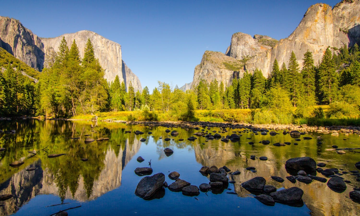
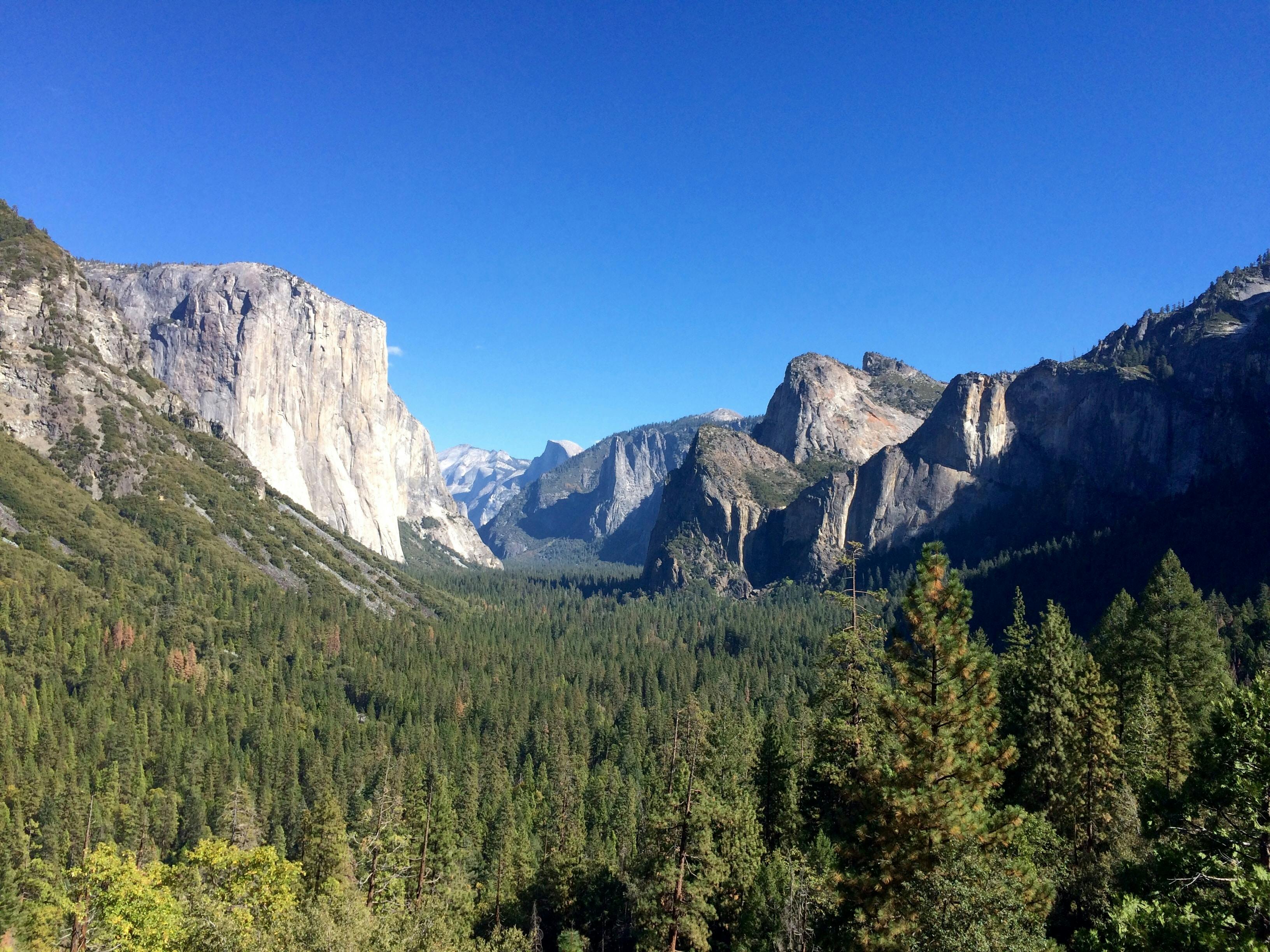
Arouca is one of northern Portugal’s most rewarding inland destinations. The small town sits in a green valley surrounded by mountains, waterfalls, ancient rock formations, rural villages and the dramatic gorge of the Paiva River.
Many visitors know Arouca only as the gateway to the Paiva Walkways or the 516 Arouca suspension bridge. Those attractions are important, but they represent only one part of a much larger destination.
Sponsored Popular Items
Quick take: Musement.com offers a worldwide selection of tours and attractions
The municipality contains a UNESCO Global Geopark, a historic monastery, enormous trilobite fossils, abandoned tungsten mines, mountain plateaus, traditional villages, river beaches and some of Portugal’s most distinctive regional food.
Arouca can be visited as a long day trip from Porto, but staying for two or three nights produces a much better experience. The main sights are spread across a large rural area, and mountain roads make journeys slower than they appear on a map.
This guide explains what to see, how to organise the Paiva attractions, which mountain sites are most worthwhile, where public transport is limited and how much time to allow.
Arouca Quick Facts
Visitor information
Details
Country
Portugal
Region
Aveiro District, northern Portugal
Distance from Porto
Approximately 60–75 kilometres, depending on the route
Typical drive from Porto
Approximately 60–90 minutes
UNESCO status
UNESCO Global Geopark since 2015
Geopark area
Approximately 328 square kilometres
Best-known attractions
Paiva Walkways, 516 Arouca, Serra da Freita and Arouca Monastery
Recommended stay
Two or three nights
Best transport
Hire car or organised tour
Public transport
Limited bus service to Arouca town; little useful transport to rural attractions
Best walking seasons
Spring and early autumn
Best white-water season
Normally wetter months, depending on river flow
Regional speciality
Arouquesa beef and traditional sweets
Important: Arouca’s outdoor attractions can close because of wildfire danger, high water, strong wind, maintenance or landslide risk. Check current official notices before travelling.
Why Visit Arouca?
Arouca offers a type of Portuguese travel experience that is difficult to find in heavily visited coastal cities.
It combines:
A compact historic town.
Mountain scenery.
Internationally important geology.
Adventure activities.
Traditional villages.
Regional food.
River landscapes.
Quiet rural accommodation.
The area is particularly suitable for active travellers, photographers, families with older children and visitors who want to add nature to a Porto itinerary.
Arouca also works well for travellers who are not serious hikers. Several major sights, including the monastery, Senhora da Mó, the Pedras Parideiras interpretation centre and the Mizarela viewpoint, can be reached by road with only short walks.
What Is Arouca UNESCO Global Geopark?
A UNESCO Global Geopark is a territory containing geological heritage of international importance that is managed together with its natural, cultural and community traditions.
The entire municipality of Arouca forms the geopark.
Its best-known geological features include:
Exceptionally large trilobite fossils.
The Pedras Parideiras nodular granite.
The Paiva Gorge.
Frecha da Mizarela waterfall.
Ancient quartzite ridges.
Granite plateaus.
Faults, folds and fossil traces.
The designation does not mean that the whole region is a fenced park with one entrance. It is a broad living territory containing towns, farms, villages, roads, forests and visitor attractions.
Many geosites can be visited freely, while interpretation centres, museums, the suspension bridge and managed walkways may require tickets.
Arouca Town and Historic Centre
Arouca town is the most practical base for exploring the region.
It contains:
Hotels and guesthouses.
Restaurants and cafés.
Supermarkets.
The tourism office.
The monastery complex.
Local shops and bakeries.
Bus connections.
The historic centre is small and can be explored comfortably on foot.
Allow time to walk around the monastery square, narrow surrounding streets and local food shops rather than treating the town only as a place to sleep.
The Interactive Tourism Shop is a useful first stop when trail conditions, fire restrictions or attraction opening hours are uncertain.
Monastery of Santa Maria de Arouca
The Monastery of Santa Maria de Arouca dominates the centre of town.
Its origins extend to the early medieval period, although much of the visible complex reflects later expansion and rebuilding.
The monastery became closely associated with Mafalda, daughter of King Sancho I and granddaughter of Portugal’s first king, Afonso Henriques.
She entered the religious community at Arouca during the 13th century and became one of the institution’s most important historical figures. She is remembered locally as Queen Saint Mafalda.
What to Look For
The long white exterior façades.
The monastery church.
The lower choir.
The pipe organ.
The cloister.
The chapter house.
The monastic kitchen.
The refectory.
Rooms connected with the history of the religious community.
The complex underwent many changes over the centuries and contains architecture and decoration from several periods.
Requalification work may affect access during 2026. Confirm which areas are open before planning the visit around a particular room or guided tour.
Museum of Sacred Art
The Museum of Sacred Art occupies part of the former monastery.
Its collections include:
Religious paintings.
Sculpture.
Gold and silverwork.
Textiles.
Furniture.
Tapestries.
Objects used by the monastic community.
The museum is valuable because it allows visitors to understand the monastery as a functioning religious and economic institution rather than merely a large historic building.
The kitchen and refectory help explain everyday life, while the chapter house and ceremonial spaces reveal the wealth and status of the community.
Planning the Visit
Opening arrangements can change because of restoration work, religious events and guided-tour schedules.
Check current hours before arrival, especially on Mondays, public holidays or during the quieter winter season.
Senhora da Mó Viewpoint
The hill of Senhora da Mó rises immediately above Arouca town.
From the summit, visitors can see:
Arouca town and monastery.
The surrounding agricultural valley.
Serra da Freita.
Montemuro mountains.
Wooded ridges and scattered villages.
A small chapel stands on the hilltop and is connected with a local legend involving a Christian prisoner, a millstone and miraculous intervention.
The viewpoint is especially attractive in the late afternoon, although haze can reduce distant visibility in summer.
The final road is narrow in places. Drive carefully and avoid blocking access near the chapel.
Paiva Walkways
The Paiva Walkways follow the left bank of the Paiva River through a steep gorge.
The traditional complete route links Areinho and Espiunca, with Vau between them.
Wooden platforms, stairs and paths provide views of:
The Paiva River.
Rocky gorges.
Rapids.
Aguieiras Waterfall.
River beaches.
Geological formations.
Native vegetation.
The complete route is approximately eight to nine kilometres in one direction and is physically demanding because of its stairs and gradients.
It is a linear walk rather than a loop, so transport between the ends must be arranged.
Current Paiva Walkways Access
Wildfire in July 2025 damaged a substantial section between Vau and Espiunca.
Reconstruction began under a municipal contract in 2026. Until an official full reopening is announced, visitors should not rely on old itineraries describing an uninterrupted route between Areinho and Espiunca.
Current official bridge information refers to access between Areinho and Vau.
Before Travelling
Check which entrances are operating.
Confirm the distance currently available.
Ask whether Vau functions as an exit or turnaround point.
Arrange transport before starting.
Do not cross barriers into damaged or reconstructed areas.
Allow for closure during extreme fire weather.
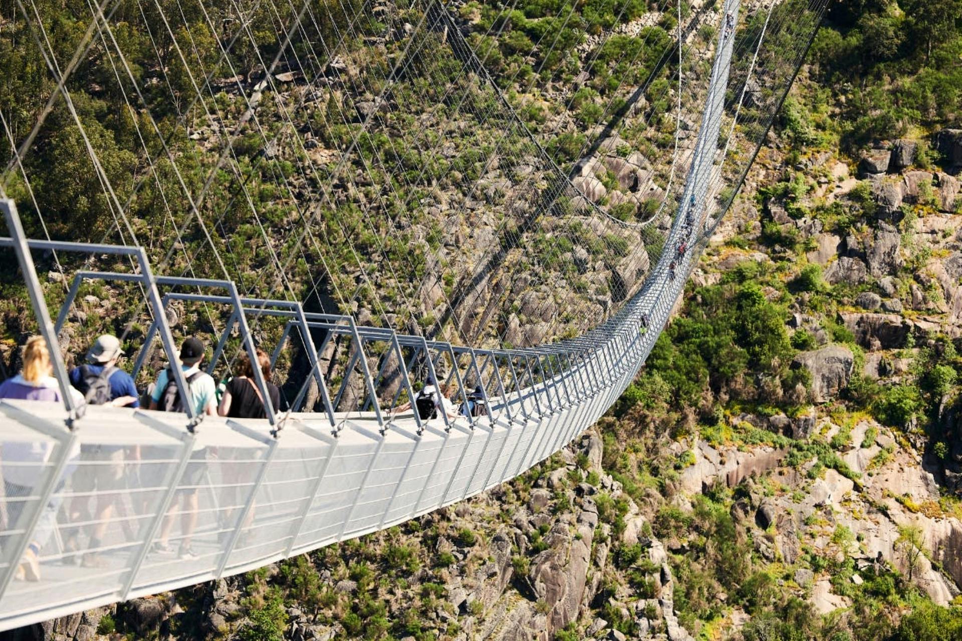
516 Arouca Suspension Bridge
The 516 Arouca suspension bridge crosses the Paiva Gorge close to the walkways.
It is 516 metres long and reaches approximately 175 metres above the river.
The deck consists of metal grating, allowing visitors to see the landscape directly beneath their feet.
Ticketing
At the time of writing:
Tickets cost €12 per individual visitor.
Reservations are made online.
Tickets are not normally sold at the bridge entrance.
Visitor numbers are limited.
The ticket includes eligible same-day access to the operating Areinho–Vau walkway section.
Reaching the Bridge
The bridge cannot be reached directly by car.
Visitors approach from:
Areinho: The more demanding route, including approximately 500 stairs.
Alvarenga: The easier approach, with a shorter walk from designated parking areas.
Allow approximately 20 minutes from the closest Alvarenga-side parking or as much as an hour from Areinho, depending on fitness and congestion.
Who May Find It Difficult?
The crossing may be uncomfortable for people with:
Strong fear of heights.
Severe vertigo.
Difficulty walking on open metal grating.
Problems balancing on a structure that moves slightly.
Children under six are not admitted. Secure footwear is required.
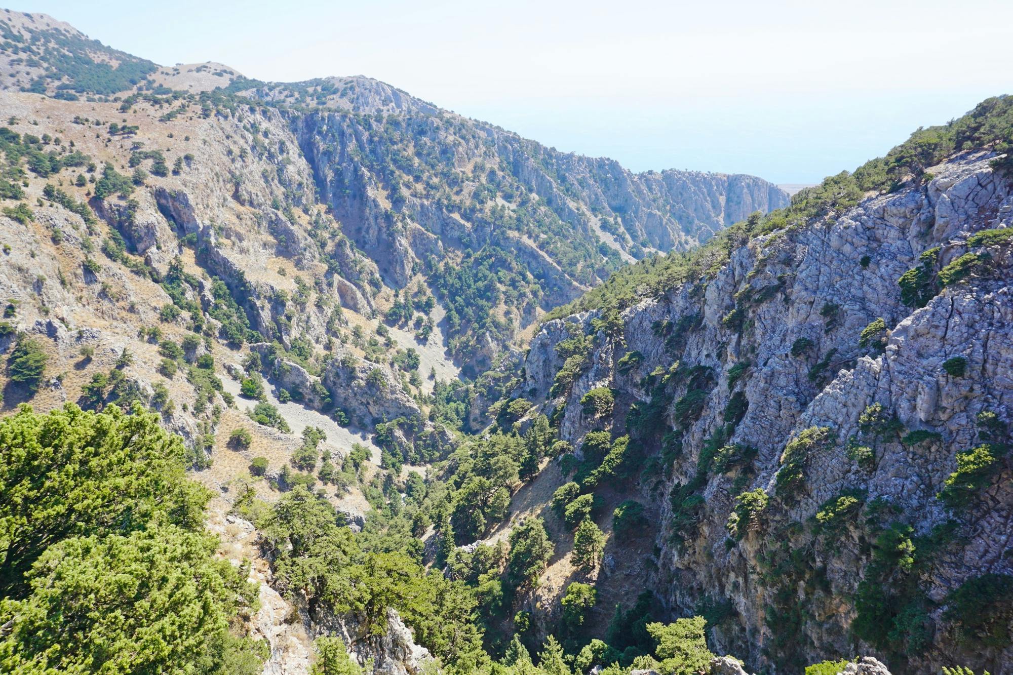
Serra da Freita
Serra da Freita is the high mountain plateau south of Arouca town.
Its scenery differs greatly from the forested Paiva Valley. Visitors encounter:
Open moorland.
Granite outcrops.
Heather and gorse.
Free-grazing cattle.
Small stone villages.
Wind-exposed viewpoints.
Waterfalls and mountain streams.
The plateau is best explored by car combined with short walks.
Driving Conditions
Expect narrow roads, wandering animals, fog and rapid weather changes.
Drive slowly around blind bends and never assume livestock will move immediately from the road.
Winter conditions can include heavy rain, low cloud and occasional ice.
Frecha da Mizarela Waterfall
Frecha da Mizarela is one of mainland Portugal’s highest waterfalls.
The Caima River drops more than 60 metres where resistant granite meets more easily eroded schist.
The waterfall can be seen from a roadside viewpoint near the villages of Mizarela and Albergaria da Serra.
When Is It Most Impressive?
The flow is strongest after sustained rain, generally from late autumn through spring.
During a dry summer, the waterfall may become a narrow stream and can look far less dramatic than winter photographs suggest.
Walking Routes
Experienced walkers can use local marked routes to explore the surrounding slopes.
The terrain is steep and exposed, and the path to lower viewpoints is very different from simply stopping at the main roadside terrace.
Do not attempt unofficial descents after rain or in fog.
Pedras Parideiras
The Pedras Parideiras, or “birthing stones,” are found near the village of Castanheira.
Dark mineral nodules form within the granite and gradually separate through weathering and temperature changes. To earlier residents, the loose nodules appeared to have been “born” from the larger rock.
The formation is internationally significant and protected as a local natural monument.
Interpretation Centre
Casa das Pedras Parideiras explains:
How the nodules formed.
The geology of Serra da Freita.
Local folklore.
Why the loose stones must not be removed.
Do Not Take a Stone
Visitors must not collect nodules or pieces of granite.
Historic removal caused serious damage to the site, and the remaining formations are protected.
Giant Trilobites of Canelas
The Geological Interpretation Centre of Canelas displays fossils from the Valongo Formation.
The most famous specimens are unusually large trilobites from the Ordovician period, when the area that is now Portugal lay beneath an ancient sea.
Some slabs preserve groups of trilobites together, providing evidence of their behaviour and environment.
The museum is small but highly worthwhile for visitors interested in fossils, geology or natural history.
Check opening times before driving to Canelas, as hours may be more limited than those of a major city museum.
Regoufe and Rio de Frades Mines
Arouca’s mountains contain the remains of tungsten-mining operations associated particularly with the period around the Second World War.
Regoufe
Regoufe contains ruined industrial buildings, mine entrances and structures spread across a remote mountain landscape.
The complex is atmospheric, but it is not a fully restored industrial museum.
Visitors should remain outside closed shafts and unstable buildings.
Rio de Frades
Rio de Frades was another important mining community.
Walking routes reveal remains of worker accommodation, processing areas, tunnels and mountain infrastructure.
The history is connected with international demand for tungsten used in military and industrial production.
Safety
Do not enter unapproved mine tunnels.
Stay away from unstable walls.
Use a guide when exploring technical mining routes.
Wear walking shoes.
Carry water and offline navigation.
Traditional Villages
Arouca’s rural villages are an important part of the Geopark experience.
Stone houses, terraced slopes, small chapels, communal spaces and old paths reveal how communities adapted to mountain conditions.
Paradinha
Paradinha is a schist village above the Paiva River and is associated with walking routes, rafting and river scenery.
Meitriz
Meitriz retains traditional architecture and lies within a quieter section of the Paiva landscape.
Alvarenga
Alvarenga is larger and offers restaurants, accommodation and practical access to the suspension bridge.
Castanheira
Castanheira is the village closest to the Pedras Parideiras and is a useful stop while exploring Serra da Freita.
When visiting small villages, park without blocking residents, farm entrances or narrow emergency routes.
Drave Village
Drave is one of the region’s most famous abandoned or nearly uninhabited mountain villages.
It lies in a remote valley and has no normal road access for ordinary visitor vehicles.
The village is reached on foot along a mountain route, commonly from Regoufe.
What to Expect
A demanding walk.
Stone houses and terraces.
No dependable commercial facilities.
Limited mobile coverage.
Strong summer sun.
Muddy or slippery paths after rain.
Drave should not be treated as a quick roadside stop.
Carry sufficient food, water and navigation information, and begin early enough to return in daylight.
Rafting, Canyoning and Outdoor Activities
Arouca is one of Portugal’s principal centres for inland adventure tourism.
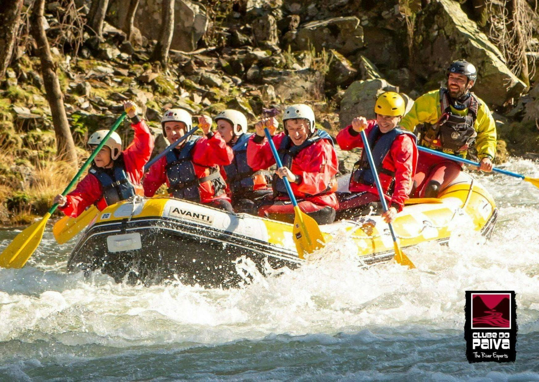
Rafting
The Paiva River offers guided rafting when water levels are suitable.
The strongest white-water conditions normally occur during wetter months.
Summer activities may use gentler river sections or switch to canoe-rafting, tubing and canyoning.
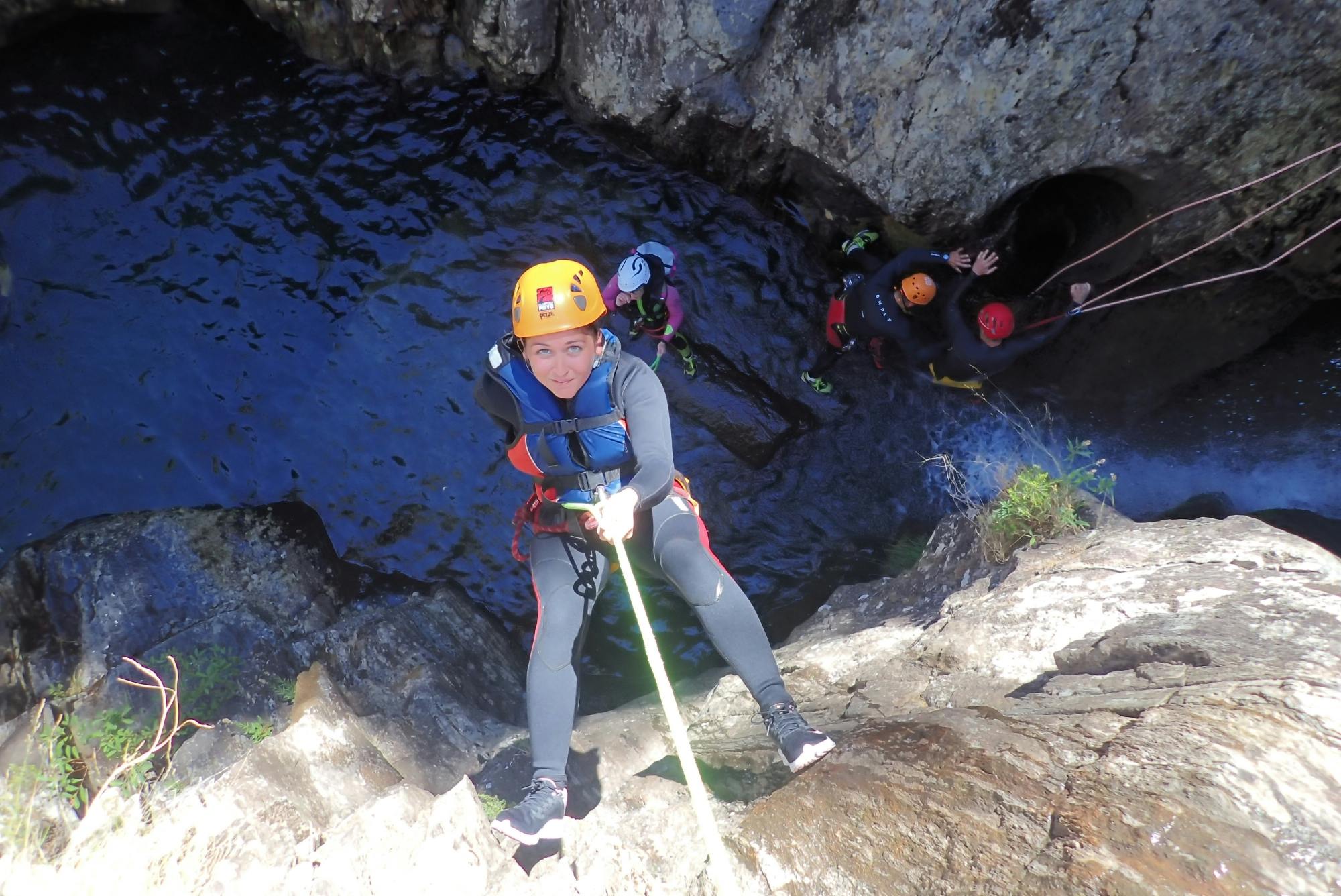
Canyoning
Mountain streams around Serra da Freita provide canyoning routes involving:
Rappelling.
Swimming.
Rock scrambling.
Natural slides.
Waterfall descents.
Walking and Trail Running
The Geopark contains many marked short routes and longer trails.
Distances alone can be misleading because gradients, heat and rough ground add difficulty.
Use Registered Operators
Guided providers should supply appropriate equipment, qualified instructors and safety information.
Do not enter white-water sections, mine tunnels or technical canyons independently without relevant experience.
River Beaches and Swimming
The Paiva and other local waterways contain recognised river recreation areas.
Popular locations include:
Areinho.
Vau.
Espiunca.
Other village bathing areas across the municipality.
Facilities differ and may include parking, picnic spaces, toilets or seasonal cafés.
Swimming Safety
Use recognised bathing areas.
Check local warning signs.
Avoid water immediately above rapids.
Do not dive into unknown depth.
Supervise children continuously.
Leave the river during thunderstorms.
Avoid high, muddy or rapidly rising water.
The water can remain cold even during summer.
What to Eat in Arouca
Food is an essential part of a visit to Arouca.
Arouquesa Beef
Arouquesa cattle are a local mountain breed traditionally raised in the region.
Restaurants commonly serve:
Posta arouquesa, a thick grilled beef steak.
Roast veal.
Beef cooked with potatoes and regional vegetables.
Portions can be substantial. Ask whether a dish is intended for one person or sharing.
Traditional Meat and Country Food
Other foods may include:
Goat or lamb.
Regional sausages.
Roast dishes.
Soup.
Local bread.
Cheese.
Honey and chestnut products.
Convent Sweets
Arouca’s monastery is associated with a long tradition of sweets based on eggs, sugar and almonds.
Look for:
Castanhas doces.
Charutos or almond rolls.
Roscas de amêndoa.
Barrigas de freira.
Other Arouca Sweets
Pão de ló de Arouca.
Cavacas.
Melindres.
Several bakeries and specialist shops in town sell mixed boxes, making it possible to try a selection rather than buying a large quantity of one item.
How to Get to Arouca
By Car from Porto
Driving is the easiest option.
Allow around 60 to 90 minutes to reach Arouca town, depending on:
Starting point in Porto.
Traffic.
Chosen motorway route.
Mountain-road conditions.
The Paiva Walkways, bridge and Serra da Freita require additional driving beyond the town.
By Bus
A limited UNIR service currently connects Porto Campanhã with Arouca’s bus terminal.
The service is not frequent enough to assume that a convenient same-day return will always be available.
Check the current Line 1022 timetable and operating day before travelling.
Reaching the bridge, Paiva Walkways and mountain geosites from Arouca bus terminal still requires a taxi, tour or prearranged transfer.
By Organised Tour
Porto-based tours commonly combine:
Paiva Walkways.
The 516 bridge.
Arouca lunch.
A short town visit.
Check whether the tour reflects the current partial walkway operation and whether bridge admission is included.
Getting Around the Geopark
A car is strongly recommended for independent visitors.
Attractions are spread across a rural municipality, and public transport between them is extremely limited.
Driving Times Can Be Deceptive
Two attractions may appear close on a map but be separated by:
Narrow roads.
Steep mountain passes.
Livestock.
Slow village traffic.
Roadworks.
Fog.
Build extra time into every itinerary.
Mobile Coverage
Coverage may weaken in gorges and remote valleys.
Download offline maps before leaving town.
Parking
Parking is generally free at many natural attractions, but capacity varies.
Arouca Town
Street and public parking can be found within walking distance of the monastery and centre.
516 Arouca
Use designated parking at Areinho or on the Alvarenga side.
There is no car park immediately beside the bridge.
Paiva Walkways
Parking is normally associated with the operating trail entrances.
Check current arrangements because reconstruction can change access.
Mountain Viewpoints
Parking may consist of a small roadside area rather than a formal car park.
Never block narrow mountain roads or emergency access.
The Best Time to Visit Arouca
March to May
Spring is one of the best seasons.
Advantages include:
Green landscapes.
Stronger waterfalls.
Comfortable walking temperatures.
Wildflowers.
Rain can make paths slippery.
June
June often provides warm but manageable conditions and long daylight hours.
July and August
Summer brings the largest crowds and highest fire risk.
Begin outdoor activities early and avoid exposed midday walking.
Waterfalls may be weak after long dry periods.
September and October
Early autumn can provide comfortable walking and fewer visitors.
Significant rain may not return until later in the season.
November to February
Winter is useful for waterfalls and rafting when conditions permit.
Expect rain, cold mountain weather, shorter days and possible bridge closure due to wind.
How Long Should You Stay?
One Day
A day trip is enough for one major outdoor attraction plus lunch and a short town visit.
Do not attempt the bridge, a substantial walkway, Serra da Freita and the monastery in one short winter day.
Two Days
Two days allow:
The bridge and walkways.
Arouca town and monastery.
Serra da Freita.
Regional meals.
Three Days
Three days are ideal for adding:
The trilobite museum.
Rafting or canyoning.
Mining villages.
Drave or another longer walk.
River swimming.
Visiting Arouca with Children
Arouca can be an excellent family destination, especially for active school-aged children.
Good Family Attractions
Casa das Pedras Parideiras.
Trilobite museum.
River beaches.
Short mountain viewpoints.
Easy sections of marked walks.
Arouca town and sweet shops.
More Demanding Activities
The Paiva Walkways involve many stairs and are not suitable for pushchairs.
The 516 bridge requires children to be at least six years old and may frighten children uncomfortable with heights.
Adventure companies apply their own age and size restrictions for rafting and canyoning.
Accessibility
Arouca town is more accessible than many of the rural attractions, but historic surfaces and older buildings can still present obstacles.
The Paiva Walkways are not wheelchair accessible because of stairs and steep gradients.
The 516 bridge has special arrangements for visitors with reduced mobility, using the easier Alvarenga approach. Advance contact is required.
Roadside viewpoints such as Senhora da Mó and Mizarela may be manageable for visitors who can walk short distances, but exact surfaces and parking positions vary.
Discuss specific requirements directly with the tourism office or attraction before travelling.
What to Bring
Walking shoes: Suitable for stairs, gravel and mountain paths.
Water: Facilities are limited outside town.
Sun protection: Essential on the plateau and walkways.
Rain jacket: Mountain weather changes quickly.
Warm layer: Serra da Freita can be colder than Porto.
Offline maps: Useful in remote valleys.
Small amount of cash: Helpful in villages and small cafés.
Swimwear and towel: For river beaches in summer.
Water shoes: Useful on river rocks.
Booking confirmations: Keep bridge and activity tickets available offline.
Suggested One-Day Arouca Itinerary
7:30 am: Leave Porto
Travel directly to the correct parking area for the 516 bridge.
9:00 am: Approach the Bridge
Use Alvarenga for the easier walk or Areinho when combining the bridge with the operating walkway section.
10:00 am: Cross 516 Arouca
Complete the timed guided visit.
11:30 am: Walk the Open Paiva Section
Follow the currently authorised route and respect all closure barriers.
1:30 pm: Lunch in Alvarenga or Arouca
Try Arouquesa beef or another regional dish.
3:30 pm: Explore Arouca Town
See the monastery exterior, historic centre and local sweet shops.
5:00 pm: Senhora da Mó
Finish with views across the town and valley before returning to Porto.
Suggested Two-Day Arouca Itinerary
Day One: Paiva Valley
Cross the 516 bridge.
Walk the authorised Paiva route.
Stop at Areinho or Vau.
Eat in Alvarenga.
Stay overnight in Arouca or a rural guesthouse.
Day Two: Town and Serra da Freita
Visit Arouca Monastery and the historic centre.
Drive to Pedras Parideiras.
See Frecha da Mizarela.
Stop at mountain viewpoints.
Return for regional sweets and dinner.
Suggested Three-Day Arouca Itinerary
Day One
Paiva Walkways, 516 Arouca and Alvarenga.
Day Two
Arouca Monastery, Serra da Freita, Pedras Parideiras and Mizarela waterfall.
Day Three
Choose one:
Rafting on the Paiva.
Trilobite museum and Canelas.
Regoufe and mining heritage.
Drave hike.
Traditional villages and river beaches.
Is Arouca Worth Visiting?
Arouca is highly worthwhile for travellers interested in nature, geology, walking and regional food.
Main Advantages
Internationally significant geological sites.
Excellent mountain scenery.
One of the world’s longest pedestrian suspension bridges.
Historic monastery and town centre.
Strong regional cuisine.
Adventure activities.
Easy to combine with Porto.
Enough variety for several days.
Possible Drawbacks
A car is almost essential.
Mountain roads are slow.
Outdoor attractions can close unexpectedly.
The Paiva Walkways are currently affected by reconstruction.
Summer heat and wildfire risk can be severe.
Some museums and centres have limited hours.
The bridge and stairs are unsuitable for some visitors.
The best approach is to treat Arouca as a broad rural destination rather than a single bridge or walkway attraction.
Frequently Asked Questions About Arouca
Where is Arouca?
Arouca is in northern Portugal, within Aveiro District and southeast of Porto.
How far is Arouca from Porto?
It is approximately 60–75 kilometres away, depending on the route.
How long does it take to drive from Porto?
Allow approximately 60–90 minutes to reach Arouca town and longer for rural attractions.
Can Arouca be visited as a day trip?
Yes, but a day trip should focus on one main outdoor activity and the town rather than trying to see the entire Geopark.
How many days are ideal?
Two or three days provide a much more complete visit.
Is Arouca a UNESCO World Heritage Site?
It is a UNESCO Global Geopark, a designation covering the geological, natural and cultural territory of the municipality.
When did Arouca become a UNESCO Global Geopark?
It received the UNESCO designation in 2015.
What is Arouca most famous for?
It is best known for the Paiva Walkways, 516 Arouca bridge, giant trilobites, Pedras Parideiras and Serra da Freita.
Are the full Paiva Walkways open?
Do not assume so. The Vau–Espiunca section was damaged by wildfire and is being reconstructed.
Which walkway section is currently available?
Current official bridge guidance refers to the Areinho–Vau section.
How long is the traditional complete walkway?
Approximately eight to nine kilometres in one direction.
Is the walkway circular?
No. It is a linear route.
How long is the 516 Arouca bridge?
It is 516 metres long.
How high is the bridge?
Its highest point is approximately 175 metres above the Paiva River.
How much is the bridge ticket?
The current individual price is €12.
Can I buy a ticket at the bridge?
No. Tickets should be purchased online before arrival.
Does the bridge ticket include the walkways?
It includes eligible same-day access to the currently operating Paiva Walkways section.
Which bridge approach is easiest?
The Alvarenga-side approach is generally easier.
How many steps are there from Areinho?
The approach includes approximately 500 steps.
Can young children cross the bridge?
Children must be at least six years old.
Is the bridge suitable for someone afraid of heights?
It may be difficult because the deck is high, open and made from metal grating.
Can I visit Arouca without a car?
Yes, but it is much less convenient. Bus service reaches the town, while rural attractions require taxis, transfers or tours.
Is there a direct bus from Porto?
A limited UNIR Line 1022 service currently connects Porto Campanhã with Arouca. Confirm the current timetable.
Can I reach the Paiva Walkways by bus?
There is no dependable frequent public service designed for ordinary visitors. Arrange a taxi or tour.
Is Arouca Monastery open?
Parts normally operate as a church and museum, but requalification work can affect access. Check current arrangements.
Who was Mafalda of Arouca?
She was a daughter of King Sancho I who became closely associated with the monastery and is venerated locally as Queen Saint Mafalda.
What are Pedras Parideiras?
They are granite rocks containing dark nodules that gradually separate through natural weathering.
Can I take a Pedras Parideiras stone?
No. The geological site is protected and stones must not be removed.
Where can I see giant trilobites?
Visit the Geological Interpretation Centre of Canelas.
Is Frecha da Mizarela always flowing strongly?
No. It is strongest after rain and may be much weaker during dry summer periods.
Can I reach the waterfall viewpoint by car?
Yes. The principal viewpoint requires only a short walk from the road.
What is the best month to visit?
May, June, September and early October usually offer favourable walking conditions.
Is Arouca very hot in summer?
It can be extremely hot, particularly on exposed walkways and mountain slopes.
Does it snow in Arouca?
Snow is uncommon in town but can occasionally affect the higher Serra da Freita plateau.
Can I swim in the Paiva River?
Yes, at suitable recognised river beaches when local conditions and warnings permit.
Is rafting available all year?
It depends on river flow. The strongest rafting conditions usually occur during wetter months.
Is Arouca suitable for families?
Yes. The trilobite museum, geological sites and river beaches work particularly well for families, while major walks require active children.
Can I take a pushchair on the Paiva Walkways?
No. The stairs and gradients make pushchairs impractical.
Is the 516 bridge wheelchair accessible?
Special arrangements may be possible through the Alvarenga side, but advance contact is required.
What food should I try?
Try Arouquesa beef, pão de ló, convent sweets, regional sausages, cheese and local honey.
Are restaurants expensive?
Prices are generally moderate compared with major European tourist centres, although large meat dishes and specialist restaurants can cost more.
Should I stay in Arouca town or near the river?
Stay in town for restaurants and services. Choose rural accommodation for quiet scenery and easier access to a particular outdoor area.
Can Arouca be combined with the Douro Valley?
It is possible with a car and several days, but both regions deserve sufficient time and use slow rural roads.
Can Arouca be combined with Aveiro?
Yes, but the journey is longer than it appears because Arouca lies inland. An overnight stay is preferable.
Is Drave easy to visit?
No. It requires a substantial walk and has no dependable visitor facilities.
Are the old mines safe to enter?
Do not enter unapproved tunnels or unstable ruins. Use guided routes where available.
Can attractions close without much notice?
Yes. Wind, wildfire, rain, flooding, rockfall or maintenance can cause temporary closures.
Sponsored Popular Items
Quick take: Musement.com offers a worldwide selection of tours and attractions
Paiva River Six-Hour Canyoning Experience from Arouca Portugal Paiva river six-hour canyoning experience from Arouca is for travellers who want movement, scenery and a more active element in their itinerary. Check current availability, inclusions and booking details before you go.
Final Thoughts
Arouca is far more than a stopping point for Portugal’s famous suspension bridge.
The region combines a historic monastic town, internationally important geology, mountain villages, waterfalls, river adventures and food traditions that remain closely connected with the surrounding land.
The principal challenge is distance. Arouca’s attractions are spread across valleys and plateaus connected by winding roads. Trying to see everything in one day creates a rushed experience.
Use Arouca town as a base, reserve the 516 bridge in advance and check the current Paiva Walkways access before departure. Give Serra da Freita a separate half-day and leave time for a proper regional meal.
With realistic planning, Arouca becomes one of the most varied and memorable inland destinations within reach of Porto.
Sponsored Popular Items
Quick take: Musement.com offers a worldwide selection of tours and attractions
Paiva River Six-Hour Canyoning Experience from Arouca Portugal Paiva river six-hour canyoning experience from Arouca is for travellers who want movement, scenery and a more active element in their itinerary. Check current availability, inclusions and booking details before you go.
516 Arouca Bridge and Paiva Walkways Tour from Porto Portugal 516 Arouca Bridge and Paiva Walkways Tour from Porto adds structure, local context and purposeful sightseeing to the itinerary. Check current availability, inclusions and booking details before you go.
The Paiva River flows through one of northern Portugal’s most dramatic natural landscapes. Between forested mountains and deep rocky gorges, its water alternates between quiet pools, river beaches and energetic white-water rapids.
The best-known section lies within the Arouca UNESCO Global Geopark, where visitors can follow wooden walkways above the river, cross the immense 516 Arouca suspension bridge, swim at designated river beaches or join guided rafting and kayaking trips.
Sponsored Popular Items
Quick take: Musement.com offers a worldwide selection of tours and attractions
Paiva River Six-Hour Canyoning Experience from Arouca Portugal Paiva river six-hour canyoning experience from Arouca is for travellers who want movement, scenery and a more active element in their itinerary. Check current availability, inclusions and booking details before you go.
The river is often promoted as a day trip from Porto, but the area deserves more than a hurried visit. Arouca’s mountain roads, geological sites, villages and outdoor activities can easily fill two or three days.
Visitors planning the Paiva Walkways must pay particular attention to current access conditions. Wildfires damaged part of the route in 2025, and reconstruction work has affected the section between Vau and Espiunca. At the time of writing, official visitor information indicates access on the Areinho–Vau side, while the complete reopening date remains subject to construction progress and safety approval.
Check official notice; the Areinho–Vau section is currently referenced
Suspension bridge
516 Arouca
Bridge length
516 metres
Bridge height above river
Approximately 175 metres at the highest point
Minimum bridge age
6 years
Main activities
Walking, bridge crossing, rafting, kayaking and river swimming
Best outdoor seasons
Spring and early autumn
Best rafting season
Usually the wetter months, subject to river level
Distance from Porto
Approximately 70 kilometres to Arouca, with additional driving to the river
Important: Wildfire damage, weather, high water, rockfall risk and maintenance can close sections of the walkways or the suspension bridge. Confirm the current operating status on the day of your visit.
What Is the Paiva River?
The Paiva rises in the Serra de Leomil in central-northern Portugal and travels for roughly 110 kilometres before joining the Douro River.
Its upper reaches pass through rural landscapes, woodland and traditional communities. Farther downstream, the river cuts through the mountainous territory of Arouca, creating narrow gorges, rapids, waterfalls and deep pools.
This middle and lower section has become internationally known for:
The Paiva Walkways.
The 516 Arouca suspension bridge.
White-water rafting and kayaking.
River beaches.
Geological formations.
Mountain villages.
Protected wildlife and plant habitats.
The river is not contained within one attraction or one town. Visitors exploring the Paiva may travel through Arouca, Alvarenga, Canelas, Espiunca, Paradinha, Meitriz, Janarde, Castelo de Paiva and several smaller communities.
Why Visit the Paiva River?
The Paiva offers a particularly strong combination of accessible scenery and genuine outdoor adventure.
The wooden walkways make sections of a previously difficult gorge reachable to ordinary hikers. At the same time, the river retains enough power to support some of Portugal’s best-known rafting and kayaking routes.
Visitors may come for:
A scenic day trip from Porto.
A challenging gorge walk.
The experience of crossing a very high suspension bridge.
Swimming in clear mountain water.
Rafting through rapids.
Geological and nature photography.
Traditional food in Arouca and Alvarenga.
A quiet rural stay away from the coast.
The character of the river changes throughout the year. In winter, higher flow creates energetic rapids and powerful waterfalls. In summer, the river is often calmer, exposing rocks and creating attractive swimming pools.
Current Walkway Access and Reconstruction
Visitors should be aware that older articles may describe the complete Paiva Walkways route from Areinho to Espiunca as continuously open.
Wildfires in July 2025 damaged approximately 3.8 kilometres of the walkway between Vau and Espiunca.
A reconstruction contract was signed in February 2026 with an expected six-month construction period. The work is intended to rebuild the damaged section and restore the complete route, but an estimated construction period is not the same as a confirmed public reopening date.
At the time of writing, official 516 Arouca guidance refers to access to the Paiva Walkways between Areinho and Vau.
What This Means for Visitors
Do not assume the complete Areinho–Espiunca trail is open.
Check the official booking platform before selecting an entrance.
Confirm whether Vau is operating as the turnaround or exit point.
Arrange transport based on the currently open section.
Do not pass barriers or enter reconstruction areas.
Allow for changes announced at short notice.
The remainder of this guide describes both the traditional complete route and the shorter access currently being promoted. This distinction is important when calculating distance, timing and transport.
The Paiva Walkways
The Paiva Walkways, known in Portuguese as Passadiços do Paiva, follow the left bank of the river through the Arouca Geopark.
The complete linear route was created between Areinho and Espiunca, with Vau approximately midway.
The infrastructure includes:
Wooden boardwalks attached to the gorge slopes.
Long staircases.
Sections of compacted earth.
Viewing platforms.
River access points.
Interpretive signs.
Emergency telephones.
Connections to the 516 Arouca bridge area.
Traditional Full Route
When every section is open, the route measures approximately 8.7 kilometres and normally takes two and a half to three hours in one direction.
This estimate does not include:
Long photography stops.
Swimming.
Lunch.
The suspension-bridge visit.
Waiting for transport.
Returning in the opposite direction.
Areinho to Vau
The currently referenced Areinho–Vau section includes some of the most dramatic scenery near the bridge, Aguieiras Waterfall and the narrow Paiva Gorge.
Depending on the operational arrangement, visitors may need to:
Return to Areinho along the same route.
Use an authorised taxi or transfer from Vau.
Combine the walk with the suspension bridge.
Confirm the exit and return plan before beginning.
Which Direction Should You Walk?
On the traditional complete route, the official recommendation describes Areinho towards Espiunca as the less physically demanding direction.
Starting at Areinho allows hikers to deal with the major staircase near the bridge area earlier and then continue generally downstream.
Starting at Areinho
Advantages include:
Less demanding overall direction on the complete route.
Convenient access to the 516 bridge area.
Areinho river beach at the beginning or end.
Some of the most dramatic scenery appears early.
The major disadvantage is the significant staircase if approaching the bridge from the Areinho side.
Starting at Espiunca
When this entrance is open, starting at Espiunca can suit visitors making a return walk because the hardest climbing is not left entirely until the end.
The Espiunca side also has cafés, parking and a river recreation area.
Current Partial Route
During reconstruction, normal direction advice may not apply. Follow the temporary route shown on the current ticket and official map.
The 516 Arouca Suspension Bridge
The 516 Arouca is one of the longest pedestrian suspension bridges in the world.
It stretches 516 metres across the Paiva Gorge and reaches approximately 175 metres above the river at its highest point.
The bridge deck is constructed from metal grating. Visitors can see the gorge and river through the floor while crossing.
What the Experience Is Like
The bridge moves slightly under wind and pedestrian movement. This is normal, but the combination of height, visible floor and motion can be difficult for visitors with vertigo.
Views include:
The Paiva River far below.
Aguieiras Waterfall.
Rocky gorge walls.
Forested slopes.
Sections of the wooden walkways.
Guided Entry
Bridge visits operate at fixed times and include an introduction from an official interpreter.
The complete experience normally lasts around 90 minutes, including meeting, briefing, access and crossing.
Visitors must arrive at the meeting point before the booked time. Arriving at the car park 15 minutes before the visit is not sufficient because the bridge cannot be reached directly by vehicle.
Age and Footwear Rules
Children under six are not permitted on the bridge.
Visitors aged six to 17 must be accompanied by an adult.
Secure sports shoes or hiking shoes are required. Flip-flops, narrow heels and unsuitable footwear may result in refused entry.
Reaching the Bridge
There is no car park immediately beside the bridge.
Visitors approach from either:
The Areinho and Canelas side.
The Alvarenga side.
From Areinho
The walk from Areinho is physically demanding and includes roughly 500 steps.
Allow approximately 45 to 60 minutes, depending on fitness and crowding.
This entrance works naturally with the Paiva Walkways but is not the easiest choice for anyone with knee problems.
From Alvarenga
The Alvarenga-side parking areas provide a less strenuous approach.
The walk may take approximately 20 minutes from the closest recommended area, depending on the parking location.
This is generally the preferred access for visitors who only want to cross the bridge or who require the least demanding available approach.
Timing Advice
Plan backwards from the bridge booking time.
Allow time for:
Finding the correct parking area.
Using toilets before the walk.
Walking to the meeting point.
Unexpected steep sections.
Photography and short rests.
Geology and River Landscapes
The Paiva Valley forms part of the Arouca UNESCO Global Geopark, a territory recognised for geological heritage of international importance.
The river crosses rocks hundreds of millions of years old and exposes evidence of ancient marine environments, mountain-building processes and long periods of erosion.
Paiva Gorge
The Paiva Gorge extends through a narrow section between Alvarenga Bridge and Vau.
Here, the river is compressed between steep walls, creating strong current, rapids and polished rock formations.
Aguieiras Waterfall
Aguieiras Waterfall descends along fractures in the granite slope near the suspension bridge.
Its appearance changes dramatically with rainfall. It can be powerful during wetter months and much lighter in dry summer conditions.
Gola do Salto
Gola do Salto is a river feature associated with fast water and exposed rock. It is especially dramatic when river flow is high.
Espiunca Fault
The Espiunca Fault provides visible evidence of movement within the Earth’s crust and is one of the recognised geological sites along the full walkway route.
Giant Potholes
Swirling water and stones have carved circular depressions into the riverbed in several places. These formations are sometimes called giant’s kettles or potholes.
They should be viewed from the walkway rather than approached during strong flow.
River Beaches
The Paiva has several recreation and swimming areas. Conditions, water quality and supervision vary by season.
Areinho River Beach
Areinho is one of the principal access points for the walkways and bridge.
Facilities may include:
Parking.
Toilets.
Picnic space.
Café or seasonal refreshments.
River access.
Outdoor-activity meeting points.
It is a convenient place to cool down after walking, but swimmers must remain aware of changing current and water depth.
Vau Recreation Area
Vau lies around the middle of the traditional full walkway route.
It provides a picnic and rest area with toilets, river access and a suspension footbridge across the water.
During partial-route operation, Vau may function as an exit or turnaround point.
Espiunca River Area
Espiunca traditionally forms the western end of the complete walkways.
The village has a river recreation area, cafés and outdoor-activity facilities. Access may be affected by the reconstruction of the damaged walkway section.
Other Paiva Swimming Areas
Additional river beaches and natural bathing areas can be found farther upstream and downstream, including locations near rural villages.
Not every attractive pool is officially supervised or approved for bathing. Follow signs and local health advice.
Swimming Safely in the Paiva
The river can look calm while still carrying a powerful current.
Water level and flow vary with rainfall, dam management upstream and seasonal conditions.
Safety Rules
Use recognised river beaches and recreation areas.
Observe warning signs.
Do not enter immediately above rapids or waterfalls.
Avoid diving into water of unknown depth.
Supervise children continuously.
Wear water shoes where rocks are slippery.
Do not swim alone.
Leave the water during storms.
Do not enter during visibly high or muddy flow.
Keep away from rafting routes when groups are passing.
Water Temperature
Even in summer, the Paiva can feel cool because it is a mountain-fed river.
Enter gradually rather than jumping directly into deep water.
Water Quality
Official bathing status can change. Do not assume that clear-looking water has automatically been approved for swimming.
Check local notices at the river beach, particularly after heavy rain or any reported water-quality concern.
Rafting and White-Water Activities
The Paiva is one of Portugal’s classic white-water rivers.
Rafting conditions are usually strongest during the wetter months, when rainfall increases flow through the gorge.
In summer, lower water levels may shift activities towards canoe-rafting, river tubing, canyoning or gentler sections.
What a Rafting Trip Includes
A typical guided experience may provide:
Wetsuit.
Helmet.
Buoyancy aid.
Paddle.
Safety briefing.
Qualified guide.
Transport to or from the river.
Changing facilities.
Insurance under the operator’s conditions.
Common River Sections
Operators choose the route according to water level and participant experience.
Sections may include:
Paradinha to Areinho.
Meitriz to Areinho.
Vau to Espiunca.
Other technically selected stretches around Alvarenga and Espiunca.
The exact names advertised can change because operators adapt to river conditions.
Do You Need Experience?
Many commercial rafting trips are designed for beginners with normal fitness.
Participants must still follow commands, paddle actively and be comfortable with the possibility of entering cold moving water.
Health Restrictions
Rafting may not suit people with:
Serious heart conditions.
Uncontrolled epilepsy.
Recent surgery.
Severe back or joint problems.
Pregnancy.
Inability to swim or remain calm in water, depending on operator rules.
Disclose medical issues before booking.
Kayaking, Canoe-Rafting and Canyoning
White-Water Kayaking
The Paiva Gorge contains technical rapids suitable for experienced paddlers.
Independent visitors should not attempt difficult sections without local knowledge, suitable equipment and recognised white-water competence.
Canoe-Rafting
Canoe-rafts are inflatable boats generally carrying one or two participants. They provide more independence than a large raft while remaining more forgiving than a rigid white-water kayak.
This activity is often offered when water levels are moderate.
River Tubing
Tubing may operate on suitable calmer sections during warm weather.
It should still be booked with an authorised operator because rocks, strainers and current create hazards.
Canyoning
Canyoning trips take place in streams and waterfall systems around the Arouca Geopark rather than simply floating along the main river.
Activities may involve:
Walking through water.
Rappelling.
Natural slides.
Jumps.
Swimming in rock pools.
Difficulty varies significantly. Choose a level suitable for the least experienced person in the group.
Wildlife and Nature
The Paiva corridor supports woodland, riverbank vegetation, fish, amphibians, reptiles, mammals and birds of prey.
Wildlife is usually easier to observe early in the morning or away from busy visitor areas.
Possible sightings include:
Herons.
Kingfishers.
Birds of prey.
Otter signs or occasional otters.
Lizards.
Frogs and other amphibians.
Dragonflies.
Native river fish.
Some species are threatened or protected. Visitors should observe animals from a distance and avoid disturbing nests, dens and riverbank vegetation.
How to Get to the Paiva River
The Arouca section of the river is easiest to explore by car, organised transfer or guided tour.
Arouca town is the principal service centre, but the river access points lie roughly 15 kilometres or more from the town centre along winding rural roads.
By Car
Driving provides the greatest flexibility.
Roads are generally surfaced but can be:
Narrow.
Winding.
Steep.
Slow behind local traffic.
Busy near attractions during weekends.
Do not estimate travel time based only on distance.
Public Transport
Public transport to Arouca is limited compared with major Portuguese destinations, and direct services to Areinho, Vau or Espiunca are not designed around every visitor schedule.
Travellers without a car generally find it easier to:
Book a day tour from Porto.
Arrange a private transfer.
Stay in Arouca and use local taxis.
Reserve a guided activity that includes transport.
Visiting from Porto
The Paiva River can be visited as a long day trip from Porto.
Allow around 75 to 100 minutes each way by road, depending on the precise river entrance, traffic and chosen route.
Independent Day Trip
A hire car allows visitors to:
Choose an early bridge time.
Stop in Arouca.
Visit a river beach.
Arrange a taxi between walkway access points.
Remain for dinner.
Organised Tour
Porto-based tours commonly include:
Hotel or central pickup.
Transport to Arouca.
Paiva Walkways access.
The suspension bridge on selected packages.
Local lunch.
Arouca town or village stop.
Read the route carefully. During reconstruction, tours may advertise an adapted partial walk rather than the complete historical route.
Avoid an Overloaded Schedule
Walking, bridge access and mountain driving take time. A package that promises the bridge, full walkways, rafting, lunch and several distant attractions in one day may feel rushed.
Parking and Transfers
Free parking is normally available at Areinho, Espiunca and designated Alvarenga-side bridge access areas.
The car parks are not supervised. Do not leave passports, luggage or electronics visible inside the vehicle.
Linear Route Problem
The full Paiva Walkways route is linear rather than circular.
When the entire trail is open, visitors usually solve the transport problem by:
Leaving one car at each end.
Using a taxi.
Booking an organised transfer.
Walking both directions.
A return walk effectively doubles the distance and is demanding.
Current Partial Route
During partial operation, ask whether transport is available from Vau and whether visitors are expected to return to Areinho on foot.
Do not assume a taxi will be waiting without a reservation.
Tickets and Reservations
Paiva Walkways
A reservation is required to enter the managed walkway route.
Tickets should be purchased through the official reservation system before travelling.
There is no normal ticket booth at the walkway entrances. Limited same-day assistance may be available through the Arouca tourism office, but visitors should not depend on this.
Ticket prices have historically been low, but the displayed online price and available entrance points should be treated as the current authority.
516 Arouca
The bridge requires a separate timed booking.
At the time of writing:
Individual admission is listed at €12.
Tickets are sold online.
Tickets are not sold at the bridge entrance.
The bridge ticket includes eligible same-day access to the currently operating Paiva Walkways section.
Entry numbers are limited.
Family packages are also available under the current published conditions.
Book Early
Advance booking is particularly important for:
Summer weekends.
Public holidays.
Spring school holidays.
Early-morning bridge times.
English-language guided slots.
Opening Hours
Published walkway hours normally vary by season:
Period
Opening
Last entry
Closing
November to March
9:00 am
3:00 pm
5:00 pm
April and October
9:00 am
4:00 pm
7:00 pm
May to September
8:00 am
5:00 pm
8:00 pm
The 516 Arouca bridge uses guided times within broadly similar seasonal opening periods.
Weather, fire danger and maintenance may override normal hours.
The Best Time to Visit
March to May
Spring is one of the best periods for walking.
Advantages include:
Greener vegetation.
Strong waterfalls.
Comfortable temperatures.
Good river flow.
Rain can make wooden surfaces and rocks slippery.
June
June often provides warm weather without the most intense summer heat.
It is a good compromise for walking and river swimming, although water may remain cool.
July and August
Summer brings the greatest demand and highest temperatures.
Walk early in the morning and avoid exposed staircases during the hottest part of the day.
River flow is generally lower, and some white-water activities may change format or location.
September and October
Early autumn provides comfortable walking and fewer visitors.
Water levels may still be low until significant rain arrives.
Winter
Winter is the principal white-water season when rainfall is suitable.
The walkways can be cold, wet and slippery, while the bridge is more vulnerable to wind closure.
Weather and Seasonal Conditions
Conditions at the river can differ considerably from Porto or Portugal’s coast.
The valley may experience:
Heavy rain.
Strong sun.
Morning mist.
Rapid temperature changes.
High fire danger.
Wind at the suspension bridge.
Hot Weather
Carry more water than expected. Long staircases and dark wooden surfaces can become extremely hot.
Rain
The walkway can remain open in light rain, but storms, flooding or landslide risk may cause closure.
Wind
Strong wind can close the 516 bridge even when the walkways remain accessible.
Wildfire Risk
Summer fires are a serious regional danger.
Do not smoke, light fires or ignore official closures. Reconstruction following the 2025 fire demonstrates how severely wildfire can affect the landscape and infrastructure.
Walking Difficulty and Fitness
The official classification of the complete Paiva Walkways route is difficult.
The challenge comes from:
Long staircases.
Steep gradients.
Approximately 8.7 kilometres of continuous walking on the full route.
Heat.
Limited shortcuts.
A linear route requiring transport or a return walk.
The wooden surface itself is generally stable, but the volume of steps can be difficult for knees.
Who May Struggle?
The route may be unsuitable for people with:
Serious knee or hip problems.
Poor balance.
Limited cardiovascular fitness.
Severe vertigo.
Difficulty managing long staircases.
A shorter Areinho–Vau visit may still be demanding because of the bridge-area stairs.
Accessibility
The Paiva Walkways are not wheelchair accessible.
Stairs, steep gradients, narrow sections and uneven ground prevent a continuous step-free route.
The 516 Arouca bridge has arrangements for visitors with reduced mobility, but advance contact is compulsory and entry must take place through the Alvarenga side.
Visitors needing assistance should contact the Arouca tourism office before purchasing tickets.
The river beaches and rural viewpoints vary considerably in accessibility. Some recreation areas can be approached by vehicle, but soft ground, rocks and steep riverbanks remain obstacles.
Visiting with Children
Older active children may enjoy the walkways, bridge and river beaches.
Parents should consider:
The number of stairs.
Summer heat.
Limited opportunities to leave the route.
Cold river water.
High bridge exposure.
The child’s comfort with heights.
Pushchairs are not permitted or practical on the walkways.
Children under six cannot enter the 516 bridge.
Children must be closely supervised near the river because current can be strong even where the surface appears calm.
What to Wear and Bring
Walking shoes: Use trainers or hiking shoes with good grip.
Water: Carry enough for the complete walk and delays.
Sun protection: Bring sunscreen, sunglasses and a hat.
Light rain jacket: Mountain weather can change quickly.
Small backpack: Large luggage is impractical.
Food or snacks: Facilities are limited between access areas.
Charged phone: Keep tickets and emergency numbers available.
Offline map: Useful on rural roads.
Swimwear and towel: For designated river beaches.
Water shoes: Helpful on slippery rocks.
Medication: Carry anything needed during a long outdoor day.
Do not wear flip-flops on the bridge or walkways.
Food and Facilities
Cafés and simple restaurants operate near the main ends of the traditional walkway route and in nearby villages.
Facilities can be seasonal, and opening hours may not match early bridge visits.
Toilets
Toilets are normally available at:
Areinho.
Vau.
Espiunca when access is operating.
Selected Alvarenga-side areas.
The nearest toilet to the bridge may still be a substantial walk away.
Picnics
Authorised picnic areas are available at the recreation zones.
Visitors must remove rubbish and should not set up tents, play loud music or block paths.
Local Food
Arouca is known for substantial mountain cuisine.
Dishes and products may include:
Arouquesa beef.
Roast veal.
Goat and lamb dishes.
Regional sausages.
Local cheeses.
Convent sweets.
Pão de ló sponge cake.
Chestnut and honey products.
Things to Do in Arouca
Arouca Monastery
The Monastery of Santa Maria de Arouca is one of the town’s principal historic monuments.
It is closely associated with Queen Mafalda and contains religious art and architectural features from several periods.
Arouca Geopark Visitor Information
The tourism office provides maps, current access information and advice about geological sites and activities.
It is a useful first stop when road, trail or wildfire conditions are uncertain.
Trilobite Museum
The Geological Interpretation Centre of Canelas displays exceptionally large trilobite fossils found in local slate quarries.
Pedras Parideiras
The “birthing stones” near Castanheira are a rare geological phenomenon in which dark nodules separate naturally from the surrounding granite.
Freita Mountain
The Serra da Freita offers viewpoints, waterfalls, walking routes and highland scenery.
Villages of the Paiva Valley
Alvarenga
Alvarenga is the principal village close to the suspension bridge and Paiva Gorge.
It has restaurants, accommodation and access routes towards the bridge.
Paradinha
Paradinha is a traditional schist village above the river.
Its stone houses and surrounding slopes provide a quieter view of the Paiva Valley.
Meitriz
Meitriz is another recognised village associated with historic river crossings and rural life.
Espiunca
Espiunca developed as one of the principal walkway and white-water activity centres.
Its role may be temporarily reduced while the damaged trail section is rebuilt.
Suggested One-Day Paiva River Itinerary
7:30 am: Leave Porto
Travel by car or prearranged tour towards Arouca and the appropriate bridge access.
9:00 am: Arrive Near the Bridge
Park on the Alvarenga side for the easier approach or at Areinho when combining the bridge with the walkways.
10:00 am: Cross the 516 Arouca Bridge
Join the official interpreter and complete the guided visit.
11:30 am: Begin the Open Walkway Section
Follow the currently authorised Areinho–Vau route or the official temporary itinerary.
1:30 pm: Lunch or Picnic
Eat at a recreation area or return to a nearby village restaurant.
3:00 pm: Visit a River Beach
Swim only when conditions and signs indicate that it is safe.
4:30 pm: Explore Arouca
Visit the monastery, tourism office or town centre.
6:00 pm: Early Dinner
Try Arouquesa beef or regional dishes before returning to Porto.
Suggested Two-Day Itinerary
Day One: Walkways and Bridge
Arrive early in Arouca.
Cross the 516 bridge.
Walk the currently open Paiva section.
Relax at Areinho or Vau.
Stay overnight in Arouca, Alvarenga or a rural guesthouse.
Day Two: Adventure or Geology
Choose between:
A guided rafting trip.
Canoe-rafting or canyoning.
The Trilobite Museum.
Pedras Parideiras.
Serra da Freita.
Paradinha and Meitriz.
Two days reduce the pressure to combine a fixed bridge time, difficult walking, lunch and long driving in one schedule.
Responsible Visiting
The Paiva Valley is a protected natural and geological environment.
Remain on the authorised walkway.
Respect closure barriers.
Do not remove rocks, quartz or plants.
Do not smoke or light fires.
Carry rubbish to designated bins.
Avoid loud music.
Do not enter rafting channels while groups are approaching.
Use recognised river access points.
Observe wildlife from a distance.
Do not fly drones without permission.
Use registered outdoor-activity operators.
Do not damage rebuilt or fire-affected areas.
Official sources have published inconsistent pet information for the walkways in the past. Confirm the current rule before travelling with an animal. Pets are not permitted on the 516 Arouca bridge.
Is the Paiva River Worth Visiting?
The Paiva River is one of Portugal’s strongest inland nature destinations.
Main Advantages
Dramatic gorge scenery.
One of the world’s longest pedestrian suspension bridges.
Well-developed walking infrastructure.
White-water rafting and kayaking.
River beaches.
UNESCO-recognised geological heritage.
Easy combination with Arouca’s food and historic centre.
Possible as a day trip from Porto.
Possible Drawbacks
Current partial walkway closure.
Steep stairs and difficult walking.
Limited public transport.
Fixed bridge times.
Weather-related closures.
Very hot summer conditions.
Linear trail requiring return transport.
Busy weekends and holidays.
The visit is most rewarding when travellers check the current trail status, reserve the bridge in advance and avoid trying to fit too many activities into one day.
Frequently Asked Questions About the Paiva River
Where is the Paiva River?
It flows through northern and central-northern Portugal before joining the Douro River between Castelo de Paiva and Cinfães.
Where does the Paiva River begin?
It rises in the Serra de Leomil near Moimenta da Beira.
How long is the Paiva River?
It is approximately 110 kilometres long.
What is the best-known section?
The most visited section is inside the Arouca UNESCO Global Geopark, where the Paiva Walkways and 516 Arouca bridge are located.
Are the complete Paiva Walkways currently open?
Do not assume so. The Vau–Espiunca section was damaged by wildfire in 2025 and is undergoing reconstruction. Check the official status before travelling.
Which section is currently referenced as open?
Current bridge information refers to access between Areinho and Vau.
How long is the complete traditional route?
Approximately 8 to 8.7 kilometres in one direction.
How long does the full walk take?
Usually around two and a half to three hours without long stops.
Is the route circular?
No. The complete route is linear.
How do I return to my car?
Visitors normally use a taxi, transfer service, second vehicle or return on foot. Current partial-route arrangements should be confirmed separately.
Which direction is easier?
On the complete route, Areinho towards Espiunca is normally considered less demanding.
Is the walk difficult?
Yes. It includes steep gradients, long staircases and significant distance.
Can I take a pushchair?
No. The stairs and narrow sections make pushchairs unsuitable.
Is the route wheelchair accessible?
No. The Paiva Walkways are not adapted for wheelchairs.
Is the 516 Arouca bridge wheelchair accessible?
Special arrangements are possible, but advance contact is compulsory and access uses the Alvarenga side.
How long is the 516 bridge?
It is 516 metres long.
How high is the bridge?
The central section is approximately 175 metres above the river.
Is the bridge safe?
Yes, when visitors follow official rules. It may close during strong wind, thunderstorms or other unsafe conditions.
Does the bridge move?
Some movement is normal on a suspension bridge.
Can people with vertigo cross it?
The transparent metal-grating floor and height can be difficult for anyone with strong vertigo.
What is the minimum age?
Visitors must be at least six years old.
Can children cross alone?
No. Visitors aged six to 17 must be accompanied by adults.
How much does the bridge cost?
At the time of writing, an individual ticket is listed at €12.
Can I buy bridge tickets at the entrance?
No. Tickets must be reserved online.
Does the bridge ticket include the walkways?
It includes eligible same-day access to the currently operating Paiva Walkways section under the published conditions.
How early should I arrive?
Arrive at the selected parking area at least 45 to 75 minutes before the booked time, depending on the access route.
Can I drive to the bridge?
No. The final approach must be completed on foot.
Which bridge entrance is easiest?
The Alvarenga side generally involves the less demanding walk.
How many steps are there from Areinho?
The approach includes roughly 500 steps.
Can I swim in the Paiva River?
Yes, at suitable recognised river beaches when conditions and local notices permit.
Is the water warm?
It is usually cool, even during summer.
Are there lifeguards?
Supervision varies by beach and season. Never assume a lifeguard is present.
Is the Paiva good for rafting?
Yes. It is one of Portugal’s best-known white-water rivers.
When is rafting available?
Rafting is most reliable during wetter periods, but operators choose activities according to water level and safety.
Can beginners go rafting?
Many guided trips are suitable for beginners with normal fitness.
Can I kayak independently?
Technical white-water sections should only be attempted by experienced paddlers with local knowledge and proper safety equipment.
Is the Paiva River suitable for children?
River beaches and selected outdoor activities can suit children, but age limits and route difficulty must be checked.
Are dogs allowed?
The bridge does not permit animals. Official walkway information has not always been consistent, so confirm the current rule before travelling with a pet.
Are there toilets?
Toilets are normally available at Areinho, Vau, Espiunca and selected bridge-access areas.
Is food available?
Cafés and restaurants operate near access areas and villages, but opening can be seasonal.
Can I visit from Porto without a car?
Yes, but an organised tour or private transfer is generally easier than relying on public transport.
How long is the drive from Porto?
Allow approximately 75 to 100 minutes each way, depending on the access point and traffic.
Can I see the bridge without crossing it?
Parts of the bridge can be viewed from the walkways and surrounding viewpoints.
Is the waterfall always flowing?
Aguieiras Waterfall is strongest after rain and may be much weaker during dry weather.
What is the best month to visit?
May, June, September and early October generally provide a good balance of scenery and walking temperatures.
Is summer too hot?
Midday summer walking can be extremely hot. Begin early and carry adequate water.
Can the attractions close suddenly?
Yes. Fire, wind, thunderstorms, floods, landslides and maintenance can cause closures.
Can I visit in winter?
Yes, but expect shorter opening hours, rain, slippery surfaces and possible bridge closure due to wind.
Should I stay overnight?
An overnight stay is worthwhile when combining the walkways with rafting, geological attractions or mountain villages.
Sponsored Popular Items
Quick take: Musement.com offers a worldwide selection of tours and attractions
Paiva River rafting experience in Arouca – Outdoor Adventure Portugal Paiva River rafting experience in Arouca adds movement, scenery and a more active element to the itinerary. Check current availability, inclusions and booking details before you go.
Final Thoughts
The Paiva River offers one of the most complete outdoor experiences within reach of Porto.
Its steep gorge, clear pools, fast rapids and ancient rocks would be impressive even without visitor infrastructure. The Paiva Walkways and 516 Arouca bridge make this landscape accessible while adding a significant physical challenge and a memorable sense of height.
The current reconstruction of the Espiunca–Vau section means careful planning is essential. Older maps and articles may no longer describe the route available on the day of your visit.
Check the official access notice, reserve the bridge online, allow enough time to walk from the car park and arrange the return journey before entering the trail.
For visitors who prepare properly, the Paiva River remains one of Portugal’s finest destinations for hiking, geology, river swimming and white-water adventure.
Sponsored Popular Items
Quick take: Musement.com offers a worldwide selection of tours and attractions
Paiva River Six-Hour Canyoning Experience from Arouca Portugal Paiva river six-hour canyoning experience from Arouca is for travellers who want movement, scenery and a more active element in their itinerary. Check current availability, inclusions and booking details before you go.
Paiva River rafting experience in Arouca – Outdoor Adventure Portugal Paiva River rafting experience in Arouca adds movement, scenery and a more active element to the itinerary. Check current availability, inclusions and booking details before you go.
The Rock of Gibraltar is one of Europe’s most recognisable natural landmarks. Rising steeply above a compact British territory at the entrance to the Mediterranean, the great limestone ridge has served as a fortress, lookout point, wildlife refuge and symbol of strength for centuries.
Most visitors come for the panoramic views and Gibraltar’s famous Barbary macaques, but the Upper Rock contains much more than a scenic summit. Inside and around the Rock are natural caves, military tunnels, gun batteries, walking trails, glass viewing platforms and remnants of fortifications created during repeated sieges.
Sponsored Popular Items
Quick take: Musement.com offers a worldwide selection of tours and attractions
On a clear day, visitors can look across the Strait of Gibraltar towards North Africa, watch ships moving between the Atlantic and Mediterranean, and see the Spanish coastline extending around the Bay of Gibraltar.
The Rock can be visited during a short cruise call or day trip from southern Spain, but it rewards travellers who allow enough time to explore beyond the main viewpoint. This guide explains what to see, how to reach the Upper Rock while the cable car is closed, how much time to allow and how to behave safely around the macaques.
Rock of Gibraltar Quick Facts
Visitor information
Details
Location
Gibraltar, at the southern end of the Iberian Peninsula
Political status
British Overseas Territory
Highest point
Approximately 426 metres above sea level
Highest accessible area
O’Hara’s Battery
Main rock type
Jurassic limestone
Protected area
Gibraltar Nature Reserve, Upper Rock
Main attractions
St Michael’s Cave, Skywalk, Great Siege Tunnels, macaques and walking trails
Adult Nature Reserve ticket
£30 at the time of writing
Child Nature Reserve ticket
£22 for children aged 5–11
Children aged 0–4
Free admission
Cable car
Closed for major refurbishment as of June 2026
Currency
Gibraltar pound; British pounds are widely accepted
Typical Upper Rock visit
Three to five hours
Full Gibraltar visit
One complete day
Important: Prices, opening hours, attraction closures and transport arrangements may change. Check official visitor information shortly before travelling.
What Is the Rock of Gibraltar?
The Rock of Gibraltar is a steep limestone promontory dominating the small territory of Gibraltar. It rises abruptly from the surrounding low ground and can be seen from ships, aircraft and roads across southern Spain.
The Rock stands beside the Strait of Gibraltar, the narrow maritime gateway connecting the Atlantic Ocean with the Mediterranean Sea. Morocco lies across the water to the south, while Spain surrounds Gibraltar to the north.
Its distinctive shape changes depending on the direction from which it is viewed. From Spain, the western side appears broad and imposing. From the Mediterranean side, the Rock presents steep cliffs rising almost directly above the sea.
The lower western slopes contain most of Gibraltar’s homes, businesses and streets. The upper slopes form the Nature Reserve, where visitors find the principal viewpoints, historic attractions and macaque groups.
How Was the Rock Formed?
The Rock consists mainly of Jurassic limestone formed from marine sediments roughly 200 million years ago. The rock was later raised, folded and tilted by enormous geological forces associated with the movement of the African and Eurasian tectonic plates.
Although Gibraltar appears connected naturally to Spain, the low sandy isthmus north of the Rock developed much later than the limestone ridge itself.
Rainwater gradually dissolved parts of the limestone, creating caves, passages, chambers and cracks. More than a hundred caves have been identified within Gibraltar.
The best known is St Michael’s Cave, but the Rock also contains archaeological caves, natural cavities and an extensive system of human-made military tunnels.
The Pillars of Hercules
In ancient geography, Gibraltar was identified with one of the Pillars of Hercules. The mountain commonly associated with the opposite pillar stands across the Strait in North Africa.
For ancient Mediterranean sailors, the pillars marked the entrance to the unknown Atlantic world beyond the familiar sea.
Why Gibraltar Became So Important
Gibraltar’s strategic value comes from its position beside one of the world’s most important maritime passages.
For centuries, whoever controlled Gibraltar could observe ships entering and leaving the Mediterranean. This made the Rock valuable to Moorish, Spanish and British forces and led to repeated sieges and military construction.
Moorish Gibraltar
In 711, forces led by Tariq ibn Ziyad crossed from North Africa during the Muslim conquest of the Iberian Peninsula. The name Gibraltar comes from the Arabic Jabal Tariq, meaning the Mountain of Tariq.
The surviving Moorish Castle reflects Gibraltar’s medieval Islamic period, although the visible fortifications were constructed and rebuilt over different stages.
British Control
An Anglo-Dutch force captured Gibraltar in 1704 during the War of the Spanish Succession. British possession was formally recognised by the Treaty of Utrecht in 1713.
Spain later made repeated attempts to recover the territory. The most famous was the Great Siege from 1779 to 1783, when British defenders created tunnels and gun positions within the northern face of the Rock.
The Second World War
Gibraltar became a major Allied military base during the Second World War. The civilian population was largely evacuated, and military engineers expanded the internal tunnel system enormously.
Command centres, storage areas, workshops, accommodation, hospitals and vehicle routes were created inside the limestone.
The Rock is therefore not only a natural formation. It is also a vast military structure containing kilometres of tunnels and chambers.
The Upper Rock Nature Reserve
The Gibraltar Nature Reserve covers a substantial section of the territory and protects the Rock’s landscape, wildlife, vegetation, caves and historic sites.
Visitors normally need a Nature Reserve ticket to enter the principal Upper Rock attractions. The ticket covers a range of sites rather than charging separately for each major stop.
The reserve includes:
St Michael’s Cave.
The Great Siege Tunnels.
Skywalk.
Windsor Suspension Bridge.
Apes’ Den.
O’Hara’s Battery.
Princess Caroline’s Battery.
Military viewpoints and exhibitions.
Marked nature trails.
Habitats used by Barbary macaques and migratory birds.
Not every site is always open. Maintenance, weather, military requirements and improvement work may temporarily restrict access.
How to Reach the Top of the Rock
Visitors currently have three main ways to explore the Upper Rock: walking, taking an authorised taxi tour or joining an organised excursion.
Walking
Walking provides the greatest freedom and allows visitors to spend time on the trails and viewpoints. However, the roads and paths are steep, and a complete circuit involves a considerable amount of climbing and descending.
Fit visitors can enter near Jews’ Gate or another recognised reserve entrance and follow marked routes between the main attractions.
A walking visit should not be judged by distance alone. Gibraltar’s heat, humidity, stairs and steep gradients can make a relatively short route tiring.
Authorised Taxi Tour
Licensed taxi tours are currently one of the easiest ways to reach the major Upper Rock attractions while the cable car is unavailable.
Drivers normally use minibuses or taxis adapted to the narrow roads and stop at a selection of attractions. The exact route, duration and number of stops depend on the tour purchased.
Before agreeing to a tour, confirm:
Whether the Nature Reserve admission fee is included.
Which attractions will be visited.
How much time is allowed at each stop.
Whether the vehicle returns to the border, town centre or cruise terminal.
Whether the price is per person or for the entire vehicle.
Organised Excursion
Day tours operate from Costa del Sol destinations including Málaga, Marbella and Estepona. Cruise passengers can also book shore excursions from Gibraltar’s port.
Some tours include only a panoramic drive and short monkey stop, while others include St Michael’s Cave, tunnels and free time in town. Read the itinerary carefully before booking.
Private Cars
Private visitor vehicles are generally not permitted to tour the Upper Rock Nature Reserve. Roads are narrow, steep and controlled.
Drivers should park in town or on the Spanish side and continue by foot, tour vehicle or local transport.
Current Gibraltar Cable Car Closure
For many years, the Gibraltar Cable Car was the best-known route from Grand Parade to the upper part of the Rock.
At the time of writing in June 2026, the cable car is closed while a major new system is constructed. No normal passenger service is operating.
Visitors should ignore outdated articles and ticket pages that still describe the cable car as the standard route to the summit.
The Upper Rock remains open. Current alternatives include:
Licensed taxi tours.
Guided minibus tours.
Walking through an official reserve entrance.
Approved guided cycling or electric-bike experiences where available.
No firm reopening date should be assumed until it is confirmed officially.
The Best Upper Rock Attractions
St Michael’s Cave
St Michael’s Cave is the best-known natural attraction inside the Rock. Its large limestone chambers contain stalactites, stalagmites and other formations created by water over thousands of years.
The main cavern is illuminated with a modern sound-and-light presentation. It is also used as an auditorium for concerts and events.
During the Second World War, the cave was prepared for possible use as a hospital, although it was not ultimately required for that purpose.
The standard tourist visit covers the Upper Cave. Lower St Michael’s Cave is a separate and more adventurous experience requiring advance arrangements and specialist supervision.
Skywalk
The Skywalk is a glass viewing platform built high on the eastern side of the Rock. It provides broad views across the Mediterranean, the Strait, Gibraltar and the Spanish coast.
On a clear day, the mountains of North Africa may be visible across the water.
The glass floor is secure, but visitors uncomfortable with heights may prefer to remain on the solid section of the platform.
Windsor Suspension Bridge
The Windsor Suspension Bridge crosses a steep rocky gap on the western side of the reserve.
The bridge is approximately 71 metres long and forms part of the walking-trail network. It moves slightly as visitors cross, creating a more adventurous experience than the nearby roads and viewpoints.
It can be avoided by visitors who dislike heights or unstable surfaces.
The Great Siege Tunnels
The Great Siege Tunnels were cut into the northern face of the Rock during the siege of 1779–1783.
The defenders initially needed a way to position guns where they could fire upon enemy forces. Openings were cut through the tunnel walls, turning the passage into an effective artillery gallery.
Displays, models and historic gun positions explain how the tunnels were constructed and used.
The passages involve slopes and steps, so allow enough time rather than rushing through.
The Second World War Tunnels
The Second World War tunnel network is much larger than the Great Siege system. Military engineers created an underground city capable of supporting a substantial garrison.
Only selected sections are open to visitors, and access arrangements may differ from the standard self-guided reserve attractions.
Visitors interested in military history should check whether a guided tunnel experience is operating on the day of their visit.
O’Hara’s Battery
O’Hara’s Battery stands near the highest point of the Rock, approximately 426 metres above sea level.
The site contains a large 9.2-inch coastal gun installed during the period when Gibraltar formed a major part of Britain’s imperial naval defence system.
Reaching the battery involves a steep climb. The reward is one of Gibraltar’s finest viewpoints.
Princess Caroline’s Battery
Princess Caroline’s Battery is another historic artillery position and provides access to military exhibits and views over the northern part of Gibraltar.
It is often combined with a visit to the Great Siege Tunnels.
Apes’ Den
Apes’ Den is a traditional viewing area associated with Gibraltar’s macaques.
The animals are not confined there and may appear almost anywhere in the Upper Rock. Sightings are common but cannot be guaranteed at one precise location.
The Moorish Castle
The Tower of Homage at the Moorish Castle is one of Gibraltar’s most visible historic structures.
At the time of writing, the castle site is closed for improvement work. Check its status before including it in an itinerary.
The Barbary Macaques
Gibraltar’s Barbary macaques are the only free-living population of monkeys in Europe.
Despite often being called apes, they are macaques and are native to North Africa. Several social groups live across the Upper Rock.
The animals have become comfortable around people, but they remain wild. They can scratch, bite, grab bags and react quickly when frightened or excited.
How to Behave Around the Macaques
Do not touch them.
Do not feed them.
Do not hold food where they can see it.
Keep bags securely closed.
Avoid carrying food in thin plastic bags.
Do not crouch beside young animals.
Do not block their path.
Do not stare directly into their eyes at close range.
Do not attempt a selfie with your face beside a macaque.
Follow the instructions of reserve staff and guides.
Feeding and interfering with the macaques is illegal. Human food changes their behaviour and encourages aggressive contact with visitors.
What to Do if a Macaque Approaches
Remain calm, avoid sudden movements and do not try to push the animal away.
If a macaque climbs onto a bag or railing beside you, allow it space to move. A guide or reserve employee can help when necessary.
Do not engage in a struggle over food or an object. Macaques are stronger and faster than they appear.
Walking Routes and Hiking Difficulty
The Upper Rock can be explored through several marked trail networks. Routes range from relatively easy walks to steep climbs involving uneven steps and exposed terrain.
Nature Lover Trail
This is one of the gentler options and focuses on scenery, vegetation and viewpoints. It is suitable for visitors who want a quieter alternative to the busiest road-based attractions.
Monkey Trail
The Monkey Trail connects areas frequently used by Gibraltar’s macaques. Wildlife remains unpredictable, so the name should not be treated as a guarantee of constant sightings.
History Buff Trail
This route links military positions, tunnels and historic sites. It is well suited to visitors interested in Gibraltar’s defensive history.
Thrill Seeker Trail
The more difficult trail network includes steep paths and demanding sections. Visitors need good footwear, sufficient water and confidence on uneven ground.
Mediterranean Steps
The Mediterranean Steps are among Gibraltar’s most strenuous recognised hikes. The route climbs the steep eastern and southern slopes towards the summit area.
The scenery is impressive, but the trail should not be attempted casually in strong heat, high wind, rain or poor visibility.
The walk includes:
Uneven stone steps.
Steep ascents.
Exposed slopes.
Limited shade.
Sections where secure footing is essential.
Start early, carry plenty of water and check local conditions before setting out.
Tickets and Opening Hours
At the time of writing, standard Nature Reserve admission is:
Ticket category
Price
Adult aged over 11
£30
Child aged 5–11
£22
Child aged 0–4
Free
The ticket provides access to the reserve and its included attractions, subject to opening status and operational restrictions.
Seasonal Opening Hours
May to September: Approximately 9:30 am to 7:00 pm.
October to April: Approximately 9:00 am to 6:00 pm.
Final ticket sales and last admission occur before closing time. Some individual attractions may close earlier.
The reserve normally closes on Christmas Day and New Year’s Day, with shorter hours on 24 and 31 December.
How Long Should You Allow?
Quick Rock Tour
A short taxi or minibus tour may take approximately 90 minutes to two hours. This is enough for selected viewpoints, a brief macaque encounter and one or two major attractions.
Standard Upper Rock Visit
Allow three to five hours to visit St Michael’s Cave, the Skywalk, macaque areas and the Great Siege Tunnels without rushing.
Walking Visit
A substantial self-guided walking route may require five to seven hours, depending on the entrance used, attractions visited and number of stops.
Complete Gibraltar Day
Allow a full day to combine the Upper Rock with Main Street, Casemates Square, Europa Point and lunch in town.
The Best Time to Visit
Spring
Spring generally provides comfortable walking temperatures, flowering vegetation and active bird migration.
Conditions can still be windy, and cloud may occasionally cover the summit.
Summer
Summer days can be hot and busy. Begin early, particularly when walking uphill or attempting the Mediterranean Steps.
Shade is limited on several routes, and reflected heat from the limestone can be intense.
Autumn
Early autumn is often warm enough for comfortable sightseeing while being less crowded than midsummer.
Rain and strong wind become more likely later in the season.
Winter
Winter can offer clear views and fewer visitors. Temperatures are usually mild compared with northern Europe, but the summit can feel cold in wind and cloud.
The Levante Cloud
Gibraltar is known for the Levante, an easterly wind that can create a dense cloud over the top of the Rock.
The town may remain sunny while the summit is hidden in mist. Views towards Africa can disappear completely during these conditions.
Check the summit before paying for a viewpoint-focused tour. Cloud does not prevent visits to caves and tunnels, but it may reduce the value of the scenic stops.
Getting to Gibraltar
From Málaga and the Costa del Sol
Gibraltar is commonly visited as a day trip from Málaga, Marbella, Estepona and other Costa del Sol resorts.
Driving times vary considerably with traffic. The journey from Málaga can take around two hours each way and sometimes longer.
Organised coaches simplify the journey but may provide limited time on the Rock.
By Car from Spain
Drivers approach through La Línea de la Concepción. Parking on the Spanish side and walking across the border is often easier than taking a car into Gibraltar.
This avoids possible vehicle queues and the difficulty of finding parking in the compact town centre.
By Bus
Spanish buses serve La Línea bus station, which is a short walk from the Gibraltar border.
After crossing, local buses, taxis and walking routes connect the border area with the town centre and reserve entrances.
By Air
Gibraltar International Airport is close to the border and town. The runway occupies the narrow isthmus linking Gibraltar with Spain.
By Cruise Ship
The cruise terminal is within walking distance of Casemates Square, although visitors with limited time may prefer a taxi or booked tour.
Cruise passengers should confirm that their Upper Rock tour returns with a generous margin before the ship’s departure.
Crossing the Gibraltar–Spain Border
The land frontier is open 24 hours a day, and there is no official fee to enter Gibraltar.
Visitors should carry a valid passport or other travel document accepted for their nationality.
Gibraltar is outside the Schengen Area and outside the European Union customs territory. Travellers crossing back into Spain must satisfy Spanish entry and customs requirements.
Border procedures can change, and delays are possible. This is especially important for:
Non-European passport holders.
Travellers close to the limit of their permitted Schengen stay.
Visitors carrying duty-free goods.
People travelling on a visa.
Cruise passengers with fixed boarding times.
Check current official border information before travelling rather than relying on old forum posts or tour-company summaries.
Accessibility
The Upper Rock presents significant accessibility challenges because of its steep terrain, historic structures, stairs and uneven surfaces.
Taxi tours can reduce the amount of walking, but not every attraction is step-free.
Visitors with limited mobility should ask tour operators specifically about:
Vehicle access at each stop.
Steps inside St Michael’s Cave.
Sloping passages in the tunnels.
Access to toilets.
Wheelchair storage in vehicles.
Time allowed for boarding and exiting.
The cable-car closure has reduced independent step-free options for reaching the upper areas. Contact the Nature Reserve or a licensed accessible-tour provider before travelling.
What to Bring
Passport: Essential when arriving through Spain.
Comfortable footwear: Roads, paths, caves and tunnels can be steep or uneven.
Water: Particularly important during summer and walking tours.
Sun protection: Bring sunscreen, sunglasses and a secure hat.
Light jacket: Summit wind and cave interiors can feel cool.
Small secure bag: Avoid loose food and open pockets around macaques.
Camera or phone: Panoramic views are a major part of the experience.
Payment card and cash: Gibraltar pounds and British pounds are commonly used.
Medication: Carry anything required during a long or strenuous visit.
Suggested One-Day Gibraltar Itinerary
8:30 am: Cross the Border or Arrive in Town
Begin early to avoid the busiest tour period and make the most of the cooler morning conditions.
9:00 am: Travel to the Upper Rock
Take a licensed taxi tour or enter the reserve on foot. Confirm that your ticket covers the attractions you intend to visit.
9:30 am: St Michael’s Cave
Allow approximately 30 to 45 minutes to explore the main chamber and lighting presentation.
10:30 am: Skywalk and Macaque Areas
Enjoy the views and observe the macaques without feeding or approaching them.
11:30 am: Great Siege Tunnels
Allow at least 45 minutes, particularly if you enjoy military history.
1:00 pm: Return to the Town Centre
Walk through Casemates Square and continue along Main Street.
1:30 pm: Lunch
Choose a pub, café or restaurant in the old town, Ocean Village or Queensway Quay.
3:00 pm: Explore Central Gibraltar
Visit the Gibraltar National Museum, city walls, churches, synagogues or shopping streets.
4:30 pm: Europa Point
Travel to Gibraltar’s southern end for views across the Strait, the lighthouse and the Ibrahim-al-Ibrahim Mosque.
6:00 pm: Return to the Border or Cruise Port
Leave extra time for traffic, border procedures or ship-security checks.
Other Places to Visit in Gibraltar
Casemates Square
Casemates Square is the main public space at the northern end of Main Street. It is surrounded by restaurants, shops and historic buildings.
Main Street
Main Street is Gibraltar’s principal shopping and pedestrian route. British, Mediterranean, Jewish, Genoese and North African influences can be seen in the surrounding streets.
Europa Point
Europa Point overlooks the Strait and North Africa. Attractions include Trinity Lighthouse, the Shrine of Our Lady of Europe and the Ibrahim-al-Ibrahim Mosque.
Catalan Bay
Catalan Bay is a small seaside settlement on the eastern side of Gibraltar, traditionally associated with fishing families.
Gibraltar National Museum
The museum explains Gibraltar’s archaeology, natural history and cultural development. It also contains remains of medieval baths.
Dolphin-Watching Trips
Boat tours operate in the Bay of Gibraltar and may encounter common, striped or bottlenose dolphins.
Wildlife sightings are never guaranteed, and visitors should choose operators that follow responsible viewing practices.
Frequently Asked Questions About the Rock of Gibraltar
Is Gibraltar a country?
Gibraltar is a British Overseas Territory rather than an independent sovereign country.
How high is the Rock of Gibraltar?
Its highest point is approximately 426 metres above sea level.
Can you currently take the cable car?
No. As of June 2026, the Gibraltar Cable Car is closed for major refurbishment.
How can I reach the Upper Rock while the cable car is closed?
You can walk, book a licensed taxi or minibus tour, or join an organised excursion.
How much does the Nature Reserve cost?
At the time of writing, tickets cost £30 for adults and £22 for children aged 5–11. Younger children enter free.
What does the Nature Reserve ticket include?
It includes entry to the reserve and a range of open attractions, including St Michael’s Cave, the Great Siege Tunnels, Skywalk and walking trails.
Is the Moorish Castle open?
It is temporarily closed for visitor-improvement work at the time of writing.
Can I drive my own car to the top?
Private visitor cars are generally not permitted to tour the Upper Rock Nature Reserve.
How long does it take to visit the Rock?
A short tour takes around two hours. Allow three to five hours for a fuller Upper Rock visit and an entire day for Gibraltar as a whole.
Can you see Africa from Gibraltar?
Yes. The mountains of North Africa are often visible on clear days, although cloud, haze and wind can obscure the view.
Are the Gibraltar monkeys wild?
Yes. The Barbary macaques live freely in social groups across the Upper Rock and should be treated as wild animals.
Can you touch the macaques?
No. Touching, feeding or interfering with them is illegal and can lead to injury.
Will macaques steal food or bags?
They may grab visible food, plastic bags or unsecured belongings. Keep food hidden and bags closed.
Is St Michael’s Cave natural?
Yes. It is a natural limestone cave, although lighting, paths and auditorium facilities have been added for visitors.
Are the Great Siege Tunnels the same as the Second World War Tunnels?
No. The Great Siege Tunnels were begun in the late 18th century. The much larger Second World War network was constructed and expanded during the 20th century.
Is the Rock suitable for children?
Yes, but children need close supervision around steep paths, glass viewpoints, tunnels and macaques.
Is the Upper Rock suitable for wheelchairs?
Accessibility is limited and varies by attraction. A prearranged vehicle tour is usually more practical than walking.
Do I need a passport to visit from Spain?
Most international visitors should carry a valid passport. Entry requirements depend on nationality and may change.
Is there a fee to cross the border?
No. There is no official charge to enter or leave Gibraltar.
Can I use euros in Gibraltar?
Euros are accepted by many businesses, but exchange rates vary and change may be returned in Gibraltar pounds.
Are British pounds accepted?
Yes. Bank of England notes and coins are widely accepted. Gibraltar banknotes may be difficult to spend after leaving the territory.
What is the best month to visit?
April, May, September and October usually provide a good balance of comfortable weather and manageable visitor numbers.
What happens when the summit is covered in cloud?
Views can be severely restricted, but caves, tunnels and historic attractions remain worthwhile.
Can Gibraltar be visited as a day trip from Málaga?
Yes, but the journey is long and border or road delays can reduce sightseeing time. An early departure is advisable.
Final Thoughts
The Rock of Gibraltar is much more than a famous shape on the horizon. It is a natural fortress containing caves, wildlife, artillery positions and an extraordinary network of tunnels created over centuries of conflict.
A rushed visit may provide a monkey photograph and a quick view across the Strait. A slower visit reveals a more complex place where Mediterranean geology, British military history, North African wildlife and modern Gibraltarian life occupy the same compact landscape.
The current cable-car closure requires more planning than usual, but the Upper Rock remains fully worth visiting. Choose a licensed tour or prepare for a steep walk, check which attractions are open and allow enough time to appreciate both the scenery and the history.
Above all, treat the macaques as wild animals, carry water and hope for a clear view across the Strait. When the cloud lifts and Africa appears beyond the sea, the strategic importance of the Rock becomes immediately understandable.
Sponsored Popular Items
Quick take: Musement.com offers a worldwide selection of tours and attractions
Imbros Gorge offers one of the most rewarding and manageable hikes in western Crete. Cut through the limestone mountains of Sfakia, the gorge combines narrow rock passages, old mule paths, shady woodland and a gradual descent towards the island’s southern coast.
Sponsored Popular Items
Quick take: Musement.com offers a worldwide selection of tours and attractions
Full-day Imbros Gorge hike and Frangokastello Beach visit Greece Plan Full-day Imbros Gorge hike and Frangokastello Beach visit, a outdoor experience, with practical tips on timing, inclusions and what to check before booking. Compare current availability, prices and booking conditions before you go.
It is often described as the easier alternative to Samaria Gorge, but Imbros deserves to be treated as an attraction in its own right. The walk is shorter, transport is simpler, and the gorge remains surprisingly dramatic. At its narrowest points, the cliffs close tightly around the rocky trail, creating a natural corridor barely wide enough for a few people to pass.
The standard route begins near the mountain village of Imbros and finishes near Komitades, above the Libyan Sea. Most reasonably active visitors complete the walk in about two and a half to three hours, although photographers, families and slower walkers should allow longer.
Imbros Gorge Quick Facts
Feature
Practical information
Location
Sfakia, Chania region, southwestern Crete
Normal starting point
Imbros village
Normal finishing point
Near Komitades village
Walking distance
Approximately 8 kilometres
Typical walking time
About 2½–3 hours
Route type
Linear, mainly downhill
Difficulty
Easy to moderate
Terrain
Loose stones, gravel, uneven rock and old paved sections
Best seasons
Spring and autumn
Guide required
No, in normal conditions
Facilities inside
Very limited
The entire natural gorge is sometimes described as being around 11 kilometres long. However, the recognised visitor trail between the entrance near Imbros and the lower exit is usually measured at approximately 8 kilometres.
Why Visit Imbros Gorge?
Imbros is a good choice for visitors who want to experience Crete’s mountain landscape without committing to the long and demanding walk through Samaria Gorge.
The trail is shorter, the transport arrangements are less complicated and both ends of the route are close to roads. There is no need to rely on a ferry to leave the finishing point, as there is after walking Samaria.
Despite being relatively accessible, Imbros still feels wild. Once inside the gorge, road noise disappears and the trail passes through a landscape of vertical cliffs, boulders, cypress trees, shrubs and naturally sculpted limestone.
Reasons to choose Imbros include:
A manageable half-day walking distance.
Dramatic narrow passages and high limestone walls.
Less physical strain than Samaria Gorge.
Convenient access from Chania, Rethymno and Chora Sfakion.
The possibility of combining the hike with a beach visit.
An interesting connection with the history of Sfakia and the Second World War.
Where Is Imbros Gorge?
Imbros Gorge lies in the municipality of Sfakia in the southern part of the Chania region. It runs roughly south from the village of Imbros towards Komitades and the coastal plain near Chora Sfakion.
The village of Imbros stands at an elevation of approximately 780 metres, close to the southern edge of the Askifou Plateau. The road through the area connects northern Crete with Chora Sfakion on the Libyan Sea.
The starting point is normally reached from Chania by driving through Vryses and the Askifou Plateau. From Rethymno, visitors generally travel west towards Vryses before turning south into the mountains.
The Walking Route Through Imbros Gorge
The normal route begins on the southern side of Imbros village. Signs near the village and local tavernas direct walkers towards the upper entrance.
A small entrance charge may be collected during staffed periods. The amount can change, so it is sensible to carry a small amount of cash rather than relying entirely on card payment.
The Upper Section
The first part of the walk descends gradually from the open mountain landscape into the gorge. The path is broad in places and passes through scrub, cypress trees and rocky ground.
This section can feel deceptively easy, but the loose stones begin almost immediately. Walkers should pay attention to their footing rather than trying to move too quickly.
The Middle Section
As the trail continues, the walls become higher and the gorge gradually narrows. The middle section contains some of the most interesting rock formations and several shaded passages.
Remnants of the old paved mule route can still be seen in places. Before the modern road was built, this path formed an important connection between the Sfakia region and northern Crete.
The Narrow Passages
The most memorable parts of Imbros are the narrow corridors where the limestone walls close in around the trail. At the narrowest point, the gap is only around 1.6 to 2 metres wide.
These sections are dramatic but not technically difficult. The trail remains on the floor of the gorge, and there is no need to climb ladders or negotiate exposed ledges.
The narrow passages also provide welcome shade, although temperatures can still become uncomfortable during the hottest part of summer.
The Lower Section
The gorge gradually widens as the route approaches its southern exit. Vegetation becomes more open, and views towards the lower hills and the Libyan Sea begin to appear.
From the official exit area, walkers continue towards the road and the village of Komitades. Depending on where transport is waiting, there may be an additional walk beyond the main gorge trail.
What You Will See Inside Imbros Gorge
Narrow Limestone Corridors
The gorge’s tight rock corridors are its most recognisable feature. In several places, the high walls almost meet above the trail, creating an enclosed and atmospheric passage.
Old Mule Paths
Sections of the historic route remain visible beneath the modern walking trail. These stone-paved areas are reminders that the gorge was once a practical transport route rather than a recreational hike.
Cypress and Fig Trees
Cypress trees, wild fig trees, shrubs and hardy mountain plants grow in cracks and sheltered areas. Spring is particularly attractive, when wildflowers appear along the upper and lower sections.
Natural Rock Arches and Formations
Water, wind and erosion have created arches, overhangs and strangely shaped limestone walls. Some formations are easy to miss, so it is worth stopping occasionally and looking upwards.
Mountain Silence
Imbros is a popular walk, but it can still feel peaceful, especially early in the morning or outside the busiest holiday period. In the quieter sections, the main sounds are footsteps, birds and the movement of wind through the trees.
How Difficult Is Imbros Gorge?
Imbros is generally considered an easy-to-moderate gorge walk. It does not involve technical climbing, major river crossings or steep exposed sections.
However, describing it as easy can be misleading. The path is continuously uneven and covered with loose stones. The downhill direction places pressure on knees, ankles and leg muscles.
The main physical challenges are:
Several hours of walking on unstable stones.
A descent of roughly 600 metres.
Limited places to sit comfortably.
Heat near the lower end of the gorge.
The possibility of tiredness affecting balance.
A person who walks regularly and is steady on uneven ground should normally manage the route without difficulty. Visitors with significant knee, hip, ankle or balance problems should consider whether the rocky descent is suitable.
Which Direction Should You Walk?
Most people walk from north to south, beginning at Imbros village and finishing near Komitades. This direction is mainly downhill and is the easiest way to experience the gorge.
It is possible to walk uphill from Komitades, but the climb is more strenuous and transport arrangements may be less convenient.
Some experienced walkers travel down and then return through the gorge to recover their vehicle. This doubles the distance and changes a moderate half-day walk into a much longer outing. It is not necessary when local return transport is available.
How to Get to Imbros Gorge
By Hire Car
Driving is the most flexible option. Parking is generally available around Imbros village, sometimes in areas associated with local tavernas or cafés.
Before leaving the vehicle, ask where the recognised entrance begins and confirm the current arrangements for returning from Komitades.
The mountain road is paved but winding. Drivers should allow more time than the distance alone might suggest.
By Public Bus
Buses travelling between Chania and Chora Sfakion use the road through the Imbros area. Depending on the seasonal timetable, it may be possible to leave the bus near Imbros village.
Services in this part of Crete are not as frequent as city routes. Check the current KTEL Chania–Rethymno timetable before travelling and confirm that the driver can stop near the required location.
Do not assume that a convenient return bus will be available immediately after completing the walk.
Sponsored Popular Items
Quick take: Musement.com offers a worldwide selection of tours and attractions
Imbros Gorge Four-Hour Hiking Tour in Crete Hora Sfakion Greece Imbros Gorge Hiking Tour in Crete: Mountain Scenery, an 8km Walk and Swimming in Hora Sfakion is for travellers who want movement, scenery and a more active element in their itinerary. Check current availability, inclusions and booking details before you go.
By Organised Tour
Organised excursions operate from Chania, Rethymno and some resort areas. These normally include road transport to the entrance, collection near the exit and time for lunch or swimming on the south coast.
A tour is useful for visitors who do not want to arrange a taxi or recover a hire car. The guide may accompany the group or simply coordinate the transport, so check what is included before booking.
By Taxi
A taxi from Chora Sfakion can take walkers to Imbros village. A return transfer can then be arranged from the lower exit or Komitades.
Agree on the pickup location and likely price before beginning the walk.
Getting Back After the Walk
Imbros Gorge is a one-way route, so anyone leaving a car at the upper entrance must plan how to return.
Local taxis and shared transfer vehicles often operate between the lower exit area and Imbros village during the main visitor season. Availability and prices vary, and vehicles may wait until several passengers are ready.
Possible arrangements include:
Taking a taxi or shared transfer back to Imbros.
Having another person collect you at Komitades.
Joining an organised excursion with included transport.
Continuing to Chora Sfakion by taxi or arranged vehicle.
Leaving a second car near the finishing point.
It is better to arrange transport before entering the gorge rather than hoping that a vehicle will be available at the finish.
The Best Time to Visit Imbros Gorge
Spring
April, May and early June are excellent months for the walk. Temperatures are normally comfortable, vegetation is greener and wildflowers may be visible.
Spring weather can still be unsettled. Avoid entering after heavy rain or when thunderstorms are forecast.
Summer
Imbros can be walked during summer, but the lower part of the trail can become very hot. Begin early in the morning and carry sufficient water.
Although parts of the gorge are shaded, the walk is not continuously protected from the sun.
Autumn
September and October often provide warm conditions with fewer visitors than midsummer. The sea is also warm enough for a swim after the walk.
Later in autumn, monitor the forecast carefully because sudden storms can affect gorge conditions.
Winter
Unlike Samaria, Imbros does not normally have the same strictly controlled operating season. It may be accessible during suitable winter weather.
However, rain, snow in the mountains, falling rocks and flash flooding can make the gorge dangerous. Do not enter simply because there is no locked gate or formal closure notice.
What to Bring
Supportive walking shoes: Choose footwear with good grip and a firm sole.
Water: Carry enough for the entire walk, particularly in summer.
Snacks: There are no reliable food outlets inside the gorge.
Sun protection: Bring sunscreen, a hat and protective clothing.
Small amount of cash: Useful for entry, local transfers and tavernas.
Basic first-aid supplies: Include blister dressings and any personal medication.
Charged phone: Reception may be limited, but a phone remains useful in an emergency.
Offline map: Helpful for locating the entrance, exit and pickup point.
Swimming gear: Worth carrying when continuing to Chora Sfakion or Frangokastello.
Trekking poles are not essential, but they can reduce strain on the knees and improve stability on loose stones.
Walking with Children and Older Visitors
Imbros is often recommended to families because it is shorter and less demanding than Samaria. Active children who are comfortable walking for several hours may enjoy the narrow passages and rock formations.
Parents should remember that the ground is uneven throughout much of the route. Young children need close supervision, particularly where loose stones make slipping more likely.
Older visitors who are generally fit may also find Imbros manageable. The important consideration is not age alone but balance, joint health and confidence on stony ground.
The route is unsuitable for wheelchairs, pushchairs and anyone unable to walk independently across rough terrain.
The History of Imbros Gorge
For generations, Imbros Gorge formed part of the route between the southern Sfakia region and northern Crete. People, animals and goods travelled through the gorge before the modern mountain road provided an easier connection.
The old mule path is still visible in several sections. Walking over the surviving stones gives visitors a clearer sense of the gorge’s former importance to local communities.
Imbros also played a role during the Battle of Crete in 1941. After German forces gained control of much of northern Crete, British, Australian, New Zealand and other Allied troops withdrew south across the mountains.
Many passed through the Imbros area while attempting to reach evacuation points near Chora Sfakion. The modern walk is peaceful, but the rough terrain helps visitors understand how difficult that retreat must have been for exhausted soldiers carrying equipment and moving under wartime conditions.
Safety Advice
Check the mountain weather forecast before starting.
Do not enter during heavy rain or when thunderstorms are expected.
Start early during warm weather.
Wear secure shoes rather than sandals or smooth-soled footwear.
Carry all the water you expect to need.
Do not climb loose rock walls or enter caves.
Keep children close in narrow and rocky sections.
Allow extra time rather than rushing to meet transport.
Tell someone where you are walking.
Carry all rubbish out of the gorge.
Dry Cretan gorges can become dangerous during rain falling higher in the mountains. Flash flooding can occur even when conditions near the entrance initially appear reasonable.
The European emergency number is 112.
Places to Visit Near Imbros Gorge
Chora Sfakion
Chora Sfakion is the main coastal village of the region. It has tavernas, accommodation, small beaches and ferry connections to Loutro and Agia Roumeli.
It is an ideal place for lunch or a swim after completing the gorge.
Komitades
Komitades is the traditional finishing village for the walk. Tavernas in and around the village provide food, cold drinks and a place to rest while waiting for transport.
Frangokastello
Frangokastello lies east of Chora Sfakion and is known for its Venetian fortress and broad coastal setting. It can be combined with Imbros when travelling by car.
Askifou Plateau
The Askifou Plateau lies north of Imbros village. Its mountain scenery and small settlements provide an interesting contrast to the dry southern coast.
Loutro
The roadless village of Loutro is reached by ferry from Chora Sfakion. An overnight stay can turn an Imbros walk into part of a longer exploration of southwestern Crete.
A Suggested Day at Imbros Gorge
8:00 am: Arrive at Imbros Village
Park or leave your transport near the village. Confirm the gorge entrance, return transfer and current weather conditions.
8:30 am: Begin the Walk
Starting early provides cooler temperatures, softer light and a quieter trail.
11:30 am: Finish Near Komitades
Allow additional time when walking with children, taking photographs or stopping frequently.
12:00 pm: Lunch
Eat at a local taverna in Komitades or travel to Chora Sfakion for a meal overlooking the sea.
2:00 pm: Swim or Explore the Coast
Spend the afternoon at a nearby beach, visit Frangokastello or take a short ferry trip from Chora Sfakion if the schedule allows.
Frequently Asked Questions About Imbros Gorge
How long is the Imbros Gorge walk?
The normal visitor route is approximately 8 kilometres. The entire geological gorge is sometimes described as being closer to 11 kilometres.
How long does the walk take?
Most visitors need about two and a half to three hours. Allow longer for rest stops, photography or slower walkers.
Is Imbros Gorge easier than Samaria Gorge?
Yes. Imbros is considerably shorter and has simpler transport arrangements. The trail is still rocky and requires reasonable fitness and balance.
Do I need a guide?
A guide is not normally required. The route is generally clear and follows the floor of the gorge. A guided tour can still be useful for transport and historical information.
Is there an entrance fee?
A small fee may be collected at the upper entrance during staffed periods. Charges can change, so bring some cash and check locally.
Can children walk Imbros Gorge?
Many active children can complete the route. They should be capable of walking for several hours on loose, uneven stones and must be closely supervised.
Can I walk in trainers?
Strong trainers with good grip may be adequate in dry conditions. Hiking shoes with firm soles provide better protection and stability.
Is there water inside the gorge?
Do not depend on finding drinkable water inside. Carry enough for the full walk.
Are there toilets inside Imbros Gorge?
Facilities are very limited and may not always be available. Use the facilities in Imbros village before starting.
Can I walk the gorge in both directions?
Yes, but most people walk downhill from Imbros to Komitades. Returning uphill makes the outing much longer and more tiring.
How do I get back to my car?
Local taxis and shared transfers often return walkers from the lower exit area to Imbros. Arrange this before beginning whenever possible.
Is Imbros Gorge open all year?
It is generally accessible for more of the year than Samaria Gorge. Weather, flooding, snow, rockfall or local safety restrictions can still make it unsafe.
What is the narrowest part of the gorge?
The narrowest passage is approximately 1.6 to 2 metres wide. The rock walls rise steeply on both sides, but the path remains straightforward.
Can I combine the walk with a beach visit?
Yes. Chora Sfakion and Frangokastello are both practical choices for swimming and lunch after the hike.
Final Thoughts
Imbros Gorge is one of the best introductions to the mountain landscapes of Crete. It is accessible enough for ordinary visitors but dramatic enough to feel like a genuine journey through the White Mountains.
The walk does not require specialist climbing skills or an entire day, yet it passes through narrow stone corridors, historic mule paths and peaceful stretches of Cretan wilderness.
Good footwear, an early start and a clear transport plan are the main requirements. With those details organised, Imbros Gorge can easily become one of the most memorable days of a visit to western Crete.
Sponsored Popular Items
Quick take: Musement.com offers a worldwide selection of tours and attractions
Full-day Imbros Gorge hike and Frangokastello Beach visit Greece Plan Full-day Imbros Gorge hike and Frangokastello Beach visit, a outdoor experience, with practical tips on timing, inclusions and what to check before booking. Compare current availability, prices and booking conditions before you go.
Imbros Gorge Four-Hour Hiking Tour in Crete Hora Sfakion Greece Imbros Gorge Hiking Tour in Crete: Mountain Scenery, an 8km Walk and Swimming in Hora Sfakion is for travellers who want movement, scenery and a more active element in their itinerary. Check current availability, inclusions and booking details before you go.
Imbros Gorge Hiking Tour from Plakias – Outdoor Adventure Greece Imbros Gorge Hiking Tour from Plakias adds movement, scenery and a more active element to the itinerary. Check current availability, inclusions and booking details before you go.
Sfakia is one of the most dramatic regions of Crete. Here, the White Mountains fall sharply towards the Libyan Sea, creating deep limestone gorges, isolated beaches, mountain villages and stretches of coastline that remain inaccessible by road.
Sponsored Popular Items
Quick take: Musement.com offers a worldwide selection of tours and attractions
Crete’s Samaria Gorge hike from Agia Galini and Matala Greece Plan Crete’s Samaria Gorge hike from Agia Galini and Matala, a outdoor experience, with practical tips on timing, inclusions and what to check before booking. Compare current availability, prices and booking conditions before you go.
The famous Samaria Gorge attracts most of the attention, but it is only one part of the story. Sfakia also contains the narrow Imbros Gorge, the wilder Aradena Gorge, the quieter Kallikratis Gorge and several remote canyons that are best attempted with local knowledge.
This is not a region where every walk is neatly circular or supported by frequent public transport. Some hikes finish beside the sea, where the only practical way out is by boat. Others require a taxi, a second vehicle or a carefully timed bus connection. With sensible planning, however, the gorges of Sfakia offer some of the finest walking experiences in Crete.
Where is Sfakia?
Sfakia occupies a rugged section of southwestern Crete in the Chania regional area. Its main coastal settlement is Chora Sfakion, also called Hora Sfakion or simply Sfakia.
To the north rise the Lefka Ori, or White Mountains. To the south lies the Libyan Sea. Between them, seasonal streams and geological erosion have cut a series of deep ravines through the limestone.
The landscape has helped keep Sfakia relatively undeveloped. Mountain roads twist across high plateaus, while coastal settlements such as Loutro and Agia Roumeli can be reached only on foot or by boat. This isolation is a large part of the region’s appeal, but it also makes transport planning essential.
Comparing the Main Gorges of Sfakia
Gorge
Approximate walking time
General difficulty
Typical route
Best suited to
Samaria
6–7 hours
Moderate to demanding
Xyloskalo to Agia Roumeli
Fit walkers wanting a full-day experience
Imbros
2–3 hours
Easy to moderate
Imbros village to Komitades
First-time gorge walkers and families with capable children
Aradena
3–4 hours, excluding onward travel
Moderate to difficult
Aradena village to Marmara Beach
Experienced walkers comfortable on rough terrain
Kallikratis
About 3.5 hours
Moderate
Kallikratis plateau towards Patsianos and Kapsodasos
Walkers seeking a quieter trail
Important: Walking times are approximate. Heat, fitness, trail conditions, rest stops and transport arrangements can add considerably to the length of the day.
Samaria Gorge: Crete’s Famous Full-Day Walk
Samaria Gorge is the best-known gorge in Crete and the centrepiece of the White Mountains National Park. The standard route begins at Xyloskalo, near the Omalos Plateau, at an elevation of more than 1,200 metres.
From the entrance, the path descends steeply through pine and cypress forest. The early section places considerable strain on knees and ankles, even though the route is mostly downhill.
Farther inside the gorge, walkers pass the abandoned settlement of Samaria before entering the narrowest and most photographed section, commonly known as the Gates. The gorge walls close in dramatically as the trail follows the rocky riverbed towards the southern entrance.
The official path through the gorge is approximately 13 kilometres long. There is then another walk of about 3 kilometres from the park exit to Agia Roumeli, making the complete journey roughly 16 kilometres.
How difficult is Samaria Gorge?
Samaria is not a technical climb, but it should not be dismissed as an easy downhill stroll. Much of the surface is rocky and uneven, and walkers repeatedly cross the riverbed using bridges, stepping stones or rough sections of trail.
A reasonable level of fitness, good balance and supportive footwear are important. People with significant knee, hip or ankle problems may find the long descent uncomfortable.
What happens at the end?
Agia Roumeli has no road connection to the rest of Crete. After completing the walk, visitors normally take a ferry to Chora Sfakion, Sougia or Paleochora and continue by bus, taxi or prearranged tour transport.
This means the ferry is not an optional sightseeing extra. It is part of the transport chain. Walkers should check both the park status and ferry timetable before setting out.
Can you do a shorter Samaria walk?
Visitors who do not want to complete the entire route can travel by boat to Agia Roumeli and walk inland from the southern entrance. The famous narrow section of the gorge is relatively close to this end.
This shorter return walk provides a taste of Samaria without committing to the long descent from Omalos. Access rules still apply, and visitors must turn around in time for their return ferry.
Imbros Gorge: The Best Introduction to Gorge Walking
Imbros Gorge is shorter, easier to organise and less physically demanding than Samaria. It is therefore a strong choice for visitors who want a genuine Cretan gorge experience without spending an entire day on the trail.
The walk normally begins near the mountain village of Imbros, at an elevation of about 780 metres. From there, the trail descends for approximately 8 kilometres towards Komitades and the road leading to Chora Sfakion.
The gorge is particularly memorable for its narrow rock passages. At several points, the walls rise steeply on either side while the path contracts to only a few metres wide.
How long does Imbros Gorge take?
Most visitors take between two and three hours, although photographers and slower walkers may take longer. The path is easy to follow, but the surface remains rocky and proper footwear is advisable.
Why choose Imbros?
It is substantially shorter than Samaria.
The entrance and exit are both near roads.
It provides shade in several narrow sections.
It can often be walked when Samaria is seasonally closed.
Tavernas can usually be found near the starting and finishing areas.
Transport after the walk
Imbros is a linear walk, so visitors who leave a car near the entrance must arrange a return transfer. Local taxis commonly operate between the lower exit area and Imbros village, although availability should be confirmed before starting.
Another option is to continue towards Chora Sfakion for lunch or an overnight stay, using local transport where available.
Aradena Gorge: Wilder, Rougher and More Adventurous
Aradena Gorge begins near the abandoned stone village of Aradena, above the southern coast. The gorge is crossed near its upper end by a high metal bridge, one of the most striking sights in the Sfakia region.
The trail descends into the gorge and follows a rough route towards Marmara Beach on the Libyan Sea. Depending on the exact route and measuring point, the walk is generally described as roughly 6 to 7 kilometres and usually takes around three to four hours.
Aradena feels considerably more remote than Imbros. There are fewer walkers, less support and sections of rough ground where hikers may need to use their hands for balance. Route conditions and fixed aids can change, so local advice is especially valuable.
Who should walk Aradena Gorge?
Aradena is better suited to experienced walkers who are comfortable with uneven terrain, steep sections and exposure. It is not the best first gorge for nervous hikers or anyone uncomfortable with heights.
A guide is a sensible choice for visitors who do not know the route or who are uncertain about current conditions.
Finishing at Marmara Beach
The gorge reaches the sea at Marmara Beach, a small pebble beach surrounded by pale rock formations. After the walk, hikers may be able to take a seasonal boat to Loutro or continue on foot along the coastal trail.
The onward path to Loutro passes near the small coastal settlements of Lykos and Finikas. Although beautiful, this additional section extends the day and should not be underestimated in hot weather.
Boat availability is seasonal and weather-dependent. Never begin the gorge on the assumption that an unscheduled boat will definitely be waiting at the beach.
Kallikratis Gorge: A Quieter Walk with Sea Views
Kallikratis Gorge lies in the southeastern section of the White Mountains and forms part of the wider E4 walking network. It receives far fewer visitors than Samaria or Imbros.
The usual descent begins near the high village and plateau of Kallikratis. The path then drops towards the lower villages of Patsianos and Kapsodasos, not far from the Frangokastello plain.
The walk takes approximately three and a half hours. Some sections provide wide views towards the Libyan Sea and the coastal plain.
Kallikratis is a good choice for walkers who value quiet scenery and traditional mountain surroundings more than dramatic crowds of towering cliffs. Because public transport is limited, a taxi, second vehicle or arranged pickup is normally required.
The Lesser-Known Gorges of Sfakia
Beyond the four main walking routes, Sfakia contains numerous smaller and more remote gorges. These include the Sfakiano Gorge, Asfendou Gorge, Iligas Gorge, Eligia Gorge, Tripiti Gorge and Kladou Gorge.
They should not all be treated as ordinary marked hiking trails. Some involve long approaches, poorly defined paths, exposed terrain, rope work or canyoning equipment.
Sfakiano Gorge
The Sfakiano Gorge is a quieter, wooded route with a long approach. It is more complicated to organise than Imbros and is better for experienced independent walkers or those accompanied by a local guide.
Sponsored Popular Items
Quick take: Musement.com offers a worldwide selection of tours and attractions
Samaria Gorge Six-Hour Hiking Tour Greece Samaria Gorge Tour is a convenient way to add structure, local context and purposeful sightseeing to the itinerary. Check current availability, inclusions and booking details before you go.
Asfendou Gorge
The area around Asfendou contains impressive narrow terrain, but some routes are rough and may require specialist equipment. Visitors should not enter unfamiliar canyon sections solely on the basis of a basic online map.
Eligia, Tripiti and Kladou
These remote western gorges are serious undertakings rather than casual holiday walks. Routes may require mountaineering experience, navigation ability, ropes, more than one day and prearranged boat transport.
They are appropriate only for properly equipped parties with current local knowledge.
Which Gorge Should You Choose?
Choose Samaria if:
You want Crete’s most famous gorge.
You are fit enough for a long, rocky descent.
You are happy to commit an entire day.
You can coordinate buses, ferries or an organised excursion.
Choose Imbros if:
You have limited time.
You want a less strenuous walk.
You are visiting outside Samaria’s operating season.
You are travelling with active older children.
Choose Aradena if:
You have previous hiking experience.
You prefer a quieter and wilder landscape.
You are comfortable on rough, occasionally exposed terrain.
You have carefully arranged your onward transport.
Choose Kallikratis if:
You want to avoid the busiest trails.
You enjoy mountain villages and open views.
You have access to a car, taxi or arranged pickup.
Getting Around Sfakia
Chora Sfakion is the most practical coastal base for exploring the region. It has accommodation, tavernas, boat services and road connections to northern Crete.
The main drive from the Chania side passes through Vryses, the Askifou Plateau and Imbros before descending towards the coast. The road is paved but winding, and journey times are often longer than the distance suggests.
Using a hire car
A car provides flexibility for reaching Imbros, Anopoli, Aradena, Kallikratis and Frangokastello. However, a car does not solve every transport problem because most gorge walks are linear.
Leaving a car at the top of a gorge can mean arranging a taxi back later. For Samaria, driving to Xyloskalo creates the additional problem of recovering the vehicle after finishing at roadless Agia Roumeli.
Using buses and organised tours
Samaria is often easiest as an organised day trip because the bus, entrance, ferry connection and return transport can be coordinated together.
Public buses also serve parts of the region, but schedules may be seasonal and may be designed around ferry arrivals rather than frequent local travel.
Using ferries
Ferries connect Chora Sfakion with Loutro and Agia Roumeli, as well as other ports along the southwestern coast. Timetables vary by season and can be affected by wind and sea conditions.
Always verify the last practical departure before beginning a walk that finishes at the coast.
The Best Time to Visit the Gorges of Sfakia
Late spring and early autumn generally provide the most comfortable balance of daylight and temperature.
Spring
Spring brings greener slopes, wildflowers and more water in the mountain landscape. However, late rain or winter damage can delay the opening of Samaria or affect other trails.
Summer
Summer provides dependable holiday weather but can produce intense heat, particularly on exposed approaches and lower coastal sections. Begin early, carry sufficient water and avoid planning a strenuous remote walk during an extreme heat warning.
Autumn
September and early October can be excellent for hiking, with warm sea temperatures and fewer visitors. Storms become more likely later in the season, and ferry services may be disrupted by strong winds.
Winter
Samaria is normally closed during winter. Other gorges may not have formal gates, but flash flooding, loose rock and storm damage can make them dangerous.
A gorge that appears dry can fill quickly when rain falls higher in the mountains.
What to Take on a Gorge Walk
Supportive footwear: Hiking shoes or sturdy trainers with reliable grip.
Water: Carry more than you expect to need, especially in Aradena and the quieter gorges.
Food: Snacks or a light lunch, as shops are not available inside the trails.
Sun protection: A hat, sunscreen and lightweight protective clothing.
Basic first-aid supplies: Include blister treatment and any personal medication.
Offline map: Mobile reception can be weak or absent.
Charged phone and power bank: Useful for emergencies, even where reception is intermittent.
Cash: Small boats, taxis or tavernas may not always accept cards.
Swimming gear: Particularly useful for routes ending at Agia Roumeli or Marmara Beach.
Trekking poles can reduce strain during long descents, particularly in Samaria.
Important Safety Advice
Check the weather in the mountains, not only at the coast.
Do not enter a gorge when heavy rain or thunderstorms are forecast.
Start early and allow more time than the estimated walking duration.
Stay on recognised routes and obey park closures.
Do not rely completely on mobile reception.
Tell someone which route you are taking and when you expect to finish.
Confirm transport from the end of the walk before entering the gorge.
Avoid remote gorges alone unless you have suitable experience.
Carry all rubbish out with you.
Do not disturb wildlife, remove plants or light fires.
In an emergency anywhere in Greece, call 112.
Where to Stay When Exploring Sfakia
Chora Sfakion
The most convenient all-round base, with ferry connections, road access, restaurants and a useful choice of accommodation.
Loutro
A small roadless village reached by boat or on foot. It is ideal for coastal walking and relaxing after a gorge hike, but it is less convenient for reaching inland trailheads.
Anopoli
A traditional mountain village well placed for Aradena and high-level walks. Staying here allows an earlier start before the heat builds.
Frangokastello
A coastal base east of Chora Sfakion, convenient for Kallikratis, beaches and the wider southeastern part of the region.
Omalos
The best overnight base for walkers who want to enter Samaria Gorge early without travelling from Chania before dawn.
A Realistic Two-Gorge Itinerary
Day One: Arrive in Chora Sfakion
Settle into the village, confirm local transport and ferry schedules, and enjoy a short coastal walk rather than beginning with a major hike.
Day Two: Walk Imbros Gorge
Travel to Imbros village in the morning, descend the gorge and arrange transport from the Komitades area. Spend the afternoon in Chora Sfakion or at a nearby beach.
Day Three: Rest or Visit Loutro
Take a boat to Loutro, walk part of the coastal path or enjoy a quiet day by the sea. A rest day is sensible before another long descent.
Day Four: Samaria or Aradena
Choose Samaria for a long, organised full-day walk. Choose Aradena only when you have suitable experience and firm arrangements for reaching or leaving Marmara Beach.
Frequently Asked Questions
What is the easiest gorge in Sfakia?
Imbros is generally the easiest of the main gorges. It is shorter than Samaria, relatively straightforward to follow and accessible by road at both ends.
What is the most spectacular gorge?
Samaria offers the grandest scale and the most famous scenery. Aradena feels wilder and may appeal more to experienced hikers seeking fewer people.
How long does it take to walk Samaria Gorge?
The complete route is roughly 16 kilometres and normally takes around six to seven hours, excluding transport and waiting time.
Do I need a guide?
A guide is not normally necessary for Samaria or Imbros when the official trails are open and conditions are good. A guide is strongly recommended for remote routes and is useful for Aradena when walkers lack local experience.
Can children walk the gorges?
Active children may manage Imbros with close supervision. Samaria requires considerably more stamina. There is no single suitable age because fitness, heat tolerance, balance and hiking experience vary greatly.
Can I walk the gorges in ordinary trainers?
Sturdy trainers with strong grip may be adequate for Imbros in dry conditions. Supportive hiking shoes are preferable for Samaria, Aradena and rougher routes. Smooth-soled fashion shoes are unsuitable.
Is there drinking water inside the gorges?
Samaria has designated rest points and seasonal water sources, but visitors should still begin with water. Do not assume that water will be available in Imbros, Aradena or the smaller gorges.
Can I reach Agia Roumeli or Loutro by car?
No. Both settlements are roadless and are reached by boat or on foot.
When is Samaria Gorge open?
The official walking season normally runs from spring into autumn, but exact opening and closing dates depend on weather, water levels, trail repairs and safety inspections. Always check the official park announcement before travelling.
Can a gorge close during my holiday?
Yes. Heavy rain, high fire danger, rockfall, extreme heat or trail damage can cause temporary closures. Ferry cancellations can also disrupt walks that finish on the coast.
Where should first-time visitors stay?
Chora Sfakion is the most practical base for a first visit because it combines road access, ferry services, accommodation and local transport options.
Final Thoughts
The gorges of Sfakia reveal a side of Crete that cannot be experienced from a resort or roadside viewpoint. Their stone walls, abandoned villages, high plateaus and hidden coastal exits tell the story of a landscape shaped by geology and isolation.
Samaria may be the headline attraction, but Imbros, Aradena and Kallikratis each offer a different experience. The key is to choose a route that suits your fitness, prepare for the terrain and arrange the journey home before taking the first step into the gorge.
In Sfakia, the walk is only one part of the adventure. The mountain road, the ferry across the Libyan Sea and the quiet meal beside a harbour are all part of the same journey.
Sponsored Popular Items
Quick take: Musement.com offers a worldwide selection of tours and attractions
Crete’s Samaria Gorge hike from Agia Galini and Matala Greece Plan Crete’s Samaria Gorge hike from Agia Galini and Matala, a outdoor experience, with practical tips on timing, inclusions and what to check before booking. Compare current availability, prices and booking conditions before you go.
Samaria Gorge Six-Hour Hiking Tour Greece Samaria Gorge Tour is a convenient way to add structure, local context and purposeful sightseeing to the itinerary. Check current availability, inclusions and booking details before you go.
The Gold Coast and Sunshine Coast are two of Queensland’s most popular holiday destinations, and at first glance they can seem similar. Both offer beautiful beaches, warm weather, coastal towns, nature escapes, family attractions and easy access from Brisbane. But the two regions have very different personalities.
The Gold Coast is bigger, busier and more energetic. It is famous for high-rise beachfront apartments, surf beaches, nightlife, shopping, theme parks, rooftop bars, family attractions and a lively holiday atmosphere. The Sunshine Coast is more relaxed, spread out and nature-focused, with beach villages, national parks, hinterland towns, markets, food trails and a slower coastal rhythm.
So, which is better: the Gold Coast or the Sunshine Coast? The answer depends on the type of holiday you want. This guide compares both destinations for beaches, families, couples, nightlife, nature, food, road trips, accommodation, transport and overall travel style.
Quick Verdict: Gold Coast vs Sunshine Coast
Choose the Gold Coast if you want theme parks, nightlife, shopping, surf beaches, high-rise accommodation, easy public transport along the coast and a busier holiday atmosphere.
Choose the Sunshine Coast if you want a more relaxed beach escape, Noosa, hinterland villages, national parks, markets, local produce, calmer coastal towns and a slower pace.
Best overall for first-time visitors: Gold Coast, especially if you want variety, entertainment and major attractions.
Best overall for a relaxing escape: Sunshine Coast, especially if you prefer beaches, nature, food and quieter coastal stays.
Gold Coast at a Glance
The Gold Coast is Queensland’s classic high-energy beach destination. It stretches from the northern theme park corridor and Main Beach through Surfers Paradise, Broadbeach, Burleigh Heads, Palm Beach, Currumbin, Kirra and Coolangatta.
It is best known for long surf beaches, high-rise accommodation, shopping centres, nightlife, major events, theme parks, waterways, wildlife attractions and the Gold Coast Hinterland. It suits travellers who want plenty to do and like having entertainment close by.
Best for: families, first-time visitors, theme parks, nightlife, shopping, surf beaches and entertainment.
Top areas: Surfers Paradise, Broadbeach, Burleigh Heads, Main Beach, Coolangatta and Kirra.
Top attractions: Surfers Paradise Beach, SkyPoint, Sea World, Movie World, Dreamworld, Wet’n’Wild, Currumbin Wildlife Sanctuary, Burleigh Head National Park and Springbrook National Park.
Holiday style: Busy, energetic, convenient and attraction-focused.
Sunshine Coast at a Glance
The Sunshine Coast has a softer and more relaxed feel. It stretches through Caloundra, Mooloolaba, Maroochydore, Coolum, Noosa and the Sunshine Coast Hinterland. The region also includes hinterland towns such as Maleny, Montville, Mapleton and Eumundi.
It is best known for beach towns, national parks, Noosa, Australia Zoo, the Glass House Mountains, Eumundi Markets, coastal walks, local produce, breweries, cafes, rainforest walks and scenic hinterland drives.
Best for: couples, relaxed beach holidays, nature lovers, food lovers, families, road trips and hinterland escapes.
Top areas: Noosa, Mooloolaba, Caloundra, Coolum, Maroochydore, Maleny and Montville.
Top attractions: Noosa National Park, Noosa Main Beach, Mooloolaba Beach, Eumundi Markets, Australia Zoo, Glass House Mountains, Maleny, Montville and Kondalilla Falls.
Holiday style: Relaxed, scenic, nature-focused and village-like.
Gold Coast vs Sunshine Coast: Main Differences
Category
Gold Coast
Sunshine Coast
Overall feel
Busy, energetic, high-rise and entertainment-focused
Relaxed, spread out, scenic and nature-focused
Best for families
Theme parks, attractions and easy entertainment
Beaches, wildlife, markets and gentle outdoor activities
Best beaches
Surf beaches, iconic skyline and patrolled swimming areas
More varied beach towns, calmer pockets and national park scenery
Nightlife
Much stronger nightlife, especially Surfers Paradise and Broadbeach
More relaxed dining, bars, breweries and sunset drinks
Nature
Excellent hinterland and rainforest day trips
Excellent beaches, national parks, hinterland villages and scenic drives
Transport
Easier without a car along the coastal strip
Better with a car because towns are more spread out
Best base
Broadbeach, Surfers Paradise, Burleigh or Coolangatta
Noosa, Mooloolaba, Caloundra, Coolum or Maleny
Best for relaxation
Good if you choose Burleigh, Main Beach or Coolangatta
Better overall for a slower holiday
Which Has Better Beaches?
Gold Coast Beaches
The Gold Coast is famous for long, open surf beaches. Surfers Paradise is the most iconic, with its skyline, wide sand and energetic holiday feel. Broadbeach is central and convenient. Burleigh Heads has a more local atmosphere, with great views from Burleigh Hill and walking tracks through Burleigh Head National Park. Tallebudgera Creek is excellent for calmer swimming, while Kirra, Coolangatta and Rainbow Bay offer a slower southern Gold Coast feel.
The Gold Coast is best if you want surf, long beach walks, a classic Queensland holiday skyline and easy access to restaurants, shopping and nightlife after a swim.
Sunshine Coast Beaches
The Sunshine Coast beaches feel more varied and relaxed. Noosa Main Beach is protected and popular with families and beginner surfers. Mooloolaba is lively but still relaxed, with dining close to the sand. Caloundra has family-friendly beaches and coastal walks. Coolum and Sunshine Beach offer a more surfy, local feel, while smaller beaches near Noosa National Park can feel scenic and tucked away.
The Sunshine Coast is better if you want a gentler coastal feel, scenic beach towns, national park walks and a more relaxed beach holiday.
Beach Verdict
Choose the Gold Coast for iconic surf beaches, skyline views, beach energy and long coastal walks.
Choose the Sunshine Coast for a calmer, more relaxed beach holiday with village atmosphere and national park scenery.
Which Is Better for Families?
Gold Coast for Families
The Gold Coast is one of Australia’s best family holiday destinations. The major theme parks are a huge drawcard, including Sea World, Warner Bros. Movie World, Dreamworld and Wet’n’Wild. Families can also visit Currumbin Wildlife Sanctuary, SkyPoint, mini golf, water activities, shopping centres and patrolled beaches.
If your children enjoy rides, shows, water parks and busy attractions, the Gold Coast is the stronger choice. It is also easy to build a five-to-seven-day family holiday around beaches, theme parks and short day trips.
Sunshine Coast for Families
The Sunshine Coast is also excellent for families, but in a more relaxed way. Children can enjoy Noosa Main Beach, Mooloolaba, Caloundra, Australia Zoo, SEA LIFE Sunshine Coast, Eumundi Markets, hinterland drives and family-friendly coastal walks.
The Sunshine Coast suits families who prefer beach days, wildlife, markets, nature, apartment stays and a less hectic pace.
Family Verdict
Gold Coast wins for families who want action, theme parks and major attractions.
Sunshine Coast wins for families who want a relaxed beach-and-nature holiday.
Which Is Better for Couples?
Gold Coast for Couples
The Gold Coast can be a great couples’ destination if you choose the right base. Broadbeach offers restaurants, bars, shopping and beach access. Burleigh Heads is stylish and relaxed, with excellent dining and sunset views. Main Beach is quieter and more polished. Coolangatta and Kirra are ideal for couples who want a slower southern beach stay.
Couples can enjoy rooftop bars, beach walks, spa treatments, fine dining, whale watching in season, a day trip to Tamborine Mountain or a rainforest escape to Springbrook.
Sunshine Coast for Couples
The Sunshine Coast is especially strong for couples who want a slower, more romantic escape. Noosa has boutique accommodation, beach walks, Hastings Street dining and Noosa National Park. Maleny and Montville offer cottages, hinterland views, wineries, cheese, chocolate, galleries and cosy country-style stays.
Mooloolaba and Coolum are good choices for couples who want a beach holiday without the full Noosa price tag.
Couples Verdict
Gold Coast is better for couples who want dining, nightlife, rooftop bars and a more energetic holiday.
Sunshine Coast is better for couples who want romance, nature, slow travel, boutique stays and hinterland scenery.
Which Has Better Nightlife?
The Gold Coast clearly has stronger nightlife. Surfers Paradise has nightclubs, bars, entertainment venues and late-night activity. Broadbeach has restaurants, bars, The Star Gold Coast and a more polished evening scene. Burleigh and Miami offer craft breweries, live music, casual bars and a younger coastal dining scene.
The Sunshine Coast has good restaurants, breweries and relaxed bars, but it is not a nightlife destination in the same way. Evenings are more about long dinners, sunset drinks, beach walks, live music at local venues and quieter village atmosphere.
Nightlife verdict: Gold Coast wins easily.
Which Is Better for Nature?
Gold Coast Nature
The Gold Coast has excellent nature experiences if you look beyond the beach. Burleigh Head National Park is right on the coast, Tallebudgera Creek is beautiful for calm-water swimming, and the hinterland offers rainforest, waterfalls and walking tracks.
Springbrook National Park, Natural Bridge, Lamington National Park and Tamborine Mountain are all popular day trips. The contrast between high-rise beaches and ancient rainforest is one of the region’s biggest strengths.
Sunshine Coast Nature
The Sunshine Coast has a more naturally scenic feel across the whole region. Noosa National Park, the Noosa Everglades, Glass House Mountains, Kondalilla Falls, Mary Cairncross Scenic Reserve and the hinterland villages all make nature part of the everyday holiday experience.
The region is less about big attractions and more about beaches, walking trails, markets, waterways, lookouts and scenic drives.
Nature Verdict
Gold Coast is excellent for dramatic day trips into rainforest and waterfalls.
Sunshine Coast feels more naturally relaxed overall and is better for gentle nature-based holidays.
Which Is Better for Food and Dining?
Gold Coast Dining
The Gold Coast has a bigger and more varied dining scene, especially in Broadbeach, Burleigh Heads, Mermaid Beach, Miami, Main Beach and Surfers Paradise. You can find fine dining, rooftop bars, beach clubs, casual eateries, Asian restaurants, breweries and surf clubs.
Broadbeach is convenient for variety, while Burleigh is strong for stylish coastal dining and bars. Surfers Paradise is more tourist-focused but has plenty of options.
Sunshine Coast Dining
The Sunshine Coast is excellent for relaxed coastal dining, local produce, seafood, markets, farm-to-table experiences, hinterland cafes, breweries and wineries. Noosa has the most polished dining scene, while Mooloolaba is strong for seafood and casual waterfront meals.
The hinterland adds another layer, with Maleny, Montville, Yandina and Eumundi offering cafes, markets, local produce and scenic lunch spots.
Food Verdict
Gold Coast is better for variety, nightlife dining and modern restaurant energy.
Sunshine Coast is better for relaxed lunches, local produce, markets, seafood and hinterland food trails.
Which Is Easier Without a Car?
The Gold Coast is easier without a car if you stay near the G:link light rail route. Surfers Paradise, Broadbeach, Southport and parts of Main Beach are well connected. You can use public transport, taxis, rideshare and tours for many attractions.
The Sunshine Coast is more spread out. Public transport exists, but it is not as convenient for visitors who want to move between Noosa, Mooloolaba, Caloundra, Eumundi, Maleny, Montville and the Glass House Mountains. A car makes a big difference.
Transport verdict: Gold Coast is better without a car. Sunshine Coast is better with a car.
Which Is Better for Accommodation?
Gold Coast Accommodation
The Gold Coast has a huge range of hotels, resorts, apartments, serviced apartments, budget stays and high-rise holiday rentals. It is very strong for beachfront apartments and family accommodation.
Surfers Paradise and Broadbeach are best for convenience. Burleigh Heads is better for a local feel. Main Beach suits travellers wanting a quieter, more polished stay. Coolangatta and Kirra suit relaxed beach holidays.
Sunshine Coast Accommodation
The Sunshine Coast also offers a wide range of accommodation, but it is more spread out. Noosa is the premium option, with boutique hotels, apartments and resorts. Mooloolaba and Caloundra are practical for families. Coolum is more relaxed, while Maleny and Montville are ideal for hinterland cottages and romantic stays.
Accommodation Verdict
Gold Coast is better for high-rise apartments, convenience and family resort-style stays.
Sunshine Coast is better for boutique beach stays, hinterland cottages and relaxed coastal accommodation.
Which Is Cheaper?
Both regions can be affordable or expensive depending on when you travel, where you stay and what you do. The Gold Coast can offer good-value apartments because there is a large supply of accommodation, but theme parks, parking, nightlife and attractions can increase the total cost.
The Sunshine Coast can feel cheaper if you focus on beaches, walks, markets and self-catering. However, Noosa can be expensive, especially around Hastings Street, school holidays and peak summer periods.
Budget verdict: Gold Coast may offer more accommodation deals, but Sunshine Coast can be cheaper for a low-key nature and beach holiday. Noosa is usually the Sunshine Coast’s premium-priced area.
Which Is Better for a Weekend?
For a short weekend, the best choice depends on your starting point and travel style.
The Gold Coast works well for a high-energy weekend with beach time, dining, shopping, nightlife, a theme park or a quick hinterland day trip.
The Sunshine Coast works well for a slower weekend with Noosa, Mooloolaba, Caloundra, Eumundi Markets, Maleny, Montville or a beach-and-hinterland combination.
Weekend verdict: Gold Coast for action; Sunshine Coast for relaxation.
Which Is Better for a Longer Holiday?
The Gold Coast is better for a longer holiday if you want to include multiple theme parks, beach days, shopping, nightlife, wildlife attractions and hinterland drives. It is especially good for families travelling for five to seven days.
The Sunshine Coast is better for a longer slow-travel holiday. You can split time between Noosa, Mooloolaba or Caloundra and the hinterland. It is also great for travellers who like markets, scenic drives, food stops and national parks.
Longer holiday verdict: Gold Coast for families and entertainment; Sunshine Coast for slow coastal touring and nature.
Best Areas to Stay on the Gold Coast
Surfers Paradise
Best for first-time visitors who want nightlife, convenience, tours, shopping and the classic Gold Coast skyline.
Broadbeach
Best for restaurants, beach access, shopping, light rail convenience and a slightly more relaxed central base.
Burleigh Heads
Best for couples, food lovers, surf culture, coastal walks and a stylish local atmosphere.
Main Beach
Best for a quieter stay close to Sea World, The Spit, Marina Mirage and waterfront dining.
Coolangatta and Kirra
Best for a relaxed southern Gold Coast beach holiday, surf views and easy access to Gold Coast Airport.
Best Areas to Stay on the Sunshine Coast
Noosa
Best for a premium beach holiday, Hastings Street dining, Noosa National Park and a polished coastal atmosphere.
Mooloolaba
Best for families, couples, seafood, beach access and a central Sunshine Coast base.
Caloundra
Best for families, calm swimming areas, coastal walks and easier access from Brisbane.
Coolum
Best for a relaxed surf-town feel, beach walks and a less crowded base.
Maleny and Montville
Best for hinterland cottages, romance, mountain views, cafes, galleries and country-style escapes.
Gold Coast vs Sunshine Coast by Travel Style
Best for Families
Winner: Gold Coast
The theme parks, wildlife attractions, beaches, shopping centres and entertainment options make the Gold Coast easier for families who want a full itinerary.
Best for Couples
Winner: Sunshine Coast
Noosa, Maleny, Montville, Coolum and Mooloolaba are ideal for relaxed romantic escapes, long lunches, beach walks and boutique stays.
Best for Nightlife
Winner: Gold Coast
Surfers Paradise, Broadbeach, Burleigh and Miami offer a stronger evening scene than anywhere on the Sunshine Coast.
Best for Beaches
Winner: Tie
The Gold Coast has iconic surf beaches and skyline views. The Sunshine Coast has more relaxed beach towns and scenic national park settings.
Best for Nature
Winner: Sunshine Coast
The Sunshine Coast feels more nature-focused overall, with Noosa National Park, the Glass House Mountains, the hinterland and the Noosa Everglades.
Best for Theme Parks
Winner: Gold Coast
The Gold Coast is the clear winner for major theme parks and big family attractions.
Best for Food and Wine
Winner: Sunshine Coast for relaxed food trails; Gold Coast for restaurant variety
The Sunshine Coast is excellent for local produce, markets and hinterland dining. The Gold Coast has a larger and livelier restaurant and bar scene.
Best Without a Car
Winner: Gold Coast
The light rail and more compact coastal activity zones make the Gold Coast easier for visitors relying on public transport, taxis and rideshare.
Best for a Quiet Holiday
Winner: Sunshine Coast
The Sunshine Coast is generally better for travellers who want calm beaches, small-town atmosphere and less nightlife.
Suggested Itineraries
3-Day Gold Coast Itinerary
Day 1: Surfers Paradise, SkyPoint, Broadbeach and beachside dinner.
Day 2: Theme park day or Sea World, followed by dinner at Main Beach or Broadbeach.
Day 3: Burleigh Heads, Tallebudgera Creek, Currumbin and Coolangatta.
3-Day Sunshine Coast Itinerary
Day 1: Mooloolaba or Caloundra beach day with seafood dinner.
Day 2: Noosa Main Beach, Noosa National Park and Hastings Street.
Day 3: Eumundi Markets, Maleny, Montville and Glass House Mountains views.
7-Day Gold Coast Family Holiday
Day 1: Settle into Surfers Paradise or Broadbeach.
Day 2: Sea World or Movie World.
Day 3: Burleigh Heads and Tallebudgera Creek.
Day 4: Dreamworld or Wet’n’Wild.
Day 5: Currumbin Wildlife Sanctuary and southern beaches.
Day 6: Springbrook National Park or Tamborine Mountain.
Day 7: Shopping, markets, beach time or a waterways cruise.
7-Day Sunshine Coast Relaxed Holiday
Day 1: Arrive and stay in Mooloolaba, Noosa or Caloundra.
Day 2: Beach day and coastal walk.
Day 3: Noosa National Park and Hastings Street.
Day 4: Australia Zoo or SEA LIFE Sunshine Coast.
Day 5: Eumundi Markets and Noosa hinterland.
Day 6: Maleny, Montville and Glass House Mountains.
Day 7: Slow beach morning, local cafes and final coastal drive.
Final Verdict: Gold Coast or Sunshine Coast?
The Gold Coast is better if you want a busy, attraction-filled holiday with beaches, theme parks, nightlife, shopping, surf culture and high-rise accommodation. It is the stronger choice for families, first-time visitors who want lots to do, groups of friends and travellers who like a lively atmosphere.
The Sunshine Coast is better if you want a slower, more relaxed holiday with beautiful beaches, Noosa, hinterland towns, national parks, markets, food trails and scenic drives. It is the stronger choice for couples, relaxed families, nature lovers, food-focused travellers and anyone wanting a quieter coastal escape.
If you have time, the best answer is to visit both. They are close enough to combine in one South East Queensland holiday, yet different enough to feel like two separate trips.
Frequently Asked Questions
Is the Gold Coast or Sunshine Coast better?
The Gold Coast is better for theme parks, nightlife, shopping, entertainment and a busier beach holiday. The Sunshine Coast is better for relaxation, nature, Noosa, hinterland towns, food trails and a slower coastal atmosphere.
Which is better for families, Gold Coast or Sunshine Coast?
The Gold Coast is usually better for families who want theme parks and major attractions. The Sunshine Coast is better for families who prefer beaches, wildlife, markets, gentle walks and a quieter pace.
Which is better for couples, Gold Coast or Sunshine Coast?
The Sunshine Coast is often better for couples because of Noosa, Maleny, Montville, beach walks, hinterland stays and relaxed dining. The Gold Coast is better for couples who want nightlife, rooftop bars, shopping and a livelier scene.
Which has better beaches, Gold Coast or Sunshine Coast?
Both have excellent beaches. The Gold Coast is better for iconic surf beaches, skyline views and long coastal energy. The Sunshine Coast is better for relaxed beach towns, calmer pockets, national park scenery and a slower coastal feel.
Which is cheaper, Gold Coast or Sunshine Coast?
It depends on where you stay and what you do. The Gold Coast can offer more apartment deals but attractions can add up. The Sunshine Coast can be affordable if you focus on beaches and nature, but Noosa is often expensive during peak periods.
Can you visit the Gold Coast and Sunshine Coast in one trip?
Yes. Many travellers combine both regions with Brisbane in one South East Queensland itinerary. A good plan is three or four nights on the Gold Coast, one or two nights in Brisbane and three or four nights on the Sunshine Coast.
Which is better without a car?
The Gold Coast is easier without a car, especially if you stay near the G:link light rail in Surfers Paradise, Broadbeach or Southport. The Sunshine Coast is more spread out and is much easier with a car.
Is Noosa on the Gold Coast or Sunshine Coast?
Noosa is on the Sunshine Coast. It is one of the region’s most popular destinations and is known for Noosa Main Beach, Hastings Street, Noosa National Park and stylish coastal accommodation.
Is the Gold Coast too busy?
The Gold Coast can be busy, especially in Surfers Paradise, Broadbeach and during school holidays. For a quieter Gold Coast stay, choose Burleigh Heads, Main Beach, Coolangatta or Kirra.
Is the Sunshine Coast boring compared with the Gold Coast?
No, but it is quieter. The Sunshine Coast has beaches, national parks, markets, wildlife attractions, hinterland towns, breweries, food trails and scenic drives. It is better suited to travellers who prefer relaxation and nature over nightlife and theme parks.
Which has better hinterland, Gold Coast or Sunshine Coast?
Both have excellent hinterland areas. The Gold Coast Hinterland is stronger for rainforest, waterfalls and dramatic national parks such as Springbrook and Lamington. The Sunshine Coast Hinterland is better for villages, food, views, gardens, cottages, Maleny, Montville and Glass House Mountains scenery.
What is the best time to visit the Gold Coast and Sunshine Coast?
Spring and autumn are excellent for both regions, with warm weather and fewer peak-season crowds. Summer is popular for beach holidays but can be busier and more humid. Winter is mild and good for walking, dining, sightseeing and whale watching in season.
SEO Title
Gold Coast vs Sunshine Coast: Which Is Better?
Meta Description
Gold Coast vs Sunshine Coast: compare beaches, family holidays, couples’ escapes, nightlife, nature, food, accommodation, transport and travel style to decide which Queensland destination is better for your trip.
Sponsored Popular Items
Quick take: Musement.com offers a worldwide selection of tours and attractions
Byron Bay, Gold Coast, Brisbane, Noosa Hop-On Hop-Off Pass Australia Hop-on hop-off along Australia’s East Coast! Travel Byron Bay, Brisbane, Gold Coast, Noosa & Rainbow Beach at your pace, with local tips, must-see spots & exclusive discounts.
'Farm to Bottle' Rum Tour & Tastings: The Tweed/Gold Coast Australia Join us at Husk Farm Distillery for an immersive farm-to-glass experience. With a cocktail in one hand and a cane knife in the other, delve into the sustainable farming processes behind Husk Rum.
Australia is a country made for slow travel. Its landscapes are vast, varied and dramatic, with long stretches of coastline, red desert, tropical rainforest, rolling farmland, mountain ranges and remote outback towns. While flying may be faster, travelling by train gives you something different: time to watch the country change outside your window.
For scenic travel lovers, Australia’s best train journeys are more than transport. They are experiences in their own right. Some cross the continent over several days in comfort and style. Others are heritage railways that wind through rainforest, mountain passes or historic goldfields. Whether you want luxury rail travel, a nostalgic steam train ride or a practical way to see more of the country, these top Australian train journeys are worth adding to your travel list.
Why Choose Train Travel in Australia?
Train travel in Australia is ideal for travellers who enjoy the journey as much as the destination. Instead of rushing from airport to airport, you can sit back, relax and watch the scenery unfold. Long-distance rail journeys also offer a sense of scale that is hard to appreciate from the air.
Australia’s scenic train journeys suit different travel styles. Luxury travellers can choose all-inclusive rail holidays such as The Ghan, Indian Pacific or Great Southern. Nature lovers can ride through rainforest on the Kuranda Scenic Railway or Tasmania’s West Coast Wilderness Railway. Families can enjoy shorter heritage rides such as Puffing Billy, Zig Zag Railway or Pichi Richi Railway. Road-trippers can also combine train journeys with self-drive holidays for a more varied itinerary.
Best Australian Train Journeys for Scenic Travel Lovers
1. The Ghan: Adelaide to Darwin
The Ghan is one of Australia’s most famous rail journeys, travelling between Adelaide and Darwin through the heart of the country. This is a bucket-list train trip for travellers who want to experience the vastness of the Australian outback without driving thousands of kilometres.
The scenery changes dramatically along the way, from South Australian plains to red desert, rocky ranges and tropical Top End landscapes. Depending on the itinerary and direction, passengers can experience stops and off-train excursions around places such as Alice Springs, Katherine and Coober Pedy.
Best for: luxury travellers, outback lovers, couples, retirees and bucket-list holidays.
Scenic highlights: Red Centre landscapes, desert sunrises, remote outback views and Top End scenery.
Travel tip: Book early, especially for peak-season departures and premium cabins.
2. Indian Pacific: Sydney to Perth
The Indian Pacific is one of the world’s great transcontinental train journeys, linking Sydney, Adelaide and Perth. It is named after the two oceans it connects: the Indian Ocean and the Pacific Ocean.
This journey is perfect for travellers who want to cross Australia in style. The route includes the Blue Mountains, South Australian landscapes, the vast Nullarbor Plain and the approach into Western Australia. The Nullarbor section is especially memorable because of its wide-open horizons and sense of isolation.
Best for: travellers who want a coast-to-coast Australian rail adventure.
Scenic highlights: Blue Mountains, Nullarbor Plain, outback sunsets and changing regional landscapes.
Travel tip: Choose this journey if you want the classic “crossing Australia by train” experience.
3. Great Southern: Brisbane to Adelaide
The Great Southern is a seasonal rail journey between Brisbane and Adelaide, showcasing a different side of Australia from the desert-focused Ghan and Indian Pacific. It combines coastal scenery, inland regions, food experiences and guided off-train touring.
This journey is a strong choice for travellers who want a luxury rail holiday with a summer feel. Depending on the itinerary, the route may include experiences around places such as Coffs Harbour, the Hunter Valley, regional Victoria, Melbourne or Canberra.
Best for: couples, food and wine lovers, summer travellers and luxury rail fans.
Scenic highlights: Coastal New South Wales, regional landscapes, vineyard regions and city stopovers.
Travel tip: Check the seasonal timetable, as this train does not run year-round.
4. Spirit of Queensland: Brisbane to Cairns
The Spirit of Queensland is one of the best practical train journeys for seeing the Queensland coast. Travelling between Brisbane and Cairns, it links major regional centres and provides access to reef, rainforest and tropical holiday destinations.
This journey is ideal for travellers who want to avoid flying and enjoy the gradual shift from subtropical south-east Queensland to tropical North Queensland. Stops along the route can connect travellers with destinations such as Bundaberg, Rockhampton, Mackay, the Whitsundays, Townsville and Cairns.
Best for: Queensland road-trip alternatives, reef holidays, seniors, backpackers and slow travellers.
Scenic highlights: Coastal Queensland, cane fields, regional towns and the approach into tropical Cairns.
Travel tip: Consider a RailBed for overnight comfort on the longer sections.
5. Spirit of the Outback: Brisbane to Longreach
The Spirit of the Outback connects Brisbane with Longreach, taking passengers from the state capital into the heart of Outback Queensland. It is one of the best Australian train journeys for travellers who want an inland adventure without a long self-drive route.
The scenery becomes more open and remote as the train heads west. Longreach is a rewarding destination, with attractions such as the Australian Stockman’s Hall of Fame, Qantas Founders Museum and Thomson River experiences.
Best for: outback travellers, history lovers, grey nomads, families and rail enthusiasts.
Scenic highlights: Western Queensland plains, country towns, big skies and outback sunsets.
Travel tip: Spend at least two or three nights in Longreach to make the journey worthwhile.
6. Kuranda Scenic Railway: Cairns to Kuranda
The Kuranda Scenic Railway is one of Australia’s most beautiful short train journeys. It travels from Cairns through the Wet Tropics rainforest to the mountain village of Kuranda, passing waterfalls, steep gorges and lush tropical scenery.
This is a classic Far North Queensland experience and works well as a day trip from Cairns or Palm Cove. Many visitors combine the train in one direction with the Skyrail Rainforest Cableway in the other direction for two different views of the rainforest.
Best for: families, cruise passengers, rainforest lovers, photographers and first-time Cairns visitors.
Travel tip: Sit on the right-hand side when travelling up from Cairns for some of the best views.
7. The Savannahlander: Cairns to Forsayth
The Savannahlander is a character-filled rail journey that departs from Cairns and travels through the Kuranda Range, the Atherton Tablelands and out into Gulf Savannah country. It is not a polished luxury train; its appeal is personality, landscape and access to remote regions.
Travellers can experience rainforest, open savannah, small towns and classic North Queensland outback scenery. The train uses classic railmotors, adding a nostalgic feel to the journey.
Best for: rail enthusiasts, adventurous travellers, outback explorers and small-group touring.
Travel tip: This is best planned as a package or multi-day trip rather than a simple point-to-point ride.
8. The Gulflander: Normanton to Croydon
The Gulflander is one of Australia’s most unusual heritage rail experiences. Running between Normanton and Croydon in Queensland’s Gulf Savannah, it is affectionately known as a train that travels “from nowhere to nowhere”.
This journey is remote, historic and full of character. It suits travellers who enjoy quirky experiences, heritage engineering and outback touring. The landscape is wide, dry and distinctly different from Queensland’s coastal regions.
Best for: outback road-trippers, heritage rail fans and travellers visiting the Gulf Country.
Scenic highlights: Gulf Savannah landscapes, heritage stations, open plains and remote railway history.
Travel tip: Combine it with a Gulf Savannah road trip or a Savannahlander package for a fuller experience.
9. West Coast Wilderness Railway: Tasmania
The West Coast Wilderness Railway is one of Australia’s most atmospheric heritage train journeys. Located on Tasmania’s rugged west coast, it travels through cool-temperate rainforest, river valleys and historic mining country between Queenstown and the Strahan region.
This journey is ideal for travellers who love rainforest, history and dramatic landscapes. The railway tells the story of Tasmania’s mining past while offering a slow and scenic ride through remote wilderness.
Best for: nature lovers, heritage travellers, photographers and Tasmania road-trippers.
Scenic highlights: Rainforest, river crossings, mountain scenery and historic mining landscapes.
Travel tip: Stay in Strahan or Queenstown and allow time for other west coast attractions such as Gordon River cruises or local walks.
10. Puffing Billy Railway: Dandenong Ranges, Victoria
Puffing Billy Railway is one of Australia’s best-loved heritage steam train experiences. Located in the Dandenong Ranges near Melbourne, it travels through forested hills, fern gullies and charming villages.
This is a particularly good choice for families, nostalgic travellers and anyone wanting a scenic day trip from Melbourne. The open-sided carriages and classic steam locomotive atmosphere make it a memorable experience for all ages.
Best for: families, day-trippers from Melbourne, steam train lovers and international visitors.
Scenic highlights: Dandenong Ranges forest, timber trestle bridges, fern gullies and village scenery.
Travel tip: Book ahead during weekends, school holidays and peak visitor periods.
11. Pichi Richi Railway: Quorn and Port Augusta, South Australia
The Pichi Richi Railway is a heritage railway in South Australia’s Flinders Ranges region. It follows part of the original Ghan route and offers a wonderful combination of railway history, dry-country scenery and vintage rolling stock.
Depending on the service, travellers may ride between Quorn and Woolshed Flat or take a longer journey between Port Augusta and Quorn. The scenery includes rocky outcrops, gum-lined creeks, cuttings, bridges and classic Flinders Ranges landscapes.
Best for: heritage rail lovers, families, Flinders Ranges visitors and photographers.
Scenic highlights: Pichi Richi Pass, historic bridges, rocky hills and old Ghan railway heritage.
Travel tip: Check the operating calendar, as heritage services usually run on selected dates rather than daily.
12. Zig Zag Railway: Blue Mountains, New South Wales
Zig Zag Railway is a heritage railway near Lithgow in the Blue Mountains region of New South Wales. It offers a nostalgic rail experience through sandstone country, bushland and historic railway engineering.
This is a good option for travellers visiting the Blue Mountains who want something different from the usual lookouts and walking tracks. It is especially appealing for families and train enthusiasts.
Best for: families, Blue Mountains visitors, heritage railway fans and weekend travellers from Sydney.
Scenic highlights: Bushland, sandstone landscapes, heritage railway structures and mountain air.
Travel tip: Pair the train ride with a visit to Lithgow, Katoomba, Blackheath or nearby Blue Mountains lookouts.
13. NSW TrainLink Sydney to Dubbo
The Sydney to Dubbo train is a practical regional journey that also offers excellent scenery. It travels from Sydney through the Blue Mountains and into the Central West of New South Wales, making it a strong choice for travellers who enjoy accessible rail travel without luxury pricing.
The early part of the trip is especially scenic, with the train climbing through mountain towns such as Katoomba and Lithgow before continuing west towards Bathurst, Orange, Wellington and Dubbo.
Best for: budget-conscious travellers, regional explorers, families and visitors heading to Taronga Western Plains Zoo.
Scenic highlights: Blue Mountains, Central West towns, open farmland and country landscapes.
Travel tip: Stay at least one or two nights in Dubbo to visit the zoo and explore the region.
14. The Overland: Melbourne to Adelaide
The Overland connects Melbourne and Adelaide, offering a relaxed daylight rail journey between two of Australia’s most appealing southern cities. While it is not as dramatic as The Ghan or Indian Pacific, it is a pleasant way to travel between Victoria and South Australia without flying.
The scenery includes regional Victoria, open farmland, small towns and the changing landscapes approaching South Australia. It works well as part of a longer rail itinerary, especially for travellers connecting with The Ghan or Indian Pacific in Adelaide.
Best for: slow travellers, city-to-city trips, seniors and rail holiday connections.
Scenic highlights: Regional Victoria, farmland, country towns and South Australian approaches.
Travel tip: Use it as a comfortable link between Melbourne and Adelaide before joining a longer luxury rail journey.
15. Victorian Goldfields Railway: Castlemaine to Maldon
The Victorian Goldfields Railway is a heritage railway between Castlemaine and Maldon in central Victoria. It offers a slower, nostalgic way to explore goldfields country, with historic towns, dry forests and rural scenery along the route.
This journey suits travellers who enjoy heritage towns, country pubs, antique shops and old railway atmosphere. Maldon and Castlemaine are both worth exploring before or after the ride.
Best for: heritage travellers, Melbourne weekenders, families and country-town explorers.
Travel tip: Combine the train with a weekend stay in Castlemaine, Maldon or nearby Bendigo.
Best Australian Train Journeys by Travel Style
Best for Luxury Travel
The Ghan
Indian Pacific
Great Southern
Best for Rainforest Scenery
Kuranda Scenic Railway
West Coast Wilderness Railway
Savannahlander, especially the Kuranda Range section
Best for Outback Landscapes
The Ghan
Spirit of the Outback
Savannahlander
Gulflander
Pichi Richi Railway
Best for Families
Puffing Billy Railway
Zig Zag Railway
Kuranda Scenic Railway
Pichi Richi Railway
NSW TrainLink Sydney to Dubbo
Best for Short Scenic Trips
Kuranda Scenic Railway
Puffing Billy Railway
Zig Zag Railway
Victorian Goldfields Railway
Pichi Richi Explorer
Best for First-Time Visitors to Australia
Indian Pacific for a coast-to-coast experience.
The Ghan for the Red Centre and outback.
Kuranda Scenic Railway for rainforest scenery near Cairns.
Puffing Billy for an easy heritage day trip from Melbourne.
Suggested Train Travel Itinerary Ideas
3-Day Melbourne Heritage Rail Escape
Day 1: Explore Melbourne and the Yarra River precinct.
Day 2: Take a day trip to Puffing Billy Railway in the Dandenong Ranges.
Day 3: Travel to Castlemaine and ride the Victorian Goldfields Railway to Maldon.
5-Day Cairns Rainforest and Rail Trip
Day 1: Arrive in Cairns and explore the Esplanade.
Day 2: Ride the Kuranda Scenic Railway and return by Skyrail if desired.
Day 3: Visit the Great Barrier Reef or Fitzroy Island.
Day 4: Explore the Atherton Tablelands or join a Savannahlander section if timing allows.
Day 5: Relax in Palm Cove or Cairns before departure.
7-Day Queensland Rail Adventure
Day 1: Depart Brisbane on the Spirit of Queensland or Spirit of the Outback.
Days 2-3: Break the journey in a regional destination such as Rockhampton, Townsville, Cairns or Longreach.
Days 4-5: Add a local experience such as reef touring, island hopping or outback sightseeing.
Days 6-7: Return by rail or continue the trip with a flight or road journey.
10-Day Luxury Australian Rail Holiday
Days 1-2: Start in Adelaide and explore the city or nearby wine regions.
Days 3-6: Travel on The Ghan between Adelaide and Darwin.
Days 7-8: Explore Darwin and the Top End.
Days 9-10: Add a short nature or cultural tour before flying home.
14-Day Coast-to-Coast Rail Journey
Days 1-2: Begin in Sydney and visit the harbour, beaches and Blue Mountains.
Days 3-6: Travel on the Indian Pacific towards Perth.
Days 7-10: Explore Perth, Fremantle and Rottnest Island.
Days 11-14: Add Margaret River, the Swan Valley or a Western Australia coastal extension.
Tips for Planning Scenic Train Travel in Australia
Book early for famous journeys: The Ghan, Indian Pacific and Great Southern can sell out, especially during popular travel periods.
Check seasonal operation: Some heritage and luxury trains run only on selected dates or during certain months.
Allow extra time: Long-distance train travel is about the experience, not speed. Avoid tight same-day connections.
Pack for changing conditions: Australia’s climate varies widely between regions, from tropical humidity to desert nights and cool mountain air.
Choose your comfort level: Some trains offer luxury cabins, while others have economy seats, shared facilities or heritage-style carriages.
Confirm luggage limits: Rail operators may have different rules from airlines, especially on heritage services.
Plan stopovers: Many train journeys are better when combined with a few nights in key destinations.
Check service updates: Timetables and operating conditions can change due to weather, maintenance, trackwork or seasonal scheduling.
Final Thoughts
Australia’s best train journeys offer a slower and more memorable way to see the country. From the luxury of The Ghan and Indian Pacific to the rainforest drama of Kuranda Scenic Railway and the heritage charm of Puffing Billy, each route reveals a different side of Australia.
For scenic travel lovers, the appeal is simple: the journey becomes part of the holiday. You can watch landscapes shift from city to coast, rainforest to outback, farmland to desert and mountains to sea. Whether you choose a short steam train ride or a multi-day rail adventure across the continent, travelling by train in Australia is a wonderful way to slow down and see more.
Frequently Asked Questions
What is the most scenic train journey in Australia?
The Ghan, Indian Pacific and Kuranda Scenic Railway are often considered among Australia’s most scenic train journeys. The best choice depends on your preferred scenery. Choose The Ghan for outback landscapes, Indian Pacific for a coast-to-coast crossing, and Kuranda Scenic Railway for rainforest and waterfalls.
What is the best luxury train journey in Australia?
The Ghan and Indian Pacific are two of Australia’s best-known luxury rail journeys. Both offer all-inclusive rail holiday options, onboard dining and off-train experiences. The Great Southern is another luxury option, especially for travellers interested in eastern and southern Australia.
Are Australian train journeys expensive?
Prices vary widely. Luxury rail journeys such as The Ghan and Indian Pacific can be expensive, especially in premium cabins. Regional services and heritage railways are usually more affordable. Short scenic rides such as Puffing Billy, Kuranda Scenic Railway or Zig Zag Railway can be good options for travellers on a smaller budget.
Can you travel around Australia by train?
You can travel between many major cities and regions by train, but Australia’s rail network is not as extensive as some countries. Many travellers combine trains with flights, buses, self-drive routes or tours to reach more remote destinations.
Which Australian train journey is best for families?
Puffing Billy Railway, Kuranda Scenic Railway, Zig Zag Railway and Pichi Richi Railway are excellent choices for families because they offer shorter, scenic experiences. The Sydney to Dubbo train can also work well for families visiting Taronga Western Plains Zoo.
What is the best train journey for seeing the outback?
The Ghan is the most famous outback rail journey, travelling through the centre of Australia. The Spirit of the Outback, Savannahlander, Gulflander and Pichi Richi Railway also offer memorable outback or dry-country rail experiences.
Is the Indian Pacific worth it?
The Indian Pacific is worth considering if you want a true coast-to-coast Australian rail journey. It is not just a way to get from Sydney to Perth; it is a multi-day experience that showcases the scale and diversity of the country.
Is The Ghan better than the Indian Pacific?
The Ghan is better if you want Red Centre and outback scenery between Adelaide and Darwin. The Indian Pacific is better if you want to cross the continent between Sydney and Perth. Both are iconic, but they offer different landscapes and travel experiences.
What is the best short scenic train ride in Australia?
Kuranda Scenic Railway is one of the best short scenic train rides in Australia because of its rainforest, waterfalls and gorge views. Puffing Billy Railway is another excellent short journey, especially for visitors staying in Melbourne.
Do Australian scenic trains run all year?
Some trains run year-round, while others operate seasonally or on selected dates. Always check the latest timetable before planning your trip, especially for heritage trains and long-distance luxury services.
SEO Title
Top Australian Train Journeys for Scenic Travel Lovers
Meta Description
Discover the top Australian train journeys for scenic travel lovers, from The Ghan and Indian Pacific to Kuranda Scenic Railway, Puffing Billy, Spirit of Queensland, West Coast Wilderness Railway and more.
Sponsored Popular Items
Quick take: Musement.com offers a worldwide selection of tours and attractions
Alice Springs: Women's Museum of Australia & Old Gaol Entry Australia Explore the Women's Museum of Australia and Old Gaol with an entry ticket. Learn about pioneering women in Central Australia, women's firsts and discover the history of the Old Gaol.
Hahndorf Walking Tour, South Australia Australia Willkommen/Welcome to our village! Take in the sites and stories at locations to which we have exclusive access Numerous photographic opportunities which you will enjoy and share for a lifetime.
Skaftafell Glacier is one of the most accessible and memorable glacier areas in south-east Iceland. Located within Vatnajökull National Park, the Skaftafell area is known for outlet glaciers, dramatic mountain scenery, black-sand plains, waterfall walks, glacier hiking tours and views of Europe’s largest ice cap.
Skaftafell Glacier Iceland: A Guide to Glacier Hikes, Viewpoints, Waterfalls and Vatnajökull National Park
Travellers often use the name “Skaftafell Glacier” to refer to the glacier experiences around Skaftafell, especially Skaftafellsjökull, Falljökull and nearby outlet glaciers flowing down from Vatnajökull. Whether you want a guided glacier hike, an easy viewpoint walk, a waterfall trail or a stop on Iceland’s South Coast, Skaftafell is one of the best places to experience the power of Icelandic ice.
Sponsored Popular Items
Quick take: Musement.com offers a worldwide selection of tours and attractions
Vatnajökull ice cave tour with a glacier hike – Outdoor Adventure Iceland Vatnajökull ice cave tour with a glacier hike adds structure, local context and purposeful sightseeing to the itinerary. Check current availability, inclusions and booking details before you go.
What Is Skaftafell Glacier?
Skaftafell Glacier usually refers to the glacier landscape around Skaftafell in Vatnajökull National Park. The most commonly visited glacier tongue is Skaftafellsjökull, an outlet glacier flowing down from the Vatnajökull ice cap. Nearby glaciers such as Falljökull and Svínafellsjökull are also associated with Skaftafell glacier tours and viewpoints.
This is not one single fenced attraction. Skaftafell is a wider nature area with trails, glacier tongues, guided tour meeting points, campsites, viewpoints and access to some of Iceland’s most dramatic south-east landscapes.
Why Visit Skaftafell?
Skaftafell is worth visiting because it gives travellers several classic Icelandic landscapes in one area: glaciers, mountains, black volcanic ground, waterfalls, birch woodland, braided rivers and views toward Vatnajökull.
It works for many travel styles. You can do a short walk to a glacier viewpoint, join a guided glacier hike, walk to Svartifoss waterfall, take a longer hike to Sjónarnípa, or use Skaftafell as a base between Jökulsárlón Glacier Lagoon and the South Coast.
Skaftafell and Vatnajökull National Park
Skaftafell is part of Vatnajökull National Park, one of Iceland’s most important protected landscapes. Vatnajökull is the huge ice cap that dominates south-east Iceland, and its outlet glaciers flow down through valleys toward the lowlands.
The Skaftafell area is especially popular because it is relatively easy to reach from Iceland’s Ring Road while still feeling wild and powerful. It is one of the best places in Iceland to understand how glaciers shape valleys, rivers, plains and mountains.
Skaftafellsjökull Glacier Viewpoint
Skaftafellsjökull is the easiest glacier tongue to view from the Skaftafell visitor area. A marked walking route leads toward a viewpoint where you can see the glacier, its moraine, meltwater and surrounding mountains.
This is a good option if you want to see a glacier without joining a guided ice hike. The walk is not the same as walking on the glacier itself; it is a land-based viewpoint route. Do not leave the marked trail or attempt to step onto the ice without a qualified guide and proper glacier equipment.
Guided Glacier Hikes
Guided glacier hikes are one of the main reasons travellers come to Skaftafell. These tours usually provide specialist equipment such as crampons, helmets, harnesses where required and ice axes, along with instruction from trained glacier guides.
A typical beginner-friendly glacier hike may involve walking across ice, learning how to use crampons, seeing crevasses from a safe distance, exploring blue ice features and understanding how the glacier moves. More advanced tours may include longer routes, deeper crevasse areas or ice climbing.
Glacier hikes should be booked in advance during busy seasons. Tour times, minimum ages, difficulty levels and meeting points vary by operator, so read the details carefully before booking.
Ice Caves and Winter Glacier Experiences
Natural ice caves are usually a winter experience in Iceland because colder conditions make some caves more stable. Skaftafell and the wider Vatnajökull region are popular bases for winter ice-cave tours, although exact cave locations change from year to year.
Never enter an ice cave independently. Ice caves can change rapidly because of melt, movement, temperature, rain and structural instability. Go only with a professional guide who has checked current conditions.
Svartifoss Waterfall
Svartifoss is one of Skaftafell’s most famous non-glacier attractions. The waterfall drops over dark basalt columns, creating one of Iceland’s most distinctive waterfall scenes.
The hike to Svartifoss is moderately uphill and takes more effort than a roadside stop, but it is one of the best short hikes in the area. The basalt-column setting makes it especially photogenic.
Sjónarnípa Viewpoint
Sjónarnípa is a scenic viewpoint above Skaftafell with sweeping views toward Skaftafellsjökull and the surrounding glacier landscape. It is a longer and more demanding walk than the simple glacier viewpoint, but it is rewarding in clear weather.
This is a good choice for travellers who want a hiking experience rather than only a short stop. Weather and visibility matter, so check conditions at the visitor centre before heading out.
Skaftafell Visitor Centre
Skaftafellsstofa Visitor Centre is the practical starting point for most visits. It provides information about trails, conditions, safety, accommodation, camping, recreation and the local environment.
Before hiking, stop here to check current trail conditions, weather, closures and advice. Icelandic weather can change quickly, and local guidance is valuable, especially if you are planning anything beyond the shortest marked walks.
How to Get There
Skaftafell is located in south-east Iceland along the Ring Road, between Kirkjubæjarklaustur and Jökulsárlón Glacier Lagoon. Most visitors arrive by rental car, campervan, guided South Coast tour or multi-day Iceland tour.
Driving from Reykjavík is a long journey, so Skaftafell is best included as part of a multi-day South Coast itinerary rather than a rushed day trip from the capital. Many travellers stay nearby or continue to Höfn, Jökulsárlón, Vík or Kirkjubæjarklaustur depending on their route.
Best Time to Visit Skaftafell
Summer
Summer is best for long daylight, green landscapes, hiking trails and easier driving. Glacier hikes usually operate in summer, but natural ice caves are generally not the main focus then.
Autumn
Autumn can be beautiful, with fewer crowds, cooler weather and changing colours. Conditions become more variable, so waterproof and warm clothing are important.
Winter
Winter is best for ice-cave tours, snowy scenery and a more dramatic frozen atmosphere. Driving can be more difficult, daylight is short and weather can disrupt plans.
Spring
Spring can offer a mix of snow, ice, meltwater and improving daylight. Trail conditions vary, and some higher routes may still be affected by snow or ice.
How Long to Spend There
One to two hours: Enough for a short stop at the visitor centre and a simple walk toward the Skaftafellsjökull viewpoint.
Half day: Good for Svartifoss, Sjónarnípa or a shorter guided glacier walk.
Full day: Best if you want a glacier hike plus one waterfall or viewpoint trail.
Two days: Ideal if you want to combine Skaftafell with Jökulsárlón, Diamond Beach, an ice cave, longer hiking or a slower South Coast route.
Simple Skaftafell Itinerary
Half-Day Visit
Arrive at Skaftafell Visitor Centre.
Check trail and weather conditions.
Walk to the Skaftafellsjökull glacier viewpoint.
Return to the visitor area for a short break.
If time allows, add a shorter section of the Svartifoss trail.
Full-Day Glacier and Waterfall Plan
Arrive early and meet your guided glacier hike operator.
Join a glacier hike with crampons and safety gear.
Have lunch near the visitor centre or picnic area.
Walk to Svartifoss waterfall in the afternoon.
Continue to Jökulsárlón or stay nearby overnight.
Winter Ice-Cave Plan
Check road and weather conditions before departure.
Join a guided ice-cave or glacier tour only with a qualified operator.
Wear warm waterproof clothing and sturdy boots.
Allow extra driving time because winter roads can be slower.
Add Jökulsárlón Glacier Lagoon or Diamond Beach if daylight allows.
What to See Nearby
Jökulsárlón Glacier Lagoon
Jökulsárlón is one of Iceland’s most famous sights, with floating icebergs, glacier views and boat tours in season. It is an easy add-on from Skaftafell by South Coast standards.
Diamond Beach
Diamond Beach sits near Jökulsárlón, where ice chunks wash onto black sand. Conditions change daily, but it can be spectacular when ice is present.
Fjallsárlón Glacier Lagoon
Fjallsárlón is a smaller glacier lagoon near Jökulsárlón. It is often quieter and gives beautiful glacier views.
Hofskirkja Turf Church
Hofskirkja is a small turf-roofed church near the Skaftafell area. It is a quick cultural photo stop if your route passes nearby.
Vík and Reynisfjara
Farther west, Vík and Reynisfjara black sand beach are major South Coast stops. They are not immediately next to Skaftafell, but they are often included on the same multi-day route.
What to Wear and Bring
Waterproof jacket
Warm layers
Sturdy hiking boots with ankle support
Gloves and hat
Waterproof trousers if hiking in wet weather
Reusable water bottle
Snacks or packed lunch
Camera or phone with power bank
Sunglasses for glacier glare
Small backpack
Microspikes for non-glacier icy trails if conditions require them
Glacier Safety Tips
Do Not Walk Onto a Glacier Alone
Glaciers are active, moving landscapes with crevasses, moulins, unstable ice, meltwater channels and changing surfaces. Only step onto a glacier with a qualified guide and proper equipment.
Use Proper Equipment
Glacier hikes require equipment such as crampons, helmets and sometimes harnesses or ice axes. Tour operators usually provide specialist gear, but you still need suitable boots and clothing.
Check Weather and Road Conditions
Weather in south-east Iceland can change quickly. Wind, rain, snow, fog and road closures can affect travel plans at any time of year.
Stay on Marked Trails
For land-based hikes, stay on marked paths and follow signs. Glacier fronts, moraine areas and river edges can be unstable.
Never Step on Floating Ice
Icebergs and floating ice can roll, break or drift suddenly. Never step onto ice in lagoons or near glacier lakes.
Respect Closures
Trail and area closures are used for safety and conservation. Do not enter closed paths, glacier access areas or unstable moraine zones.
Be Honest About Fitness
Glacier hikes vary in difficulty. Choose a tour that matches your fitness, age, experience and comfort with cold, uneven terrain.
FAQs About Skaftafell Glacier
Where is Skaftafell Glacier?
Skaftafell Glacier is in the Skaftafell area of Vatnajökull National Park in south-east Iceland, close to the Ring Road and west of Jökulsárlón Glacier Lagoon.
Is Skaftafell Glacier worth visiting?
Yes. Skaftafell is one of the best places in Iceland for glacier views, guided glacier hikes, waterfall trails and South Coast mountain scenery.
Can you walk on Skaftafell Glacier without a guide?
No. You should not walk onto any glacier in Iceland without proper experience, equipment and local knowledge. A certified glacier guide is strongly recommended.
What glacier is near Skaftafell?
Skaftafellsjökull is the most accessible glacier tongue near the Skaftafell visitor area. Nearby glacier-tour areas may also include Falljökull and Svínafellsjökull.
How long is the walk to the Skaftafellsjökull viewpoint?
The walk is a relatively short return route from the visitor area, but conditions and exact timing vary. Allow roughly one to two hours if you want to walk, take photos and return comfortably.
What is the best glacier hike in Skaftafell?
The best glacier hike depends on your fitness and experience. Beginners should choose an introductory guided glacier walk, while more active travellers may prefer a longer glacier hike or ice-climbing tour.
Can you visit ice caves in Skaftafell?
Ice-cave tours are usually winter experiences in the Skaftafell and Vatnajökull region. Exact cave locations and availability change each season.
Is Skaftafell good for families?
Yes, Skaftafell can be good for families, especially for short walks and viewpoints. Glacier hikes may have minimum age limits, so check tour requirements before booking.
What else can you do in Skaftafell besides glacier hiking?
You can hike to Svartifoss, walk to Skaftafellsjökull viewpoint, visit Sjónarnípa, use the visitor centre, camp nearby and combine the area with Jökulsárlón and Diamond Beach.
What is the best time to visit Skaftafell?
Summer is best for hiking and long daylight. Winter is best for ice caves and snowy glacier scenery. Spring and autumn can be quieter but more weather-dependent.
Final Thoughts
Skaftafell Glacier is one of the best places in Iceland to experience the meeting of ice, mountains and black volcanic landscape. Whether you join a guided glacier hike, walk to a glacier viewpoint or hike to Svartifoss, the area gives a powerful sense of how glaciers shape Iceland’s South Coast.
For the best visit, stop first at Skaftafellsstofa Visitor Centre, check current conditions, book glacier tours ahead in busy seasons and never step onto glacier ice without a qualified guide. With the right planning, Skaftafell can be one of the most memorable stops on an Iceland Ring Road or South Coast itinerary.
Sponsored Popular Items
Quick take: Musement.com offers a worldwide selection of tours and attractions
Vatnajökull ice cave tour with a glacier hike – Outdoor Adventure Iceland Vatnajökull ice cave tour with a glacier hike adds structure, local context and purposeful sightseeing to the itinerary. Check current availability, inclusions and booking details before you go.
Riyue Mountain, also called Sun and Moon Mountain, is one of the most meaningful stops between Xining and Qinghai Lake. Located near Huangyuan County in Qinghai Province, this high-altitude mountain pass is known for wide plateau views, prayer flags, Sun and Moon pavilions, Tibetan cultural elements and the famous legend of Princess Wencheng on her journey to Tibet.
Xining Riyue Mountain: A Guide to Sun and Moon Mountain, Princess Wencheng Legends and Qinghai Plateau Views
For travellers exploring Qinghai, Riyue Mountain is usually visited as part of a day trip from Xining to Qinghai Lake, Chaka Salt Lake or the wider Qinghai-Gansu loop. It is not a long hiking destination for most visitors. Instead, it is a scenic and cultural stop where the landscape changes noticeably from farmland and valleys to open grassland and Tibetan Plateau scenery.
Sponsored Popular Items
Quick take: Musement.com offers a worldwide selection of tours and attractions
Da Nang/Hoi An: Monkey Mountain, Marble Mountain, Am Phu Cave Vietnam Explore the mysterious caves and ancient temples on the Marble Mountains and admire the majestic Lady Buddha at Monkey Mountain on this tour from Hoi An or Da Nang with a local guide
What Is Riyue Mountain?
Riyue Mountain is a historic and scenic mountain pass in Qinghai Province, west of Xining and close to the route toward Qinghai Lake. Its Chinese name is 日月山, meaning Sun and Moon Mountain.
The mountain has long been seen as a transition point between different landscapes and cultures. To the east are valleys, farmland and more settled agricultural areas. To the west, the land opens into grasslands, high plateau scenery and the route toward Qinghai Lake and Tibetan regions.
For travellers, the stop is memorable because the scenery changes quickly. Prayer flags flutter across the slopes, Tibetan-style pavilions sit on the hills, and the wide skies and open grassland give a strong first impression of the Qinghai-Tibet Plateau.
Why Visit Sun and Moon Mountain?
Riyue Mountain is worth visiting because it adds cultural and geographic meaning to a Qinghai Lake trip. Many visitors would otherwise drive from Xining directly to the lake, but stopping at Sun and Moon Mountain helps explain why this route has mattered for centuries.
The site is linked with Princess Wencheng, Tang-Tibetan history, plateau trade routes, and the meeting point between farming and nomadic pastoral landscapes. It is also a good place to stretch your legs, take photos, experience the altitude and see the difference between the eastern and western sides of the mountain pass.
The scenery is broad rather than dramatic in the cliff-and-waterfall sense. Expect open views, rolling grassland, pavilions, prayer flags, wind, high-altitude light and a strong sense of crossing from one world into another.
The Legend of Princess Wencheng
The most famous story connected with Riyue Mountain is the legend of Princess Wencheng. During the Tang Dynasty, Princess Wencheng travelled west to marry the Tibetan king Songtsen Gampo, a marriage remembered as an important moment in Tang-Tibetan relations.
According to local legend, the princess carried a treasured mirror that could show her homeland. When she reached this mountain pass and looked into the mirror, she could no longer see Chang’an and her family as she had hoped. Overcome with sorrow, she threw the mirror down, and it broke into two pieces. One piece became associated with the sun and the other with the moon, giving the mountain its name.
Whether treated as history, legend or cultural memory, the story gives Riyue Mountain its emotional identity. The site is not only a viewpoint; it is a place associated with departure, homesickness, diplomacy, sacrifice and connection between cultures.
Sun Pavilion and Moon Pavilion
The Sun Pavilion and Moon Pavilion are the best-known structures at Riyue Mountain. They stand on separate hilltops and are built in a Tibetan-inspired architectural style. Prayer flags, bright colours and open plateau views make them popular photo spots.
These pavilions are modern scenic-area structures rather than ancient Tang Dynasty buildings, but they represent the legend of Princess Wencheng and the mountain’s sun-and-moon symbolism.
Visitors usually walk up short paths or steps to the pavilions, take photos, look over the surrounding grassland and feel the wind and altitude of the mountain pass.
A Natural Geographic Divide
One of the most interesting things about Riyue Mountain is its role as a geographic boundary. Local tourism and government descriptions emphasise that the mountain marks several important divides: the Loess Plateau and the Qinghai-Tibet Plateau, farming and pastoral regions, monsoon and non-monsoon zones, and contrasting eastern and western landscapes.
This is why the area feels different from lower-altitude sightseeing around Xining. East of the mountain, the scenery is more agricultural, with valleys, villages and cultivated land. West of the mountain, the landscape becomes broader, drier, higher and more pastoral.
For travellers, this makes Riyue Mountain a good place to understand Qinghai’s geography. It is not only a scenic stop; it is a visible transition into the plateau world.
What to See at Riyue Mountain
Sun Pavilion
The Sun Pavilion is one of the main photo stops. It is usually decorated with bright colours and surrounded by prayer flags, giving it a strong plateau atmosphere.
Moon Pavilion
The Moon Pavilion is the companion structure to the Sun Pavilion. Together, the two pavilions represent the broken mirror legend and the mountain’s name.
Prayer Flags
Colourful prayer flags are one of the most striking visual features of the area. They add movement and colour to the open slopes, especially when the plateau wind is strong.
Princess Wencheng Memorial Elements
Depending on the exact area visited, you may see statues, memorial displays or cultural references to Princess Wencheng and her journey to Tibet.
Plateau Views
The broad views are the main natural attraction. Look east and west to notice how the scenery changes across the pass.
Grassland Scenery
In the warmer months, the slopes can be green, with grazing animals, wildflowers, tents and wide-open skies adding to the highland atmosphere.
Combining Riyue Mountain with Qinghai Lake
Most visitors do not travel to Riyue Mountain as a standalone day trip. It is usually included on the road from Xining to Qinghai Lake, especially when heading toward Erlangjian Scenic Area, Heima River, Chaka Salt Lake or the larger Qinghai-Gansu loop.
A typical route may include Xining, Riyue Mountain, Daotang River, Qinghai Lake and then onward to Chaka Salt Lake or an overnight stop near the lake. This makes Riyue Mountain a convenient cultural and scenic pause before reaching the huge blue expanse of Qinghai Lake.
If time is short, you can treat Riyue Mountain as a 30-minute to one-hour stop. If you enjoy photography, legends and slow sightseeing, allow more time to walk between viewpoints and absorb the landscape.
Altitude and Weather
Riyue Mountain is a high-altitude area, with the main pass commonly described at around 3,520 metres. Some surrounding areas and ridges are higher. Even if you are only stopping briefly, the altitude can feel noticeable, especially if you have just arrived in Xining from a lower-elevation city.
Most visitors can manage a short stop without difficulty, but it is sensible to walk slowly, avoid running or climbing too fast, drink water and keep warm. The wind can be strong, and temperatures can feel much colder than in Xining or lower valleys.
People with heart, lung or significant altitude sensitivity should be cautious and seek medical advice before travelling through high-altitude Qinghai routes.
Best Time to Visit
The best time to visit Riyue Mountain is usually from late spring to early autumn, especially May to September. During this period, the grasslands are greener, flowers may appear, and the route to Qinghai Lake is at its most scenic.
Summer is popular because the grasslands look lush and Qinghai Lake trips are in full season. However, summer also brings more visitors, traffic and tour groups.
Winter can be stark and beautiful, with snow and clear plateau light, but it can also be very cold, windy and less comfortable for casual sightseeing. Always check road and weather conditions before travelling in colder months.
How to Get There from Xining
Riyue Mountain is usually reached by car, private driver, organised day tour or group tour from Xining. It lies on the main travel route toward Qinghai Lake, so transport is often arranged as part of a wider lake or loop itinerary.
Driving time from Xining is commonly around two hours depending on traffic, weather, road conditions and stops. If you are joining a full Qinghai Lake or Chaka Salt Lake day tour, expect an early start and a long day on the road.
Independent public transport may be possible via regional buses and local transfers, but for most overseas travellers, a private driver or organised tour is much simpler.
How Long to Spend There
30 minutes: Enough for a quick photo stop, restroom break and view of the pavilions.
One hour: Better for walking up to the pavilions, taking photos and enjoying the view without rushing.
One to two hours: Best if you want to explore the scenic area slowly, read displays, take photos and spend time with the Princess Wencheng story.
Most travellers will not need more than two hours unless they are visiting with a guide, doing detailed photography or using the area as a slow scenic break.
Simple Xining to Riyue Mountain Itinerary
Classic Qinghai Lake Day Route
Morning: Depart Xining after breakfast.
First stop: Visit Riyue Mountain for views, pavilions and Princess Wencheng legends.
Late morning: Continue toward Daotang River or roadside grassland stops if included.
Midday: Arrive at Qinghai Lake or Erlangjian Scenic Area.
Afternoon: Explore the lake, take photos and enjoy the plateau scenery.
Evening: Return to Xining or continue toward Chaka Salt Lake if staying overnight.
Long Qinghai Lake and Chaka Salt Lake Day
Leave Xining very early.
Stop briefly at Riyue Mountain.
Continue to Qinghai Lake for sightseeing.
Drive onward to Chaka Salt Lake.
Return late to Xining or stay overnight near Chaka or Qinghai Lake.
This longer route can be tiring because of distance and altitude. It is usually better as an overnight trip if your schedule allows.
What to Wear and Bring
Warm jacket or windproof layer
Comfortable walking shoes
Hat and sunglasses
Sunscreen
Water bottle
Small snacks
Camera or phone with power bank
Scarf or neck warmer if windy
Medication you may need for high-altitude travel
Cash or mobile payment option for small purchases
Practical Travel Tips
Do Not Underestimate the Altitude
The stop may be short, but the altitude is high. Walk slowly, avoid rushing up steps and give yourself time to adjust.
Bring Warm Clothing Even in Summer
High-altitude wind can make Riyue Mountain feel cold even when Xining or Qinghai Lake feels mild.
Visit as Part of a Qinghai Lake Route
Riyue Mountain is most useful as a stop between Xining and Qinghai Lake rather than as a separate full-day destination.
Use the Chinese Name in Maps
Search for 日月山 if English map names are unclear. This reduces confusion with other similarly translated places.
Expect Wind
The mountain pass is often windy. Secure hats, scarves and loose clothing before walking up to viewpoints.
Check Opening and Ticket Details Locally
Published opening hours and ticket prices vary between travel platforms. Ask your hotel, driver or guide for the current details before departure.
Respect Prayer Flags and Cultural Objects
Do not pull, climb on or disturb prayer flags, statues or memorial features. Treat the site as a cultural landscape, not only a photo backdrop.
Avoid Peak Holiday Crowds
Chinese public holidays and summer travel periods can bring heavy traffic on the Xining to Qinghai Lake route.
Watch for Sudden Weather Changes
Qinghai plateau weather can change quickly. Sun, cloud, wind, rain and cold can all appear in one day.
Keep the Stop in Perspective
Riyue Mountain is meaningful and scenic, but it is a short plateau stop. Its value is greatest when understood as part of the historic route toward Qinghai Lake and Tibet.
FAQs About Xining Riyue Mountain
Where is Riyue Mountain?
Riyue Mountain is near Huangyuan County, west of Xining in Qinghai Province, China, on the route toward Qinghai Lake.
What does Riyue Mountain mean?
Riyue Mountain means Sun and Moon Mountain. In Chinese, it is written as 日月山.
Why is Riyue Mountain famous?
It is famous for the Princess Wencheng legend, Sun and Moon pavilions, high-altitude grassland scenery and its role as a geographic divide between different plateau landscapes.
Is Riyue Mountain worth visiting?
Yes, it is worth visiting if you are travelling from Xining to Qinghai Lake. It is best treated as a meaningful scenic and cultural stop rather than a full-day destination.
How high is Riyue Mountain?
The mountain area averages around 4,000 metres, while the main pass on the Qinghai-Tibet highway is commonly described at about 3,520 metres.
How long do you need at Riyue Mountain?
Most visitors need about one hour. A quick stop can take 30 minutes, while a slower visit may take one to two hours.
Can you visit Riyue Mountain from Xining in one day?
Yes. It is commonly visited on a day trip from Xining to Qinghai Lake, and sometimes as part of a longer route toward Chaka Salt Lake.
What is the Princess Wencheng story?
Legend says Princess Wencheng broke her sun-and-moon mirror at this mountain pass while travelling to Tibet, and the broken pieces became associated with the sun and moon, giving the mountain its name.
What is the best time to visit Riyue Mountain?
May to September is generally best for green grasslands, wildflowers and more comfortable road conditions.
Do I need to worry about altitude sickness?
Most visitors only stop briefly and do not have serious problems, but the altitude is high. Walk slowly, keep warm, stay hydrated and avoid strenuous activity if you feel unwell.
Final Thoughts
Xining Riyue Mountain is not simply a photo stop on the way to Qinghai Lake. It is a symbolic crossing point where geography, legend and culture meet. The pavilions, prayer flags, plateau wind and Princess Wencheng story give the landscape a deeper meaning than its short visit time might suggest.
For the best experience, include Riyue Mountain on a Xining to Qinghai Lake route, allow enough time to walk up to the pavilions, dress warmly for the wind and pause to notice the change in scenery between the eastern valleys and western plateau. It is a small stop with a large sense of transition.
Sponsored Popular Items
Quick take: Musement.com offers a worldwide selection of tours and attractions
Da Nang/Hoi An: Monkey Mountain, Marble Mountain, Am Phu Cave Vietnam Explore the mysterious caves and ancient temples on the Marble Mountains and admire the majestic Lady Buddha at Monkey Mountain on this tour from Hoi An or Da Nang with a local guide
Da Nang: Golden Bridge, Marble Mountain & Monkey Mountain Vietnam Explore Da Nang’s highlights on a private trip to the Golden Bridge, Marble Mountains, and Lady Buddha at Monkey Mountain, with comfortable transportation and flexible timing
Great Smoky Mountains National Park is one of America’s most loved mountain parks, known for mist-covered ridges, ancient forests, waterfalls, historic cabins, black bears, elk, wildflowers, scenic drives and autumn colour. Spread across Tennessee and North Carolina, the park protects a beautiful section of the southern Appalachian Mountains and offers everything from easy roadside viewpoints to long backcountry hikes.
Great Smoky Mountains National Park: A Guide to Cades Cove, Kuwohi, Waterfalls, Wildlife and Scenic Drives
For first-time visitors, the best Great Smoky Mountains trip usually includes Cades Cove, Newfound Gap Road, Kuwohi, Roaring Fork Motor Nature Trail, Laurel Falls, Oconaluftee, Gatlinburg or Cherokee, and at least one slower walk through forest or beside a mountain stream.
Sponsored Popular Items
Quick take: Musement.com offers a worldwide selection of tours and attractions
Great Smoky Mountains National Park Self-Driving Tour – Guided Tour United States Great Smoky Mountains National Park Self-Driving Tour places landscapes, habitats or wildlife at the centre of the day. Check current availability, inclusions and booking details before you go.
Why Visit Great Smoky Mountains National Park?
Great Smoky Mountains National Park is worth visiting because it combines easy scenic driving with deep mountain nature. You can see grand viewpoints from your car, walk to waterfalls, explore historic homesteads, watch wildlife in valleys, picnic beside streams and drive through forests that change dramatically with the seasons.
The park is especially good for travellers who enjoy road trips, photography, waterfalls, autumn foliage, wildlife, family-friendly walks and historic mountain landscapes. It is also one of the most accessible national parks in the eastern United States, with gateway towns such as Gatlinburg, Pigeon Forge, Townsend, Cherokee and Bryson City nearby.
Cades Cove
Cades Cove is one of the most famous areas of the Smokies. It is a broad mountain valley surrounded by forested ridges, with an 11-mile one-way loop road, open fields, historic cabins, churches, barns, cemeteries, a gristmill and excellent wildlife-viewing opportunities.
This is one of the best places in the park to look for black bears, white-tailed deer, wild turkeys and coyotes, although sightings are never guaranteed. Early morning and late afternoon are usually best for wildlife and softer light.
The loop road can be very slow in peak season. Allow at least two to four hours, and more if you plan to stop often, walk to historic buildings or hike one of the nearby trails. Use pullouts when stopping for photos or wildlife so traffic can continue moving.
Kuwohi and Newfound Gap
Kuwohi, formerly known as Clingmans Dome, is the highest point in Great Smoky Mountains National Park. It is reached by a seasonal road from Newfound Gap and has a paved but steep path leading to an observation tower.
On clear days, the tower offers sweeping views across the Smokies and surrounding Appalachian ridges. On cloudy or foggy days, the view may disappear completely, but the high-elevation spruce-fir forest can still feel atmospheric and beautiful.
The walk to the tower is short but steep. Take your time, especially if you are not used to elevation or have knee, heart or breathing concerns. Bring a jacket because temperatures at the top can be much cooler than in Gatlinburg or Cherokee.
Newfound Gap Road
Newfound Gap Road, also known as US 441, crosses the park between Gatlinburg, Tennessee, and Cherokee, North Carolina. It is one of the best scenic drives in the Smokies and the main route for reaching Newfound Gap and Kuwohi Road.
The drive climbs through different forest zones, from lower-elevation hardwoods to cool high-elevation forest. There are several pullouts along the way, and Newfound Gap itself is an important viewpoint and Appalachian Trail crossing.
Weather can change quickly on this road. Fog, ice, snow, heavy rain and rockfall can cause temporary closures, so always check current park road conditions before relying on it for travel between Tennessee and North Carolina.
Roaring Fork Motor Nature Trail
Roaring Fork Motor Nature Trail is a narrow one-way scenic drive near Gatlinburg. It is known for forest, mountain streams, historic cabins, waterfalls and access to popular walks such as Grotto Falls and Rainbow Falls.
This is a good choice if you want a scenic drive that feels more intimate than Newfound Gap Road. The road is narrow and winding, so it is not suitable for large RVs or trailers.
Roaring Fork is typically seasonal, so check current opening dates before planning your day around it.
Best Waterfalls
The Smokies are full of waterfalls, cascades and mountain streams. Some are easy to reach, while others require longer hikes.
Laurel Falls
Laurel Falls is one of the most popular waterfall hikes in the park. The paved trail makes it more accessible than many other waterfall walks, but it can be busy and parking fills quickly. Start early if this is a priority.
Grotto Falls
Grotto Falls is reached from the Roaring Fork area and is famous because the trail passes behind the waterfall. It is a rewarding moderate walk when the road and trail are open.
Rainbow Falls
Rainbow Falls is a longer, more strenuous hike from the Roaring Fork area. It is best for hikers with enough time, water and fitness.
Abrams Falls
Abrams Falls is reached from Cades Cove and is one of the area’s most popular hikes. The waterfall is not extremely tall, but it has strong water flow. Swimming is dangerous and should be avoided.
Deep Creek Waterfalls
The Deep Creek area near Bryson City offers good waterfall walks, including Juney Whank Falls, Tom Branch Falls and Indian Creek Falls. It is a good option on the North Carolina side.
Wildlife Viewing
Great Smoky Mountains National Park is a strong wildlife destination. Visitors may see black bears, elk, deer, wild turkeys, coyotes, salamanders, birds and smaller mammals.
Cades Cove is one of the best-known wildlife areas on the Tennessee side. Oconaluftee and Cataloochee are strong areas for elk, especially around dawn and dusk.
Wildlife should always be viewed from a safe distance. Never feed animals, never approach a bear or elk for a photo, and never block traffic in the middle of the road. If an animal changes its behaviour because of you, you are too close.
Oconaluftee and Cherokee Entrance
Oconaluftee is the southern gateway to the Smokies near Cherokee, North Carolina. It is a good base for elk viewing, the Oconaluftee Visitor Center, the Mountain Farm Museum and access to Newfound Gap Road.
The Mountain Farm Museum gives visitors a look at historic Appalachian buildings and rural life. The Oconaluftee River Trail is an easy walk beside the river and is one of the few park trails where dogs and bicycles are permitted.
Gatlinburg and Tennessee Side
Gatlinburg is the busiest gateway town on the Tennessee side of the park. It offers hotels, restaurants, attractions, shops and quick access to Sugarlands Visitor Center, Newfound Gap Road, Roaring Fork and the Elkmont area.
Pigeon Forge and Sevierville are nearby and offer even more accommodation, entertainment and family attractions. Townsend is quieter and works well for visitors focusing on Cades Cove and a calmer Smokies experience.
Where to Stay
Gatlinburg
Best for first-time visitors who want quick access to park roads, restaurants and town attractions. It is convenient but busy.
Pigeon Forge
Best for families who want shows, attractions, shopping and a wide range of accommodation. It is farther from the park interior than Gatlinburg.
Townsend
Best for a quieter stay near Cades Cove and the western side of the park. It has a calmer feel than Gatlinburg or Pigeon Forge.
Cherokee
Best for Oconaluftee, elk viewing, the North Carolina entrance and access to Newfound Gap Road from the south.
Bryson City
Best for Deep Creek, rafting, scenic train trips and a quieter North Carolina mountain-town base.
Inside the Park
The park has campgrounds and backcountry sites, but no large in-park hotel lodge system like some western national parks. LeConte Lodge is a unique hike-in lodge, but it must be planned well ahead and is not a normal drive-up accommodation option.
How Long to Spend There
One day: Enough for a scenic drive and one or two major stops, but very rushed.
Two days: Good for Cades Cove, Newfound Gap Road, Kuwohi and one waterfall walk.
Three days: A strong first-time visit. You can explore both Tennessee and North Carolina sides, add wildlife viewing and enjoy a slower pace.
Four to five days: Better for hikers, photographers and visitors who want Cades Cove, Roaring Fork, Deep Creek, Oconaluftee, waterfalls and less rushing.
One week: Ideal for deeper exploration, longer hikes, quieter areas and nearby towns.
Simple Smoky Mountains Itinerary
Day 1: Gatlinburg, Newfound Gap and Kuwohi
Start at Sugarlands Visitor Center.
Drive Newfound Gap Road toward Newfound Gap.
Stop at scenic pullouts along the way.
Continue to Kuwohi Road if open.
Walk to the Kuwohi observation tower if conditions suit.
Return to Gatlinburg or continue to Cherokee.
Day 2: Cades Cove
Start very early to reduce traffic and improve wildlife-viewing chances.
Drive the 11-mile Cades Cove Loop Road.
Stop at historic churches, cabins, barns and Cable Mill.
Use pullouts for photos and wildlife viewing.
Add Abrams Falls only if you have enough time and fitness.
Return via Townsend or Wears Valley.
Day 3: Roaring Fork or Oconaluftee
If staying on the Tennessee side, drive Roaring Fork Motor Nature Trail when open.
Walk to Grotto Falls or choose a shorter forest stop.
If staying on the North Carolina side, visit Oconaluftee and the Mountain Farm Museum.
Look for elk near Oconaluftee at dawn or dusk, keeping a safe distance.
Finish with a relaxed town dinner in Gatlinburg, Townsend, Cherokee or Bryson City.
Best Time to Visit
Spring
Spring is excellent for wildflowers, waterfalls and fresh green forest. Weather can be changeable, and higher elevations may still be cold.
Summer
Summer brings warm weather, full visitor services and busy family travel. It can be humid at lower elevations, so start hikes early and expect crowds.
Autumn
Autumn is one of the most popular times to visit because of the fall foliage. The colours can be spectacular, but traffic and parking pressure are heavy. Book accommodation early.
Winter
Winter is quieter and can be beautiful, especially with snow at higher elevations. Some roads close seasonally or temporarily, and icy conditions can affect access.
Parking Tags and Entry Rules
Great Smoky Mountains National Park does not charge a standard entrance fee, but vehicles parked inside the park for longer than 15 minutes need a valid parking tag. Daily, weekly and annual tags are available.
A parking tag does not guarantee a parking space. Popular trailheads and viewpoints can fill early, especially Cades Cove, Laurel Falls, Kuwohi, Newfound Gap and Roaring Fork trailheads. Plan to arrive early or have a backup destination.
Physical display is required, so do not rely only on a digital copy. If you buy a daily or weekly tag online, print it before arrival.
What to Wear and Bring
Comfortable walking or hiking shoes
Layered clothing
Rain jacket
Warm layer for high elevations
Hat and sunglasses
Reusable water bottle
Snacks or picnic food
Printed parking tag if bought online
Paper map or offline maps
Binoculars for wildlife
Camera or phone with power bank
Insect repellent in warmer months
Small first-aid kit
Safety Tips
Keep Your Distance from Wildlife
Stay at least 50 yards from bears and elk. Do not feed, touch, tease or disturb wildlife. Wildlife that becomes too comfortable around people can become dangerous and may have to be removed or euthanised.
Use Pullouts
Do not stop in traffic lanes for photos or wildlife. Use paved pullouts and keep all four wheels off the roadway.
Check Road Conditions
Roads can close because of snow, ice, fallen trees, rockslides, storms or maintenance. Check current park alerts before setting out.
Do Not Climb on Wet Rocks
Waterfall and stream areas can be extremely slippery. Many injuries happen when visitors climb near water for photos.
Be Weather Ready
The Smokies can be hot and humid in valleys but cold, windy or foggy at higher elevations. Bring layers even in warmer months.
Start Early
Early starts help with wildlife, parking, cooler temperatures and quieter roads. This is especially important in summer and autumn.
Respect Historic Buildings
Do not carve, climb on, remove items from or damage historic cabins, churches, barns or cemeteries.
FAQs About Great Smoky Mountains National Park
Where is Great Smoky Mountains National Park?
Great Smoky Mountains National Park is on the border of Tennessee and North Carolina in the southern Appalachian Mountains.
Is Great Smoky Mountains National Park worth visiting?
Yes. It is one of the best national parks for scenic drives, waterfalls, forest walks, wildlife, autumn colour, historic buildings and accessible mountain views.
Does Great Smoky Mountains National Park have an entrance fee?
No standard entrance fee is charged, but vehicles parked inside the park for more than 15 minutes need a valid parking tag.
What is the best area for first-time visitors?
Cades Cove, Newfound Gap Road, Kuwohi, Sugarlands and Roaring Fork are excellent first-time areas. Oconaluftee is also very worthwhile on the North Carolina side.
What is Cades Cove famous for?
Cades Cove is famous for its 11-mile one-way loop road, historic buildings, mountain valley scenery and wildlife viewing.
What is Clingmans Dome called now?
The highest peak in the park is now officially called Kuwohi. It was formerly known as Clingmans Dome.
How many days do you need in the Smokies?
Three days is a good minimum for first-time visitors. Four or five days is better if you want waterfalls, wildlife, scenic drives and both Tennessee and North Carolina sides.
When is the best time to visit?
Spring is best for wildflowers and waterfalls, summer for full access, autumn for foliage and winter for fewer crowds and quiet mountain scenery.
Can you see bears in the Smoky Mountains?
Yes, black bears live throughout the park, and Cades Cove is a common viewing area. Sightings are never guaranteed, and visitors must keep a safe distance.
Is the park good for families?
Yes. Families can enjoy scenic drives, short walks, visitor centres, historic buildings, waterfalls and picnic areas. Children should be supervised closely near streams, roads and wildlife.
Final Thoughts
Great Smoky Mountains National Park is a destination that rewards slow travel. Its beauty is not only in big viewpoints, but also in mist rising over ridges, quiet creeks, old cabins, mossy forests, wildflowers and the changing light of the mountains.
For the best first visit, allow at least three days, buy and display your parking tag, start early for Cades Cove and popular trailheads, check road conditions daily and keep a respectful distance from wildlife. Whether you come for waterfalls, fall colours, black bears, mountain drives or Appalachian history, the Smokies offer one of the most accessible and memorable national park experiences in the United States.
Sponsored Popular Items
Quick take: Musement.com offers a worldwide selection of tours and attractions
Great Smoky Mountains National Park Self-Driving Tour – Guided Tour United States Great Smoky Mountains National Park Self-Driving Tour places landscapes, habitats or wildlife at the centre of the day. Check current availability, inclusions and booking details before you go.
Smoky Mountains Tours & Visitor Attractions United States Compare sightseeing experiences in Smoky Mountains Tours & Visitor, with practical tips on timing, inclusions and choosing the right option. Check current availability, prices and booking conditions before you go.
Cades Cove and Great Smoky Self-Guided Bundle Tour – Self-Guided Tour Cades Cove and Great Smoky Self-Guided Bundle Tour is designed for travellers who prefer independent exploration while still having structured digital guidance available. Check current availability, inclusions and booking details before you go.
Yosemite National Park is one of the most spectacular natural destinations in the United States. Located in California’s Sierra Nevada, it is famous for towering granite cliffs, powerful waterfalls, giant sequoia trees, alpine meadows, clear rivers, deep valleys, high-country roads and some of the most recognisable landscapes in North America.
Yosemite National Park Travel Guide: Waterfalls, Granite Cliffs, Giant Sequoias and Scenic Drives
For first-time visitors, Yosemite Valley is the main highlight. This is where you will see El Capitan, Half Dome, Yosemite Falls, Bridalveil Fall, meadows, river views and some of the park’s most iconic photo spots. With more time, you can add Glacier Point, Mariposa Grove, Tuolumne Meadows, Tioga Road, Hetch Hetchy and quieter hiking areas.
Sponsored Popular Items
Quick take: Musement.com offers a worldwide selection of tours and attractions
Yosemite National Park Tours & Activities Guide United States Yosemite National Park: Tours & Activities (Summary + Direct Links) Yosemite is a classic big granite + waterfalls park:. Check current availability, inclusions and booking details before you go.
Why Visit Yosemite National Park?
Yosemite is worth visiting because it combines some of the most dramatic scenery in the American national park system. The park’s granite walls, waterfalls, forests and high-country landscapes create a powerful mix of easy viewpoints, scenic drives, challenging hikes and peaceful nature experiences.
It works for many types of travellers. Families can enjoy short walks, waterfalls and shuttle stops in Yosemite Valley. Photographers can chase sunrise, sunset and waterfall light. Hikers can choose anything from flat meadow loops to strenuous mountain trails. Road-trippers can link Yosemite with San Francisco, Lake Tahoe, Sequoia National Park, Kings Canyon, Mammoth Lakes or the wider Sierra Nevada.
Yosemite Valley
Yosemite Valley is the heart of the park and the best place for a first visit. This glacial valley is surrounded by towering granite cliffs and includes many of Yosemite’s most famous sights.
Key valley highlights include El Capitan, Half Dome, Yosemite Falls, Bridalveil Fall, Sentinel Meadow, Cook’s Meadow, Swinging Bridge, Mirror Lake, the Merced River and several classic viewpoints.
The valley is also the busiest part of Yosemite. Parking can fill early in peak season, and traffic can be slow. For the best experience, arrive early, park once, then use the free shuttle, walk or cycle around the valley rather than repeatedly moving your car.
Tunnel View
Tunnel View is one of the most famous viewpoints in Yosemite. From here, you can see a classic panorama of Yosemite Valley with El Capitan on the left, Bridalveil Fall on the right and Half Dome in the distance.
This is often the first major viewpoint for visitors entering from the Wawona Road. It is a must-stop for first-time visitors and is especially beautiful in the morning, late afternoon or after a storm when clouds move through the valley.
El Capitan
El Capitan is a massive granite cliff rising above Yosemite Valley. It is one of the most famous rock-climbing walls in the world and one of Yosemite’s defining landmarks.
You can see El Capitan from several locations in the valley, including El Capitan Meadow, Tunnel View and valley road pullouts. Even if you are not a climber, it is worth stopping nearby and looking carefully at the wall. With binoculars, you may be able to spot climbers on the granite face.
Half Dome
Half Dome is one of Yosemite’s most recognisable symbols. Its rounded granite face and sheer cut side dominate views from several parts of the park.
The famous Half Dome hike is a very strenuous route that requires a permit when the cables are in place. Most visitors do not need to hike it to enjoy the landmark. Excellent views are available from Yosemite Valley, Glacier Point, Sentinel Bridge and many other viewpoints.
Yosemite Falls
Yosemite Falls is one of the tallest waterfall systems in North America and one of the park’s most popular sights. It is made up of Upper Yosemite Fall, middle cascades and Lower Yosemite Fall.
The easy Lower Yosemite Fall Trail is one of the best short walks in the valley. It is suitable for many visitors and gives close views of the lower waterfall when water is flowing strongly.
Waterfall flow is usually strongest in spring and early summer, when snowmelt feeds the falls. By late summer or autumn, Yosemite Falls can be much reduced or even dry depending on the year.
Bridalveil Fall
Bridalveil Fall is one of the first waterfalls many visitors see when entering Yosemite Valley. It drops from a hanging valley near the western end of Yosemite Valley and is visible from Tunnel View and nearby pullouts.
The short walk to the Bridalveil Fall viewing area is worthwhile, especially in spring when the water is strong. The mist can be intense, so expect wet paths and slippery conditions near the base.
Glacier Point
Glacier Point is one of the best high viewpoints in Yosemite. It offers sweeping views over Yosemite Valley, Half Dome, the High Sierra and surrounding granite landscapes.
The drive to Glacier Point is seasonal, usually open from sometime in May until sometime in November depending on snow and road conditions. When the road is closed, access is much more limited and may require long-distance hiking or skiing depending on season and conditions.
If Glacier Point Road is open during your visit, it is one of the best additions to a Yosemite itinerary. Sunset can be beautiful, but expect crowds and allow enough time for the drive back in the dark.
Mariposa Grove of Giant Sequoias
Mariposa Grove is the largest grove of giant sequoias in Yosemite and one of the best places in the park to experience these enormous ancient trees. It is located near the park’s South Entrance.
The grove includes famous trees such as the Grizzly Giant and California Tunnel Tree. Visitors usually park at the Mariposa Grove Welcome Plaza and use the seasonal shuttle when it is operating, unless they have disability access permission or special conditions apply.
Mariposa Grove is a strong choice if you are entering from the south or combining Yosemite with Wawona. It deserves several hours if you want to walk beyond the shortest viewpoints.
Tioga Road and Tuolumne Meadows
Tioga Road is Yosemite’s high-country road, crossing the park from Crane Flat toward Tioga Pass and the eastern Sierra. When open, it gives access to Tuolumne Meadows, Tenaya Lake, Olmsted Point, high-altitude trailheads and a very different side of Yosemite.
This area is quieter and more alpine than Yosemite Valley. It is excellent for scenic driving, photography, hiking, lake views and escaping some of the valley crowds.
Tioga Road is seasonal and typically opens late May or June, then closes sometime in November. Always check current road status before planning an east-west Yosemite route.
Best Yosemite Walks and Hikes
Yosemite has walks and hikes for many fitness levels. Choose carefully based on weather, daylight, elevation, water availability and your experience.
Easy Walks
Lower Yosemite Fall Trail: Short, popular walk to waterfall views.
Cook’s Meadow Loop: Easy valley walk with views of Half Dome, Yosemite Falls and meadows.
Mirror Lake Trail: Relatively easy walk with views of Half Dome and seasonal reflections.
Bridalveil Fall Trail: Short walk to a classic waterfall viewpoint.
Mariposa Grove lower trails: Good for seeing giant sequoias, depending on shuttle and route conditions.
Moderate Hikes
Vernal Fall Footbridge: A popular route on the Mist Trail corridor.
Taft Point: Seasonal Glacier Point Road hike with cliff views.
Sentinel Dome: Seasonal hike with panoramic views.
May Lake: High-country lake hike when Tioga Road is open.
Strenuous Hikes
Mist Trail to Vernal and Nevada Falls: Steep, wet and demanding in places.
Upper Yosemite Falls Trail: Long climb with major elevation gain.
Four Mile Trail: Strenuous route between Yosemite Valley and Glacier Point when open.
Half Dome: Very strenuous permit hike with exposed cable section.
Wildlife in Yosemite
Yosemite is home to black bears, mule deer, coyotes, bobcats, squirrels, birds and many smaller animals. Seeing wildlife can be a highlight, but feeding or approaching animals is dangerous and harmful.
Food storage is especially important because bears are active in Yosemite. Never leave food, scented items, rubbish or coolers visible in your vehicle. Use bear-proof lockers where required and follow all park food-storage rules.
Where to Stay
Where you stay has a major effect on your Yosemite experience. The park is large, and driving into Yosemite Valley can take time.
Inside Yosemite Valley
Staying inside Yosemite Valley is the most convenient option for first-time visitors, but lodging books far ahead and is expensive. It gives you the best access to sunrise, sunset, shuttles and major valley sights.
Wawona
Wawona is useful for Mariposa Grove and the South Entrance. It is quieter than Yosemite Valley but farther from many valley highlights.
El Portal
El Portal is one of the most convenient gateway communities outside the park, especially for access through the Arch Rock Entrance.
Mariposa
Mariposa offers more hotel and dining choices but adds driving time. It can be a practical base when in-park lodging is unavailable.
Oakhurst
Oakhurst is near the South Entrance and works well for visitors combining Mariposa Grove with Yosemite Valley.
Lee Vining and Mammoth Lakes
These east-side bases are useful when Tioga Road is open. They work well for high-country Yosemite, Mono Lake and the eastern Sierra.
How Long to Spend in Yosemite
One day: Enough for Yosemite Valley highlights only. Focus on Tunnel View, Yosemite Falls, El Capitan, Bridalveil Fall and valley viewpoints.
Two days: Better for Yosemite Valley plus either Glacier Point or Mariposa Grove, depending on road access.
Three days: A good minimum for first-time visitors. You can explore the valley, add Glacier Point and see Mariposa Grove or Tioga Road if open.
Four to five days: Ideal for a less rushed visit with hiking, high country, giant sequoias and more time for sunrise or sunset.
One week: Best for serious hikers, photographers and travellers who want to explore beyond the busiest sights.
Simple Yosemite Itinerary
Day 1: Yosemite Valley Highlights
Arrive early and stop at Tunnel View.
Continue into Yosemite Valley and park once if possible.
Walk to Lower Yosemite Fall.
Explore Cook’s Meadow and Sentinel Bridge views.
Stop at El Capitan Meadow.
Visit Bridalveil Fall if parking and access are manageable.
Stay for late-afternoon light in the valley.
Day 2: Glacier Point or Valley Hiking
If Glacier Point Road is open, drive to Glacier Point for high views of Half Dome and Yosemite Valley.
Add Taft Point or Sentinel Dome if you are comfortable with moderate hiking.
If Glacier Point Road is closed, spend the day on valley walks or a hike such as Vernal Fall Footbridge.
Return to the valley for sunset or a relaxed evening.
Day 3: Mariposa Grove or Tioga Road
Choose Mariposa Grove if you want giant sequoias.
Choose Tioga Road if it is open and you want high-country scenery.
For Tioga Road, stop at Olmsted Point, Tenaya Lake and Tuolumne Meadows.
Return to your accommodation or continue toward the eastern Sierra if your route allows.
Best Time to Visit Yosemite
Spring
Spring is one of the best times to visit Yosemite Valley because waterfalls are usually at their strongest. Snow may still affect higher roads, but the valley can be spectacular.
Summer
Summer offers the most access, with Tioga Road and Glacier Point Road usually open. It is also the busiest season, with traffic, full parking lots and crowded trails.
Autumn
Autumn brings cooler weather and fewer crowds. Waterfalls may be much lower, but hiking conditions can be excellent, and the high country may remain open until snow closes roads.
Winter
Winter is quieter and beautiful, with snow on cliffs and trees. Some roads close, tire chains may be required, and access is more limited, but Yosemite Valley can be peaceful and dramatic.
Getting Around Yosemite
Driving is the most common way to reach Yosemite, but once you are in Yosemite Valley, it is usually better to park once and use shuttles, bikes or walking routes where available.
In peak season, parking in Yosemite Valley can fill early. Traffic congestion is common, especially late morning through afternoon. Arriving early is one of the most important Yosemite planning tips.
Public and regional transit options may be available from some gateway communities through YARTS, which can reduce parking stress. Check current schedules before relying on it.
Entrance Fees and Reservations
Yosemite requires an entrance pass. In 2026, Yosemite is not using a timed vehicle reservation system, but entrance fees still apply.
Visitors should check current official fee rules before travelling. Yosemite is cashless at entrance stations, so bring a card or buy a pass online before arrival.
Accommodation, campgrounds, wilderness permits and Half Dome permits are separate from the general park entrance pass and should be planned well ahead.
What to Wear and Pack
Comfortable walking shoes or hiking shoes
Layered clothing
Rain jacket or wind shell
Warm layer for mornings and evenings
Hat, sunglasses and sunscreen
Reusable water bottle
Snacks or picnic food
Offline maps or paper map
Power bank
Binoculars for wildlife and climbers
Small first-aid kit
Bear-safe food storage plan
Tire chains in winter or when required
Safety Tips
Stay Away from Water Edges
Yosemite’s rivers and waterfalls can be powerful, cold and dangerous, especially during snowmelt. Stay behind barriers and away from slippery rocks near water.
Store Food Properly
Bears are active in Yosemite. Store food, toiletries and scented items correctly in bear lockers or approved containers. Never leave food visible in a vehicle.
Do Not Approach Wildlife
Keep a respectful distance from deer, coyotes, bears and all other animals. Feeding wildlife is dangerous and illegal.
Respect Trail Closures
Closures happen because of rockfall, snow, ice, fire, restoration or safety risks. Do not enter closed areas.
Carry Enough Water
Even short hikes can feel hot and exposed in summer. Carry water and refill where permitted.
Watch for Rockfall
Yosemite’s cliffs are active natural landscapes. Stay on marked trails and avoid lingering near unstable areas.
Check Road Conditions
Roads can close because of snow, storms, fire, construction or rockfall. Check official conditions before and during your trip.
Start Early
Early starts help with parking, heat, crowds and photography. This is one of the simplest ways to improve a Yosemite visit.
FAQs About Yosemite National Park
Is Yosemite National Park worth visiting?
Yes. Yosemite is one of the most beautiful national parks in the United States, with granite cliffs, waterfalls, giant sequoias, meadows, rivers and high-country scenery.
What is Yosemite famous for?
Yosemite is famous for Yosemite Valley, El Capitan, Half Dome, Yosemite Falls, Bridalveil Fall, Tunnel View, Glacier Point, Mariposa Grove and Tioga Road.
Do you need a reservation to enter Yosemite?
In 2026, Yosemite is not requiring timed vehicle reservations for park entry. You still need an entrance pass, and separate reservations or permits may be needed for lodging, camping, wilderness travel or Half Dome.
How many days do you need in Yosemite?
Three days is a good minimum for a first visit. One day is possible but rushed. Four or five days is better if you want hiking, Glacier Point, Mariposa Grove and Tioga Road.
What is the best month to visit Yosemite?
May and June are often excellent for waterfalls, while July and August give broader road access but heavier crowds. September and October can be quieter with good hiking weather, but waterfalls may be lower.
Can you visit Yosemite in one day?
Yes, but focus on Yosemite Valley only. Visit Tunnel View, Lower Yosemite Fall, El Capitan Meadow, Bridalveil Fall and valley viewpoints rather than trying to cover the whole park.
Where should first-time visitors stay?
Inside Yosemite Valley is most convenient, but it books early. El Portal, Mariposa and Oakhurst are common gateway bases if in-park lodging is unavailable.
Is Yosemite good for families?
Yes. Families can enjoy short walks, waterfalls, meadows, scenic viewpoints, shuttle rides and giant sequoias. Children should be closely supervised near water, cliffs and roads.
Can you see giant sequoias in Yosemite?
Yes. Mariposa Grove near the South Entrance is the largest and most famous giant sequoia grove in Yosemite.
Is Yosemite difficult to drive around?
The main roads are paved, but traffic, limited parking, seasonal closures and mountain driving can make travel slow. Arrive early and check road conditions before setting out.
Final Thoughts
Yosemite National Park is a destination that lives up to its reputation. The first view from Tunnel View, the scale of El Capitan, the sound of Yosemite Falls, the curve of Half Dome and the quiet presence of giant sequoias make it one of America’s great natural experiences.
For the best first visit, allow at least three days, stay as close to the park as your budget allows, start early each morning and build your plans around current road conditions. Focus first on Yosemite Valley, then add Glacier Point, Mariposa Grove or Tioga Road depending on the season. Yosemite rewards both grand sightseeing and slow moments, so give yourself time to stop, look and listen.
Sponsored Popular Items
Quick take: Musement.com offers a worldwide selection of tours and attractions
Yosemite National Park Tours & Activities Guide United States Yosemite National Park: Tours & Activities (Summary + Direct Links) Yosemite is a classic big granite + waterfalls park:. Check current availability, inclusions and booking details before you go.
Yosemite National Park Day Tour from San Francisco United States Yosemite National Park full-day tour from San Francisco places landscapes, habitats or wildlife at the centre of the experience. Check current availability, inclusions and booking details before you go.
Yosemite National Park Day Tour – Nature & Wildlife Experience United States Yosemite National Park Day Tour places landscapes, habitats or wildlife at the centre of the experience. Check current availability, inclusions and booking details before you go.
Springbrook National Park is one of the most beautiful natural escapes in the Gold Coast hinterland. Known for ancient rainforest, dramatic waterfalls, volcanic cliffs, glow worms, lookouts and cool mountain air, it is a rewarding day trip from the Gold Coast or Brisbane.
Springbrook National Park: A Guide to Waterfalls, Rainforest Walks, Natural Bridge and Gold Coast Hinterland Views
Part of the Gondwana Rainforests of Australia World Heritage Area, Springbrook protects subtropical rainforest, rare plants, ancient trees, cliff lines and waterfalls shaped by the remains of a massive ancient shield volcano. It is a place for short walks, scenic drives, photography, birdwatching and quiet rainforest experiences.
Sponsored Popular Items
Quick take: Musement.com offers a worldwide selection of tours and attractions
Gold Coast: Springbrook Waterfalls & Rainforest Private Tour Australia Discover the beauty of Springbrook National Park on a private tour featuring spectacular waterfalls, ancient rainforest, Natural Bridge, Best of All Lookout and the scenic Numinbah… Check current availability, inclusions and booking conditions.
Why Visit Springbrook National Park?
Springbrook National Park is worth visiting because it offers a classic Gold Coast hinterland experience: waterfalls, rainforest, misty lookouts, mountain roads and ancient natural landscapes within easy reach of the coast.
Unlike the beachside Gold Coast, Springbrook feels cool, green and peaceful. It is ideal for travellers who want a break from the surf and city atmosphere, families looking for accessible rainforest walks, photographers chasing waterfalls, and nature lovers interested in World Heritage rainforest.
The park has several separate sections, so planning matters. Natural Bridge is not right beside Purling Brook Falls, and Mount Cougal is in another area again. Choose your route before you leave so you do not spend the day backtracking on winding roads.
Natural Bridge
Natural Bridge is one of Springbrook’s most famous attractions. A waterfall drops through a hole in the roof of a basalt cave into a dark pool below, creating one of the most photogenic rainforest scenes in Queensland.
The Natural Bridge Circuit is a short, popular rainforest walk. The track leads through lush forest to viewing areas where you can see the cave, waterfall and creek. It is a good option for visitors who want a memorable walk without committing to a long hike.
Swimming is not permitted at Natural Bridge. Cave Creek is a protected and restricted area, and visitors must stay on the formed track and behind barriers. This protects both visitors and the fragile glow-worm habitat.
Purling Brook Falls
Purling Brook Falls is one of Springbrook’s signature waterfalls. The waterfall drops from the plateau into a deep forested gorge, and the surrounding walking circuit gives several ways to experience the landscape.
The Purling Brook Falls Circuit is around 4 km and is commonly walked clockwise. This direction is often recommended because it makes the climb more manageable and gives a strong view of the waterfall and gorge scenery.
The walk includes forest, cliff views, steps and sections where the gorge atmosphere feels much cooler than the plateau above. Allow enough time, take water and wear proper shoes.
Restricted areas at the top and base of Purling Brook Falls must not be entered. These areas are unstable and dangerous, especially after rain.
Twin Falls Circuit
Twin Falls Circuit is another excellent Springbrook walk. It is around 4 km return and is known for rainforest, rock clefts, waterfalls, palms, tree ferns and the chance to walk behind waterfall sections depending on conditions.
The walk can be started from Tallanbana picnic area or Canyon Lookout. It is a strong choice if you want a slightly more adventurous walk than the short lookouts but still want something manageable for a half-day visit.
After rain, the waterfalls can look especially impressive, but tracks may also be slippery. Wear shoes with good grip and stay on the formed trail.
Best of All Lookout
Best of All Lookout is one of the easiest and most rewarding short walks in Springbrook. The track is about 600 m return and leads through cool rainforest to a lookout with sweeping views across the ancient volcanic landscape.
On a clear day, the view can stretch across the border ranges and toward the surrounding valleys. The walk itself is also part of the experience, with Antarctic beech trees and cool, mossy forest giving it a very different feel from the warmer coastal side of the Gold Coast.
This is a good stop for visitors with limited time or anyone who wants a beautiful lookout without a strenuous walk.
Other Lookouts in Springbrook
Springbrook has several lookouts that can be combined into a scenic driving route.
Canyon Lookout
Canyon Lookout is one of the most accessible lookouts in the park. It gives views across cliffs, forested valleys and waterfalls, and it is also a starting point for some walks.
Goomoolahra Falls Lookout
Goomoolahra Falls Lookout is a short and easy stop with views over the waterfall area and surrounding landscape. It is useful for travellers who want a scenic stop without a long walk.
Boojerahla Lookout
Boojerahla Lookout is another short walking option on the plateau and can be added to a slower sightseeing day.
Wunburra Lookout
Wunburra Lookout gives another perspective across the hinterland and is a worthwhile quick stop if you are exploring the plateau by car.
Glow Worms at Natural Bridge
Natural Bridge is one of the best-known places in Queensland to see glow worms. They are usually seen at night inside the cave area, where tiny blue-green lights appear on the cave walls.
If visiting for glow worms, keep noise low, avoid shining torches directly at the glow worms, and do not use flash photography. Glow worms are sensitive to light and disturbance.
A guided night tour can be a good option for visitors who do not want to drive winding hinterland roads in the dark or who want help understanding the glow-worm habitat.
Mount Cougal and Cougal Cascades
The Mount Cougal section is separate from the Springbrook plateau and Natural Bridge areas. It is accessed from the Currumbin Valley side and is known for Cougal Cascades, rainforest, creek scenery and historic sawmill remains.
This area works well as a different kind of hinterland outing, especially if you are staying around Currumbin, Palm Beach or southern Gold Coast suburbs. Roads can be affected by heavy rain, so check conditions before travelling.
Best Time to Visit
Springbrook can be visited year-round, but the best experience depends on what you want.
After Rain
Waterfalls are usually more dramatic after rain, and the rainforest looks lush and fresh. However, tracks can be slippery, creeks can rise quickly and roads may be affected by weather.
Clear Days
Clear days are best for lookouts such as Best of All Lookout and Canyon Lookout. Views can be hidden by mist or cloud, especially in cooler or wet weather.
Summer
Summer can be humid and stormy, but the rainforest is rich and green. Start early, bring water and watch weather warnings.
Winter
Winter often brings cooler, clearer conditions and comfortable walking weather. Mornings and evenings can feel chilly on the plateau.
How to Get There
Springbrook National Park is in the Gold Coast hinterland, about 100 km south of Brisbane and within day-trip range of the Gold Coast.
From the Gold Coast
For the Springbrook plateau, many visitors travel via Mudgeeraba and Gold Coast–Springbrook Road. The road is sealed but steep, narrow and winding in places, so drive carefully.
From Nerang
Another route uses Nerang–Murwillumbah Road and Pine Creek Road. This can be useful depending on which section of the park you are visiting.
To Natural Bridge
Natural Bridge is commonly reached via Nerang–Murwillumbah Road. It is a separate section, so do not assume it is right beside the main Springbrook plateau walks.
Important Road Note
There is no through-road access to New South Wales from the Springbrook plateau. Plan your route carefully, especially if using map apps that may suggest scenic but impractical detours.
How Long to Spend There
Two to three hours: Enough for one short walk, such as Natural Bridge or a lookout-focused visit.
Half day: Good for Purling Brook Falls or Twin Falls Circuit plus one or two lookouts.
Full day: Best for a relaxed visit combining Natural Bridge, plateau lookouts, Purling Brook Falls and picnic stops.
Two days: Ideal if you want slow walks, glow worms at night, sunrise or sunset lookouts and less driving pressure.
Simple Springbrook Day Trip Itinerary
Gold Coast to Springbrook Full-Day Plan
8:00 am: Leave the Gold Coast and drive toward Springbrook plateau.
9:00 am: Stop at Canyon Lookout for views.
9:30 am: Walk Twin Falls Circuit or choose a shorter lookout walk.
12:00 pm: Picnic lunch or café stop on the plateau.
1:00 pm: Visit Best of All Lookout.
2:30 pm: Drive toward Natural Bridge.
3:30 pm: Walk the Natural Bridge Circuit.
5:00 pm: Return to the Gold Coast, or stay later for a guided glow-worm experience.
Easy Short Visit
Visit Natural Bridge only.
Allow about one hour for the circuit.
Add a short picnic or coffee stop nearby.
Return before dark if you are not comfortable driving winding roads at night.
Waterfall-Focused Visit
Start with Purling Brook Falls Circuit.
Add Goomoolahra Falls Lookout.
Finish with Canyon Lookout or Twin Falls if time and energy allow.
What to Wear and Bring
Comfortable walking shoes with good grip
Reusable water bottle
Light rain jacket
Warm layer in winter or late afternoon
Hat and sunscreen
Insect repellent
Snacks or picnic food
Phone with offline maps or enough battery
Power bank
Small first-aid kit
Torch with red-light option if visiting glow worms
Safety Tips
Stay on Formed Tracks
Springbrook has cliffs, waterfalls, slippery rocks and restricted areas. Stay on formed tracks and behind barriers at all times.
Do Not Enter Restricted Areas
Restricted areas around Cave Creek at Natural Bridge and Purling Brook Falls are closed for safety and environmental protection. Penalties can apply.
Do Not Swim at Natural Bridge
Swimming is prohibited at Cave Creek, including in the cave pool at Natural Bridge.
Be Careful After Rain
Creeks can rise quickly, tracks can become slippery and roads may be affected by flooding or debris. Check park alerts before leaving.
Drive Slowly
Access roads are steep, narrow and winding. Use low gear on descents, watch for cyclists and wildlife, and avoid rushing.
Supervise Children Closely
Lookouts, cliff edges and waterfalls can be dangerous. Keep children close and do not let them climb barriers.
Respect Glow Worms
Keep quiet, avoid bright lights and never touch the cave walls. Flash photography can disturb glow worms.
Check Park Alerts
Queensland national parks can have temporary closures, track works and weather-related alerts. Check official park alerts before travelling.
FAQs About Springbrook National Park
Where is Springbrook National Park?
Springbrook National Park is in the Gold Coast hinterland in south-east Queensland, about 100 km south of Brisbane and within easy day-trip distance of the Gold Coast.
Is Springbrook National Park worth visiting?
Yes. Springbrook is one of the best Gold Coast hinterland destinations for waterfalls, rainforest walks, lookouts, glow worms and World Heritage nature.
What is Springbrook National Park famous for?
Springbrook is famous for Natural Bridge, Purling Brook Falls, Twin Falls, Best of All Lookout, ancient rainforest, glow worms and volcanic cliff scenery.
Can you swim at Natural Bridge?
No. Swimming is prohibited at Cave Creek in the Natural Bridge section, including inside the cave.
Can you see glow worms at Springbrook?
Yes. Glow worms can be seen at Natural Bridge at night. Visitors should avoid bright lights, noise and flash photography.
How long is the Purling Brook Falls walk?
The Purling Brook Falls Circuit is about 4 km. It is a Grade 3 walk and includes stairs, slopes and rainforest sections.
Is Springbrook suitable for families?
Yes, many parts of Springbrook are family-friendly, especially short lookout walks and Natural Bridge. Families should supervise children closely near cliffs, creeks and waterfalls.
Do you need a 4WD for Springbrook?
No. Main access roads are sealed, but they are steep, narrow and winding. Drive carefully, especially in wet weather.
What is the best walk in Springbrook?
Natural Bridge is the best short iconic walk, Purling Brook Falls is excellent for a waterfall circuit, Twin Falls is great for rainforest and waterfall scenery, and Best of All Lookout is ideal for a short scenic walk.
Can you visit Springbrook as a day trip from the Gold Coast?
Yes. Springbrook is one of the best day trips from the Gold Coast. A full day gives enough time for one longer walk, several lookouts and Natural Bridge.
Final Thoughts
Springbrook National Park is one of the Gold Coast hinterland’s most rewarding natural escapes. Its waterfalls, rainforest, cliffs, lookouts and glow-worm cave offer a completely different experience from the beaches below.
For the best visit, choose your section carefully, start early, wear proper walking shoes, check park alerts and respect restricted areas. Whether you come for Natural Bridge, Purling Brook Falls, Twin Falls or Best of All Lookout, Springbrook is a peaceful and powerful reminder of the ancient rainforest landscapes protected in south-east Queensland.
Sponsored Popular Items
Quick take: Musement.com offers a worldwide selection of tours and attractions
Gold Coast: Springbrook Waterfalls & Rainforest Private Tour Australia Discover the beauty of Springbrook National Park on a private tour featuring spectacular waterfalls, ancient rainforest, Natural Bridge, Best of All Lookout and the scenic Numinbah… Check current availability, inclusions and booking conditions.
Gold Coast: Natural Bridge & Springbrook Waterfalls Tour Australia Discover the World Heritage rainforest of Springbrook National Park on a guided adventure to Natural Bridge, scenic lookouts and cascading waterfalls, with light refreshments included. Check current availability, inclusions and booking conditions.
Natural Bridge and Springbrook Tour – Gold Coast Guided Tour Australia Natural Bridge and Springbrook tour is a convenient way to add structure, local context and purposeful sightseeing to the itinerary. Check current availability, inclusions and booking details before you go.