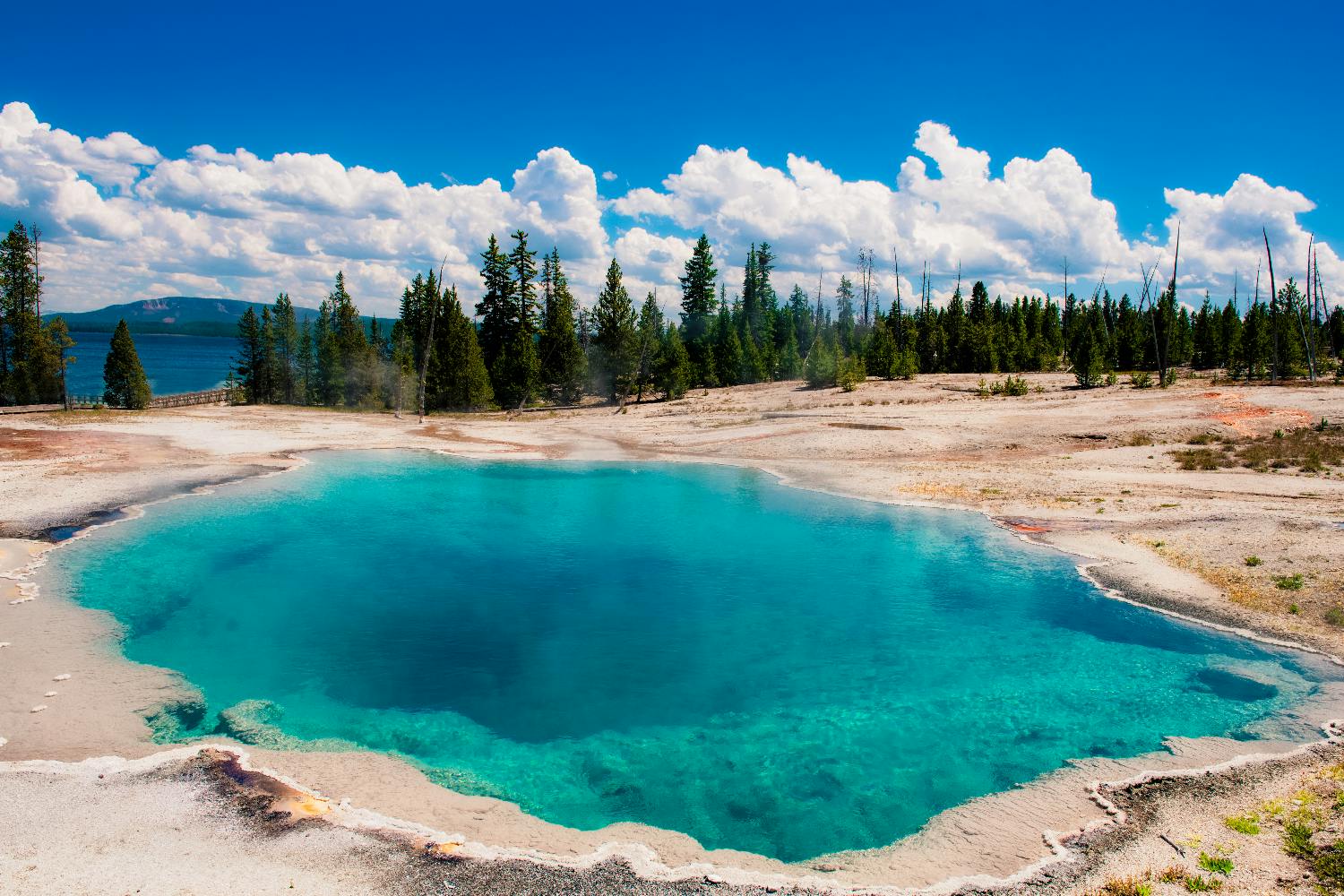
Yellowstone National Park is one of the most spectacular natural destinations in the United States. Spread across Wyoming, Montana and Idaho, it is famous for geysers, hot springs, bubbling mud pots, colourful thermal pools, waterfalls, canyons, forests, alpine lakes, bison herds, elk, bears, wolves and wide-open mountain scenery.
Yellowstone National Park Travel Guide: Geysers, Wildlife, Hot Springs, Canyons and Road Trip Tips
As the world’s first national park, Yellowstone is both iconic and complex. It is huge, seasonal, weather-dependent and busy in peak months. The best visit comes from planning carefully: choose the right entrance, allow enough driving time, book accommodation early, respect wildlife distances and build your route around Yellowstone’s major regions.
Sponsored Popular Items
Quick take: Musement.com offers a worldwide selection of tours and attractions
Yellowstone is worth visiting because it combines scenery, wildlife and geology in a way few places can match. In one trip, you can watch Old Faithful erupt, walk beside steaming geyser basins, see rainbow-coloured hot springs, photograph waterfalls, drive through bison-filled valleys and stand beside one of America’s most dramatic river canyons.
The park is especially good for road trippers, photographers, families, hikers, wildlife watchers and travellers who want a classic American national park experience. It is also a strong addition to a wider route through Grand Teton National Park, Jackson Hole, Montana, Wyoming, Idaho or the Rocky Mountain West.
Old Faithful and Upper Geyser Basin
Old Faithful is Yellowstone’s most famous geyser and one of the park’s must-see attractions. It erupts regularly enough that visitors can usually plan around predicted eruption windows posted by the park and visitor centre.
The geyser sits in the Upper Geyser Basin, one of the most concentrated hydrothermal areas in the world. Many visitors make the mistake of watching Old Faithful and leaving immediately. A better plan is to walk the boardwalks around the basin and explore nearby geysers, pools and thermal features.
Old Faithful Village also has visitor services, lodging, dining, restrooms, parking and the historic Old Faithful Inn. It is one of the busiest parts of Yellowstone, so arrive early or expect crowds in peak season.
Grand Prismatic Spring
Grand Prismatic Spring is one of Yellowstone’s most photographed sights. Its blue centre, orange and yellow microbial mats, steam and large circular shape make it one of the park’s most visually striking thermal features.
There are two main ways to experience it. The boardwalk at Midway Geyser Basin takes you close to the spring, where you can see the colours and steam from ground level. The Grand Prismatic Overlook trail gives a higher view, which is often better for seeing the full shape and colour pattern.
For the best photos, visit on a cooler morning for steam effects or later in the day for clearer colour, depending on conditions. Crowds and parking can be heavy, so allow extra time.
Mammoth Hot Springs
Mammoth Hot Springs is located in the northern part of Yellowstone and is known for its pale travertine terraces. The terraces are formed by mineral-rich hot water flowing over limestone, creating stepped formations that look very different from the geyser basins near Old Faithful.
The area includes upper and lower terrace boardwalks, historic buildings, visitor services and frequent elk sightings around Mammoth village. Because the northern road corridor is one of the most accessible parts of the park, Mammoth is also important for shoulder-season and winter planning.
Grand Canyon of the Yellowstone
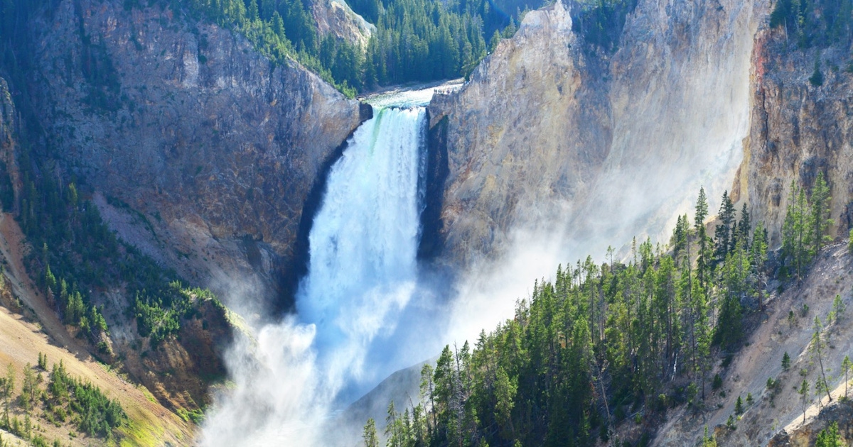
The Grand Canyon of the Yellowstone is one of the park’s most dramatic landscapes. The canyon is known for steep yellow, orange and rust-coloured walls, the Yellowstone River and powerful waterfalls.
The two most famous waterfalls are Upper Falls and Lower Falls. Lower Falls is the taller and more iconic of the two, often viewed from overlooks such as Artist Point, Lookout Point, Red Rock Point and the Brink of the Lower Falls area.
This region is excellent for photography and short viewpoint walks. It is also one of the best places in the park to appreciate Yellowstone’s scale beyond the geysers.
Yellowstone Lake
Yellowstone Lake is the largest body of water in the park and one of the largest high-elevation lakes in North America. It gives the park a very different mood from the geyser basins and wildlife valleys.
The lake area is good for scenic driving, photography, picnic stops, boating access where permitted, lakeside walks and a calmer break from the busier thermal areas. Lake Village, Fishing Bridge, Bridge Bay and West Thumb are useful lake-region stops.
West Thumb Geyser Basin is especially worth visiting because it combines thermal features with lake views. Steam, hot pools and the wide lake backdrop make it one of Yellowstone’s most scenic boardwalk areas.
Lamar Valley
Lamar Valley is one of the best wildlife-watching areas in Yellowstone. Located in the park’s northeast, it is famous for bison, pronghorn, wolves, bears, coyotes and wide-open valley scenery.
Wildlife viewing is best early in the morning or late in the evening. Bring binoculars or a spotting scope if possible. Many animals will be far away, and approaching wildlife is dangerous and illegal.
Lamar Valley is farther from the park’s busiest southern attractions, so it works best if you stay near Mammoth, Roosevelt, Cooke City, Gardiner or plan a long wildlife-focused driving day.
Hayden Valley
Hayden Valley is another prime wildlife area, located between Canyon Village and Yellowstone Lake. It is one of the easiest places to see bison from the road and is also good for birdlife, elk, coyotes and occasional bear or wolf sightings.
Traffic can slow dramatically when animals are near the road. This is part of the Yellowstone experience, but it also means drive times can be much longer than expected. Use pullouts, do not stop in the road, and stay inside your vehicle when wildlife is close.
Wildlife in Yellowstone
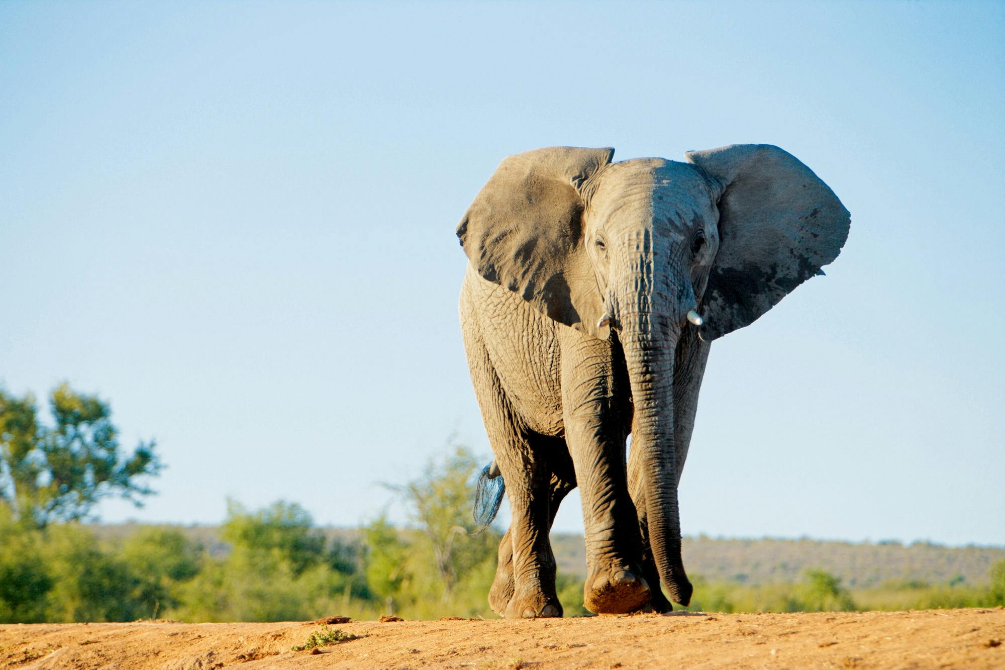
Yellowstone is one of the best wildlife destinations in the United States. Commonly seen animals include bison, elk, mule deer, pronghorn, bighorn sheep, coyotes and many birds. With luck, visitors may also see black bears, grizzly bears, wolves, moose, foxes and river otters.
The safest and best wildlife viewing is done from a distance. Binoculars and telephoto lenses are essential if you want close-looking views without approaching animals.
Important wildlife safety rules include staying at least 100 yards from bears and wolves, and at least 25 yards from all other wildlife, including bison and elk. Bison may look calm but can run fast and injure visitors who get too close.
Yellowstone Entrances
Yellowstone has five main entrances, and the best one depends on your route.
West Entrance
The West Entrance near West Yellowstone, Montana, is one of the most popular entrances. It is convenient for Old Faithful, Grand Prismatic Spring, Madison and geyser basin routes.
North Entrance
The North Entrance near Gardiner, Montana, is useful for Mammoth Hot Springs, Lamar Valley and northern Yellowstone. It is also important for shoulder-season access.
Northeast Entrance
The Northeast Entrance near Cooke City and Silver Gate is best for Lamar Valley and wildlife-focused trips. It is one of the most scenic approaches, but road conditions and seasonal access matter.
East Entrance
The East Entrance connects Yellowstone with Cody, Wyoming. It works well for travellers coming from eastern Wyoming or building a route with Cody’s museums and western heritage.
South Entrance
The South Entrance connects Yellowstone with Grand Teton National Park and Jackson. It is ideal for travellers combining both parks, but visitors entering from the south usually pass through Grand Teton first and may need to account for separate park fees.
Where to Stay
Yellowstone is large, so where you stay has a major impact on your trip. In-park lodging is convenient but books far ahead. Gateway towns can offer more choice but add driving time.
Inside the Park
Staying inside Yellowstone saves driving and lets you reach major sights earlier. Useful areas include Old Faithful, Canyon Village, Lake Yellowstone, Grant Village, Mammoth Hot Springs and Roosevelt. In-park lodging and campgrounds are seasonal and should be booked as early as possible.
West Yellowstone
West Yellowstone is one of the most convenient gateway towns for first-time visitors. It has hotels, restaurants, tour operators and easy access to the West Entrance.
Gardiner
Gardiner is useful for the North Entrance, Mammoth Hot Springs and northern wildlife routes.
Cooke City and Silver Gate
These small towns are good for Lamar Valley and wildlife photographers, especially early morning starts.
Cody
Cody is farther from Yellowstone’s central sights but works well for travellers entering from the east or wanting a western-town experience.
Jackson and Grand Teton
Jackson is best if you are combining Yellowstone with Grand Teton National Park. It is not ideal as your only base for Yellowstone because many park highlights are a long drive away.
How Long to Spend in Yellowstone
One day: Very rushed. Choose either Old Faithful and Grand Prismatic, or Canyon and Hayden Valley, but do not expect to see the whole park.
Two days: Enough for the main southern highlights, including Old Faithful, Grand Prismatic, Yellowstone Lake and the Grand Canyon of the Yellowstone.
Three days: A good minimum for first-time visitors. This allows geyser basins, Canyon, Yellowstone Lake and one wildlife valley.
Four to five days: Better for most travellers. You can slow down, add Lamar Valley, Mammoth Hot Springs and more boardwalk walks.
One week: Ideal for deeper wildlife watching, hiking, photography, sunrise starts, less rushing and combining multiple regions of the park.
Simple Yellowstone Itinerary
Day 1: Old Faithful and Geyser Country
Enter through the West or South Entrance, depending on your route.
Visit Old Faithful and check the next predicted eruption time.
Walk the Upper Geyser Basin boardwalks.
Visit Biscuit Basin or Black Sand Basin if time allows.
Continue to Grand Prismatic Spring at Midway Geyser Basin.
Walk to the Grand Prismatic Overlook if conditions are suitable.
Stay near Old Faithful, West Yellowstone or Madison if available.
Day 2: Yellowstone Lake and Canyon
Start early and drive toward West Thumb Geyser Basin.
Visit Yellowstone Lake and Lake Village viewpoints.
Drive through Hayden Valley for wildlife viewing.
Explore the Grand Canyon of the Yellowstone.
Stop at Artist Point, Lookout Point and other waterfall viewpoints.
Stay near Canyon Village, Lake, West Yellowstone or Gardiner depending on route.
Day 3: Mammoth Hot Springs and Lamar Valley
Visit Mammoth Hot Springs terraces in the morning.
Drive toward Lamar Valley for wildlife scenery.
Bring binoculars and allow time at pullouts.
Return through Roosevelt or continue to Cooke City if staying nearby.
Watch for wildlife at dusk, but avoid driving too fast or too late when visibility is poor.
Optional Day 4: Slower Stops and Short Hikes
Add Norris Geyser Basin, Tower Fall or additional Canyon viewpoints.
Take a short hike suited to your ability.
Revisit a favourite area in better light.
Use this day as a weather buffer if earlier days were smoky, stormy or crowded.
Best Time to Visit Yellowstone
The best time to visit Yellowstone depends on what you want to see.
Late Spring
Late spring brings wildlife activity, newborn animals, waterfalls and cooler weather. Some roads and facilities may still be opening, so check current conditions carefully.
Summer
Summer is the busiest season, with most roads, lodges, campgrounds and visitor services open. It is the easiest time for a first visit, but crowds, full parking lots and traffic jams are common.
Autumn
Autumn is one of the best times for wildlife, cooler weather and fewer crowds. Elk rut activity can be dramatic, and the light is beautiful for photography. Services begin closing gradually, so check operating dates.
Winter
Winter is quiet, snowy and beautiful, but access is limited. Most park roads are closed to regular vehicles, with travel to many areas by snowcoach or snowmobile. Mammoth and the northern road corridor remain especially important in winter planning.
Driving and Road Planning
Yellowstone driving takes longer than maps suggest. Roads are winding, speed limits are modest, parking areas fill, wildlife jams happen often and construction or weather can slow travel.
Plan by region rather than distance. For example, group Old Faithful, Upper Geyser Basin and Grand Prismatic together. Group Canyon, Hayden Valley and Yellowstone Lake together. Group Mammoth and Lamar Valley together.
Always check current road status before and during your trip. Yellowstone’s weather can change quickly, and seasonal closures are normal.
Entrance Fees and Reservations
Yellowstone requires an entrance pass, but the National Park Service currently states that vehicle reservations are not required to enter the park. A standard private vehicle entrance pass is typically valid for seven consecutive days.
Non-US residents should check the current fee rules carefully before arrival, as Yellowstone currently lists an additional nonresident fee for visitors aged 16 and over unless admitted with an Annual or America the Beautiful Pass.
Separate reservations are needed for lodging, campgrounds, some tours, guided activities and backcountry camping. Accommodation inside the park can book out far ahead, especially in summer.
Safety Tips
Stay on Boardwalks
Thermal areas are dangerous. The ground around hot springs and geysers can look solid but may be thin crust over superheated water. Stay on boardwalks and designated trails at all times.
Never Touch Thermal Water
Even runoff from thermal features can burn skin. Do not touch, enter or throw objects into hot springs, geysers or thermal pools.
Keep Wildlife Distance
Stay at least 100 yards from bears and wolves, and at least 25 yards from bison, elk and other wildlife. Use binoculars instead of approaching animals.
Carry Bear Spray on Trails
Yellowstone is bear country. Carry bear spray where it is quickly accessible, know how to use it and hike in groups where possible.
Drive Carefully
Wildlife often crosses roads. Bison may walk on roads and cause long delays. Use pullouts for photos and never block traffic.
Prepare for Fast Weather Changes
Yellowstone can have cold nights, storms, wind and even winter-like weather outside winter. Bring layers and rain protection.
What to Wear and Pack
Comfortable walking shoes or hiking shoes
Layered clothing for changing temperatures
Rain jacket
Warm jacket or fleece, even in summer
Hat, sunglasses and sunscreen
Reusable water bottle
Snacks or picnic supplies
Binoculars for wildlife
Camera or phone with power bank
Bear spray for hiking
Paper map or offline maps
Insect repellent in summer
Small first-aid kit
FAQs About Yellowstone National Park
Is Yellowstone National Park worth visiting?
Yes. Yellowstone is one of the most extraordinary national parks in the world, with geysers, hot springs, wildlife, waterfalls, canyons, lakes and mountain scenery.
What is Yellowstone famous for?
Yellowstone is famous for Old Faithful, Grand Prismatic Spring, Mammoth Hot Springs, the Grand Canyon of the Yellowstone, Yellowstone Lake, bison herds, wolves, bears and hydrothermal activity.
How many days do you need in Yellowstone?
Three days is a good minimum for first-time visitors. Four to five days is better if you want a less rushed trip with Lamar Valley, Mammoth Hot Springs and more wildlife time.
Do you need a reservation to enter Yellowstone?
Vehicle reservations are not currently required to enter Yellowstone, but an entrance pass is required. Lodging, campgrounds and tours should be reserved ahead.
What is the best entrance for Yellowstone?
The West Entrance is very convenient for Old Faithful and geyser basins. The North Entrance is good for Mammoth and Lamar Valley. The South Entrance is best for combining Yellowstone with Grand Teton.
Can you visit Yellowstone in one day?
You can visit for one day, but it will be very rushed. Focus on one region, such as Old Faithful and Grand Prismatic, rather than trying to cross the whole park.
When is the best time to visit Yellowstone?
Summer has the most services open, but also the biggest crowds. Late spring and autumn can be excellent for wildlife and fewer visitors, while winter offers a snowy, quieter experience with limited access.
Is Yellowstone good for families?
Yes. Yellowstone is excellent for families, especially with short boardwalk walks, wildlife viewing, geyser eruptions and scenic drives. Children must be closely supervised near thermal areas and wildlife.
Can you see wildlife from the road?
Yes. Many visitors see bison, elk and other animals from roads and pullouts. Lamar Valley and Hayden Valley are especially good for wildlife viewing.
Is Yellowstone dangerous?
Yellowstone is safe if visitors follow rules, but it has real hazards: hot springs, wild animals, fast-changing weather, traffic, rivers and bear country. Stay on boardwalks, keep wildlife distance and prepare properly.
Final Thoughts
Yellowstone National Park is a destination that deserves time and respect. Its geysers, hot springs, wildlife valleys, waterfalls and volcanic landscapes are unforgettable, but the park is large and seasonal, so careful planning matters.
For the best first visit, allow at least three or four days, stay in or near the park if possible, start early each morning, group your sightseeing by region and build in extra time for wildlife jams and weather changes. Whether you come for Old Faithful, Grand Prismatic Spring, Lamar Valley wolves or the Grand Canyon of the Yellowstone, this is one of America’s great natural journeys.
Sponsored Popular Items
Quick take: Musement.com offers a worldwide selection of tours and attractions
Yellowstone National Park Self-Driving Audio Tour United States Yellowstone national park self-driving audio tour is designed for travellers who prefer independent exploration while still having structured digital guidance available. Check current availability, inclusions and booking details before you go.
Yellowstone National Park Tours & Visitor Attractions United States Compare sightseeing experiences in Yellowstone National Park Tours & Visitor, with practical tips on timing, inclusions and choosing the right option. Check current availability, prices and booking conditions before you go.
Las Vegas is one of the most famous entertainment cities in the world. Known for its neon lights, casino resorts, live shows, celebrity restaurants, nightlife, shopping, pool clubs and desert scenery, it is a destination built around spectacle, choice and energy.
Las Vegas Travel Guide: The Strip, Shows, Casinos, Food, Fremont Street and Desert Day Trips
Most first-time visitors focus on the Las Vegas Strip, where huge themed resorts line Las Vegas Boulevard. But the city also offers Downtown Las Vegas, Fremont Street, the Arts District, museums, sports venues, family attractions and easy day trips to places like Red Rock Canyon, Hoover Dam, Valley of Fire and the Grand Canyon West Rim.
Sponsored Popular Items
Quick take: Musement.com offers a worldwide selection of tours and attractions
Las Vegas Strip Highlights Night Flight - Guided Sightseeing Tour United States Las Vegas Strip highlights night flight is a convenient way to add structure, local context and purposeful sightseeing to the itinerary. Check current availability, inclusions and booking details before you go.
Why Visit Las Vegas?
Las Vegas is worth visiting because it combines entertainment, food, nightlife, architecture, shopping and desert scenery in one compact travel experience. You can watch a world-class show, eat at a celebrity-chef restaurant, walk through themed resorts, see free attractions, visit a casino, relax by a pool and take a canyon or desert day trip all in the same holiday.
The city works for many travel styles. It can be a party weekend, a luxury escape, a food-focused break, a sports trip, a family holiday, a wedding destination, a road-trip stop or a base for exploring Nevada, Arizona and Utah landscapes.
The Las Vegas Strip
The Las Vegas Strip is the city’s main visitor zone. It is the stretch of Las Vegas Boulevard lined with large casino resorts, theatres, restaurants, bars, shops, fountains, themed architecture and bright signage.
Walking the Strip is part of the experience, but distances are longer than they look. Resorts are huge, pedestrian bridges add extra walking, and summer heat can make short distances feel tiring. Choose a few key areas each day rather than trying to walk everything at once.
Popular Strip Areas
Central Strip: Bellagio, Caesars Palace, Paris Las Vegas, The Cosmopolitan and nearby resorts.
South Strip: MGM Grand, New York-New York, Excalibur, Luxor and Mandalay Bay.
North Strip: The Venetian, Wynn, Encore, Resorts World, Fontainebleau and The STRAT area.
Bellagio Fountains
The Bellagio Fountains are one of the best free things to see in Las Vegas. The show combines water, lights and music on the lake in front of Bellagio, with the Paris Las Vegas Eiffel Tower replica and Strip lights nearby.
It is especially beautiful at night, but daytime shows are also worth seeing if you are nearby. For the best view, stand along the Bellagio lake railings, across the street near Paris Las Vegas, or from a restaurant or bar with a fountain view.
Sphere Las Vegas
Sphere has quickly become one of Las Vegas’ most talked-about modern venues. Its huge exterior display is visible from many parts of the Strip, while the interior hosts immersive shows, concerts and special events.
If you want to attend an event, book ahead and check the exact show schedule. Sphere is not only a building to photograph from outside; it is designed as a full entertainment venue with immersive visuals and sound.
Fremont Street and Downtown Las Vegas
Downtown Las Vegas offers a different atmosphere from the Strip. Fremont Street is famous for its covered light canopy, street performers, live music, older casinos, bars and the SlotZilla zipline.
This area feels louder, grittier and more compact than the Strip. It is good for an evening out, especially if you want old-school Vegas energy, neon signs, casual bars and a less polished casino scene.
Nearby, the Downtown Arts District offers murals, independent restaurants, bars, vintage shops, galleries and a more local-feeling side of Las Vegas.
Casinos and Resorts
Las Vegas casinos are not only for gambling. Many resorts are attractions in themselves, with themed architecture, restaurants, shops, gardens, aquariums, theatres, art, pools and nightlife.
If you do gamble, set a strict budget before you start and treat it as entertainment money, not a way to make money. Casino floors are designed to keep you inside, so take breaks, drink water and keep track of time.
Resorts Worth Walking Through
Bellagio: Fountains, conservatory, restaurants and elegant interiors.
The Venetian: Canals, gondolas, shops and Italian-inspired design.
Caesars Palace: Roman-inspired interiors, Forum Shops and entertainment venues.
Wynn and Encore: Luxury design, gardens, restaurants and nightlife.
Paris Las Vegas: Eiffel Tower replica and central Strip views.
New York-New York: City-themed exterior and roller coaster.
Shows and Entertainment
Shows are one of the best reasons to visit Las Vegas. Options include Cirque-style productions, magic, comedy, concerts, residencies, tribute shows, adult revues, immersive experiences and sports events.
Book popular shows ahead, especially on weekends and holiday periods. If you are flexible, same-day ticket booths and apps may offer discounted seats for selected performances.
Common Entertainment Types
Cirque-style acrobatic shows
Magic and illusion shows
Comedy shows
Concert residencies
Sphere immersive shows
Sports events
Nightclubs and dayclubs
Family-friendly performances
Where and What to Eat
Las Vegas has one of the most varied dining scenes in the United States. You can eat at luxury fine-dining restaurants, buffets, celebrity-chef venues, steak houses, casual food halls, late-night diners, Asian restaurants, Mexican eateries, pizza shops and local neighbourhood favourites.
The Strip is best for big-name restaurants, hotel dining and special occasion meals. Downtown and the Arts District can be better for a more local, less resort-focused food experience.
Food Experiences to Consider
A classic Las Vegas buffet
A steakhouse dinner
A celebrity-chef restaurant
Late-night pizza or diner food
Chinatown restaurants west of the Strip
Downtown Arts District dining
Rooftop or fountain-view cocktails
Family-Friendly Las Vegas
Las Vegas is famous for adult entertainment, but it also has plenty for families. The key is choosing the right hotel, location and activities.
Family-friendly options include the Bellagio Fountains, themed resort walks, aquariums, observation wheels, museums, arcades, magic shows, roller coasters, chocolate shops, pool time and day trips to natural attractions.
Family-Friendly Ideas
Bellagio Fountains
Bellagio Conservatory
High Roller Observation Wheel
Shark Reef Aquarium at Mandalay Bay
Discovery Children’s Museum
AREA15 attractions
Red Rock Canyon scenic drive
Hoover Dam day trip
Shopping in Las Vegas
Las Vegas is excellent for shopping, especially if you enjoy large malls, luxury brands, outlet centres and resort shopping arcades.
Popular Shopping Areas
Forum Shops at Caesars Palace: Luxury and designer shopping in a themed setting.
Grand Canal Shoppes: Venetian-style shopping, restaurants and indoor canals.
Fashion Show Las Vegas: Large mall opposite Wynn and The Venetian.
Miracle Mile Shops: Central Strip shopping at Planet Hollywood.
Las Vegas North Premium Outlets: Popular outlet shopping north of Downtown.
Las Vegas South Premium Outlets: Outlet shopping south of the Strip.
Best Day Trips from Las Vegas
Las Vegas is surrounded by desert, canyons, mountains and historic sites. If you stay more than two or three nights, adding a day trip can balance the bright lights with natural scenery.
Red Rock Canyon
Red Rock Canyon is one of the easiest nature escapes from Las Vegas. It is ideal for scenic drives, short walks, desert photography and sandstone cliffs.
Hoover Dam
Hoover Dam is a classic engineering and history day trip, often combined with Lake Mead or the Grand Canyon West Rim.
Valley of Fire State Park
Valley of Fire is known for red sandstone formations, desert colours, short hikes and dramatic photo stops.
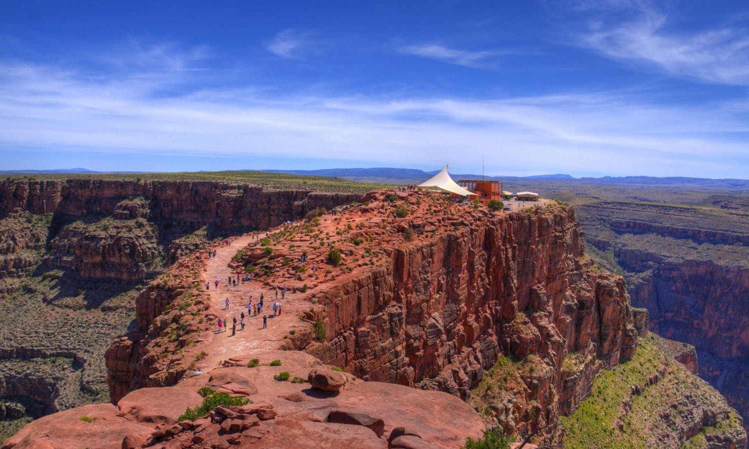
Grand Canyon West Rim
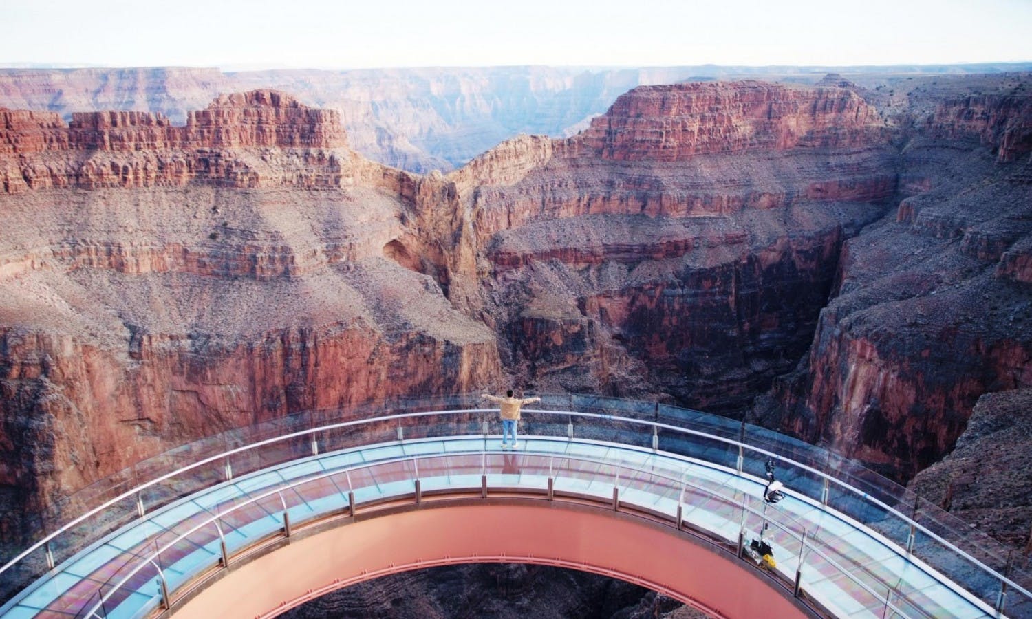
Grand Canyon West is the closest major Grand Canyon experience to Las Vegas and is known for the Skywalk at Eagle Point. The official Grand Canyon West FAQ describes Las Vegas as approximately a two-hour drive from Grand Canyon West. :contentReference[oaicite:4]{index=4}
Death Valley National Park
Death Valley can be visited from Las Vegas on a long day trip, especially in cooler months. Avoid extreme heat and check road and weather conditions carefully.
Where to Stay
Where you stay in Las Vegas shapes the whole trip. First-time visitors usually do best on or near the Strip, especially if they want shows, casinos, dining and easy walking access.
Best Areas
Central Strip: Best for first-timers who want easy access to major resorts and attractions.
South Strip: Good for families, events, sports venues and airport access.
North Strip: Good for newer luxury resorts and a slightly less central base.
Downtown Las Vegas: Good for Fremont Street, lower room rates and old-school Vegas atmosphere.
Off-Strip: Good for quieter stays, local dining and travellers with a car.
Always check resort fees before booking. Las Vegas hotel rates can look cheap at first, but resort fees, parking charges and taxes can change the true cost.
How Long to Stay
Two nights: Enough for a quick Strip visit, one show and a few major attractions.
Three nights: A good minimum for first-time visitors. You can explore the Strip, see a show, visit Fremont Street and enjoy several restaurants.
Four nights: Better if you want a day trip to Red Rock Canyon, Hoover Dam or Grand Canyon West.
Five nights or more: Good for a slower trip with pool time, shopping, shows, food, nightlife and multiple day trips.
Simple Las Vegas Itinerary
Day 1: Arrival and Central Strip
Arrive at Harry Reid International Airport and transfer to your hotel.
Explore your resort and nearby Strip area.
See the Bellagio Fountains at night.
Have dinner at a central Strip restaurant.
Day 2: Resorts, Shopping and a Show
Walk through Bellagio, Caesars Palace, Paris Las Vegas and The Venetian.
Shop at the Forum Shops, Grand Canal Shoppes or Fashion Show mall.
Relax by the pool or visit a museum or attraction in the afternoon.
Book a show or concert for the evening.
Day 3: Downtown Las Vegas and Fremont Street
Spend the morning at a relaxed breakfast or brunch.
Visit the Arts District, Neon Museum or Mob Museum.
Head to Fremont Street in the evening for lights, music and old-school casinos.
Return to the Strip or stay Downtown for nightlife.
Day 4: Desert Day Trip
Choose Red Rock Canyon for an easy nature escape.
Choose Hoover Dam for history and engineering.
Choose Grand Canyon West for a longer canyon day trip.
Return to Las Vegas for a final dinner or rooftop drink.
Best Time to Visit
The best time to visit Las Vegas is generally spring or autumn, when temperatures are warm but not as extreme as summer. These seasons are good for walking the Strip and taking day trips into the desert.
Summer can be very hot, especially from June to September. If visiting in summer, plan outdoor walking early or late, use rideshare or taxis more often, and stay hydrated.
Winter is cooler and can be a good value period outside major holidays, conventions and event weekends. Pool season may be limited depending on the hotel.
Getting Around Las Vegas
Las Vegas looks walkable on a map, but resorts are large and distances are deceptive. Use a mix of walking, rideshare, taxis, monorail, trams and buses depending on your route.
Transport Options
Walking: Best for short Strip sections, especially in cooler weather.
Rideshare and taxis: Convenient, but pickup points can be inside hotel garages or designated zones.
Las Vegas Monorail: Useful on the east side of the Strip.
Free resort trams: Helpful between selected resort clusters.
Rental car: Useful for day trips, but not always needed for a Strip-focused stay.
Bus: Useful for budget travellers, especially between the Strip and Downtown.
Las Vegas Airport
Harry Reid International Airport is the main airport serving Las Vegas. It is close to the Strip compared with many major city airports, making transfers relatively straightforward by taxi, rideshare, shuttle or rental car.
Check whether your flight uses Terminal 1 or Terminal 3, as they are separate terminal areas. If departing during busy convention, holiday or weekend periods, allow extra time for traffic, check-in and security.
Practical Travel Tips
Watch Resort Fees
Resort fees are common in Las Vegas and can add a significant amount to the nightly price. Check the full cost before booking.
Book Shows Early
Popular shows, concerts and Sphere events can sell out or become expensive close to the date. Book early for must-see performances.
Use Comfortable Shoes
You will walk more than expected. The Strip is long, casinos are huge and pedestrian bridges add extra steps.
Stay Hydrated
The desert climate can dehydrate you quickly, especially in summer or when drinking alcohol.
Do Not Overpack Each Day
Las Vegas can be tiring. Leave time for pool breaks, naps, long meals or simply exploring your hotel.
Set a Gambling Budget
If you gamble, decide your limit before you start. Treat it as entertainment, not income.
Check Restaurant Dress Codes
Casual clothes are fine in many places, but high-end restaurants, clubs and lounges may have dress codes.
Plan Day Trips Carefully
Desert day trips can involve heat, long drives and limited services. Carry water, fuel up before leaving and check weather conditions.
Expect Dynamic Pricing
Hotel prices can change dramatically during conventions, sports events, concerts and holiday weekends.
Use Designated Pickup Areas
Large resorts often have specific taxi and rideshare pickup zones. Follow signs rather than waiting at random entrances.
FAQs About Las Vegas
Is Las Vegas worth visiting?
Yes. Las Vegas is worth visiting for entertainment, shows, restaurants, nightlife, casinos, shopping, pool resorts, sports events and desert day trips.
How many days do you need in Las Vegas?
Three nights is a good minimum for first-time visitors. Four nights is better if you want a day trip to Red Rock Canyon, Hoover Dam or Grand Canyon West.
What is Las Vegas famous for?
Las Vegas is famous for the Strip, casino resorts, live shows, Bellagio Fountains, nightlife, celebrity restaurants, weddings, pool clubs and nearby desert attractions.
Where should first-time visitors stay?
First-time visitors usually do best on the central Strip, close to Bellagio, Caesars Palace, Paris Las Vegas, The Cosmopolitan and nearby resorts.
Is Las Vegas only for gambling?
No. Gambling is a major part of Las Vegas, but many visitors come for shows, dining, shopping, spas, pools, sports, museums, nightlife and day trips.
Is Las Vegas suitable for families?
Yes, if you choose activities carefully. Families can enjoy fountains, aquariums, observation wheels, museums, magic shows, pools, arcades and nearby nature trips.
What is the best free thing to do in Las Vegas?
The Bellagio Fountains are one of the best free attractions. Walking through themed resorts and exploring Fremont Street are also popular low-cost experiences.
Do you need a car in Las Vegas?
You do not need a car for a Strip-focused stay. A car is useful if you want to visit Red Rock Canyon, Hoover Dam, Valley of Fire or other day-trip destinations.
What is the best time of year to visit Las Vegas?
Spring and autumn are generally the most comfortable. Summer is very hot, while winter is cooler and can be good for lower prices outside major events.
Can you do the Grand Canyon as a day trip from Las Vegas?
Yes. Grand Canyon West is the easiest Grand Canyon day trip from Las Vegas. The South Rim is farther and is better with an overnight stay if possible.
Final Thoughts
Las Vegas is a city built for variety. You can make it glamorous, casual, food-focused, family-friendly, outdoorsy, nightlife-heavy or completely show-centred depending on how you plan your trip.
For the best first visit, stay on or near the Strip, see at least one show, watch the Bellagio Fountains, spend an evening Downtown at Fremont Street, try a memorable restaurant and leave time for a desert day trip. Las Vegas is brightest at night, but its best trips balance neon, food, entertainment and the dramatic landscapes just beyond the city.
Sponsored Popular Items
Quick take: Musement.com offers a worldwide selection of tours and attractions
Las Vegas Strip Highlights Night Flight - Guided Sightseeing Tour United States Las Vegas Strip highlights night flight is a convenient way to add structure, local context and purposeful sightseeing to the itinerary. Check current availability, inclusions and booking details before you go.
King of Canyons Landing Tour with Las Vegas Strip – Guided Tour King of Canyons Landing Tour with Las Vegas Strip is a convenient way to add structure, local context and purposeful sightseeing to the itinerary. Check current availability, inclusions and booking details before you go.
Grand Canyon West Rim is one of the most popular Grand Canyon day trips from Las Vegas. Famous for the glass Skywalk at Eagle Point, wide canyon views at Guano Point, Hualapai cultural experiences and optional adventure activities, it offers a very different experience from the South Rim inside Grand Canyon National Park.
Grand Canyon West Rim: A Practical Guide to the Skywalk, Eagle Point, Guano Point and Las Vegas Day Trips
Grand Canyon West is located on Hualapai tribal land in north-west Arizona. It is closer to Las Vegas than the South Rim, making it a practical choice for visitors who want to see the Grand Canyon in one long day without driving four to five hours each way.
Sponsored Popular Items
Quick take: Musement.com offers a worldwide selection of tours and attractions
North Canyon Helicopter Tour from Grand Canyon South Rim – Tusayan Scenic Flight United States North Canyon Helicopter Tour from the Grand Canyon South Rim: What to Expect A short, narrated helicopter flight designed to show the Grand Canyon’s widest, deepest sections from above. Check current availability, inclusions and booking details before you go.
What Is Grand Canyon West Rim?
Grand Canyon West Rim, usually promoted as Grand Canyon West, is a visitor area on the Hualapai Reservation in Arizona. It is best known for the Skywalk, a glass bridge that extends out over the canyon at Eagle Point.
The West Rim is not part of Grand Canyon National Park. It has its own ticketing, opening hours, shuttle system, activities and visitor rules. This is important because national park passes, South Rim advice and National Park Service shuttle information do not apply in the same way here.
The main visitor areas are Eagle Point, Guano Point and Hualapai Point. Visitors usually park at the main terminal and use the in-park shuttle to move between stops.
Grand Canyon West Rim vs South Rim
The West Rim and South Rim are often confused, but they are very different experiences.
Grand Canyon West Rim
Closest major Grand Canyon experience to Las Vegas.
Home to the Skywalk glass bridge.
Located on Hualapai tribal land.
Operates with its own admission tickets and shuttle system.
Good for a one-day Las Vegas tour.
More commercial and activity-focused than the South Rim.
Grand Canyon South Rim
Part of Grand Canyon National Park.
Farther from Las Vegas but more iconic for classic national park scenery.
Offers extensive rim trails, viewpoints, lodges, visitor centres and ranger programs.
Better for hiking, photography and a deeper national park visit.
Usually best with an overnight stay if travelling from Las Vegas.
If you want the classic national park experience, choose the South Rim. If you want the closest Grand Canyon day trip from Las Vegas and the Skywalk experience, choose Grand Canyon West.
Why Visit the West Rim?
Grand Canyon West Rim is worth visiting if you want dramatic canyon views within a manageable day trip from Las Vegas. It is especially popular with travellers who have limited time, want to walk on the Skywalk, or prefer an organised tour with transport included.
The West Rim also gives visitors a chance to learn about the Hualapai Tribe, whose land and culture are central to the experience. Cultural exhibits, performances and guided interpretation may be included depending on your ticket and timing.
It is a good choice for families, first-time visitors, cruise-style coach tour travellers, and anyone wanting a mix of sightseeing, photos, food stops and optional adventure activities.
Grand Canyon Skywalk
The Skywalk is the signature attraction at Grand Canyon West. It is a horseshoe-shaped glass bridge that extends out from the rim at Eagle Point, giving visitors the sensation of standing above the canyon.
The glass floor is the main thrill. Looking down through the transparent walkway can be exciting, intimidating or slightly dizzying depending on how you feel about heights. Visitors wear protective booties over their shoes to help protect the glass surface.
The Skywalk is not a long walk, but it is memorable. It is best for travellers who want a unique photo experience and a dramatic viewpoint rather than a long hiking route.
Skywalk Rules to Know
Shoes are required.
Protective booties are worn over shoes.
Cell phones are currently permitted, but visitors are responsible for their own device.
Cameras, purses, backpacks and similar belongings are not allowed on the glass bridge.
Free lockers are provided for personal items.
Professional photos may be available for purchase.
Peak Skywalk hours are often late morning to mid-afternoon.
Eagle Point
Eagle Point is the home of the Skywalk and one of the main stops at Grand Canyon West. It is named for a natural rock formation that resembles an eagle with outstretched wings.
This area is usually the busiest part of the West Rim because most visitors come specifically for the Skywalk. It also includes canyon viewpoints, cultural exhibits, dining and shopping options depending on current operations.
Take time to look beyond the Skywalk. The canyon views around Eagle Point are impressive, and the eagle-shaped rock formation is part of the cultural and visual identity of this stop.
Guano Point
Guano Point is often the favourite West Rim stop for travellers who care most about open canyon scenery. It has wide views, rugged walking areas and a more natural feel than the Skywalk area.
The viewpoint offers broad canyon panoramas and a chance to walk along rocky areas for different angles. This is one of the best places at Grand Canyon West for photography, especially if you want sweeping views rather than the glass-bridge experience.
Wear proper shoes and stay well back from edges. Some areas are uneven, exposed and unfenced.
Hualapai Point
Hualapai Point is a visitor area with food, family activities, cultural experiences, shopping, cabins and optional attractions depending on your ticket and availability. It can be a useful stop for meals, shade and a break between canyon viewpoints.
The zipline is associated with Hualapai Point and may be included in some ticket packages, but availability can depend on weather, wind, operations and capacity. Always check current details before planning your day around it.
Tickets and Passes
Grand Canyon West uses its own ticket system. The main ticket types usually include general admission and upgraded passes that include the Skywalk and other activities.
General admission is suitable if you want canyon views and walking areas without the Skywalk. The All-Access Pass is better if the Skywalk is your main reason for visiting or if you want access to additional activities such as the zipline, shuttle service, cultural experiences and other inclusions.
Ticket inclusions and prices can change, so always check the official Grand Canyon West ticket page before booking. If you are joining a tour from Las Vegas, confirm whether your tour includes admission, Skywalk, lunch, helicopter rides, boat rides or optional upgrades.
How to Get There from Las Vegas
Grand Canyon West is one of the easiest Grand Canyon areas to visit from Las Vegas. The drive is usually around two hours each way, depending on traffic, road conditions and stops.
The official address is:
Grand Canyon West
5001 E. Diamond Bar Road
Meadview, AZ 86444
Many visitors combine the trip with Hoover Dam, Lake Mead, Joshua tree desert scenery or a photo stop along the route.
Self-Drive from Las Vegas
Self-driving gives you the most flexibility. You can leave early, stop at Hoover Dam, spend as long as you want at the viewpoints and avoid being tied to a coach schedule.
Before self-driving, check the following:
Opening hours and last entry time.
Current ticket prices and inclusions.
Fuel level before leaving Las Vegas.
Road conditions and weather.
Arizona time zone details.
Rental car rules and insurance coverage.
Once you arrive, expect to park and use the Grand Canyon West shuttle system to move between visitor points.
Tours from Las Vegas
Guided tours from Las Vegas are very popular. They can be simpler than self-driving because transport, timing and ticketing are handled for you.
Common Tour Options
Coach tours from Las Vegas.
Small-group van tours.
Skywalk admission upgrade tours.
Helicopter tours to the West Rim.
Helicopter and Colorado River boat combinations.
Hoover Dam and West Rim combination tours.
Sunset tours.
When comparing tours, check exactly what is included. Some tours advertise a low base price but charge extra for Skywalk, lunch, helicopter rides, boat rides or hotel pickup from certain locations.
Best Time to Visit
The best time to visit Grand Canyon West is usually spring or autumn, when temperatures are more comfortable than peak summer. Winter can be quieter and cooler, while summer can be very hot and exposed.
For the best experience, arrive early. Morning visits can mean easier parking, shorter queues, cooler temperatures and better light before the busiest part of the day.
Late afternoon can be beautiful for softer light and sunset views, but you must pay attention to last entry and park closing times. If using a sunset pass or evening tour, check timing carefully.
How Long to Spend There
Two hours: Very rushed, enough only for a short visit to the main viewpoints.
Three to four hours: A reasonable amount of time for Eagle Point, Skywalk and Guano Point.
Four to five hours: Better if you want lunch, Hualapai Point, cultural experiences or a slower pace.
Full day from Las Vegas: Most visitors should treat the West Rim as a full-day outing once driving, tickets, shuttles and stops are included.
Simple Grand Canyon West Rim Itinerary
Self-Drive Day Trip from Las Vegas
7:00 am: Leave Las Vegas early.
8:00 am: Optional Hoover Dam photo stop.
10:00 am: Arrive at Grand Canyon West and check in.
10:30 am: Visit Eagle Point and walk the Skywalk if included.
12:00 pm: Take the shuttle to Guano Point for canyon views and photos.
1:30 pm: Lunch at a Grand Canyon West dining stop.
2:30 pm: Visit Hualapai Point or return to favourite viewpoints.
3:30 pm: Begin the drive back to Las Vegas.
5:30 pm: Arrive back in Las Vegas, depending on traffic and stops.
Las Vegas Tour Plan
Choose a tour that clearly states whether Skywalk is included.
Confirm hotel pickup time and pickup location.
Bring water, sun protection and a charged phone.
Expect a long day with early departure and several hours on the road.
Use free time at Grand Canyon West to prioritise Eagle Point and Guano Point.
What to Wear and Bring
Comfortable walking shoes
Hat and sunglasses
Sunscreen
Reusable water bottle
Light jacket in winter or for early morning
Breathable clothing in summer
Phone with enough battery
Power bank
Small bag for items not taken onto the Skywalk
Photo ID and booking confirmation
Snacks if driving independently
Practical Travel Tips
Know That It Is Not the National Park
Grand Canyon West is operated by the Hualapai Tribe and is not part of Grand Canyon National Park. Check Grand Canyon West rules, not South Rim rules, before visiting.
Check Ticket Inclusions Carefully
General admission may not include the Skywalk. If walking on the glass bridge matters to you, book a ticket or tour that clearly includes it.
Arrive Early
Early arrival helps you avoid the busiest Skywalk period, which is often late morning through mid-afternoon.
Use the Free Lockers for Skywalk Items
Backpacks, cameras, purses and similar personal items are not allowed on the glass bridge. Use the lockers and only take permitted items.
Keep Your Phone Secure
Phones are currently allowed on the Skywalk, but you are responsible for your device. Do not lean over railings or hold your phone in unsafe ways.
Wear Proper Shoes
Guano Point and other walking areas can be rocky and uneven. Avoid flip-flops or slippery sandals.
Respect Hualapai Land
You are visiting sovereign tribal land. Follow posted rules, respect cultural exhibits and do not enter restricted areas.
Prepare for Heat
Summer can be extremely hot and exposed. Carry water, wear sun protection and avoid overexertion during the hottest part of the day.
Watch the Time Zone
Grand Canyon West operates on Arizona time. Check the current time difference from Las Vegas when planning departures, tours and last entry.
Do Not Underestimate the Drive
Even though Grand Canyon West is closer to Las Vegas than the South Rim, it is still a long day. Avoid driving tired, especially after sunset.
FAQs About Grand Canyon West Rim
Is Grand Canyon West Rim worth visiting?
Yes, Grand Canyon West Rim is worth visiting if you want a convenient Grand Canyon day trip from Las Vegas, Skywalk access and dramatic canyon views. Choose the South Rim instead if you want the classic national park experience.
Is Grand Canyon West part of Grand Canyon National Park?
No. Grand Canyon West is on Hualapai tribal land and is not part of Grand Canyon National Park.
How far is Grand Canyon West from Las Vegas?
Grand Canyon West is about a two-hour drive from Las Vegas, depending on traffic, road conditions and stops.
What is the Skywalk?
The Skywalk is a horseshoe-shaped glass bridge at Eagle Point that extends over the canyon rim, allowing visitors to look down through the glass floor.
Can you take photos on the Skywalk?
Cell phones are currently permitted on the Skywalk, but cameras, backpacks, purses and similar items are not allowed. Professional photos may also be available.
What are the main viewpoints at Grand Canyon West?
The main visitor stops are Eagle Point, Guano Point and Hualapai Point. Eagle Point has the Skywalk, while Guano Point is especially good for wide canyon views.
How long do you need at Grand Canyon West?
Allow at least three to four hours at Grand Canyon West itself. From Las Vegas, plan for a full-day outing including travel time.
Can you visit Grand Canyon West without a tour?
Yes. You can self-drive from Las Vegas or other areas, buy admission and use the in-park shuttle system. Tours are easier if you do not want to drive.
Is the West Rim better than the South Rim?
Neither is simply better. The West Rim is closer to Las Vegas and has the Skywalk. The South Rim is part of Grand Canyon National Park and offers the classic national park scenery, trails and viewpoints.
Is Grand Canyon West good for families?
Yes. Families can enjoy the viewpoints, shuttle stops, cultural experiences and Skywalk. Children are welcome on the Skywalk, but strollers are not permitted on the glass bridge.
Final Thoughts
Grand Canyon West Rim is one of the easiest ways to experience the Grand Canyon from Las Vegas. The Skywalk gives it a unique thrill, Eagle Point adds cultural and visual interest, and Guano Point offers some of the best open canyon views in the area.
For the best visit, book the right ticket, arrive early, check Skywalk rules, wear proper shoes and allow enough time for both Eagle Point and Guano Point. If you understand that Grand Canyon West is a Hualapai-operated destination rather than part of the national park, you can plan the day properly and enjoy it for what it does best: dramatic canyon views, cultural context and a convenient West Rim experience from Las Vegas.
Sponsored Popular Items
Quick take: Musement.com offers a worldwide selection of tours and attractions
North Canyon Helicopter Tour from Grand Canyon South Rim – Tusayan Scenic Flight United States North Canyon Helicopter Tour from the Grand Canyon South Rim: What to Expect A short, narrated helicopter flight designed to show the Grand Canyon’s widest, deepest sections from above. Check current availability, inclusions and booking details before you go.
Grand Canyon West Rim Bus Tour, Helicopter Ride, Skywalk, Hoover Dam Stop United States Grand Canyon West Rim bus tour, helicopter ride, Skywalk, Hoover Dam stop is a convenient way to add structure, local context and purposeful sightseeing to the itinerary. Check current availability, inclusions and booking details before you go.
Grand Canyon West Rim Bus Tour with Skywalk Ticket & Hoover Dam Stop United States Grand Canyon West Rim bus tour with Skywalk ticket and Hoover Dam stop is a convenient way to add structure, local context and purposeful sightseeing to the itinerary. Check current availability, inclusions and booking details before you go.
Zhangjiajie is one of China’s most dramatic natural destinations. Located in Hunan Province, it is famous for towering sandstone pillars, misty mountain scenery, cliffside walkways, glass bridges, cable cars, forest trails and landscapes often linked with the floating mountains in the film Avatar.
Zhangjiajie What to Expect: Avatar Mountains, Glass Walkways, Cable Cars and Travel Tips
For first-time visitors, Zhangjiajie can be both breathtaking and overwhelming. The scenery is spectacular, but the area is large, transport can be confusing, tickets are separate for different attractions, and weather can change quickly. With good planning, it becomes one of the most memorable mountain trips in China.
Sponsored Popular Items
Quick take: Musement.com offers a worldwide selection of tours and attractions
Zhangjiajie Avatar Mountains, Tianmen & Glass Bridge 1–2-Day – Nature &… China 1-2 Days All-inclusive Mini Tour:Avatar+Tianmen+Glass Bridge adds structure, local context and purposeful sightseeing to the itinerary. Check current availability, inclusions and booking details before you go.
What Is Zhangjiajie?
Zhangjiajie is a city and mountain tourism region in Hunan Province, China. Most travellers visit for the Wulingyuan Scenic Area, Zhangjiajie National Forest Park, Tianmen Mountain and the Zhangjiajie Grand Canyon Glass Bridge.
The scenery is famous for tall sandstone pillars rising from forested valleys. Mist, cloud and changing light make the landscape feel otherworldly, especially after rain or in the early morning.
Zhangjiajie is not one single park entrance with one simple walking route. It is a region with several major attractions spread across different areas. Planning your route before arrival will make the trip much easier.
What to Expect in Zhangjiajie
Expect huge mountain views, dramatic cliffs, cable cars, shuttle buses, stairs, viewpoints, crowds at famous places and weather that can shift quickly from clear to misty. Some parts are very accessible, while others require more walking and patience.
You do not need to be a serious hiker to enjoy Zhangjiajie. Many famous viewpoints can be reached by cable car, elevator, shuttle bus or short walks. However, you should still expect stairs, uneven paths, busy platforms and long days on your feet.
The main challenge is logistics. Different attractions have different tickets, entrances, transport systems and travel times. It is best to treat Zhangjiajie as a multi-day destination rather than a quick photo stop.
The Avatar Mountains
The so-called Avatar Mountains are usually associated with the sandstone pillars of Zhangjiajie National Forest Park, especially around Yuanjiajie Scenic Area. One of the best-known formations is often promoted as the Avatar Hallelujah Mountain.
The landscape really does feel cinematic. Tall stone columns rise vertically from the forest, often surrounded by mist. In cloudy weather, the peaks appear and disappear, creating the floating-mountain effect that Zhangjiajie is famous for.
For the best experience, visit early in the day and allow enough time for viewpoints. If visibility is poor, be patient. Cloud can move quickly, and a completely hidden valley can open up within minutes.
Zhangjiajie National Forest Park
Zhangjiajie National Forest Park is the core area most travellers imagine when they think of Zhangjiajie. It includes several scenic zones, shuttle buses, cable cars, walking trails, viewpoints and famous pillar landscapes.
The park is large, so do not expect to see everything in one day. The best-known areas include Yuanjiajie, Tianzi Mountain, Yangjiajie, Huangshi Village and Golden Whip Stream.
Most visitors use a combination of park shuttle buses, the Bailong Elevator, cable cars and walking paths. The internal transport system is useful, but it can be confusing at first, especially if signs, crowds and language barriers make route planning harder.
Yuanjiajie Scenic Area
Yuanjiajie is one of the most famous parts of Zhangjiajie National Forest Park. This is where many visitors go to see the classic sandstone pillar views associated with the Avatar-style scenery.
The area has viewing platforms connected by paths, and it can be reached using the Bailong Elevator or other park routes. Expect crowds, especially at the most famous viewpoints.
If you only have limited time in Zhangjiajie National Forest Park, Yuanjiajie should be one of your priorities.
Tianzi Mountain
Tianzi Mountain is another major scenic area in Zhangjiajie National Forest Park. It is known for wide views across peak forests, cloud-filled valleys and clustered sandstone formations.
The scenery here can be especially beautiful when mist moves through the peaks. Cable cars and shuttle buses make it more accessible than a full mountain hike, but you should still expect walking between viewpoints.
Tianzi Mountain pairs well with Yuanjiajie for a full day inside the national forest park.
Golden Whip Stream
Golden Whip Stream offers a different Zhangjiajie experience. Instead of viewing the pillars from above, this route follows a valley floor beside water, cliffs and forest.
The walk is gentler than many mountain routes and gives a closer view of the lower forest and rock walls. It is a good option if you want a more peaceful trail after busy viewpoints.
Expect monkeys in some areas. Keep food secure, do not feed wildlife and avoid holding snacks openly where monkeys can grab them.
Tianmen Mountain
Tianmen Mountain is separate from Zhangjiajie National Forest Park and is closer to Zhangjiajie city. It is famous for its long cable car, cliffside walkways, glass skywalks, winding mountain road and the huge natural arch known as Tianmen Cave or Heaven’s Gate.
This is one of the most dramatic visitor experiences in Zhangjiajie. You may take a cable car high above the city, walk along cliffside paths, step onto glass sections if you are comfortable with heights, and visit the stairway leading toward the natural arch.
Tianmen Mountain can be done in half a day to a full day, depending on queues, weather and how slowly you move around the summit paths.
Zhangjiajie Grand Canyon Glass Bridge
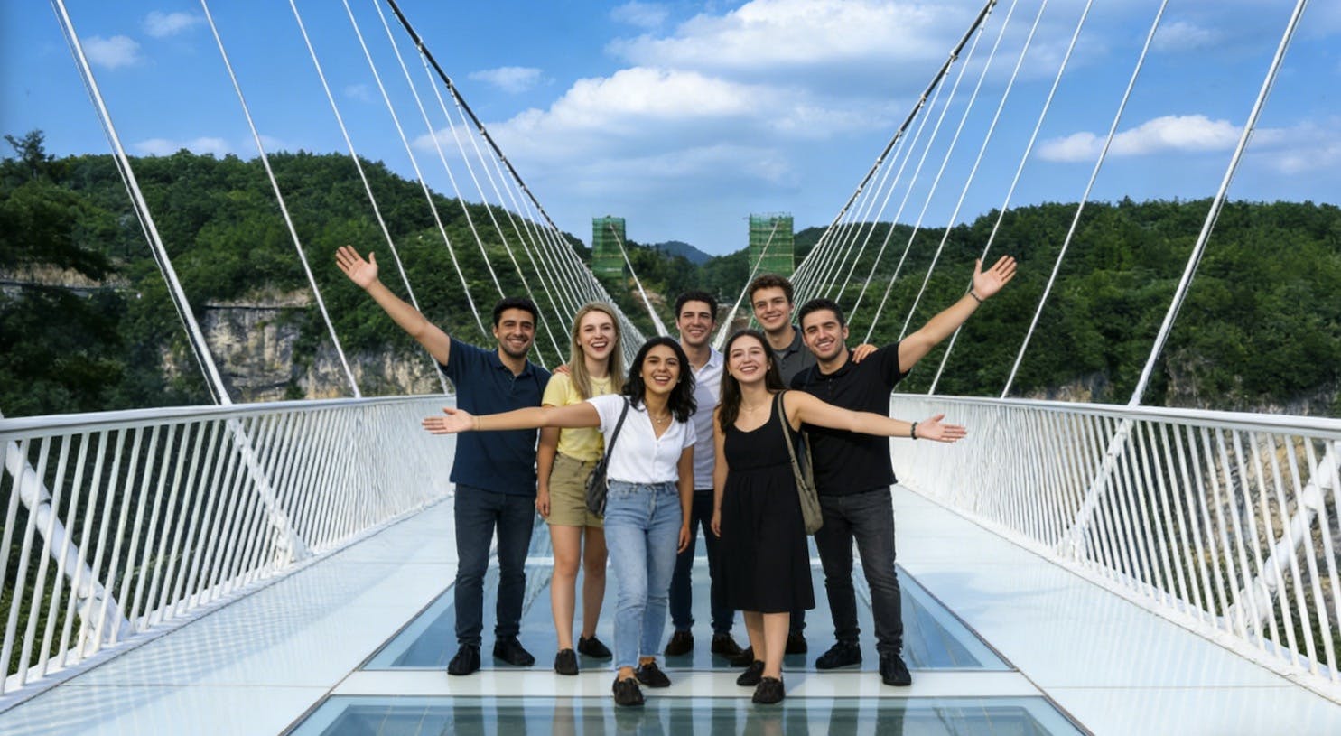
The Zhangjiajie Grand Canyon Glass Bridge is a separate attraction from both Zhangjiajie National Forest Park and Tianmen Mountain. It is known for its transparent glass deck suspended across a canyon.
This is best for travellers who enjoy thrill attractions, glass bridges and high canyon views. If you dislike heights, it may be more stressful than enjoyable. The bridge is often combined with canyon walking routes and adventure activities depending on the ticket type and current operations.
Do not confuse the Grand Canyon Glass Bridge with the glass skywalks on Tianmen Mountain. They are different attractions in different locations.
Crowds and Queues
Zhangjiajie is very popular with domestic and international visitors. Expect crowds at major viewpoints, cable car stations, the Bailong Elevator, Tianmen Mountain and the Glass Bridge.
Chinese public holidays can be extremely busy, especially National Day Golden Week, Labour Day holidays and summer school holidays. If possible, avoid these periods.
Early starts help. Arriving at major entrances before peak tour-group times can make the day much smoother.
Weather and Visibility
Weather is one of the biggest factors in Zhangjiajie. The mountain scenery can be clear, misty, rainy or completely hidden by fog. This can be frustrating, but mist is also part of the magic.
Cloudy weather can make the pillars look mysterious and atmospheric. Heavy fog, however, can block the views entirely. If you have several days, build flexibility into your itinerary so you can adjust plans according to visibility.
Spring and autumn are generally popular for comfortable temperatures and scenic conditions. Summer can be hot, humid and crowded. Winter can be quiet and beautiful, but some paths may be cold, slippery or affected by weather.
Walking Difficulty
Zhangjiajie is easier than it looks in some ways and harder in others. Cable cars, elevators and shuttle buses reduce the need for long climbs, but there are still many stairs, slopes, platforms and walking sections.
Travellers with moderate fitness can enjoy the main sights, especially with careful route planning. Those with knee problems, mobility issues or fear of heights should choose easier routes and avoid overly ambitious schedules.
The most tiring part is often not one difficult hike but the combination of early starts, transfers, queues, stairs and a full day moving between viewpoints.
Where to Stay
The two main base areas are Zhangjiajie city and Wulingyuan.
Wulingyuan
Wulingyuan is the best base for Zhangjiajie National Forest Park. Staying here gives easier access to the park entrances and saves travel time if your main priority is the Avatar mountain scenery.
Zhangjiajie City
Zhangjiajie city is better for Tianmen Mountain, the airport, train station and some transport connections. It is useful at the start or end of your trip.
Best Strategy
If you have enough time, split your stay: spend one or two nights in Wulingyuan for the national forest park, then one night in Zhangjiajie city for Tianmen Mountain and departure.
How Long to Spend
Two days: Enough for a rushed visit to Zhangjiajie National Forest Park and Tianmen Mountain.
Three days: A good minimum for most travellers. You can spend two days in the national forest park and one day at Tianmen Mountain.
Four days: Better if you also want the Grand Canyon Glass Bridge or need weather flexibility.
Five days or more: Ideal for a slower visit, photography, hiking, nearby ancient towns or more relaxed travel between areas.
Simple Zhangjiajie Itinerary
Day 1: Arrive and Stay in Wulingyuan
Arrive in Zhangjiajie by flight or train.
Transfer to Wulingyuan if focusing on the national forest park first.
Check in and organise tickets, route plans and transport for the next day.
Have an early night so you can start the park day early.
Day 2: Zhangjiajie National Forest Park Highlights
Start early from the Wulingyuan entrance.
Visit Yuanjiajie for the Avatar-style sandstone pillar views.
Use the Bailong Elevator or park transport depending on your route.
Continue to Tianzi Mountain for panoramic peak forest views.
Return to Wulingyuan in the late afternoon.
Day 3: Golden Whip Stream or Second Park Day
Walk part or all of Golden Whip Stream for valley scenery.
Visit Huangshi Village or Yangjiajie if you want more viewpoints.
Keep this day flexible in case weather affected your first park day.
Transfer to Zhangjiajie city in the evening if visiting Tianmen Mountain next.
Day 4: Tianmen Mountain
Take the cable car or current official route up Tianmen Mountain.
Walk the summit paths and glass skywalks if open and suitable.
Visit Tianmen Cave and the Heaven’s Gate stairway area.
Return to Zhangjiajie city for departure or another overnight stay.
Optional Day 5: Grand Canyon Glass Bridge
Travel to Zhangjiajie Grand Canyon.
Walk the glass bridge if you are comfortable with heights.
Add canyon walking or activity routes depending on current tickets.
Return to Zhangjiajie city or Wulingyuan.
What to Wear and Pack
Comfortable walking shoes with good grip
Light rain jacket or poncho
Layered clothing for changing mountain weather
Small day backpack
Water bottle
Snacks
Power bank
Phone with translation and map apps
Passport for ticket checks and hotel registration
Sunscreen, hat and sunglasses in warmer months
Warm layer in winter or early morning
Practical Travel Tips
Do Not Try to See Everything in One Day
Zhangjiajie is too large and too weather-dependent for a rushed visit. Give yourself at least three days if possible.
Stay in the Right Area
Stay in Wulingyuan for Zhangjiajie National Forest Park and in Zhangjiajie city for Tianmen Mountain. This reduces unnecessary travel time.
Start Early
Early starts help with queues, shuttle buses, cable cars and viewpoints. This is especially important during busy travel periods.
Check Weather but Stay Flexible
Weather forecasts are useful, but mountain conditions can change quickly. If fog blocks one viewpoint, wait or move to another area.
Bring Your Passport
Tourist sites, hotels and transport in China often require passport identification. Keep it secure but accessible.
Use a Guide if Logistics Worry You
A local guide can be useful in Zhangjiajie because park transport, entrances and route choices can be confusing.
Prepare for Heights
Cable cars, cliff paths, glass walkways and high viewpoints are part of the Zhangjiajie experience. If you dislike heights, choose routes carefully.
Carry Snacks and Water
Food is available in tourist areas, but queues and prices can vary. Carry basic supplies for long park days.
Avoid Major Chinese Holidays
If possible, avoid National Day Golden Week, Labour Day holidays and peak summer periods. Crowds can change the entire experience.
Expect Lots of Stairs
Even with elevators and cable cars, Zhangjiajie involves many stairs and platforms. Pace yourself and wear proper shoes.
FAQs About Zhangjiajie
Is Zhangjiajie worth visiting?
Yes. Zhangjiajie is one of China’s most spectacular natural destinations, especially for sandstone pillars, mountain viewpoints, cable cars, misty scenery and glass walkways.
What is Zhangjiajie famous for?
Zhangjiajie is famous for the sandstone pillar landscape of Wulingyuan, the Avatar-style mountains, Zhangjiajie National Forest Park, Tianmen Mountain and the Zhangjiajie Grand Canyon Glass Bridge.
How many days do you need in Zhangjiajie?
Three days is a good minimum. Four days is better if you want Zhangjiajie National Forest Park, Tianmen Mountain and the Grand Canyon Glass Bridge without rushing.
Where should I stay in Zhangjiajie?
Stay in Wulingyuan for Zhangjiajie National Forest Park. Stay in Zhangjiajie city for Tianmen Mountain, the airport and train connections. Splitting your stay can work well.
Is Zhangjiajie difficult to walk around?
It can be tiring but not always technically difficult. Cable cars, elevators and shuttle buses help, but you should still expect stairs, slopes and long walking days.
Is Zhangjiajie good for older travellers?
Yes, if routes are chosen carefully. Use cable cars, elevators and shorter viewpoint walks. Avoid overly long hiking days and allow extra rest time.
Can you visit Zhangjiajie without a guide?
Yes, independent travel is possible, but a guide can make logistics easier, especially for first-time visitors who do not speak Chinese.
When is the best time to visit Zhangjiajie?
Spring and autumn are generally the most comfortable seasons. Summer can be hot and crowded, while winter can be quieter but colder.
Will fog ruin the views?
Heavy fog can block views, but mist can also make Zhangjiajie look magical. Staying several days gives you a better chance of clear or partly clear conditions.
Is the Zhangjiajie Glass Bridge the same as Tianmen Mountain glass walk?
No. The Grand Canyon Glass Bridge and Tianmen Mountain glass skywalks are separate attractions in different areas.
Final Thoughts
Zhangjiajie is a destination that feels larger and more complex than many travellers expect. The views are extraordinary, but the trip works best when you allow enough time, choose your base carefully and avoid trying to rush every attraction into one day.
For the best experience, spend at least three or four days in the region, stay near Wulingyuan for the national forest park, add Tianmen Mountain from Zhangjiajie city, and keep one flexible day for weather or the Grand Canyon Glass Bridge. Expect mist, stairs, shuttle buses, crowds and unforgettable mountain scenery.
Sponsored Popular Items
Quick take: Musement.com offers a worldwide selection of tours and attractions
Paphos Half-Day BBQ Cruise: What to Expect – Boat & Water Experience Cyprus Quick overview Duration: the cruise time is described as four hours (the listing also shows a broader “duration” range depending on options/logistics). Check current availability, inclusions and booking details before you go.
Ponta de São Lourenço Madeira: A Guide to the Island’s Wild Eastern Peninsula
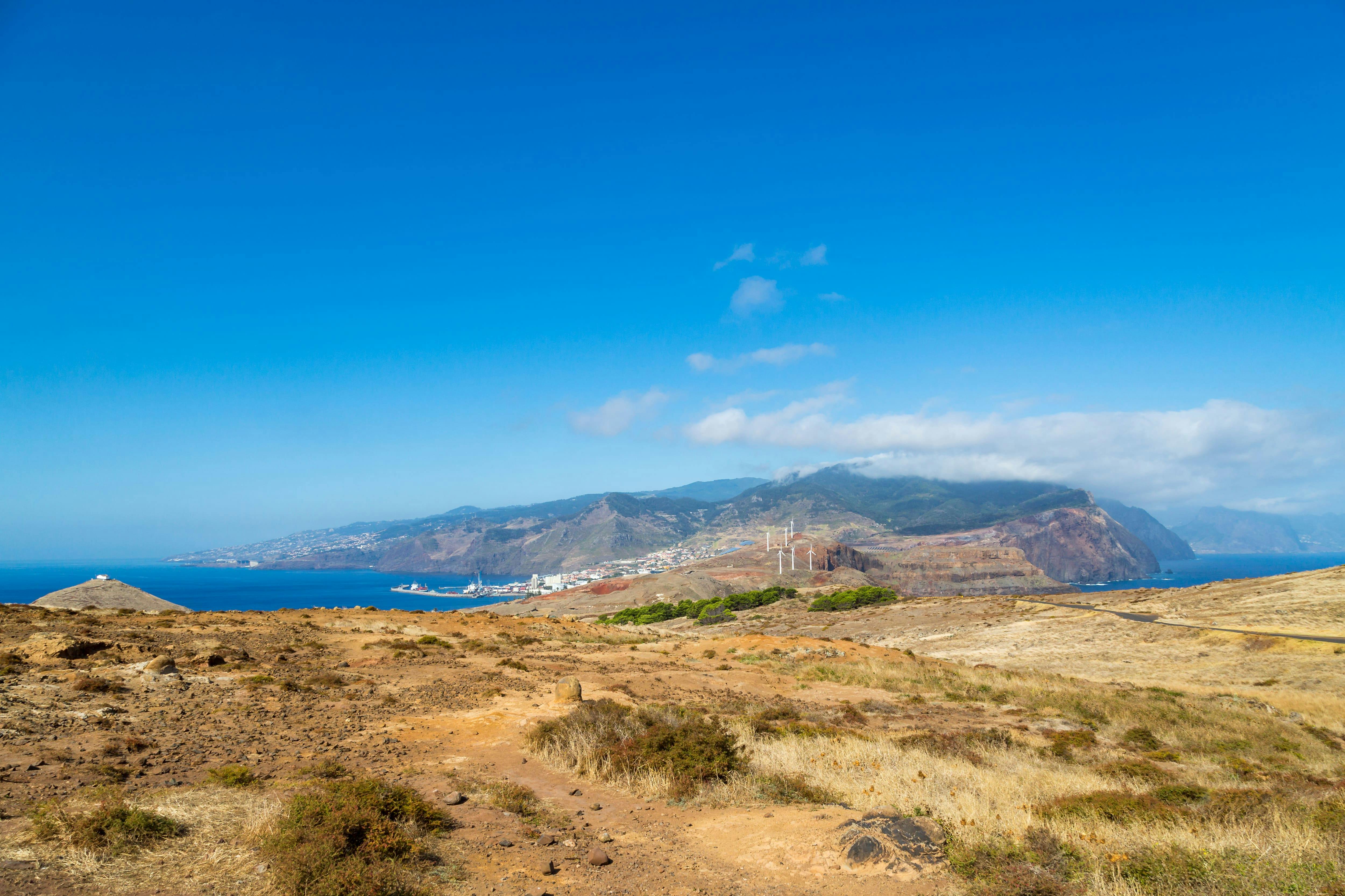
Ponta de São Lourenço is one of the most striking landscapes in Madeira. Located at the far eastern tip of the island, this rugged volcanic peninsula feels very different from the lush green mountains, levadas and forests found elsewhere on Madeira. Here, the scenery is dry, exposed and dramatic, with red-brown cliffs, turquoise Atlantic water, wind-shaped hills and sweeping coastal views.
Ponta de São Lourenço Madeira: A Guide to the Island’s Wild Eastern Peninsula
The best way to experience the area is by walking the PR 8 Vereda da Ponta de São Lourenço trail. This coastal route follows the narrow peninsula from Baía d’Abra toward Casa do Sardinha, passing viewpoints, rocky ridges, sea cliffs and open landscapes with views to both the north and south sides of Madeira.
Sponsored Popular Items
Quick take: Musement.com offers a worldwide selection of tours and attractions
Ponta São Lourenço Full-Day Guided Walk from Western Madeira Portugal Ponta São Lourenço guided walk from the west is a convenient way to add structure, local context and purposeful sightseeing to the itinerary. Check current availability, inclusions and booking details before you go.
What Is Ponta de São Lourenço?
Ponta de São Lourenço is the easternmost peninsula of Madeira, stretching out into the Atlantic Ocean near Caniçal. It is a protected natural area known for volcanic rock, dry hills, exposed cliffs, seabirds, ocean views and a landscape that looks almost desert-like compared with the rest of Madeira.
The peninsula is mostly formed from volcanic basalt, with some sedimentary formations. Because it is exposed to strong winds and has a semi-arid climate, there are very few trees. This gives the area its distinctive open, bare and sculptural appearance.
At the far end of the peninsula are offshore islets, including Desembarcadouro Islet and Farol Islet. These rocky forms add to the feeling that you are walking toward the edge of Madeira.
Why Visit Ponta de São Lourenço?
Ponta de São Lourenço is worth visiting because it offers one of the most unusual landscapes on Madeira. While much of the island is known for green mountains, waterfalls and laurel forest, this eastern peninsula feels raw, dry and ocean-carved.
It is especially good for travellers who enjoy coastal hiking, photography, geology, wildlife, sunrise views and open landscapes. The trail gives constant sea views, and because the peninsula is narrow, you can often see both sides of the island at once.
The colours are a major part of the attraction: rust-coloured cliffs, golden grass, black volcanic rock, white waves and deep blue water. In bright sunlight, the contrast is dramatic. On cloudy or windy days, the peninsula feels wilder and more atmospheric.
PR 8 Vereda da Ponta de São Lourenço
The main walking route is the official PR 8 Vereda da Ponta de São Lourenço. It starts at Baía d’Abra and heads toward Casa do Sardinha. The official route is around 3 km each way, making it approximately 6 km return.
The walk is officially considered moderate and usually takes around two and a half hours, although many visitors take longer because of photo stops, rest breaks and time at the viewpoints.
The path is well-defined, but it is exposed. There is very little shade, and the wind can be strong. The trail includes undulating sections, rocky ground, steps and cliffside viewpoints, so it is not a flat seaside stroll.
What to See Along the Trail
Volcanic Cliffs
The cliffs are the highlight of Ponta de São Lourenço. Their red, brown and black layers show the volcanic origin of the peninsula. From several viewpoints, you can look down into clear blue water, sea caves, rocky coves and wave-washed cliffs.
North and South Coast Views
Because the peninsula is narrow, the trail offers views across both sides of Madeira. On a clear day, you can see the Atlantic stretching in every direction, with the main island rising behind you.
Dry Semi-Arid Landscape
The low vegetation and lack of trees make this area feel very different from Madeira’s green interior. The open landscape allows uninterrupted views and gives the walk a wild, almost lunar quality.
Seabirds and Marine Life
The area is important for birdlife, including seabirds that nest or feed around the cliffs and offshore rocks. With luck, visitors may also spot marine life offshore, including dolphins or the rare monk seal.
Viewpoints and Photo Stops
There are several natural viewpoints along the route. Some look back toward Madeira’s main mountain mass, while others face the ocean and outer islets. The best photos often come from stopping frequently rather than rushing to the end.
Casa do Sardinha
Casa do Sardinha is the main endpoint of the official PR 8 trail. It sits near the far end of the walk and provides a welcome rest point after the exposed coastal path.
Many walkers use this area as a place to pause, eat a snack, refill energy and enjoy the final views before turning back. Facilities can vary, so do not rely on finding everything you need there. Bring enough water and food for the full walk.
Cais do Sardinha
Cais do Sardinha is a small coastal spot near the end of the route where some visitors swim when conditions are suitable. The water can look inviting, especially after walking in full sun, but sea conditions should always be treated carefully.
Only swim if it is safe on the day. Waves, currents, slippery rocks and changing weather can make coastal swimming risky. If in doubt, enjoy the view rather than entering the water.
How Difficult Is the Walk?
The PR 8 trail is moderate rather than extremely difficult. Most reasonably active travellers can complete it, but it still requires sensible shoes, water, sun protection and care near cliff edges.
The main challenges are:
Strong sun and very little shade
Wind exposure
Rocky and uneven ground
Some uphill and downhill sections
Cliffside areas where care is needed
Crowds during busy periods
If you have knee problems, balance issues or a strong fear of heights, take your time and avoid getting close to exposed edges. You do not need to walk every metre of the route to enjoy the scenery.
Best Time to Visit
The best time to visit Ponta de São Lourenço is early morning or late afternoon. Early morning usually brings cooler temperatures, softer light and fewer people. Late afternoon can be beautiful for photography, especially when warm light hits the red cliffs.
Midday can be hot and harsh because there is almost no shade. If you visit in the middle of the day, bring plenty of water, wear a hat and take breaks.
The trail can be walked year-round, but wind and weather matter. On very windy, rainy or foggy days, the exposed sections can feel less comfortable and visibility may be reduced.
How to Get There
Ponta de São Lourenço is near Caniçal on Madeira’s eastern side. The trailhead is at Baía d’Abra, where the road ends and the walk begins.
By Car
Driving is the easiest option. From Funchal, the journey usually takes around 30 to 45 minutes depending on traffic and where you are staying. Parking is available near the trailhead, but it can fill quickly during busy times.
By Bus
Public buses may serve the Caniçal and Baía d’Abra area, but schedules should be checked carefully before you go. Bus travel can work well for budget travellers, but it gives less flexibility than a car.
By Tour
Guided hiking tours are available and can be useful if you do not want to arrange transport or prefer walking with a guide. Tours may also include hotel pickup, route information and safety guidance.
What to Wear and Bring
Comfortable walking shoes or trainers with good grip
Lightweight clothing suitable for hiking
Hat and sunglasses
Sunscreen
Windproof layer or light jacket
At least one litre of water per person, more in hot weather
Snacks or packed lunch
Camera or phone with enough battery
Power bank if taking lots of photos
Swimwear and towel if you plan to swim at Cais do Sardinha
Small rubbish bag so you can take waste away with you
Practical Travel Tips
Pay the Required Trail Fee
Madeira now charges visitor fees for some official walking routes. Check the current PR 8 payment requirements before you go and complete any required payment through the official system.
Start Early
Early morning is the best time for cooler temperatures, easier parking and quieter viewpoints. It also gives you more flexibility if you want to walk slowly.
Do Not Underestimate the Sun
Ponta de São Lourenço is extremely exposed. Even if the temperature feels mild, the sun and wind can dehydrate you quickly.
Stay on the Marked Trail
The cliffs are steep and the ground can be unstable near edges. Stay on the marked path and respect barriers and warning signs.
Bring More Water Than You Think You Need
There is very little shade and limited access to facilities. Carry enough water for the full return walk.
Expect Wind
The peninsula is exposed to Atlantic winds. A light windproof jacket can be useful even on sunny days.
Allow Time for Photos
The walk is not only about reaching the end. Some of the best views are along the way, so allow extra time for viewpoints and photography.
Combine It With Caniçal
After the hike, consider stopping in Caniçal for seafood, a drink or a relaxed coastal break before returning to Funchal or another part of Madeira.
FAQs About Ponta de São Lourenço
Where is Ponta de São Lourenço?
Ponta de São Lourenço is at the eastern tip of Madeira Island, near Caniçal and Baía d’Abra.
Is Ponta de São Lourenço worth visiting?
Yes. It is one of Madeira’s most distinctive landscapes, with volcanic cliffs, ocean views, dry hills and a very different atmosphere from the island’s green interior.
How long is the PR 8 walk?
The official PR 8 route is about 3 km each way, or 6 km return.
How difficult is the Ponta de São Lourenço hike?
The hike is moderate. It is not technical, but it has uneven ground, exposed sections, wind, sun and some uphill and downhill walking.
How long does the walk take?
The official estimated duration is around two and a half hours, but many visitors take three hours or more with photo stops and rests.
Can you swim at Ponta de São Lourenço?
Some visitors swim near Cais do Sardinha when conditions are safe. Always check the sea conditions and avoid swimming if the water is rough or access looks unsafe.
Do you need hiking boots?
Hiking boots are useful but not essential for everyone. Good trainers or walking shoes with grip are usually enough in dry conditions. Avoid flip-flops or smooth-soled sandals.
Is there shade on the trail?
Very little. The route is exposed, so sun protection and plenty of water are essential.
Can children do the walk?
Active children can enjoy the walk, but adults should supervise closely because of cliffs, wind and uneven ground. Families may choose to walk only part of the route if needed.
What is the best time of day for photos?
Early morning and late afternoon usually give the best light. The red cliffs and blue water look especially dramatic when the sun is lower.
Final Thoughts
Ponta de São Lourenço is one of Madeira’s most memorable coastal experiences. Its exposed volcanic cliffs, wild Atlantic views, dry open hills and sculptural rock formations make it feel unlike anywhere else on the island.
For the best visit, start early, bring water, wear proper shoes and allow time to enjoy the viewpoints rather than rushing to the end. Whether you walk the full PR 8 route or only explore part of the peninsula, Ponta de São Lourenço is a must-see for travellers who want to experience Madeira’s raw, windswept eastern edge.
Sponsored Popular Items
Quick take: Musement.com offers a worldwide selection of tours and attractions
Ponta São Lourenço Full-Day Guided Walk from Western Madeira Portugal Ponta São Lourenço guided walk from the west is a convenient way to add structure, local context and purposeful sightseeing to the itinerary. Check current availability, inclusions and booking details before you go.
Ponta da Piedade catamaran cruise with open bar and lunch Australia Plan Ponta da Piedade catamaran cruise with open bar and lunch, a food and drink experience, with practical tips on timing, inclusions and what to check before booking. Compare current availability, prices and booking conditions before you go.
Lagos Catamaran Cruise to Ponta da Piedade Australia Plan Lagos Catamaran Cruise to Ponta da Piedade, a water-based experience, with practical tips on timing, inclusions and what to check before booking. Compare current availability, prices and booking conditions before you go.
Tsavo East National Park Kenya: A Safari Guide to Red Elephants, Wild Landscapes and Classic Game Drives
Tsavo East National Park is one of Kenya’s most iconic safari destinations. Famous for its vast open plains, red-dust elephants, Galana River scenery, baobab trees, lions, buffalo, giraffes and big skies, it offers a wilder and less crowded safari experience than some of Kenya’s more famous reserves.
Located between Nairobi and the Kenyan coast, Tsavo East is especially popular with travellers combining a safari with a beach holiday in Mombasa, Diani, Watamu or Malindi. It is also a strong choice for anyone who wants a dramatic, open, classic African safari landscape with plenty of space and a real sense of wilderness.
Sponsored Popular Items
Quick take: Musement.com offers a worldwide selection of tours and attractions
Kenya National Parks and Reserves Nature Tours & Regional Day Trips Kenya Compare nature and outdoor experiences in Kenya National Parks and Reserves, with practical tips on timing, inclusions and choosing the right option. Check current availability, prices and booking conditions before you go.
Why Visit Tsavo East National Park?
Tsavo East is worth visiting because it feels big, open and wild. The landscape is different from the green rolling plains often associated with the Masai Mara. Here, the scenery is drier and more rugged, with red earth, thorn bush, riverine vegetation, rocky outcrops and huge horizons.
The park is especially famous for elephants that appear red after dust-bathing in the iron-rich soil. Seeing a herd of red elephants crossing a dry track, gathering near water or moving across the plains is one of the classic Tsavo experiences.
Tsavo East is also a practical safari choice. It works well as a short safari from the coast, a stop between Nairobi and Mombasa, or part of a longer Kenya itinerary that includes Amboseli, Tsavo West, Taita Hills, Diani Beach or the Kenyan coast.
The Famous Red Elephants of Tsavo
The red elephants are the symbol of Tsavo East. The elephants are not naturally red; they become dust-red from rolling, wallowing and spraying themselves with the park’s reddish soil. This gives them a striking colour that looks especially dramatic against the dry bush and blue sky.
Elephants are often seen in family groups, sometimes with calves moving close to their mothers. During dry periods, water sources such as rivers, dams and waterholes become especially important for sightings.
For photographers, early morning and late afternoon are the best times to capture the red colour, softer light and dust rising around the herds.
Wildlife You May See
Tsavo East is home to a wide variety of wildlife. Sightings depend on season, time of day, weather, water availability and luck, but the park offers strong opportunities for classic safari viewing.
Common Wildlife Highlights
Elephants
Lions
Buffalo
Giraffes
Zebras
Impala
Waterbuck
Lesser kudu
Gerenuk
Hippos
Crocodiles
Many bird species
Predators such as lion, leopard and cheetah can be present, but sightings are never guaranteed. Tsavo is large and wild, so patience is part of the experience. The reward is that when wildlife appears, it often feels less staged and less crowded than in more compact safari areas.
Galana River
The Galana River is one of the most important natural features of Tsavo East. It brings life to the dry landscape and attracts wildlife, especially during drier months.
Elephants, hippos, crocodiles, birds and other animals may be seen around the river depending on the season and location. The river also creates a strong scenic contrast: blue or brown water, palms, sandbanks and green riverine vegetation cutting through the dry red landscape.
For many visitors, the Galana River area is one of the most memorable parts of the park because it combines wildlife viewing with beautiful safari scenery.
Lugard’s Falls
Lugard’s Falls is not a tall waterfall in the usual sense. It is a dramatic rocky section of the Galana River, where water flows through sculpted channels and eroded rock formations.
The attraction is interesting for its geology, river views and photographic textures. Depending on water levels, you may see rushing water, smooth rock, pools and narrow channels carved through the stone.
Because this is a wild area, visitors should follow guide instructions and avoid getting too close to unsafe edges or crocodile areas.
Mudanda Rock
Mudanda Rock is a long rock formation rising above the surrounding plains. It acts as a natural lookout and is known for wildlife viewing, especially when animals gather near water below during dry periods.
It is a good place to stop, stretch your legs where permitted, and look across the landscape. Elephants are sometimes seen nearby, and the rock gives a useful sense of the park’s scale.
The area is best visited with a driver-guide who knows current wildlife movement and safe stopping points.
Aruba Dam
Aruba Dam is another important wildlife-viewing location in Tsavo East. The dam attracts animals looking for water, especially during drier conditions, and can be a productive stop on a morning or afternoon game drive.
Birdlife can also be good around water sources, so bring binoculars if you enjoy birdwatching. Even when big cats are not visible, waterholes and dams often provide interesting smaller scenes: birds feeding, antelope approaching cautiously, elephants drinking and crocodiles resting near the water.
Tsavo East vs Tsavo West
Tsavo is divided into two separate national parks: Tsavo East and Tsavo West. They are often combined, but they feel different.
Tsavo East
Tsavo East is generally more open, flatter and better known for large elephant herds, red earth, Galana River scenery and broad plains. It can be easier for classic game viewing because of the more open landscape.
Tsavo West
Tsavo West is more varied and rugged, with volcanic landscapes, hills, lava flows, springs and denser vegetation. It is known for places such as Mzima Springs and dramatic scenery, but wildlife can sometimes be harder to spot because the bush is thicker.
If you have time, visiting both parks gives the best overall Tsavo experience. If you only have one or two nights and want open plains and red elephants, Tsavo East is a strong choice.
How to Get to Tsavo East
Tsavo East is accessible from both Nairobi and the Kenyan coast. The most suitable route depends on your wider itinerary.
From Mombasa or Diani Beach
Tsavo East is a popular safari option from the coast. Many travellers visit from Mombasa, Diani, Watamu or Malindi as a one-night or two-night safari. This makes it a convenient wildlife add-on to a Kenya beach holiday.
From Nairobi
From Nairobi, Tsavo East can be reached by road, train connections combined with transfers, private safari vehicle, or arranged tour. The drive is longer than from the coast, so many travellers combine Tsavo with other stops rather than treating it as a quick day trip.
By Safari Vehicle
Most visitors enter Tsavo East with a safari operator, private driver-guide or lodge transfer. This is the easiest way to handle park gates, game drives, timing and route planning.
By Air
There are airstrips serving the Tsavo region and some lodges or camps can arrange fly-in options. This is usually more expensive but saves time on longer itineraries.
Best Time to Visit
Tsavo East can be visited all year, but the best wildlife viewing is usually during the dry seasons, especially June to October and January to February. During dry periods, animals are more likely to gather around rivers, dams and waterholes, making them easier to see.
The wet seasons can bring greener landscapes and good birdwatching, but wildlife may spread out more widely because water is available across a larger area. Some roads can also become more difficult after heavy rain.
Dry Season
Usually best for general wildlife viewing
Animals gather closer to water sources
Vegetation is less dense
Dusty conditions can create dramatic safari scenes
Green Season
Landscapes become greener and softer
Birdlife can be excellent
There may be fewer visitors
Wildlife can be more spread out
How Long to Stay
One day: Possible from nearby areas, but rushed. You may spend too much time driving and not enough time on game drives.
One night: A good minimum from the coast. This allows an afternoon game drive, overnight stay and morning game drive.
Two nights: Better for most visitors. You get more relaxed game drives and a stronger chance of varied wildlife sightings.
Three nights or more: Best for serious safari lovers or travellers combining different areas of Tsavo East and Tsavo West.
Simple Tsavo East Safari Itinerary
One-Night Safari from the Coast
Day 1 Morning: Depart Mombasa, Diani, Watamu or Malindi early.
Midday: Enter Tsavo East and game drive toward your lodge or camp.
Afternoon: Rest, then head out for an afternoon game drive.
Evening: Dinner and overnight in or near the park.
Day 2 Morning: Early morning game drive when animals are most active.
Late Morning: Exit the park and return to the coast or continue your Kenya trip.
Two-Night Tsavo East Safari
Day 1: Travel to Tsavo East, afternoon game drive and sunset wildlife viewing.
Day 2: Morning and afternoon game drives, with possible visits to Galana River, Aruba Dam, Mudanda Rock or Lugard’s Falls depending on your lodge location and guide’s plan.
Day 3: Final morning game drive before departure.
Tsavo East and Tsavo West Combination
Day 1: Enter Tsavo East and focus on open plains and red elephants.
Day 2: Continue game drives in Tsavo East, then transfer toward Tsavo West.
Day 3: Explore Tsavo West’s springs, volcanic scenery and hillier landscapes.
Day 4: Continue to Amboseli, Nairobi or the coast.
What to Pack
Lightweight neutral-coloured clothing
Warm layer for early morning game drives
Hat, sunglasses and sunscreen
Binoculars
Camera with extra battery or power bank
Reusable water bottle
Insect repellent
Comfortable closed shoes
Small day bag
Any personal medication
Passport or ID required for travel and park entry
Practical Safari Tips
Start Game Drives Early
Wildlife is often more active in the early morning and late afternoon. Midday can be hot, and animals may rest in shade.
Bring Binoculars
Tsavo East is large and open. Binoculars make a big difference, especially for birds, distant elephants, lions resting under trees or wildlife near the river.
Use an Experienced Guide
A good guide understands animal behaviour, park routes, water sources and safe viewing distances. This can greatly improve your safari.
Do Not Expect Guaranteed Big Cats
Lions and leopards live in Tsavo East, but the park is huge. Big cat sightings are possible, not guaranteed. Enjoy all wildlife, including elephants, birds, antelope and landscapes.
Stay Hydrated
Tsavo East is warm and dry. Carry enough drinking water, especially on longer game drives.
Respect Wildlife Distances
Never pressure your guide to move too close to animals. Elephants, buffalo, hippos and predators can be dangerous if disturbed.
Check Park Fees Before Travel
Park fees and payment systems can change. Confirm current Kenya Wildlife Service fees, payment methods and entry requirements before your safari.
Combine Safari and Beach
Tsavo East is one of the best safari choices for travellers heading to Kenya’s coast. A short safari followed by beach time in Diani, Mombasa, Watamu or Malindi creates a balanced itinerary.
FAQs About Tsavo East National Park
Is Tsavo East National Park worth visiting?
Yes. Tsavo East is worth visiting for its red elephants, open landscapes, Galana River scenery, big wilderness feeling and convenient access from the Kenyan coast.
What is Tsavo East famous for?
Tsavo East is famous for dust-red elephants, large open plains, Galana River, Lugard’s Falls, Mudanda Rock, Aruba Dam and classic safari wildlife.
Can you see the Big Five in Tsavo East?
Tsavo East has several Big Five species, including elephant, lion, leopard, buffalo and rhino, but sightings vary. Elephants and buffalo are usually easier to see than leopards or rhinos.
Why are the elephants red in Tsavo?
The elephants look red because they dust-bathe and wallow in Tsavo’s red soil. The colour coats their skin and gives them their famous red appearance.
Is Tsavo East better than Tsavo West?
Neither is better; they are different. Tsavo East is more open and often better for seeing elephants across broad landscapes. Tsavo West is more rugged, volcanic and scenic, with springs and hillier terrain.
How many days do you need in Tsavo East?
One night is the minimum for a short safari, but two nights is better. Three or more nights allows a deeper, more relaxed safari experience.
Can you visit Tsavo East from Diani Beach?
Yes. Tsavo East is commonly visited from Diani Beach, Mombasa, Watamu and Malindi as a one-night or two-night safari.
What is the best time to visit Tsavo East?
The dry months from June to October and January to February are generally best for wildlife viewing. The green season can still be beautiful, especially for birdlife and photography.
Is Tsavo East good for families?
Yes, Tsavo East can be suitable for families, especially with a private safari vehicle and a lodge that welcomes children. Families should plan shorter game drives for younger children and follow all safety rules.
What should I not miss in Tsavo East?
Do not miss the red elephants, Galana River scenery, Aruba Dam, Mudanda Rock and Lugard’s Falls if they fit your route and timing.
Final Thoughts
Tsavo East National Park is one of Kenya’s great safari destinations: vast, wild, sunlit and full of character. Its red elephants, open plains, river scenery and dramatic dry-country atmosphere create a safari experience that feels different from Kenya’s greener reserves.
For the best visit, stay at least one night, choose a good guide, start game drives early and allow time to enjoy the landscape as much as the animals. Whether you visit from Nairobi, Mombasa, Diani or as part of a longer Kenya itinerary, Tsavo East offers a memorable taste of safari wilderness and the classic beauty of Kenya’s wild south-east.
Sponsored Popular Items
Quick take: Musement.com offers a worldwide selection of tours and attractions
Kenya National Parks and Reserves Nature Tours & Regional Day Trips Kenya Compare nature and outdoor experiences in Kenya National Parks and Reserves, with practical tips on timing, inclusions and choosing the right option. Check current availability, prices and booking conditions before you go.
Four-Day Kenyan Safari in Tsavo East & Amboseli – Outdoor Adventure Kenya Four-Day Kenyan Safari in Tsavo East and Amboseli places landscapes, habitats or wildlife at the centre of the experience. Check current availability, inclusions and booking details before you go.
Huashan, also called Mount Hua, is one of the most spectacular mountain day trips from Xi’an. Famous for sheer granite cliffs, Taoist temples, narrow stone stairways, cable cars, sunrise viewpoints and the legendary cliffside plank walk, Huashan is one of China’s most dramatic sacred mountains.
Located near Huayin City in Shaanxi Province, Huashan is often visited as a long day trip from Xi’an, although adventurous travellers may choose to stay overnight on or near the mountain for sunrise. It is beautiful, physically demanding in parts, and best planned carefully.
Sponsored Popular Items
Quick take: Musement.com offers a worldwide selection of tours and attractions
Full-Day Private Tour of Huashan Mountain - Guided Sightseeing Tour China Full day private tour of Huashan Mountain is a convenient way to add structure, local context and purposeful sightseeing to the itinerary. Check current availability, inclusions and booking details before you go.
What Is Huashan?
Huashan is a sacred mountain in Shaanxi Province, east of Xi’an. It is one of China’s Five Great Mountains and has long been associated with Taoism, pilgrimage, temples and dramatic mountain paths.
The mountain is famous for its steep granite peaks. Unlike softer, forested mountains, Huashan rises sharply in pale rock walls, ridges and cliffs. Many paths are cut directly into the mountain, with stone steps, chains and narrow ledges adding to the sense of adventure.
Huashan is not just a scenic viewpoint. It is a full mountain experience. Even if you use cable cars, you should expect walking, stairs, exposed sections and strong legs by the end of the day.
Why Visit Huashan from Xi’an?
Xi’an is best known for the Terracotta Warriors, city walls, Muslim Quarter and ancient capital history, but Huashan adds a completely different experience to a Shaanxi itinerary. It gives you big mountain scenery, a sacred cultural setting and one of China’s most exciting hiking environments.
Huashan is especially worthwhile if you enjoy:
Dramatic mountain landscapes
High viewpoints and cliff scenery
Challenging walks and stair climbs
Taoist temples and sacred mountain culture
Photography, sunrise or sunset views
Adventure-style travel close to a major city
The Five Peaks of Huashan
Huashan is usually described as having five main peaks. Each has its own character, and most visitor routes connect several of them by mountain paths.
North Peak
North Peak is often the first major peak reached by hikers or by the North Peak cable car. It is lower than the other main peaks but still gives dramatic views. It is a common starting point for people who want a more active route across the mountain.
West Peak
West Peak is one of the most beautiful and photogenic areas of Huashan. The West Peak cable car is popular because it delivers visitors close to the higher scenic areas and reduces the hardest part of the climb.
South Peak
South Peak is the highest peak of Huashan and one of the main goals for many visitors. It offers wide views and a real sense of achievement, but reaching it still involves uphill walking and stairs.
East Peak
East Peak is known as a sunrise viewpoint. Travellers who stay overnight or climb through the night often aim to reach East Peak early in the morning.
Middle Peak
Middle Peak is smaller and often treated as part of the route between the larger peaks. It is associated with Taoist sites and can be included if you have enough time and energy.
How to Get from Xi’an to Huashan
The fastest and most convenient way to reach Huashan from Xi’an is usually by high-speed train.
By High-Speed Train
Depart from Xi’an North Railway Station.
Arrive at Huashan North Railway Station.
The train journey usually takes around 30 to 40 minutes.
From Huashan North, take a shuttle, taxi or local transfer to the Huashan tourist centre.
This is the best option for most independent travellers because it is fast, efficient and avoids a long road transfer from Xi’an.
By Private Driver or Tour
A private driver or guided tour is easier if you want door-to-door service from your Xi’an hotel. It costs more than the train, but it removes the stress of station transfers, ticket collection and local transport at Huashan.
By Bus
Bus services may be available between Xi’an and Huashan, but they are generally slower than the high-speed train. For most visitors with limited time, the train is the better choice.
Huashan Cable Cars
Huashan has two main cable car options: the North Peak cable car and the West Peak cable car. These make the mountain much more accessible, but they do not remove all walking. Once you are on the mountain, you still need to walk between peaks, climb stairs and manage steep sections.
North Peak Cable Car
The North Peak cable car is often used by travellers who want a more active route. It brings you to North Peak, from where you can continue walking toward the higher peaks. This route usually involves more hiking than starting from the West Peak.
West Peak Cable Car
The West Peak cable car is more scenic and places you closer to the higher peaks. It is a good option if you want maximum views with less climbing from the base. Many first-time visitors choose to go up by West Peak cable car and come down by North Peak cable car, or return the same way depending on time and energy.
Best Huashan Routes
Easiest Scenic Route: West Peak Up and West Peak Down
This is the simplest option for travellers who want to experience Huashan without a long mountain traverse. Take the West Peak cable car up, visit West Peak, South Peak and nearby viewpoints, then return to the West Peak cable car.
Best for: travellers with limited time, moderate fitness, older visitors, or those who want big views without the hardest route.
Classic One-Day Route: West Peak Up, North Peak Down
This is one of the most popular routes for a strong day trip. Take the West Peak cable car up, walk through West Peak, South Peak, East Peak or Middle Peak depending on time, then continue toward North Peak and descend by the North Peak cable car.
Best for: active travellers who want a full Huashan experience without hiking from the base.
More Challenging Route: North Peak Up, West Peak Down
This route starts lower and requires more climbing between North Peak and the higher peaks. It is rewarding but more physically demanding.
Best for: fit travellers who want a stronger hiking challenge.
Traditional Hiking Route from the Base
The traditional route starts near Yuquan Yuan, also known as Jade Spring Temple, and climbs up toward North Peak before continuing across the mountain. This is a serious hike and should only be attempted by travellers with good fitness, enough time and suitable gear.
Best for: experienced hikers, pilgrimage-style travellers and those who want to earn the mountain the old way.
The Huashan Plank Walk
The Huashan Plank Walk, often called the Changkong Plank Road, is one of the mountain’s most famous and intimidating attractions. It involves walking along narrow wooden planks attached to a cliff face while wearing a safety harness.
This is not essential for enjoying Huashan. Many visitors skip the plank walk and still have an excellent day. The mountain itself is already dramatic, and there are many viewpoints, temples and paths that do not require this level of exposure.
If you do choose to do the plank walk, take it seriously. Follow all staff instructions, use the safety equipment properly, do not rush, and avoid it if you have a fear of heights, poor balance, unsuitable shoes, or any health condition that could affect your confidence or coordination.
Can You Visit Huashan as a Day Trip from Xi’an?
Yes, Huashan can be visited as a long day trip from Xi’an, especially if you use high-speed trains and cable cars. However, it is important to start early.
Simple Day Trip Plan
Early morning: Travel from Xi’an North to Huashan North by high-speed train.
Morning: Transfer to the Huashan tourist centre and take the shuttle to your chosen cable car.
Late morning: Take the cable car up the mountain.
Midday to afternoon: Walk between selected peaks and viewpoints.
Late afternoon: Descend by cable car before final operations.
Evening: Return to Xi’an by train.
A day trip is best if you are realistic. Do not try to do every peak, every photo stop and the plank walk unless you are very fit, well organised and travelling in good weather.
Overnight and Sunrise Options
Huashan is famous for sunrise, especially around East Peak. To see sunrise, travellers usually need to stay overnight on or near the mountain, or attempt a night climb.
Overnight options can include basic mountain hotels, guesthouses or accommodation near the mountain base. Facilities on the mountain are more limited and can be more expensive than in Xi’an, but the reward is being in position for early morning views.
A sunrise trip is best for travellers who are comfortable with colder temperatures, early starts, mountain conditions and a less comfortable night than a city hotel stay.
How Difficult Is Huashan?
Huashan can be easy, moderate or very difficult depending on the route you choose.
Easy to moderate: West Peak cable car up and down, with limited walking near the top.
Moderate to hard: West Peak up and North Peak down, walking across several peaks.
Hard: North Peak up and West Peak down, with more climbing.
Very hard: Full climb from the base, especially if combined with multiple peaks.
Even cable-car visitors should expect stairs, slopes, crowds and exposed paths. Huashan is not a casual flat walk. Good shoes, pacing and realistic planning matter.
Best Time to Visit Huashan
The best seasons for Huashan are usually spring and autumn. These periods often bring more comfortable walking temperatures and better conditions for mountain views.
Summer can be hot, humid and crowded, especially during holidays. Winter can be beautiful with snow, but paths may be icy and conditions more difficult. Always check weather and cable car operation before travelling.
Avoid major Chinese public holidays if possible, especially periods such as Labour Day and National Day Golden Week, when crowds can be heavy and queues may be long.
What to Wear and Bring
Comfortable hiking shoes or trainers with strong grip
Layered clothing, as mountain weather can be cooler than Xi’an
Light rain jacket or poncho
Gloves if you plan to use chains on steep sections
Water and snacks
Power bank for your phone
Passport for ticketing and train travel
Sunscreen, sunglasses and hat in clear weather
Small backpack rather than heavy luggage
Any personal medication
Practical Travel Tips
Start Early from Xi’an
Huashan is possible as a day trip, but only if you leave Xi’an early. Late starts can cause problems with queues, cable car timing and return transport.
Book Transport in Advance During Busy Periods
High-speed train tickets and scenic area tickets can be harder to secure during holidays and weekends. Book ahead where possible.
Check Cable Car Closing Times
This is crucial. If you miss the last cable car, your day becomes much more complicated. Always confirm final operation times on the day of travel.
Do Not Carry Heavy Luggage
Leave large bags at your hotel or luggage storage. Huashan paths are steep, and heavy luggage will make the day unpleasant.
Be Realistic About Fitness
Choose your route based on your actual fitness, not just the photos you want. The mountain has many stairs and exposed sections.
Respect One-Way Flow and Crowds
Some narrow sections can become congested. Move patiently, hold chains where needed and avoid stopping suddenly in tight areas.
Skip the Plank Walk If Unsure
The plank walk is optional. There is no need to do it to have a memorable Huashan visit.
Watch the Weather
Rain, fog, wind or ice can change the experience completely. Poor visibility can reduce views, while wet stone steps can become slippery.
FAQs About Xi’an and Huashan
How far is Huashan from Xi’an?
Huashan is about 120 kilometres east of Xi’an, near Huayin City in Shaanxi Province.
Can I visit Huashan in one day from Xi’an?
Yes. A day trip is practical if you take an early high-speed train from Xi’an North to Huashan North and use the cable cars. Start early and keep your route realistic.
Which cable car is better at Huashan?
The West Peak cable car is better for easier access to the higher scenic areas and big views. The North Peak cable car is better if you want a more active route and do not mind extra hiking.
Is Huashan dangerous?
Huashan has steep, exposed and challenging sections, but standard visitor routes have steps, chains and managed paths. It becomes risky if you rush, ignore safety barriers, wear poor footwear, visit in bad weather or attempt routes beyond your ability.
Do I have to do the plank walk?
No. The plank walk is optional. You can enjoy Huashan’s peaks, temples, cable cars and viewpoints without doing it.
How much walking is there if I take the cable car?
There is still a lot of walking if you want to visit several peaks. Even with cable cars, expect stairs, slopes and uneven mountain paths.
What is the best route for first-time visitors?
For most first-time visitors, the easiest scenic route is to take the West Peak cable car up, visit West Peak and South Peak, then return by cable car or continue toward North Peak if time and energy allow.
Is Huashan suitable for older travellers?
It can be suitable for active older travellers if using cable cars and limiting the route. Anyone with knee problems, poor balance, heart issues or strong fear of heights should choose a gentle route and avoid exposed sections.
What should I not miss at Huashan?
Do not miss the cable car views, West Peak, South Peak if you are able, the dramatic ridge walks, Taoist temple scenery and the sense of scale from the mountain viewpoints.
Final Thoughts
Huashan is one of the most exciting side trips from Xi’an. It combines sacred mountain history, dramatic cliffs, cable-car scenery, challenging paths and unforgettable viewpoints in a way few destinations can match.
For the best experience, plan your route before you go, start early, use the cable cars wisely and choose a level of hiking that suits your fitness. Whether you visit for a long day trip, a sunrise stay or a serious mountain challenge, Huashan is one of the most memorable natural experiences in the Xi’an region.
Sponsored Popular Items
Quick take: Musement.com offers a worldwide selection of tours and attractions
Full-Day Private Tour of Huashan Mountain - Guided Sightseeing Tour China Full day private tour of Huashan Mountain is a convenient way to add structure, local context and purposeful sightseeing to the itinerary. Check current availability, inclusions and booking details before you go.
Private Madeira Dramatic West Coast Tour with Lunch in Porto Moniz Portugal Plan Private Madeira Dramatic West Coast Tour with Lunch in Porto Moniz, a food and drink experience, with practical tips on timing, inclusions and what to check before booking. Compare current availability, prices and booking conditions before you go.
Resava Cave and Veliki Buk Waterfall: A Nature Day Trip in Serbia
Resava Cave and Veliki Buk Waterfall are two of the most beautiful natural attractions near Despotovac in Serbia. Often visited together on the same day, they offer a rewarding mix of underground limestone chambers, colourful cave formations, forest scenery, clear spring water and one of Serbia’s best-known waterfalls.
This is a great trip for travellers who want to see a quieter side of Serbia beyond Belgrade. The route is especially popular as a day trip from Belgrade, often combined with Manasija Monastery, but it also works well as part of a slower journey through eastern or central Serbia.
Sponsored Popular Items
Quick take: Musement.com offers a worldwide selection of tours and attractions
Chiang Mai: Sticky Waterfall & Angel Waterfall Park Day Tour Thailand Discover two of Chiang Mai’s most enchanting nature spots in one day. Visit the dreamy Dan Tewada and climb the Sticky Waterfall, where you can enjoy a refreshing jungle waterfall climbing adventure
Overview
Resava Cave and Veliki Buk Waterfall sit in a scenic part of Serbia known for limestone landscapes, forested hills, springs, rivers and monasteries. The two attractions are close enough to visit together, making them an easy and satisfying nature-focused day out.
Resava Cave gives you the dramatic underground experience: cool air, stone chambers, stalactites, stalagmites, pillars and colourful mineral formations. Veliki Buk Waterfall gives you the outdoor contrast: fresh air, greenery, flowing water, riverside restaurants and a peaceful forest setting.
If you enjoy caves, waterfalls, easy nature walks and scenic countryside, this combination is one of the most worthwhile excursions in this part of Serbia.
Resava Cave
Resava Cave, also written as Resavska Pećina, is one of Serbia’s best-known show caves. It is located near Despotovac, in a limestone landscape shaped over millions of years by underground water and mineral deposits.
The cave is famous for its colourful formations. Inside, visitors can see stalactites hanging from the ceiling, stalagmites rising from the floor, stone columns, draperies, flowstone walls and formations that look like frozen waterfalls. The colours come from minerals in the rock and water, with tones of red, yellow and white appearing throughout the cave.
What to Expect Inside Resava Cave
Resava Cave is visited on a managed route rather than by free wandering. Visitors follow paths and stairs through several chambers and corridors, with lighting used to highlight the cave formations.
The cave is cool throughout the year, with an interior temperature of around 7°C. Even if you visit Serbia in summer, you should bring a jacket or jumper for the cave section. The air can also feel damp because cave humidity is high.
The walking route is not extreme, but it does include steps, uneven sections and dim lighting. It is best suited to travellers who are comfortable walking slowly through a cave environment. It may not be ideal for visitors with significant mobility difficulties.
Highlights of Resava Cave
Ancient limestone chambers and corridors
Stalactites, stalagmites and stone columns
Colourful mineral formations
A constant cool cave temperature
A guided underground walking route
Veliki Buk Waterfall
Veliki Buk Waterfall, also known as Lisine Waterfall, is a beautiful waterfall near the village of Lisine and the Veliko Vrelo spring. The waterfall drops through a green, mossy limestone setting into a clear pool below.
The area around the waterfall is peaceful and refreshing, with paths, bridges, forest scenery and riverside restaurants nearby. It is a good place to slow down after visiting the cave, enjoy lunch, take photos and listen to the sound of flowing water.
The waterfall is especially attractive in spring, when water flow is usually stronger, and in autumn, when the forest colours add extra atmosphere. In summer, the cool water and shaded setting make it a welcome break from the heat.
Best Things to Do
Explore Resava Cave
Take your time inside the cave and look closely at the different formations. The most interesting details are not only the large chambers, but also the textures, colours and mineral patterns along the walls.
Photograph the Cave Formations
Photography rules may vary, so check before taking photos. If photography is allowed, use low-light settings and avoid flash where restricted. The cave lighting can create dramatic images, but it is better to move slowly and avoid blocking the path for other visitors.
Walk to Veliki Buk Waterfall
The waterfall area is easy to enjoy at a relaxed pace. Follow the path toward the water, stop at viewpoints and enjoy the scenery around the pool and cascades.
Have Lunch by the Water
The Lisine area is known for riverside restaurants and fresh local food. Trout is commonly served in the region and makes a good lunch choice after visiting the waterfall.
Add Manasija Monastery
Many travellers combine Resava Cave and Veliki Buk Waterfall with Manasija Monastery. This adds a cultural and historical stop to the day, making the trip a strong mix of nature, heritage and Serbian countryside.
How to Get There
The nearest main town is Despotovac. From Belgrade, the journey is usually done by car, private transfer or organised day tour. Public transport can be more complicated, especially if you want to visit both the cave and waterfall in one day.
If you are driving independently, plan your route carefully and use the local names Resavska Pećina, Vodopad Veliki Buk and Lisine in your map app. Road conditions can vary in rural areas, so allow extra time rather than planning a rushed schedule.
For travellers without a car, an organised tour from Belgrade is often the easiest option. Many tours include transport, a guide, Resava Cave, Veliki Buk Waterfall and Manasija Monastery in one full-day itinerary.
Sample Day Trip Itinerary
Belgrade to Resava Cave and Veliki Buk Waterfall
Morning: Leave Belgrade and travel toward Despotovac.
Late morning: Visit Manasija Monastery if included in your route.
Midday: Explore Resava Cave on the visitor route.
Afternoon: Continue to Veliki Buk Waterfall and the Lisine area.
Lunch: Eat at a riverside restaurant near the waterfall.
Late afternoon: Walk around the waterfall area and return to Belgrade or continue your Serbia trip.
Best Time to Visit
Spring, summer and autumn are the best seasons for combining Resava Cave and Veliki Buk Waterfall. Spring often brings stronger water flow at the waterfall, summer is pleasant because the cave and waterfall area feel cool, and autumn adds beautiful forest colours.
The cave stays cool year-round, so the outside temperature matters less for the cave itself. However, weather can affect the comfort of walking around the waterfall and enjoying the outdoor restaurant areas.
What to Wear and Bring
A light jacket or jumper for Resava Cave
Comfortable walking shoes with good grip
Water bottle
Camera or phone with enough battery
Small amount of cash for tickets, parking or local purchases
Sun protection in summer
Rain jacket if visiting in wet weather
Practical Travel Tips
Bring Warm Clothing for the Cave
Do not be fooled by hot weather outside. Resava Cave is cold inside, so a jacket makes the visit much more comfortable.
Wear Shoes, Not Sandals
The cave route and waterfall paths can be damp or uneven. Comfortable shoes with grip are the safest choice.
Check Opening Times Before You Go
Opening hours and ticket prices can change by season. Check current details before travelling, especially outside the main tourist season.
Allow a Full Day from Belgrade
Although the attractions themselves do not require a full day each, the driving distance and combination of stops make this best planned as a full-day trip.
Carry Some Cash
Smaller attractions, parking areas and rural restaurants may not always be convenient for card payments. Carrying Serbian dinars is useful.
Do Not Rush the Waterfall Stop
Veliki Buk Waterfall is not only about seeing the waterfall quickly. The surrounding area is part of the experience, especially if you stop for lunch by the water.
FAQs About Resava Cave and Veliki Buk Waterfall
Can you visit Resava Cave and Veliki Buk Waterfall on the same day?
Yes. The two attractions are close enough to visit together, and many day tours combine them with Manasija Monastery.
Where are Resava Cave and Veliki Buk Waterfall located?
They are near Despotovac in Serbia. Resava Cave is close to the village area around Divljakovac, while Veliki Buk Waterfall is near Lisine and the Veliko Vrelo spring.
Is Resava Cave cold inside?
Yes. The cave temperature is around 7°C, so bring a jacket or jumper even in summer.
Is the cave suitable for children?
Many children enjoy Resava Cave, especially if they are comfortable with steps, dim lighting and enclosed spaces. Parents should supervise children closely because cave paths can be damp and uneven.
Is Veliki Buk Waterfall easy to reach?
The waterfall area is generally easy to visit once you arrive nearby. There are walking paths and restaurants in the area, but surfaces can be wet or slippery close to the water.
Can you swim at Veliki Buk Waterfall?
The waterfall is mainly visited for scenery, photography and relaxation rather than swimming. Follow local signs and advice, as protected natural areas may have restrictions.
How long should I spend at each place?
Allow around one hour for Resava Cave and one to two hours for Veliki Buk Waterfall if you want time for photos, a short walk and lunch nearby.
Is this trip worth doing from Belgrade?
Yes, especially if you want a nature-focused day trip. It is a good choice for travellers who enjoy caves, waterfalls, monasteries, countryside drives and quieter destinations away from the city.
Final Thoughts
Resava Cave and Veliki Buk Waterfall make one of Serbia’s most enjoyable nature combinations. The cave offers an ancient underground world of limestone formations, while the waterfall provides fresh air, forest scenery and a relaxing riverside setting.
For the best experience, visit with enough time to enjoy both places without rushing, bring warm clothing for the cave, wear proper walking shoes and consider adding Manasija Monastery to create a full and memorable Serbia day trip.
Sponsored Popular Items
Quick take: Musement.com offers a worldwide selection of tours and attractions
Chiang Mai: Sticky Waterfall & Angel Waterfall Park Day Tour Thailand Discover two of Chiang Mai’s most enchanting nature spots in one day. Visit the dreamy Dan Tewada and climb the Sticky Waterfall, where you can enjoy a refreshing jungle waterfall climbing adventure
From Pu Luong: Trekking, Rafting & Waterfall/Cave Day Trip Vietnam Pu Luong on a full-day: Learn silk weaving with local artisans, trek rice terraces, glide on a bamboo raft with a floating lunch, unwind at Hieu Waterfall or Trekking Kho Muong Village and Bat Cave
Jinping Mountain Buddha: Visiting the Golden Maitreya Buddha in Mile, Yunnan
Jinping Mountain Buddha is one of the most recognisable landmarks in Mile City, Yunnan Province. Set within Jinping Mountain Scenic Area, the large golden Maitreya Buddha sits high above the temple complex, smiling over the forested hillside and the surrounding countryside.
This peaceful mountain attraction is a rewarding stop for travellers visiting Mile, especially if you are already exploring Dongfengyun Art Town, Mile’s hot springs, or southern Yunnan’s cultural and natural scenery. The site combines Buddhist heritage, mountain views, temple courtyards, a dramatic stairway climb and one of the most photogenic Buddha statues in the region.
Sponsored Popular Items
Quick take: Musement.com offers a worldwide selection of tours and attractions
Jinping Mountain Buddha is the large golden Maitreya Buddha statue located within Jinping Mountain Scenic Area in Mile City, Yunnan. The Chinese name is often written as 弥勒锦屏山 or 锦屏山风景区. The Buddha is also commonly called the Mile Maitreya Buddha or 弥勒大佛.
The attraction is closely tied to the name of Mile itself. In Chinese, Mile is written as 弥勒, the same characters used for Maitreya Buddha. This creates a distinctive connection between the city name, the mountain setting, the temple and the Buddha statue.
Where Is Jinping Mountain Scenic Area?
Jinping Mountain Scenic Area is located north of Mile City in Honghe Hani and Yi Autonomous Prefecture, Yunnan Province. Mile is a useful stop between Kunming and southeastern Yunnan, and it is becoming increasingly popular with travellers because of its hot springs, art-town scenery and relaxed pace.
If you are using a map app or ride-hailing service in China, search for 锦屏山风景区, 弥勒大佛 or 弥勒锦屏山. The Chinese names are more reliable than English translations, which can vary between Jinping Mountain, Mt. Jinping Scenic Resort, Maitreya Buddha and Mile Giant Buddha.
Why Visit Jinping Mountain Buddha?
Jinping Mountain Buddha is worth visiting for three main reasons: the huge golden Buddha statue, the peaceful mountain temple atmosphere, and the views over the surrounding landscape. It is not just a quick photo stop. The approach through the scenic area, the stairway, the temple buildings and the forested mountain all add to the experience.
For travellers interested in Buddhist culture, this is one of the most meaningful stops in Mile. For photographers, the contrast between the golden Buddha, red-and-yellow temple architecture and green hills makes the site visually striking. For casual visitors, it is a calm and memorable half-day outing.
The Golden Maitreya Buddha
The main attraction is the large seated Maitreya Buddha statue. Maitreya is often associated with joy, generosity, tolerance and future blessing. The Buddha’s smiling expression gives the site a warm and welcoming feeling, quite different from more solemn temple statues.
The statue sits on a raised platform above the temple area, making it visible from a distance. Many visitors climb to the plaza at the base of the Buddha to pray, take photos, walk around the platform and enjoy the mountain view.
Maitreya Temple and the Mountain Setting
Below and around the Buddha is the Maitreya Temple complex. The temple buildings feature traditional Chinese architectural details, including red walls, tiled roofs, courtyards and ceremonial spaces. The mountain setting gives the temple a more peaceful feeling than attractions in busy city centres.
The wider scenic area includes forested slopes, walking paths, viewpoints and cultural features. Even if you are not visiting for religious reasons, the site is pleasant for slow walking and quiet sightseeing.
The 1,999 Steps: Walk or Take the Shuttle?
One of the memorable features of Jinping Mountain is the climb up the long stairway. The number 1,999 is closely associated with the site and the Buddha’s completion in 1999. Walking the steps can feel symbolic, especially for visitors who come to pray or reflect.
However, the climb can be tiring, particularly in warm weather. If you have knee issues, limited mobility, young children, or do not want a strenuous visit, check whether the scenic area shuttle is operating. Many visitors prefer to take transport up and walk down slowly through the temple area.
How to Get There
The easiest way to reach Jinping Mountain Buddha is from Mile City. If you are travelling from Kunming, take a high-speed train to Mile Railway Station, then use a taxi, private driver or local transport to reach the scenic area.
For most independent travellers, a taxi or ride-hailing car is the simplest option, especially if you want to combine Jinping Mountain with Dongfengyun Art Town or a hot spring resort on the same day.
Combine It With Dongfengyun Art Town
Jinping Mountain Buddha pairs very well with Dongfengyun Art Town. Dongfengyun is famous for its surreal red-brick buildings, flower fields and art spaces, while Jinping Mountain offers a more spiritual and traditional mountain-temple experience.
A good one-day Mile itinerary could look like this:
Morning: Visit Jinping Mountain Scenic Area and the Golden Maitreya Buddha.
Lunch: Return toward Mile City or stop near the scenic area.
Afternoon: Explore Dongfengyun Art Town for architecture, flowers and photography.
Evening: Relax at a Mile hot spring hotel or return to Kunming by train.
Best Time to Visit
The best time to visit Jinping Mountain Buddha is during mild weather, especially in spring or autumn. Clear days are best for photos and mountain views, while cloudy or misty days can give the temple area a softer, more atmospheric look.
Try to visit in the morning if you want cooler conditions and fewer crowds. Late afternoon can also be beautiful for photography, but check closing times before planning a later visit.
Practical Travel Tips
Use the Chinese Name for Transport
Show your driver 锦屏山风景区 or 弥勒大佛. This avoids confusion with other places called Jinping Mountain in China.
Wear Comfortable Shoes
There are steps, slopes and temple paths. Supportive walking shoes are much better than slippery sandals.
Bring Water
The climb can be tiring, especially on sunny days. Carry water and take your time.
Check Shuttle Availability
If you do not want to climb the full stairway, ask at the entrance about shuttle transport or sightseeing vehicles.
Respect the Religious Setting
This is both a tourist attraction and a Buddhist site. Dress modestly, keep your voice low in temple areas, and be respectful when people are praying or making offerings.
Allow Enough Time
Plan for at least two to three hours. If you walk the steps slowly, visit the temple buildings and take photos, a half-day visit is more comfortable.
FAQs About Jinping Mountain Buddha
Is Jinping Mountain Buddha in Mile or Maitreya?
It is in Mile City, Yunnan. The confusion comes from the Chinese name 弥勒, which can be translated as Mile and is also associated with Maitreya Buddha.
What is the Chinese name for Jinping Mountain Buddha?
Useful Chinese names include 弥勒大佛, 锦屏山风景区 and 弥勒锦屏山.
How tall is the Maitreya Buddha at Jinping Mountain?
The golden Maitreya Buddha is commonly described as 19.99 metres tall, a number linked with the year 1999.
Do you have to climb stairs to reach the Buddha?
Many visitors climb the long stairway, which is associated with 1,999 steps. However, shuttle or sightseeing transport may be available, so check at the entrance if you prefer an easier route.
Is Jinping Mountain Buddha worth visiting?
Yes, especially if you are already in Mile. The golden Buddha, temple complex, mountain setting and cultural connection to the city make it one of Mile’s key attractions.
Can I visit Jinping Mountain and Dongfengyun on the same day?
Yes. They make a good same-day combination. Visit Jinping Mountain in the morning, then spend the afternoon at Dongfengyun Art Town.
How long should I spend at Jinping Mountain Scenic Area?
Allow two to three hours for a standard visit. If you want to climb slowly, take photos, rest, visit temple halls and enjoy the scenery, allow half a day.
Final Thoughts
Jinping Mountain Buddha is one of Mile’s most meaningful and memorable attractions. The large golden Maitreya Buddha, the mountain temple setting and the symbolic stairway create a visit that feels both scenic and spiritual.
If you are planning a trip through Yunnan, Jinping Mountain Scenic Area is especially worthwhile when combined with Dongfengyun Art Town, Mile’s hot springs and the relaxed atmosphere of Mile City. Use the Chinese name when arranging transport, wear comfortable shoes, and allow enough time to enjoy the climb, the temple and the view without rushing.
Sponsored Popular Items
Quick take: Musement.com offers a worldwide selection of tours and attractions
Da Nang: Golden Bridge, Marble Mountain & Monkey Mountain Vietnam Explore Da Nang’s highlights on a private trip to the Golden Bridge, Marble Mountains, and Lady Buddha at Monkey Mountain, with comfortable transportation and flexible timing
From Hoi An: Golden Bridge, Lady Buddha, Marble Mt & Caves Vietnam Discover Central Vietnam, English-speaking driver is your local companion! He will accompany you and help you discover each place, sharing local stories, culture and useful tips along the way
The Golden Bridge in Da Nang is one of Vietnam’s most photographed modern landmarks. Set high in the Ba Na Hills, this golden pedestrian walkway appears to float above the mountains, held in place by two enormous stone hands that seem to rise from the forest below.
Quick take: Musement.com offers a worldwide selection of tours and attractions
Hoi An/Da Nang: Da Nang Food Tour & Cruise Trip on Han River Vietnam Tour program: 3:30 pm to 9:30 pm. Discover Da Nang´s hidden places and try 6 different Vietnamese local food. Visit Con & Han Market. Enjoy the beauty of Dragon Bridge Fire and Water show at weekend
Known in Vietnamese as Cầu Vàng, the bridge has become an icon of Da Nang tourism. It is dramatic, unusual and instantly recognisable, combining mountain scenery, fantasy-style design and one of the most memorable photo opportunities in central Vietnam.
Why Visit the Golden Bridge?
The Golden Bridge is worth visiting because it delivers a travel experience that feels unlike anywhere else in Vietnam. The curved golden walkway, giant weathered hands, cool mountain air and sweeping views over Ba Na Hills create a scene that feels almost dreamlike.
For many travellers, the bridge is the main reason to visit Ba Na Hills. It is especially popular with photographers, couples, families, social media travellers and anyone who wants to see one of Vietnam’s most unusual architectural attractions.
Where Is the Golden Bridge?
The Golden Bridge is located within the Ba Na Hills resort area near Da Nang in central Vietnam. It sits high in the mountains west of the city and is reached by cable car as part of a Ba Na Hills visit.
Most visitors travel to the Golden Bridge on a day trip from Da Nang or Hoi An. The journey usually includes road transport to the Ba Na Hills cable car station, then a scenic cable car ride up through forested mountain scenery.
The Giant Stone Hands
The most famous feature of the Golden Bridge is the pair of enormous stone hands that appear to support the walkway. The hands look ancient and weathered, even though the bridge is a modern attraction.
This contrast is what makes the bridge so memorable. The golden railings and walkway feel sleek and polished, while the hands look like something from mythology. Together, they create the illusion of a bridge lifted out of the mountains by giant guardians.
The Mountain Views
The Golden Bridge is not only about the bridge itself. Its high position in Ba Na Hills gives visitors wide views over mountains, forest, valleys and, on clear days, the distant coastline around Da Nang.
Weather can change quickly in the mountains. One moment the bridge may be clear and bright; the next it may be wrapped in mist. This changing atmosphere is part of the experience. Fog can actually make the bridge feel even more magical, as if it is floating in the clouds.
The Ba Na Hills Cable Car
Reaching the Golden Bridge is part of the adventure. Visitors usually ride the Ba Na Hills cable car, which climbs from the lower station up into the mountain resort area.
The ride offers views of forested slopes, waterfalls, valleys and misty peaks. For many travellers, the cable car is almost as memorable as the bridge itself, especially if the weather is clear enough to see the landscape unfolding below.
Main Things to See at Ba Na Hills
Golden Bridge
The Golden Bridge is the headline attraction. Walk slowly across the bridge, take in the views and allow time for photos from both ends. The best photos often show the curve of the walkway with the giant hands rising around it.
Le Jardin d’Amour Flower Gardens
Near the Golden Bridge, the flower gardens add colour and a softer atmosphere to the visit. They are a pleasant place to wander before or after seeing the bridge, especially if you enjoy landscaped gardens and photo spots.
French Village
The French Village area is one of Ba Na Hills’ most recognisable themed zones. It has European-style buildings, squares, towers, cafés and restaurants, creating a playful contrast with the Vietnamese mountain setting.
Linh Ung Pagoda
Linh Ung Pagoda adds a spiritual and cultural element to the Ba Na Hills visit. Its Buddhist architecture and mountain setting provide a quieter contrast to the busier themed areas.
Fantasy Park
Fantasy Park is a family-friendly entertainment area with indoor games and amusement-style activities. It can be a useful addition if you are travelling with children or visiting Ba Na Hills as a full-day experience.
Best Time to Visit the Golden Bridge
The best time to visit the Golden Bridge is usually early in the morning before the largest crowds arrive. This gives you a better chance of taking photos without too many people on the walkway.
Late afternoon can also be beautiful, especially when the light is soft and the mountain atmosphere becomes more dramatic. However, weather in Ba Na Hills can be unpredictable, so views are never guaranteed.
Is the Golden Bridge Crowded?
Yes, the Golden Bridge can be very crowded, especially during weekends, holidays and peak travel seasons. It is one of the most popular photo stops in Vietnam, so patience is important.
If you want the best experience, arrive early, avoid major holiday periods where possible and allow enough time to wait for clear photo moments. Even when busy, the bridge is still impressive because of its scale and mountain setting.
How Long Do You Need at the Golden Bridge?
You only need around 30 to 60 minutes for the Golden Bridge itself, depending on crowds and how many photos you want to take. However, because the bridge is inside Ba Na Hills, most visitors spend a half day or full day in the wider resort area.
If you are including the cable car, gardens, French Village, Linh Ung Pagoda, lunch and Fantasy Park, allow most of the day.
How to Visit from Da Nang
The easiest way to visit the Golden Bridge from Da Nang is by organised tour, private driver or transfer to Ba Na Hills. Many tours include hotel pickup, return transport, cable car tickets and time at the main attractions.
Independent visitors can also arrange transport to the Ba Na Hills entrance, then purchase tickets for the cable car and resort area. A tour can be simpler if you want everything arranged in advance.
How to Visit from Hoi An
The Golden Bridge can also be visited from Hoi An as a day trip. The journey is longer than from Da Nang, but many travellers combine Hoi An, Da Nang and Ba Na Hills in the same central Vietnam itinerary.
If travelling from Hoi An, allow a full day. This gives enough time for the drive, cable car, Golden Bridge, Ba Na Hills attractions and return journey.
Suggested Golden Bridge Day Trip Itinerary
Morning: Leave Da Nang or Hoi An early and travel to the Ba Na Hills cable car station.
Mid-morning: Ride the cable car up into the mountains and head first to the Golden Bridge.
Late morning: Visit Le Jardin d’Amour Flower Gardens and nearby viewpoints.
Lunch: Eat at Ba Na Hills or choose a tour option that includes lunch.
Afternoon: Explore French Village, Linh Ung Pagoda and Fantasy Park.
Late afternoon: Return by cable car and travel back to Da Nang or Hoi An.
Photography Tips for the Golden Bridge
Arrive early for fewer people and clearer photo opportunities.
Use wide shots to capture the bridge, hands and mountain backdrop together.
Take photos from both ends of the bridge for different angles.
Clouds and mist can create a magical atmosphere, so do not be disappointed by imperfect weather.
Keep your camera or phone protected if the weather turns damp or foggy.
Be patient, as the bridge is a popular photo spot and crowds move in waves.
What to Wear and Bring
Comfortable shoes: You will walk around Ba Na Hills, not just across the bridge.
Light jacket: The mountain air can feel cooler than Da Nang city.
Rain jacket or umbrella: Weather can change quickly in the hills.
Camera or phone: The Golden Bridge is one of Vietnam’s best-known photo stops.
Sunscreen and hat: The bridge and open areas can be exposed in clear weather.
Water: Useful for a full-day visit, especially in warmer months.
Nearby Attractions to Combine with the Golden Bridge
Ba Na Hills French Village
The French Village is part of the Ba Na Hills experience and is easy to combine with the Golden Bridge. It offers themed architecture, restaurants, cafés and lively photo spots.
Marble Mountains
The Marble Mountains are located closer to Da Nang and are often combined with Ba Na Hills on broader sightseeing itineraries. They offer caves, temples, viewpoints and stone stairways.
My Khe Beach
After a mountain day at Ba Na Hills, My Khe Beach provides a relaxed coastal contrast. It is one of Da Nang’s most popular beach areas, with a long sandy shoreline and plenty of food options nearby.
Dragon Bridge
Dragon Bridge is another modern Da Nang landmark. It is especially popular at night, and on selected evenings the dragon may breathe fire and water, making it a fun city stop after a day trip.
Hoi An Ancient Town
Hoi An is one of central Vietnam’s most atmospheric heritage towns. Many travellers visit the Golden Bridge from Hoi An or combine Hoi An, Da Nang and Ba Na Hills over several days.
Is the Golden Bridge Worth Visiting?
Yes, the Golden Bridge is worth visiting if you enjoy dramatic photo spots, mountain views and unusual modern landmarks. It is one of the most recognisable attractions in Vietnam and a highlight for many travellers visiting Da Nang.
However, it is best to understand that the bridge is part of a themed mountain resort, not an ancient heritage site. If you go expecting a natural or historic attraction, the experience may feel commercial. If you go expecting a scenic, playful and highly photogenic day trip, it can be very enjoyable.
Final Thoughts
The Golden Bridge in Da Nang is one of those attractions that looks almost unreal the first time you see it. The giant hands, golden walkway, mountain clouds and wide views create a scene that feels designed for wonder.
Whether you visit for the photos, the cable car, the Ba Na Hills experience or the chance to see one of Vietnam’s most famous modern landmarks, the Golden Bridge is a memorable addition to a central Vietnam itinerary. It is bold, theatrical, scenic and unmistakably unique.
Frequently Asked Questions About the Golden Bridge in Da Nang
Where is the Golden Bridge in Vietnam?
The Golden Bridge is located at Ba Na Hills near Da Nang in central Vietnam. It is reached by cable car as part of the Ba Na Hills resort area.
What is the Golden Bridge famous for?
The Golden Bridge is famous for its curved golden walkway supported by two giant stone hands, along with its mountain views and dramatic location in Ba Na Hills.
How long is the Golden Bridge?
The Golden Bridge is commonly listed as nearly 150 metres long.
Can you visit the Golden Bridge from Da Nang?
Yes, the Golden Bridge is commonly visited as a day trip from Da Nang. Many tours include hotel pickup, transport, cable car tickets and time at Ba Na Hills.
Can you visit the Golden Bridge from Hoi An?
Yes, it is possible to visit the Golden Bridge from Hoi An on a full-day trip. The journey is longer than from Da Nang, so allow a full day.
Do you need a cable car to reach the Golden Bridge?
Yes, visitors generally reach the Golden Bridge by taking the Ba Na Hills cable car up into the mountain resort area.
Is the Golden Bridge crowded?
Yes, it can be very crowded, especially during peak travel periods, weekends and holidays. Visit early if you want better photos and a calmer experience.
Is the Golden Bridge worth visiting?
Yes, the Golden Bridge is worth visiting if you enjoy unique architecture, mountain scenery and iconic photo spots. It is especially worthwhile as part of a wider Ba Na Hills day trip.
Sponsored Popular Items
Quick take: Musement.com offers a worldwide selection of tours and attractions
Hoi An/Da Nang: Da Nang Food Tour & Cruise Trip on Han River Vietnam Tour program: 3:30 pm to 9:30 pm. Discover Da Nang´s hidden places and try 6 different Vietnamese local food. Visit Con & Han Market. Enjoy the beauty of Dragon Bridge Fire and Water show at weekend
Da Nang: Charming Da Nang Show Ticket Vietnam Explore Vietnam’s culture and tradition in one unforgettable display of talents. It provides a unique and entertaining glimpse into the culture and history, leaving a lasting impression on all who see it
Da Nang: Full-Day Car Rental in Da Nang & Hoi An city Vietnam Explore Da Nang at your own pace with a car rental and a suggested itinerary. Visit the Dragon Bridge, Cham Museum, Han Market, Marble Mountains, My Khe Beach, Son Tra Peninsula & Hoi An lantern
Kuranda Rainforest: A Tropical Escape Above Cairns
A lush mountain village experience of ancient rainforest, soaring cableway views, heritage railway curves, waterfall lookouts, colourful markets and easy day-trip adventure from Cairns.
Kuranda has a different feel from the coast almost as soon as you begin the climb. The air cools, the road bends into greener country, and the whole landscape shifts from tropical city edge to deep rainforest atmosphere. By the time you arrive, Kuranda feels less like a stop and more like a retreat, with forest all around, birdsong in the background and a village centre full of markets, cafés, galleries and wildlife experiences.
What makes Kuranda especially appealing is that getting there is part of the attraction. You can drive up through the range, float above the canopy on Skyrail, or take the Kuranda Scenic Railway through Barron Gorge with waterfalls and steep rainforest-clad slopes unfolding around you. That combination of journey, scenery and village character is what makes Kuranda one of the strongest day trips from Cairns.
Where Is Kuranda Rainforest?
Kuranda is a rainforest village in the hills above Cairns in Tropical North Queensland. It sits on the edge of the Wet Tropics and is closely linked with Barron Gorge National Park, which gives the whole area its dramatic mix of rainforest canopy, river valleys, gorge views and waterfalls.
Why Visit Kuranda?
It is one of the easiest rainforest escapes from Cairns, with straightforward access by road, rail or cableway.
The journey is part of the experience, especially if you travel one way by Skyrail and the other by train.
It combines nature with village atmosphere, so the day feels more varied than a simple lookout stop.
It suits many travel styles, from families and first-time visitors to photographers and slower-paced travellers.
It works well as a full-day outing, with enough to do beyond the transport experience itself.
How to Get There
By Car from Cairns
Driving is the simplest independent option. The trip from Cairns takes around 30 to 40 minutes, making Kuranda an easy day trip if you want flexibility and time to explore at your own pace.
By Skyrail Rainforest Cableway
Skyrail is one of the most scenic ways to arrive. It glides above and through the rainforest with stops at Red Peak and Barron Falls, giving you time to step out, walk through the forest and appreciate the scale of the gorge.
By Kuranda Scenic Railway
The railway is the more nostalgic and historic way to reach Kuranda. The journey winds through rainforest and Barron Gorge, passes waterfalls and climbs into the village through one of Tropical North Queensland’s most iconic travel experiences.
Best Way to Do It
Many visitors choose one direction by Skyrail and the other by Kuranda Scenic Railway. This gives the day more variety and lets you experience the landscape from two very different perspectives.
Closest Towns and Best Bases
Cairns
Cairns is the main base for visiting Kuranda and the easiest place to stay if you are planning the trip as a day out.
Northern Beaches
The Northern Beaches are also convenient if you want a more resort-style base while still staying within reach of Kuranda.
Port Douglas
Port Douglas is farther away but still commonly paired with a Kuranda visit as part of a broader Tropical North Queensland itinerary.
Mareeba and the Tablelands
The nearby Tablelands side gives Kuranda a different context and can work well if you are exploring inland rainforest, farms and cooler-country scenery beyond the coast.
What to Do in Kuranda Rainforest
1. Ride the Kuranda Scenic Railway
This is one of the area’s signature experiences. It is slow enough to enjoy the details, scenic enough to feel special, and historic enough to give the trip real character.
2. Float Above the Canopy on Skyrail
Skyrail brings a completely different perspective, with long views across the Wet Tropics, glimpses of the Coral Sea and close-up moments above the rainforest canopy.
3. See Barron Falls
Barron Falls is one of the standout natural highlights in the Kuranda area. Even when the flow changes with the seasons, the gorge scenery alone makes it worth the stop.
4. Walk to Din Din Barron Falls Lookout
This is one of the easiest and most rewarding short walks near Kuranda, making it a strong option for travellers who want a rainforest walk without committing to a long hike.
5. Explore Kuranda Village and Its Markets
The village itself is part of the attraction. Browsing the markets, local shops, galleries and cafés gives the day a more relaxed rhythm and helps Kuranda feel more personal than a simple transport-based outing.
6. Visit a Wildlife Attraction
Kuranda also has several popular wildlife-focused attractions, including the Australian Butterfly Sanctuary, Birdworld Kuranda and Kuranda Koala Gardens, making it especially good for families and animal lovers.
7. Try a Rainforest Walk or Trail
If you want more than village wandering, Barron Gorge National Park has short and longer walking options that add more depth to the rainforest experience.
How Long Should You Allow?
Half a day: possible, but too short to appreciate both the journey and the village.
Full day: ideal for most visitors, especially if you combine Skyrail or the railway with time in Kuranda itself.
Longer: worth considering if you want a slower village stay or plan to explore more rainforest walks and nearby attractions.
Suggested Kuranda Day Plan
Start from Cairns in the morning
Travel to Kuranda by Skyrail or Kuranda Scenic Railway
Spend late morning exploring the village
Have lunch in one of the cafés or market areas
Visit Barron Falls or a wildlife attraction in the afternoon
Return by the alternate transport option for a more complete day
What to Wear and Bring
Light clothing for tropical weather
Comfortable walking shoes
A hat, sunscreen and insect repellent
A light rain layer, especially in the wetter months
A camera or phone for gorge and canopy views
A small day bag for essentials
Useful Travel Tips
Book transport ahead if you want a specific Skyrail or railway combination.
Allow enough time in the village rather than treating Kuranda as only a transfer point.
Check current conditions for walking tracks and waterfall access before you go.
Bring water and plan for warm, humid weather even if the village feels cooler than Cairns.
Consider travelling one way by Skyrail and the other by train for the best overall experience.
Who Will Love Kuranda?
First-time visitors to Cairns and Tropical North Queensland
Families wanting an easy rainforest day trip
Travellers who enjoy scenic transport experiences
Nature lovers and photographers
Visitors wanting a balance of rainforest scenery, village charm and light adventure
Final Thoughts
Kuranda works so well because it offers more than a single viewpoint or attraction. It gives you the rainforest from above, from within and from the village edge, all in one outing. The combination of ancient forest, dramatic gorge scenery, market atmosphere and easy access from Cairns makes it one of the most rewarding short escapes in the region.
If you are planning time in Tropical North Queensland, Kuranda deserves more than a rushed stop. Give it a full day, let the journey be part of the experience, and take time to enjoy both the rainforest and the village itself. That is when Kuranda feels most memorable.
Sponsored Popular Items
Quick take: Musement.com offers a worldwide selection of tours and attractions
Kuranda Scenic Railway Australia Book your Kuranda Scenic Railway tickets online. Save time and money with our best price guarantee. Make the most of your visit to Kuranda. Check current availability, inclusions and booking conditions.
Kuranda Wildlife Experience: Koalas, Birds & Butterflies Australia Get up close and personal with incredible wildlife with access to 3 great attractions. Includes entry to Kuranda Koala Gardens, Birdworld Kuranda and The Australian Butterfly Sanctuary. Check current availability, inclusions and booking conditions.
Kuranda: Birdworld Entry Ticket Australia Immerse yourself in one of the most unique wildlife attractions of tropical North Queensland. Check current availability, inclusions and booking conditions.
Uluru (Ayers Rock): Australia’s Great Red Heart Experience
A powerful desert destination of sunrise colour, ancient culture, red-earth walks, vast skies and one of the world’s most recognisable natural landmarks.
Uluru is one of those places that feels bigger than a landmark. Yes, the rock itself is extraordinary, but what makes the experience so memorable is the wider sense of space, stillness and significance that surrounds it. The desert light shifts by the hour, the colours deepen and soften across the stone, and the whole landscape seems to carry a presence that is difficult to describe until you are actually there.
For many travellers, Uluru is a bucket-list destination. Yet it is far more than a quick photo stop in the outback. It is a place to slow down, walk, learn, watch the light change, visit nearby Kata Tjuta, and spend time understanding that this is not just a geological wonder but a living cultural landscape with deep meaning for Aṉangu Traditional Owners.
Where Is Uluru?
Uluru is in Uluṟu-Kata Tjuṯa National Park in the Northern Territory, in the heart of Australia’s Red Centre. It rises from a vast desert landscape of spinifex, red earth and open sky, creating one of the most distinctive and iconic scenes in the country.
Why Visit Uluru?
It is one of Australia’s most iconic natural landmarks, but it feels even more impressive in person than in photographs.
The landscape changes constantly, especially at sunrise and sunset when the colours across the rock shift dramatically.
It offers cultural depth as well as scenery, making the visit richer than a simple sightseeing stop.
Kata Tjuta adds a second major highlight, giving the region more than one unforgettable experience.
The desert atmosphere is part of the appeal, with huge skies, quiet roads and a sense of distance that feels uniquely Australian.
How to Get There
By Air
The easiest way to reach Uluru is to fly into Ayers Rock Airport, near Yulara. This is the most practical arrival point for most visitors and makes it possible to reach the national park without a long overland drive.
By Road
Driving from Alice Springs is also a popular option for travellers exploring more of the Red Centre. The roads are sealed, and the drive itself is part of the outback experience, with big horizons and a strong sense of remoteness.
Getting Around
Once you arrive, most visitors get around by rental car, organised tour or a dedicated local shuttle service. This is one of those destinations where transport planning matters, because the main sights are spread out across a vast desert landscape.
Closest Towns and Best Bases
Yulara
Yulara is the main accommodation base for visiting Uluru. It sits just outside the national park and is the obvious choice for most travellers because it keeps you close to sunrise, sunset and early-morning walks.
Alice Springs
Alice Springs is much farther away, but it is still an important regional hub. It works well if you are combining Uluru with a wider Red Centre road trip that includes Kings Canyon or other outback stops.
What to Do at Uluru
1. Watch Sunrise Over Uluru
Sunrise is one of the classic Uluru experiences. The early light slowly reveals the desert around you, and the rock changes through deep red, rust and glowing ochre tones. It is one of the simplest activities here, but also one of the most memorable.
2. Stay for Sunset
Sunset is just as important as sunrise, but it feels different. The light becomes warmer and more dramatic, and the atmosphere often feels softer and more reflective. If your schedule allows, do both rather than choosing only one.
3. Walk Part or All of the Base Walk
The best way to understand Uluru properly is to walk around it rather than only viewing it from a lookout. The base walk reveals changing textures, waterholes, desert plant life and a surprising variety of features that you simply do not appreciate from a distance.
4. Visit the Cultural Centre
The Cultural Centre adds essential context to the visit. This is where the experience becomes deeper and more meaningful, helping you understand the living cultural importance of the landscape and why it should be approached with care and respect.
5. Explore Kata Tjuta
Do not stop at Uluru alone. Kata Tjuta is one of the great highlights of the region and gives the trip a second, very different landscape experience. The domes feel wilder, more enclosed and more rugged, and they add real depth to any Red Centre itinerary.
6. Walk Waḻpa Gorge or Valley of the Winds
If you enjoy walking, Kata Tjuta offers some of the region’s most rewarding tracks. Waḻpa Gorge is a strong option for a shorter walk, while Valley of the Winds is better for travellers who want something more immersive and physically demanding.
7. Enjoy the Night Sky
Uluru is also a wonderful place to slow down after dark. With so little urban glow, the desert sky can feel immense. Even a quiet evening outside after dinner can become one of the trip’s most memorable moments.
How Long Should You Stay?
1 day: enough for a quick look, but too short to do the region justice
2 days: a much better minimum for Uluru sunrise or sunset, the Cultural Centre and at least one major walk
3 days or more: ideal if you want Uluru, Kata Tjuta and time to enjoy the Red Centre at a slower pace
Suggested Two-Day Plan
Arrive in Yulara and settle in
Visit the Cultural Centre
Watch sunset over Uluru
Start early the next day for sunrise
Walk part or all of the base walk in the cooler morning
Head to Kata Tjuta for Waḻpa Gorge or Valley of the Winds
Spend the evening relaxing under the desert sky
Best Time to Visit
Many travellers prefer the cooler months, when walking and outdoor sightseeing are more comfortable. Shoulder seasons can also work well, but summer conditions can be extremely hot, so early starts and careful planning become even more important.
What to Wear and Bring
Lightweight clothing for daytime heat
Layers for cooler mornings and evenings
Sturdy walking shoes
A wide-brim hat, sunscreen and sunglasses
Plenty of water for any walk
A camera or phone for sunrise and sunset light
Useful Travel Tips
Start walks early, especially in warmer months.
Give yourself enough time for both Uluru and Kata Tjuta.
Read and follow local cultural guidance carefully.
Book accommodation and transport ahead, especially in peak travel periods.
Do not underestimate distances in the Red Centre, even when the map looks simple.
Who Will Love Uluru?
First-time visitors to the Australian outback
Travellers interested in landscape and culture together
Photographers chasing changing desert light
Walkers who enjoy scenic, meaningful trails
Anyone wanting one of Australia’s most powerful travel experiences
Final Thoughts
Uluru deserves its reputation not because it is simply famous, but because it feels deeply grounded and unforgettable once you arrive. The scale, the silence, the colour and the cultural significance all work together to create an experience that stays with people long after the trip ends.
If you are planning a journey into Australia’s Red Centre, give Uluru more than a rushed stop. Stay long enough to walk, learn, watch the light change and feel the rhythm of the desert. That is when the destination becomes something much more powerful than a landmark.
Sponsored Popular Items
Quick take: Musement.com offers a worldwide selection of tours and attractions
Uluru: Guided Trek of Uluru's Base in a Small Group Australia Experience Uluru at sunrise on a 6-hour, small-group tour. Walk the full base of Uluru and enjoy breakfast along the way. See ancient rock art, explore Mutitjulu waterhole, and visit Kantju Gorge.
Uluru: Sunset, Sparkling Wine, Cheeseboard & Gourmet BBQ Australia Experience the magic of Uluru at sunset with sparkling wine and a delicious cheeseboard. Head to an exclusive spot for a gourmet BBQ dinner under the stars—an unforgettable outback evening.
Uluru: Guided Walking Tour at Sunrise with Light Breakfast Australia Discover Australia's spiritual heart on a 10.5-kilometer walk around the entire base of Uluru! Get incredible views of the red desert landscape as the sun rises. Listen to an informative commentary about the sacred site.