Moritzburg Castle is a magnificent Baroque palace surrounded by water, woodland and historic parkland in Saxony, eastern Germany. Located in the small town of Moritzburg, approximately 15 kilometres northwest of Dresden, it is one of the most rewarding castle day trips in the region.
With pale-yellow walls, four rounded towers and distinctive red domed roofs reflected in the surrounding castle pond, Moritzburg looks like a palace from a storybook. Its appearance is certainly romantic, but the castle also offers a fascinating look at Saxon royal life, court celebrations, hunting traditions and extravagant Baroque design.
Moritzburg Castle, Germany: A Fairytale Palace Near Dresden
Why visit Moritzburg Castle?
Moritzburg Castle offers much more than an attractive exterior. Visitors can explore historic state rooms, unusual royal collections, landscaped grounds and a wider cultural landscape containing lakes, forest trails, the Little Pheasant Castle and Saxony’s only lighthouse.
The castle is particularly worthwhile for travellers interested in:
Baroque architecture and European royal history
Beautiful castles surrounded by water
Photography and easy lakeside walks
Historic interiors and unusual collections
Day trips from Dresden
The classic film Three Wishes for Cinderella
Steam-train journeys through the Saxon countryside
A quick visitor can see the main palace in a few hours. However, spending most of the day in Moritzburg provides enough time to explore the interior, walk around the water and continue through the park to the Little Pheasant Castle and lighthouse.
Where is Moritzburg Castle?
Moritzburg Castle is in the town of Moritzburg in Saxony, Germany, northwest of Dresden.
Location: Schloßallee, 01468 Moritzburg, Germany
Nearest major city: Dresden
Approximate distance from Dresden: 15 kilometres
Nearby towns: Radebeul, Coswig, Radeburg and Meissen
The town of Moritzburg is compact and easy to explore on foot. Its long central avenue leads directly towards the castle, creating an impressive first view of the palace across the water.
The history of Moritzburg Castle
The history of Moritzburg Castle began in 1542 when Duke Maurice of Saxony commissioned a hunting lodge in the forests near Dresden. The original Renaissance building was named after the duke and used by members of Saxony’s ruling family.
Beginning in 1723, Augustus the Strong ordered the hunting lodge to be transformed into a much grander Baroque pleasure palace. Architect Matthäus Daniel Pöppelmann, who was also associated with Dresden’s famous Zwinger Palace, directed much of the transformation.
The existing building was expanded and reorganised around four substantial corner towers. The surrounding pond, terraces and landscape became part of the overall design, allowing the palace to appear almost as though it were floating on the water.
Moritzburg was not simply a private royal residence. It was a setting for hunting gatherings, court celebrations, elaborate meals and entertainment intended to impress important guests.
What to see inside Moritzburg Castle
The Baroque rooms
The palace interior reveals the elaborate tastes of Saxony’s royal court. Visitors pass through historic rooms containing decorated ceilings, ceremonial furnishings, paintings and unusual wall coverings.
Many of the rooms focus on the royal family’s enthusiasm for hunting, entertainment and collecting rather than presenting Moritzburg as a conventional furnished home.
The historic hunting collection
Moritzburg Castle contains one of Europe’s most significant historic hunting-trophy collections. The displays include exceptionally large and unusually formed sets of antlers collected by Saxon rulers.
Some modern visitors may find the hunting displays confronting. However, they provide useful historical context because royal hunting once represented political power, wealth, land ownership and social status.
The gilt-leather wall coverings
Several rooms contain rare Baroque leather wall hangings decorated with elaborate patterns and mythological scenes. Some of the designs feature Diana, the Roman goddess traditionally associated with hunting.
These wall coverings help illustrate the richness and visual drama that royal visitors would have experienced during the palace’s 18th-century peak.
The Feather Room
The Feather Room is one of Moritzburg Castle’s most extraordinary attractions. More than one million coloured bird feathers were used to create the room’s intricate decorative hangings and the fabric surrounding its ceremonial four-poster bed.
The remarkably delicate craftsmanship makes the room unlike almost anything found in another European castle.
The Moritzburg treasure
The palace also displays precious objects connected with the Wettin dynasty, the ruling family of Saxony. Some pieces formed part of a treasure hidden during the final months of the Second World War and rediscovered decades later.
Walk around the castle pond and grounds
Even travellers who choose not to enter the palace should make time to walk around the castle pond. Different positions along the shoreline reveal changing views of the four towers, terraces and long approach road.
On a calm morning or late afternoon, the palace can be reflected almost perfectly in the water. These are generally the best times for photography because the light is softer and the grounds may be quieter.
The surrounding area is suitable for:
Gentle walking
Castle and landscape photography
Autumn foliage viewing
Quiet breaks away from Dresden
Exploring the wider Moritzburg lake district
Combining cultural sightseeing with outdoor activity
Comfortable footwear is recommended because a complete visit can involve considerably more walking than simply touring the main castle.
Little Pheasant Castle
The Little Pheasant Castle, called Fasanenschlösschen in German, is an important part of the Moritzburg estate but is sometimes missed by visitors concentrating only on the main palace.
This small late-Rococo palace was created as an intimate royal retreat. Although the building is compact, its rooms contain elaborate decorative details, including unusual feather, straw, pearl and embroidered wall decorations.
Because the interiors are small and fragile, visits are generally managed through guided tours. Opening periods and tour availability may be seasonal, so check the current arrangements before travelling.
The Little Pheasant Castle is separated from the main palace by the park and lake landscape. Allow enough time to walk between the two attractions rather than treating them as adjoining buildings.
Saxony’s only lighthouse
Near the Little Pheasant Castle is one of Moritzburg’s most unexpected attractions: a small inland lighthouse.
The lighthouse was constructed as part of an 18th-century miniature harbour and maritime entertainment complex. Members of the Saxon court used the lake for sailing displays, staged naval scenes and elaborate outdoor entertainment.
It is not a working coastal lighthouse, but its position beside a wooded lake makes it a distinctive and memorable place to visit.
The Three Wishes for Cinderella connection
Moritzburg Castle is closely associated with the 1973 German-Czech film Three Wishes for Cinderella, also known as Three Hazelnuts for Cinderella.
Exterior scenes were filmed at the castle, and Moritzburg remains a popular destination for fans from Germany, Czechia, Slovakia, Scandinavia and other parts of Europe.
A seasonal exhibition is sometimes held during the colder months, featuring costumes, props, filming stories and displays connected with the movie. Exhibition dates can change, so film fans should confirm the current programme before arranging a winter visit.
Ride the historic steam railway to Moritzburg
One of the most atmospheric ways to reach the area is aboard the Lößnitzgrundbahn, a historic narrow-gauge railway connecting Radebeul, Moritzburg and Radeburg.
Steam-hauled services operate on the route, taking passengers through woodland and the gentle countryside north of Dresden. The railway journey can become one of the highlights of the day rather than simply a method of transport.
Moritzburg railway station is outside the immediate castle grounds, so passengers should allow additional time to walk into the town centre. Always check the current timetable before travelling, particularly outside the main tourist season.
How to get to Moritzburg Castle
From Dresden by public transport
Moritzburg can be reached from Dresden using regional public transport. Bus services operate between Dresden-Neustadt and the Moritzburg area, although route numbers and departure times can change.
Check the current journey planner from the Verkehrsverbund Oberelbe regional transport authority before departure, especially when travelling on weekends or public holidays.
By historic railway
Travel from Radebeul to Moritzburg aboard the Lößnitzgrundbahn narrow-gauge railway. This option normally takes longer than a direct road journey but provides a much more memorable experience.
By car
Moritzburg is an easy drive from Dresden. Visitor parking is available in the town and near the main approach to the castle, although parking charges and access arrangements may vary.
During busy weekends, public holidays and special events, arriving earlier in the day can make parking easier.
By bicycle
The relatively flat countryside between Dresden, Radebeul and Moritzburg is suitable for cycling. Routes pass through a mixture of woodland, villages and lake scenery.
Check a current cycling map before departure because some roads may be busier or less suitable for recreational riders.
How long should you spend at Moritzburg Castle?
Two to three hours: Main palace and a short exterior walk
Four to five hours: Palace, lunch and a longer walk through the grounds
Full day: Main castle, Little Pheasant Castle, lighthouse, parkland and steam railway
Allow approximately 60 to 90 minutes for the main interior exhibition, depending on your pace and interest in the individual displays.
Suggested one-day Moritzburg itinerary
Morning
Arrive before the busiest part of the day and begin with a walk along the main approach. Photograph the palace from across the pond before entering.
Spend approximately 90 minutes exploring the Baroque rooms, hunting displays, Feather Room and other historic interiors.
Lunch
Stop for lunch in Moritzburg village or at one of the restaurants near the castle. The town contains traditional restaurants, cafés, hotel dining rooms and seasonal refreshment options.
Opening days can vary, particularly outside summer, so checking ahead is worthwhile when visiting on a quieter weekday.
Afternoon
Walk through the wider cultural landscape towards the Little Pheasant Castle. Join a guided tour when available, then continue to the miniature harbour and lighthouse.
Return through the forest and lake landscape to central Moritzburg. Travellers using the narrow-gauge railway should allow enough time to walk back to the station before their chosen departure.
Where to stay near Moritzburg Castle
Moritzburg
Stay in Moritzburg for a quiet rural atmosphere and convenient access to the castle grounds. Local accommodation includes small hotels, guesthouses, traditional inns and self-contained holiday apartments.
Moritzburg is the best base for travellers who want early-morning photographs, peaceful walks or a slower exploration of the surrounding lakes and forests.
Dresden
Dresden offers the largest selection of hotels, apartments, restaurants and evening activities. It is the most practical base for travellers combining Moritzburg with the Frauenkirche, Dresden Zwinger, Semperoper and museums of the historic city centre.
Accommodation near Dresden-Neustadt can be particularly convenient for public transport towards Moritzburg and Radebeul.
Radebeul
Radebeul is a good compromise between the city and countryside. The town is known for vineyards, historic villas and access to the Lößnitzgrundbahn railway.
Choose Radebeul when the steam-train journey forms an important part of your Moritzburg visit.
Meissen
Meissen is a suitable base for travellers planning a broader exploration of Saxony. The town contains a beautiful historic centre, riverside scenery, Albrechtsburg Castle, Meissen Cathedral and the famous porcelain tradition.
Other places to visit near Moritzburg Castle
Dresden
Saxony’s capital is known for world-class museums, reconstructed Baroque landmarks and an attractive position beside the River Elbe. Moritzburg works particularly well as a day trip from Dresden.
Radebeul
Explore vineyards, traditional village areas and historic villas, or use Radebeul as the starting point for the narrow-gauge railway.
Meissen
Visit Albrechtsburg Castle, Meissen Cathedral and the historic porcelain manufactory. The old town is compact and suitable for a half-day or full-day visit.
Wackerbarth Castle
Schloss Wackerbarth, near Radebeul, combines Baroque architecture with vineyards and sparkling-wine production. Tours, tastings and seasonal events may be available.
Moritzburg wildlife enclosure
The forest landscape near Moritzburg also contains a wildlife park featuring animals associated with the region. It can be combined with the castle for a family-oriented day out.
Best time to visit Moritzburg Castle
Spring
Spring brings fresh greenery, colourful gardens and comfortable conditions for walking. Seasonal tours of outlying attractions often resume during this period.
Summer
Summer is ideal for long walks, outdoor photography and exploring the complete estate. It is also the busiest season, especially on weekends and public holidays.
Autumn
Autumn colours make the surrounding woodland and lake scenery particularly photogenic. Cooler temperatures can also be more comfortable for longer walks.
Winter
Winter gives the castle a distinctive atmosphere and may coincide with the seasonal Three Wishes for Cinderella exhibition. However, some attractions can follow reduced or separate winter opening arrangements.
Opening hours and admission
Moritzburg Castle’s opening hours, ticket prices and available exhibitions vary according to the season. The Little Pheasant Castle also follows separate opening periods and guided-tour arrangements.
Checking current information is particularly important during winter, public holidays, restoration work and special events.
Accessibility at Moritzburg Castle
The main castle provides accessibility features including ramps and lifts serving the exhibition floors. Historic buildings can still present practical limitations, so wheelchair users may benefit from contacting visitor services before arriving.
The Little Pheasant Castle has steps and a fragile historic interior and may not be accessible to wheelchair users. Parts of the surrounding visitor facilities and outdoor landscape are more accessible.
Routes through the estate may include historic surfaces, gravel, slopes and extended distances between attractions.
Practical tips for visiting Moritzburg Castle
Arrive early for quieter views and better photographs.
Allow more time than expected if visiting the wider estate.
Wear comfortable shoes suitable for historic surfaces and park trails.
Carry a light rain jacket because much of the visit is outdoors.
Check guided-tour times for the Little Pheasant Castle.
Confirm public-transport times before leaving Dresden.
Do not assume every attraction follows the same opening schedule.
Allow extra walking time between the castle, railway station and lighthouse.
Check photography restrictions before taking pictures inside exhibition rooms.
Frequently asked questions about Moritzburg Castle
Is Moritzburg Castle worth visiting?
Yes. Its combination of Baroque architecture, lake scenery, historic interiors and surrounding parkland makes it one of the most worthwhile day trips from Dresden. It is especially suitable for travellers who enjoy castles, history, photography and gentle outdoor walks.
Can you see Moritzburg Castle without buying a ticket?
Visitors can admire the exterior and explore accessible areas of the surrounding grounds without entering the museum. A valid admission ticket is required to visit the palace exhibitions.
How far is Moritzburg Castle from Dresden?
Moritzburg Castle is approximately 15 kilometres northwest of central Dresden. The actual travel time depends on traffic, public-transport connections and the chosen route.
Can you reach Moritzburg Castle by public transport?
Yes. Regional buses connect Dresden with the Moritzburg area. Travellers can also reach Moritzburg from Radebeul using the historic Lößnitzgrundbahn narrow-gauge railway. Check current timetables before travelling.
How long does a Moritzburg Castle visit take?
Allow at least two to three hours for the main palace and nearby grounds. A full day is recommended when adding the Little Pheasant Castle, lighthouse, steam railway, lunch and longer walks.
Is Moritzburg Castle suitable for children?
Yes. The fairytale appearance, castle setting, open grounds, railway journey and Cinderella connection can appeal to families. Parents should check current rules concerning prams and pushchairs inside sensitive exhibition rooms.
Was Three Wishes for Cinderella filmed at Moritzburg Castle?
Yes. Moritzburg Castle was used as a filming location for the 1973 German-Czech production. A seasonal exhibition connected with the film is sometimes presented at the castle.
Is the Little Pheasant Castle included in the main ticket?
Ticket arrangements can vary. The Little Pheasant Castle has separate opening times and is generally visited through a guided tour. Check current ticket options before arriving.
Can wheelchair users visit Moritzburg Castle?
The main palace has accessibility features including ramps and lifts, although contacting visitor services in advance is recommended. The Little Pheasant Castle may not be wheelchair accessible because of steps and its historic layout.
What is the nearest city to Moritzburg Castle?
Dresden is the nearest major city and the most convenient base for most international and interstate visitors.
What is the best season to visit Moritzburg Castle?
Late spring through early autumn provides the best conditions for exploring the grounds. Autumn is especially attractive for photography, while winter may appeal to visitors interested in the castle’s Cinderella exhibition and seasonal atmosphere.
Is Moritzburg Castle worth adding to a Germany itinerary?
Moritzburg Castle succeeds because the palace and surrounding landscape feel inseparable. The building was designed to be admired across the water, approached ceremonially and experienced as part of a wider setting of forests, ponds, gardens and royal entertainment.
A hurried visitor can see the main castle in one morning. A more rewarding visit takes most of the day, leaving enough time to appreciate the unusual interiors, walk beside the lake, explore the Little Pheasant Castle and discover the unexpected lighthouse hidden in the Saxon countryside.
For travellers staying in Dresden, Moritzburg provides an easy change of pace from the city’s major museums and urban attractions. Its combination of history, architecture and peaceful scenery makes it one of Saxony’s most memorable destinations.
Travel from downtown Juneau to the Mendenhall Glacier Recreation Area on a convenient three-hour round-trip excursion. After a narrated coach journey, enjoy approximately two hours to explore the visitor centre, photograph the glacier and follow the trail beside Mendenhall Lake to Nugget Falls.
Explore Mendenhall Lake, glacier viewpoints, walking trails and Nugget Falls during your independent visit.
Affiliate disclosure: This page may contain affiliate links. We may receive a commission when you make a booking, without increasing the price you pay.
Check current tour times and prices
Departure times, prices and remaining seats vary according to the date and Juneau cruise-ship schedule.
Round-trip transportation in an air-conditioned vehicle
Commentary
Narration and local information from the driver during the coach journey
Glacier visit
Self-guided exploration within the Mendenhall Glacier Recreation Area
Entrance fees
Park and visitor-centre entrance fees are listed as included
Maximum group size
Up to 50 travellers
Language
English
Ticket type
Mobile ticket
Tour operator
M&M Glacier and City Tours
The Mendenhall Glacier Express is primarily a convenient transportation and sightseeing service between Juneau’s cruise-port area and the Mendenhall Glacier Visitor Centre.
A driver-guide provides commentary during the road journey. Once at Mendenhall Glacier, passengers explore independently because tour guides are not permitted to conduct guided tours within the recreation area under the operator’s United States Forest Service permit.
This is not a glacier-walking tour. The excursion does not include landing on, climbing or walking across the ice. Mendenhall Glacier is viewed from the visitor-centre area, Mendenhall Lake and surrounding trails.
What to expect from the Mendenhall Glacier Express
The experience is structured around a scheduled outward and return journey. You travel to the recreation area with your assigned group, explore independently for approximately two hours and then return to downtown Juneau on the designated bus.
The operator advises that passengers cannot extend their visit by returning on a later service. Round-trip tickets are connected to a specific departure and return time.
Good choice for: Juneau cruise passengers who want straightforward transportation to Mendenhall Glacier, enough time for the principal viewpoints and the Nugget Falls trail, and a scheduled return to the port area.
Set the right expectation: much of the experience is self-guided. The driver provides information during the coach journey, but you will not have a personal guide accompanying you along the trails.
Why consider this Mendenhall Glacier tour?
Convenient cruise-port location: meet near the Goldbelt Tram in downtown Juneau.
Return transportation: avoid arranging separate taxis or a rental car.
Approximately two hours at the glacier: enough time for the main viewpoints and a walk to Nugget Falls for many visitors.
Park fees included: recreation-area and visitor-centre admission is listed among the inclusions.
Independent exploration: choose how to divide your time between the trails, lake, photography and exhibits.
Local commentary: hear information about Juneau and the surrounding area during the road journey.
Family friendly: the operator describes the excursion as suitable for families and children.
Short port-day activity: the approximate three-hour duration can leave time for another Juneau activity.
Mendenhall Glacier Express itinerary
1. Meet beside the Goldbelt Tram
Meet the tour representative on the waterfront side of the Goldbelt Tram building. Look for the green canopy and a representative carrying an M&M Tours sign.
Arrive at least 15 minutes before the scheduled departure so there is enough time to check in and board.
2. Narrated journey through Juneau
Board the coach for the journey from downtown Juneau to the Mendenhall Valley. Depending on the driver and road conditions, commentary may cover Juneau’s history, local culture, scenery, wildlife and useful visitor information.
The driving portion normally takes around 25 to 30 minutes in each direction, although traffic and port activity can affect travel time.
3. Explore Mendenhall Glacier independently
After arrival, approximately two hours are provided for self-guided exploration. Possible activities include visiting the interpretive centre, walking to Photo Point, viewing Mendenhall Lake and following the trail to Nugget Falls.
Your driver will explain the return time and meeting place. Pay close attention because passengers must return to the bus assigned to their booking.
4. Return to downtown Juneau
Meet the coach at the designated time for the return journey. The excursion ends near the original meeting point beside the Goldbelt Tram and Juneau cruise terminal.
Walking to Nugget Falls
Nugget Falls is one of the most popular features within the Mendenhall Glacier Recreation Area. The broad waterfall descends beside the glacier-fed lake, with Mendenhall Glacier visible across the water in suitable conditions.
The operator describes the Nugget Falls route as approximately 1.5 miles, or about 2.4 kilometres, return. Much of the route is relatively level, but conditions can be wet, uneven or muddy.
Allow approximately 40 to 60 minutes for the return walk, depending on your pace, crowd levels, photo stops and trail conditions. Slower walkers may need longer.
Manage your time carefully. The full visit is limited to approximately two hours. Leave enough time to walk back from the falls, use the facilities and reach the bus before the stated departure time.
Alternatives to the Nugget Falls walk
Travellers who do not want to complete the longer walk can still enjoy glacier views and shorter pathways closer to the visitor centre.
Photo Point Trail
Visitor-centre viewing areas
Interpretive displays
Mendenhall Lake viewpoints
Short walks around the recreation area
Seasonal wildlife viewing near Steep Creek
Mendenhall Glacier Visitor Centre
The visitor centre contains interpretive information about glaciers, geology, wildlife and the changing Mendenhall landscape. Large windows and nearby viewpoints provide views towards the glacier and lake.
During the principal summer season, the United States Forest Service currently lists visitor-centre operating hours from 9:00 am until 6:00 pm between May and September. The surrounding grounds remain open for longer hours.
Hours, exhibits and ranger services can change because of staffing, seasonal operations, weather or federal closures. The tour can still provide access to outdoor viewpoints and trails when the building itself is unavailable, subject to recreation-area conditions.
Possible wildlife sightings
Wildlife may be seen within the recreation area, but sightings cannot be guaranteed. Possible species include:
Black bears
Bald eagles
Porcupines
Beavers
Mountain goats on surrounding slopes
Arctic terns and other waterbirds
Seasonally returning salmon
Remain wildlife aware. Do not approach or feed animals. Follow all posted instructions, maintain a safe distance and keep food secured.
What is included?
Round-trip transportation from downtown Juneau
Air-conditioned coach or similar vehicle
Driver-guide during the bus journey
Narrated transportation
Approximately two hours of independent time at Mendenhall Glacier
Park entrance fees
Mendenhall Glacier Visitor Centre admission when the centre is operating
Return to the original downtown meeting area
The exact vehicle, driver and commentary can vary according to the departure.
What is not included?
A personal guide while exploring the glacier recreation area
Walking on or landing on Mendenhall Glacier
Meals and drinks
Hotel pickup outside the stated meeting arrangements
Private transportation
Extended time beyond the scheduled two-hour visit
Return on a different or later bus
Specialist guided hiking equipment
Gratuities
Travel insurance
Juneau meeting point
The meeting point is on the waterfront side of the Goldbelt Tram building near Juneau’s cruise-ship terminal.
Look for:
A green canopy tent
An Alaska Tales tour representative
An M&M Tours sign
Passengers should arrive 15 minutes before their confirmed departure. Use the directions on the final Viator voucher because port arrangements and boarding locations can change.
Goldbelt spelling: some booking information may display the location as “Gold Belt Tram,” but the attraction is commonly known as the Goldbelt Tram.
Information for Juneau cruise passengers
The excursion is designed around Juneau’s cruise-port area, making it convenient for passengers whose ships dock close to downtown.
Confirm the walking distance between your ship’s berth and the Goldbelt Tram meeting area. Some vessels may use a more distant dock or tender arrangement.
Before booking, compare these times
Your ship’s scheduled arrival time
The time passengers are permitted to disembark
The tour check-in and departure time
The expected tour return time
Your ship’s all-aboard time
Any tender, shuttle or dock-transfer time
Although the operator aligns departures with cruise activity, an independently booked shore excursion is not controlled by the cruise line. Leave a sensible margin before your ship’s all-aboard deadline.
Accessibility and physical requirements
Viator lists the excursion as not wheelchair accessible but pushchair accessible. Infants must sit on an adult’s lap during transportation.
The tour operator advises that a moderate degree of fitness may be needed because visitors can encounter uneven surfaces, walking trails and stairs.
Travellers with limited mobility should ask the operator about:
Coach steps and handrails
Space for folding mobility aids
Walking distance from the bus to the viewpoints
Availability of ramps and accessible facilities
Whether assistance is available during boarding
Current trail conditions
The longer Nugget Falls trail is optional. Visitors can remain closer to the visitor centre and choose shorter viewing routes.
What to bring
Juneau weather can change quickly. Rain, wind and cool conditions are possible even during summer.
Waterproof jacket
Warm fleece or jumper
Layered clothing
Comfortable shoes with non-slip soles
Small umbrella if preferred
Camera or fully charged phone
Portable charging bank
Water bottle
Small snack
Sunscreen and sunglasses
Insect repellent
Any required medication
Downloaded or printed booking voucher
Photography tip: carry a lens cloth or small dry cloth. Fine rain and waterfall spray can quickly cover phone and camera lenses.
Cancellation and booking conditions
Viator currently lists free cancellation when the reservation is cancelled at least 24 hours before the scheduled starting time.
The cut-off is calculated according to the experience’s local time. Late cancellations may not qualify for a refund.
The operator also advises that tours can sell out, particularly when several cruise ships are visiting Juneau. Advance booking is recommended for travellers with a specific port date or preferred departure time.
Weather, road conditions, recreation-area restrictions and operational requirements can affect the tour. Read the final booking conditions before completing payment.
The complete excursion lasts approximately three hours, including transportation and time at Mendenhall Glacier.
How much time is spent at the glacier?
Passengers receive approximately two hours to explore the Mendenhall Glacier Recreation Area independently.
Is the glacier visit guided?
No. The driver provides commentary during the road journey, but the two-hour visit at Mendenhall Glacier is self-guided.
Do you walk on Mendenhall Glacier?
No. This tour visits the Mendenhall Glacier Recreation Area and its viewpoints. It does not include walking on, landing on or climbing the glacier.
Can I walk to Nugget Falls?
Yes. Many passengers use their independent exploration time to follow the lakeside trail to Nugget Falls.
How long is the Nugget Falls trail?
The operator describes the trail as approximately 1.5 miles, or 2.4 kilometres, return. Allow roughly 40 to 60 minutes, depending on pace and conditions.
Are entrance fees included?
Yes. Park entrance fees are listed among the tour inclusions.
Is the visitor centre included?
Visitor-centre admission is listed as included when the building is operating. Hours and services remain subject to seasonal and operational changes.
Where does the tour meet?
Meet on the waterfront side of the Goldbelt Tram building beneath the green canopy. Look for a representative holding an M&M Tours sign.
Does the tour return to the cruise port?
The excursion returns to the original downtown meeting area near the Juneau cruise terminal and Goldbelt Tram.
Can I return on a later bus?
No. The operator states that passengers must return on the scheduled bus connected with their booking.
Is the tour wheelchair accessible?
No. Viator currently lists the excursion as not wheelchair accessible.
Can I bring a pushchair?
Viator lists the excursion as pushchair accessible. Confirm storage space and boarding arrangements with the operator before travelling.
Can children join?
Yes. The operator describes the tour as family friendly and suitable for children of all ages.
Are infant seats provided?
The operator does not provide car seats. Viator states that infants must sit on an adult’s lap. Families may bring their own suitable seat after confirming arrangements with the operator.
Could I see bears or other wildlife?
Black bears, bald eagles, porcupines, beavers, mountain goats and seasonal salmon may be present, but wildlife sightings cannot be guaranteed.
Does the tour operate in rain?
Tours commonly operate in wet weather. Dress in layers and carry rain protection. Severe conditions or safety concerns can still cause changes or cancellations.
Is food included?
No meals or drinks are listed as included. Consider carrying water and a small snack.
How large is the group?
Viator lists a maximum of 50 travellers for this tour.
Can I cancel for a refund?
Viator currently allows cancellation up to 24 hours before the experience begins for a full refund, subject to the published local-time deadline.
Should I book in advance?
Advance booking is recommended because seats and suitable cruise-port departure times can sell out.
Visit Mendenhall Glacier from downtown Juneau
Check available departure times, current prices and the latest booking conditions before reserving your excursion.
Editorial note: Tour details were reviewed on 18 July 2026. Prices, departure times, meeting arrangements, visitor-centre hours, access, trail conditions, inclusions and cancellation policies may change. The final Viator booking page and supplier confirmation govern your reservation.
4-Day Private South Island Tour from Auckland with Flight
Fly from Auckland to Queenstown and experience several of New Zealand’s most celebrated South Island destinations on this four-day private tour. The journey includes Queenstown, Te Anau, Milford Sound, Aoraki Mount Cook, Lake Tekapo, Castle Hill, Arthur’s Pass and the TranzAlpine railway before finishing in Christchurch.
Travel from Queenstown through Fiordland, the Southern Alps and the Mackenzie region on a private four-day itinerary.
Affiliate disclosure: This page may contain affiliate links. We may receive a commission when you make a booking, without increasing the price you pay.
Check dates, package options and current prices
Accommodation and attraction tickets depend on the package selected. Review the live Viator listing carefully before confirming your reservation.
Standard economy flight from Auckland to Queenstown
Main destinations
Queenstown, Te Anau, Milford Sound, Aoraki Mount Cook, Lake Tekapo, Castle Hill, Arthur’s Pass and Christchurch
Accommodation
Three nights in four- to five-star properties only when the “With Hotels” option is selected
Attraction tickets
Major activity tickets are included only when the “With Tickets” option is selected
Transport
Private ground transportation with an English-speaking guide-driver
Language
English
Ticket type
Mobile ticket
Tour operator
Waimate Journeys
This is a fast-paced one-way tour across the central and southern South Island. It begins with a domestic flight from Auckland to Queenstown and finishes in Christchurch rather than returning to Auckland.
The itinerary is designed for travellers who want to see many of the South Island’s principal landscapes within a limited period. It combines private road transport with an included domestic flight and, depending on the package purchased, cruises, caves, stargazing, Queenstown activities and a section of the TranzAlpine railway.
Understanding the different booking options
Important: The lowest-priced package may not include hotels or attraction tickets. Check the exact name and inclusions of the option selected before completing payment.
Standard tour inclusions
The core package includes the Auckland-to-Queenstown economy flight, private road transportation and the services of a guide-driver. Complimentary onboard items such as water, snacks, Wi-Fi, charging cables and emergency rain gear are also listed.
“With Hotels” option
This option includes three nights in four- to five-star properties, subject to availability and season. Breakfast is included with the hotel package.
“With Tickets” option
This package adds tickets for the listed activities, which may include:
Queenstown Skyline Gondola and luge rides
Queenstown thrill jet-boating experience
Te Anau Glowworm Caves tour
Milford Sound cruise
Lake Tekapo stargazing activity
TranzAlpine train journey from Arthur’s Pass to Christchurch
Where an activity is unavailable or cancelled by its provider, the operator states that an alternative will be offered. Substitutions remain subject to availability, timing, route feasibility and any price difference.
Why consider this private South Island tour?
Private touring: only your own group participates in the guided road-tour portion.
Flight included: the itinerary includes an economy flight from Auckland to Queenstown.
Broad itinerary: see Fiordland, Mount Cook, Lake Tekapo and Arthur’s Pass in one journey.
One-way routing: begin in Auckland and finish in Christchurch without retracing the entire route.
Guide-driver: private ground transportation and local guidance are arranged throughout the tour.
Flexible packages: choose whether to add hotel accommodation and major attraction tickets.
Scenic rail journey: the ticket package includes the Arthur’s Pass-to-Christchurch section of the TranzAlpine railway.
Onboard conveniences: Wi-Fi, water, snacks, charging cables and emergency rain gear are listed.
Best suited to: travellers with limited time who want a private, structured journey through several South Island regions and are comfortable with long driving days and frequent changes of location.
Four-day South Island itinerary
Day 1: Auckland, Queenstown and Te Anau
Check in at Auckland Airport Domestic Terminal using the instructions supplied with your flight ticket. The tour includes a standard economy flight from Auckland to Queenstown.
Your guide meets your group after arrival at Queenstown Airport. The itinerary then allows time to explore Queenstown and its Lake Wakatipu waterfront before continuing towards Te Anau.
Travellers who select the ticket package can take part in a Queenstown thrill jet-boating experience and visit the Te Anau Glowworm Caves. The cave excursion normally involves a boat trip across Lake Te Anau followed by a guided visit into the limestone cave system.
Accommodation in Te Anau is included only with the “With Hotels” option. Meals are not listed as included on the first day unless provided separately by the selected accommodation package.
Day 2: Milford Sound and Queenstown
Travel from Te Anau along the Milford Road into Fiordland National Park. The route passes through mountain valleys, native forest and alpine scenery before reaching Milford Sound.
The “With Tickets” option includes the Milford Sound cruise. Cruise routes commonly travel beneath the surrounding cliffs and past waterfalls towards the Tasman Sea, although the precise route can vary with weather and operating conditions.
After returning through Fiordland, continue to Queenstown. The ticket package includes the Skyline Gondola and luge rides, providing elevated views across Queenstown, Lake Wakatipu and the surrounding mountains.
Queenstown accommodation is included only with the hotel option. Meals other than any included hotel breakfast should be budgeted for separately.
Day 3: Lindis Pass, Lake Pukaki, Mount Cook and Lake Tekapo
Leave Queenstown and travel through Central Otago towards Lindis Pass. A scenic stop is scheduled at the summit lookout before the tour continues into the Mackenzie region.
Stop beside Lake Pukaki, known for its distinctive glacial colour and views towards the Southern Alps. Continue into Aoraki Mount Cook National Park, where the itinerary allocates approximately three and a half hours.
Time at Mount Cook may be used for sightseeing, a short self-guided walk, visiting the village or taking an optional activity. Weather, seasonal conditions and the traveller’s selected package will affect what is possible.
Continue to Lake Tekapo. The “With Tickets” option includes an evening stargazing activity within the region’s internationally recognised dark-sky environment.
Lake Tekapo accommodation is included only when the “With Hotels” option is purchased.
Day 4: Castle Hill, Arthur’s Pass and Christchurch
Begin the final day at Lake Tekapo before travelling towards Castle Hill. The limestone formations scattered across the landscape make this one of Canterbury’s most distinctive scenic stops.
Continue into Arthur’s Pass National Park, crossing the Southern Alps through mountain valleys and native beech forest. The itinerary also includes a short stop at the Otira Viaduct lookout.
Travellers who select the ticket package board the TranzAlpine train at Arthur’s Pass for the scenic journey across the Canterbury Plains to Christchurch.
The tour finishes in Christchurch. Accommodation after arrival and onward transportation from Christchurch are not listed as included.
What is included?
Core inclusions
Standard economy flight ticket from Auckland to Queenstown
Private ground transportation
Knowledgeable English-speaking guide-driver
Wi-Fi aboard the road vehicle
Packaged drinking water
Packaged snacks and chocolates
Use of charging cables
Use of emergency rain gear when required
Included with the “With Hotels” option
Three nights of accommodation
Four- to five-star properties, subject to season and availability
Three breakfasts
Included with the “With Tickets” option
Queenstown Skyline Gondola and luge tickets
Queenstown thrill jet-boating ticket
Te Anau Glowworm Caves admission
Milford Sound cruise ticket
Lake Tekapo stargazing ticket
TranzAlpine train ticket from Arthur’s Pass to Christchurch
Inclusions can vary according to the exact package selected. The option shown on the final checkout screen and booking confirmation governs the reservation.
What is not included?
Meals and drinks unless specifically included
Breakfast when the hotel package has not been selected
Accommodation when the “With Hotels” option has not been selected
Activity admissions when the “With Tickets” option has not been selected
Travel insurance
Optional activities not included in the purchased package
Additional costs resulting from requested activity substitutions
Christchurch accommodation after the tour
Return transportation or a flight from Christchurch to Auckland
Anything not expressly described in the confirmed inclusions
The tour does not return to Auckland. It finishes in Christchurch, so arrange your Christchurch accommodation and onward travel separately.
Accommodation
Three nights of accommodation are included only when the “With Hotels” option is selected. The listing describes the properties as four- to five-star accommodation, subject to seasonal availability.
The expected overnight locations are:
Night 1: Te Anau
Night 2: Queenstown
Night 3: Lake Tekapo or the surrounding region
The exact hotels are not guaranteed in the general listing. Following booking, the operator contacts travellers to confirm preferences and applicable arrangements.
Travellers should verify the room configuration, bedding, number of rooms, breakfast arrangements and accessibility before finalising the booking.
Auckland to Queenstown flight
A standard economy arrival flight from Auckland to Queenstown is listed as included. Travellers check in independently at Auckland Airport Domestic Terminal according to the flight-ticket instructions.
A guide meets the group after landing at Queenstown Airport. Confirm the following details with the operator after booking:
Flight departure time
Airline and flight number
Checked and carry-on baggage allowance
Required airport check-in time
Procedure for delays or cancelled flights
Meeting instructions at Queenstown Airport
Practical note: Airline baggage limits may be lower than the capacity of the private tour vehicle. Pack according to the allowance stated on the issued flight ticket.
Meeting and finishing points
Starting point
The tour begins at Auckland Airport Domestic Terminal on Ray Emery Drive, Māngere. The published itinerary shows an early operating time, so travellers may need accommodation near Auckland Airport the previous night.
Check in according to the domestic flight instructions provided after booking. The private guide does not meet the group until arrival at Queenstown Airport.
Finishing point
The journey ends in Christchurch after the fourth day’s itinerary. The selected ticket package includes the TranzAlpine train from Arthur’s Pass to Christchurch.
Confirm the expected Christchurch arrival time and final drop-off arrangement with the operator before reserving a same-day flight.
Avoid tightly timed onward travel. Road conditions, weather, activity schedules and railway operations may affect the final arrival time.
Accessibility and participation requirements
The tour is listed as not wheelchair accessible. It involves an airport, private road transportation, boat and train travel, accommodation changes and several outdoor sightseeing locations.
Service animals are listed as permitted, and infant seats can be provided. Travellers requiring either should notify the operator before the departure date.
The supplier advises that the experience is not recommended for pregnant travellers or people with serious heart or other significant medical conditions. Most other travellers can participate.
Anyone with limited mobility, balance concerns or a medical condition should ask the operator about:
Vehicle access and seating
Walking distances at scheduled stops
Boat and train boarding
Hotel stairs and lifts
Bathroom availability during long driving sections
Whether luggage assistance is available
Alternative arrangements if an activity is unsuitable
What to pack
The itinerary crosses several climate zones. Fiordland can be wet at any time of year, while Mount Cook, Lake Tekapo and Arthur’s Pass may be cold even when conditions in Queenstown or Christchurch are mild.
Waterproof jacket
Warm fleece or jumper
Layered clothing
Comfortable non-slip walking shoes
Compact overnight luggage
Personal medication
Sunscreen, hat and sunglasses
Insect repellent
Refillable water bottle
Camera or phone
Portable charging bank
Travel adaptor for international visitors
Snacks for long driving periods
Printed or downloaded copies of flight and tour confirmations
Emergency rain gear and charging cables are listed among the onboard provisions, but bringing your own properly fitting waterproof clothing is recommended.
Cancellation and booking conditions
The live Viator listing states that the tour can be cancelled up to three days before the scheduled experience for a full refund.
The precise cut-off time is based on the experience’s local time. Cancellations made after the permitted deadline may not qualify for a refund.
Flight, accommodation and attraction components can have separate operational requirements. Read all conditions displayed for the selected option before completing payment.
Comprehensive travel insurance is recommended by the operator. Suitable cover may be particularly important because this itinerary includes domestic air travel, remote roads, weather-dependent activities and several prepaid components.
The itinerary lasts approximately four days, beginning with a flight from Auckland to Queenstown and finishing in Christchurch.
Is this a private tour?
Yes. The road-tour portion is private, and only members of your booking group participate. Flights, cruises, attractions and trains may be shared with other passengers.
Is the Auckland flight included?
A standard economy flight from Auckland to Queenstown is listed among the core inclusions.
Does the tour return to Auckland?
No. This is a one-way itinerary. It starts at Auckland Airport and finishes in Christchurch.
Where does the tour finish?
The tour finishes in Christchurch on the fourth day. Confirm the exact final drop-off point and expected arrival time with the operator.
Are hotels included?
Hotels are included only when the “With Hotels” option is selected. That package provides three nights in four- to five-star properties, subject to availability and season.
Is breakfast included?
Three breakfasts are included with the hotel package. Breakfast is not listed as a core inclusion when accommodation is booked independently.
Are attraction tickets included?
Major attraction tickets are included only with the “With Tickets” option. Check the package description before paying.
Is the Milford Sound cruise included?
The Milford Sound cruise is included with the ticket package. It may not be included in the base transport package.
Are the Te Anau Glowworm Caves included?
Admission to the Te Anau Glowworm Caves is included with the “With Tickets” option.
Are Queenstown activities included?
The ticket package lists a thrill jet-boating experience and the Skyline Gondola with luge rides. Check the chosen option for the current activity inclusions.
Is Lake Tekapo stargazing included?
The Lake Tekapo stargazing activity is included with the ticket package and remains subject to weather and operating conditions.
Is the TranzAlpine train included?
The “With Tickets” option includes the TranzAlpine journey from Arthur’s Pass to Christchurch.
How long is spent at Mount Cook?
The published itinerary allocates approximately three and a half hours to Aoraki Mount Cook.
Which meals are included?
The hotel option includes three breakfasts. Other food and drinks are not listed as included unless expressly stated in the selected package.
How much luggage can I bring?
The flight’s baggage allowance will determine how much luggage can be brought from Auckland. Confirm the allowance shown on the issued airline ticket.
Is the tour wheelchair accessible?
No. The Viator listing states that the tour is not wheelchair accessible.
Can children join?
Infant seats are listed as available. Families should confirm child ages, flight seating, room arrangements and individual attraction restrictions before booking.
What happens in bad weather?
Weather can affect Milford Sound cruises, stargazing, roads and optional alpine activities. The operator states that alternatives may be arranged when an included activity is cancelled or unavailable.
Can activities be changed?
Travellers selecting the ticket package may request alternatives such as scenic flights, horse trekking, skydiving or glacier activities. Changes depend on availability, schedule feasibility, the route and any difference in cost.
Can I cancel for a refund?
The listing states that cancellation is available up to three days before the experience for a full refund. Check the local-time deadline and complete conditions before booking.
Do I need travel insurance?
The operator advises travellers to have comprehensive travel insurance. Review the policy carefully to ensure domestic flights, cancellations, weather disruption and planned activities are covered.
Explore New Zealand’s South Island from Auckland
Compare the available transport-only, hotel and ticket packages before selecting your departure date.
Editorial note: Tour details were reviewed on 18 July 2026. Prices, flight arrangements, hotels, attraction tickets, schedules, routes, accessibility and cancellation conditions may change. The package shown on the final booking page and the supplier’s confirmation govern your reservation.
Sponsored Popular Items
Quick take: Musement.com offers a worldwide selection of tours and attractions
Milford Sound: Self-Guided Milford Track Day Walk New Zealand Experience the Milford Track, NZ's most famous hiking trail, at your own pace. Take a short boat trip between Milford Sound and Sandfly Point and enjoy an easy walk to Giant Gate Falls
From Wanaka: Milford Sound Flight with Landing & Glaciers New Zealand Experience the grandeur of Milford Sound from above on this scenic roundtrip flight from Wanaka. Marvel at glaciers and mighty Mt. Aspiring, enjoy a brief landing to capture the splendor
Milford Sound: Small-Group Tour from Te Anau New Zealand Discover Milford Sound on a full-day tour from Te Anau, including a 1 hr 45 min nature cruise, 1.5 hours of free time, scenic stops, and optional helicopter upgrades available at checkout
3-Day Doubtful Sound Overnight Cruise and Glowworm Tour from Queenstown
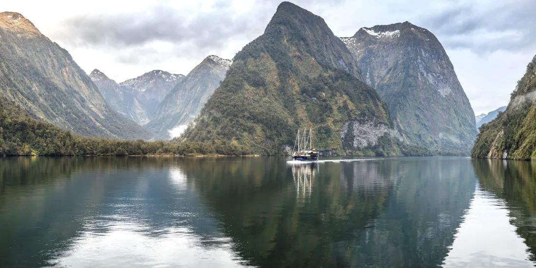
Journey from Queenstown into the dramatic landscapes of Fiordland on a three-day small-group tour combining Te Anau, its celebrated glowworm caves and an overnight cruise through remote Pātea Doubtful Sound. The itinerary includes one night near Lake Te Anau and one night aboard the Fiordland Navigator.
Cruise between rainforest-covered mountains and remote waterways in Doubtful Sound.
Affiliate disclosure: This page may contain affiliate links. We may receive a commission when you make a booking, without increasing the price you pay.
Check dates and current prices
Prices, departure dates, room availability and pickup arrangements can change. Review the current Viator booking page before confirming your trip.
Te Anau, Te Anau Glowworm Caves, Manapouri and Doubtful Sound
Accommodation
One night in three-star accommodation in Te Anau and one night aboard the Fiordland Navigator
Meals listed
One dinner and one breakfast
Group size
Maximum of 10 travellers
Language
English
Ticket type
Mobile ticket
Tour operator
Supplied by Discover New Zealand
This tour removes much of the transport planning involved in visiting Doubtful Sound independently. Coach travel begins in Queenstown, continues through Te Anau and Manapouri, and returns to Queenstown on the final day.
The central experience is the overnight cruise. Remaining in the fiord after daytime visitors leave provides an opportunity to experience the quieter evening and early-morning atmosphere that is difficult to appreciate during a standard day trip.
Why consider this Doubtful Sound tour?
Two major Fiordland experiences: the Te Anau Glowworm Caves and an overnight Doubtful Sound cruise are combined in one itinerary.
Return travel from Queenstown: there is no need to organise a separate rental car or drive the long route yourself.
Small group: the Viator listing specifies a maximum of 10 travellers for the overall tour.
Overnight in the fiord: experience Doubtful Sound during the evening and following morning.
Onboard accommodation: spend the second night aboard the traditional-style Fiordland Navigator.
Nature-focused journey: look for waterfalls, forest-covered mountains, dolphins, fur seals and native birdlife.
Best suited to: travellers who want a more immersive Fiordland experience than a single-day coach trip and who prefer to have transport, accommodation and major activities arranged in advance.
Three-day itinerary
Day 1: Queenstown to Te Anau and the glowworm caves
Leave Queenstown by coach and travel south towards Te Anau, the principal gateway to Fiordland National Park. Time is allowed in Te Anau before joining the included glowworm cave excursion.
The cave experience normally begins with a cruise across Lake Te Anau. Inside the cave system, flowing water, sculpted rock passages and clusters of glowworms create a memorable underground environment.
The first night is spent in three-star accommodation within walking distance of Te Anau’s shops. Meals are not listed as included on the first day, so travellers should budget separately for lunch and dinner.
Day 2: Doubtful Sound overnight cruise
Continue towards Manapouri and begin the multi-stage journey into Doubtful Sound. Access typically involves travelling across Lake Manapouri and crossing Wilmot Pass before boarding the Fiordland Navigator at Deep Cove.
Once aboard, the vessel cruises through the deep waterways of Pātea Doubtful Sound, surrounded by steep mountains, native rainforest and waterfalls. Wildlife sightings are never guaranteed, but the region supports bottlenose dolphins, New Zealand fur seals, Fiordland crested penguins and numerous seabirds.
Conditions permitting, passengers may be offered a kayaking excursion or a smaller tender-boat trip. Dinner is served aboard the vessel before guests retire to their overnight cabins.
Day 3: Morning cruise and return to Queenstown
Wake in Doubtful Sound and enjoy breakfast aboard the Fiordland Navigator. The vessel continues through the fiord before beginning the return journey through Deep Cove, Wilmot Pass and Manapouri.
Coach transport then returns passengers to Queenstown. The precise arrival time can be affected by road, weather and cruise conditions, so avoid arranging a tightly timed flight or major commitment immediately after the tour.
What is included?
Coach transport beginning and ending in Queenstown
Experienced English-speaking coach drivers
Admission to the Te Anau Glowworm Caves
One night of accommodation in Te Anau
One night aboard the Fiordland Navigator in Doubtful Sound
Breakfast
Dinner aboard the overnight cruise
Activities and nature commentary provided as part of the overnight cruise itinerary
Expenses to allow for separately
Meals not specifically listed as included
Accommodation in Queenstown before or after the tour
Personal purchases and drinks from any licensed onboard bar
Gratuities
Travel insurance
Optional activities or itinerary upgrades not shown in the selected package
Always check the inclusions attached to your selected departure date and room option before paying. Package details can differ by season and availability.
Accommodation and meals
Te Anau accommodation
The first night includes three-star accommodation within walking distance of the Te Anau shopping area. The exact property may depend on the departure date and available inventory.
Fiordland Navigator accommodation
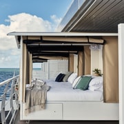
The second night is spent aboard the Fiordland Navigator. The traditional-style vessel has indoor lounges, outdoor viewing areas, a dining saloon and overnight cabins. The selected booking option determines the cabin configuration.
A buffet-style dinner and breakfast are associated with the overnight cruise. Travellers with allergies or specific dietary requirements should provide details during booking and reconfirm them with the local operator before departure.
Queenstown meeting point and departure
The listing advises that the coach departs from Queenstown’s central business district at approximately 7:00 am. Pickup may be available from some major Queenstown CBD hotels when accommodation details are supplied at the time of booking.
Pickup arrangements can change. Confirm the exact location, reporting time and luggage instructions directly with the local provider before the departure date.
Do not rely solely on the general meeting-point description. Use the information on your final voucher and any message sent by the tour operator. Missing the scheduled coach can affect the entire three-day itinerary.
Accessibility and physical requirements
Viator describes the tour as wheelchair and pushchair accessible and states that accessible transportation and surfaces are available. Service animals are also listed as permitted.
However, the itinerary includes coaches, boats, changing transport, accommodation and potentially wet outdoor areas. The separate cruise information also indicates that a reasonable level of mobility may be required.
Travellers who use a wheelchair, walker or other mobility aid should contact the operator before booking to confirm cabin access, bathroom layout, boarding arrangements and whether assistance is available at each transfer point.
What to pack for Doubtful Sound
Fiordland is known for frequent rainfall and rapidly changing conditions. Rain is also responsible for the region’s waterfalls and mist-covered landscapes, so wet weather does not necessarily make the trip unsuccessful.
Waterproof jacket
Warm fleece, jumper or layered clothing
Comfortable non-slip walking shoes
Change of clothes
Small overnight bag
Personal medication
Insect repellent
Sunscreen and sunglasses
Camera or phone with sufficient storage
Portable charging bank
Swimwear when appropriate
Snacks and any meals not included in the package
Large suitcases may be impractical aboard the cruise. Follow the baggage instructions supplied with the confirmed booking and consider leaving unnecessary luggage at your Queenstown accommodation.
Important booking conditions
This Viator experience is listed as non-refundable. The published policy states that cancellations and requested amendments are not refunded. Read the conditions displayed for your selected date before completing payment.
Confirmation may take up to 48 hours and remains subject to availability. Overnight cabins and small-group departures have limited capacity, so booking well ahead is advisable during the spring, summer and early-autumn operating season.
Prices shown online may vary according to travel date, cabin occupancy, seasonal surcharges, currency conversion and remaining availability. The final booking screen is the authoritative source for the amount payable.
The complete experience lasts approximately three days, beginning with the coach journey from Queenstown and ending after the return coach trip.
Does it begin and end in Queenstown?
Yes. The published itinerary starts in central Queenstown and returns to Queenstown on day three.
Are the Te Anau Glowworm Caves included?
Yes. Admission to the glowworm cave excursion is listed as included on the first day.
Where are the two nights spent?
The first night is spent in three-star accommodation in Te Anau. The second night is aboard the Fiordland Navigator in Doubtful Sound.
Is the cruise cabin private?
The Fiordland Navigator offers private twin or double cabins. Confirm the exact cabin and occupancy arrangement shown in the booking option you select.
Does the cabin have a private bathroom?
Ensuite cabins are associated with the Fiordland Navigator cruise. Check the selected room description to ensure that it specifies a private ensuite rather than another cabin category.
Which meals are included?
The Viator listing includes one dinner and one breakfast. Other meals should be treated as an additional expense unless the final booking details state otherwise.
How much luggage can I bring?
A small carry-on or overnight bag is recommended for the cruise. Review the operator’s final baggage instructions before leaving Queenstown.
Is kayaking included?
Kayaking or a tender-boat excursion may be offered during the overnight cruise when weather and operating conditions permit. A particular activity cannot be guaranteed.
What wildlife might be seen?
Possible sightings include bottlenose dolphins, New Zealand fur seals, Fiordland crested penguins and native seabirds. Wildlife is free-ranging, so sightings cannot be guaranteed.
Does the tour operate in rain?
Fiordland experiences substantial rainfall, and tours commonly operate in wet conditions. Severe weather or safety concerns can still result in itinerary changes.
Is the tour wheelchair accessible?
Viator marks the experience as wheelchair accessible. Travellers should nevertheless confirm access to every coach, vessel, cabin and bathroom with the operator before booking.
How large is the group?
The overall tour is listed with a maximum of 10 travellers. The overnight vessel can carry additional passengers who have booked through other arrangements.
Can children join?
Children can generally join when accompanied by an adult. Confirm the minimum age, room-sharing requirements and child price attached to the selected departure.
Is hotel pickup included?
Pickup may be available from major hotels in Queenstown’s CBD. Provide your accommodation details when booking and wait for the operator to confirm the exact arrangements.
Can the booking be cancelled for a refund?
The Viator listing describes this experience as non-refundable and not changeable. Review the policy presented during checkout before paying.
When does the tour operate?
The overnight cruise is a seasonal experience, generally operating during the warmer months. Available dates should be checked directly on the booking calendar.
How far ahead should I book?
Booking early is sensible because the tour combines limited small-group places, Te Anau accommodation and overnight cruise cabins. Popular summer departures may fill several months ahead.
Explore Doubtful Sound from Queenstown
Check available dates, cabin options, current prices and the complete booking conditions before reserving your place.
Editorial note: Tour details were reviewed on 18 July 2026. Departure times, prices, accommodation, accessibility, activities, inclusions and cancellation conditions may change. The final supplier confirmation and booking voucher govern your reservation.
Sponsored Popular Items
Quick take: Musement.com offers a worldwide selection of tours and attractions
Queenstown: Queenstown Lake Cruise and Walter Peak Farm Tour New Zealand Set sail on a stunning Lake Whakatipu cruise and step into the heart of Kiwi farming life with an unforgettable adventure to Walter Peak High Country Farm—departing from the vibrant hub of Queenstown
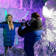
Queenstown Ice Bar - Queenstown’s Premium Ice Bar Experience New Zealand Experience Queenstown's Premium Ice Bar with a delicious drink in hand. Relax on an evening out in a unique setting built from almost 30 tonnes of hand-carved, crystal-clear ice architecture
Explore New Zealand’s South Island from Christchurch with coach travel, Milford Sound, Queenstown, glacier country and the TranzAlpine scenic train.
The 6 Day South Island Trains, Fiords and Glaciers Tour from Christchurch is a semi-independent New Zealand itinerary designed for travellers who want the scenery of a South Island road trip without driving every leg themselves. The route combines coach travel, included accommodation, Milford Sound, Queenstown, glacier country, Greymouth and the TranzAlpine scenic train back to Christchurch.
This tour suits first-time South Island visitors, solo travellers, couples, older travellers, rail lovers, scenery-focused travellers and visitors who prefer organised transport but still want free time in key destinations. It is a practical option if you want to experience Fiordland, Queenstown, Franz Josef Glacier and the famous TranzAlpine railway in one compact itinerary.
Book the 6 Day South Island Trains, Fiords and Glaciers Tour
Compare live availability, current prices, accommodation standard, cancellation terms, departure dates, coach and train arrangements, included activities and optional upgrades before booking your Christchurch South Island tour.
This is a 6-day semi-independent South Island circuit beginning and ending in Christchurch. It uses arranged transport, accommodation and included experiences rather than a fully escorted private guide every hour of the day. That means your main travel legs and key activities are coordinated, while some time is left for you to explore destinations such as Queenstown at your own pace.
The itinerary is especially useful for travellers who do not want to hire a car, drive long alpine roads, organise multiple transfers or separately book train tickets, glacier transport, Queenstown activities and Milford Sound arrangements.
Tour Highlights
6-day South Island itinerary starting and ending in Christchurch.
Coach transport from Christchurch through major South Island scenery.
5 nights’ accommodation with standard 3-star or superior 4-star options, depending on the selected package.
Te Anau Glowworm Caves included as part of the Fiordland section.
Milford Sound Nature Cruise through one of New Zealand’s most famous fiord landscapes.
Queenstown free time to explore New Zealand’s adventure capital.
Skyline Queenstown Gondola for elevated views above Lake Wakatipu.
Franz Josef Glacier access with Glacier Valley Shuttle included.
West Coast scenery including glacier country, rainforest and alpine routes.
TranzAlpine Scenic Train from Greymouth to Christchurch on the final day.
What Is Included?
Included Transport and Experiences
Air-conditioned vehicles.
Return coach transport from Christchurch.
Brief commentary on board coaches and tours.
5 nights’ accommodation.
Milford Sound Nature Cruise.
Queenstown Skyline Gondola.
Glacier Valley Shuttle.
TranzAlpine Scenic Train.
Not Usually Included
Meals unless specifically stated in your selected package.
Pre-tour accommodation in Christchurch.
Post-tour accommodation in Christchurch.
Gratuities.
Travel insurance.
Personal expenses, optional activities and upgrades not listed in your chosen package.
Meeting Point and Ending Point
The tour starts at the Christchurch Bus Interchange on the corner of Lichfield Street and Colombo Street in central Christchurch. The listed meeting instructions state that travellers should arrive and check in before the Intercity coach departure.
The tour finishes in Christchurch after the TranzAlpine scenic train returns from Greymouth to Christchurch Railway Station in Addington. If you need onward accommodation, airport transport or another tour connection, allow enough buffer time after the train arrival.
Day-by-Day Itinerary Guide
Day 1: Christchurch to Queenstown
The first day begins in Christchurch and travels south by coach toward Queenstown. This is a long scenic travel day that introduces the South Island’s changing landscapes, from Canterbury plains to lakes, mountains and alpine resort scenery.
Queenstown is one of New Zealand’s best-known visitor towns, set beside Lake Wakatipu with mountain views, restaurants, adventure activities and easy access to Fiordland, Central Otago and alpine touring routes.
Day 2: Queenstown to Te Anau and Te Anau Glowworm Caves
Day two moves toward Te Anau, the main gateway town for Fiordland. The Te Anau Glowworm Caves experience usually includes a lake crossing, guided cave visit and glowworm grotto section. This adds a quieter natural experience before the Milford Sound day.
Te Anau is calmer than Queenstown and works well as a Fiordland base. Expect lake scenery, mountain views, cooler weather and a more relaxed evening atmosphere.
Day 3: Milford Sound Nature Cruise and Return to Queenstown
Day three is one of the major highlights of the tour. Milford Sound / Piopiotahi is known for steep cliffs, waterfalls, rainforest, dark water, Mitre Peak and dramatic Fiordland scenery. The included Milford Sound Nature Cruise gives you time on the water to see the fiord from below the mountain walls.
The day also includes coach travel through Fiordland scenery. This can be a long day, but it is one of the classic South Island travel experiences.
Day 4: Free Day in Queenstown and Skyline Gondola
Day four gives you a full day to explore Queenstown, with the Skyline Gondola included. You can use the free time for lakefront walks, cafés, adventure activities, gardens, short cruises, wine tours, shopping or simply enjoying the alpine resort atmosphere.
The Skyline Gondola is a strong choice for views over Lake Wakatipu, Queenstown and the surrounding mountains. It is one of the easiest scenic activities in town because it does not require a long day trip.
Day 5: Queenstown to Franz Josef Glacier
Day five travels north and west toward glacier country. The West Coast has a different feel from Queenstown and Fiordland, with rainforest, rugged coastline, remote settlements, river valleys and glacier landscapes.
The itinerary includes Franz Josef Glacier access with Glacier Valley Shuttle. Weather, visibility and access conditions can change quickly in glacier country, so flexibility is important.
Day 6: Franz Josef to Greymouth and TranzAlpine Scenic Train to Christchurch
The final day travels from Franz Josef to Greymouth before boarding the TranzAlpine Scenic Train back to Christchurch. This is one of the most memorable parts of the tour for rail travellers.
The TranzAlpine route crosses from the West Coast through Arthur’s Pass and the Southern Alps before descending across Canterbury toward Christchurch. Expect mountain valleys, river gorges, forests, farmland and wide South Island landscapes.
Why Choose This Tour Instead of Self-Driving?
Self-driving the South Island can be rewarding, but it also involves long distances, mountain roads, weather changes, one-way logistics, accommodation planning and careful timing. This tour removes much of that planning by coordinating transport, accommodation and major activities.
It is particularly useful for travellers who prefer not to drive in New Zealand, do not want to navigate winter or alpine roads, or want to enjoy the scenery from coach and train windows rather than focusing on the road.
Tour Style: Semi-Independent, Not Fully Escorted
This is best understood as a semi-independent itinerary. Your transport, accommodation and key activity bookings are arranged, but you may be travelling on scheduled coaches, joining local tours and managing some transitions yourself. That gives more freedom than a fully escorted group tour, but it also means you should pay close attention to pickup points, departure times and voucher instructions.
If you prefer a guide with you at all times, a private escorted tour may suit better. If you are comfortable with scheduled transport and a little independence, this style can be a good balance between organisation and flexibility.
Who Is This Tour Best For?
First-time South Island visitors: The route covers several major highlights in one trip, including Queenstown, Milford Sound, glacier country and the TranzAlpine railway.
Travellers without a car: This tour is useful if you want South Island scenery without hiring a vehicle or driving long distances.
Rail enthusiasts: The TranzAlpine Scenic Train is a major highlight and a memorable way to return to Christchurch.
Solo travellers: The semi-independent structure can be easier than organising every transfer alone.
Couples: The route combines scenery, lake towns, fiords, glaciers and rail travel into a compact South Island holiday.
Older travellers: Organised transport can reduce driving stress, though travellers should still be comfortable with long travel days and self-managing some transfers.
Photographers: Fiordland, Lake Wakatipu, glacier country, Arthur’s Pass and the West Coast offer strong landscape photography opportunities.
Who Should Think Carefully Before Booking?
This tour may not suit travellers who dislike long coach days, want a private guide throughout, need full door-to-door assistance at every step, or prefer very slow travel with multiple nights in each place. It is also worth checking mobility suitability, as coach boarding, train travel, hotel changes and short walks may be involved.
Accommodation Options
Accommodation is included for five nights, with the choice of standard 3-star or superior 4-star accommodation depending on the package selected and availability. This is helpful because the route covers multiple destinations and arranging each overnight stop separately can be time-consuming.
Always check whether the price shown is for the accommodation standard you want, and confirm room configuration before booking. If you require twin beds, double beds, accessible rooms, late check-in, lift access or specific hotel standards, confirm these details before travel.
What to Bring
Layered clothing: Weather changes quickly between Christchurch, Queenstown, Fiordland, the West Coast and Arthur’s Pass.
Waterproof jacket: Essential for Milford Sound, glacier country and the West Coast.
Warm layer: Even in warmer months, alpine and evening conditions can be cool.
Comfortable walking shoes: Useful for viewpoints, towns, lakefronts, caves and glacier-area stops.
Sun protection: Bring sunglasses, sunscreen and a hat for lake and alpine glare.
Camera or phone with spare storage: This route is highly scenic.
Power bank and charging cable: Useful for long coach and train days.
Small daypack: Keep your jacket, water, snacks, medication and travel documents easily accessible.
Travel sickness medication: Helpful if you are prone to motion sickness on coaches, boats or winding roads.
Personal medication: Carry medication with you rather than packing it deep in checked luggage.
Booking Tips
Read the itinerary carefully: This is a multi-day semi-independent tour, so check every departure, meeting point and included activity.
Arrive in Christchurch the day before: The first coach departure is early, so pre-tour accommodation in Christchurch is usually sensible.
Book post-tour accommodation if needed: The final night after returning to Christchurch is not normally included.
Check accommodation standard: Compare 3-star and 4-star options before booking.
Allow for weather: Milford Sound, glacier country and the West Coast can be affected by rain, road conditions and visibility.
Consider travel insurance: Multi-day travel with trains, coaches, accommodation and weather-sensitive activities should be insured.
Pack light but smart: You will be moving between towns, so manageable luggage makes the tour easier.
Check meal inclusions: Meals are generally not included unless specifically stated, so budget for breakfasts, lunches, dinners and snacks.
Best Time to Take This Tour
This South Island route can be rewarding year-round, but each season has a different feel. Summer offers longer daylight and generally warmer conditions. Autumn can bring beautiful colour and cooler travel. Winter can deliver snow-capped scenery, but road and weather conditions need more flexibility. Spring can bring waterfalls, fresh alpine views and changeable weather.
Fiordland and the West Coast are naturally wet regions, so rain should not automatically be seen as a failed day. Rain can make Milford Sound’s waterfalls more dramatic, but waterproof clothing and flexible expectations are essential.
Suggested Add-Ons Before or After the Tour
Extra Night in Christchurch Before Departure
Because the tour starts early, staying in Christchurch the night before gives you more comfort and reduces the risk of missing the first coach connection.
Extra Night in Christchurch After the Tour
Adding a final Christchurch night allows time to rest after the TranzAlpine train, explore the city, visit the Botanic Gardens or connect to your next flight without rushing.
Akaroa Day Trip
Akaroa is a good Christchurch add-on for harbour scenery, French-influenced village atmosphere, wildlife cruises and a relaxed Banks Peninsula day.
Christchurch City Attractions
Christchurch offers the Botanic Gardens, Riverside Market, Avon River punting, trams, museums, street art and easy city walks.
Extra Queenstown Days
If you want more adventure activities, wineries, lake cruises, Glenorchy, Arrowtown or spa time, consider adding separate Queenstown nights before or after your broader South Island travel.
Nearby and Related Destinations
Christchurch
Christchurch is the start and end point of the tour. It is the South Island’s largest city and a practical gateway for rail, road and air connections.
Queenstown
Queenstown is a major alpine resort town known for Lake Wakatipu, mountain views, restaurants, adventure activities and access to Central Otago and Fiordland.
Te Anau
Te Anau is the main gateway to Fiordland and a practical stop before Milford Sound. It is quieter than Queenstown and offers lakefront scenery and access to glowworm caves.
Milford Sound
Milford Sound is one of the South Island’s most famous natural attractions, known for steep cliffs, waterfalls, rainforest, Mitre Peak and fiord cruises.
Franz Josef Glacier
Franz Josef is a West Coast glacier town with rainforest, glacier valley access, scenic flights, short walks and alpine views when conditions are clear.
Greymouth
Greymouth is the West Coast rail gateway for the TranzAlpine, with access to Punakaiki, coastal scenery, pounamu heritage and West Coast touring routes.
Arthur’s Pass
Arthur’s Pass is a dramatic alpine crossing between the West Coast and Canterbury. It is one of the scenic highlights of the TranzAlpine route.
6 Day South Island Trains, Fiords and Glaciers Tour FAQ
Is this South Island tour worth it?
It can be worth it if you want to see Queenstown, Milford Sound, glacier country and the TranzAlpine train without planning every hotel, transfer and major activity yourself. It is best for travellers who value scenery, convenience and organised transport.
Where does the tour start?
The tour starts at the Christchurch Bus Interchange in central Christchurch. Arrive early and check your booking instructions carefully.
Where does the tour finish?
The tour finishes in Christchurch after the TranzAlpine scenic train returns from Greymouth to Christchurch Railway Station in Addington.
Is accommodation included?
Yes. The tour includes five nights’ accommodation, with standard 3-star or superior 4-star accommodation options depending on the package selected.
Are meals included?
Meals are generally not included unless specifically stated in your booking option. Budget separately for breakfasts, lunches, dinners and snacks.
Is this a private tour?
No. This is best understood as a semi-independent tour using organised coaches, local tours, accommodation and the TranzAlpine train. It is different from a fully private escorted tour.
Does the tour include Milford Sound?
Yes. The itinerary includes a Milford Sound Nature Cruise and coach travel connected with the Milford Sound day.
Does the tour include the TranzAlpine train?
Yes. The final day includes the TranzAlpine Scenic Train from Greymouth back to Christchurch.
Is this tour suitable without a rental car?
Yes. This is one of the main advantages of the tour. It is designed for travellers who want to see major South Island highlights without self-driving.
Should I book travel insurance?
Yes. Travel insurance is recommended for multi-day tours, especially where weather, transport, accommodation, trains, cruises and personal health can affect the itinerary.
Ready to Book Your South Island Trains, Fiords and Glaciers Tour?
Search live availability for the 6 Day South Island Trains, Fiords and Glaciers Tour from Christchurch, compare accommodation standards and booking conditions, and choose the best departure date for your New Zealand rail, fiord and glacier itinerary.
Queenstown to Christchurch via Mt Cook One-Way Tour New Zealand This one way small group tour offers a perfect blend of adventure, relaxation, and breathtaking scenery, taking you from the adrenaline capital of Queenstown to the vibrant city of Christchurch
Mount Cook Full-Day Tour: Queenstown to Christchurch New Zealand Encounter breathtaking sights on this full-day guided tour from Queenstown to Christchurch. Journey through dramatic landscapes in Mount Cook National Park, visit Lake Tekapo, and see the Southern Alps
Explore the South Island by private tour from Queenstown, with Fiordland, Te Anau, Milford Sound or Doubtful Sound, Mount Cook, Lake Tekapo, Arthur’s Pass, Christchurch and optional premium activities.
This 5 Day South Island New Zealand Private Tour from Queenstown is designed for travellers who want to see several of the South Island’s major highlights without self-driving, planning each transfer or joining a large coach group. The itinerary starts in Queenstown and travels through Fiordland, Te Anau, Queenstown, Aoraki / Mount Cook, Lake Tekapo, Arthur’s Pass and Christchurch, with optional activity upgrades depending on the package selected.
The tour suits couples, families, small groups, first-time New Zealand visitors, older travellers who prefer private transport, photographers, honeymooners and travellers who want a curated South Island route with a guide-driver. It is especially useful if you want to combine dramatic scenery, alpine roads, lakes, fiords, glowworm caves, scenic rail, stargazing and wildlife-style day options in one organised itinerary.
Book the South Island Private Tour from Queenstown
Compare live availability, current prices, group-size pricing, accommodation options, optional ticket packages, cancellation terms and pickup details before booking. Check whether your selected option includes hotels, activity tickets, cruise tickets, scenic flights, train tickets or only private transport and guiding.
This is a private multi-day sightseeing tour beginning in Queenstown and ending in Christchurch. Unlike a standard large-group coach tour, the experience is private to your group, with a dedicated guide-driver and private transport. That makes it more flexible, personal and comfortable for travellers who prefer a guided road trip without the work of driving New Zealand’s alpine roads themselves.
The itinerary combines several of the South Island’s most famous travel experiences: Fiordland, Milford Sound or Doubtful Sound, Te Anau Glowworm Caves, Queenstown sightseeing, Skyline Queenstown, Lindis Pass, Lake Pukaki, Aoraki / Mount Cook, Lake Tekapo, stargazing, Arthur’s Pass, the TranzAlpine train and a final day option around Kaikōura or Akaroa.
Tour Highlights
Private South Island touring with a guide-driver exclusively for your group.
Queenstown pickup from a preferred searchable location in Queenstown City.
Fiordland option with Milford Sound or Doubtful Sound depending on availability and chosen route.
Te Anau Glowworm Caves as part of the first-day Fiordland experience when selected.
Queenstown sightseeing including Lake Wakatipu, Queenstown Gardens, the wharf area and Skyline Queenstown options.
Aoraki / Mount Cook with alpine scenery, Lake Pukaki and optional scenic helicopter activity.
Lake Tekapo with dark-sky stargazing options and Mackenzie Country scenery.
Arthur’s Pass and Castle Hill for high-country landscapes, dramatic rock formations and alpine roads.
TranzAlpine train section from Arthur’s Pass to Christchurch when selected.
Final-day Kaikōura or Akaroa option depending on your selected activity and route feasibility.
What Is Included?
Core Inclusions
Private transportation for your group.
Guide-driver exclusively for your group.
Wi-Fi on board where available.
Packaged water bottles.
Packaged snacks and chocolates.
Use of charging cables and emergency rain gear.
Pickup from your preferred searchable location in Queenstown City.
Optional “With Hotels” Package
Depending on the selected booking option, accommodation may be included for four nights in 4 to 5-star hotels with breakfast, subject to availability and season. Always check the selected package carefully before paying, because hotel inclusion is not automatic on every option.
Optional “With Tickets” Package
Depending on the selected option, activity tickets may include Milford Sound or Doubtful Sound cruise, Te Anau Glowworm Caves, Skyline Queenstown with luge, thrill jet boating, Mount Cook scenic helicopter ride, Lake Tekapo stargazing, TranzAlpine Scenic Train, Akaroa nature cruise and alpaca farm, or a Kaikōura whale watching or kayaking option.
Not Usually Included
Food and drinks are generally not included unless specifically described in your chosen option. Travel insurance is also not included, and travellers should arrange their own comprehensive insurance before departure.
Day-by-Day Itinerary Guide
Day 1: Queenstown to Fiordland, Milford Sound or Doubtful Sound, Te Anau Glowworm Caves and Te Anau
The first day usually begins with pickup in Queenstown before travelling toward Fiordland. Depending on the chosen route and availability, the day may include Milford Sound or Doubtful Sound. These are among New Zealand’s most famous fiord landscapes, known for steep mountains, waterfalls, rainforest and dramatic water views.
The itinerary also includes Te Anau Glowworm Caves, where travellers experience Lake Te Anau, limestone cave passages and a glowworm grotto. The day typically ends in Te Anau if the accommodation option is selected.
Day 2: Te Anau to Queenstown, Queenstown Gardens, Lake Wakatipu, Jet Boating and Skyline Queenstown
Day two focuses on Queenstown, Lake Wakatipu and popular adventure or sightseeing activities. Depending on the selected package, this may include Queenstown Gardens, the lakefront, the wharf area, jet boating and Skyline Queenstown with luge rides.
This is the day where the tour shifts from Fiordland wilderness into Queenstown’s alpine resort atmosphere. It is useful for travellers who want both scenic sightseeing and a taste of Queenstown’s adventure identity.
Day 3: Queenstown to Lindis Pass, Lake Pukaki, Aoraki / Mount Cook, Scenic Helicopter Ride and Lake Tekapo
Day three moves through some of the South Island’s most photogenic inland scenery. The route includes Lindis Pass, Lake Pukaki and Aoraki / Mount Cook. Weather permitting, views of turquoise lakes, alpine peaks and broad high-country landscapes can be a major highlight.
A scenic helicopter ride at Aoraki / Mount Cook may be included with the relevant ticket option. The day may continue to Lake Tekapo, where stargazing can be included under the selected activity package.
Day 4: Lake Tekapo to Castle Hill, Arthur’s Pass, Otira Viaduct, TranzAlpine Train and Christchurch
Day four travels from the Mackenzie Country toward Canterbury and Arthur’s Pass. Stops may include Lake Tekapo, Castle Hill, Arthur’s Pass National Park and the Otira Viaduct Lookout. These landscapes are very different from Queenstown and Fiordland, with high-country basins, limestone formations, alpine roads and mountain passes.
With the relevant ticket option, travellers board the TranzAlpine Scenic Train from Arthur’s Pass to Christchurch. This is one of New Zealand’s best-known rail journeys and gives the tour a strong car-free scenic component.
Day 5: Christchurch to Kaikōura or Akaroa, then Return to Christchurch
The final day is based around Christchurch with a choice-style route toward either Kaikōura or Akaroa, depending on availability, weather, preferences and package inclusions. Kaikōura is best known for marine wildlife experiences, while Akaroa offers harbour scenery, French-influenced history, nature cruises and rural side activities.
This day gives the tour a strong Canterbury finish before returning to Christchurch. Accommodation is usually not included on the final night unless specifically arranged separately.
Why Choose a Private Tour Instead of Self-Driving?
The South Island is spectacular, but the driving can be long, winding and weather-dependent. A private tour removes the need to navigate alpine roads, manage timing between distant locations, organise separate bookings and work out which stops are realistic each day.
A private guide-driver can also help with local context, photo stops, timing, weather changes, route adjustments and travel comfort. This is particularly useful for travellers who are visiting New Zealand for the first time or who want to maximise scenery without handling logistics.
Who Is This Tour Best For?
First-time South Island visitors: The itinerary covers many famous sights in a compact format.
Couples and honeymooners: Private touring gives a more personal feel than a large coach trip.
Families: Private transport can make multi-day touring easier for families who want comfort, flexibility and fewer transfers.
Older travellers: A guide-driver removes the stress of self-driving long alpine routes, although guests should still be comfortable with multi-day travel.
Photographers: Fiordland, Lake Pukaki, Mount Cook, Lake Tekapo, Castle Hill and Arthur’s Pass offer strong landscape photography opportunities.
Luxury travellers: Optional 4 to 5-star accommodation and premium activity tickets make this suitable for travellers wanting a higher-comfort South Island trip.
Small groups: Because pricing may vary by group size, it can suit small private groups who want to share the experience.
Who Should Think Carefully Before Booking?
This tour may not suit travellers who prefer very slow travel, independent exploration, budget backpacking or long stays in one place. It is a packed multi-day itinerary with substantial travel between regions. It may also be less suitable for travellers who dislike long vehicle days, have significant mobility limitations or need a fully wheelchair-accessible experience.
Accommodation Options
The “With Hotels” option may include four nights in 4 to 5-star hotels with breakfast, depending on availability and season. This can be useful if you want the tour operator to coordinate the full route and overnight stays.
If you choose a transport-only or tickets-only version, check whether you need to book hotels separately in Te Anau, Queenstown, Lake Tekapo or Christchurch. Before booking, confirm exactly which nights are covered and whether breakfast is included.
Activity Ticket Options
The optional ticket package can significantly change the value and style of the tour. Premium inclusions may include cruises, glowworm caves, Skyline Queenstown, jet boating, scenic helicopter rides, stargazing, the TranzAlpine train, Akaroa activities or Kaikōura marine experiences.
If an activity is cancelled or unavailable due to operator scheduling, weather or other conditions, alternatives may be offered. Always check how substitutions, refunds or activity swaps are handled before booking.
What to Bring
Layered clothing: South Island weather can change quickly between lakes, mountains, fiords and inland basins.
Waterproof jacket: Essential for Fiordland, Milford Sound, Doubtful Sound and alpine stops.
Comfortable walking shoes: Useful for viewpoints, short walks, caves, lakefronts and photo stops.
Warm layer: Even in warmer months, alpine and evening conditions can be cool.
Sun protection: Bring sunglasses, hat and sunscreen for high-glare lakes and mountain areas.
Camera or phone with spare storage: This route is highly scenic, so carry chargers and power banks.
Small daypack: Keep essentials accessible during stops.
Travel sickness medication: Helpful if you are prone to motion sickness on winding alpine roads or cruises.
Reusable water bottle: Useful between stops, even though bottled water may be provided.
Personal medication: Carry all medication with you rather than packing it deep in luggage.
Booking Tips
Check the exact option selected: Accommodation and tickets are optional, so confirm what your chosen package includes.
Confirm pickup details: Provide a Queenstown City pickup location that can be found on Google Maps.
Ask about activity swaps: Some optional activities may be replaceable with alternatives such as scenic flights, horse trekking, glacier hiking, ziplining, spa experiences or other options.
Allow for weather changes: Fiordland, Mount Cook and alpine roads can be affected by weather, so flexibility is important.
Consider travel insurance: Multi-day trips with cruises, scenic flights and premium tickets should be covered by comprehensive insurance.
Check mobility needs: The tour is not listed as wheelchair accessible, so ask before booking if mobility is a concern.
Book early in peak season: Hotel availability, scenic flights, cruises and trains can become limited during busy New Zealand travel periods.
Best Time to Take This South Island Tour
The South Island can be visited year-round, but each season changes the experience. Summer brings longer daylight and generally easier touring conditions. Autumn is excellent for colour, photography and cooler travel. Winter can bring snow-capped alpine scenery, but roads and weather require more flexibility. Spring brings waterfalls, fresh mountain scenery and changeable weather.
If your priority is scenic flights, stargazing, cruises and alpine viewpoints, choose dates with enough flexibility for weather changes. Premium activities such as helicopters and cruises can be weather-sensitive.
Suggested Travel Style
Fast but Scenic Overview
This tour works well if you want a concentrated South Island overview in five days. It covers a lot of ground, so expect a scenic road-trip pace rather than a slow single-destination holiday.
Premium Activity Focus
Choose the ticket-inclusive option if you want the tour to feel like a curated premium experience, with cruises, glowworm caves, scenic train, stargazing and helicopter-style highlights included where available.
Comfort and Convenience
Choose the accommodation-inclusive option if you prefer the operator to coordinate overnight stays and reduce planning time. This is especially useful in high season or if you are unfamiliar with New Zealand distances.
Nearby and Related Destinations
Queenstown
Queenstown is the starting point and one of New Zealand’s major alpine resort towns. It is known for Lake Wakatipu, adventure activities, restaurants, wineries, mountain views and easy access to Fiordland and Central Otago.
Te Anau
Te Anau is a gateway to Fiordland and a practical overnight base for Milford Sound, Doubtful Sound and the glowworm caves. It is quieter than Queenstown and useful for travellers who want a calmer lake town.
Milford Sound
Milford Sound is one of New Zealand’s most famous natural attractions, with steep cliffs, waterfalls, rainforest and fiord cruises. Weather can change quickly, but rain often makes the waterfalls more dramatic.
Aoraki / Mount Cook
Aoraki / Mount Cook is New Zealand’s highest mountain and one of the most impressive alpine stops on a South Island route. The area is known for glaciers, short walks, scenic flights and mountain views.
Lake Tekapo
Lake Tekapo is known for turquoise water, the Church of the Good Shepherd, Mackenzie Country scenery and dark-sky stargazing.
Arthur’s Pass
Arthur’s Pass is a dramatic alpine crossing through the Southern Alps. It works especially well when combined with the TranzAlpine Scenic Train.
Christchurch
Christchurch is the end point and the South Island’s largest city. It offers gardens, riverfront areas, restaurants, heritage sites, art, trams and access to Akaroa, Kaikōura and Canterbury touring.
5 Day South Island Private Tour FAQ
Is this South Island private tour worth it?
It can be worth it if you want a private, guided, multi-day South Island route without driving or organising every hotel, cruise, activity and transfer yourself. It is best suited to travellers who value convenience, scenery and private transport.
Where does the tour start and end?
The tour starts in Queenstown, with pickup available from a preferred searchable location in Queenstown City. The itinerary ends in Christchurch.
Is accommodation included?
Accommodation is only included if you select the “With Hotels” option. That option may include four nights in 4 to 5-star hotels with breakfast, subject to availability and season.
Are activity tickets included?
Activity tickets are only included if you select the relevant “With Tickets” option. Check your chosen package carefully before booking.
Is this a private tour?
Yes. The listing describes it as a private tour or activity, meaning only your group participates.
Can the itinerary be customised?
The operator may confirm preferences after booking, and some activities may be swapped for alternatives depending on availability, cost differences, route timing and schedule feasibility.
Is this tour wheelchair accessible?
The listing states that it is not wheelchair accessible. Travellers with mobility concerns should contact the operator before booking.
Is this tour suitable for children?
It may suit children who are comfortable with long travel days and a multi-day itinerary. Infant seats may be available, but families should confirm requirements before booking.
What happens if a scenic flight or cruise is cancelled?
Weather-sensitive activities may be cancelled or unavailable. The listing notes that alternatives may be provided when optional activities are cancelled by the activity provider or unavailable.
Should I buy travel insurance?
Yes. A multi-day private tour with premium activities, changing weather conditions and optional tickets should be covered by comprehensive travel insurance.
Ready to Book Your South Island Private Tour?
Search live availability for the 5 Day South Island New Zealand Private Tour from Queenstown, compare transport-only, hotel-inclusive and ticket-inclusive options, and choose the best package for your Queenstown to Christchurch South Island journey.
Queenstown: Queenstown Lake Cruise and Walter Peak Farm Tour New Zealand Set sail on a stunning Lake Whakatipu cruise and step into the heart of Kiwi farming life with an unforgettable adventure to Walter Peak High Country Farm—departing from the vibrant hub of Queenstown
Queenstown Ice Bar - Queenstown’s Premium Ice Bar Experience New Zealand Experience Queenstown's Premium Ice Bar with a delicious drink in hand. Relax on an evening out in a unique setting built from almost 30 tonnes of hand-carved, crystal-clear ice architecture
Explore Moore Reef on a full-day Cairns Outer Great Barrier Reef cruise with snorkelling, reef pontoon activities, glass-bottom boat viewing, semi-submersible touring and family-friendly reef access.
A Cairns Outer Great Barrier Reef snorkel cruise is one of the classic ways to experience the Great Barrier Reef, especially if you want a full-day reef trip with easy access to snorkelling, coral viewing, marine life and onboard facilities. This cruise travels from Cairns to Moore Reef, where visitors spend several hours at an outer reef pontoon designed for swimming, snorkelling, glass-bottom boat viewing, semi-submersible touring and relaxed reef sightseeing.
This is a strong option for first-time Great Barrier Reef visitors, families, non-swimmers who still want reef viewing, couples, cruise passengers with enough time in Cairns, older travellers, beginner snorkellers and anyone who wants the security of a large reef platform rather than a smaller boat-only snorkel trip.
Book Cairns Outer Great Barrier Reef Snorkel Cruise Tickets
Compare live availability, prices, inclusions, family tickets, cancellation terms, departure times, optional extras and reef activity upgrades before booking your Cairns to Moore Reef pontoon cruise. Check whether your preferred date includes snorkelling equipment, buffet lunch, glass-bottom boat tours, semi-submersible tours, waterslide access and any optional extras such as guided snorkelling, diving, helmet diving or scenic helicopter flights.
What Is the Cairns Outer Great Barrier Reef Snorkel Cruise?
This full-day reef trip departs from Cairns and travels to Moore Reef, an Outer Great Barrier Reef location where visitors use a floating activity platform as their base for the day. Rather than simply anchoring beside the reef, the pontoon gives guests a stable place to enter the water, relax between activities, access equipment and join reef-viewing experiences.
The day is designed to make the reef accessible to a wide range of travellers. Confident swimmers can snorkel directly from the platform, beginners can use flotation aids and instruction, and non-swimmers can still enjoy coral and marine life through glass-bottom boat or semi-submersible tours.
What to Expect on the Day
Check-In at Cairns Reef Fleet Terminal
The cruise departs from the Cairns Reef Fleet Terminal at 1 Spence Street, Cairns City. Arrive early enough to collect boarding passes, check in, organise extras and settle in before departure. Cairns city hotels are often within a short taxi, rideshare or walking distance of the terminal.
Catamaran Cruise to the Outer Reef
The journey to Moore Reef is part of the experience. The vessel travels from Cairns across the Coral Sea toward the outer reef platform. On calm days, the cruise can be scenic and relaxing; on windy days, travellers prone to seasickness should take precautions before departure.
Moore Reef Pontoon Time
The highlight of the day is the time spent at Moore Reef pontoon. The pontoon gives visitors a stable reef base with snorkel access, activity areas, viewing options and places to rest between water activities.
Snorkelling the Great Barrier Reef
Snorkelling is the main activity for many guests. Equipment is included, and the reef environment can include colourful coral, reef fish and changing underwater visibility depending on weather, tide, wind and sea conditions.
Glass-Bottom Boat Tour
The glass-bottom boat tour is useful for travellers who do not want to snorkel, families with younger children, older visitors or anyone who wants a different perspective on the reef without getting fully wet.
Semi-Submersible Reef Viewing
A semi-submersible tour allows passengers to view coral and marine life from below the waterline while remaining seated and dry. This is one of the most practical options for non-swimmers or mixed-ability groups.
Waterslide and Family Activities
Moore Reef pontoon includes activity features such as an onboard waterslide, making the trip appealing for families and children who want more than just a standard snorkel stop.
Buffet Lunch, Tea and Coffee
The cruise includes a buffet lunch, tea and coffee. If you have dietary requirements, advise them at booking and reconfirm with the operator before travel.
Key Inclusions
Full-day Great Barrier Reef tour from Cairns to Moore Reef pontoon.
Approximately four hours at Moore Reef pontoon for reef activities and relaxation.
Snorkelling equipment and expert instruction.
Glass-bottom boat tour for dry coral viewing.
Semi-submersible tour for underwater reef viewing without swimming.
Access to the onboard waterslide at the reef platform.
Buffet lunch plus tea and coffee.
Free Wi-Fi onboard where available.
Optional Extras to Consider
Guided Snorkel Tour
A guided snorkel tour can be useful if you are nervous, want help identifying marine life or prefer to follow a reef guide rather than exploring independently.
Introductory Scuba Diving
Introductory diving may be available for beginners who want to try scuba diving under supervision. Medical restrictions can apply, so check requirements carefully before booking.
Certified Diving
Certified divers may be able to add dives depending on conditions, availability and operator requirements. Bring proof of certification if you plan to dive.
Seawalker Helmet Diving
Helmet diving can be a good option for travellers who want an underwater experience without traditional scuba diving. Check age, health, comfort and availability requirements before booking.
Scenic Helicopter Flight
A scenic helicopter flight is a premium add-on that offers aerial views of the reef, reef colours and Coral Sea patterns. It suits special occasions and travellers wanting a reef view from above.
Who Is This Cruise Best For?
First-time reef visitors: The pontoon setup makes it easy to understand where to go, where to swim and how to access activities.
Families: The combination of snorkelling, glass-bottom boat, semi-submersible viewing, buffet lunch and waterslide makes this one of the more family-friendly reef styles.
Beginner snorkellers: Equipment and instruction help make the reef more approachable for travellers who have not snorkelled often.
Non-swimmers: Glass-bottom boat and semi-submersible options allow reef viewing without needing to snorkel.
Mixed-ability groups: Some guests can snorkel or dive while others stay dry and still enjoy coral-viewing activities.
Couples: A full reef day from Cairns works well as a memorable holiday activity, especially if combined with a few days in Cairns, Palm Cove or Port Douglas.
Older travellers: The pontoon provides a more structured reef experience than a small-boat snorkel tour, but visitors should still be comfortable with a full-day marine trip.
Who Should Think Carefully Before Booking?
This tour may not suit travellers who dislike boats, are very prone to seasickness, have limited mobility, are uncomfortable in open water, or cannot manage a full day away from shore. It is also worth checking medical requirements before adding scuba diving, helmet diving or other underwater extras.
What to Bring
Swimwear: Wear it under your clothes to make changing easier.
Towel: Bring one towel per person.
Reef-safe sun protection: Use sunscreen, hat, sunglasses and sun-protective clothing.
Light jacket or warm layer: Boat decks can feel cool after swimming or on windy days.
Dry clothes: Useful for the cruise back to Cairns.
Seasickness medication: Take it before departure if you are prone to motion sickness and follow the medication instructions.
Water bottle: Stay hydrated throughout the day.
Card or cash: Useful for optional extras, drinks, photos or onboard purchases.
Waterproof phone pouch: Helpful around the boat, but avoid dropping anything into the reef environment.
Reef Safety Tips
Listen to the safety briefing: Pay attention to snorkel zones, currents, signals and return times.
Use flotation aids if needed: Noodles, vests or other buoyancy aids can make snorkelling more relaxed.
Stay within marked areas: Do not drift beyond the supervised snorkelling zone.
Tell staff if you are nervous: Crew can advise on easier entry, flotation and beginner-friendly snorkelling.
Do not stand on coral: Coral is fragile and can also cut feet or legs.
Know your limits: Rest between swims, stay hydrated and avoid overexertion.
Responsible Reef Travel
The Great Barrier Reef is a delicate marine environment, so visitors should follow reef-friendly behaviour throughout the day. Avoid touching coral, chasing wildlife, feeding fish, taking shells or coral, or leaving anything behind. Keep fins away from coral and use flotation if you are not confident staying horizontal in the water.
A responsible reef visit is not only safer and more enjoyable; it also helps protect the marine life and coral gardens that make the reef worth visiting.
Best Time to Do a Cairns Outer Reef Cruise
Cairns reef cruises operate in a tropical climate, so conditions can vary by season. The dry season generally brings pleasant weather and lower humidity, while the wet season can bring warmer water, humidity and tropical rain. Reef visibility can change from day to day depending on wind, swell, tide and recent weather.
If you have several days in Cairns, avoid booking your reef cruise on your final day only. Leaving a spare day gives you more flexibility if weather, sea conditions or personal plans change.
Where Does the Cruise Depart?
The cruise departs from the Sunlover Cruises counter inside the Cairns Reef Fleet Terminal at 1 Spence Street, Cairns City. This central location is convenient for travellers staying in Cairns city, the Esplanade, Cairns CBD or nearby accommodation.
Suggested Cairns Itinerary Ideas
One Big Reef Day
Stay in Cairns city, walk or taxi to the Reef Fleet Terminal, spend the day at Moore Reef, then return to the Esplanade for dinner.
Cairns Family Break
Combine the Outer Great Barrier Reef snorkel cruise with Cairns Aquarium, Kuranda Scenic Railway, Skyrail Rainforest Cableway and a relaxed Esplanade Lagoon day.
Reef and Rainforest Trip
Pair this reef cruise with a Daintree Rainforest or Cape Tribulation tour for a strong reef-and-rainforest Far North Queensland itinerary.
Couples Reef Escape
Stay in Cairns, Palm Cove or Trinity Beach, book the reef cruise for your main adventure day, then add a scenic dinner, spa treatment or sunset waterfront walk.
Nearby Things to Do in Cairns
Cairns Esplanade
The Cairns Esplanade is useful before or after your reef day, with waterfront walking, restaurants, parkland, public spaces and the popular lagoon swimming area.
Kuranda Scenic Railway and Skyrail
Kuranda is one of the most popular rainforest day trips from Cairns and pairs well with a separate reef day.
Green Island
Green Island offers a shorter island-based reef experience and can be a good alternative for visitors who prefer a smaller island day rather than a full outer reef pontoon trip.
Fitzroy Island
Fitzroy Island is another popular island day trip from Cairns, with beaches, walking tracks and snorkelling close to shore.
Daintree Rainforest and Cape Tribulation
The Daintree and Cape Tribulation offer a rainforest contrast to the reef, making them ideal additions to a longer Far North Queensland holiday.
Cairns Outer Great Barrier Reef Snorkel Cruise FAQ
Is the Cairns Outer Great Barrier Reef snorkel cruise worth it?
Yes, especially for first-time visitors who want a structured full-day reef experience with snorkelling, lunch, pontoon facilities and dry reef-viewing options such as glass-bottom boat and semi-submersible tours.
How long is the tour?
The Experience Oz listing describes the tour as approximately seven hours and 30 minutes, with departure from Cairns in the morning and return in the late afternoon.
How much time do you get at Moore Reef?
The tour includes approximately four hours at Moore Reef pontoon, giving visitors time to snorkel, eat lunch, join included viewing tours and enjoy the reef platform.
Do I need to know how to swim?
Swimming ability helps if you want to snorkel, but non-swimmers can still enjoy reef viewing from the glass-bottom boat and semi-submersible tours. Nervous swimmers should speak with crew and use flotation aids.
Is snorkelling equipment included?
Yes. Snorkelling equipment and instruction are included. Check the current booking page for any special equipment requests or size requirements.
Is this tour good for children?
Yes, this style of reef pontoon cruise can be a good family option because it includes snorkelling, dry reef-viewing options, lunch, a waterslide and a stable activity platform.
Can I scuba dive on this tour?
Diving may be available as an optional extra, including introductory and certified diving. Medical, age and safety requirements may apply, so check conditions before booking.
What should I wear?
Wear swimwear under light clothing, bring a towel, hat, sunglasses, sun-protective clothing and a warm layer for the return cruise.
What happens if the weather is bad?
Reef tours are subject to weather and sea conditions. Operators assess conditions and safety, so check cancellation terms and reconfirm if weather looks uncertain.
Where does the cruise leave from?
The cruise departs from the Cairns Reef Fleet Terminal at 1 Spence Street, Cairns City, from the Sunlover Cruises counter.
Ready to Book Your Cairns Outer Reef Cruise?
Search live availability for the Cairns Outer Great Barrier Reef Snorkel Cruise to Moore Reef Pontoon, compare current inclusions and optional extras, and choose the best date for your reef day from Cairns.
Reef Sleep: 2-Day Great Barrier Reef All Inclusive Overnight Australia Sleep overnight on the Great Barrier Reef. Experience the tranquility of just you, the sea and the stars. Explore the reef by day, watch the sun set over the water, enjoy gourmet meals… Check current availability, inclusions and booking conditions.
From Port Douglas: Sail to Low Isles Great Barrier Reef Australia Board a catamaran and enjoy an idyllic day on this sailing cruise. Sunbathe on an unspoiled coral cay island in the middle of the Great Barrier Reef and learn about the reef from a… Check current availability, inclusions and booking conditions.
Explore the Te Anau Glowworm Caves by lake cruise, guided cave walk and silent small-boat ride beneath the glowworms.
The Te Anau Glowworm Caves are one of the most memorable things to do in Fiordland, especially for travellers staying in Te Anau before or after visiting Milford Sound or Doubtful Sound. The experience combines a scenic cruise across Lake Te Anau, a guided walk through limestone caves and a quiet small-boat ride through a dark grotto lit by native New Zealand glowworms.
This is a good activity for visitors who want a short Fiordland experience without committing to a full-day hike or long road trip. It works well for couples, families with older children, first-time visitors to New Zealand, nature lovers, photographers outside the cave, Milford Sound travellers and anyone interested in glowworms, geology and underground rivers.
Book Te Anau Glowworm Caves Tours
Compare Te Anau Glowworm Caves tickets, guided cave tours, Fiordland day trips, Milford Sound combinations and multi-day South Island itineraries. Check live prices, availability, departure times, cancellation terms, review scores and whether your preferred tour departs from Te Anau, Queenstown or another South Island location.
The Te Anau Glowworm Caves are limestone caves on the western shore of Lake Te Anau in Fiordland, New Zealand. Visitors reach the caves by boat from Te Anau, then join a guided underground experience through narrow passages, flowing water, sculpted rock formations and a glowworm grotto.
The glowworms create a blue-green bioluminescent display on the cave roof, often described as looking like a night sky. The most atmospheric part of the tour is the silent boat ride through the grotto, where visitors sit quietly while their eyes adjust to the darkness and the glowworms become visible above.
What to Expect on the Tour
Lake Te Anau Cruise
The experience usually begins with a scenic boat trip across Lake Te Anau. This is part of the appeal of the tour, not just transport. On clear days, the lake crossing can include views of forested shoreline, mountains and Fiordland scenery.
Cavern House Introduction
After arriving across the lake, guests usually spend time at Cavern House, where guides introduce the cave system, glowworms, local geology and the formation of the underground environment before leading visitors into the caves.
Guided Cave Walk
Inside the caves, the guide leads visitors along paths and steps through limestone passages. Expect dim light, moving water, wet walkways, rock formations, narrow sections and the sound of underground streams.
Underground Waterfall and River
One of the memorable features of the caves is the rushing underground water. The cave is still being shaped by water, so this is not a dry, still cave environment. Wear shoes with good grip and bring a warm layer.
Silent Boat Ride Beneath the Glowworms
The highlight is the small-boat section through the glowworm grotto. Visitors remain quiet and still while the boat glides through darkness beneath the glowworms. Phones, flashes and photography are not permitted inside the cave so everyone can enjoy the glowworm display properly.
Why Visit the Te Anau Glowworm Caves?
Unique Fiordland experience: It combines lake scenery, cave geology, underground rivers and native glowworms in one short tour.
Good before or after Milford Sound: Te Anau is a common overnight base for Milford Sound, so the caves fit well into a Fiordland itinerary.
Short activity length: The tour is much easier to fit into a travel day than a full-day hike or long scenic drive.
All-weather appeal: Because much of the experience is underground, it can be a useful option when Fiordland weather is wet or changeable.
Memorable glowworm viewing: The silent boat ride through the dark grotto is the part most travellers remember.
Good educational value: Guides explain glowworms, cave formation, the underground river and Fiordland’s natural environment.
Best Time to Visit
The glowworms can be seen because the cave is dark, so the experience is not dependent on bright daylight. Daytime tours can be easier to combine with lake views and other Te Anau activities, while evening tours can feel more atmospheric if you want a darker, quieter Fiordland experience.
Summer and holiday periods can be busier, especially when travellers are using Te Anau as a Milford Sound base. Winter and shoulder seasons may be quieter, but Fiordland weather can be cold and wet, so warm clothing is important year-round.
How to Get There
From Te Anau
The easiest option is to stay in Te Anau and join a tour from the lakefront. This is the most convenient choice if you are already overnighting in Te Anau before or after Milford Sound.
From Queenstown
Queenstown is a longer drive from Te Anau, so the glowworm caves are better as part of a full Fiordland day, a Te Anau overnight stay, or a multi-day South Island tour. Self-driving visitors should allow enough time for the return journey and avoid underestimating South Island driving distances.
From Milford Sound
Te Anau is a practical stop before or after Milford Sound. Many travellers visit Milford Sound during the day and then return to Te Anau for the evening, or stay in Te Anau first and do the glowworm caves before continuing their Fiordland itinerary.
Who Is This Tour Best For?
First-time Fiordland visitors: A good short activity that adds variety to a Milford Sound or Te Anau itinerary.
Couples: The lake cruise and quiet glowworm grotto make it a memorable soft-adventure experience.
Families with older children: The tour can be fascinating for children who are comfortable in darkness, silence and cave environments.
Nature lovers: The caves combine glowworms, limestone, water, forested lake scenery and Fiordland geology.
Rainy-day travellers: Fiordland weather can change quickly, and this is a useful activity when outdoor plans are affected by rain.
Milford Sound travellers: Te Anau is a common staging point for Milford Sound, making the caves easy to add to an overnight stay.
Who Should Think Carefully Before Booking?
This tour may not suit everyone. The cave entrance requires bending, there are steps, walkways can be wet, the cave is dark and visitors need to stay silent for part of the glowworm section. It may not be ideal for people with significant mobility limitations, claustrophobia, strong fear of darkness, or very young children who may struggle to remain quiet in the cave.
What to Wear and Bring
Non-slip shoes: Walkways can be damp and cave surfaces may be uneven.
Warm layer: The cave can be cool even when the weather outside is mild.
Waterproof jacket: Useful for the lake crossing, rain and Fiordland’s changeable weather.
Insect repellent: Helpful around Fiordland lake and bush areas.
Camera for outside only: Photography is not permitted inside the cave, but you may want photos around Lake Te Anau.
Medication if needed: Bring personal medication, especially if you may need it during a boat or cave-based activity.
Booking Tips
Book ahead in peak season: Summer, school holidays and busy Milford Sound travel periods can sell out.
Check departure location: Some tours depart directly from Te Anau, while multi-day tours may start in Queenstown, Christchurch, Dunedin or Auckland.
Compare tour duration: A dedicated cave tour is short, while multi-day tours may include the caves as one activity among many.
Check cancellation terms: Weather, travel plans and Fiordland driving times can affect your schedule.
Allow buffer time: Do not schedule the tour too tightly after a long drive or before another fixed departure.
Consider your child’s comfort: The dark, quiet grotto is magical for many families, but not all young children will enjoy it.
Nearby Things to Do
Lake Te Anau
Lake Te Anau is part of the experience and also worth enjoying before or after the tour. Allow time for lakefront walks, photos, cafés and views across the water.
Milford Sound
Milford Sound is the major Fiordland day-trip draw and pairs naturally with a night in Te Anau. Many travellers use Te Anau as the calmer base before the final drive to Milford Sound.
Doubtful Sound
Doubtful Sound is more remote and often quieter than Milford Sound. It works well for travellers spending more time in Fiordland and wanting a deeper wilderness experience.
Fiordland National Park
Te Anau is a gateway to Fiordland National Park, including lake scenery, forest walks, great walks, birdlife, mountain views and cruises.
Kepler Track
The Kepler Track begins near Te Anau and is ideal for walkers who want a taste of Fiordland’s forest, lake and mountain landscapes.
Suggested Itinerary Ideas
Short Te Anau Stay
Arrive in Te Anau, walk along the lakefront, join the Te Anau Glowworm Caves tour, stay overnight, then travel to Milford Sound the next day.
Milford Sound Combination
Spend one night in Te Anau, visit Milford Sound by coach, car or tour, and book the glowworm caves either the evening before or the evening after your Milford trip.
Relaxed Fiordland Base
Stay two or three nights in Te Anau, combining the glowworm caves with Lake Te Anau, Milford Sound, local walks, the bird sanctuary and a slower Fiordland itinerary.
Te Anau Glowworm Caves FAQ
Are the Te Anau Glowworm Caves worth visiting?
Yes, especially if you are staying in Te Anau or travelling to Milford Sound. The combination of a Lake Te Anau cruise, guided limestone cave walk and silent glowworm boat ride makes it one of the most distinctive short activities in Fiordland.
How long does the Te Anau Glowworm Caves tour take?
The full experience usually takes around 2 to 2.5 hours, including the boat ride across Lake Te Anau, guided cave visit, glowworm grotto boat section and return to Te Anau.
Can you visit the caves without a guided tour?
No. The caves are reached by boat and are visited as part of a guided experience.
Can I take photos inside the Te Anau Glowworm Caves?
No. Photography and video are not permitted inside the cave because light affects the glowworm-viewing experience and disturbs the darkness needed for visitors’ eyes to adjust.
Is the tour suitable for children?
It can suit older children who are comfortable with darkness, caves, boats and quiet periods. It may not be ideal for very young children or children who may be frightened by dark spaces.
Is the Te Anau Glowworm Caves tour wheelchair accessible?
The cave environment includes bending, steps and natural cave conditions, so it is not generally suitable for wheelchair users or visitors with significant mobility limitations.
What should I wear?
Wear comfortable non-slip shoes, warm clothing and a waterproof jacket. The cave is cool and damp, and Fiordland weather can change quickly.
Should I book in advance?
Booking ahead is recommended during summer, holidays and busy Fiordland travel periods. Spaces can be limited because visitors enter the cave in small guided groups.
Can I do the glowworm caves and Milford Sound on the same day?
It may be possible depending on departure times, but it can make for a long day. A more relaxed option is to stay overnight in Te Anau and do the caves before or after your Milford Sound trip.
Where do tours depart from?
Dedicated Te Anau Glowworm Caves tours usually depart from the Te Anau lakefront area. Multi-day tours may include the caves as part of a wider itinerary from Queenstown, Christchurch, Dunedin or Auckland.
Ready to Visit the Te Anau Glowworm Caves?
Search live Te Anau Glowworm Caves tour options, compare guided cave experiences, Fiordland day trips, Milford Sound combinations and South Island itineraries, and choose the best tour for your Te Anau stay, Milford Sound stopover or New Zealand road trip.
Kepler Heli Hike from Te Anau | 4-Hour Self-Guided Tour New Zealand Fly from Te Anau on a scenic helicopter to the Kepler Track, then enjoy a self-guided hike through pristine alpine landscapes. A unique Fiordland adventure for independent explorers
Te Anau: Guided Farm Tour with Sheep Shearing & Dog Show New Zealand Experience authentic farm life on a guided tour in Te Anau. Watch a sheep shearing demonstration, see a working dog show, and enjoy the chance to interact with friendly farm animals
Cologne’s Old Town, known locally as the Altstadt, occupies the historic centre between Cologne Cathedral and the River Rhine. Its colourful gabled houses, cobbled lanes, busy squares and traditional brewery pubs create the impression of a compact medieval quarter, but the area tells a much more complicated story.
Cologne began as an important Roman settlement, grew into one of medieval Europe’s wealthiest commercial cities and suffered enormous destruction during the Second World War. Much of the Old Town visitors see today was carefully rebuilt, restored or reimagined during the post-war decades.
Sponsored Popular Items
Quick take: Musement.com offers a worldwide selection of tours and attractions
Cologne Under Dark Magic City Exploration Game Germany Plan Cologne Under Dark Magic City Exploration Game, a self-guided game or exploration experience, with practical tips on timing, inclusions and what to check before booking. Compare current availability, prices and booking conditions before you go.
The result is not a perfectly preserved medieval town. Instead, it is a lively urban neighbourhood where Roman archaeology, Romanesque churches, Gothic architecture, modern museums, restaurants and riverfront promenades sit within a few minutes’ walk of one another.
Cologne Old Town Quick Facts
Local name
Altstadt Köln
Location
Between Cologne Cathedral, the historic city centre and the Rhine
Nearest station
Köln Hauptbahnhof, Cologne Central Station
Best known for
Cologne Cathedral, Alter Markt, Great St Martin Church, brewery houses and the Rhine promenade
Suggested visit
Half a day for the main sights or a full day with museums
Walking difficulty
Generally easy, although some streets have cobbles and uneven surfaces
Admission
The Old Town itself is free to explore; individual attractions may charge admission
Best for
History, architecture, local food, photography and riverside walks
Why Visit Cologne’s Old Town?
The main advantage of Cologne’s Old Town is how much can be seen within a relatively small area. A visitor can step out of the central railway station, stand beneath one of Europe’s most important Gothic cathedrals, walk past Roman remains, enter a modern art museum and reach the Rhine in less than half an hour.
The Altstadt is also one of the best places to experience Cologne’s social character. Traditional brewery houses are not simply tourist attractions. They remain busy meeting places where residents drink Kölsch beer, eat regional dishes and share long tables with strangers.
Although the Old Town can become crowded, particularly around the cathedral and riverfront, quieter lanes and courtyards can still be found behind the major squares. The district rewards visitors who walk slowly and look for small details such as fountains, sculptures, medieval street names and unusual figures attached to buildings.
A Short History of Cologne’s Old Town
Roman Cologne
Cologne’s history stretches back more than 2,000 years. The Roman city was known as Colonia Claudia Ara Agrippinensium and became an important administrative and commercial centre on the Rhine.
The outline of the Roman settlement still influences the modern city centre. Sections of walls, roads, gates, drainage systems and building foundations survive beneath or between later structures.
Visitors should not expect a separate Roman district. Instead, traces appear throughout the Old Town, sometimes below modern buildings and sometimes incorporated into museums or archaeological sites.
Medieval wealth and religious power
During the Middle Ages, Cologne became a major centre of trade, pilgrimage and church authority. Merchants used the Rhine to move goods through northern Europe, while pilgrims arrived to visit religious shrines and important churches.
The city’s medieval importance is reflected in its churches, guild traditions, market squares and historic town hall. Construction of Cologne Cathedral began in 1248, although the immense building was not completed until 1880.
War damage and reconstruction
Cologne suffered extensive destruction during the Second World War. Much of the central city was reduced to ruins, including large parts of the historic quarter.
The colourful houses and apparently old streets beside the Rhine should therefore be understood as part of a major reconstruction effort. Some buildings were restored using surviving elements, while others were rebuilt in simplified or historically inspired forms.
This history does not make the Altstadt less interesting. It adds another layer to the area, revealing how Cologne chose to preserve a sense of continuity while rebuilding as a modern city.
Best Things to See and Do in Cologne’s Old Town
Cologne Cathedral
Cologne Cathedral, or Kölner Dom, dominates the city centre with its twin Gothic towers. Construction began in 1248 and was completed in 1880, with later builders continuing the original medieval design.
Inside, visitors can see soaring vaulted ceilings, medieval stained glass, carved choir stalls and the Shrine of the Three Kings. The cathedral was added to the UNESCO World Heritage List in 1996.
The cathedral remains an active place of worship, and religious services take priority over sightseeing. Visitor hours can change for ceremonies, security requirements and special events.
From 1 July 2026, tourist visits to the cathedral require a visitor ticket. Entry for services, personal prayer or lighting a candle remains separate from tourist admission arrangements.
The cathedral tower can also be climbed, but the route involves more than 500 steps and tight spiral staircases. The viewing platform provides wide views over the Rhine, railway station and city rooftops.
Roncalliplatz and the Cathedral Precinct
Roncalliplatz is the broad pedestrian space beside the cathedral. It acts as a natural starting point for exploring the Old Town and provides access to several museums and archaeological features.
The square is often busy with guided groups, performers and commuters. Early morning is generally the best time to appreciate the cathedral exterior without the largest crowds.
Alter Markt
Alter Markt is one of the traditional centres of the Old Town. The large pedestrian square is surrounded by restaurants, brewery houses and reconstructed historic façades.
At its centre stands the Jan von Werth Fountain, which commemorates a seventeenth-century cavalry commander associated with a popular Cologne love story.
The square is especially lively during Cologne Carnival and the Christmas season. At quieter times, it is a convenient place to pause between the cathedral, town hall and riverfront.
Cologne’s Historic Town Hall
Cologne’s Rathaus has a building history extending across roughly 800 years and is regarded as Germany’s oldest documented town hall.
Its most distinctive features include a Gothic tower, Renaissance loggia, carillon and a façade decorated with sculptures representing rulers, saints, artists and figures from Cologne’s history.
Look for the Platzjabbeck beneath the tower clock. This carved wooden head opens its mouth and sticks out its tongue when the clock sounds.
Fischmarkt
The Fischmarkt is one of the most photographed parts of Cologne. A row of narrow, brightly coloured gabled houses stands in front of Great St Martin Church, creating the classic Old Town view seen on postcards and travel brochures.
The houses are reconstructed rather than untouched medieval survivors, but the square remains atmospheric, particularly in the morning and early evening.
The Rhine is only steps away, and outdoor tables make this a popular place for coffee, drinks and meals during warmer weather.
Great St Martin Church
Great St Martin, or Groß St Martin, is one of Cologne’s twelve major Romanesque churches. Its broad central tower and four corner turrets form one of the most recognisable elements of the city skyline.
The visible church was largely developed from the twelfth to the thirteenth centuries, although the site has a much older history. Roman warehouses and other structures once occupied the area, which originally stood on an island beside the Rhine.
Archaeological remains beneath the church reveal parts of these Roman foundations. Opening arrangements for the church and excavations can vary around worship services.
The Rhine Promenade
The Rhine promenade provides a pleasant contrast to the enclosed lanes of the Old Town. The broad riverside route passes excursion boats, restaurant terraces, green spaces and views towards Deutz on the opposite bank.
Walking south leads towards the Chocolate Museum and Rheinauhafen, while walking north leads towards the Hohenzollern Bridge and areas beyond the main Old Town.
River cruises depart from several landing stages near the historic centre. Short sightseeing cruises are useful for understanding Cologne’s position on the Rhine and viewing the skyline from the water.
Hohenzollern Bridge
The Hohenzollern Bridge carries trains and pedestrians across the Rhine beside Cologne Central Station. Its rail traffic, cathedral views and vast collection of padlocks make it one of the city’s best-known modern landmarks.
Walking across the bridge leads to the Deutz riverbank and Rhine Boulevard. From there, visitors can look back towards the cathedral, Great St Martin Church and the Old Town skyline.
The opposite bank is particularly attractive around sunset, when the cathedral and waterfront buildings begin to light up.
Tünnes and Schäl
Tünnes and Schäl are two traditional comic characters associated with Cologne’s Hänneschen puppet theatre. Their bronze statues can be found in the Old Town near Great St Martin Church.
Tünnes represents a good-natured, rustic personality, while Schäl is portrayed as shrewder and more calculating. Together, they reflect Cologne’s fondness for humour, satire and self-mockery.
Visitors often rub Tünnes’ bronze nose for luck, which explains its polished appearance.
Heinzelmännchen Fountain
The Heinzelmännchen Fountain depicts the legendary household spirits said to have completed the city’s work while residents slept.
According to the story, the helpful spirits disappeared after a tailor’s curious wife tried to see them by scattering peas across the floor. The tale remains part of Cologne’s popular folklore and gives its name to a major Old Town Christmas market.
Farina Fragrance Museum
Cologne gave its name to eau de Cologne, and the Farina Fragrance Museum tells the story of one of the city’s best-known perfume traditions.
The museum is located opposite the town hall in the house associated with perfumer Johann Maria Farina. Visits are generally conducted as guided tours, so booking ahead is sensible.
A Self-Guided Cologne Old Town Walking Route
This compact route covers the principal Old Town sights. Allow about three hours for the walk itself or most of a day when entering the cathedral, churches and museums.
Begin at Cologne Cathedral: Walk around the exterior before entering, paying attention to the contrast between the dark stone façade and the open modern square.
Cross Roncalliplatz: Look for the museum buildings and surviving traces of Roman Cologne around the cathedral precinct.
Walk to the historic town hall: Examine the Renaissance loggia, Gothic tower and sculpted figures.
Continue into Alter Markt: See the Jan von Werth Fountain and the traditional brewery houses surrounding the square.
Find the Tünnes and Schäl statues: Continue through the narrow lanes behind the market.
Visit Great St Martin Church: Explore the church when open and look for information about its Roman foundations.
Stop at Fischmarkt: Photograph the colourful houses with the church tower rising behind them.
Walk along the Rhine promenade: Follow the river north towards the Hohenzollern Bridge.
Cross the bridge to Deutz: Finish at the Rhine Boulevard for a panoramic view back towards the Old Town.
Visitors with more time can extend the route south along the river to the Chocolate Museum and the modern Rheinauhafen district.
Brewery Houses, Kölsch and Local Food
Eating or drinking in a traditional brewery house is one of the defining Old Town experiences. These establishments are known as Brauhäuser and generally combine beer hall traditions with hearty regional cooking.
Understanding Kölsch beer service
Kölsch is normally served in a narrow 0.2-litre glass called a Stange. A traditional waiter, known as a Köbes, carries multiple glasses in a circular tray called a Kranz.
In many brewery houses, another glass may arrive automatically once the previous one is empty. The waiter records each serving with a mark on the beer coaster.
To indicate that you have finished, place the coaster on top of the glass. Simply leaving an empty glass on the table may be interpreted as a request for another beer.
Traditional dishes to try
Himmel un Ääd: Mashed potato and apple, often served with blood sausage and onions.
Halver Hahn: Despite the name, this is not half a chicken. It is a rye roll served with aged cheese, mustard and onions.
Rheinischer Sauerbraten: Marinated pot roast, traditionally served with a sweet-and-sour sauce.
Haxe: Roasted or grilled pork knuckle, usually accompanied by potatoes or cabbage.
Reibekuchen: Fried potato pancakes, often served with apple sauce.
Well-known brewery houses around the Old Town include Früh am Dom, Brauhaus Sion and Peters Brauhaus. Popular locations can become extremely busy at weekends, during trade fairs and around Carnival.
Museums in and Near the Old Town
Museum Ludwig
Museum Ludwig stands beside the cathedral and focuses on modern and contemporary art. Its collection includes important works of Pop Art, German Expressionism, photography and Picasso.
It is an excellent choice for visitors who want a contrast to the historic buildings of the Old Town.
Wallraf-Richartz Museum
The Wallraf-Richartz Museum houses European paintings from the medieval period through to the nineteenth century, including significant works from the Cologne school.
The museum is scheduled to close from 3 August 2026 for an approximately two-year renovation. Travellers visiting after this date should check whether exhibitions have been relocated or temporarily suspended.
Romano-Germanic Museum
The main Romano-Germanic Museum beside the cathedral is currently closed for major renovation.
Selected archaeological objects are being shown in an interim exhibition at the Belgian House on Cäcilienstraße, near Neumarkt. Visitors should not assume that the familiar cathedral-side museum building is open.
Cologne City Museum
The Cologne City Museum explores the city’s political, social and cultural history. It is useful for understanding how Roman, medieval, Prussian, wartime and post-war Cologne connect.
Chocolate Museum
The Chocolate Museum stands south of the traditional Old Town beside the Rhine. Exhibits examine cocoa cultivation, industrial production and the cultural history of chocolate.
It is especially popular with families and is easily combined with a riverfront walk.
How Long to Spend in Cologne’s Old Town
Allow at least half a day to walk through the main streets, visit the cathedral and spend time beside the Rhine.
A full day is more realistic when including a museum, church interior, brewery meal or bridge crossing. Two days allow visitors to explore at a relaxed pace and add nearby attractions such as the Chocolate Museum, Rhine Boulevard and additional Romanesque churches.
Available time
Suggested plan
Two hours
Cathedral exterior, Alter Markt, Fischmarkt and Rhine promenade
Half a day
Add the cathedral interior, town hall and Great St Martin Church
One full day
Add a museum, brewery lunch and Hohenzollern Bridge
Two days
Explore museums, Roman remains, churches and the southern riverfront
Best Time to Visit Cologne’s Old Town
Spring
Spring usually brings comfortable walking weather and longer daylight without the largest summer crowds. Outdoor brewery terraces begin to reopen as temperatures improve.
Summer
Summer is lively, with busy riverfront promenades, outdoor dining and frequent events. Weekends can be crowded, particularly around the cathedral, Alter Markt and Fischmarkt.
Autumn
Early autumn can offer pleasant conditions and slightly fewer visitors. Rain becomes more likely later in the season, but museums and brewery houses provide good indoor alternatives.
Christmas season
The Old Town becomes especially atmospheric during the Christmas market period. Alter Markt and Heumarkt host the large Heinzelmännchen-themed market, with decorated stalls, food, crafts and an ice rink.
This is also one of the busiest periods of the year, so accommodation and restaurants should be booked well ahead.
Carnival
Cologne Carnival transforms the Old Town into a major celebration area. Costumes, music, street events and parades attract very large crowds.
Visitors seeking the Carnival experience may find it unforgettable. Travellers wanting quiet sightseeing should avoid the principal celebration days.
How to Get to Cologne’s Old Town
By train
Cologne Central Station is immediately beside the cathedral. This makes the Old Town one of the easiest historic centres in Germany to reach by train.
From the station entrance, the cathedral, Museum Ludwig and Rhine are all within a few minutes’ walk.
By tram or underground
Useful stops include Dom/Hauptbahnhof, Rathaus and Heumarkt. The best stop depends on whether you want to begin at the cathedral, town hall or southern side of the historic centre.
By car
Driving within the central area is usually unnecessary. Streets can be congested, parking is expensive and many parts of the Old Town are pedestrianised.
Public car parks are available near Heumarkt and Great St Martin Church, but travellers staying outside the centre may find public transport more convenient.
On foot
The main sights are close together and walking is the most practical way to explore. Distances are short, although cobblestones and crowds can slow progress.
Accessibility
The principal squares and Rhine promenade are generally accessible, but conditions vary from street to street. Historic lanes may contain cobbles, uneven paving, kerbs and narrow passages.
The area around the cathedral and railway station is broad and mostly level. Alter Markt and Heumarkt also offer relatively open pedestrian spaces.
Museum accessibility is generally good, with lifts and accessible toilets available at major institutions. Historic churches may have steps, heavy doors or restricted access to crypts, towers and excavation areas.
The Cologne Cathedral tower climb is not suitable for wheelchair users or anyone who has difficulty with stairs, confined spaces or strenuous exercise.
Practical Tips for Visiting
Start early: The cathedral precinct is noticeably quieter before organised tour groups arrive.
Remember that much is reconstructed: The post-war rebuilding is an important part of the Old Town’s history.
Check cathedral arrangements: Services, security measures and ticket rules can affect tourist access.
Wear comfortable footwear: Cobbles and uneven paving are common in the smaller lanes.
Cross the Rhine: The best complete view of the Old Town skyline is from the Deutz bank.
Do not rush Fischmarkt: Visit in the morning or evening for better light and fewer people.
Learn the beer-coaster rule: Cover your Kölsch glass when you want the waiter to stop bringing refills.
Check museum closures: Several major Cologne museums are undergoing or preparing for renovation.
Expect event crowds: Carnival, Christmas markets and major trade fairs can dramatically increase visitor numbers.
Explore side streets: The lanes behind Alter Markt often feel more atmospheric than the busiest riverfront route.
Frequently Asked Questions
Is Cologne’s Old Town genuinely medieval?
Parts of its street pattern, churches, archaeological remains and historic buildings have medieval origins. However, much of the visible Old Town was reconstructed after extensive destruction during the Second World War.
Is Cologne’s Old Town worth visiting?
Yes. It brings together the cathedral, Roman history, historic churches, museums, brewery culture and the Rhine within a compact and walkable area.
How long should I spend in Cologne’s Old Town?
Half a day is enough for the principal outdoor sights. A full day is better when visiting the cathedral, a museum and a traditional brewery house.
Is the Old Town free to visit?
Yes. The streets, squares and Rhine promenade are free. Museums, tours, river cruises and some cathedral attractions require tickets.
Do I need a ticket to enter Cologne Cathedral?
From 1 July 2026, tourist visits require a visitor ticket. Worship, personal prayer and lighting a candle are treated separately. Check the cathedral’s current arrangements before visiting.
Can I walk from Cologne Central Station?
Yes. The station is beside Cologne Cathedral, at the northern edge of the main Old Town sightseeing area.
What is the prettiest part of Cologne’s Old Town?
Fischmarkt, with its colourful gabled houses and view of Great St Martin Church, is generally considered the most picturesque area.
Where is the best view of the Cologne skyline?
Cross the Hohenzollern Bridge and look back from the Rhine Boulevard in Deutz. This provides a broad view of the cathedral, bridge and Old Town waterfront.
What is Kölsch?
Kölsch is Cologne’s traditional pale, top-fermented beer. It is normally served in small cylindrical glasses in local brewery houses.
Why does the waiter keep bringing beer?
In traditional brewery houses, an empty Kölsch glass may be replaced automatically. Place your beer coaster on top of the glass when you have finished.
Is the Old Town suitable for children?
Yes. The riverfront, Chocolate Museum, fountains, bridge and colourful streets can appeal to families. Cathedral tower climbing is better suited to older children who are comfortable with steep stairs.
Is Cologne’s Old Town wheelchair accessible?
Many principal areas are accessible, but cobbles, uneven surfaces and steps can create difficulties. Major museums are generally better equipped than smaller historic buildings.
Is the Romano-Germanic Museum open?
The main museum building beside the cathedral is closed for renovation. Selected objects are displayed at an interim location in the Belgian House near Neumarkt.
What should I not miss during a short visit?
Prioritise Cologne Cathedral, Alter Markt, Fischmarkt, Great St Martin Church, the Rhine promenade and the view from the Hohenzollern Bridge.
Sponsored Popular Items
Quick take: Musement.com offers a worldwide selection of tours and attractions
Cologne Murder Mystery City Exploration Game Germany Plan Cologne Murder Mystery City Exploration Game, a self-guided game or exploration experience, with practical tips on timing, inclusions and what to check before booking. Compare current availability, prices and booking conditions before you go.
Final Thoughts
Cologne’s Old Town is most rewarding when approached as a living city centre rather than a perfectly preserved historic district. Roman foundations, medieval churches, reconstructed houses, modern museums and busy brewery halls all occupy the same compact landscape.
The famous view of colourful buildings beneath Great St Martin Church may draw visitors into the Altstadt, but the area’s deeper interest lies in its many historical layers. Spend time beyond the main postcard locations, look for the Roman and post-war stories beneath the façades, and finish beside the Rhine with the cathedral skyline behind you.
Sponsored Popular Items
Quick take: Musement.com offers a worldwide selection of tours and attractions
Cologne Under Dark Magic City Exploration Game Germany Plan Cologne Under Dark Magic City Exploration Game, a self-guided game or exploration experience, with practical tips on timing, inclusions and what to check before booking. Compare current availability, prices and booking conditions before you go.
Cologne Murder Mystery City Exploration Game Germany Plan Cologne Murder Mystery City Exploration Game, a self-guided game or exploration experience, with practical tips on timing, inclusions and what to check before booking. Compare current availability, prices and booking conditions before you go.
Evening river boat cruise with panoramic view of Cologne Germany Plan Evening river boat cruise with panoramic view of Cologne, a water-based experience, with practical tips on timing, inclusions and what to check before booking. Compare current availability, prices and booking conditions before you go.
Behind an elegant Baroque entrance on Graz’s central Herrengasse lies one of Europe’s most remarkable historic collections. The Landeszeughaus, usually called the Styrian Armoury in English, contains around 32,000 pieces of armour, weaponry and military equipment arranged across four densely packed floors.
This is not a modern museum filled with reconstructed scenes. It is an original seventeenth-century arsenal whose timber floors, weapon racks and storage system have survived largely intact. Rows of dark helmets hang above narrow aisles, suits of armour stand in formation and racks of pikes appear to stretch into the distance.
Sponsored Popular Items
Quick take: Musement.com offers a worldwide selection of tours and attractions
Landeszeughaus Styrian Armoury Entry Ticket Graz Austria Landeszeughaus Styrian Armory Entrance Ticket provides a structured way to visit a notable attraction or cultural site. Check current availability, inclusions and booking details before you go.
Even travellers with little interest in military history may find the Landeszeughaus compelling. Its value lies not only in individual objects, but also in the extraordinary scale and atmosphere of the collection.
Landeszeughaus Quick Facts
Official name
Landeszeughaus, or Styrian Armoury
Location
Herrengasse 16, central Graz, Austria
Collection
Approximately 32,000 historic objects
Main period represented
From the late fifteenth century to the eighteenth century
Building dates
Constructed from 1642 to 1644
Exhibition levels
Four historic storage floors
Recommended visit
About 90 minutes, or up to two hours with a guided tour
Best for
History, architecture, craftsmanship and unusual museums
Nearest tram stop
Hauptplatz/Graz Congress
Why the Styrian Armoury Is Worth Visiting
The Landeszeughaus is often described as a weapons museum, but that description does not fully explain what makes it special. The building was created as a functioning regional armoury, and much of the collection remains arranged according to its original storage purpose.
The result feels less like a conventional exhibition and more like entering a seventeenth-century military warehouse that has been placed on pause. Instead of viewing a few isolated objects in glass cases, visitors see hundreds of helmets, breastplates, swords, muskets and polearms stored together in disciplined rows.
The overwhelming quantity is part of the experience. It shows the logistical scale of early modern warfare: equipment had to be ordered, manufactured, maintained and stored for thousands of soldiers who could be called upon to defend Styria.
The armoury is also a striking example of historic preservation. Its timber-lined interior helps regulate moisture, while specialist conservators continue the demanding work of protecting thousands of metal objects from corrosion.
The History of the Landeszeughaus
For centuries, Styria occupied a vulnerable position in the southeastern territories of the Habsburg monarchy. From the late fifteenth century onward, regional authorities faced repeated military pressure associated with Ottoman expansion, border warfare and conflict in neighbouring areas.
The Styrian estates gradually accumulated large stocks of defensive equipment. By the seventeenth century, the existing storage facilities were no longer sufficient, and a purpose-built armoury was commissioned beside the Styrian Landhaus.
The Italian-born architect Antonio Solar designed the narrow, multi-storey building, which was constructed between 1642 and 1644. Its location beside the provincial government building was practical: political administration and military preparation stood side by side.
At its peak, the armoury is believed to have held as many as 190,000 items. These were not primarily ceremonial treasures. Most were practical pieces of equipment intended for ordinary soldiers, including helmets, breastplates, firearms, pikes, swords, powder containers and tools.
During the eighteenth century, Empress Maria Theresa reorganised the military administration of the Habsburg lands and proposed closing regional armouries. The Styrian estates successfully argued that the Landeszeughaus should be retained as a historic monument.
That decision preserved both the building and a substantial portion of its contents. In April 2026, the Landeszeughaus received the European Heritage Label in recognition of its wider importance to European cultural history.
What to See Inside the Styrian Armoury
The historic storage rooms
The four main floors are the attraction’s defining feature. Wooden racks fill the galleries from floor to ceiling, creating long, symmetrical views through thousands of pieces of equipment.
Look beyond the individual weapons and notice how the rooms were organised. Similar items were grouped together so that equipment could be counted, maintained and distributed efficiently when troops were mobilised.
Suits of armour
The armoury contains thousands of pieces of protective equipment, including helmets, breastplates, backplates, arm and leg protection and several complete suits of armour.
Many belonged to ordinary infantrymen rather than wealthy knights. Their relatively standardised construction demonstrates that armour was produced on a considerable scale, although individual sizes and details still varied.
The horse armour
One of the collection’s most memorable exhibits is an almost completely preserved suit of armour for a horse. It dates from the early sixteenth century and is one of only a small number of comparable examples surviving worldwide.
The display gives visitors a clearer sense of the weight, cost and visual impact of armoured cavalry than isolated pieces could provide.
Pikes, halberds and other polearms
Long ranks of pikes and halberds form some of the armoury’s most dramatic displays. Pikes allowed groups of foot soldiers to create defensive formations, while halberds combined several functions in a single weapon.
Seen together in large numbers, these weapons reveal how military effectiveness depended on formations and coordinated movement rather than individual combat alone.
Historic firearms
The collection includes muskets, pistols and other early firearms, together with powder flasks, bullet moulds and associated equipment. These objects help trace the gradual transformation of European warfare as firearms became increasingly important.
Some weapons are relatively plain and practical, while others display highly skilled metalworking, decorative inlay and carved wooden stocks.
Swords and edged weapons
Swords, sabres, daggers and other cutting or thrusting weapons appear throughout the collection. Their shapes and construction differed according to purpose, period and the type of soldier expected to use them.
The finest examples demonstrate that weapon making could combine engineering, craftsmanship and artistic decoration.
The building itself
Do not focus only on the displays. The structure is a major part of the visit. Heavy wooden beams, worn floorboards and original storage fittings preserve the atmosphere of a working arsenal.
The exterior is relatively restrained, although the entrance is decorated with statues of Mars, the Roman god of war, and Minerva, associated with wisdom, strategy and the arts.
Should You Take a Guided Tour?
A guided tour is particularly valuable at the Landeszeughaus because the artefacts are not individually labelled inside the historic rooms. Extensive signs and display panels have deliberately been avoided to protect the character and fabric of the site.
Without interpretation, the enormous quantity of equipment is impressive but can become difficult to understand. A guide explains why the armoury was created, how weapons were stored, who used them and how the collection survived.
Regular English-language tours are generally offered at 12:30 pm, with German tours usually scheduled at 11:00 am and 2:00 pm. Tour times and availability can change, so confirm the current programme before visiting.
Visitors who prefer to explore independently can request a free printed visitor guide. A paid multimedia or audio guide is also available in several languages.
How Long to Spend at the Armoury
Allow approximately 90 minutes for a comfortable self-guided visit. History enthusiasts and visitors using an audio guide may want closer to two hours.
A quick visit can be completed in about an hour, but moving too quickly reduces the experience to repeated rows of metal objects. Taking time to examine the differences in armour, firearm mechanisms and craftsmanship makes the collection far more rewarding.
Four floors can also involve more walking and standing than expected, although a lift is available.
Tickets and Opening Hours
During the 2026 summer season, from 1 April to 31 October, the armoury is scheduled to open Tuesday to Sunday and on public holidays from 10:00 am until 6:00 pm. It is normally closed on Mondays, apart from certain public-holiday exceptions.
Winter access is more restricted and may depend on joining a guided tour. Limited independent admission is sometimes offered on selected weekends and holiday dates. Anyone visiting between November and March should check the current schedule before arriving.
Standard adult admission was listed at €13 in 2026, with discounted tickets for seniors, students, young people, visitors with disabilities and families. Children under six enter free. Prices may change after publication.
The museum is part of the Universalmuseum Joanneum. A 24-hour or 48-hour Joanneum ticket can offer better value when visiting several participating museums in Graz and elsewhere in Styria.
Entry is also included with qualifying versions of the Graz Card. Check the current card conditions because inclusions can be revised.
How to Get to the Landeszeughaus
The armoury is located at Herrengasse 16 in the heart of Graz’s Old Town. It is only a short walk from Hauptplatz, the city’s main square, and can easily be included in a walking tour of central Graz.
The nearest major public transport stop is Hauptplatz/Graz Congress. Several tram routes serve the stop, after which the armoury is reached by walking south along Herrengasse.
Driving into the historic centre is generally unnecessary. Central Graz is compact, pedestrian-friendly and well served by trams. Travellers arriving by car will usually find it easier to use a public parking garage outside the most restricted Old Town streets.
Accessibility
The Herrengasse entrance is accessible, and a lift provides access to the exhibition levels. The route through the museum is step-free.
Some upper-floor wooden surfaces are old and uneven, so wheelchair users and visitors with limited mobility should move carefully. An accessible toilet is available on the ground floor, reached by a ramp where some visitors may require assistance.
Wheelchairs may be borrowed free of charge at the ticket counter on presentation of photographic identification. Assistance dogs are permitted.
What to See Near the Styrian Armoury
Landhaus courtyard
The armoury stands beside the Styrian Landhaus, one of Graz’s finest Renaissance buildings. Its arcaded courtyard is free to enter when open and takes only a few minutes to explore.
Hauptplatz
Graz’s main square is lined with colourful historic façades and overlooked by the Rathaus. It is an easy starting point for exploring the Old Town.
Schlossberg and the Clock Tower
The wooded Schlossberg rises above the city centre. Visitors can walk, take the funicular or use the Schlossberg lift to reach panoramic viewpoints near the famous Clock Tower.
Graz Cathedral and the Mausoleum
The cathedral and the neighbouring Mausoleum of Emperor Ferdinand II provide a contrasting look at the religious and imperial history of Graz.
Kunsthaus Graz and Murinsel
Across the River Mur, the futuristic Kunsthaus and the floating Murinsel structure show the modern side of Graz. Both are within walking distance of the armoury.
Practical Tips for Visiting
Join the English tour when possible: The lack of individual labels means guided interpretation adds considerable value.
Visit earlier in the day: The narrow historic galleries are more atmospheric when they are less crowded.
Look up as well as around: Helmets and other equipment are stored above eye level throughout the building.
Wear stable footwear: Some of the centuries-old wooden floors are uneven.
Allow time for every level: The displays may initially appear similar, but each floor contains different types of equipment.
Check seasonal hours: Winter admission arrangements differ substantially from the main summer season.
Combine the visit with the Landhaus: The adjacent courtyard provides useful architectural and political context.
Ask about photography: Confirm the current museum rules at the entrance before taking photographs.
Frequently Asked Questions
What is the Landeszeughaus?
The Landeszeughaus is a historic regional armoury in Graz. It was built during the seventeenth century to store weapons and defensive equipment for Styrian troops.
Why is the Styrian Armoury famous?
It is considered the world’s largest preserved historic armoury. Around 32,000 objects remain inside the original building and its historic wooden storage system.
Is the Landeszeughaus a medieval armoury?
Some objects date from the late medieval period, but much of the collection belongs to the early modern era. The building itself was constructed from 1642 to 1644.
How many floors are open to visitors?
The principal collection is displayed across four historic storage levels. The building has an additional ground-floor area used for visitor services and other functions.
How long does a visit take?
Most visitors should allow between 90 minutes and two hours. A focused visit can be completed in around one hour.
Are there English-language tours?
Yes. An English tour is generally scheduled at 12:30 pm on operating days, although visitors should verify the time before arriving.
Are the weapons individually labelled?
No. Extensive labels have not been installed in the historic rooms. Visitors can use a printed guide, audio guide or guided tour for information about the collection.
Is the Styrian Armoury suitable for children?
School-aged children interested in knights, armour or history often enjoy the dramatic displays. Younger children may find four floors of similar-looking equipment repetitive, so a shorter visit may work better.
Is the building wheelchair accessible?
Yes. A lift reaches the exhibition floors and the visitor route is step-free. Some original wooden flooring is uneven, and assistance may be useful in certain areas.
Can I visit the Landeszeughaus in winter?
Yes, but access is more limited than during the summer season and may require a guided tour. Always check the current winter timetable before travelling.
Is the Styrian Armoury included with the Graz Card?
Admission is included with qualifying Graz Card products under the current arrangements. Check the latest card inclusions before purchase.
Is it worth visiting if I am not interested in weapons?
Yes. The authentic building, repeated visual patterns, craftsmanship and unusual survival of an original arsenal make it interesting as a historical and architectural site, not merely as a collection of weapons.
Final Thoughts
The Landeszeughaus is one of those rare attractions whose impact comes from the survival of an entire place rather than a single masterpiece. Thousands of objects remain surrounded by the timber racks and storerooms for which they were made, preserving a powerful record of Styria’s difficult frontier history.
Its rows of armour can be visually spectacular, but the deeper story is about administration, manufacturing, regional defence and the human cost of centuries of conflict. A guided tour helps reveal that context and transforms the armoury from an impressive store of old weapons into one of Graz’s most thought-provoking historic sites.
Sponsored Popular Items
Quick take: Musement.com offers a worldwide selection of tours and attractions
Landeszeughaus Styrian Armoury Entry Ticket Graz Austria Landeszeughaus Styrian Armory Entrance Ticket provides a structured way to visit a notable attraction or cultural site. Check current availability, inclusions and booking details before you go.
Kunsthaus Graz is one of Austria’s most recognisable contemporary buildings. Its swollen blue form rises beside the River Mur like a futuristic organism, contrasting dramatically with the tiled roofs, church towers and historic façades of central Graz.
The building is widely known as the “Friendly Alien,” a nickname that captures its unusual relationship with the surrounding city. It appears strange without feeling hostile, hovering above a transparent ground floor while curved nozzles project from its roof and hundreds of façade lights communicate with the streets after dark.
Sponsored Popular Items
Quick take: Musement.com offers a worldwide selection of tours and attractions
Kunsthaus Graz Austria Entry Ticket Austria Kunsthaus Graz entrance ticket provides a structured way to visit a notable attraction or cultural site. Check current availability, inclusions and booking details before you go.
Inside, Kunsthaus Graz is an exhibition centre for international contemporary art rather than a museum with a permanent collection. Displays change regularly and may include large installations, sculpture, photography, film, digital art, performance and projects responding directly to the building’s vast curved interior.
The architecture is therefore as important as the exhibition programme. Visitors enter beneath the blue shell, travel upward on long moving walkways, explore two expansive gallery levels and finish at a glass viewing platform overlooking Graz.
Kunsthaus Graz stands immediately across the river from the historic centre and only a short walk from the Murinsel, Hauptplatz and Schlossberg. It can be visited in approximately two hours or included in a full day combining contemporary art, historic Graz and panoramic city views.
Kunsthaus Graz Quick Facts
Visitor information
Details
Location
Lendkai 1, Graz, Austria
River
Mur
Opened
2003
Architects
Peter Cook and Colin Fournier
Nickname
The Friendly Alien
Main purpose
Changing exhibitions of international contemporary art
Permanent collection
No traditional permanent collection
Current adult single ticket
€13
Visitors under 19
Free single admission
Reduced single ticket
€11 for eligible visitors
Students aged 19–25
€6.50 with appropriate identification
Joanneum 24-hour ticket
€20 for adults
Joanneum 48-hour ticket
€26 for adults
Opening hours
Tuesday–Sunday and public holidays, 10:00 am–6:00 pm
Normal closing day
Monday
Recommended visit
One and a half to two hours
Nearest tram stop
Südtiroler Platz–Kunsthaus
Parking
Underground car park beneath the building
Included photography venue
Camera Austria exhibition rooms
Best exterior experience
After dark when the BIX façade is illuminated
Current-information note: The exhibition programme, room access, BIX displays and public-holiday schedule change throughout the year. Check current arrangements before travelling to see one particular exhibition.
What Is Kunsthaus Graz?
Kunsthaus Graz is a contemporary-art exhibition centre operated as part of the Universalmuseum Joanneum.
It presents temporary exhibitions rather than maintaining a conventional permanent display. The galleries can therefore look completely different from one visit to another.
Depending on the programme, visitors may encounter:
Large installations.
Painting and sculpture.
Film and video.
Photography.
Sound art.
Digital and interactive works.
Performance.
Architecture and design.
Ecological and socially engaged projects.
The building is also an artwork-like object in its own right. Many people visit primarily to experience its shape, internal circulation, BIX façade and relationship with Graz’s historic cityscape.
Why Visit Kunsthaus Graz?
Kunsthaus Graz offers two closely linked experiences: contemporary art and experimental architecture.
Main reasons to visit include:
Seeing one of Europe’s most unusual museum buildings.
Exploring changing international art exhibitions.
Travelling through the building on its distinctive moving walkways.
Looking through a nozzle towards the Schlossberg Clock Tower.
Experiencing the dark, curved gallery interiors.
Viewing Graz from the glass Needle.
Seeing the BIX media façade after dark.
Visiting Camera Austria with the same admission ticket.
Combining the museum easily with the historic centre.
The museum is especially rewarding for travellers interested in contemporary architecture, installation art, urban design and the way modern buildings can interact with historic cities.
History of Kunsthaus Graz
Plans for a major contemporary-art building in Graz developed during preparations for the city’s year as European Capital of Culture in 2003.
An earlier proposal for a museum near the Schlossberg generated significant public debate. The eventual location was chosen on the western bank of the Mur in the Lend district.
This position was symbolically important. Graz’s major historic attractions were concentrated primarily on the eastern side of the river, while the western districts had traditionally received less visitor attention.
Kunsthaus Graz helped connect the two sides of the city and contributed to the cultural renewal of the Lend and Gries areas.
Construction incorporated the historic Eisernes Haus while adding the radically different blue exhibition structure above and beside it.
The building opened in 2003 and quickly became one of Graz’s defining landmarks.
Graz European Capital of Culture 2003
Kunsthaus Graz was one of several important projects created for Graz’s European Capital of Culture year.
Another lasting project was the Murinsel, the artificial island and pedestrian structure in the river nearby.
The 2003 programme aimed to:
Strengthen Graz’s international cultural profile.
Encourage contemporary architecture.
Reconnect the city with the River Mur.
Create cultural activity outside the historic core.
Support new public spaces and institutions.
Both Kunsthaus Graz and the Murinsel were initially associated with a specific cultural year but became permanent parts of the city.
Peter Cook and Colin Fournier
Kunsthaus Graz was designed by British architect Peter Cook and architect Colin Fournier.
Cook was closely associated with Archigram, the influential experimental architecture group known for futuristic proposals involving movable cities, technology and flexible living environments.
The Kunsthaus reflects similar interests in:
Organic form.
Technology.
Movement.
Media.
Architecture resembling a living organism.
Flexible internal space.
Rather than imitating Graz’s historic buildings, the architects created an intentionally different structure capable of entering into visual conversation with them.
Why Is It Called the Friendly Alien?
The nickname “Friendly Alien” is associated with Colin Fournier’s description of the building.
It appears alien because its smooth blue body, rounded underside and tubular rooftop openings have little in common with the surrounding traditional architecture.
It appears friendly because:
Its shape is rounded rather than aggressive.
The transparent ground level remains open to the street.
It communicates with the city through light.
It does not attempt to dominate the historic buildings.
One nozzle deliberately faces the Clock Tower.
Visitors have compared the building with a whale, sea creature, heart, spaceship, baby hippopotamus and giant blue bubble.
The architects deliberately avoided assigning one fixed interpretation.
Understanding the Architecture
The building combines several visually different elements:
The blue biomorphic gallery body.
A transparent glass entrance level.
The restored Eisernes Haus.
Long internal travelators.
Curved dark exhibition spaces.
The BIX media façade.
The glass Needle extending towards the city.
The main blue form spans up to approximately 60 metres and contains two principal exhibition levels.
Its irregular shape was difficult to design and construct using traditional drafting alone. Computer modelling was used to translate the handmade architectural model into individually manufactured building components.
The Blue Acrylic Skin
The outer surface is formed from translucent blue acrylic elements over a double-layered structure.
During daylight, the skin reflects:
The sky.
Clouds.
The River Mur.
Neighbouring buildings.
Changing weather.
The colour can shift from deep navy to bright cobalt or metallic grey according to the light.
After dark, the surface becomes a screen for the BIX lighting system.
The Rooftop Nozzles
Sixteen trunk-like openings project from the building’s upper surface.
These are known as nozzles and serve primarily as sources of controlled daylight.
Most face north, helping to introduce indirect natural light rather than strong direct sunlight.
One nozzle points east towards the Schlossberg Clock Tower.
This creates a deliberate connection between:
Graz’s traditional landmark.
Its major contemporary landmark.
The old city on one side of the river.
The newer cultural district on the other.
Travelators and the Journey Inside
Visitors do not simply climb a normal staircase from the foyer to the galleries.
A long moving walkway, commonly called the Travelator or Pin, carries visitors upward through the blue shell.
The journey creates a gradual transition from:
The bright glass entrance.
The ordinary street environment.
The dark internal skin.
The controlled atmosphere of the galleries.
A second moving walkway connects the principal exhibition levels.
The travelators are among the building’s most memorable features, although lifts provide an alternative route for visitors who cannot or prefer not to use them.
Space01 and Space02
The principal galleries are known as Space01 and Space02.
Space02
Space02 is the first major exhibition level reached from the entrance.
Its wide floor and dark ceiling allow curators to create:
Open installations.
Temporary rooms.
Screening spaces.
Sculptural environments.
Flexible lighting arrangements.
Space01
Space01 occupies the higher level and reaches approximately eight metres at its tallest point.
It is especially suitable for:
Large sculpture.
Monumental installations.
Suspended works.
Immersive environments.
Projects responding to the building’s organic shape.
The curved walls and absence of conventional rectangular rooms can make orientation unusual. This is intentional and encourages visitors to explore rather than follow a rigid corridor.
The Needle Viewing Platform
The Needle is a glass extension projecting from the upper part of the building.
After experiencing the dark exhibition spaces, visitors emerge into this brighter linear platform.
Views may include:
The River Mur.
The historic centre.
Church towers.
Schlossberg.
The Clock Tower.
Roofs of the Lend district.
The view provides an important final connection between the exhibitions and the surrounding city.
The Historic Eisernes Haus
Kunsthaus Graz incorporates the Eisernes Haus, or Iron House, a historic building dating from the 19th century.
Its cast-iron construction was innovative for its time and is among the oldest surviving examples of this structural approach in Central Europe.
Rather than demolishing the building, the Kunsthaus project restored it and connected it to the new galleries by bridges.
The contrast demonstrates two different periods of technological ambition:
Industrial iron-and-glass construction.
Computer-modelled organic architecture.
Camera Austria occupies exhibition rooms within the Eisernes Haus section.
The BIX Media Façade
BIX is a combination of the words “big” and “pixels.”
The system was developed by the architecture and art studio realities:united.
Hundreds of circular lamps are integrated into the acrylic skin facing the Mur and historic centre.
Each light functions as a large, low-resolution pixel.
The façade can display:
Abstract movement.
Text.
Symbols.
Simple animations.
Artist-designed sequences.
Interactive projects.
BIX is not intended to compete with a high-resolution advertising screen. Its limited visual information creates images that are read from a distance and interpreted through movement, rhythm and brightness.
Seeing Kunsthaus Graz at Night
The exterior experience is strongest after dark, when BIX becomes visible across the river.
Good viewing positions include:
The Murinsel.
The eastern riverbank.
The Erzherzog-Johann Bridge.
Streets near Südtiroler Platz.
Elevated viewpoints on Schlossberg.
The exact display varies. Some evenings feature a current artistic project, while others use programmed sequences or reduced illumination.
Allow time to see the building both during daylight and after sunset when possible.
Does Kunsthaus Graz Have a Permanent Collection?
No conventional permanent collection is displayed.
Kunsthaus Graz is primarily an exhibition venue. Its programme changes several times each year.
This means visitors should check the current exhibitions before purchasing a ticket.
The advantage is that:
Every visit can provide a different experience.
Artists can respond directly to the architecture.
Large spaces can be completely transformed.
The programme can address current social and environmental themes.
The possible disadvantage is that visitors cannot expect to find a fixed group of famous masterpieces.
Current 2026 Exhibitions
As of June 2026, the principal Kunsthaus Graz exhibitions form part of the wider Universalmuseum Joanneum theme BLOOM.
Exhibition or project
Location
Dates
30% Dandelion
Space02
21 March–8 November 2026
Hybrid Pleasures: Helen Chadwick Supported by Liesl Raff
Space01
21 March–20 September 2026
Expanded Garden by Markus Jeschaunig
Terrace
21 March 2026–20 March 2027
Circadian Bloom by Anna Ridler
BIX façade
20 March–2 July 2026
Speak More Truth, Eat More Fruit by Maruša Sagadin
Forecourt
Until March 2027
Dates are useful for planning, but installations, terrace access and individual works may be affected by maintenance or events.
30% Dandelion
30% Dandelion brings together more than 35 works examining flowers as botanical organisms, cultural symbols, aesthetic forms and companions to human life.
The exhibition uses the dandelion as a symbol of:
Persistence.
Adaptation.
Healing.
Seed dispersal.
Shared ecosystems.
Resistance to control.
Life on overlooked margins.
Its themes connect flowers with ecological crisis, colonial histories, digital acceleration and different forms of coexistence.
The presentation includes contemporary art alongside material drawn from fields such as natural history, literature and cultural history.
It is more political and ecological than the title’s cheerful yellow flower may initially suggest.
Hybrid Pleasures
Hybrid Pleasures: Helen Chadwick Supported by Liesl Raff places works by influential British artist Helen Chadwick in dialogue with contemporary sculptures by Liesl Raff.
Chadwick’s practice challenged divisions between:
Beauty and disgust.
The body and technology.
Human and non-human life.
Organic and artificial materials.
Desire and mortality.
Raff’s works use materials such as latex and metal to respond to Chadwick’s investigation of bodies, language and hybrid forms.
The exhibition was adapted specifically to Kunsthaus Graz’s flowing upper gallery and includes a programme of performances and live events.
Some imagery and themes may be challenging for younger children. Families should ask staff about the current display before entering.
Expanded Garden
Markus Jeschaunig’s Expanded Garden occupies the Kunsthaus terrace.
The project extends the museum’s 2026 focus on flowers and ecology into an outdoor environment.
Terrace access can depend on:
Weather.
Maintenance.
Events.
Seasonal plant conditions.
Ask at the ticket counter whether the terrace is fully accessible on the day of the visit.
Camera Austria
Camera Austria is an independent institution devoted to photography and contemporary image culture.
Its exhibition rooms are located on the second floor of the Kunsthaus and Eisernes Haus complex.
A Kunsthaus Graz single ticket currently includes admission to Camera Austria.
The exhibitions may explore:
Contemporary photography.
Documentary practice.
Moving images.
Publishing.
Politics of representation.
Digital image culture.
Allow approximately 20–40 additional minutes when Camera Austria’s current exhibition is of interest.
Current Ticket Prices
Single Kunsthaus ticket
Current price
Adult
€13
Visitors under 19
Free
Senior citizens
€11
Eligible visitors with disabilities
€11
Groups of 12 or more
€11 per person
Students, apprentices and eligible service personnel aged 19–25
€6.50
Student groups and social institutions
€3 per person
Multimedia guide
€3
Scheduled guided tour supplement
€4
Identification is required for age-based or concession admission.
The single ticket permits one visit during the calendar day and includes the Camera Austria exhibition rooms.
Joanneum 24-Hour and 48-Hour Tickets
The Universalmuseum Joanneum operates numerous museums in Graz and across Styria.
Joanneum ticket
Adult
Age 6–18
24 hours
€20
€5
48 hours
€26
€6.50
The multi-museum ticket may be better value when combining Kunsthaus Graz with attractions such as:
Styrian Armoury.
Neue Galerie Graz.
Natural History Museum.
History Museum.
Schloss Eggenberg museums.
Folk Life Museum.
The validity period begins from purchase or activation according to the ticket conditions.
Guided tours and certain special events are normally charged separately.
Graz Card and Graz Card Light
The tourist Graz Card includes entry to selected attractions, including Kunsthaus Graz, together with additional benefits.
Card
24 hours
48 hours
72 hours
Graz Card with public transport
€32
€42
€47
Graz Card Light without public transport
€24
€30
€35
The full Graz Card currently includes:
Public transport within Zone 101.
Selected museum admission.
Schlossbergbahn funicular.
Schlossberg lift.
A guided historic-centre walk.
Additional attraction discounts.
Two children under 15 can be included with each adult card, but individual child tickets must be issued when purchasing.
The card is most valuable when visiting several museums and using transport or the Schlossberg services during the same period.
Current Opening Hours
Kunsthaus Graz normally opens:
Tuesday–Sunday: 10:00 am–6:00 pm.
Public holidays: 10:00 am–6:00 pm unless otherwise announced.
Monday: Closed under the normal weekly schedule.
For the remainder of 2026, the museum currently lists additional opening on 26 October.
It is scheduled to close on:
24 December 2026.
25 December 2026.
Individual galleries may begin closing shortly before the official building closure.
Do You Need to Book?
Advance booking is not usually necessary for an ordinary individual visit.
Booking is useful for:
Special events.
English-language tours.
Workshops.
Large groups.
School visits.
Opening weekends.
Prearranged group tours should generally be requested at least one week ahead.
The building can become busy during exhibition openings and free-admission events, but it rarely experiences the continuous queues associated with Europe’s major historic art museums.
How Long Should You Spend?
Time available
Realistic experience
45–60 minutes
Architecture and one principal exhibition
90 minutes
Both major galleries and Needle viewpoint
2 hours
Comfortable visit including Camera Austria
2½–3 hours
Detailed exhibitions, multimedia guide, terrace and café
Two hours is suitable for most first-time visitors.
Allow longer when the current exhibitions include extensive video works or when attending a guided tour.
The Best Route Through the Building
Walk around the exterior before entering.
Examine the transparent ground-floor relationship with the blue structure.
Check the current exhibitions and terrace access at the ticket desk.
Use the first travelator to reach Space02.
Explore the lower principal exhibition.
Continue by travelator or lift to Space01.
Visit the upper exhibition.
Look through the Clock Tower-facing nozzle where accessible.
Continue towards the Needle viewpoint.
Visit Camera Austria.
Return to the foyer, shop and café.
Cross the river to see the exterior from a distance.
One-Hour Highlights Visit
When time is limited:
Spend ten minutes examining the exterior.
Use the travelator to Space02.
Choose the exhibition most suited to your interests.
Continue briefly to the upper level.
Finish at the Needle viewpoint.
See the BIX façade from across the river later that evening.
Do not spend the full hour reading every introductory panel. The building itself deserves time and attention.
Detailed Two-Hour Visit
First 20 Minutes: Exterior and Foyer
Walk around the Lendkai and Südtiroler Platz sides, examine the nozzles and compare the new structure with the Eisernes Haus.
Next 40 Minutes: Space02
Explore 30% Dandelion or the current lower-level exhibition.
Next 40 Minutes: Space01
Visit Hybrid Pleasures or the current upper-level installation.
Final 20 Minutes
Visit the Needle, terrace if open and selected Camera Austria rooms.
Add additional time for the café, shop or multimedia guide.
Guided Tours and Multimedia Guides
Scheduled guided tours generally cost €4 in addition to admission.
A prebooked private group tour for up to approximately 25 people currently costs €55 plus admission.
English-language tours are offered on selected dates rather than continuously.
Guides can be especially helpful because contemporary installations may depend on:
Political context.
Material processes.
Performance history.
Site-specific design.
Concepts not immediately visible.
A multimedia guide is available for approximately €3, and free online audio material may accompany individual exhibitions.
Visiting with Children
Kunsthaus Graz can be enjoyable for children because the building feels unusual and exploratory.
Children may particularly enjoy:
The building’s creature-like appearance.
The moving walkways.
Looking through the nozzles.
Large installations.
Light and video works.
The glass Needle.
The BIX façade.
The actual suitability of exhibitions varies considerably.
Some contemporary displays may include:
Nudity.
Disturbing images.
Loud sounds.
Dark rooms.
Flashing light.
Complex political themes.
Ask staff for current family recommendations before beginning.
Visitors under 19 currently receive free single admission, making it inexpensive for families to enter briefly and concentrate on the building.
Accessibility
Kunsthaus Graz was designed with extensive step-free access.
Arrival
An underground car park is available beneath the building.
A designated accessible parking area is available on Grieskai.
Vehicles can stop briefly near the entrance for passenger drop-off and collection.
Automatic entrance doors are clearly marked.
Inside
Lifts connect the principal floors.
The ticket desk has tactile and visual features.
A guidance system assists navigation from the entrance.
Acoustic announcements operate in the lift.
Seating is available in the entrance area and Needle.
Staff can assist with individual access needs.
Visual Accessibility
A tactile model of the building stands outside and includes information in Braille.
White gloves may be provided so blind or partially sighted visitors can touch selected authorised objects.
Accessible Tours
Accessible guided tours can be arranged on published dates or by request and may be available in different languages.
Light, Sound and Sensory Considerations
Contemporary exhibitions may use:
Flashing light.
Rapid video projection.
Dark spaces.
Loud or repetitive sound.
Smoke or atmospheric effects.
Mirrors and disorienting surfaces.
Some effects may present a risk to visitors with photosensitive epilepsy.
Ask at the ticket desk whether the current exhibitions include flashing or rapidly changing light.
Visitors with sensory sensitivities may prefer opening time on a weekday, when the galleries are usually quieter.
Bags, Lockers and Visitor Rules
Large bags and backpacks may need to be stored before entering the galleries.
General rules normally include:
Do not touch artworks unless specifically invited.
Keep food and drinks outside exhibition rooms.
Follow floor markings around installations.
Supervise children closely.
Do not sit on art objects unless they are clearly designated as seating.
Follow staff instructions in dark or interactive spaces.
Installation requirements change, so an object that appears robust may still be fragile or operationally sensitive.
Photography
Personal photography is usually permitted in much of the building, but restrictions may apply to individual exhibitions or borrowed works.
Expect prohibitions on:
Flash.
Tripods.
Selfie sticks.
Professional filming without permission.
Photography of selected temporary works.
The best architectural photography locations include:
Südtiroler Platz.
The eastern bank of the Mur.
Murinsel.
Schlossberg.
The Needle.
Kunsthauscafé and Shop
Kunsthauscafé occupies the ground-floor area and can normally be entered without purchasing an exhibition ticket.
It serves as a café, restaurant and evening meeting place for the Lend district.
The café’s hours are separate from the museum’s and may continue after the galleries close.
The Kunsthaus shop offers items such as:
Exhibition catalogues.
Architecture books.
Contemporary-art publications.
Design objects.
Postcards.
Graz souvenirs.
Children’s creative products.
Getting to Kunsthaus Graz
Kunsthaus Graz stands at Lendkai beside the River Mur, directly opposite the historic centre.
Its central location makes it easy to reach by:
Tram.
Walking.
Bicycle.
Taxi.
Car.
Most visitors staying in central Graz do not need a car.
Arriving by Tram
The nearest stop is Südtiroler Platz–Kunsthaus.
Tram lines serving this stop currently include:
Line 1.
Line 4.
Line 6.
Line 7.
Tram lines 3 and 5 stop at Hauptplatz–Graz Congress, followed by a short walk through Murgasse and across the river.
Some sections of central Graz operate as a free Old Town tram zone. Check the current boundaries and ticket requirements before travelling beyond the free area.
Walking from Central Graz
Kunsthaus Graz is only a few minutes from Hauptplatz.
A pleasant route is:
Begin at Hauptplatz.
Walk west through Murgasse.
Cross the River Mur.
Continue towards Südtiroler Platz.
Approach the museum from the historic-centre side.
Another route crosses the Murinsel, providing attractive views of the building from the river.
Approximate walking times:
Starting point
Approximate walk
Hauptplatz
5–8 minutes
Murinsel
2–5 minutes
Schlossbergplatz
8–12 minutes
Joanneumsviertel
10–15 minutes
Graz Opera
20–25 minutes
From Graz Hauptbahnhof
From Graz’s main railway station, use a tram towards the city centre and leave at Südtiroler Platz–Kunsthaus.
The public-transport journey normally takes approximately ten minutes once aboard, depending on the service and waiting time.
Walking from the station takes approximately 20–30 minutes.
The route is mostly straightforward but is less attractive with heavy luggage. Store bags at accommodation or the station before visiting.
Driving and Parking
An underground parking garage is located directly beneath Kunsthaus Graz, with access from Lendkai.
Parking charges are separate from museum admission.
Driving in central Graz can involve:
One-way streets.
Tram lines.
Pedestrian areas.
Cycle lanes.
Limited street parking.
Use the underground garage rather than searching repeatedly for roadside spaces.
A car is unnecessary for a central sightseeing day and may be less convenient than public transport.
The Best Time to Visit
Tuesday to Friday Morning
Weekday opening time generally provides the quietest galleries.
Late Afternoon
A visit beginning around 3:30 or 4:00 pm allows time inside before seeing the exterior light change towards evening.
After Dark
Return to the opposite riverbank to see BIX.
The exact illumination time changes with daylight, programming and season.
Rainy Days
Kunsthaus Graz is a strong wet-weather attraction, although the exterior and city views are less striking during heavy rain.
Monday
The museum is normally closed. Use Monday for outdoor Graz attractions or museums with different closing schedules.
Attractions Near Kunsthaus Graz
The museum is exceptionally well placed for combining contemporary architecture with historic Graz.
Nearby attractions include:
Murinsel.
Hauptplatz.
Franciscan Church.
Schlossberg.
Clock Tower.
Graz Museum.
Styrian Armoury.
Joanneumsviertel.
Neue Galerie Graz.
Natural History Museum.
Murinsel
Murinsel is a shell-like structure floating in the River Mur a short walk from Kunsthaus Graz.
It was designed by New York artist Vito Acconci for Graz’s European Capital of Culture year in 2003.
The structure includes:
Pedestrian bridges.
A café.
An amphitheatre.
River-level views.
Night lighting.
Crossing the Murinsel is free.
It provides one of the best close views of Kunsthaus Graz and creates a natural modern-architecture pairing.
Schlossberg and Clock Tower
Schlossberg rises immediately above the historic centre.
Visitors can reach the summit by:
Stairs.
Paths.
Lift.
Funicular.
The hill provides excellent views of the Kunsthaus blue shell surrounded by traditional red roofs.
The Clock Tower is Graz’s best-known historic landmark and is deliberately framed by one of the Kunsthaus nozzles.
A combined Kunsthaus and Schlossberg visit demonstrates the dialogue between old and new Graz particularly clearly.
Graz Old Town
Graz’s historic centre is recognised as part of a UNESCO World Heritage property.
Important sights include:
Hauptplatz.
Graz Town Hall.
Landhaus courtyard.
Styrian Armoury.
Graz Cathedral.
Mausoleum of Emperor Ferdinand II.
Sporgasse.
Glockenspielplatz.
The Kunsthaus stands just outside the traditional core, making it easy to contrast different periods of the city in one walk.
Other Museums to Combine with Kunsthaus Graz
Neue Galerie Graz
Neue Galerie presents modern and contemporary art and provides a more collection-based complement to the changing Kunsthaus programme.
Styrian Armoury
The armoury contains an exceptional historic collection of weapons and armour stored in its original city arsenal setting.
Natural History Museum
This museum covers geology, zoology, botany and the natural environment of Styria.
CoSA
The Center of Science Activities offers interactive science experiences and is particularly suitable for families.
Schloss Eggenberg
The palace complex contains historic state rooms, gardens and several Joanneum collections.
It requires a tram journey from the centre and is best given at least half a day.
Suggested Half-Day Kunsthaus Graz Itinerary
10:00 am: Enter Kunsthaus Graz
Explore the architecture and current exhibitions for approximately two hours.
12:00 pm: Kunsthauscafé
Have coffee or an early lunch.
1:00 pm: Murinsel
Cross the river using the island structure and photograph Kunsthaus Graz from the water.
1:30 pm: Hauptplatz
Walk through Murgasse to Graz’s principal square.
2:00 pm: Schlossberg
Use the lift, funicular or walking route to reach the Clock Tower and panoramic viewpoints.
Suggested Full-Day Graz Itinerary
9:00 am: Historic Centre
Begin at Hauptplatz and explore the Landhaus courtyard and Herrengasse.
10:00 am: Styrian Armoury
Allow approximately one hour.
11:30 am: Kunsthaus Graz
Cross the Mur and spend approximately two hours in the museum.
1:30 pm: Lunch
Eat at Kunsthauscafé or in the Lend district.
3:00 pm: Murinsel
Cross the river and continue towards Schlossbergplatz.
3:30 pm: Schlossberg
Visit the Clock Tower, viewpoints and gardens.
5:30 pm: Old Town
Walk through Sporgasse or visit Graz Cathedral.
After Dark
Return to the river to see the illuminated Kunsthaus and Murinsel.
Is Kunsthaus Graz Worth Visiting?
Kunsthaus Graz is highly worthwhile for visitors interested in architecture, contemporary art or urban design.
Main Advantages
One of Austria’s most distinctive modern buildings.
Central location.
Changing international exhibitions.
Memorable interior circulation.
Excellent city views.
Camera Austria included.
Free single admission for visitors under 19.
Easy combination with Murinsel and the Old Town.
Impressive night-time façade.
Possible Drawbacks
No permanent collection.
Exhibition quality and personal appeal vary.
Some art may be conceptually difficult.
Dark rooms and media effects may not suit everyone.
Closed on Mondays.
The BIX display is more effective after dark than during a daytime-only visit.
Even visitors who are uncertain about contemporary art may find the architecture alone worth the admission.
Frequently Asked Questions About Kunsthaus Graz
Where is Kunsthaus Graz?
It is beside the River Mur at Lendkai 1, directly opposite Graz’s historic centre.
What is Kunsthaus Graz?
It is a contemporary-art exhibition centre and architectural landmark operated within the Universalmuseum Joanneum.
Why is it called the Friendly Alien?
The nickname refers to its unusual blue organic form and its deliberate but non-aggressive contrast with historic Graz.
Who designed the building?
Peter Cook and Colin Fournier designed it.
When did it open?
It opened in 2003 during Graz’s year as European Capital of Culture.
What does the building resemble?
Visitors have compared it with a spaceship, whale, sea creature, heart, bubble and baby hippopotamus.
Does it have a permanent collection?
No. It presents changing temporary exhibitions.
What type of art is shown?
The programme includes contemporary painting, sculpture, photography, installations, film, performance, digital art and socially engaged projects.
What exhibitions are running in June 2026?
The principal exhibitions are 30% Dandelion and Hybrid Pleasures: Helen Chadwick Supported by Liesl Raff.
When does 30% Dandelion end?
It is currently scheduled to continue until 8 November 2026.
When does Hybrid Pleasures end?
It is scheduled until 20 September 2026.
How much is admission?
A current adult single ticket costs €13.
Do children enter free?
Visitors under 19 currently receive free single admission.
How much is the student ticket?
Eligible students aged 19–25 currently pay €6.50.
Is Camera Austria included?
Yes. The Kunsthaus single ticket currently includes Camera Austria’s exhibition rooms.
What is the Joanneum 24-hour ticket?
It is a €20 adult ticket covering exhibitions at participating Universalmuseum Joanneum museums for 24 hours.
Is Kunsthaus Graz included in the Graz Card?
Yes, under the current Graz Card and Graz Card Light benefits.
What are the opening hours?
The museum normally opens Tuesday–Sunday and public holidays from 10:00 am to 6:00 pm.
Is it open on Monday?
It is normally closed on Mondays.
Does it close at Christmas?
It is currently scheduled to close on 24 and 25 December 2026.
Do I need an advance ticket?
Not normally for an individual visit, although booking is useful for tours, events and workshops.
How long does a visit take?
Allow one and a half to two hours.
Can I see it in one hour?
Yes, by concentrating on the building and one principal exhibition.
What are the nozzles?
They are trunk-like rooftop openings that introduce controlled natural light into the galleries.
How many nozzles are there?
There are sixteen.
Why does one nozzle face the Clock Tower?
It creates a visual dialogue between Graz’s traditional landmark and its modern architectural landmark.
What is the BIX façade?
It is a low-resolution media façade made from individually controlled circular lights integrated into the building’s skin.
What does BIX mean?
The name combines “big” and “pixels.”
When can I see BIX?
It is most visible after dark, although the exact programme and illumination time vary.
Where is the best view of BIX?
The eastern riverbank and Murinsel provide excellent views.
What is the Needle?
It is the glass viewing platform extending from the upper building.
What are the travelators?
They are long moving walkways carrying visitors from the entrance through the blue skin to the gallery levels.
Can I use a lift instead?
Yes. Lifts provide an alternative step-free route.
Is Kunsthaus Graz wheelchair accessible?
Yes. It has automatic entrances, lifts, accessible parking options and internal guidance systems.
Is there a tactile model?
Yes. A tactile model with Braille information is positioned outside the building.
Are there flashing lights?
Some temporary exhibitions use flashing light or video effects. Ask staff about current sensory conditions.
Is it suitable for children?
The architecture is family-friendly, but the suitability of temporary exhibitions varies.
Can I take photographs?
Personal photography is usually possible, but restrictions may apply to specific works and exhibitions.
Is there a café?
Yes. Kunsthauscafé occupies the ground-floor area and normally has separate opening hours from the museum.
Can I visit the café without a museum ticket?
Normally yes.
Is there a museum shop?
Yes. It sells art, architecture and design publications as well as gifts.
What is the nearest tram stop?
Südtiroler Platz–Kunsthaus.
Which tram lines stop there?
Lines 1, 4, 6 and 7 currently serve the stop.
How far is Kunsthaus Graz from Hauptplatz?
It is approximately a five- to eight-minute walk.
How far is it from Murinsel?
Only a few minutes on foot.
How far is it from Graz Hauptbahnhof?
The tram journey is short, while walking commonly takes around 20–30 minutes.
Is there parking?
Yes. An underground garage is located beneath the building, with entry from Lendkai.
Is the Murinsel free?
Yes. The pedestrian structure can be crossed without admission.
Can I combine Kunsthaus Graz and Schlossberg?
Yes. They form an excellent modern-and-historic architecture itinerary.
Can I combine it with Styrian Armoury?
Yes. The armoury is within walking distance and is included in the Joanneum multi-museum ticket.
Is the museum worth visiting when I do not like contemporary art?
Yes, particularly for the architecture, travelators, Needle viewpoint and BIX façade.
What is the biggest planning mistake?
Arriving on Monday or assuming that the museum has a fixed permanent collection.
Final Thoughts
Kunsthaus Graz demonstrates how a radically modern building can become part of a historic city without imitating its surroundings.
The blue Friendly Alien remains deliberately strange, yet its transparent ground floor, Clock Tower-facing nozzle, BIX façade and riverfront setting connect it closely with Graz.
The exhibition programme changes regularly, so checking the current artists and themes is essential. In 2026, the museum’s focus on flowers, ecology, bodies and hybrid forms makes particularly strong use of the building’s flowing spaces.
Allow approximately two hours inside, use the travelators rather than moving immediately to the lift, and finish at the Needle viewpoint. Afterwards, cross the Murinsel, explore the historic centre and climb Schlossberg.
Return to the river after dark. Seeing the blue skin transformed by BIX completes the experience and explains why Kunsthaus Graz has become far more than a temporary project from the 2003 European Capital of Culture year.
Sponsored Popular Items
Quick take: Musement.com offers a worldwide selection of tours and attractions
Kunsthaus Graz Austria Entry Ticket Austria Kunsthaus Graz entrance ticket provides a structured way to visit a notable attraction or cultural site. Check current availability, inclusions and booking details before you go.
The Fundació Joan Miró is one of Barcelona’s most distinctive art museums. Set among the gardens of Montjuïc, it combines an outstanding collection of Joan Miró’s paintings, sculptures, drawings and textiles with a purpose-built modernist museum designed specifically for his work.
The museum is not simply a gallery containing Miró paintings. Artist Joan Miró and architect Josep Lluís Sert worked together to create a place where art, architecture, natural light, courtyards, terraces and the surrounding landscape form one continuous experience.
Sponsored Popular Items
Quick take: Musement.com offers a worldwide selection of tours and attractions
Fundació Joan Miró Tickets, Tours & Attractions Spain Compare sightseeing experiences in Fundació Joan Miró Tickets, Tours &, with practical tips on timing, inclusions and choosing the right option. Check current availability, prices and booking conditions before you go.
Inside, visitors can follow Miró’s development from early Catalan landscapes and experimental paintings of the 1920s to his Constellations, monumental sculptures, politically charged canvases and radical late works made with fire, rough materials and everyday objects.
The museum also supports contemporary artists through temporary exhibitions and the experimental Espai 13 programme. This reflects Miró’s intention that the Foundation should remain a living creative institution rather than become a static memorial devoted only to his own career.
Its Montjuïc location requires slightly more planning than museums in Barcelona’s historic centre, but the journey is worthwhile. The visit can be combined with the Olympic Ring, National Art Museum of Catalonia, Montjuïc Castle, botanical gardens, cable car and panoramic views across Barcelona.
Fundació Joan Miró Quick Facts
Visitor information
Details
Official name
Fundació Joan Miró – Centre d’Estudis d’Art Contemporani
Location
Parc de Montjuïc, Barcelona
Address
Avinguda de Miramar 1
Opened
10 June 1975
Architect
Josep Lluís Sert
Main collection
Paintings, drawings, sculptures, ceramics, textiles and prints by Joan Miró
Current onsite adult ticket
€18
Current online adult ticket
€17
Current onsite concession
€12
Current online concession
€11
Children
Free for children under 12 accompanied by an adult
Step-free access available, although some ramps are steep
Free museum app
Bloomberg Connects
Current-information note: Prices, transport arrangements, exhibitions and exceptional Monday openings can change. Recheck the museum and Barcelona transport information immediately before travelling.
What Is the Fundació Joan Miró?
The Fundació Joan Miró is a museum, research centre and contemporary-art institution created by Joan Miró himself.
It was founded to:
Make Miró’s work accessible to a broad public.
Preserve and study his artistic legacy.
Support younger and experimental artists.
Encourage contemporary creation.
Bring art into dialogue with architecture and nature.
Provide archives and research resources.
The Foundation’s initial holdings came largely from Miró’s own collection and donations made by the artist and his family.
Although many visitors call it the “Miró Museum,” the official name uses the Catalan word Fundació, meaning Foundation.
The museum should not be confused with the Fundació Miró Mallorca, which occupies Miró’s former studios in Palma de Mallorca, or Mas Miró near Mont-roig del Camp.
Why Visit the Fundació Joan Miró?
The museum provides the most complete introduction to Miró in Barcelona.
Its strongest features include:
A collection spanning almost the whole of Miró’s career.
Paintings that are difficult to see elsewhere.
Monumental sculptures and textiles.
A building designed specifically for the art.
Natural light and calm interior courtyards.
Outdoor terraces with views across Barcelona.
Changing contemporary-art exhibitions.
A quieter atmosphere than the city’s busiest attractions.
Easy combination with other Montjuïc sights.
The Foundation is particularly valuable because Miró’s work can appear deceptively simple in reproductions.
Seeing the original works reveals:
Changes in surface texture.
Scratches and drips.
Burn marks.
Corrections and overpainting.
Unexpected materials.
The physical scale of late canvases.
Differences between delicately drawn and aggressively painted works.
Who Was Joan Miró?
Joan Miró was born in Barcelona in 1893.
He trained in art while also encountering pressure from his family to follow a more conventional commercial career. Periods spent at the family property in Mont-roig del Camp became central to his development and remained an important source of imagery throughout his life.
Miró later divided his time between Catalonia, Paris and Mallorca.
His career was shaped by:
Catalan landscape and rural culture.
Modernist Barcelona.
Poetry.
Dada.
Surrealism.
The Spanish Civil War.
The Second World War.
Japanese art and calligraphy.
American Abstract Expressionism.
Political and social protest.
Miró worked in many media:
Painting.
Drawing.
Printmaking.
Sculpture.
Ceramics.
Tapestry.
Stage design.
Public murals.
Artists’ books.
He developed a personal visual vocabulary of stars, birds, moons, eyes, women, ladders, signs and biomorphic figures.
Miró died in Palma de Mallorca on 25 December 1983 and was buried at Montjuïc Cemetery in Barcelona.
History of the Foundation
The idea of creating a permanent centre developed after Miró’s major Barcelona exhibition at the former Hospital de la Santa Creu in 1968.
Miró wanted Barcelona to have a place where:
His works could remain accessible.
Young artists could experiment.
Contemporary art could be discussed openly.
Architecture would support rather than overwhelm the art.
The Foundation was legally established in 1972.
Miró’s friend Josep Lluís Sert was commissioned to design the building on Montjuïc. The museum opened to the public on 10 June 1975.
The original name included the phrase Centre d’Estudis d’Art Contemporani, emphasising that the institution was intended to support the study of contemporary art rather than function solely as a memorial museum.
The building was enlarged in 1988 and again in 2000 by architect Jaume Freixa, a former student and collaborator of Sert. The extensions retained the original visual language of white walls, geometric forms, patios and natural light.
Josep Lluís Sert’s Building
Josep Lluís Sert was a major Catalan modernist architect and urban planner.
He had worked with international modernist movements and later became dean of Harvard University’s Graduate School of Design.
For the Foundation, Sert created a building that combines rationalist modern architecture with Mediterranean traditions.
Important architectural features include:
White concrete walls.
Flat roofs.
Roof lanterns and skylights.
Interior patios.
Terracotta and ceramic flooring.
Curved and cylindrical elements.
Wide circulation spaces.
Terraces opening towards the landscape.
Careful control of natural light.
The building avoids an imposing monumental façade. It is intended to feel human in scale and gradually reveal itself as visitors move through it.
What to Notice About the Architecture
Central Courtyard
The principal courtyard is organised around an olive tree.
It acts as the heart of the building and provides:
Natural orientation.
A place to rest.
A transition between indoor and outdoor space.
A reference to Mediterranean domestic architecture.
Carob Tree Patio
Another courtyard contains a carob tree and provides a quieter outdoor setting close to the restaurant terrace.
North Patio
The north-facing outdoor area opens towards views across Barcelona.
Skylights
Sert used roof forms to introduce indirect daylight into the galleries.
This reduces harsh glare while allowing paintings and sculptures to be seen in changing natural conditions.
Octagonal Tower
The tower contains the Jacques Dupin Library, a specialist collection devoted to Miró, modern art and contemporary artistic research.
Rest Areas
Benches, courtyards and terraces form part of the intended museum route.
Visitors do not need to move continuously from artwork to artwork. The pauses are part of the design.
Understanding the Miró Collection
The collection covers many stages of Miró’s development.
Visitors can see the transformation from recognisable landscapes and figures into a highly personal abstract language.
The collection includes:
Early drawings and landscapes.
Paintings from the 1920s.
Works linked with Surrealism.
Images produced during war and exile.
Constellation paintings.
Large post-war canvases.
Assemblage sculpture.
Ceramics.
Textile works.
Burnt and damaged canvases.
Late monumental works.
Miró’s art changed continually. Visitors should not expect every room to contain bright primary colours and playful star-like figures.
Some periods are:
Dark.
Politically confrontational.
Minimal.
Violent in their materials.
Influenced by rural craft.
Concerned with emptiness and silence.
Women, Birds, Stars and Miró’s Visual Language
Miró developed a vocabulary of recurring signs rather than a fixed alphabet with one precise meaning.
Women
Female figures may appear as:
Curving bodies.
Eyes.
Triangles.
Vertical forms.
Explosive shapes.
They can represent sexuality, fertility, earth, humanity or a more ambiguous creative force.
Birds
Birds often connect the earth with the sky.
They may suggest movement, escape, imagination or communication.
Stars
Stars can appear as simple crossing lines or complex celestial signs.
They help create a sense of cosmic space.
Ladders
Ladders frequently suggest escape, ascent, communication or a passage between worlds.
Eyes
Large staring eyes give many figures an alert or dreamlike presence.
Visitors should remain open to several possible interpretations rather than searching for one official translation of every symbol.
Early Catalan Landscapes
Miró’s early work demonstrates that he was a skilled draughtsman and observational painter before developing his famous symbolic style.
Landscapes and village scenes from the 1910s show:
Churches.
Fields.
Houses.
Roads.
Trees.
Farm buildings.
Even in these recognisable scenes, the colours and shapes are often simplified or intensified.
Works connected with Mont-roig are especially important because the rural environment remained an emotional and visual foundation for Miró’s later abstractions.
The early rooms help demonstrate that his mature style was a deliberate process of reduction and transformation rather than an inability to paint realistically.
Miró and Surrealism
Miró became associated with Surrealist artists and writers in Paris during the 1920s.
He shared their interest in:
Dreams.
Automatic creation.
The unconscious.
Poetry.
Unexpected combinations of objects.
Rebellion against traditional artistic rules.
However, Miró maintained considerable independence.
He did not simply illustrate dreams. He transformed memories, objects, words and marks into open-ended visual poetry.
Paintings from this period may have:
Large empty backgrounds.
Tiny floating signs.
Distorted figures.
Fragments of written words.
Humorous or disturbing details.
Stand back from these works first, then move closer to inspect the small lines and symbols.
Morning Star and the Constellations
Morning Star, dated 16 March 1940, belongs to Miró’s celebrated Constellations series.
Miró began the series in France as Europe descended into the Second World War and continued it after returning to Spain.
The works are small compared with many of his later canvases, but they contain densely organised networks of:
Stars.
Birds.
Eyes.
Women.
Crescent moons.
Lines and dots.
Floating creatures.
The delicate cosmic worlds contrast with the violence occurring in Europe.
They can be interpreted as:
A form of imaginative escape.
A search for universal order.
A response to fear.
A celebration of poetry and music.
A private world created during political catastrophe.
Because works on paper are sensitive to light, individual pieces may not always remain on continuous display.
Large and Late Paintings
Miró’s later paintings often use enormous areas of colour and a limited number of strong gestures.
These works can look spontaneous, but their scale requires close physical involvement.
Look for:
Broad black brushstrokes.
Paint poured or splashed across the surface.
Unpainted canvas.
Bright primary colours.
Marks resembling calligraphy.
Figures pushed towards the edge.
Japanese calligraphy influenced Miró’s appreciation of the single decisive gesture and the importance of empty space.
The late works are best viewed from several distances.
Close inspection reveals the brush, pigment and fabric. From farther away, the scattered marks form a complete spatial composition.
The Burnt Canvases
During the 1970s, Miró deliberately cut, scorched and burned some of his canvases.
These works challenged the idea of painting as a precious, protected object.
The destruction was part of the creative process.
Burning produced:
Holes.
Blackened edges.
Exposed supports.
Irregular shapes.
Smoke marks.
Unexpected openings through the surface.
The works may be read as attacks on conventional art institutions, commercial collecting or political complacency.
They also demonstrate Miró’s continuing willingness to take risks late in his career.
May 1968
Miró’s painting May 1968 was completed in 1973 but refers to the protests, strikes and social upheaval that spread across France and other countries in 1968.
The work is large and energetic, using vivid colours and forceful marks.
Rather than illustrating a specific demonstration, it communicates movement, confrontation and collective energy.
Miró was nearly 75 during the events, yet remained interested in younger generations and political transformation.
Miró’s Sculptures
Miró created sculpture by combining everyday objects and casting them in bronze.
Objects used as starting points could include:
Stools.
Boxes.
Tools.
Natural objects.
Household containers.
Discarded materials.
Children’s toys.
Once combined and cast, familiar objects become strange creatures or figures.
Colour was sometimes added to the bronze, further separating the object from its original function.
Miró’s sculpture rewards close examination because recognisable components often remain visible beneath the transformation.
The Caress of a Bird
The Caress of a Bird is a large painted-bronze sculpture dated 1967.
The tall figure combines found-object forms into an unexpected personage.
Its playful title contrasts with the sculpture’s strange proportions and rough physical presence.
The work demonstrates Miró’s ability to turn ordinary forms into:
Birds.
Human bodies.
Totems.
Comic figures.
Dreamlike creatures.
Walk around the sculpture where permitted. Its appearance changes dramatically from different angles.
Tapestries and Textiles
Miró collaborated with textile specialists to produce large tapestries and experimental fabric works.
These pieces expand his visual language through:
Wool.
Rope.
Knotted fibres.
Found materials.
Rough surfaces.
Three-dimensional elements.
The textiles are not simply painted images translated into fabric. The material has its own weight and physical energy.
The Foundation’s monumental tapestry demonstrates the importance of collaboration in Miró’s later career.
Rooftop Terrace and Sculpture Garden
The rooftop and outdoor terraces are essential parts of the visit.
They combine:
Miró sculptures.
White architectural forms.
Open sky.
Views over Barcelona.
Montjuïc vegetation.
The changing light alters both the artworks and the building throughout the day.
Photography
The terrace is one of the best areas for photographs, but visitors should:
Remain behind barriers.
Avoid climbing on architectural walls.
Keep children close.
Secure hats during windy weather.
Respect temporary closures.
Weather
Outdoor areas may become uncomfortable or close during:
Heavy rain.
Strong wind.
Extreme heat.
Maintenance.
Special events.
Joan Miró: Circles
The current collection presentation, Joan Miró: Circles, began in March 2026 and is scheduled to continue until March 2028.
The display reorganises the collection around the relationship between:
Miró’s artworks.
Sert’s architecture.
Natural light.
Visitors’ movement.
Interior and exterior spaces.
Rather than treating the building as a neutral gallery, the presentation places architecture at the centre of the museum experience.
The exhibition highlights Miró’s connection with Catalan land and culture while also examining his continuous dialogue with international avant-garde art.
Current and Upcoming 2026 Exhibitions
Kapwani Kiwanga: Changing States
This exhibition runs from 30 April to 13 September 2026.
It is the first major Spanish retrospective devoted to Kapwani Kiwanga, recipient of the 2025 Joan Miró Prize.
The exhibition explores:
Architecture.
Power.
Material exchange.
Geological time.
Control of space.
Social and political structures.
Opening the Archive 08: Le gros orteil
This archival exhibition runs from 18 June to 29 November 2026.
It includes a recently donated 1930 work and material illuminating Miró’s relationships with artists, writers and publications.
Homes on the Move
This photography and social project runs from 11 June to 6 September 2026 and developed through work with people experiencing homelessness.
Charlotte Perriand
A major retrospective devoted to designer and architect Charlotte Perriand opens on 9 October 2026 and continues until 28 February 2027.
The exhibition is part of a wider 2026 programme examining architecture as:
A way of organising life.
A social tool.
A relationship between people and landscape.
A means of understanding the past and imagining the future.
Temporary exhibition dates and room access can change during installation periods.
Espai 13
Espai 13 is the Foundation’s experimental exhibition space for emerging and developing contemporary artists.
It has played an important role in Barcelona’s contemporary-art scene by supporting:
New commissions.
Curatorial research.
Site-specific installations.
Artists at an early career stage.
Experimental practices.
Admission to Espai 13 is currently free.
The space is in the basement and its lighting, sound and layout change with each exhibition.
Current Ticket Prices
Ticket category
At the museum
Online
General adult admission
€18
€17
Reduced admission
€12
€11
Children under 12
Free
Free
Espai 13
Free
Free
Articket BCN
€38 under current conditions
Reduced Admission
Reduced tickets currently apply to categories including:
Students aged 13–25.
Visitors aged over 65.
Barcelona library-card holders.
Carnet Jove holders.
Eligible large or single-parent families.
Companions of some visitors with disabilities.
Proof of eligibility is required.
Free Admission
Free admission currently applies to groups including:
Children under 12.
Unemployed visitors with proof.
Visitors holding a disability card.
ICOM and CIMAM members.
Accredited professional guides.
Eligible teachers.
Friends and Benefactors of the Foundation.
The accompanying person of a visitor with a severe disability may also qualify for free admission depending on the documented level of assistance required.
Current Opening Hours
Summer Hours: 1 April–31 October
Tuesday–Saturday: 10:00 am–8:00 pm.
Sunday: 10:00 am–7:00 pm.
Monday: Normally closed.
Winter Hours: 1 November–31 March
Tuesday–Sunday: 10:00 am–7:00 pm.
Monday: Normally closed.
Entry to the exhibition rooms ends 30 minutes before closing.
Exceptional Monday Openings in 2026
The museum has announced selected Monday openings around public holidays, including dates in April, May, October and December.
Check the current calendar rather than assuming every Monday is closed or open.
Do You Need to Book?
Advance booking is recommended but not normally compulsory for ordinary individual visits.
Online booking is useful because:
The ticket is €1 cheaper.
You can save the ticket on a phone.
It reduces time at the admission desk.
Busy temporary exhibitions may have capacity controls.
It provides certainty during weekends and holidays.
Book ahead during:
Easter.
Summer weekends.
Major exhibition openings.
Public holidays.
School vacation periods.
Is Articket Barcelona Worth Buying?
Articket Barcelona provides admission to several major Barcelona art museums under one pass.
Participating institutions normally include:
Fundació Joan Miró.
Museu Picasso.
Museu Nacional d’Art de Catalunya.
MACBA.
CCCB.
Fundació Antoni Tàpies.
The current price is €38.
It Is Good Value When:
You plan to visit at least three participating museums.
You are staying in Barcelona for several days.
Modern and contemporary art are major interests.
You will also visit the Picasso Museum or MNAC.
It May Not Be Worthwhile When:
You only plan to visit one or two museums.
Your itinerary is focused on architecture and outdoor attractions.
You qualify for substantial individual concessions.
How Long Should You Spend?
Time available
Realistic experience
45–60 minutes
Selected Miró highlights and terrace
90 minutes
Comfortable collection visit
2 hours
Collection, architecture and sculpture terraces
2½–3 hours
Permanent collection and temporary exhibition
Half day
Detailed museum visit, restaurant and Montjuïc walk
Most first-time visitors should allow approximately two hours.
Add another hour when a major temporary exhibition is important.
The Best Route Through the Museum
The collection route is designed to move between galleries, patios and terraces.
A practical sequence is:
Begin with early landscapes and drawings.
Follow Miró’s transition towards abstraction.
Study the Surrealist and poetic paintings.
Spend time with the Constellations.
Continue to the large post-war canvases.
Explore sculptures and assemblages.
See the textiles and late experimental works.
Visit the rooftop sculpture terrace.
Continue into the current temporary exhibition.
Finish with Espai 13, the bookshop or restaurant.
Room arrangements may change as works are loaned, conserved or reorganised.
One-Hour Highlights Route
When time is limited, prioritise:
An early Catalan landscape.
A painting from Miró’s 1920s Paris period.
Morning Star or another Constellation work when displayed.
Woman Encircled by a Flight of Birds in the Night.
May 1968.
A Burnt Canvas.
The Caress of a Bird.
The monumental tapestry.
The rooftop sculpture terrace.
Download the museum app beforehand and use its highlights section to locate currently displayed works.
Detailed Two-Hour Visit
First 30 Minutes: Origins
Study Miró’s early landscapes and the process through which recognisable villages, farms and figures became signs.
Second 30 Minutes: Poetry and Surrealism
Focus on the open backgrounds, dreamlike figures, words and floating marks of the 1920s and 1930s.
Third 30 Minutes: War and the Cosmos
Spend time with the Constellations and works shaped by the Spanish Civil War and Second World War.
Final 30 Minutes: Monumental Miró
See the large paintings, Burnt Canvases, sculpture, textiles and roof terrace.
Add time separately for the temporary exhibition.
Guided Tours and Museum App
Bloomberg Connects App
The free app provides information about:
Major Miró works.
Sert’s architecture.
The relationship between art and landscape.
Temporary exhibitions.
Visitor activities.
Download it before arriving and bring earphones.
Free Wi-Fi is available inside the museum.
Guided Collection Tours
The Foundation schedules regular guided tours in several languages.
Some sessions are included with museum admission, while others require a separate reservation or activity fee.
Check:
Language.
Starting time.
Whether booking is required.
Whether the temporary exhibition is included.
Architecture Tours
Special tours of Sert’s building are particularly worthwhile for visitors interested in modern architecture.
Visiting with Children
The museum can work well for families because Miró’s colours, creatures and symbols invite imaginative interpretation.
Children May Enjoy:
Finding birds and stars.
Inventing names for sculptures.
Looking for everyday objects hidden in bronze figures.
Comparing large and small paintings.
Exploring the patios and terraces.
Using family materials and games.
Family Room
The museum has a family area with:
Games.
Mats.
Sofas.
Resources for younger visitors.
Suggested Family Visit
Limit the initial gallery visit to around one hour and select a small number of works.
Ask children questions such as:
What animal does this shape resemble?
Where is the bird?
How many stars can you find?
Which sculpture looks funniest?
What sound would this painting make?
Children under 12 enter free but must be accompanied by an adult.
Accessibility
The Fundació Joan Miró provides extensive accessibility facilities, although the hilltop location and some steep internal ramps require planning.
Entrance
Step-free entry is provided by a ramp approximately 30 metres long.
The route has no stairs, but wheelchair users may need assistance because of the gradient.
Visitors arriving alone can contact the museum for staff support.
Inside the Museum
Most permanent-collection rooms are on a broadly level route.
A lift connects principal levels.
A long ramp with an approximately 12% gradient also reaches the upper floor.
Espai 13 can be reached by lift.
Staff assistance is available for access to the auditorium and library.
Wheelchairs and Seating
Two wheelchairs and mobile seats are available from the information desk.
Accessible Toilets
Accessible toilets are available on the ground floor, near the library and in the auditorium area.
Parking
Two designated reduced-mobility parking spaces are located approximately 35 metres from the entrance.
Hearing Accessibility
Facilities include:
Magnetic loops at several service desks and rooms.
Portable loops for guided activities.
Subtitled museum videos.
Selected activities in Catalan sign language.
Visual Accessibility
The museum provides:
Relief reproductions of selected Miró works.
A tactile model of the building.
Large-print or Braille material for selected exhibitions.
Audio descriptions.
An accessible easy-to-read guide.
Assistance Dogs
Recognised assistance dogs are admitted with appropriate documentation.
Lockers and Bag Rules
Visitor lockers use a refundable €1 coin.
The following items must normally be stored:
Backpacks.
Bags larger than approximately 30 × 30 centimetres.
Umbrellas.
Motorcycle helmets.
Food.
Drinks.
Objects that could endanger the artworks.
Contact customer service when carrying an unusually large object.
Do not assume the museum can store airline-size suitcases or substantial luggage.
Photography and Drawing
Personal photography is normally permitted.
The following are prohibited:
Flash.
Tripods.
Selfie sticks.
Commercial photography without permission.
Equipment that obstructs circulation.
Temporary exhibitions may impose additional restrictions.
Drawing
Visitors may draw in the galleries using:
Graphite pencils.
Coloured pencils.
Paint, ink and materials that could stain the galleries are not permitted.
Restaurant, Bookshop and Facilities
Bar-Restaurant
The museum restaurant has an indoor dining area and a garden terrace in the Carob Tree Patio.
It follows the museum’s general opening hours.
It is accessible without purchasing a museum ticket.
Bookshop
The specialist bookshop sells:
Miró monographs.
Exhibition catalogues.
Books on architecture and design.
Contemporary-art publications.
Posters and prints.
Art journals.
Gift Shop
The gift shop carries:
Home accessories.
Jewellery.
Fashion items.
Children’s products.
Educational games.
Miró-inspired souvenirs.
Library
The Jacques Dupin Library is normally open Tuesday–Friday from 10:00 am to 2:00 pm.
It is principally a research library devoted to Miró and modern and contemporary art.
Wi-Fi
Free Wi-Fi is available to museum visitors.
Getting to the Fundació Joan Miró
The museum stands on Montjuïc above the Poble-sec district.
It is not directly served by Barcelona’s underground metro network, so the final section normally involves a bus, replacement shuttle, taxi, bicycle or uphill walk.
The address is:
Avinguda de Miramar 1, Parc de Montjuïc, Barcelona.
Arriving by Bus
Buses 55 and 150 serve Montjuïc and stop close to the museum.
Bus 150
Bus 150 is particularly useful from the Plaça d’Espanya area and continues towards major Montjuïc attractions.
It can also serve:
Olympic facilities.
Montjuïc Castle area.
Other hilltop stops.
Bus 55
Bus 55 connects the museum with other parts of central Barcelona.
Check the current Barcelona transport journey planner because:
Routes can be diverted.
Stops may temporarily move.
Major events affect Montjuïc traffic.
Service frequency varies by day.
Montjuïc Funicular
The Montjuïc Funicular normally links Paral·lel metro station with Parc de Montjuïc.
The upper terminus is close to the museum and to the lower station of the Montjuïc cable car.
At the time of checking in June 2026, the funicular was temporarily out of service and a special shuttle bus was operating between Avinguda Paral·lel and the cable-car base.
This is a temporary transport condition and may change before your visit.
Check live transport information rather than relying on an older travel guide.
Montjuïc Cable Car
The Montjuïc cable car travels between Parc de Montjuïc and Montjuïc Castle.
It is not required to reach the Foundation when arriving at the nearby funicular or shuttle stop.
The cable car is best treated as an additional sightseeing experience.
Possible Combination
Visit the Fundació Joan Miró.
Walk to the cable-car station.
Ride to Montjuïc Castle.
Explore the castle and viewpoints.
Return by cable car, bus or on foot.
The cable car requires a separate ticket and may stop during strong wind or technical disruption.
Walking Up Montjuïc
Walking to the museum provides an attractive approach through gardens and viewpoints.
Possible starting points include:
Plaça d’Espanya.
Poble-sec.
Avinguda del Paral·lel.
MNAC and the Olympic Ring.
Walking Conditions
Expect:
Long slopes.
Stairs.
Park paths.
Limited shade on some sections.
Hot conditions during summer.
Allow significantly more time than the map distance suggests.
Carry water between June and September.
Driving and Parking
The Foundation does not provide a general visitor car park.
Public transport is normally easier.
Driving Challenges
Event-related road closures.
Limited street parking.
Tour buses.
Restrictions near sports facilities.
Busy conditions during concerts and football matches.
Two accessible parking spaces are provided for eligible reduced-mobility visitors near the entrance.
Other drivers should use legal public parking and expect to walk.
The Best Time to Visit
At Opening Time
Arriving at 10:00 am offers:
Quieter galleries.
Cooler Montjuïc temperatures.
Better access to popular works.
Time for other attractions afterwards.
Afternoon
The museum itself notes that afternoons can be quieter than school-group periods earlier in the day.
Late afternoon is particularly attractive when sunlight reaches the patios and terraces.
Summer
Summer brings:
Long opening hours.
Bright rooftop conditions.
Higher visitor numbers.
Very hot uphill walking.
Use public transport and avoid the steepest walk during the middle of the day.
Winter
Winter is quieter and more comfortable for walking, although outdoor terraces can be cold or windy.
Rainy Days
The galleries remain worthwhile during rain, but part of the intended architectural experience involves outdoor patios and terraces.
Attractions Near the Museum
Museu Nacional d’Art de Catalunya
MNAC occupies the Palau Nacional and contains important collections of:
Romanesque murals.
Gothic art.
Renaissance and Baroque painting.
Catalan modernism.
Photography.
Montjuïc Castle
The fortress stands at the summit and offers views over Barcelona’s harbour and coastline.
Olympic Ring
The 1992 Olympic complex includes:
Olympic Stadium.
Palau Sant Jordi.
Communications tower.
Public plazas.
Barcelona Botanical Garden
The garden displays Mediterranean-climate plants from several regions of the world.
Montjuïc Botanical Garden Historic Site
The historic garden occupies former quarry spaces and contains shaded paths and mature vegetation.
Poble Espanyol
This open-air architectural complex contains recreated buildings, craft workshops, restaurants and cultural events.
CaixaForum Barcelona
CaixaForum occupies a former textile factory designed by Josep Puig i Cadafalch and hosts changing art and cultural exhibitions.
German Pavilion
The reconstructed Barcelona Pavilion by Ludwig Mies van der Rohe is one of the city’s essential modern-architecture sites.
Other Miró Works in Barcelona
Miró intended visitors arriving in Barcelona by air, sea and land to encounter his work.
Barcelona Airport Mural
A large ceramic mural created with Josep Llorens Artigas can be seen at Barcelona Airport.
Pla de l’Os Mosaic
Miró’s colourful pavement mosaic is installed on La Rambla near the Liceu area.
Thousands of pedestrians cross it daily.
Woman and Bird
The monumental sculpture Woman and Bird stands in Parc de Joan Miró near Plaça d’Espanya.
It can be combined easily with the journey to Montjuïc.
Miró’s Grave
Joan Miró is buried in Montjuïc Cemetery, although the cemetery is in a different part of the hill and requires separate planning.
Where to Eat
Museum Restaurant
The Foundation’s own restaurant is the most convenient option and has a pleasant garden terrace.
Poble-sec
The neighbourhood below Montjuïc is known for:
Tapas bars.
Pintxos.
Catalan restaurants.
Casual international dining.
Cafés.
Carrer de Blai is well known for inexpensive pintxos but can be crowded and tourist-oriented.
Plaça d’Espanya Area
This area provides transport convenience and a range of casual restaurants, although it is less atmospheric than Poble-sec.
Picnic
Montjuïc has many outdoor spaces, but follow local rules and do not take food into museum galleries.
Suggested Half-Day Fundació Joan Miró Itinerary
10:00 am: Enter the Foundation
Begin with the collection before the busiest period.
10:30 am: Early Works and Surrealism
Follow Miró’s transition from Catalan landscapes to his symbolic language.
11:15 am: Constellations and Late Paintings
Spend time with the more complex war-period and monumental works.
11:45 am: Sculpture and Textile Galleries
Look for the everyday objects hidden within Miró’s sculptural figures.
12:15 pm: Rooftop Terrace
Explore the outdoor sculptures and Barcelona views.
12:45 pm: Temporary Exhibition
Visit the current Kapwani Kiwanga or later Charlotte Perriand exhibition according to the date.
1:30 pm: Lunch
Eat at the museum restaurant or descend towards Poble-sec.
Suggested Full-Day Montjuïc Itinerary
9:30 am: Travel to Montjuïc
Use the current bus, funicular-replacement or walking route.
10:00 am: Fundació Joan Miró
Allow approximately two hours.
12:15 pm: Gardens and Olympic Ring
Walk through Montjuïc’s landscaped areas towards the Olympic facilities.
1:30 pm: Lunch
Eat on Montjuïc or near Plaça d’Espanya.
3:00 pm: MNAC
Visit the Romanesque and Catalan modern-art collections.
5:30 pm: National Palace Viewpoint
Enjoy the view over Plaça d’Espanya and Barcelona.
Evening
Descend towards Poble-sec for dinner or continue to a scheduled Montjuïc event.
Is the Fundació Joan Miró Worth Visiting?
The Foundation is highly worthwhile for visitors interested in Miró, modern art, Catalan culture or architecture.
Main Advantages
Barcelona’s most important Miró collection.
A museum designed specifically for the artist.
Excellent sculptures and monumental works.
Beautiful natural light.
Outdoor terraces.
Contemporary temporary exhibitions.
Strong accessibility resources.
Easy combination with Montjuïc attractions.
Generally calmer than the Picasso Museum or Sagrada Família.
Possible Drawbacks
Uphill location.
No direct metro station at the entrance.
Temporary funicular disruption.
No general visitor parking.
Some visitors may find abstract art difficult without interpretation.
Outdoor areas are weather-dependent.
Large temporary exhibitions can alter the normal collection route.
The museum is strongest when visitors allow time to experience Sert’s building as well as Miró’s artworks.
Frequently Asked Questions About the Fundació Joan Miró
Where is the Fundació Joan Miró?
It is in Parc de Montjuïc in Barcelona, above the Poble-sec neighbourhood.
Is it a museum?
Yes. It is both a museum devoted to Joan Miró and a centre for contemporary art and research.
What does Fundació mean?
Fundació is the Catalan word for Foundation.
When did it open?
It opened to the public on 10 June 1975.
Who designed the building?
Catalan architect Josep Lluís Sert designed it in collaboration with Miró.
Why is the building important?
It is a major example of Barcelona rationalist architecture and was designed specifically to unite Miró’s art with daylight, courtyards and landscape.
How much is admission?
Current adult admission is €18 at the museum or €17 online.
How much is reduced admission?
It is currently €12 onsite or €11 online for eligible visitors.
Do children enter free?
Children under 12 enter free when accompanied by an adult.
Is Espai 13 free?
Yes.
Is the museum closed on Monday?
It is normally closed on Mondays, although selected public-holiday Mondays are exceptions.
What are the summer opening hours?
From April through October it opens Tuesday–Saturday from 10:00 am to 8:00 pm and Sunday until 7:00 pm.
What are the winter hours?
From November through March it opens Tuesday–Sunday from 10:00 am to 7:00 pm.
What time is last entry?
Entry ends 30 minutes before closing.
Do I need to book?
It is recommended, especially during weekends and major exhibitions, but ordinary individual visitors can normally buy tickets at the museum.
Is it cheaper online?
Yes. Online general and concession tickets are currently €1 cheaper.
How long does the museum take?
Allow one and a half to two and a half hours.
Can I see it in one hour?
Yes, by focusing on the major paintings, sculptures and rooftop terrace.
What should I not miss?
Look for the Constellation works, May 1968, the Burnt Canvases, The Caress of a Bird, the monumental tapestry and the sculpture terrace.
Is Morning Star always displayed?
Not necessarily. Works on paper are sensitive to light and may rotate or be loaned.
Is Miró a Surrealist?
He was closely associated with Surrealism but maintained an independent artistic identity.
Are there only paintings?
No. The collection also contains sculptures, drawings, prints, ceramics, textiles and archival material.
Are there artworks by other artists?
Yes. Temporary exhibitions and Espai 13 present modern and contemporary artists.
What is Joan Miró: Circles?
It is the current presentation of the permanent collection, placing Miró’s work in dialogue with Sert’s architecture.
What major exhibition is on in summer 2026?
Kapwani Kiwanga’s Changing States runs until 13 September 2026.
What opens in October 2026?
A major Charlotte Perriand retrospective opens on 9 October.
Is there a free audio guide?
The free Bloomberg Connects app provides detailed museum and artwork information.
Should I bring earphones?
Yes, when planning to use the app’s audio material.
Is there free Wi-Fi?
Yes.
Are guided tours available?
Yes. Collection, exhibition and architecture tours are scheduled in several languages.
Is the museum suitable for children?
Yes. Miró’s colours, creatures and sculptures are well suited to imaginative family visits.
Is there a family area?
Yes. It contains games, mats and sofas.
Is the museum wheelchair accessible?
Yes, although some ramps are steep and assistance may be useful.
Can I borrow a wheelchair?
Two wheelchairs and portable seats are available from the information desk.
Are accessible toilets available?
Yes, on several levels.
Are assistance dogs permitted?
Yes, with recognised documentation.
Are there tactile resources?
Yes. The museum provides relief reproductions of artworks and a tactile model of the building.
Are there lockers?
Yes. They require a refundable €1 coin.
Do I need to store my backpack?
Backpacks and bags larger than approximately 30 × 30 centimetres must be placed in a locker.
Can I take photographs?
Yes, for private use without flash, a tripod or selfie stick.
Can I sketch?
Yes, using graphite or coloured pencils.
Is there a restaurant?
Yes. It has an indoor area and a garden terrace.
Can I enter the restaurant without a museum ticket?
Yes. Access to the restaurant, shop and bookshop is free.
Is there a bookshop?
Yes. It specialises in Miró, contemporary art, architecture and design.
Is the museum near a metro station?
There is no metro station immediately beside it. Visitors normally use a bus, the Montjuïc funicular connection or an uphill walk.
Which buses go there?
Buses 55 and 150 serve the museum area.
Is the Montjuïc Funicular operating?
At the time of checking in June 2026 it was temporarily out of service, with a replacement shuttle operating. Check the live status before travelling.
Does the cable car take you to the museum?
The museum is close to the lower cable-car station. The cable car itself continues uphill towards Montjuïc Castle.
Can I walk from Plaça d’Espanya?
Yes, but the route is uphill and involves slopes and possibly stairs.
Can I drive?
You can reach Montjuïc by road, but the museum has no general visitor car park.
Is there accessible parking?
Two reduced-mobility spaces are located near the entrance.
What else can I visit nearby?
Nearby attractions include MNAC, Montjuïc Castle, the Olympic Ring, botanical gardens, CaixaForum, Poble Espanyol and the Mies van der Rohe Pavilion.
Can I combine the Miró Foundation and MNAC?
Yes. They make a strong full-day art itinerary on Montjuïc.
Where else can I see Miró in Barcelona?
See the airport mural, the La Rambla pavement mosaic and the monumental Woman and Bird sculpture near Plaça d’Espanya.
Is Articket Barcelona accepted?
Yes, under current arrangements.
Is Articket good value?
It is usually worthwhile when visiting at least three participating museums.
Is the rooftop included?
Yes, when open and weather conditions permit.
Does the rooftop have good views?
Yes. It provides views over Barcelona and combines architecture with outdoor Miró sculptures.
What is the quietest time to visit?
Opening time or later in the afternoon usually provides a calmer visit than school-group mornings.
Is it busy in summer?
Yes, particularly during major exhibitions, but it is generally less congested than Barcelona’s most famous architectural attractions.
What is the biggest visitor mistake?
Looking only at the paintings and failing to explore the patios, sculpture terraces and Sert architecture.
Final Thoughts
The Fundació Joan Miró is one of the rare museums where the building, collection and landscape were conceived as parts of one creative project.
Miró’s early landscapes show his connection with Catalonia, while the Surrealist paintings, Constellations, sculptures and Burnt Canvases reveal an artist who continually reinvented his methods.
The Foundation also fulfils Miró’s wish that younger artists should continue writing the institution’s story. Contemporary exhibitions and Espai 13 prevent the museum from becoming only a historical monument.
Allow around two hours, purchase the slightly cheaper online ticket and download the free museum app before arriving. Spend time in the courtyards and rooftop areas rather than moving directly from one painting to the next.
Combine the visit with another Montjuïc attraction, but avoid trying to see every museum and viewpoint on the hill in one rushed day. The Fundació Joan Miró is most rewarding when experienced at the slower pace its art and architecture were designed to encourage.
Sponsored Popular Items
Quick take: Musement.com offers a worldwide selection of tours and attractions
Fundació Joan Miró Tickets, Tours & Attractions Spain Compare sightseeing experiences in Fundació Joan Miró Tickets, Tours &, with practical tips on timing, inclusions and choosing the right option. Check current availability, prices and booking conditions before you go.