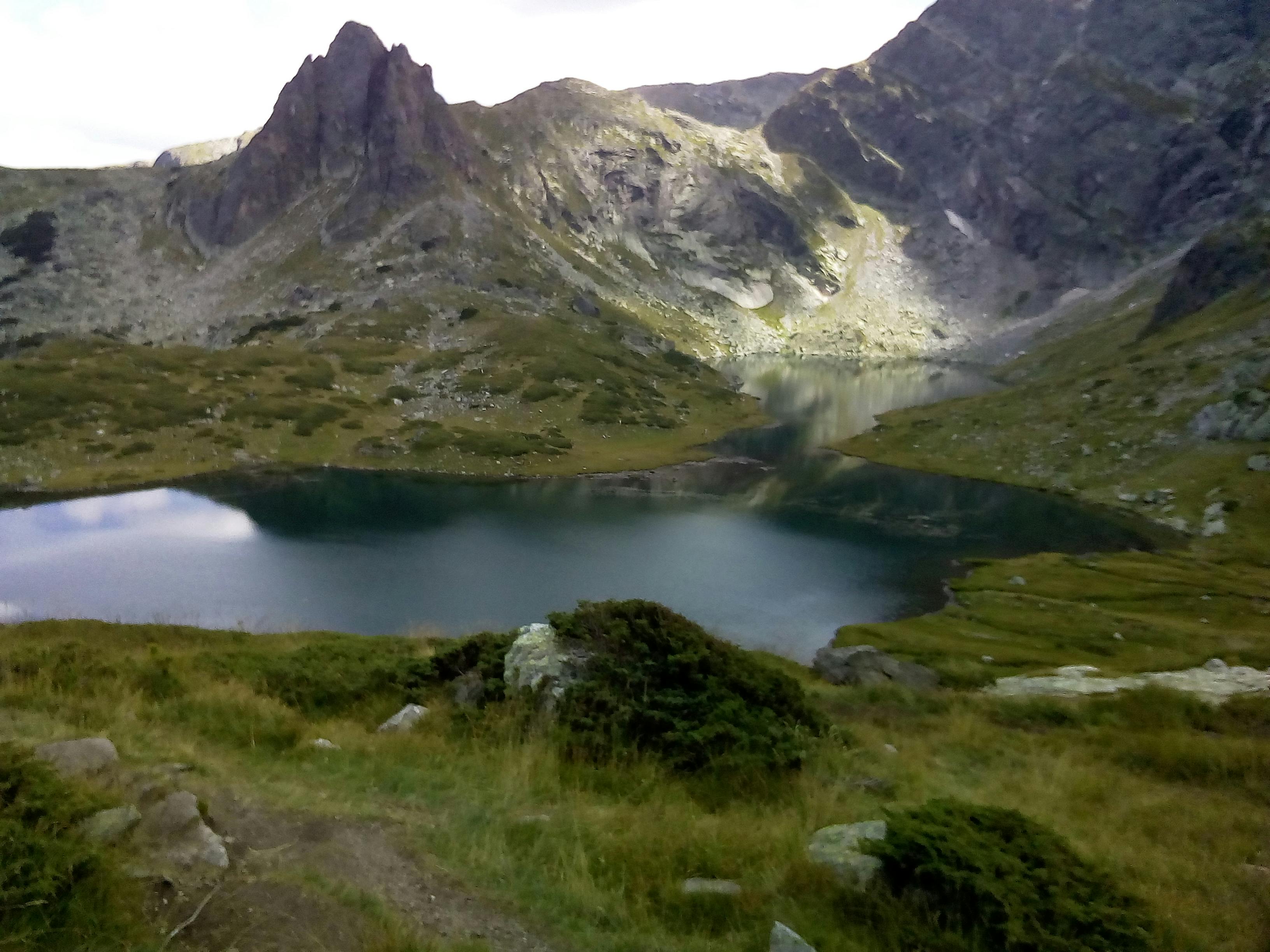
High in the Rila Mountains of southwestern Bulgaria lies one of the country’s most breathtaking natural treasures—the Seven Rila Lakes. Formed by ancient glaciers and arranged like a necklace across a dramatic alpine valley, these lakes captivate visitors with their crystal-clear waters, wildflower meadows, and panoramic views that feel almost otherworldly.
Whether you’re a nature lover, hiking enthusiast, or curious traveller seeking unforgettable landscapes, the Seven Rila Lakes offer a rejuvenating escape into some of Europe’s most stunning mountain scenery.
A Natural Masterpiece Sculpted by Ice
The Seven Rila Lakes are glacial lakes located between 2,100 and 2,500 meters above sea level. Each lake has its own shape, personality, and evocative name:
The Lower Lake (Dolnoto Ezero) – The lowest in elevation, where water flows out of the system.
The Fish Lake (Ribnoto Ezero) – Shallow and peaceful.
The Trefoil (Trilistnika) – Named for its three-lobed shape.
The Twin (Bliznaka) – The largest lake, divided into two parts.
The Kidney (Babreka) – Famous for its curved shape and dramatic surrounding cliffs.
The Eye (Okoto) – The deepest lake, with strikingly clear dark-blue water.
The Tear (Salzata) – The highest lake, known for its incredible clarity and breathtaking views.
Hikers often say standing at the Tear feels like standing on the edge of the world.
One of Bulgaria’s Most Beautiful Hikes
The Seven Rila Lakes trail is one of Bulgaria’s most popular hikes, but for good reason. The views span rugged peaks, glacial valleys, and endless sky. The terrain varies from gentle paths to steeper climbs, making it suitable for most active travellers.
How Difficult Is the Hike?
Moderate. Most routes take 4–6 hours round-trip, depending on your pace and chosen path.
Cable Car Access
Many visitors start from the Panichishte chairlift, which carries you close to the lakes and shortens the hiking time significantly.
October: Cooler temperatures and golden autumn colours.
Winter: Possible with a guide, but only for experienced hikers due to snow and ice.
A Place of Peace, Nature & Energy
Many locals believe the Seven Rila Lakes possess special spiritual energy. Every August, thousands gather here for the White Brotherhood Dance, celebrating nature, unity, and renewal.
Even if you don’t participate, the atmosphere is unmistakably serene—crisp alpine air, echoing silence, and the feeling of standing in a place shaped by time itself.
Self-Guided Tour to Rila Mountains and the Seven Rila Lakes from Sofia Bulgaria Self-guided tour to Rila Mountains and the Seven Rila Lakes from Sofia supports independent exploration while still providing structured digital guidance. Check current availability, inclusions and booking details before you go.
Seven Rila Lakes Full-Day Hiking Tour from Sofia – Outdoor Adventure Bulgaria Planning Seven Rila Lakes Full-Day Hiking Tour from Sofia – Outdoor Adventure For an outdoor adventure, compare the activity level, equipment and conditions with your fitness and confidence. Check current availability, inclusions and booking details before you go.
Kakadu National Park: Australia’s Ancient Wilderness
Kakadu National Park is the beating heart of Australia’s Top End — a vast, living landscape of waterfalls, wetlands, escarpments, and 65,000 years of continuous Aboriginal culture. Jointly managed by its Traditional Owners and Parks Australia, Kakadu covers nearly 20,000 square kilometres, making it the largest national park in Australia and a UNESCO World Heritage site for both its natural and cultural significance.
Getting There and Best Time to Visit
How to Get There
By car: About 150 km east of Darwin via the Arnhem Highway, around a 3-hour drive to the Bowali Visitor Centre near Jabiru.
By tour: Guided day or multi-day tours depart Darwin in the dry season, combining scenic highlights and cultural sites.
By air: Scenic flights from Darwin or Jabiru reveal wetlands, escarpments, and seasonal waterfalls.
When to Go
Dry season (May to October): Best for walking, swimming, and 4WD touring. Most roads open, steady waterfall flow.
Wet season (November to April): Green Season. Rains transform the park; wetlands teem with birdlife; dramatic storms are common.
Top Attractions in Kakadu
1. Ubirr Rock Art and Lookout
Some of the world’s best-preserved Aboriginal rock art. The top lookout surveys golden floodplains at sunset.
2. Nourlangie (Burrungkuy) Rock Art
Ancient shelters with vivid depictions of spirits, animals, and stories. Add the Anbangbang Billabong walk for mirrored escarpment views.
3. Jim Jim Falls and Twin Falls
Dry-season 4WD access to towering escarpment falls and crystal plunge pools. Rugged, rewarding, and iconic.
4. Yellow Water Billabong
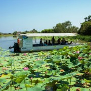
Dawn or sunset cruises near Cooinda for crocodiles, magpie geese, and jabirus reflected on still water.
5. Gunlom Falls
Famous natural rock pools at the top with panoramic views across savannah country. Check access conditions before you go.
6. Bowali Visitor Centre (Jabiru)
Start here for maps, safety updates, cultural interpretation, and trip planning advice.
Culture and Indigenous Heritage
Kakadu is Aboriginal land, home to the Bininj (north) and Mungguy (south) peoples. Rock art, Dreaming stories, and living traditions connect people and Country. Join ranger-led cultural walks, art tours, and seasonal events, and always respect sacred sites and signage.
Wildlife and Landscapes
Wetlands: Yellow Water and Mamukala are premier birdwatching locations with hundreds of species.
Escarpments: The Arnhem Land Plateau shelters wallabies, black cockatoos, and the shy rock python.
Rivers and billabongs: Freshwater and saltwater crocodiles occur. Obey crocodile safety signs at all times.
Savannah woodlands: Eucalypts, termite mounds, and cycads dominate the dry uplands.
Practical Tips and Safety
Park pass: Buy a Kakadu Park Pass online or at visitor centres.
Plan for distance: Kakadu is huge. Top up fuel early, carry extra water, check road reports.
Crocodile safety: Swim only where clearly signed safe. Many billabongs and rivers are off-limits.
4WD access: Jim Jim and Twin Falls are 4WD only in the dry. Hire a 4WD or join a tour if you lack experience.
Heat awareness: Start walks early. Rest in the middle of the day. Carry at least 2 L of water per person per hour on longer walks.
Kakadu FAQs
Do I need a 4WD to visit Kakadu?
Answer: Ubirr, Burrungkuy (Nourlangie), and Yellow Water are on sealed or graded roads, usually OK for 2WD. Jim Jim and Twin Falls require 4WD in the dry.
Can I swim in Kakadu?
Answer: Only in signed safe areas such as Gunlom upper pools or Maguk when open. Crocodiles are common elsewhere.
How long should I spend in Kakadu?
Answer: Two days for highlights; three to five days to include remote waterfalls and cultural tours.
When is the best time to visit?
Answer: May to October for access and hiking. November to April for dramatic storms, bursting wetlands, and fewer crowds.
Suggested 3-Day Kakadu Itinerary
Day 1 – Wetlands and Rock Art
Drive from Darwin via Fogg Dam or Adelaide River wetlands.
Visit Mamukala and Ubirr; sunset at Ubirr lookout.
Overnight in Jabiru or Cooinda.
Day 2 – Falls and Forests
Morning Yellow Water cruise.
Walk at Burrungkuy or around Anbangbang Billabong.
Optional 4WD to Maguk or Gunlom depending on conditions.
Day 3 – Culture and Return
Bowali Visitor Centre exhibits and trip planning.
Warradjan Cultural Centre near Cooinda.
Return to Darwin or continue toward Katherine.
Why Kakadu Belongs on Your Itinerary
Kakadu is a living story of Australia: ancient art, thunderous falls, crocodile-lined billabongs, and vast floodplains alive with birds. By 4WD, boat, or on foot, it connects you to the deep rhythms of the Top End.
Sponsored Popular Items
Quick take: Musement.com offers a worldwide selection of tours and attractions
Jabiru: Guided Flight over Kakadu National Park Australia Appreciate nature during this guided, fixed-wing flight over Kakadu National Park. Marvel at Kakadu's changing landscapes and dynamic ecosystems.
From Darwin: Kakadu National Park Day Tour with Cruise Australia Discover Kakadu National Park on a full day tour from Darwin. Admire stunning wildlife and lush floodplains, see ancient rock art, and enjoy an Aboriginal river cruise. Check current availability, inclusions and booking conditions.
Darwin: Sunset Kakadu National Park with Yellow Water Cruise Australia Discover Kakadu National Park on a sunset tour from Darwin featuring the award-winning Yellow Water River Cruise; witness stunning wildlife, birdlife, lush floodplains and ancient rock art Check current availability, inclusions and booking conditions.
Carved over eons in the red heart of Australia, **Kings Canyon** lies within **Watarrka National Park** in the Northern Territory. Towering sandstone walls, hidden creeks, ancient cycads, and dramatic lookout points define this rugged landscape. Whether you’re here for the iconic rim hike or quiet rainforest pockets, Kings Canyon is a must-see on any Red Centre itinerary.
Getting There & Best Time to Visit
Where It Is
Kings Canyon is in Watarrka National Park, roughly **323 km southwest of Alice Springs**. :contentReference[oaicite:0]{index=0} It sits at the western end of the George Gill Range. :contentReference[oaicite:1]{index=1}
How to Drive There
From Alice Springs: via Stuart → Lasseter → Luritja Road (all sealed). :contentReference[oaicite:2]{index=2}
From Uluru / Yulara: about 310 km via Lasseter Highway then Luritja Road. :contentReference[oaicite:3]{index=3}
Optional route: the Mereenie Loop (4WD track) connects West MacDonnell to Kings Canyon; a permit is required. :contentReference[oaicite:4]{index=4}
When to Visit
May to October: Cooler, pleasant walking conditions. Many hikers prefer this as the prime season. :contentReference[oaicite:5]{index=5}
November to April: Hot season; high heat risk. Walks like the Rim Walk may be closed or discouraged during midday. :contentReference[oaicite:6]{index=6}
Avoid the midday sun and plan for early morning starts. :contentReference[oaicite:7]{index=7}
Top Walks & Features
Rim Walk (6 km loop, ~3–4 hours)
The most famous walk. It begins with a steep “Heart Attack Hill” climb, then follows the canyon rim, circles through the Garden of Eden waterhole, and passes sandstone domes dubbed the “Lost City.” :contentReference[oaicite:8]{index=8}
This walk is graded “difficult to moderate” (Grade 4), with the initial section being the hardest. :contentReference[oaicite:9]{index=9}
King’s Creek Walk (2.6 km return, ~1 hour)
An easier, lower-level walk along the canyon floor. You’ll see towering walls from below, native plants, and rugged terrain without the climb. :contentReference[oaicite:10]{index=10}
South Wall Return (4.8 km return, ~2 hours)
This route climbs partway to the canyon rim and returns via the south wall for different vantage points. Moderate difficulty. :contentReference[oaicite:11]{index=11}
Kathleen Springs Walk (2.4 km return, ~1.5 hours)
A gentle walk along a sealed path to a spring-fed waterhole, with interpretive signage and less strenuous terrain, often accessible to many visitors. :contentReference[oaicite:12]{index=12}
Giles Track (22 km between Kings Canyon & Kathleen Springs)
For adventurous hikers, this trail links the canyon to Kathleen Springs. It’s typically walked over multiple days. :contentReference[oaicite:13]{index=13}
Flora, Fauna & Geology
Geological Layers
The canyon cuts through two sandstone layers: the **Mereenie Sandstone** (about 400 million years old) above, and the older **Carmichael Sandstone** (~440 million years) beneath. :contentReference[oaicite:14]{index=14}
A thin shale/mudstone layer sits between them, marking ancient environmental shifts. :contentReference[oaicite:15]{index=15}
Plants & Animals
Over 750 plants recorded in the park; some 60 species are rare or relict. :contentReference[oaicite:16]{index=16}
Notable plants include cycads, palms in sheltered gorges, ferns, eucalypts, acacia. :contentReference[oaicite:17]{index=17}
Wildlife includes birds (honeyeaters, kestrels, spinifex pigeons), reptiles (perentie, ring-tailed dragons), and sometimes dingoes. :contentReference[oaicite:18]{index=18}
Practical Tips & Safety
Best Time of Day
Begin the Rim Walk at sunrise to avoid heat, and to catch golden light on canyon walls. Midday is harsh and many visitors avoid walking then. :contentReference[oaicite:19]{index=19}
Essentials to Pack
At least 1.5–2 L of water per person
Sun protection: hat, sunglasses, sunscreen
Good walking shoes or boots
Light layers (mornings get cold, midday intense sun)
First aid, insect repellent, camera
Walk Closures & Conditions
During extreme heat, the Rim Walk may be closed for safety. Always check with park rangers or the National Park website before heading out. :contentReference[oaicite:20]{index=20}
Respect Cultural Sites
Watarrka lies in Luritja and Arrernte Country. Some parts of the park are sacred, and certain waterholes or rock art are off-limits. Follow signage and guidance. :contentReference[oaicite:21]{index=21}
Suggested 2–3 Day Itineraries
2 Days: Rim & Creek
Day 1: Arrive mid-morning, hike the Rim Walk at sunrise or via early start.
Day 2: Do the Creek Walk or Kathleen Springs, then depart via Kings Creek Station or back toward Uluru. :contentReference[oaicite:22]{index=22}
3 Days: Add the Loop & Cultural Insights
Day 1: Rim Walk, sunset at the canyon edge.
Day 2: Creek Walk, South Wall return, or partial Giles Track segment.
Day 3: Scenic drive to Kathleen Springs, or connect on a Red Centre route to Uluru or Alice Springs. :contentReference[oaicite:23]{index=23}
Why Kings Canyon Deserves a Spot on Your Outback Journey
Among the red deserts of Central Australia, Kings Canyon is a dramatic gorge that reveals hidden pockets of life, from deep green waterholes to ancient cycads and wind-sculpted domes. It’s a place of contrasts: rugged cliffs paired with sheltered garden-like oases. For walkers, it’s an unforgettable vertical journey through time and terrain.
Sponsored Popular Items
Quick take: Musement.com offers a worldwide selection of tours and attractions
Northern Territory: Corroboree Billabong Nature Cruises Australia Only 90 minutes from Darwin is a nature lover's paradise and a wetland experience not to be missed. Get up close and personal to an abundance of wildlife in their natural environment… Check current availability, inclusions and booking conditions.
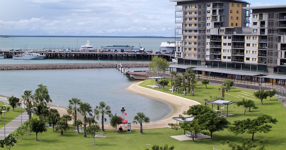
Darwin Northern Territory Visitor Guide: Attractions, Tours & Local Experiences Australia The best things to do in Darwin Northern Territory Darwin is a vibrant tropical city blending Indigenous culture, World War II history, and stunning waterfront scenery. Check current availability, inclusions and booking details before you go.
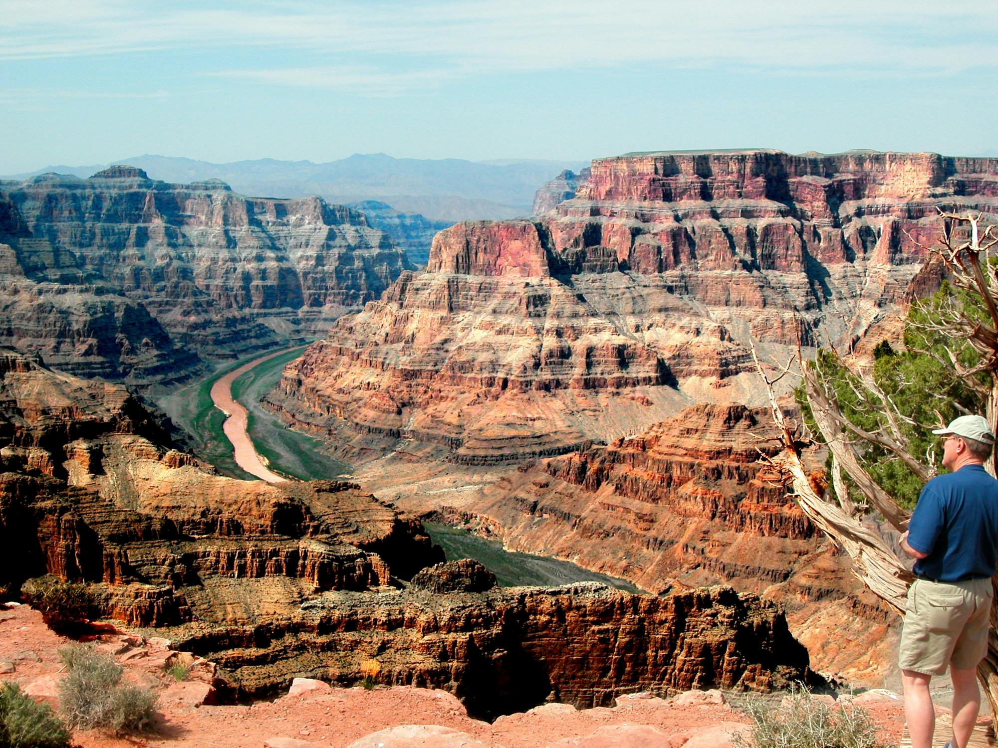
Indian Territory Grand Canyon West Tour from Las Vegas – Guided Tour United States Indian Territory Grand Canyon West tour from Las Vegas is a convenient way to add structure, local context and purposeful sightseeing to the itinerary. Check current availability, inclusions and booking details before you go.
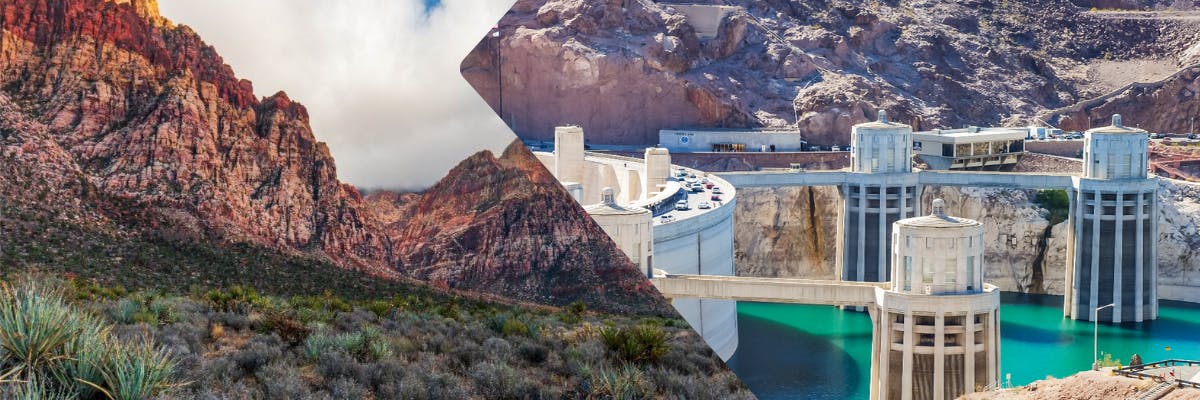
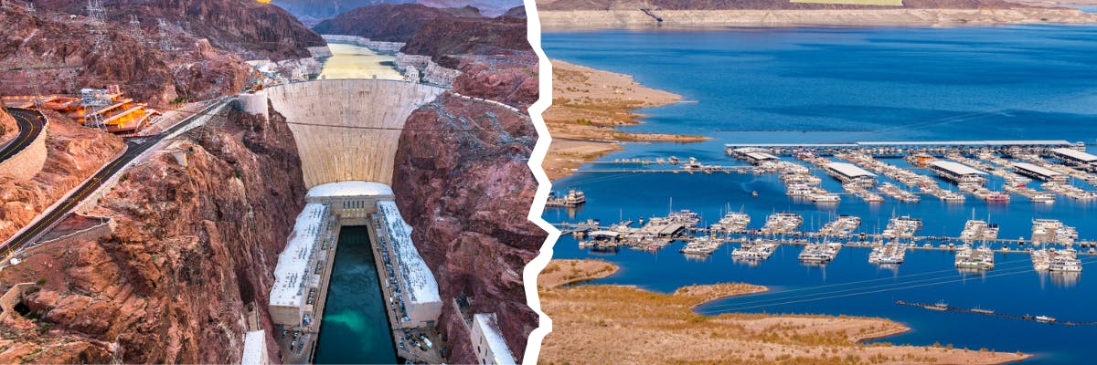
Discover Hoover Dam and Red Rock Canyon Self-Guided Driving Audio Tour museums, galleries, landmarks, parks, food culture, and hidden gems with practical tips
Sponsored Popular Items
Quick take: Musement.com offers a worldwide selection of tours and attractions
Why Visit Hoover Dam and Red Rock Canyon Self-Guided Driving Audio Tour USD 24.99
Hoover Dam and Red Rock Canyon Self-Guided Driving Audio Tour USD 24.99 blends history, culture, and everyday life in a way that rewards slow exploration. Travellers find a mix of museums, lively streets, and neighbourhood charm.
From landmark architecture to green spaces and local markets, the city offers a balanced itinerary for first-time visitors and repeat travellers alike.
History & Heritage Museums
Hoover Dam and Red Rock Canyon Self-Guided Driving Audio Tour USD 24.99’s museums help you step through the region’s timeline with clear exhibits and well-curated collections. Expect artifacts, multimedia displays, and concise interpretation panels.
Most venues are walkable or connected by public transport, and many offer audio guides or rotating exhibitions that spotlight local stories alongside global context.
Art Galleries & Cultural Spaces
Creative hubs in Hoover Dam and Red Rock Canyon Self-Guided Driving Audio Tour USD 24.99 highlight classical works, contemporary installations, and community projects under one skyline. Small studios sit alongside established galleries.
Look for temporary shows, evening openings, and cultural centres where workshops, talks, and performances make art approachable and engaging for all visitors.
Science & Innovation Centers
Interactive science spaces introduce technology, nature, and engineering through hands-on exhibits. Families appreciate zones designed for curious minds at different ages.
Expect live demos, observatories or labs, and special programming during weekends or holidays that turn complex ideas into memorable experiences.
Landmarks & Architecture
Hoover Dam and Red Rock Canyon Self-Guided Driving Audio Tour USD 24.99 combines historic façades with modern silhouettes. Prominent squares, monuments, and skyline viewpoints help orient your footsteps across the city.
Architectural walks reveal different eras side by side, while guided tours unpack details you might otherwise miss, from craftsmanship to city-planning decisions.
Family Attractions
Parks with playgrounds, small zoos or aquariums, and light-touch museums make planning with kids straightforward. Many sites include cafés, shade, and stroller-friendly paths.
Pick attractions with short dwell times and nearby rest stops, then layer in one larger activity—like a scenic ride, boat trip, or theme exhibit—per day.
Parks & Promenades
Green belts, riverside walks, and hilltop lookouts provide fresh air between museum visits. Morning jogs and sunset strolls show a quieter side of the city.
Wayfinding is generally intuitive; look for signed trails and public gardens with seasonal blooms, sculptures, and benches for unhurried breaks.
Food & Culture Highlights
Food in Hoover Dam and Red Rock Canyon Self-Guided Driving Audio Tour USD 24.99 reflects regional produce and neighbourhood traditions. Markets offer quick tastings, while casual eateries and bakeries keep schedules flexible.
Consider a short food walk to sample local staples, sweets, or street snacks. Reserve popular spots early for weekends and arrive mid-week for calmer dining rooms.
Local Favorites & Hidden Gems
Beyond main streets, residential quarters hide pocket parks, indie bookshops, and family-run cafés. Small museums and community theatres reward curious detours.
Chat with locals for tips on viewpoint alleys, quiet courtyards, and seasonal events—simple moments that often become the highlight of a visit.
Travel Tips
Use a reloadable transit card or day pass; many sights cluster by district, making it easy to group stops. Comfortable walking shoes are essential on mixed surfaces.
Check opening days and timed-entry policies, especially on Mondays and public holidays. Carry a refillable bottle and light layers for changeable weather.
Final Thoughts
Hoover Dam and Red Rock Canyon Self-Guided Driving Audio Tour USD 24.99 invites you to balance headline attractions with slow, local moments. Pace your days, follow your interests, and give each neighbourhood time to breathe.
With thoughtful planning and an open schedule, you’ll leave with a clear sense of place—and reasons to return.
Sponsored Popular Items
Quick take: Musement.com offers a worldwide selection of tours and attractions
Grand Canyon West Rim and Hoover Dam Combo Tour – Las Vegas Guided Tour United States Grand Canyon West Rim and Hoover Dam combo tour is a convenient way to add structure, local context and purposeful sightseeing to the itinerary. Check current availability, inclusions and booking details before you go.
Hoover Dam and Lake Mead Self-Guided Driving Audio Tour - Self-Guided Experience Hoover Dam and Lake Mead Self-Guided Driving Audio Tour combines independent exploration with recorded commentary, allowing travellers to discover Las Vegas at their own pace. Check current availability, inclusions and booking details before you go.
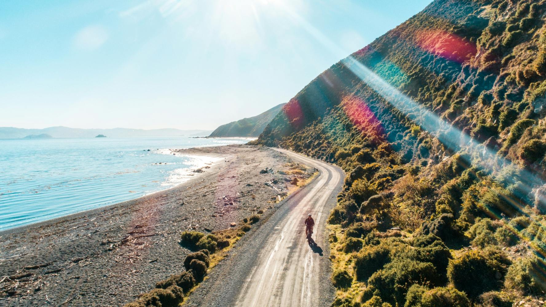
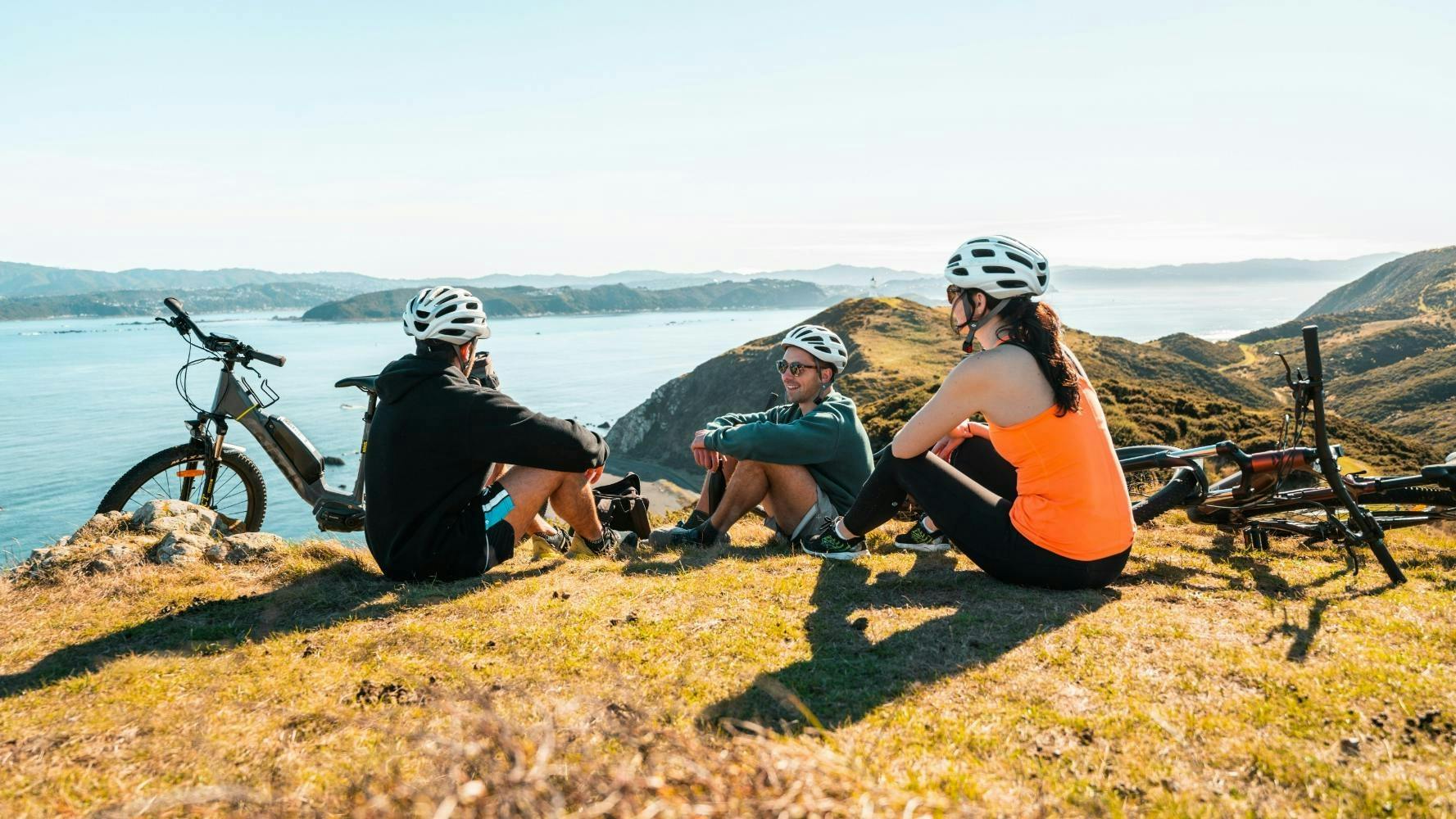
Discover 4-Hour Mountain Bike Hire in Pencarrow museums, galleries, landmarks, parks, food culture, and hidden gems with practical tips for an easy, engaging
Sponsored Popular Items
Quick take: Musement.com offers a worldwide selection of tours and attractions
Pencarrow 4-Hour Mountain Bike Hire Travellers who value local context and an organised route may find 4-Hour Mountain Bike Hire in Pencarrow a practical addition to a visit to Wellington. Check current availability, inclusions and booking details before you go.
Why Visit 4-Hour Mountain Bike Hire in Pencarrow USD 36
4-Hour Mountain Bike Hire in Pencarrow USD 36 blends history, culture, and everyday life in a way that rewards slow exploration. Travellers find a mix of museums, lively streets, and neighbourhood charm.
From landmark architecture to green spaces and local markets, the city offers a balanced itinerary for first-time visitors and repeat travellers alike.
History & Heritage Museums
4-Hour Mountain Bike Hire in Pencarrow USD 36’s museums help you step through the region’s timeline with clear exhibits and well-curated collections. Expect artifacts, multimedia displays, and concise interpretation panels.
Most venues are walkable or connected by public transport, and many offer audio guides or rotating exhibitions that spotlight local stories alongside global context.
Art Galleries & Cultural Spaces
Creative hubs in 4-Hour Mountain Bike Hire in Pencarrow USD 36 highlight classical works, contemporary installations, and community projects under one skyline. Small studios sit alongside established galleries.
Look for temporary shows, evening openings, and cultural centres where workshops, talks, and performances make art approachable and engaging for all visitors.
Science & Innovation Centers
Interactive science spaces introduce technology, nature, and engineering through hands-on exhibits. Families appreciate zones designed for curious minds at different ages.
Expect live demos, observatories or labs, and special programming during weekends or holidays that turn complex ideas into memorable experiences.
Landmarks & Architecture
4-Hour Mountain Bike Hire in Pencarrow USD 36 combines historic façades with modern silhouettes. Prominent squares, monuments, and skyline viewpoints help orient your footsteps across the city.
Architectural walks reveal different eras side by side, while guided tours unpack details you might otherwise miss, from craftsmanship to city-planning decisions.
Family Attractions
Parks with playgrounds, small zoos or aquariums, and light-touch museums make planning with kids straightforward. Many sites include cafés, shade, and stroller-friendly paths.
Pick attractions with short dwell times and nearby rest stops, then layer in one larger activity—like a scenic ride, boat trip, or theme exhibit—per day.
Parks & Promenades
Green belts, riverside walks, and hilltop lookouts provide fresh air between museum visits. Morning jogs and sunset strolls show a quieter side of the city.
Wayfinding is generally intuitive; look for signed trails and public gardens with seasonal blooms, sculptures, and benches for unhurried breaks.
Food & Culture Highlights
Food in 4-Hour Mountain Bike Hire in Pencarrow USD 36 reflects regional produce and neighbourhood traditions. Markets offer quick tastings, while casual eateries and bakeries keep schedules flexible.
Consider a short food walk to sample local staples, sweets, or street snacks. Reserve popular spots early for weekends and arrive mid-week for calmer dining rooms.
Local Favorites & Hidden Gems
Beyond main streets, residential quarters hide pocket parks, indie bookshops, and family-run cafés. Small museums and community theatres reward curious detours.
Chat with locals for tips on viewpoint alleys, quiet courtyards, and seasonal events—simple moments that often become the highlight of a visit.
Travel Tips
Use a reloadable transit card or day pass; many sights cluster by district, making it easy to group stops. Comfortable walking shoes are essential on mixed surfaces.
Check opening days and timed-entry policies, especially on Mondays and public holidays. Carry a refillable bottle and light layers for changeable weather.
Final Thoughts
4-Hour Mountain Bike Hire in Pencarrow USD 36 invites you to balance headline attractions with slow, local moments. Pace your days, follow your interests, and give each neighbourhood time to breathe.
With thoughtful planning and an open schedule, you’ll leave with a clear sense of place—and reasons to return.
Sponsored Popular Items
Quick take: Musement.com offers a worldwide selection of tours and attractions
Pencarrow 4-Hour Mountain Bike Hire Travellers who value local context and an organised route may find 4-Hour Mountain Bike Hire in Pencarrow a practical addition to a visit to Wellington. Check current availability, inclusions and booking details before you go.
4-Hour E-Bike Hire in Pencarrow - Outdoor Adventure 4-Hour E-Bike Hire in Pencarrow offers a structured way to discover more of Wellington without having to organise every detail independently. Check current availability, inclusions and booking details before you go.
Cairns: Pontoon Boat Hire with Optional BBQ and Fishing Hire Australia Hire a pontoon boat in Cairns and cruise Trinity Inlet at your own pace. Perfect for sightseeing or fishing, with optional BBQ and fishing gear to complete your day on the water. Check current availability, inclusions and booking conditions.
Discover Private Las Vegas and Red Rock Canyon half day sidecar tour museums, galleries, landmarks, parks, food culture, and hidden gems with practical
Sponsored Popular Items
Quick take: Musement.com offers a worldwide selection of tours and attractions
Why Visit Private Las Vegas and Red Rock Canyon half day sidecar tour USD 624
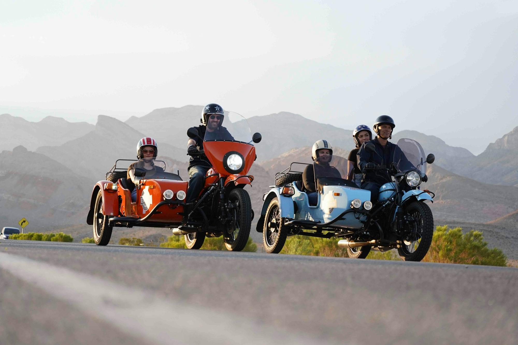
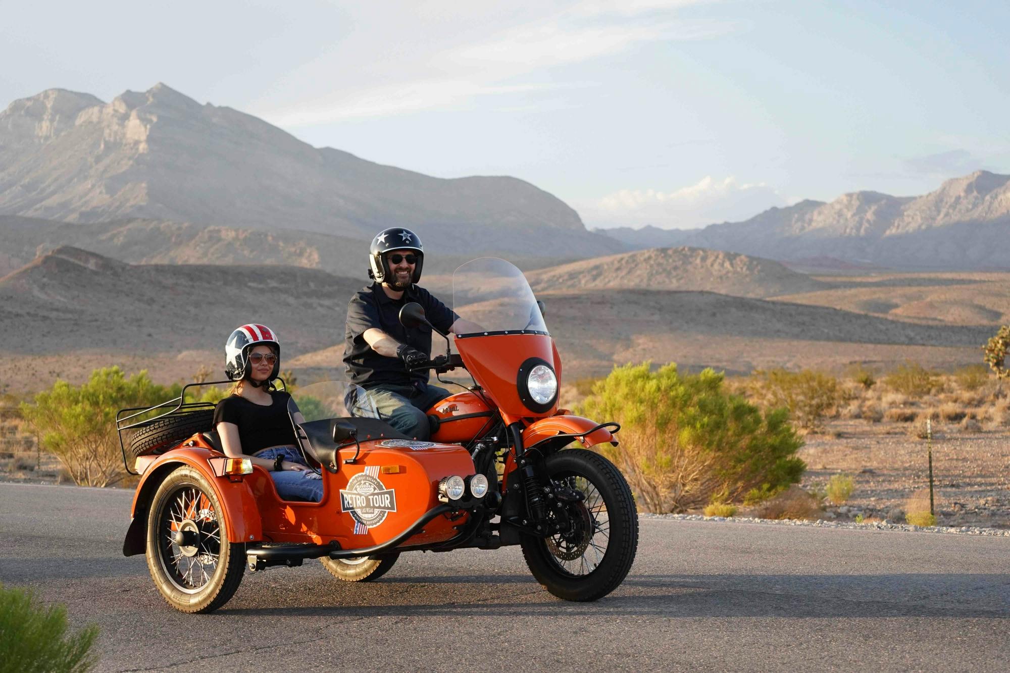
Private Las Vegas and Red Rock Canyon half day sidecar tour USD 624 blends history, culture, and everyday life in a way that rewards slow exploration. Travellers find a mix of museums, lively streets, and neighbourhood charm.
From landmark architecture to green spaces and local markets, the city offers a balanced itinerary for first-time visitors and repeat travellers alike.
History & Heritage Museums
Private Las Vegas and Red Rock Canyon half day sidecar tour USD 624’s museums help you step through the region’s timeline with clear exhibits and well-curated collections. Expect artifacts, multimedia displays, and concise interpretation panels.
Most venues are walkable or connected by public transport, and many offer audio guides or rotating exhibitions that spotlight local stories alongside global context.
Art Galleries & Cultural Spaces
Creative hubs in Private Las Vegas and Red Rock Canyon half day sidecar tour USD 624 highlight classical works, contemporary installations, and community projects under one skyline. Small studios sit alongside established galleries.
Look for temporary shows, evening openings, and cultural centres where workshops, talks, and performances make art approachable and engaging for all visitors.
Science & Innovation Centers
Interactive science spaces introduce technology, nature, and engineering through hands-on exhibits. Families appreciate zones designed for curious minds at different ages.
Expect live demos, observatories or labs, and special programming during weekends or holidays that turn complex ideas into memorable experiences.
Landmarks & Architecture
Private Las Vegas and Red Rock Canyon half day sidecar tour USD 624 combines historic façades with modern silhouettes. Prominent squares, monuments, and skyline viewpoints help orient your footsteps across the city.
Architectural walks reveal different eras side by side, while guided tours unpack details you might otherwise miss, from craftsmanship to city-planning decisions.
Family Attractions
Parks with playgrounds, small zoos or aquariums, and light-touch museums make planning with kids straightforward. Many sites include cafés, shade, and stroller-friendly paths.
Pick attractions with short dwell times and nearby rest stops, then layer in one larger activity—like a scenic ride, boat trip, or theme exhibit—per day.
Parks & Promenades
Green belts, riverside walks, and hilltop lookouts provide fresh air between museum visits. Morning jogs and sunset strolls show a quieter side of the city.
Wayfinding is generally intuitive; look for signed trails and public gardens with seasonal blooms, sculptures, and benches for unhurried breaks.
Food & Culture Highlights
Food in Private Las Vegas and Red Rock Canyon half day sidecar tour USD 624 reflects regional produce and neighbourhood traditions. Markets offer quick tastings, while casual eateries and bakeries keep schedules flexible.
Consider a short food walk to sample local staples, sweets, or street snacks. Reserve popular spots early for weekends and arrive mid-week for calmer dining rooms.
Local Favorites & Hidden Gems
Beyond main streets, residential quarters hide pocket parks, indie bookshops, and family-run cafés. Small museums and community theatres reward curious detours.
Chat with locals for tips on viewpoint alleys, quiet courtyards, and seasonal events—simple moments that often become the highlight of a visit.
Travel Tips
Use a reloadable transit card or day pass; many sights cluster by district, making it easy to group stops. Comfortable walking shoes are essential on mixed surfaces.
Check opening days and timed-entry policies, especially on Mondays and public holidays. Carry a refillable bottle and light layers for changeable weather.
Final Thoughts
Private Las Vegas and Red Rock Canyon half day sidecar tour USD 624 invites you to balance headline attractions with slow, local moments. Pace your days, follow your interests, and give each neighbourhood time to breathe.
With thoughtful planning and an open schedule, you’ll leave with a clear sense of place—and reasons to return.
Sponsored Popular Items
Quick take: Musement.com offers a worldwide selection of tours and attractions
Valley of Fire and Lake Mead Full-Day Sidecar Tour from Las Vegas - Guided Tour Valley of Fire and Lake Mead full day sidecar tour from Las Vegas brings the main theme of the experience into one planned outing, making it easier to use limited time in Las Vegas well. Check current availability, inclusions and booking details before you go.
Private Two-Hour Sidecar Tour of Las Vegas Nightlife - Guided Sightseeing Tour Private two-hour sidecar tour of Las Vegas nightlife brings the main theme of the experience into one planned outing, making it easier to use limited time in Las Vegas well. Check current availability, inclusions and booking details before you go.
Discover Blue Mountains Waterfalls Full-Day Tour from Sydney museums, galleries, landmarks, parks, food culture, and hidden gems with practical tips for an easy,
Sponsored Popular Items
Quick take: Musement.com offers a worldwide selection of tours and attractions
Why Visit Blue Mountains Waterfalls Full-Day Tour from Sydney USD 185
Blue Mountains Waterfalls Full-Day Tour from Sydney USD 185 blends history, culture, and everyday life in a way that rewards slow exploration. Travellers find a mix of museums, lively streets, and neighbourhood charm.
From landmark architecture to green spaces and local markets, the city offers a balanced itinerary for first-time visitors and repeat travellers alike.
History & Heritage Museums
Blue Mountains Waterfalls Full-Day Tour from Sydney USD 185’s museums help you step through the region’s timeline with clear exhibits and well-curated collections. Expect artifacts, multimedia displays, and concise interpretation panels.
Most venues are walkable or connected by public transport, and many offer audio guides or rotating exhibitions that spotlight local stories alongside global context.
Art Galleries & Cultural Spaces
Creative hubs in Blue Mountains Waterfalls Full-Day Tour from Sydney USD 185 highlight classical works, contemporary installations, and community projects under one skyline. Small studios sit alongside established galleries.
Look for temporary shows, evening openings, and cultural centres where workshops, talks, and performances make art approachable and engaging for all visitors.
Science & Innovation Centers
Interactive science spaces introduce technology, nature, and engineering through hands-on exhibits. Families appreciate zones designed for curious minds at different ages.
Expect live demos, observatories or labs, and special programming during weekends or holidays that turn complex ideas into memorable experiences.
Landmarks & Architecture
Blue Mountains Waterfalls Full-Day Tour from Sydney USD 185 combines historic façades with modern silhouettes. Prominent squares, monuments, and skyline viewpoints help orient your footsteps across the city.
Architectural walks reveal different eras side by side, while guided tours unpack details you might otherwise miss, from craftsmanship to city-planning decisions.
Family Attractions
Parks with playgrounds, small zoos or aquariums, and light-touch museums make planning with kids straightforward. Many sites include cafés, shade, and stroller-friendly paths.
Pick attractions with short dwell times and nearby rest stops, then layer in one larger activity—like a scenic ride, boat trip, or theme exhibit—per day.
Parks & Promenades
Green belts, riverside walks, and hilltop lookouts provide fresh air between museum visits. Morning jogs and sunset strolls show a quieter side of the city.
Wayfinding is generally intuitive; look for signed trails and public gardens with seasonal blooms, sculptures, and benches for unhurried breaks.
Food & Culture Highlights
Food in Blue Mountains Waterfalls Full-Day Tour from Sydney USD 185 reflects regional produce and neighbourhood traditions. Markets offer quick tastings, while casual eateries and bakeries keep schedules flexible.
Consider a short food walk to sample local staples, sweets, or street snacks. Reserve popular spots early for weekends and arrive mid-week for calmer dining rooms.
Local Favorites & Hidden Gems
Beyond main streets, residential quarters hide pocket parks, indie bookshops, and family-run cafés. Small museums and community theatres reward curious detours.
Chat with locals for tips on viewpoint alleys, quiet courtyards, and seasonal events—simple moments that often become the highlight of a visit.
Travel Tips
Use a reloadable transit card or day pass; many sights cluster by district, making it easy to group stops. Comfortable walking shoes are essential on mixed surfaces.
Check opening days and timed-entry policies, especially on Mondays and public holidays. Carry a refillable bottle and light layers for changeable weather.
Final Thoughts
Blue Mountains Waterfalls Full-Day Tour from Sydney USD 185 invites you to balance headline attractions with slow, local moments. Pace your days, follow your interests, and give each neighbourhood time to breathe.
With thoughtful planning and an open schedule, you’ll leave with a clear sense of place—and reasons to return.
Sponsored Popular Items
Quick take: Musement.com offers a worldwide selection of tours and attractions
Fullday Excursion to Mont Saint-Michel from Paris France Fullday excursion to Mont Saint-Michel from Paris is a convenient way to add structure, local context and purposeful sightseeing to the itinerary. Check current availability, inclusions and booking details before you go.
Discover Saguaro National Park Self-Guided Driving Audio Tour museums, galleries, landmarks, parks, food culture, and hidden gems with practical tips for an easy,
Sponsored Popular Items
Quick take: Musement.com offers a worldwide selection of tours and attractions
Audio-Guided Driving Tour to Saguaro National Park United States Planning Audio-Guided Driving Tour to Saguaro National Park For a guided sightseeing experience, compare the itinerary and logistics so the tour fits comfortably with the rest of your plans. Check current availability, inclusions and booking details before you go.
Why Visit Saguaro National Park Self-Guided Driving Audio Tour USD 16.99
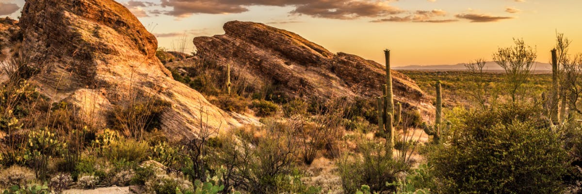
Saguaro National Park Self-Guided Driving Audio Tour USD 16.99 blends history, culture, and everyday life in a way that rewards slow exploration. Travellers find a mix of museums, lively streets, and neighbourhood charm.
From landmark architecture to green spaces and local markets, the city offers a balanced itinerary for first-time visitors and repeat travellers alike.
History & Heritage Museums
Saguaro National Park Self-Guided Driving Audio Tour USD 16.99’s museums help you step through the region’s timeline with clear exhibits and well-curated collections. Expect artifacts, multimedia displays, and concise interpretation panels.
Most venues are walkable or connected by public transport, and many offer audio guides or rotating exhibitions that spotlight local stories alongside global context.
Art Galleries & Cultural Spaces
Creative hubs in Saguaro National Park Self-Guided Driving Audio Tour USD 16.99 highlight classical works, contemporary installations, and community projects under one skyline. Small studios sit alongside established galleries.
Look for temporary shows, evening openings, and cultural centres where workshops, talks, and performances make art approachable and engaging for all visitors.
Science & Innovation Centers
Interactive science spaces introduce technology, nature, and engineering through hands-on exhibits. Families appreciate zones designed for curious minds at different ages.
Expect live demos, observatories or labs, and special programming during weekends or holidays that turn complex ideas into memorable experiences.
Landmarks & Architecture
Saguaro National Park Self-Guided Driving Audio Tour USD 16.99 combines historic façades with modern silhouettes. Prominent squares, monuments, and skyline viewpoints help orient your footsteps across the city.
Architectural walks reveal different eras side by side, while guided tours unpack details you might otherwise miss, from craftsmanship to city-planning decisions.
Family Attractions
Parks with playgrounds, small zoos or aquariums, and light-touch museums make planning with kids straightforward. Many sites include cafés, shade, and stroller-friendly paths.
Pick attractions with short dwell times and nearby rest stops, then layer in one larger activity—like a scenic ride, boat trip, or theme exhibit—per day.
Parks & Promenades
Green belts, riverside walks, and hilltop lookouts provide fresh air between museum visits. Morning jogs and sunset strolls show a quieter side of the city.
Wayfinding is generally intuitive; look for signed trails and public gardens with seasonal blooms, sculptures, and benches for unhurried breaks.
Food & Culture Highlights
Food in Saguaro National Park Self-Guided Driving Audio Tour USD 16.99 reflects regional produce and neighbourhood traditions. Markets offer quick tastings, while casual eateries and bakeries keep schedules flexible.
Consider a short food walk to sample local staples, sweets, or street snacks. Reserve popular spots early for weekends and arrive mid-week for calmer dining rooms.
Local Favorites & Hidden Gems
Beyond main streets, residential quarters hide pocket parks, indie bookshops, and family-run cafés. Small museums and community theatres reward curious detours.
Chat with locals for tips on viewpoint alleys, quiet courtyards, and seasonal events—simple moments that often become the highlight of a visit.
Travel Tips
Use a reloadable transit card or day pass; many sights cluster by district, making it easy to group stops. Comfortable walking shoes are essential on mixed surfaces.
Check opening days and timed-entry policies, especially on Mondays and public holidays. Carry a refillable bottle and light layers for changeable weather.
Final Thoughts
Saguaro National Park Self-Guided Driving Audio Tour USD 16.99 invites you to balance headline attractions with slow, local moments. Pace your days, follow your interests, and give each neighbourhood time to breathe.
With thoughtful planning and an open schedule, you’ll leave with a clear sense of place—and reasons to return.
Sponsored Popular Items
Quick take: Musement.com offers a worldwide selection of tours and attractions
Audio-Guided Driving Tour to Saguaro National Park United States Planning Audio-Guided Driving Tour to Saguaro National Park For a guided sightseeing experience, compare the itinerary and logistics so the tour fits comfortably with the rest of your plans. Check current availability, inclusions and booking details before you go.
Saguaro National Park Self-Guided Driving Audio Tour - Self-Guided Experience Saguaro National Park Self-Guided Driving Audio Tour combines independent exploration with recorded commentary, allowing travellers to discover Tucson at their own pace. Check current availability, inclusions and booking details before you go.
Discover Šibenik, Krka National Park and Primošten bus tour museums, galleries, landmarks, parks, food culture, and hidden gems with practical tips for an
Sponsored Popular Items
Quick take: Musement.com offers a worldwide selection of tours and attractions
Why Visit Šibenik, Krka National Park and Primošten bus tour USD 47
Šibenik, Krka National Park and Primošten bus tour USD 47 blends history, culture, and everyday life in a way that rewards slow exploration. Travellers find a mix of museums, lively streets, and neighbourhood charm.
From landmark architecture to green spaces and local markets, the city offers a balanced itinerary for first-time visitors and repeat travellers alike.
History & Heritage Museums
Šibenik, Krka National Park and Primošten bus tour USD 47’s museums help you step through the region’s timeline with clear exhibits and well-curated collections. Expect artifacts, multimedia displays, and concise interpretation panels.
Most venues are walkable or connected by public transport, and many offer audio guides or rotating exhibitions that spotlight local stories alongside global context.
Art Galleries & Cultural Spaces
Creative hubs in Šibenik, Krka National Park and Primošten bus tour USD 47 highlight classical works, contemporary installations, and community projects under one skyline. Small studios sit alongside established galleries.
Look for temporary shows, evening openings, and cultural centres where workshops, talks, and performances make art approachable and engaging for all visitors.
Science & Innovation Centers
Interactive science spaces introduce technology, nature, and engineering through hands-on exhibits. Families appreciate zones designed for curious minds at different ages.
Expect live demos, observatories or labs, and special programming during weekends or holidays that turn complex ideas into memorable experiences.
Landmarks & Architecture
Šibenik, Krka National Park and Primošten bus tour USD 47 combines historic façades with modern silhouettes. Prominent squares, monuments, and skyline viewpoints help orient your footsteps across the city.
Architectural walks reveal different eras side by side, while guided tours unpack details you might otherwise miss, from craftsmanship to city-planning decisions.
Family Attractions
Parks with playgrounds, small zoos or aquariums, and light-touch museums make planning with kids straightforward. Many sites include cafés, shade, and stroller-friendly paths.
Pick attractions with short dwell times and nearby rest stops, then layer in one larger activity—like a scenic ride, boat trip, or theme exhibit—per day.
Parks & Promenades
Green belts, riverside walks, and hilltop lookouts provide fresh air between museum visits. Morning jogs and sunset strolls show a quieter side of the city.
Wayfinding is generally intuitive; look for signed trails and public gardens with seasonal blooms, sculptures, and benches for unhurried breaks.
Food & Culture Highlights
Food in Šibenik, Krka National Park and Primošten bus tour USD 47 reflects regional produce and neighbourhood traditions. Markets offer quick tastings, while casual eateries and bakeries keep schedules flexible.
Consider a short food walk to sample local staples, sweets, or street snacks. Reserve popular spots early for weekends and arrive mid-week for calmer dining rooms.
Local Favorites & Hidden Gems
Beyond main streets, residential quarters hide pocket parks, indie bookshops, and family-run cafés. Small museums and community theatres reward curious detours.
Chat with locals for tips on viewpoint alleys, quiet courtyards, and seasonal events—simple moments that often become the highlight of a visit.
Travel Tips
Use a reloadable transit card or day pass; many sights cluster by district, making it easy to group stops. Comfortable walking shoes are essential on mixed surfaces.
Check opening days and timed-entry policies, especially on Mondays and public holidays. Carry a refillable bottle and light layers for changeable weather.
Final Thoughts
Šibenik, Krka National Park and Primošten bus tour USD 47 invites you to balance headline attractions with slow, local moments. Pace your days, follow your interests, and give each neighbourhood time to breathe.
With thoughtful planning and an open schedule, you’ll leave with a clear sense of place—and reasons to return.
Sponsored Popular Items
Quick take: Musement.com offers a worldwide selection of tours and attractions
Krka Waterfalls Tour Sibenik with Transfer & Brunch Croatia Krka waterfalls tour with transfer and brunch places landscapes, habitats or wildlife at the centre of the experience. Check current availability, inclusions and booking details before you go.
Discover Jiufen night view, Shifen Waterfall and Raohe Market tour museums, galleries, landmarks, parks, food culture, and hidden gems with practical tips for
Sponsored Popular Items
Quick take: Musement.com offers a worldwide selection of tours and attractions
Jiufen Night View, Shifen Waterfall and Raohe Market Tour - Guided Sightseeing Tour Taiwan Travellers who value local context and an organised route may find Jiufen night view, Shifen Waterfall and Raohe Market tour a practical addition to a visit to Taipei. Check current availability, inclusions and booking details before you go.
Why Visit Jiufen night view, Shifen Waterfall and Raohe Market tour USD 36
Jiufen night view, Shifen Waterfall and Raohe Market tour USD 36 blends history, culture, and everyday life in a way that rewards slow exploration. Travellers find a mix of museums, lively streets, and neighbourhood charm.
From landmark architecture to green spaces and local markets, the city offers a balanced itinerary for first-time visitors and repeat travellers alike.
History & Heritage Museums
Jiufen night view, Shifen Waterfall and Raohe Market tour USD 36’s museums help you step through the region’s timeline with clear exhibits and well-curated collections. Expect artifacts, multimedia displays, and concise interpretation panels.
Most venues are walkable or connected by public transport, and many offer audio guides or rotating exhibitions that spotlight local stories alongside global context.
Art Galleries & Cultural Spaces
Creative hubs in Jiufen night view, Shifen Waterfall and Raohe Market tour USD 36 highlight classical works, contemporary installations, and community projects under one skyline. Small studios sit alongside established galleries.
Look for temporary shows, evening openings, and cultural centres where workshops, talks, and performances make art approachable and engaging for all visitors.
Science & Innovation Centers
Interactive science spaces introduce technology, nature, and engineering through hands-on exhibits. Families appreciate zones designed for curious minds at different ages.
Expect live demos, observatories or labs, and special programming during weekends or holidays that turn complex ideas into memorable experiences.
Landmarks & Architecture
Jiufen night view, Shifen Waterfall and Raohe Market tour USD 36 combines historic façades with modern silhouettes. Prominent squares, monuments, and skyline viewpoints help orient your footsteps across the city.
Architectural walks reveal different eras side by side, while guided tours unpack details you might otherwise miss, from craftsmanship to city-planning decisions.
Family Attractions
Parks with playgrounds, small zoos or aquariums, and light-touch museums make planning with kids straightforward. Many sites include cafés, shade, and stroller-friendly paths.
Pick attractions with short dwell times and nearby rest stops, then layer in one larger activity—like a scenic ride, boat trip, or theme exhibit—per day.
Parks & Promenades
Green belts, riverside walks, and hilltop lookouts provide fresh air between museum visits. Morning jogs and sunset strolls show a quieter side of the city.
Wayfinding is generally intuitive; look for signed trails and public gardens with seasonal blooms, sculptures, and benches for unhurried breaks.
Food & Culture Highlights
Food in Jiufen night view, Shifen Waterfall and Raohe Market tour USD 36 reflects regional produce and neighbourhood traditions. Markets offer quick tastings, while casual eateries and bakeries keep schedules flexible.
Consider a short food walk to sample local staples, sweets, or street snacks. Reserve popular spots early for weekends and arrive mid-week for calmer dining rooms.
Local Favorites & Hidden Gems
Beyond main streets, residential quarters hide pocket parks, indie bookshops, and family-run cafés. Small museums and community theatres reward curious detours.
Chat with locals for tips on viewpoint alleys, quiet courtyards, and seasonal events—simple moments that often become the highlight of a visit.
Travel Tips
Use a reloadable transit card or day pass; many sights cluster by district, making it easy to group stops. Comfortable walking shoes are essential on mixed surfaces.
Check opening days and timed-entry policies, especially on Mondays and public holidays. Carry a refillable bottle and light layers for changeable weather.
Final Thoughts
Jiufen night view, Shifen Waterfall and Raohe Market tour USD 36 invites you to balance headline attractions with slow, local moments. Pace your days, follow your interests, and give each neighbourhood time to breathe.
With thoughtful planning and an open schedule, you’ll leave with a clear sense of place—and reasons to return.
Sponsored Popular Items
Quick take: Musement.com offers a worldwide selection of tours and attractions
Jiufen Night View, Shifen Waterfall and Raohe Market Tour - Guided Sightseeing Tour Taiwan Travellers who value local context and an organised route may find Jiufen night view, Shifen Waterfall and Raohe Market tour a practical addition to a visit to Taipei. Check current availability, inclusions and booking details before you go.
Taipei: Jiufen View and Shifen Day Tour Taiwan Best deals for Taipei: Jiufen View and Shifen Day Tour. Explore the northeast coast of Taipei on a tour with a licensed guide. Feel the force of nature at Shifen Waterfall, launch a sky lantern from Shifen Old Street, and discover Jiufen. Available from getyourguide.com.
Taipei: Jiufen, Shifen Waterfall and Pingxi Sky Lantern Tour Taiwan Best deals for Taipei: Jiufen, Shifen Waterfall and Pingxi Sky Lantern Tour. Enjoy Northern Taiwan's beauty on a private half-day tour. Visit the Golden Waterfall, release a sky lantern in Pingxi, and explore Jiufen's historic streets. Available from getyourguide.com.
Discover Seattle And Olympic National Park Self-Guided Audio Tour museums, galleries, landmarks, parks, food culture, and hidden gems with practical tips for an
Sponsored Popular Items
Quick take: Musement.com offers a worldwide selection of tours and attractions
Why Visit Seattle And Olympic National Park Self-Guided Audio Tour USD 16.99
Seattle And Olympic National Park Self-Guided Audio Tour USD 16.99 blends history, culture, and everyday life in a way that rewards slow exploration. Travellers find a mix of museums, lively streets, and neighbourhood charm.
From landmark architecture to green spaces and local markets, the city offers a balanced itinerary for first-time visitors and repeat travellers alike.
History & Heritage Museums
Seattle And Olympic National Park Self-Guided Audio Tour USD 16.99’s museums help you step through the region’s timeline with clear exhibits and well-curated collections. Expect artifacts, multimedia displays, and concise interpretation panels.
Most venues are walkable or connected by public transport, and many offer audio guides or rotating exhibitions that spotlight local stories alongside global context.
Art Galleries & Cultural Spaces
Creative hubs in Seattle And Olympic National Park Self-Guided Audio Tour USD 16.99 highlight classical works, contemporary installations, and community projects under one skyline. Small studios sit alongside established galleries.
Look for temporary shows, evening openings, and cultural centres where workshops, talks, and performances make art approachable and engaging for all visitors.
Science & Innovation Centers
Interactive science spaces introduce technology, nature, and engineering through hands-on exhibits. Families appreciate zones designed for curious minds at different ages.
Expect live demos, observatories or labs, and special programming during weekends or holidays that turn complex ideas into memorable experiences.
Landmarks & Architecture
Seattle And Olympic National Park Self-Guided Audio Tour USD 16.99 combines historic façades with modern silhouettes. Prominent squares, monuments, and skyline viewpoints help orient your footsteps across the city.
Architectural walks reveal different eras side by side, while guided tours unpack details you might otherwise miss, from craftsmanship to city-planning decisions.
Family Attractions
Parks with playgrounds, small zoos or aquariums, and light-touch museums make planning with kids straightforward. Many sites include cafés, shade, and stroller-friendly paths.
Pick attractions with short dwell times and nearby rest stops, then layer in one larger activity—like a scenic ride, boat trip, or theme exhibit—per day.
Parks & Promenades
Green belts, riverside walks, and hilltop lookouts provide fresh air between museum visits. Morning jogs and sunset strolls show a quieter side of the city.
Wayfinding is generally intuitive; look for signed trails and public gardens with seasonal blooms, sculptures, and benches for unhurried breaks.
Food & Culture Highlights
Food in Seattle And Olympic National Park Self-Guided Audio Tour USD 16.99 reflects regional produce and neighbourhood traditions. Markets offer quick tastings, while casual eateries and bakeries keep schedules flexible.
Consider a short food walk to sample local staples, sweets, or street snacks. Reserve popular spots early for weekends and arrive mid-week for calmer dining rooms.
Local Favorites & Hidden Gems
Beyond main streets, residential quarters hide pocket parks, indie bookshops, and family-run cafés. Small museums and community theatres reward curious detours.
Chat with locals for tips on viewpoint alleys, quiet courtyards, and seasonal events—simple moments that often become the highlight of a visit.
Travel Tips
Use a reloadable transit card or day pass; many sights cluster by district, making it easy to group stops. Comfortable walking shoes are essential on mixed surfaces.
Check opening days and timed-entry policies, especially on Mondays and public holidays. Carry a refillable bottle and light layers for changeable weather.
Final Thoughts
Seattle And Olympic National Park Self-Guided Audio Tour USD 16.99 invites you to balance headline attractions with slow, local moments. Pace your days, follow your interests, and give each neighbourhood time to breathe.
With thoughtful planning and an open schedule, you’ll leave with a clear sense of place—and reasons to return.
Sponsored Popular Items
Quick take: Musement.com offers a worldwide selection of tours and attractions
Olympic National Park Full-Day Tour from Seattle United States Olympic National Park full-day tour from Seattle places landscapes, habitats or wildlife at the centre of the day. Check current availability, inclusions and booking details before you go.
Discover 25+ National Parks Self-Guided Driving Tours Bundle museums, galleries, landmarks, parks, food culture, and hidden gems with practical tips for an easy,
Sponsored Popular Items
Quick take: Musement.com offers a worldwide selection of tours and attractions
Utah National Parks Bundle Self-Guided Driving Tour United States Ultimate Utah National Parks bundle self-guided driving tour offers a nature-focused break from urban sightseeing and a closer look at the destination’s environment. Check current availability, inclusions and booking details before you go.
Why Visit 25+ National Parks Self-Guided Driving Tours Bundle USD 84.99
25+ National Parks Self-Guided Driving Tours Bundle USD 84.99 blends history, culture, and everyday life in a way that rewards slow exploration. Travellers find a mix of museums, lively streets, and neighbourhood charm.
From landmark architecture to green spaces and local markets, the city offers a balanced itinerary for first-time visitors and repeat travellers alike.
History & Heritage Museums
25+ National Parks Self-Guided Driving Tours Bundle USD 84.99’s museums help you step through the region’s timeline with clear exhibits and well-curated collections. Expect artifacts, multimedia displays, and concise interpretation panels.
Most venues are walkable or connected by public transport, and many offer audio guides or rotating exhibitions that spotlight local stories alongside global context.
Art Galleries & Cultural Spaces
Creative hubs in 25+ National Parks Self-Guided Driving Tours Bundle USD 84.99 highlight classical works, contemporary installations, and community projects under one skyline. Small studios sit alongside established galleries.
Look for temporary shows, evening openings, and cultural centres where workshops, talks, and performances make art approachable and engaging for all visitors.
Science & Innovation Centers
Interactive science spaces introduce technology, nature, and engineering through hands-on exhibits. Families appreciate zones designed for curious minds at different ages.
Expect live demos, observatories or labs, and special programming during weekends or holidays that turn complex ideas into memorable experiences.
Landmarks & Architecture
25+ National Parks Self-Guided Driving Tours Bundle USD 84.99 combines historic façades with modern silhouettes. Prominent squares, monuments, and skyline viewpoints help orient your footsteps across the city.
Architectural walks reveal different eras side by side, while guided tours unpack details you might otherwise miss, from craftsmanship to city-planning decisions.
Family Attractions
Parks with playgrounds, small zoos or aquariums, and light-touch museums make planning with kids straightforward. Many sites include cafés, shade, and stroller-friendly paths.
Pick attractions with short dwell times and nearby rest stops, then layer in one larger activity—like a scenic ride, boat trip, or theme exhibit—per day.
Parks & Promenades
Green belts, riverside walks, and hilltop lookouts provide fresh air between museum visits. Morning jogs and sunset strolls show a quieter side of the city.
Wayfinding is generally intuitive; look for signed trails and public gardens with seasonal blooms, sculptures, and benches for unhurried breaks.
Food & Culture Highlights
Food in 25+ National Parks Self-Guided Driving Tours Bundle USD 84.99 reflects regional produce and neighbourhood traditions. Markets offer quick tastings, while casual eateries and bakeries keep schedules flexible.
Consider a short food walk to sample local staples, sweets, or street snacks. Reserve popular spots early for weekends and arrive mid-week for calmer dining rooms.
Local Favorites & Hidden Gems
Beyond main streets, residential quarters hide pocket parks, indie bookshops, and family-run cafés. Small museums and community theatres reward curious detours.
Chat with locals for tips on viewpoint alleys, quiet courtyards, and seasonal events—simple moments that often become the highlight of a visit.
Travel Tips
Use a reloadable transit card or day pass; many sights cluster by district, making it easy to group stops. Comfortable walking shoes are essential on mixed surfaces.
Check opening days and timed-entry policies, especially on Mondays and public holidays. Carry a refillable bottle and light layers for changeable weather.
Final Thoughts
25+ National Parks Self-Guided Driving Tours Bundle USD 84.99 invites you to balance headline attractions with slow, local moments. Pace your days, follow your interests, and give each neighbourhood time to breathe.
With thoughtful planning and an open schedule, you’ll leave with a clear sense of place—and reasons to return.
Sponsored Popular Items
Quick take: Musement.com offers a worldwide selection of tours and attractions
Utah National Parks Bundle Self-Guided Driving Tour United States Ultimate Utah National Parks bundle self-guided driving tour offers a nature-focused break from urban sightseeing and a closer look at the destination’s environment. Check current availability, inclusions and booking details before you go.
Arizona Tours: Self-Guided Driving Bundle (9+ Tours) – Self-Guided Experience United States Arizona Tours: Self-Guided Driving Bundle (9+ Tours) is designed for travellers who prefer independent exploration while still having structured commentary available. Check current availability, inclusions and booking details before you go.