The Franklin Institute is one of Philadelphia’s best-known museums and one of the most popular science attractions in the United States. Located on the Benjamin Franklin Parkway, this large hands-on science museum is famous for interactive exhibits, the Giant Heart, the Fels Planetarium, live demonstrations, space and body-science galleries, and the Benjamin Franklin National Memorial.
The Franklin Institute Philadelphia: A Practical Guide to Science Exhibits, the Giant Heart and the Fels Planetarium
For families, students, curious adults and first-time visitors to Philadelphia, The Franklin Institute is a strong choice because it makes science physical, visual and interactive. Instead of only reading panels, visitors can walk through a giant heart, explore space, test sports science, learn about the brain, watch demonstrations and experience immersive astronomy shows.
Sponsored Popular Items
Quick take: Musement.com offers a worldwide selection of tours and attractions
The Art Institute of Chicago: Semi-Private Skip-the-Line Tour - Guided… United States The Art Institute of Chicago: semi-private skip-the-line tour is a convenient way to add structure, local context and purposeful sightseeing to the itinerary. Check current availability, inclusions and booking details before you go.
What Is The Franklin Institute?
The Franklin Institute is a science museum and educational institution in Philadelphia, Pennsylvania. It is named after Benjamin Franklin, one of America’s most famous inventors, scientists, writers and statesmen.
The museum is located at 222 North 20th Street, Philadelphia, PA 19103, along the Benjamin Franklin Parkway. This places it close to several other major cultural attractions, including the Philadelphia Museum of Art, the Barnes Foundation, the Academy of Natural Sciences and Logan Square.
The Franklin Institute is designed for active exploration. Many exhibits are hands-on, making it especially good for families with children, school groups and visitors who prefer interactive museums over quiet gallery-style displays.
Why Visit The Franklin Institute?
The Franklin Institute is worth visiting because it turns science into something you can see, touch and test. It is not only for children. Adults can also enjoy the planetarium, space exhibits, human body displays, historic memorial hall and special exhibitions.
The museum is especially useful on rainy, hot or cold days in Philadelphia because most of the experience is indoors. It also works well as part of a wider Philadelphia museum day, especially if you are staying near Center City or the Parkway area.
Families should put it high on the list because the museum has enough variety to hold attention for several hours. Space, the body, the brain, sports, physics, machines and live demonstrations give children different ways to engage without the day feeling repetitive.
The Giant Heart and Body Odyssey
The Giant Heart is one of The Franklin Institute’s most iconic attractions. For generations, visitors have walked through this oversized heart model to learn about anatomy, circulation and the way the human body works.
The current body-science experience is connected with Body Odyssey, an exhibit focused on the human body, health, balance and well-being. This area is a strong stop for families because it combines visual learning with physical scale. Children can understand the heart more easily when they can move through it rather than only look at a diagram.
If you are visiting with children, the Giant Heart is one of the first exhibits to prioritise. It is memorable, easy to understand and strongly associated with the museum’s identity.
Wondrous Space
Wondrous Space is one of the museum’s major modern exhibit experiences. It is designed to introduce visitors to space science, exploration, spacecraft, planetary systems and the wider universe through immersive displays and interactive elements.
This is a good section for visitors who enjoy astronomy, rockets, planets, black holes, space travel and big visual experiences. It pairs naturally with the Fels Planetarium, so check the daily schedule and consider planning both on the same visit.
Fels Planetarium
The Fels Planetarium is one of the most important experiences at The Franklin Institute. Planetarium shows allow visitors to explore stars, planets, galaxies and astronomical ideas in a domed theatre setting.
Planetarium schedules can vary, so it is worth checking showtimes before you arrive. If a specific show is important to you, plan your museum route around that time rather than hoping to fit it in at the end.
The planetarium is especially good for families, science lovers, space fans and anyone who wants a quieter seated experience between more active exhibit areas.
Your Brain
Your Brain is an interactive exhibit focused on how people think, sense, remember and make decisions. It is one of the museum’s strongest areas for visitors interested in psychology, neuroscience and perception.
The exhibit is useful because it takes a complex topic and makes it approachable. Instead of presenting the brain as only a medical subject, it connects brain science with everyday experiences such as attention, memory, movement and decision-making.
SportsZone
SportsZone explores the science behind movement, performance, training, reaction time and athletic skill. It is a good exhibit for active children, teenagers and adults who like sport but may not usually think of it as science.
This section helps visitors connect physics, biology and technology with familiar activities such as running, throwing, balance and coordination. It is a useful reminder that science is not only in laboratories; it is also in the way the body moves and performs.
Benjamin Franklin National Memorial
The Benjamin Franklin National Memorial is located inside The Franklin Institute and is one of the museum’s most impressive architectural spaces. The memorial features a large seated statue of Benjamin Franklin in a grand domed hall.
This area feels very different from the interactive science exhibits. It is more formal, historic and reflective. It is worth pausing here even if your main reason for visiting is the hands-on museum experience.
The memorial also connects the museum back to Franklin himself: a figure associated with experimentation, invention, public service, electricity, printing, diplomacy and practical curiosity.
Live Science Demonstrations
The Franklin Institute often includes live science demonstrations as part of the visitor experience. These short demonstrations can make scientific ideas more exciting through experiments, audience participation and visual effects.
Check the daily schedule when you arrive so you can work demonstrations into your visit. They are especially useful for children because they add surprise and energy to the day.
Special Exhibitions
The Franklin Institute regularly hosts special and limited-time exhibitions. These can cover pop culture, technology, science, engineering, the body, space, entertainment design or other large-scale themes.
Special exhibitions may require a separate timed ticket or additional fee. Before visiting, check the museum’s current exhibition page so you know what is included with general admission and what needs a separate booking.
Tickets and Planning
General museum admission usually includes access to the main hands-on science exhibits, but planetarium shows, special exhibitions and events may have separate rules or ticket requirements.
It is best to buy tickets online in advance if you are visiting during weekends, school holidays, public holidays or during a popular limited-time exhibition. Families should also check age recommendations and showtimes before choosing tickets.
Before you go, check:
Current opening hours
General admission prices
Planetarium showtimes
Special exhibition ticket requirements
Parking details
Accessibility information
Food and café options
Daily demonstration schedule
How Long to Spend There
Two hours: Enough for a quick highlights visit, but you will need to choose carefully.
Three to four hours: Best for most visitors. This gives time for several major exhibits, the Giant Heart, the memorial and possibly a planetarium show.
Half day: Ideal for families, especially if children like interactive exhibits and need snack breaks.
Full day: Worth considering if you plan to see a special exhibition, planetarium show, live demonstrations and most exhibit areas without rushing.
How to Get There
The Franklin Institute is located in central Philadelphia on the Benjamin Franklin Parkway. It can be reached by public transport, rideshare, taxi, walking from nearby Center City hotels or by car.
By Public Transport
Several SEPTA bus routes serve the Parkway and surrounding area. Regional Rail passengers can also connect through nearby central stations and walk or transfer depending on their route.
By Car
The museum has an on-site parking garage at 271 North 21st Street. Parking availability and prices can change, so check the museum’s current parking information before driving.
On Foot
If you are staying near Logan Square, Rittenhouse Square, Center City or the Parkway, walking may be the easiest option. The area is also close to several other museums, making it suitable for a cultural day on foot.
What to See Nearby
The Franklin Institute sits in one of Philadelphia’s strongest museum districts. Nearby attractions include:
The Barnes Foundation: Famous for art collections including Impressionist and Post-Impressionist works.
Philadelphia Museum of Art: One of the city’s major art museums, also known for the Rocky Steps.
Rodin Museum: A smaller museum focused on the work of Auguste Rodin.
Academy of Natural Sciences: A family-friendly natural history museum with dinosaurs and science exhibits.
Logan Square: A scenic urban square and fountain area near the museum.
Benjamin Franklin Parkway: A broad cultural boulevard lined with museums and public spaces.
Simple Franklin Institute Itinerary
Family Half-Day Visit
Arrive soon after opening to avoid the busiest period.
Start with the Giant Heart and Body Odyssey.
Visit Your Brain or SportsZone.
Check the time for a live science demonstration.
Take a snack or lunch break.
Finish with Wondrous Space or a Fels Planetarium show.
Adult Visitor Plan
Begin at the Benjamin Franklin National Memorial.
Explore Wondrous Space and the Fels Planetarium.
Visit Your Brain for perception and neuroscience exhibits.
Walk through Body Odyssey and the Giant Heart.
Continue to the Barnes Foundation, Rodin Museum or Philadelphia Museum of Art nearby.
Rainy-Day Philadelphia Plan
Spend the morning at The Franklin Institute.
Have lunch nearby or at the museum if available.
Visit the Academy of Natural Sciences or Barnes Foundation in the afternoon.
Stay in the Parkway area to minimise outdoor walking.
Practical Visitor Tips
Check the Daily Schedule First
Planetarium shows and demonstrations run at specific times. Check the schedule before you start exploring so you do not miss the experience you most want.
Visit After 2:00 pm on Weekdays for a Quieter Experience
The museum notes that weekday mornings can have a higher volume of group visits. If you want a more relaxed visit, later afternoon on a weekday may be better.
Prioritise the Giant Heart
The Giant Heart is one of the museum’s most famous attractions. Visit it early if you are travelling with children or if it is a must-see for your group.
Plan for Active Children
This is a hands-on museum, so children may move quickly between exhibits. Set a meeting point and keep younger children close in busy galleries.
Allow Time for the Memorial Hall
Do not skip the Benjamin Franklin National Memorial. It provides a calmer historical counterpoint to the interactive exhibits.
Check Special Exhibition Costs
Special exhibitions may not be included with basic admission. Confirm prices before promising a specific exhibit to children or planning your budget.
Use the Museum as Part of a Parkway Day
The location makes it easy to combine The Franklin Institute with other nearby museums. This is one of the best areas in Philadelphia for a full cultural day.
Buy Tickets Ahead During Busy Periods
Advance tickets can save time, especially during school holidays, weekends and popular exhibitions.
FAQs About The Franklin Institute
Where is The Franklin Institute?
The Franklin Institute is located at 222 North 20th Street, Philadelphia, Pennsylvania, on the Benjamin Franklin Parkway.
What is The Franklin Institute famous for?
It is famous for hands-on science exhibits, the Giant Heart, the Fels Planetarium, live science demonstrations, Wondrous Space, Body Odyssey and the Benjamin Franklin National Memorial.
Is The Franklin Institute good for children?
Yes. It is one of Philadelphia’s best museums for children because many exhibits are interactive, physical and easy to engage with.
Is The Franklin Institute only for kids?
No. Adults can enjoy the planetarium, space exhibits, body science, neuroscience displays, special exhibitions, live demonstrations and the Benjamin Franklin National Memorial.
How long do you need at The Franklin Institute?
Most visitors should allow three to four hours. Families or visitors seeing a planetarium show and special exhibition may want a half day or more.
Does The Franklin Institute have a planetarium?
Yes. The Fels Planetarium offers astronomy and space-related shows in a domed theatre setting.
Can you visit the Benjamin Franklin National Memorial inside the museum?
Yes. The Benjamin Franklin National Memorial is inside The Franklin Institute and features a large seated marble statue of Franklin in Memorial Hall.
Is there parking at The Franklin Institute?
Yes. The museum lists an on-site parking garage at 271 North 21st Street. Check current rates and availability before driving.
What else is near The Franklin Institute?
Nearby attractions include the Barnes Foundation, Philadelphia Museum of Art, Rodin Museum, Academy of Natural Sciences, Logan Square and the Benjamin Franklin Parkway.
Should I buy tickets in advance?
Advance tickets are recommended for weekends, school holidays and special exhibitions. They can also help you plan planetarium shows and timed entries more easily.
Final Thoughts
The Franklin Institute is one of Philadelphia’s best attractions for curious travellers. It combines serious science education with hands-on fun, making it valuable for children, adults, families and school groups alike.
For the best visit, check the current daily schedule, prioritise the Giant Heart and Body Odyssey, include the Fels Planetarium if showtimes suit your day, and allow time for the Benjamin Franklin National Memorial. With its central Parkway location and nearby museums, The Franklin Institute is an easy and rewarding addition to any Philadelphia itinerary.
Sponsored Popular Items
Quick take: Musement.com offers a worldwide selection of tours and attractions
Art Institute of Chicago Guided Tour - Guided Sightseeing Tour United States Book online the tickets and enjoy a captivating journey through the heart of creativity with a tour of the Art Institute. Check current availability, inclusions and booking details before you go.
Coron Island is one of the most spectacular places in Palawan, Philippines. Known for its jagged limestone cliffs, clear turquoise water, hidden lagoons, freshwater and brackish lakes, coral gardens and small white-sand beaches, it is the main reason many travellers visit Coron.
Coron Island Philippines: A Guide to Kayangan Lake, Twin Lagoon, Limestone Cliffs and Island Hopping
Most visitors stay in Coron Town on Busuanga Island and visit Coron Island by boat. The island itself is not a typical resort island where you freely wander everywhere. Much of it is protected and culturally significant, with access managed through selected tour routes and local rules.
Sponsored Popular Items
Quick take: Musement.com offers a worldwide selection of tours and attractions
Coron Town: Coron Island Escapade Private Tour with Lunch Philippines Discover the beauty of Coron on a guided day tour. Experience island hopping, swim at the island's beaches, marvel at the beautiful corals and tropical fish, and enjoy lunch in a traditional hut
What Is Coron Island?
Coron Island is a dramatic limestone island in the Calamian Islands of northern Palawan. It sits across the water from Coron Town, the main tourism base on Busuanga Island.
The island is famous for steep karst cliffs, hidden lakes, lagoons, turquoise bays and excellent snorkelling areas. Some of the best-known stops include Kayangan Lake, Twin Lagoon, Barracuda Lake and Banul Beach.
It is important to understand that Coron Island is part of the ancestral domain of the Indigenous Tagbanua people. Visitors should treat the area with respect, follow tour rules, avoid restricted zones and remember that these landscapes are not only tourist attractions but also culturally significant places.
Why Visit Coron Island?
Coron Island is worth visiting because it offers some of the most beautiful water scenery in the Philippines. The contrast between black limestone cliffs, bright blue lagoons and clear green lakes is unforgettable.
The main activities are boat touring, swimming, snorkelling, kayaking, photography and relaxing on small beaches. Unlike Boracay or many beach resort destinations, Coron Island is less about long sandy beaches and more about cliffs, lagoons, reefs and dramatic island-hopping scenery.
It is especially good for travellers who enjoy nature, photography, swimming, snorkelling and boat-based day trips.
Kayangan Lake
Kayangan Lake is Coron Island’s most famous attraction. It is known for clear water, steep limestone surroundings and the classic viewpoint overlooking the bay below.
To reach the lake, visitors usually climb a set of stairs from the boat docking area. Partway up, there is a popular viewpoint where you can take one of Coron’s most recognisable photos: turquoise water, limestone cliffs and boats floating below.
After the viewpoint, the path descends to the lake. Swimming here is usually calm and beautiful, with clear water and rock formations beneath the surface. Life jackets are commonly required, and visitors should follow local guide instructions.
Twin Lagoon
Twin Lagoon is another highlight of Coron Island. It consists of two lagoons separated by a narrow limestone opening. Depending on the tide, visitors may swim through a low opening or use steps to pass from one lagoon to the other.
The scenery is spectacular: high limestone walls, still water and a sheltered feeling that makes the lagoon seem hidden from the outside world. Kayaking is especially enjoyable here when available, as it lets you move slowly through the water and appreciate the scale of the cliffs.
Twin Lagoon can become crowded during standard group tour hours. A private boat with an early start can improve the experience if your budget allows.
Barracuda Lake
Barracuda Lake is known for its clear water, dramatic rock formations and unusual underwater conditions. It is popular with swimmers, snorkellers and divers, although the diving experience is best suited to those with proper training and local guidance.
The lake is surrounded by sharp limestone cliffs, creating a more rugged and adventurous atmosphere than some other Coron stops. The entry may involve steps and rocky sections, so water shoes or secure sandals can be useful.
Even if you are not diving, Barracuda Lake is memorable for swimming and photography because of its enclosed, otherworldly setting.
Banul Beach
Banul Beach, sometimes written as Banol Beach, is a small white-sand beach backed by limestone cliffs and clear water. It is often used as a lunch stop on Coron Island tours.
The beach is not huge, but it is beautiful. Expect shallow turquoise water, traditional boats anchored offshore and simple huts or shaded areas depending on the current setup.
Because it is small, Banul Beach can feel crowded when several tour boats arrive at once. Visiting earlier or later in the day can make it more peaceful.
Siete Pecados and Coral Gardens
Siete Pecados is one of the best-known snorkelling areas near Coron. It is usually visited as part of island-hopping itineraries rather than as a long beach stop.
The area is known for coral, reef fish and clear water. Conditions vary by weather, tide and visibility, but when the water is calm it can be one of the most rewarding snorkelling stops near Coron Town.
Coral gardens around Coron are fragile. Do not stand on coral, do not touch marine life and avoid using sunscreen that can damage reefs. A rash guard is a good sun-protection alternative while snorkelling.
Skeleton Wreck
Skeleton Wreck is a popular snorkelling and diving stop near Coron. It is a shallow wreck site where snorkellers can often see the outline of a sunken vessel from the surface, depending on visibility.
Coron is famous for World War II wreck diving, although many major wrecks are better suited to certified divers. Skeleton Wreck is one of the more accessible wreck-related stops for casual visitors on island-hopping tours.
Coron Island Hopping Tours
The easiest way to visit Coron Island is through an island-hopping tour from Coron Town. Tours usually include hotel pickup or a meeting point, boat transport, guide, lunch and several stops.
Common tour names include Coron Island Tour, Coron Ultimate Tour, Super Ultimate Tour or private Coron Island boat tour. Exact stops vary by operator, weather, permits and local rules.
Group Tour
A group tour is the most affordable option and works well if you want an easy, organised day. The downside is less flexibility and more time spent moving with a schedule.
Private Boat Tour
A private boat costs more but gives you more control over timing. This can help avoid the busiest hours at places like Kayangan Lake and Twin Lagoon.
Best Stops to Prioritise
Kayangan Lake
Twin Lagoon
Barracuda Lake
Banul Beach
Siete Pecados
Skeleton Wreck
Coral Garden
Best Time to Visit Coron Island
The best time to visit Coron Island is usually during the dry season, from around November to May. This period generally brings better conditions for boat trips, snorkelling, swimming and island hopping.
March, April and May can be very hot, but the water is often calm and clear. The rainy season can still be beautiful, but tours may be affected by weather, rough seas or reduced visibility.
For fewer crowds, avoid major Philippine holidays and peak travel periods where possible. Early morning departures are best for smoother water, cooler conditions and quieter photo stops.
How Long to Stay in Coron
Two nights: Very rushed, but enough for one main Coron Island tour.
Three nights: A good minimum. You can do one Coron Island tour and one additional day for beaches, hot springs or another island route.
Four to five nights: Better for most travellers. This allows time for Coron Island, island escapes, diving or snorkelling, Mt. Tapyas and Maquinit Hot Springs.
One week: Ideal if you want to include wreck diving, multiple boat tours, slower rest days and nearby islands such as Malcapuya, Banana Island or Bulog Dos.
Simple Coron Island Itinerary
Day 1: Arrival in Coron Town
Arrive at Busuanga Airport or by ferry.
Transfer to Coron Town and check in.
Walk around town and book your boat tour.
Climb Mt. Tapyas for sunset if you have energy.
Have dinner in Coron Town.
Day 2: Coron Island Highlights
Start early for your island-hopping tour.
Visit Kayangan Lake and the viewpoint.
Swim or kayak at Twin Lagoon.
Stop at Barracuda Lake if included.
Have lunch at Banul Beach or another beach stop.
Snorkel at Siete Pecados, Skeleton Wreck or Coral Garden.
Return to Coron Town in the afternoon.
Day 3: Relaxed Coron Day
Choose a second island-hopping route or a diving trip.
Visit Maquinit Hot Springs in the late afternoon.
Enjoy a slower dinner in town.
Day 4: Optional Outer Island Trip
Take a day trip to Malcapuya Island, Banana Island or Bulog Dos.
Spend the day swimming, snorkelling and relaxing on wider beaches.
Return to Coron Town before departure or stay another night.
How to Get to Coron Island
Most travellers first reach Coron Town on Busuanga Island. From there, Coron Island is reached by boat.
By Air
The nearest airport is Francisco B. Reyes Airport, often called Busuanga Airport. Flights connect Coron with Manila, Cebu and other Philippine hubs depending on current airline schedules.
By Ferry
Ferries connect Coron with destinations such as El Nido and Manila on selected routes. Schedules can change, so check current ferry operators before planning.
By Boat Tour
Once in Coron Town, boat tours depart from the port area and visit Coron Island’s lakes, lagoons, beaches and snorkelling stops.
What to Wear and Bring
Swimwear worn under light clothing
Rash guard or sun shirt
Reef-safe sunscreen
Hat and sunglasses
Dry bag for phone and valuables
Water shoes or secure sandals
Towel
Reusable water bottle
Snorkel gear if you prefer your own
Waterproof phone pouch or action camera
Small cash for fees, tips or rentals
Practical Travel Tips
Book a Private Boat If You Want Flexibility
A private boat gives you more control over timing and can help you avoid the busiest periods at major stops.
Start Early
Early departures usually mean calmer water, better light and fewer crowds at popular sites.
Respect Tagbanua Rules
Coron Island has cultural and ancestral significance. Follow local rules, stay in permitted visitor areas and do not enter restricted zones.
Wear a Life Jacket Where Required
Some lakes and lagoons require life jackets. Follow your guide’s instructions even if you are a confident swimmer.
Use Reef-Safe Sun Protection
Coron’s reefs are fragile. A rash guard is often better than relying only on sunscreen.
Do Not Touch Coral or Marine Life
Stand only on sand or boat ladders, never on coral. Do not chase fish, turtles or other marine life.
Expect Crowds at Famous Stops
Kayangan Lake and Twin Lagoon are very popular. Crowds are part of the experience unless you arrange a careful private route.
Check Weather Before Boat Trips
Island-hopping depends on sea conditions. Tours may change or cancel if weather is unsafe.
Bring Water Shoes
Some stops involve rocky entries, shells, limestone steps or slippery surfaces. Water shoes make the day easier.
FAQs About Coron Island
Where is Coron Island?
Coron Island is in northern Palawan, Philippines, across the water from Coron Town on Busuanga Island.
Is Coron Island the same as Coron Town?
No. Coron Town is on Busuanga Island and is where most visitors stay. Coron Island is the limestone island visited by boat for lakes, lagoons and beaches.
Is Coron Island worth visiting?
Yes. Coron Island is one of the most beautiful island-hopping destinations in the Philippines, especially for lagoons, lakes, limestone cliffs and clear water.
What is Coron Island famous for?
Coron Island is famous for Kayangan Lake, Twin Lagoon, Barracuda Lake, Banul Beach, limestone cliffs, turquoise water and snorkelling areas.
Can you stay overnight on Coron Island?
Most travellers stay in Coron Town on Busuanga Island and visit Coron Island by day tour. Access to Coron Island is controlled, and visitors should follow local rules.
How many days do you need in Coron?
Three nights is a good minimum. Four to five nights is better if you want multiple island tours, hot springs, Mt. Tapyas and diving or snorkelling.
What is the best Coron Island tour?
For first-time visitors, choose a tour that includes Kayangan Lake, Twin Lagoon, Barracuda Lake and at least one snorkelling stop. Private tours are best for flexibility.
Can you swim in Kayangan Lake?
Yes, swimming is usually allowed in designated areas, with life jackets commonly required. Follow local guide instructions.
Is Coron better than El Nido?
Coron is best for clear lakes, lagoons, wreck diving and limestone scenery. El Nido is better known for wider island-hopping routes, dramatic beaches and Bacuit Bay scenery. Both are worth visiting if time allows.
When is the best time to visit Coron?
The dry season from November to May is generally best for island hopping. March to May can be hot, while the rainy season may bring rougher seas and schedule changes.
Final Thoughts
Coron Island is one of the great natural highlights of the Philippines. Its limestone cliffs, hidden lakes, turquoise lagoons, coral gardens and small beaches create a boat-trip experience that feels both adventurous and beautiful.
For the best visit, stay in Coron Town for at least three nights, book an early island-hopping tour, bring proper water gear and respect the local rules that protect Coron Island’s natural and cultural heritage. Whether you come for Kayangan Lake, Twin Lagoon, Barracuda Lake or the snorkelling, Coron Island is a destination that deserves time, care and responsible travel.
Sponsored Popular Items
Quick take: Musement.com offers a worldwide selection of tours and attractions
Coron Town: Coron Island Escapade Private Tour with Lunch Philippines Discover the beauty of Coron on a guided day tour. Experience island hopping, swim at the island's beaches, marvel at the beautiful corals and tropical fish, and enjoy lunch in a traditional hut
Coron: Coron Island Sunset Kayaking trail Philippines Coron Island at the end of the day. An unforgettable sunset kayaking experience between islets, hidden coastlines, & that golden hour. With a local, professional kayak guide. A must do in Coron
Coron/Palawan: Coron Super Ultimate Tour with Lunch Philippines Visit the most iconic spots and enjoy a relaxed pace. The Most Complete Tour destination in Coron Island with 3 highlights and 4 other popular destinations, a well organise tour for you
Siem Reap is one of Cambodia’s most important travel destinations and the gateway to the temples of Angkor. Most visitors come for Angkor Wat, Bayon, Ta Prohm and Banteay Srei, but the city itself also offers lively markets, Khmer food, craft shops, cafés, spas, cooking classes, night markets, floating village trips and a relaxed traveller atmosphere.
Siem Reap Cambodia: A Practical Travel Guide to Angkor, Markets, Food and Day Trips
For first-time visitors to Cambodia, Siem Reap is often the highlight of the trip. It combines ancient temple history with easy hotels, restaurants, transport, tours and evening entertainment. Whether you have two days or a full week, Siem Reap is a rewarding base for exploring Angkor and the surrounding countryside.
Sponsored Popular Items
Quick take: Musement.com offers a worldwide selection of tours and attractions
Amazing Cambodia 5-Day Private Tour Phnom Penh & Siem Reap Cambodia Gain in-depth insight into Cambodia’s intriguing past on this exciting 5-day tour of iconic Phnom Penh and Angkor Wat. Guided visits to UNESCO World Heritage Sites Angkor Temples and discover
Why Visit Siem Reap?
Siem Reap is worth visiting because it gives travellers access to one of the world’s great archaeological landscapes. Angkor is not just one temple; it is a huge area of ancient capitals, temple complexes, water systems, roads, gates, causeways and forested ruins.
The city is also easy to enjoy between temple visits. After an early Angkor sunrise, you can return to your hotel pool, visit a museum, have a massage, shop for crafts, join a cooking class or spend the evening around Pub Street and the night markets.
Siem Reap works for many travel styles. It can be cultural, romantic, family-friendly, food-focused, budget-friendly or luxurious, depending on how you plan your stay.
Angkor Wat
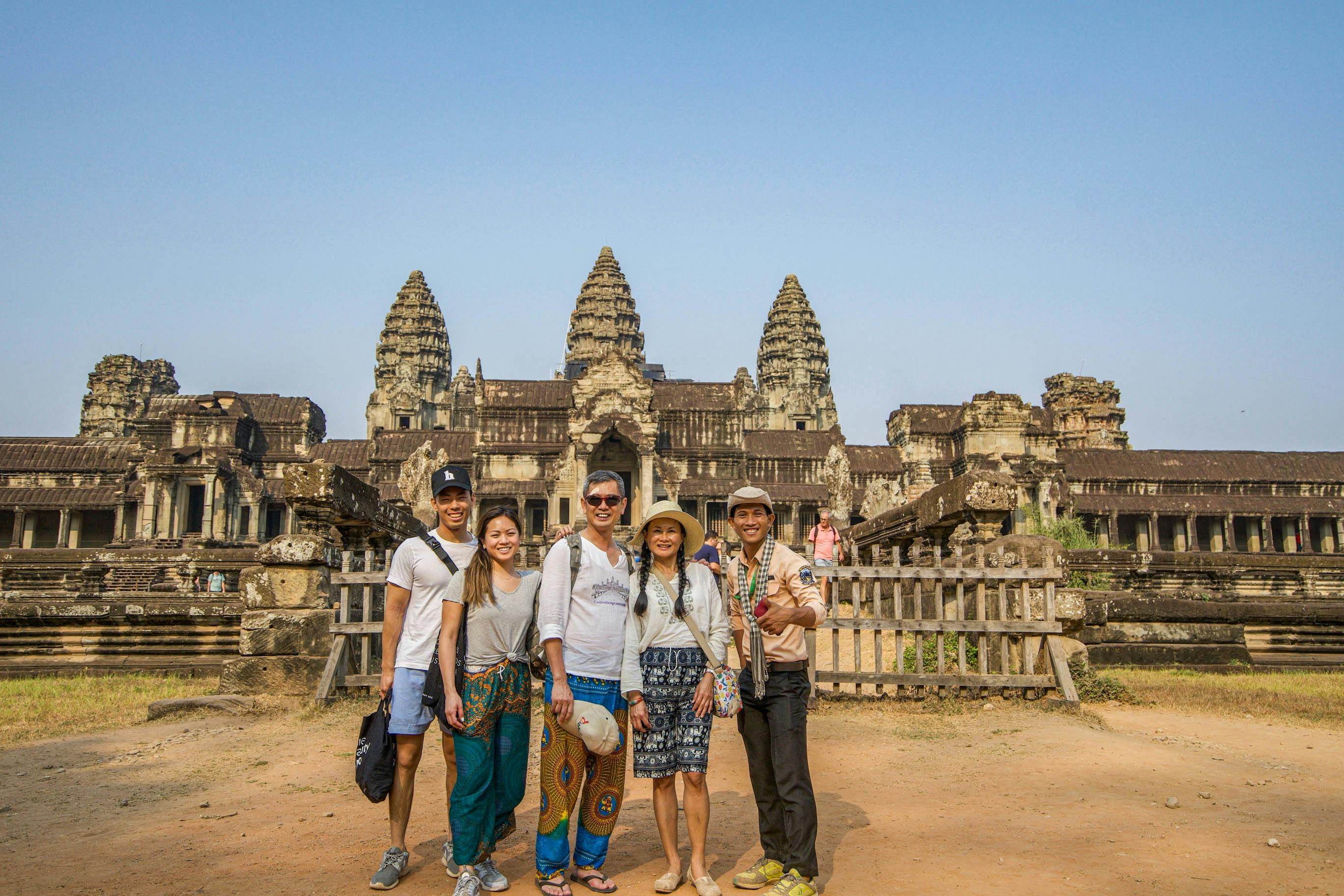
Angkor Wat is the most famous temple in Cambodia and the main reason many travellers visit Siem Reap. Built in the 12th century, it is known for its five towers, long galleries, bas-reliefs, moats, causeways and sunrise reflections.
Sunrise at Angkor Wat is the classic experience. Visitors gather near the reflection ponds before dawn to watch the temple silhouette appear against the sky. It can be crowded, but it remains memorable, especially if the weather is clear.
Do not leave immediately after sunrise. Many visitors rush away for breakfast, which can make the temple quieter for exploring. Walk through the galleries, study the carvings and climb permitted upper levels if open and suitable.
Angkor Thom and Bayon
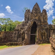
Angkor Thom was the great walled city of the Khmer Empire, and Bayon is its most famous temple. Bayon is known for its large stone faces, carved towers and atmospheric inner galleries.
Within Angkor Thom, visitors can also see the Terrace of the Elephants, Terrace of the Leper King, ancient gates and other temple remains. This area is best visited with a guide or good background information because the layout and symbolism are much easier to understand with context.
Ta Prohm
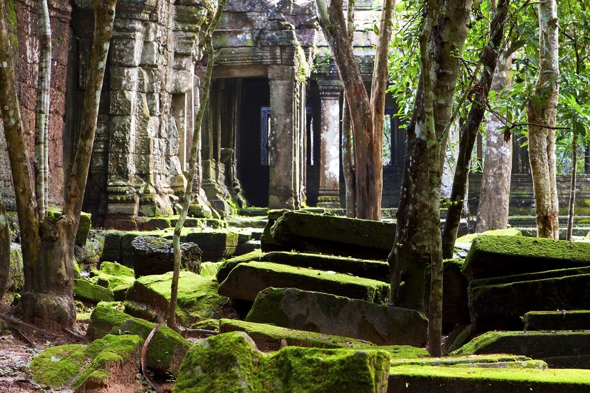
Ta Prohm is one of Angkor’s most atmospheric temples. It is famous for giant tree roots growing around stone walls, doorways and courtyards. The combination of jungle and ruins gives the temple a romantic, mysterious feeling.
It is also one of the busiest temples, so early morning or late afternoon can be better for photos. Stay on marked paths and do not climb on fragile walls or roots.
Banteay Srei
Banteay Srei is a smaller temple north-east of the main Angkor circuit, famous for pink-red sandstone and incredibly detailed carvings. It is often called the “Jewel of Khmer Art” because of its refined stonework.
This temple is best visited as a half-day trip from Siem Reap, often combined with Banteay Samré, Pre Rup, East Mebon, Kbal Spean or the Cambodia Landmine Museum.
Angkor Pass and Temple Planning
Most visitors need an Angkor Pass to enter the main temples of Angkor Archaeological Park. Pass options usually include one-day, three-day and seven-day choices, but ticket conditions and validity should always be checked through the official Angkor Enterprise system before visiting.
For most travellers, a three-day pass is the best balance. One day is enough only for a rushed highlights tour. Three days allows Angkor Wat, Angkor Thom, Ta Prohm, smaller temples and Banteay Srei without complete temple exhaustion.
Suggested Temple Planning
One day: Angkor Wat sunrise, Angkor Thom, Bayon and Ta Prohm.
Two days: Main temples on day one, Banteay Srei and eastern temples on day two.
Three days: Main circuit, Grand Circuit, Banteay Srei and slower sunrise or sunset stops.
Siem Reap Town
Siem Reap town is compact, easy to navigate and full of traveller services. The main tourist area includes Pub Street, Old Market, riverside streets, boutique hotels, restaurants, cafés, spas, tuk-tuk stands and tour offices.
Pub Street is the nightlife centre, with bars, restaurants, music and bright signs. It is lively and touristy, but useful for an easy evening meal or drink. Nearby streets are often better for quieter restaurants, cafés and boutique shopping.
The Siem Reap River area is pleasant for a slower walk, especially in the late afternoon or evening. It offers a calmer contrast to the louder Pub Street zone.
Markets and Shopping
Siem Reap has several markets and shopping areas where travellers can buy souvenirs, clothing, spices, artwork, bags, jewellery and locally made crafts.
Old Market
Old Market, also known as Psar Chas, is close to Pub Street and is one of the easiest places to browse. It has souvenirs, textiles, food stalls and local market sections.
Angkor Night Market
Angkor Night Market is popular for evening shopping, souvenirs and a relaxed wander after dinner. It is useful if your days are busy with temple visits and you want to shop at night.
Made in Cambodia Market
Made in Cambodia Market is a good option for higher-quality local products, crafts, gifts and design-focused souvenirs.
When shopping, bargain politely where appropriate, but avoid aggressive haggling. Supporting local makers, social enterprises and fair-trade shops can make your spending more meaningful.
What to Eat in Siem Reap
Siem Reap is a good place to try Khmer food, from simple street snacks to refined Cambodian restaurants.
Fish Amok
Fish amok is one of Cambodia’s signature dishes. It is a mild, fragrant curry-like dish often made with fish, coconut milk, kroeung spice paste and banana leaf presentation.
Lok Lak
Lok lak is a popular stir-fried beef dish often served with rice, salad and a pepper-lime dipping sauce.
Khmer Curry
Khmer curry is usually milder and sweeter than some neighbouring Southeast Asian curries. It may include chicken, vegetables, coconut milk and local spices.
Nom Banh Chok
Nom banh chok is a traditional noodle dish often eaten for breakfast. It is made with rice noodles, herbs and a fish-based green curry-style sauce.
Street Food and Snacks
Look for grilled skewers, fresh fruit shakes, banana pancakes, spring rolls, coconut desserts and local noodles. Choose busy stalls with high turnover and good hygiene practices.
Tonle Sap Lake and Floating Villages
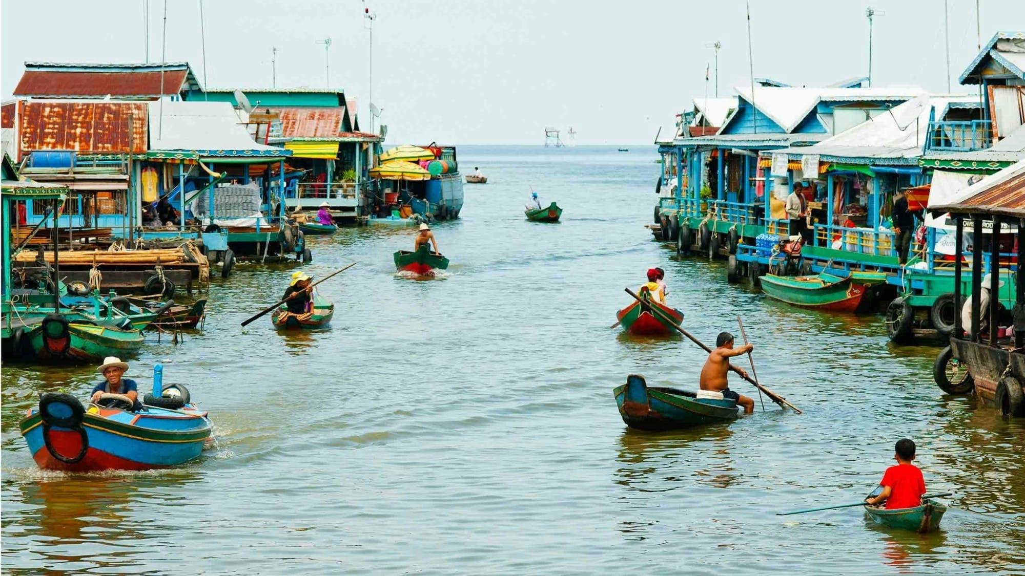
Tonle Sap Lake is one of the most common day trips from Siem Reap. Visitors usually go to see floating villages, stilt houses, flooded forests and lake life.
Popular options include Chong Kneas, Kampong Phluk and Kampong Khleang. Chong Kneas is the closest and easiest, but it can feel very touristy. Kampong Phluk and Kampong Khleang are farther away and may offer a more interesting experience, depending on season and tour quality.
Choose floating village tours carefully. Look for ethical operators who are clear about where money goes and avoid tours that pressure visitors into questionable donations or exploit local communities.
How Long to Stay
Two nights: Very rushed, but enough for one full Angkor highlights day.
Three nights: A good minimum for first-time visitors. This allows one or two temple days plus time in town.
Four nights: Better for most travellers. You can see the main temples, Banteay Srei, enjoy restaurants and avoid rushing.
Five to six nights: Ideal if you want Tonle Sap, cooking classes, spas, museums, countryside cycling or slower temple days.
Simple Siem Reap Itinerary
Day 1: Arrival and Siem Reap Town
Arrive at Siem Reap–Angkor International Airport.
Transfer to your hotel and settle in.
Walk around the Old Market and riverside area.
Have dinner near Pub Street or in a quieter side street.
Book or confirm your temple transport for the next day.
Day 2: Angkor Wat Sunrise and Main Temples
Start before dawn for Angkor Wat sunrise.
Explore Angkor Wat after sunrise.
Visit Angkor Thom and Bayon.
Stop at the Terrace of the Elephants and nearby sites.
Visit Ta Prohm in the afternoon.
Return to Siem Reap for dinner and rest.
Day 3: Banteay Srei and Grand Circuit
Visit Banteay Srei in the morning.
Stop at Banteay Samré, Pre Rup or East Mebon if included in your route.
Return to town for a pool break or massage.
Visit a night market in the evening.
Day 4: Tonle Sap or Slow Siem Reap Day
Take a morning trip to Kampong Phluk or another Tonle Sap village.
Alternatively, visit Angkor National Museum and take a cooking class.
Spend the afternoon at a café, spa or local craft market.
Enjoy a final Khmer dinner.
Best Time to Visit
The best time to visit Siem Reap is generally during the dry season, from around November to April. Weather is usually better for temple sightseeing, although this is also the busier tourist period. The wet season runs roughly from May to October, with heavier rains often later in the season, but it brings greener landscapes and fewer crowds. :contentReference[oaicite:3]{index=3}
December and January are popular because temperatures are usually more comfortable. March to May can be very hot. During the wet season, mornings are often still workable for temple visits, with rain more likely later in the day.
Getting Around Siem Reap
Tuk-tuks are the classic way to get around Siem Reap and the Angkor temples. They are affordable, flexible and easy to arrange through hotels or directly with drivers.
For longer temple days, Banteay Srei trips or hot weather, a private car can be more comfortable. For active travellers, bicycle tours can be rewarding, but the heat and distances should be taken seriously.
For Angkor temple days, it is worth using the same driver for the day. Agree on the route, start time, price and finishing point before leaving.
Siem Reap Airport
Siem Reap is served by Siem Reap–Angkor International Airport, also known by the code SAI. It replaced the older airport closer to town and is located much farther from central Siem Reap, so airport transfers now take longer than they did in the past. :contentReference[oaicite:4]{index=4}
When booking accommodation or tours, check whether airport pickup is included. If not, arrange a transfer in advance, especially if arriving late at night.
Practical Travel Tips
Start Temple Days Early
Early starts help you avoid the worst heat and give better light for photography. Even if you skip Angkor Wat sunrise, leaving early is worthwhile.
Buy the Right Angkor Pass
Do not automatically buy a one-day ticket if you have several days in Siem Reap. A three-day pass often gives a much better experience because you can slow down and avoid temple fatigue.
Dress Respectfully
For Angkor temples, cover shoulders and knees. Bring a light scarf or long-sleeved layer if needed, but proper clothing is better than trying to cover up only at entrances.
Bring Water and Sun Protection
Siem Reap can be hot and humid. Carry water, wear a hat, use sunscreen and take breaks during the middle of the day.
Use a Guide for at Least One Temple Day
A good guide can explain temple symbolism, Khmer history, Hindu and Buddhist imagery, and the layout of Angkor. This makes the ruins far more meaningful.
Plan Rest Time
Temple sightseeing is tiring. A hotel with a pool can be a major advantage, especially in the hot season.
Be Careful With Floating Village Tours
Choose reputable operators and avoid exploitative donation stops. A responsible tour should respect local communities and be transparent about costs.
Carry Small Cash
Small notes are useful for tuk-tuks, snacks, tips, markets and local purchases. US dollars and Cambodian riel are both commonly used, but local practice can vary.
Check Current Travel Advice
Before travelling, check current government travel advice and local updates, especially if your Cambodia itinerary includes border areas or remote provinces. Siem Reap itself is a major tourism centre, but conditions elsewhere can change.
FAQs About Siem Reap
Is Siem Reap worth visiting?
Yes. Siem Reap is worth visiting as the gateway to Angkor Archaeological Park and for its food, markets, nightlife, museums, countryside tours and relaxed travel atmosphere.
What is Siem Reap famous for?
Siem Reap is famous for Angkor Wat, Angkor Thom, Bayon, Ta Prohm, Banteay Srei, Pub Street, night markets and access to Tonle Sap Lake.
How many days do you need in Siem Reap?
Three nights is a good minimum. Four nights is better for most travellers because it allows more temple time and a less rushed pace.
Can you see Angkor Wat in one day?
Yes, but one day is rushed. You can see Angkor Wat, Bayon and Ta Prohm in a long day, but you will miss many excellent temples and quieter areas.
What is the best area to stay in Siem Reap?
First-time visitors usually do well near the Old Market, riverside area or central Siem Reap. These areas give easy access to restaurants, markets, spas and tuk-tuks.
Is Pub Street worth visiting?
Pub Street is touristy but useful for nightlife, restaurants and easy evening entertainment. Quieter and better dining options can often be found in nearby side streets.
Do I need a guide for Angkor?
You can visit independently, but a guide makes the temples much more meaningful. If your budget allows, hire a guide for at least one main temple day.
Is Siem Reap suitable for families?
Yes. Siem Reap can be excellent for families, especially with a comfortable hotel, private driver, shorter temple days and pool breaks in the afternoon.
What should I wear to Angkor temples?
Wear lightweight clothing that covers shoulders and knees, comfortable walking shoes, a hat and sun protection.
What is the best time of year to visit Siem Reap?
The dry season from November to April is generally the most comfortable for temple sightseeing. The wet season can still be rewarding, with greener scenery and fewer crowds.
Final Thoughts
Siem Reap is much more than a gateway city. Angkor is the main reason to come, but the town’s markets, food, cafés, crafts, spas, countryside trips and warm atmosphere make it a destination in its own right.
For the best experience, stay at least three or four nights, buy an Angkor Pass that suits your pace, start temple days early and allow time to rest between big sightseeing days. With good planning, Siem Reap offers one of Southeast Asia’s most memorable combinations of ancient history, local culture and easy travel comfort.
Sponsored Popular Items
Quick take: Musement.com offers a worldwide selection of tours and attractions
Amazing Cambodia 5-Day Private Tour Phnom Penh & Siem Reap Cambodia Gain in-depth insight into Cambodia’s intriguing past on this exciting 5-day tour of iconic Phnom Penh and Angkor Wat. Guided visits to UNESCO World Heritage Sites Angkor Temples and discover
Majestic Vietnam and Cambodia 8-Day Full Package Tour - Guided Sightseeing Tour Majestic Vietnam and Cambodia 8-Day Full Package Tour brings the main theme of the experience into one planned outing, making it easier to use limited time in Hanoi well. Check current availability, inclusions and booking details before you go.
Banteay Srei is one of the most beautiful and finely carved temples in the Angkor region of Cambodia. Smaller than Angkor Wat, Bayon and Ta Prohm, this 10th-century temple is famous for its pink-red sandstone, delicate Hindu carvings, floral patterns, guardian figures and richly decorated doorways.
Located north-east of the main Angkor temple circuit, Banteay Srei is often called the “Jewel of Khmer Art.” It is a rewarding half-day trip from Siem Reap, especially for travellers who enjoy architecture, photography, Khmer history and close-up temple detail.
Banteay Srei Cambodia: A Visitor Guide to Angkor’s Pink Sandstone Temple
Sponsored Popular Items
Quick take: Musement.com offers a worldwide selection of tours and attractions
Beng Mealea and Banteay Srei Temple Private Full-Day Tour Cambodia Beng Mealea and Banteay Srei temple private full-day tour is a convenient way to add structure, local context and purposeful sightseeing to the itinerary. Check current availability, inclusions and booking details before you go.
Why Visit Banteay Srei?
Banteay Srei is worth visiting because it offers a different experience from Angkor’s larger temples. Angkor Wat impresses with scale, Bayon with stone faces and Ta Prohm with jungle atmosphere. Banteay Srei impresses with detail.
The temple’s carvings are some of the finest in the Angkor region. Doorways, lintels, pediments and walls are covered with Hindu mythological scenes, devatas, floral scrolls, animals and decorative borders. The stonework is so precise that many visitors spend more time studying one doorway here than walking through much larger temples.
The journey from Siem Reap also adds to the experience. The drive passes countryside, villages, rice fields and palm trees, giving travellers a softer view of rural Cambodia beyond the central Angkor complex.
A Short History of Banteay Srei
Banteay Srei dates to the 10th century and was dedicated in 967. It was built during the Angkor period and was primarily dedicated to the Hindu god Shiva.
Unlike many major Khmer temples, Banteay Srei was not built directly by a king. It is associated with high-ranking courtiers and religious scholars, which makes it unusual among Angkor’s important temples.
The temple’s modern name is often translated as “Citadel of Women” or “Citadel of Beauty.” This name is usually linked to the refinement and delicacy of the carvings, rather than to a confirmed historical role as a women’s temple.
The Pink Sandstone Carvings
The pink-red sandstone is the main reason Banteay Srei looks and feels different from many other Angkor temples. The stone allowed Khmer artists to carve very fine detail, and much of that detail remains visible today.
Look closely at the lintels above the doorways and the triangular pediments over the entrances. These areas show some of the temple’s most impressive carving, including gods, demons, animals, foliage, mythological scenes and decorative patterns.
The colour of the sandstone changes with the light. In the early morning or late afternoon, the temple can glow with a warm rose tone. In harsh midday sun, the colour may look paler and the carved detail can be harder to photograph.
What to See at Banteay Srei
The Central Sanctuary
The central sanctuary is compact but richly decorated. It includes towers, doorways and carved surfaces that show the exceptional craftsmanship of the temple. Some areas may be protected by barriers, but the permitted viewing areas still give excellent close-up views.
Carved Lintels and Pediments
The lintels and pediments are the artistic highlight of Banteay Srei. Take your time here. These carvings are not background decoration; they are the main reason the temple is considered one of Angkor’s masterpieces.
Devatas and Guardian Figures
The temple features graceful devatas and guardian figures carved into the sandstone. Their jewellery, clothing, poses and facial expressions show the skill of Khmer sculptors.
The Causeway and Enclosures
The approach to the temple includes a causeway and a series of enclosures. Although Banteay Srei is small, its layout still gives visitors a clear sense of sacred progression from outer space toward the inner sanctuary.
The Moat and Landscaped Setting
The temple sits in a calm, landscaped setting with water features and open paths. This makes the visit feel less crowded and more peaceful than some of the busier central Angkor sites.
How to Get There from Siem Reap
Banteay Srei is located north-east of Siem Reap and is farther from town than Angkor Wat, Bayon and Ta Prohm. Most visitors travel by private car, tuk-tuk, motorbike, driver-guide or organised tour.
A private car is the most comfortable option, especially in hot weather. A tuk-tuk is cheaper and more atmospheric, but the ride is longer and can be dusty. For older travellers, families or anyone sensitive to heat, a car is usually the better choice.
Because Banteay Srei is outside the main temple loop, it is best planned as a half-day outing rather than added casually at the end of a long temple day.
Do You Need an Angkor Pass?
Yes. Banteay Srei is part of the Angkor Archaeological Park ticket system, so visitors generally need a valid Angkor Pass. Tickets can be bought through official Angkor Enterprise channels, and there is also a Banteay Srey ticket counter for visitors travelling directly to the temple.
Always check the current ticket rules before visiting, especially if you are combining Banteay Srei with other temples or travelling independently.
What to Combine With Banteay Srei
Banteay Srei pairs well with other temples and attractions in the same general direction. Good combinations include:
Banteay Samré: A quieter Angkor temple with attractive towers, walls and a peaceful atmosphere.
Pre Rup: A larger temple often used for sunset and eastern Angkor routes.
East Mebon: A useful stop if you are exploring the eastern temple circuit.
Kbal Spean: A forest walk to riverbed carvings, best for travellers who want a longer nature-and-temple day.
Cambodia Landmine Museum: A serious but worthwhile stop that gives context to Cambodia’s more recent history.
Best Time to Visit
The best time to visit Banteay Srei is early morning or late afternoon. Early morning gives cooler air, better light and fewer crowds. Late afternoon can make the pink sandstone look warmer and more vivid.
Midday is usually the least comfortable time because the heat can be strong and the light can flatten the carvings. If you visit around midday, bring water, sun protection and patience.
The dry season from November to March is the most comfortable period for temple sightseeing around Siem Reap. The green season can be hotter and wetter, but the countryside is lush and the temple surroundings may feel more atmospheric.
How Long to Spend There
Allow at least one hour at Banteay Srei itself. If you enjoy photography, art or history, allow 90 minutes so you can study the carvings slowly.
For the full trip from Siem Reap, allow half a day. If you combine Banteay Srei with Kbal Spean or several other temples, plan for a longer day.
Practical Travel Tips
Go Early for Better Light
Early morning light brings out the warm colour of the sandstone and makes the carvings easier to photograph.
Bring Water
Banteay Srei is farther from Siem Reap than the main Angkor circuit. Carry water, especially if travelling by tuk-tuk.
Hire a Guide if You Like Mythology
A good guide can explain the Hindu stories carved into the lintels and pediments. Without that context, the carvings are beautiful but harder to understand.
Do Not Touch the Carvings
The stonework is delicate and historically important. Do not touch, lean on, climb or sit on any temple structure.
Dress Respectfully
Wear clothing that covers shoulders and knees. Banteay Srei is an ancient religious site, not just a scenic attraction.
Use a Car in Hot Weather
A tuk-tuk is scenic, but the longer distance can be tiring in heat and dust. A private car is more comfortable for many travellers.
Take Close-Up Photos
Banteay Srei is not only about wide temple views. The best photos are often close-ups of carvings, lintels, pillars and sandstone textures.
FAQs About Banteay Srei
Is Banteay Srei worth visiting?
Yes. Banteay Srei is one of the most beautiful temples in the Angkor region and is especially worthwhile for its pink sandstone and intricate carvings.
What is Banteay Srei famous for?
Banteay Srei is famous for its pink-red sandstone, small scale and exceptionally detailed Khmer carvings.
Is Banteay Srei part of Angkor?
Yes. Banteay Srei is part of the wider Angkor Archaeological Park, although it is farther from the central temple circuit.
How far is Banteay Srei from Siem Reap?
Banteay Srei is north-east of Siem Reap and is usually visited as a half-day trip. Travel time depends on your transport and route.
Do you need an Angkor Pass for Banteay Srei?
Yes. Visitors generally need a valid Angkor Pass to enter Banteay Srei.
Is Banteay Srei older than Angkor Wat?
Yes. Banteay Srei dates to the 10th century, while Angkor Wat was built later in the 12th century.
Can you visit Banteay Srei by tuk-tuk?
Yes. Many visitors travel by tuk-tuk from Siem Reap, but the journey is longer than the central Angkor temple loop. A car may be more comfortable in hot weather.
How much time do you need at Banteay Srei?
Most visitors need about one hour. Travellers who enjoy photography or temple detail may want 90 minutes or more.
What should I combine with Banteay Srei?
Good combinations include Banteay Samré, Pre Rup, East Mebon, Kbal Spean and the Cambodia Landmine Museum.
When is the best time for photos?
Early morning and late afternoon are best because the sandstone looks warmer and the carved detail is easier to see.
Final Thoughts
Banteay Srei may be smaller than Angkor’s most famous temples, but it is one of the finest examples of Khmer artistry. Its pink sandstone, delicate carvings and peaceful setting make it a highlight for travellers who want to look closely rather than simply move quickly from temple to temple.
For the best experience, visit early, take your time with the carvings, dress respectfully and consider combining the temple with Banteay Samré or Kbal Spean. Banteay Srei is not just another Angkor stop; it is one of Cambodia’s most refined and memorable temple experiences.
Sponsored Popular Items
Quick take: Musement.com offers a worldwide selection of tours and attractions
Beng Mealea and Banteay Srei Temple Private Full-Day Tour Cambodia Beng Mealea and Banteay Srei temple private full-day tour is a convenient way to add structure, local context and purposeful sightseeing to the itinerary. Check current availability, inclusions and booking details before you go.
3-Day Angkor Temples, Banteay Srei and Floating Village Private Tour Cambodia 3-Day Angkor Temples, Banteay Srei and Floating Village private tour is a convenient way to add structure, local context and purposeful sightseeing to the itinerary. Check current availability, inclusions and booking details before you go.
Amazing Cambodia 5-Day Private Tour Phnom Penh & Siem Reap Cambodia Gain in-depth insight into Cambodia’s intriguing past on this exciting 5-day tour of iconic Phnom Penh and Angkor Wat. Guided visits to UNESCO World Heritage Sites Angkor Temples and discover
Pico do Areeiro is one of Madeira’s most dramatic mountain viewpoints and one of the easiest high-altitude places to reach on the island. At 1,818 metres above sea level, it offers jagged peaks, deep valleys, sunrise above the clouds, wild weather, sharp ridgelines and access to one of Madeira’s most famous mountain trails.
Pico do Areeiro Madeira: A Guide to Sunrise Views, Mountain Roads and the PR1 Trail
Also commonly written as Pico do Arieiro, this viewpoint is a must-see for travellers who want to experience Madeira’s high mountain scenery without needing a full-day hike. You can drive close to the summit, watch the sunrise, enjoy the viewpoint, walk part of the PR1 trail or, when fully open and safe, continue toward Pico Ruivo, the highest peak in Madeira.
Sponsored Popular Items
Quick take: Musement.com offers a worldwide selection of tours and attractions
Madeira Transfer between Pico do Areeiro & Pico Ruivo Trails Portugal Bus Transfer between Pico do Areeiro and Pico Ruivo adds structure, local context and purposeful sightseeing to the itinerary. Check current availability, inclusions and booking details before you go.
What Is Pico do Areeiro?
Pico do Areeiro is Madeira’s third-highest peak and one of the island’s most famous mountain viewpoints. It sits in Madeira’s central mountain massif and is known for steep volcanic ridges, cloud-filled valleys, sunrise views and access to the PR1 Vereda do Areeiro hiking route.
Unlike many mountain viewpoints, Pico do Areeiro is accessible by road. This makes it popular with hikers, photographers, tour groups, sunrise watchers and visitors who want a high mountain experience without committing to a demanding hike.
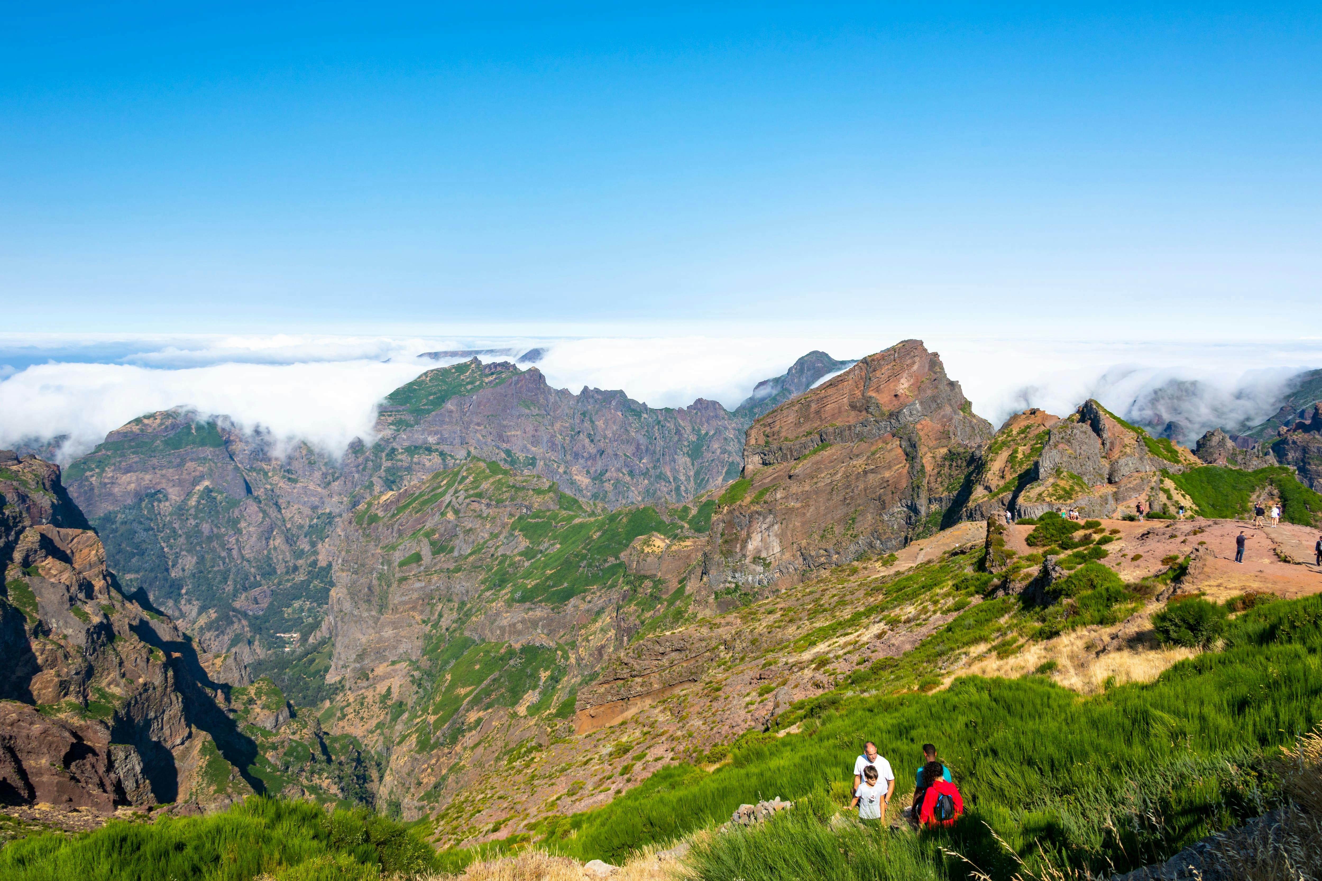
The landscape feels very different from Madeira’s coast. Instead of banana terraces, ocean promenades or levada forests, you get sharp rock formations, exposed ridges, cold wind, sudden mist and views that can change in minutes.
Why Visit Pico do Areeiro?
Pico do Areeiro is worth visiting because it offers one of the most powerful views in Madeira. On a clear day, you can see across the island’s mountains, down into dramatic valleys and out toward the Atlantic. On cloudy days, you may stand above a blanket of clouds with peaks rising like islands.
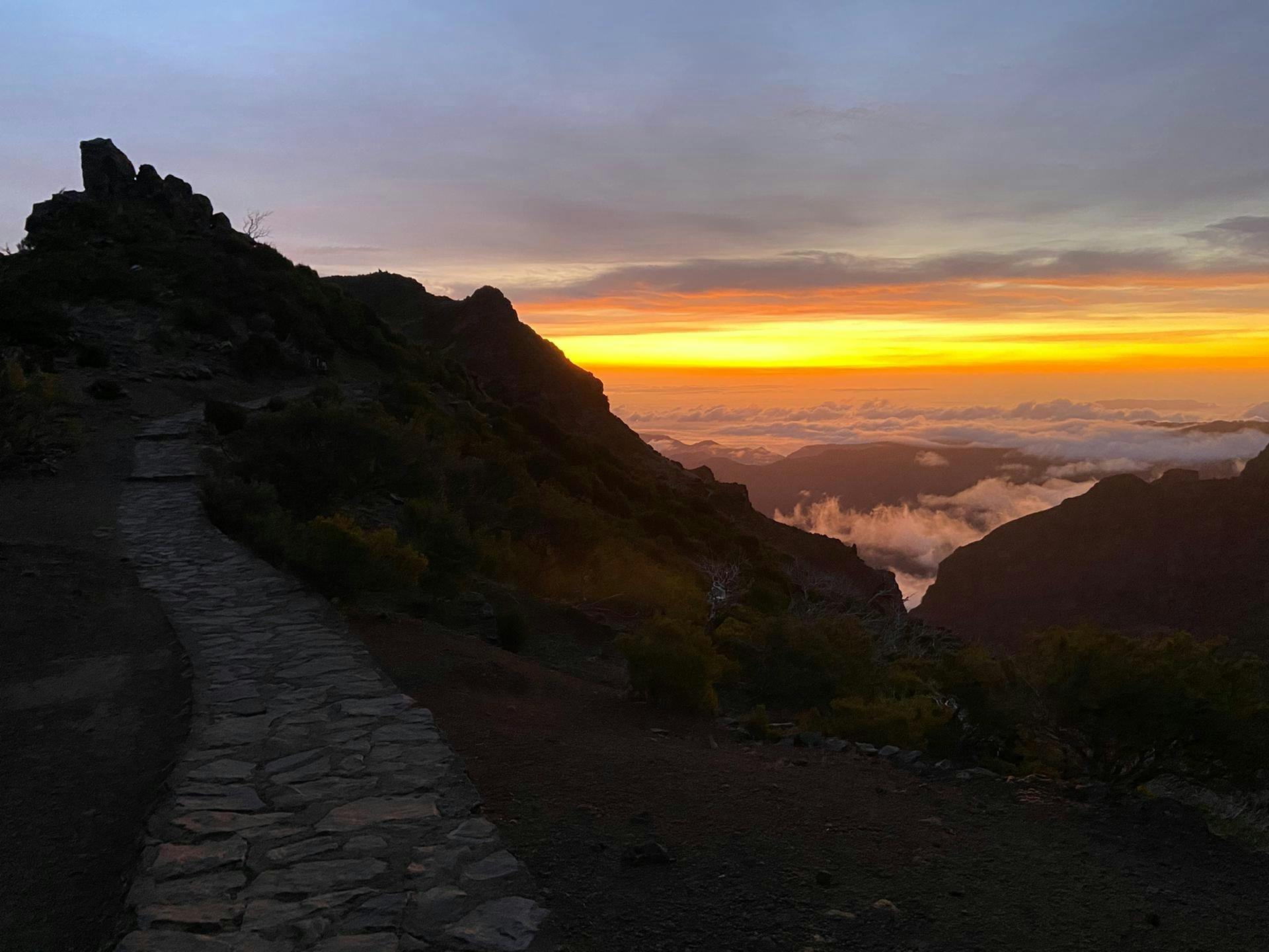
It is also one of the best sunrise locations in Madeira. Watching the first light hit the ridges and clouds is a memorable experience, especially when the weather cooperates. Even if you do not hike far, the viewpoint itself can be spectacular.
For active travellers, Pico do Areeiro is the starting point for one of Madeira’s most iconic walks: the PR1 route toward Pico Ruivo. This trail crosses some of the island’s most dramatic mountain terrain, although access can change due to weather, landslides, fire damage or safety works.
Sunrise at Pico do Areeiro
Sunrise is the most popular time to visit Pico do Areeiro. Visitors arrive before dawn to watch the sky brighten over Madeira’s mountain ridges. When conditions are right, clouds sit below the summit and the sun rises over a soft white layer, creating one of the island’s most famous views.
However, sunrise is never guaranteed. The summit can be clear, cloudy, windy, foggy or completely hidden in mist. Weather can change quickly at this altitude, so it is worth checking mountain webcams and forecasts before leaving your accommodation.
If you visit for sunrise, arrive early. Parking can be busy, especially during peak travel periods. Bring warm clothing because temperatures before dawn can feel much colder than in Funchal or coastal areas.
PR1 Vereda do Areeiro
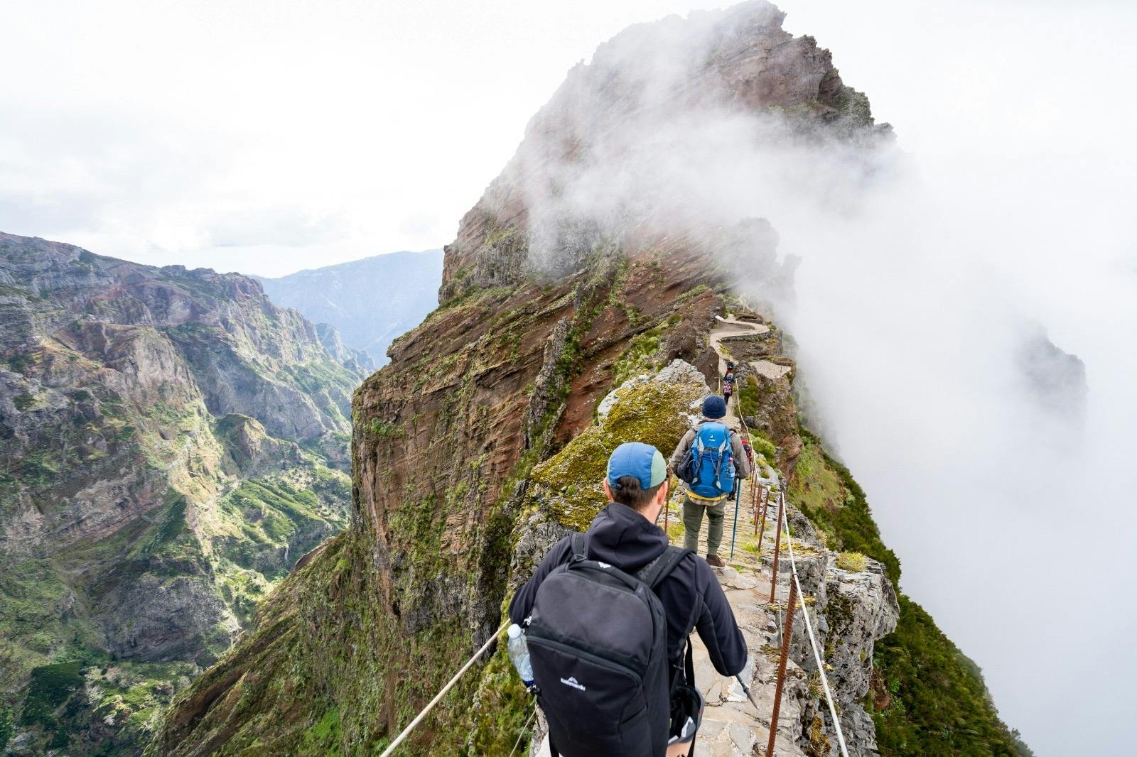
The PR1 Vereda do Areeiro is the famous mountain trail that normally connects Pico do Areeiro with Pico Ruivo, Madeira’s highest peak. The route crosses ridges, tunnels, stairways, exposed slopes and high mountain scenery.
When fully open, the route is one of Madeira’s most spectacular hikes. It usually begins at the Pico do Areeiro viewpoint, passes viewpoints such as Ninho da Manta, continues through dramatic rock formations and eventually reaches the area near Pico Ruivo.
This is not a casual walk. Even though the official route is often described as moderate, the terrain can feel demanding because of exposure, stairs, narrow sections, changing weather and significant climbs. Anyone attempting the full route should be fit, properly equipped and aware of current trail conditions.
Current Trail Access Note
Before planning the full PR1 hike, check the official Madeira trail status. At the time of writing, the official Visit Madeira page states that the footpath is accessible only between Pico do Areeiro and Pedra Rija Belvedere at kilometre 1.2.
This means visitors should not assume they can walk the full route to Pico Ruivo from Pico do Areeiro. Conditions can change, and trail closures are taken seriously for safety reasons. If the full trail is closed, you can still enjoy the summit viewpoint and walk the open section toward Pedra Rija if permitted.
If reaching Pico Ruivo is your priority, check whether the alternative PR1.2 route from Achada do Teixeira is open and suitable for your plans.
Best Viewpoints
Pico do Areeiro Summit Viewpoint
The summit viewpoint is the easiest place to enjoy the mountain scenery. It is close to the parking area and gives sweeping views over the central massif. This is the main spot for sunrise visitors.
Ninho da Manta Viewpoint
Ninho da Manta is one of the best-known viewpoints along the beginning of PR1. It offers dramatic views over steep valleys and rock formations. If the trail section is open, this is a rewarding short walk from the summit area.
Pedra Rija Belvedere
Pedra Rija is an important point on the early section of the PR1 trail. If current restrictions allow walking only to this area, it can still provide an impressive mountain experience without completing the full route.
Roadside Mountain Views
The drive up to Pico do Areeiro also has beautiful views, especially when clouds sit below the road or light breaks across the ridges. Stop only where it is safe and permitted.
How Difficult Is the Walk?
The difficulty depends on how far you walk.
Viewpoint only: Easy. You can enjoy the main summit area with minimal walking.
Short walk to open viewpoints: Moderate. Expect uneven ground, steps, wind and exposure.
Full PR1 to Pico Ruivo when open: Challenging for many visitors. The route includes steep climbs, descents, tunnels, stairways, narrow paths and exposed mountain sections.
Weather has a major effect on difficulty. Fog, rain, strong wind or wet stone can make the walk feel much harder and less safe.
How to Get There
Pico do Areeiro is reached by road from Funchal and other parts of Madeira. The drive from Funchal usually takes around 40 to 50 minutes, depending on traffic, weather and where you are staying.
By Car
Driving is the most flexible option. The road reaches close to the summit, making Pico do Areeiro one of the easiest high mountain viewpoints to access in Madeira. However, the road is winding and can be dark, foggy or busy before sunrise.
By Guided Tour
A guided sunrise tour or hiking transfer is a good option if you do not want to drive mountain roads in the dark. Tours often include hotel pickup and can help manage timing.
By Taxi or Transfer
Private transfers are popular with hikers, especially if walking a one-way route when trails are open. Confirm pickup times and locations carefully before starting any hike.
By Public Transport or Shuttle
Shuttle services may operate depending on season and current transport arrangements. Check the latest local options before relying on this method.
Parking and Visitor Fees
Parking at Pico do Areeiro can be busy, especially around sunrise. Paid parking may apply, and the official tourism page lists parking at the viewpoint area.
Visitors walking the PR1 route may also need to pay a trail fee through the official Madeira system. Rules and fees can change, so check the current official information before you go.
If you only plan to visit the viewpoint and not walk the trail, still check parking rules, time limits and payment methods before arrival.
Best Time to Visit
Sunrise
Sunrise is the most dramatic time to visit, especially if the clouds are below the summit. It is also the busiest and coldest time, so arrive early and bring warm layers.
Morning
Morning is excellent for clearer conditions, strong light and a slightly calmer visit after sunrise crowds begin to leave.
Late Afternoon
Late afternoon can be beautiful if the weather is clear. The light softens across the ridges, and the viewpoint may feel less crowded than sunrise.
Winter and Shoulder Seasons
Winter can bring dramatic clouds and cooler air, while spring and autumn often offer good hiking conditions. Weather is always variable in the mountains, so check forecasts carefully.
What to Wear and Bring
Warm layer or fleece, especially for sunrise
Windproof jacket
Rain jacket if conditions are uncertain
Comfortable walking shoes with good grip
Head torch if arriving before sunrise or walking early
Water and snacks
Phone with enough battery
Power bank if taking photos or using maps
Sunscreen and sunglasses for clear days
Hat or beanie depending on season
Trail fee confirmation if required
Practical Travel Tips
Check the Weather Before You Go
Pico do Areeiro can be clear while Funchal is cloudy, or completely fogged in while the coast is sunny. Use mountain forecasts and webcams where available.
Do Not Assume the Full PR1 Is Open
Trail access can change. Always check official trail status before planning the hike to Pico Ruivo.
Arrive Early for Sunrise
Sunrise is popular. Arriving shortly before sunrise may mean full parking areas and crowded viewpoints.
Bring Warm Clothes
The summit can feel very cold and windy, especially before dawn. Dress for mountain conditions, not beach weather.
Stay Behind Barriers
The drops are serious. Do not climb barriers, step off marked paths or take risks for photos.
Wear Proper Shoes
Even short walks can include rocky and uneven ground. Avoid flip-flops or smooth-soled shoes.
Respect Trail Closures
Closures are usually due to real hazards such as unstable ground, fire damage, rockfall risk or weather-related danger. Do not enter closed sections.
Have a Backup Plan
If the summit is fogged in or trails are closed, consider nearby alternatives such as Ribeiro Frio, Balcões viewpoint, Curral das Freiras or a lower-altitude levada walk.
FAQs About Pico do Areeiro
Where is Pico do Areeiro?
Pico do Areeiro is in Madeira’s central mountain massif, roughly inland from Funchal and accessible by road.
How high is Pico do Areeiro?
Pico do Areeiro is 1,818 metres above sea level, making it one of Madeira’s highest peaks.
Can you drive to Pico do Areeiro?
Yes. One of the reasons Pico do Areeiro is so popular is that you can drive close to the summit viewpoint.
Is Pico do Areeiro good for sunrise?
Yes. It is one of Madeira’s best-known sunrise viewpoints, especially when clouds sit below the summit.
Can you hike from Pico do Areeiro to Pico Ruivo?
Normally, the PR1 route links Pico do Areeiro with Pico Ruivo, but access can change. Check official trail status before planning the full hike.
Is the PR1 hike difficult?
The full PR1 route is challenging for many walkers because of steep sections, stairs, tunnels, exposure and changing weather. Short viewpoint walks are much easier.
Do you need to pay to visit Pico do Areeiro?
Parking and trail visitor fees may apply. Check the current official Madeira visitor information before you go.
What should I wear to Pico do Areeiro?
Wear layers, a windproof jacket and proper walking shoes. For sunrise, bring warm clothing because the summit can be cold.
Is Pico do Areeiro suitable for children?
The main viewpoint can be suitable for children with close supervision. Exposed trail sections require extra care, and families should not attempt difficult routes in poor weather.
What if the weather is cloudy?
Clouds can either create magical above-the-cloud views or completely block visibility. Check webcams before travelling and be flexible with timing.
Final Thoughts
Pico do Areeiro is one of Madeira’s most unforgettable places. It gives visitors access to high mountain scenery, sunrise above the clouds and some of the island’s most dramatic volcanic ridges without needing to hike from sea level.
For the best experience, check the weather, arrive early if visiting for sunrise, bring warm layers and confirm the current PR1 trail status before planning any serious walk. Whether you stay near the viewpoint or hike the open sections of the trail, Pico do Areeiro is one of Madeira’s essential mountain experiences.
Sponsored Popular Items
Quick take: Musement.com offers a worldwide selection of tours and attractions
Madeira Transfer between Pico do Areeiro & Pico Ruivo Trails Portugal Bus Transfer between Pico do Areeiro and Pico Ruivo adds structure, local context and purposeful sightseeing to the itinerary. Check current availability, inclusions and booking details before you go.
Pico do Arieiro & Pico Ruivo Guided Hiking Tour Portugal Pico do Arieiro Hiking Tour is for travellers who want movement, scenery and a more active element in their itinerary. Check current availability, inclusions and booking details before you go.
Ponta de São Lourenço Madeira: A Guide to the Island’s Wild Eastern Peninsula
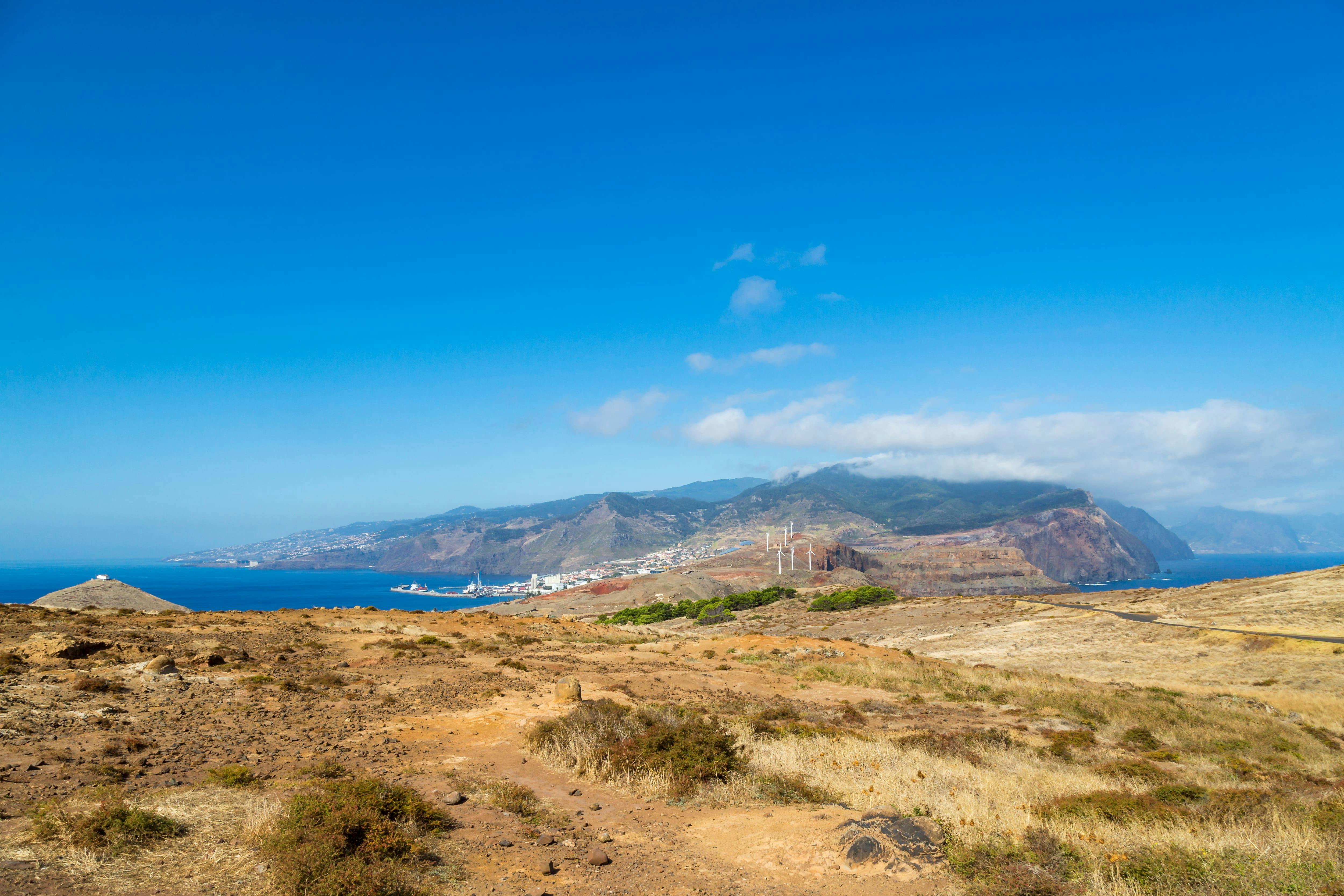
Ponta de São Lourenço is one of the most striking landscapes in Madeira. Located at the far eastern tip of the island, this rugged volcanic peninsula feels very different from the lush green mountains, levadas and forests found elsewhere on Madeira. Here, the scenery is dry, exposed and dramatic, with red-brown cliffs, turquoise Atlantic water, wind-shaped hills and sweeping coastal views.
Ponta de São Lourenço Madeira: A Guide to the Island’s Wild Eastern Peninsula
The best way to experience the area is by walking the PR 8 Vereda da Ponta de São Lourenço trail. This coastal route follows the narrow peninsula from Baía d’Abra toward Casa do Sardinha, passing viewpoints, rocky ridges, sea cliffs and open landscapes with views to both the north and south sides of Madeira.
Sponsored Popular Items
Quick take: Musement.com offers a worldwide selection of tours and attractions
Ponta São Lourenço Full-Day Guided Walk from Western Madeira Portugal Ponta São Lourenço guided walk from the west is a convenient way to add structure, local context and purposeful sightseeing to the itinerary. Check current availability, inclusions and booking details before you go.
What Is Ponta de São Lourenço?
Ponta de São Lourenço is the easternmost peninsula of Madeira, stretching out into the Atlantic Ocean near Caniçal. It is a protected natural area known for volcanic rock, dry hills, exposed cliffs, seabirds, ocean views and a landscape that looks almost desert-like compared with the rest of Madeira.
The peninsula is mostly formed from volcanic basalt, with some sedimentary formations. Because it is exposed to strong winds and has a semi-arid climate, there are very few trees. This gives the area its distinctive open, bare and sculptural appearance.
At the far end of the peninsula are offshore islets, including Desembarcadouro Islet and Farol Islet. These rocky forms add to the feeling that you are walking toward the edge of Madeira.
Why Visit Ponta de São Lourenço?
Ponta de São Lourenço is worth visiting because it offers one of the most unusual landscapes on Madeira. While much of the island is known for green mountains, waterfalls and laurel forest, this eastern peninsula feels raw, dry and ocean-carved.
It is especially good for travellers who enjoy coastal hiking, photography, geology, wildlife, sunrise views and open landscapes. The trail gives constant sea views, and because the peninsula is narrow, you can often see both sides of the island at once.
The colours are a major part of the attraction: rust-coloured cliffs, golden grass, black volcanic rock, white waves and deep blue water. In bright sunlight, the contrast is dramatic. On cloudy or windy days, the peninsula feels wilder and more atmospheric.
PR 8 Vereda da Ponta de São Lourenço
The main walking route is the official PR 8 Vereda da Ponta de São Lourenço. It starts at Baía d’Abra and heads toward Casa do Sardinha. The official route is around 3 km each way, making it approximately 6 km return.
The walk is officially considered moderate and usually takes around two and a half hours, although many visitors take longer because of photo stops, rest breaks and time at the viewpoints.
The path is well-defined, but it is exposed. There is very little shade, and the wind can be strong. The trail includes undulating sections, rocky ground, steps and cliffside viewpoints, so it is not a flat seaside stroll.
What to See Along the Trail
Volcanic Cliffs
The cliffs are the highlight of Ponta de São Lourenço. Their red, brown and black layers show the volcanic origin of the peninsula. From several viewpoints, you can look down into clear blue water, sea caves, rocky coves and wave-washed cliffs.
North and South Coast Views
Because the peninsula is narrow, the trail offers views across both sides of Madeira. On a clear day, you can see the Atlantic stretching in every direction, with the main island rising behind you.
Dry Semi-Arid Landscape
The low vegetation and lack of trees make this area feel very different from Madeira’s green interior. The open landscape allows uninterrupted views and gives the walk a wild, almost lunar quality.
Seabirds and Marine Life
The area is important for birdlife, including seabirds that nest or feed around the cliffs and offshore rocks. With luck, visitors may also spot marine life offshore, including dolphins or the rare monk seal.
Viewpoints and Photo Stops
There are several natural viewpoints along the route. Some look back toward Madeira’s main mountain mass, while others face the ocean and outer islets. The best photos often come from stopping frequently rather than rushing to the end.
Casa do Sardinha
Casa do Sardinha is the main endpoint of the official PR 8 trail. It sits near the far end of the walk and provides a welcome rest point after the exposed coastal path.
Many walkers use this area as a place to pause, eat a snack, refill energy and enjoy the final views before turning back. Facilities can vary, so do not rely on finding everything you need there. Bring enough water and food for the full walk.
Cais do Sardinha
Cais do Sardinha is a small coastal spot near the end of the route where some visitors swim when conditions are suitable. The water can look inviting, especially after walking in full sun, but sea conditions should always be treated carefully.
Only swim if it is safe on the day. Waves, currents, slippery rocks and changing weather can make coastal swimming risky. If in doubt, enjoy the view rather than entering the water.
How Difficult Is the Walk?
The PR 8 trail is moderate rather than extremely difficult. Most reasonably active travellers can complete it, but it still requires sensible shoes, water, sun protection and care near cliff edges.
The main challenges are:
Strong sun and very little shade
Wind exposure
Rocky and uneven ground
Some uphill and downhill sections
Cliffside areas where care is needed
Crowds during busy periods
If you have knee problems, balance issues or a strong fear of heights, take your time and avoid getting close to exposed edges. You do not need to walk every metre of the route to enjoy the scenery.
Best Time to Visit
The best time to visit Ponta de São Lourenço is early morning or late afternoon. Early morning usually brings cooler temperatures, softer light and fewer people. Late afternoon can be beautiful for photography, especially when warm light hits the red cliffs.
Midday can be hot and harsh because there is almost no shade. If you visit in the middle of the day, bring plenty of water, wear a hat and take breaks.
The trail can be walked year-round, but wind and weather matter. On very windy, rainy or foggy days, the exposed sections can feel less comfortable and visibility may be reduced.
How to Get There
Ponta de São Lourenço is near Caniçal on Madeira’s eastern side. The trailhead is at Baía d’Abra, where the road ends and the walk begins.
By Car
Driving is the easiest option. From Funchal, the journey usually takes around 30 to 45 minutes depending on traffic and where you are staying. Parking is available near the trailhead, but it can fill quickly during busy times.
By Bus
Public buses may serve the Caniçal and Baía d’Abra area, but schedules should be checked carefully before you go. Bus travel can work well for budget travellers, but it gives less flexibility than a car.
By Tour
Guided hiking tours are available and can be useful if you do not want to arrange transport or prefer walking with a guide. Tours may also include hotel pickup, route information and safety guidance.
What to Wear and Bring
Comfortable walking shoes or trainers with good grip
Lightweight clothing suitable for hiking
Hat and sunglasses
Sunscreen
Windproof layer or light jacket
At least one litre of water per person, more in hot weather
Snacks or packed lunch
Camera or phone with enough battery
Power bank if taking lots of photos
Swimwear and towel if you plan to swim at Cais do Sardinha
Small rubbish bag so you can take waste away with you
Practical Travel Tips
Pay the Required Trail Fee
Madeira now charges visitor fees for some official walking routes. Check the current PR 8 payment requirements before you go and complete any required payment through the official system.
Start Early
Early morning is the best time for cooler temperatures, easier parking and quieter viewpoints. It also gives you more flexibility if you want to walk slowly.
Do Not Underestimate the Sun
Ponta de São Lourenço is extremely exposed. Even if the temperature feels mild, the sun and wind can dehydrate you quickly.
Stay on the Marked Trail
The cliffs are steep and the ground can be unstable near edges. Stay on the marked path and respect barriers and warning signs.
Bring More Water Than You Think You Need
There is very little shade and limited access to facilities. Carry enough water for the full return walk.
Expect Wind
The peninsula is exposed to Atlantic winds. A light windproof jacket can be useful even on sunny days.
Allow Time for Photos
The walk is not only about reaching the end. Some of the best views are along the way, so allow extra time for viewpoints and photography.
Combine It With Caniçal
After the hike, consider stopping in Caniçal for seafood, a drink or a relaxed coastal break before returning to Funchal or another part of Madeira.
FAQs About Ponta de São Lourenço
Where is Ponta de São Lourenço?
Ponta de São Lourenço is at the eastern tip of Madeira Island, near Caniçal and Baía d’Abra.
Is Ponta de São Lourenço worth visiting?
Yes. It is one of Madeira’s most distinctive landscapes, with volcanic cliffs, ocean views, dry hills and a very different atmosphere from the island’s green interior.
How long is the PR 8 walk?
The official PR 8 route is about 3 km each way, or 6 km return.
How difficult is the Ponta de São Lourenço hike?
The hike is moderate. It is not technical, but it has uneven ground, exposed sections, wind, sun and some uphill and downhill walking.
How long does the walk take?
The official estimated duration is around two and a half hours, but many visitors take three hours or more with photo stops and rests.
Can you swim at Ponta de São Lourenço?
Some visitors swim near Cais do Sardinha when conditions are safe. Always check the sea conditions and avoid swimming if the water is rough or access looks unsafe.
Do you need hiking boots?
Hiking boots are useful but not essential for everyone. Good trainers or walking shoes with grip are usually enough in dry conditions. Avoid flip-flops or smooth-soled sandals.
Is there shade on the trail?
Very little. The route is exposed, so sun protection and plenty of water are essential.
Can children do the walk?
Active children can enjoy the walk, but adults should supervise closely because of cliffs, wind and uneven ground. Families may choose to walk only part of the route if needed.
What is the best time of day for photos?
Early morning and late afternoon usually give the best light. The red cliffs and blue water look especially dramatic when the sun is lower.
Final Thoughts
Ponta de São Lourenço is one of Madeira’s most memorable coastal experiences. Its exposed volcanic cliffs, wild Atlantic views, dry open hills and sculptural rock formations make it feel unlike anywhere else on the island.
For the best visit, start early, bring water, wear proper shoes and allow time to enjoy the viewpoints rather than rushing to the end. Whether you walk the full PR 8 route or only explore part of the peninsula, Ponta de São Lourenço is a must-see for travellers who want to experience Madeira’s raw, windswept eastern edge.
Sponsored Popular Items
Quick take: Musement.com offers a worldwide selection of tours and attractions
Ponta São Lourenço Full-Day Guided Walk from Western Madeira Portugal Ponta São Lourenço guided walk from the west is a convenient way to add structure, local context and purposeful sightseeing to the itinerary. Check current availability, inclusions and booking details before you go.
Ponta da Piedade catamaran cruise with open bar and lunch Portugal Plan Ponta da Piedade catamaran cruise with open bar and lunch, a food and drink experience, with practical tips on timing, inclusions and what to check before booking. Compare current availability, prices and booking conditions before you go.
Lagos Catamaran Cruise to Ponta da Piedade Portugal Plan Lagos Catamaran Cruise to Ponta da Piedade, a water-based experience, with practical tips on timing, inclusions and what to check before booking. Compare current availability, prices and booking conditions before you go.
Wadi Darbat Oman: A Guide to Salalah’s Waterfalls, Lakes and Green Khareef Valley
Wadi Darbat is one of the most beautiful natural places near Salalah in Oman’s Dhofar region. Famous for seasonal waterfalls, green hills, calm lakes, grazing camels, limestone cliffs and misty Khareef scenery, it is one of the best day trips for travellers visiting southern Oman.
Unlike many dry wadis in Oman, Wadi Darbat can feel surprisingly lush, especially during the Khareef monsoon season when Dhofar turns green. Families picnic near the water, camels wander through the valley, waterfalls spill from the cliffs and visitors come for boat rides, photography, walking, viewpoints and peaceful mountain scenery.
Sponsored Popular Items
Quick take: Musement.com offers a worldwide selection of tours and attractions
Wadi Darbat is a scenic valley in Dhofar, southern Oman, located east of Salalah near Taqah and Khor Rori. It is known for its lakes, waterfalls, caves, cliffs, greenery and camels, especially during the Khareef season.
The word “wadi” usually refers to a valley or dry riverbed, but Wadi Darbat is much more than a dry channel. In the right season, it becomes one of the greenest and most photogenic places in Oman, with water flowing through the valley and mist sitting low over the mountains.
It is one of the most popular stops on East Salalah sightseeing tours and mountain safari routes. Many travellers visit Wadi Darbat together with Taqah Castle, Taqah Beach, Sumhuram archaeological site, Tawi Atair Sinkhole, Jabal Samhan and the Anti-Gravity Point.
Why Visit Wadi Darbat?
Wadi Darbat is worth visiting because it shows a side of Oman that surprises many travellers. Instead of desert dunes and dry mountains, you can see green slopes, waterfalls, lakes, camels and lush seasonal landscapes.
It is especially appealing for families, photographers, nature lovers and travellers who want a gentle outdoor experience without difficult hiking. You can walk, take photos, enjoy a picnic, hire a boat, watch camels, visit viewpoints or simply sit near the water and enjoy the cooler Dhofar atmosphere.
The scenery changes dramatically by season. During Khareef, Wadi Darbat can be green, misty and wet. Outside Khareef, the valley is usually drier, but the lakes, cliffs and mountain setting can still be beautiful.
Wadi Darbat During Khareef
Khareef is the monsoon season in Dhofar, usually running through the summer months. During this period, moisture from the Arabian Sea brings mist, drizzle and cooler temperatures to the mountains around Salalah.
This is when Wadi Darbat is at its most famous. The hills turn green, waterfalls become more active, rivers and pools are replenished, and the whole valley can feel almost tropical compared with the rest of Oman.
Khareef is also the busiest time to visit. Local families, Gulf travellers and international visitors come to see the greenery, waterfalls and cool weather. Expect more cars, more people and possible delays around popular viewpoints and picnic areas.
Wadi Darbat Waterfalls
The waterfalls are one of Wadi Darbat’s biggest attractions. During Khareef and shortly afterwards, water can cascade down limestone cliffs into turquoise pools and green valley areas.
Waterfall flow is seasonal. Some years and months are more dramatic than others, depending on rainfall, timing and local conditions. If seeing waterfalls is your main reason for visiting, check recent local updates or ask your hotel, driver or tour operator before you go.
The waterfall viewpoints can become crowded during peak Khareef, so early morning is usually better if you want quieter photos and easier parking.
Lakes, Boat Rides and Kayaking
Wadi Darbat has calm lake areas where visitors may find paddle boats, kayaks or small boat rides, depending on season and local operations. These activities are especially popular with families and couples.
The water is surrounded by cliffs, trees and mountain scenery, making boating one of the most relaxed ways to experience the wadi. It is not an extreme adventure activity; it is more of a scenic, gentle outing.
Availability can vary, so do not assume every activity will be operating every day. Weather, water levels, seasonal demand and local management can all affect what is available.
Camels and Valley Scenery
One of the classic Wadi Darbat scenes is camels wandering beside the water. You may see them grazing, crossing the road, drinking near pools or standing on rocky slopes above the valley.
They make the landscape feel very distinctive: green Dhofar scenery mixed with traditional Omani desert life. However, camels are still large animals, so keep a respectful distance and avoid feeding or crowding them.
The combination of camels, turquoise pools, cliffs and misty hills is one of the main reasons Wadi Darbat is so popular for photography.
Best Things to Do at Wadi Darbat
See the Seasonal Waterfalls
If you visit during Khareef or soon after good rainfall, head to the waterfall areas and viewpoints. The cascades are the main highlight for many travellers.
Take a Boat Ride
Where available, a paddle boat or kayak ride is a gentle way to enjoy the lake scenery. This is especially good for families and travellers who want a relaxed activity.
Watch the Camels
Camels are often seen around the wadi and make excellent photo subjects. Keep your distance, drive slowly and remember they may wander onto the road.
Have a Picnic
Wadi Darbat is a favourite picnic area, especially during Khareef. Bring snacks, water and a picnic mat, but take all rubbish with you.
Walk Short Trails and Viewpoints
There are places to walk and explore, depending on conditions. Some paths can be muddy, rocky or slippery during the wet season, so wear sensible shoes.
Visit Darbat Café
Some tour itineraries include a coffee stop at Darbat Café, which can be a pleasant break with views over the landscape.
Photograph the Valley
The best photos often come early or late in the day, when the light is softer. During Khareef, mist and cloud can create dramatic atmospheric images.
How to Get to Wadi Darbat
Wadi Darbat is east of Salalah, near Taqah. Most travellers visit by rental car, private driver, taxi arrangement or organised East Salalah tour.
The drive from Salalah is usually straightforward in normal conditions, but travel time can increase during Khareef because of traffic, mist, wet roads and high visitor numbers. If you are driving yourself, use caution on mountain roads and watch for camels.
A guided tour or private driver is the easiest option if you want to combine Wadi Darbat with other eastern Dhofar sights without planning the route yourself.
What to Combine With Wadi Darbat
Wadi Darbat is usually visited as part of an East Salalah day trip. Good nearby combinations include:
Taqah Castle: A small historic fort that adds cultural context to the day.
Taqah Beach: A coastal stop with sea views and fishing-town atmosphere.
Sumhuram Archaeological Site: Ancient ruins linked with the frankincense trade near Khor Rori.
Tawi Atair Sinkhole: A dramatic limestone sinkhole in the Dhofar mountains.
Jabal Samhan: A high mountain viewpoint with cliffs, clouds and huge views.
Anti-Gravity Point: A fun roadside optical illusion stop often included on tours.
Baobab Trees: Unusual ancient-looking trees found in the eastern Dhofar landscape.
Best Time to Visit
The best time for green scenery and waterfalls is during Khareef, usually from June to September. This is when Wadi Darbat is at its most lush and atmospheric.
The best time for fewer crowds and clearer weather is outside peak Khareef, especially in the cooler months from October to March. The valley may be drier, but the weather is often more comfortable for walking and sightseeing.
If you want both greenery and slightly fewer crowds, visiting just after the main Khareef period can be a good compromise, though waterfall flow depends on the season’s rainfall.
How Long to Spend There
Allow at least one to two hours for a simple visit to Wadi Darbat. This gives you time to see the lake, take photos, stop at viewpoints and enjoy the general scenery.
If you want to take a boat ride, picnic, visit waterfalls and relax properly, allow three to four hours. As part of a full East Salalah tour, Wadi Darbat may be one of several stops across a six-to-eight-hour day.
What to Wear and Bring
Comfortable walking shoes with grip
Light clothing for warm weather
A light rain jacket during Khareef
Hat and sunglasses outside misty conditions
Sunscreen
Reusable water bottle
Snacks or picnic food
Camera or phone with power bank
Small cash for activities, cafés or local purchases
Modest clothing suitable for public family areas
Practical Travel Tips
Check Waterfall Conditions Before You Go
The waterfalls are seasonal. Ask locally before visiting if waterfall flow is important to your plans.
Visit Early During Khareef
Khareef is beautiful but busy. Early morning gives you a better chance of easier parking, cooler weather and fewer crowds.
Drive Slowly
Camels, wet roads, mist and visitor traffic can all affect driving conditions. Take your time, especially during Khareef.
Do Not Swim Unless It Is Clearly Allowed and Safe
Water conditions, depth, currents and local rules can vary. Follow signs and local advice.
Keep the Wadi Clean
Take all rubbish with you. Wadi Darbat is a fragile natural area and gets heavy visitor pressure during peak season.
Wear Proper Shoes
Some areas can be muddy, slippery or rocky, especially near water and during Khareef.
Respect Local Families
Wadi Darbat is popular with local families. Dress modestly, avoid intrusive photography and keep noise respectful.
Combine It With East Salalah Sights
Wadi Darbat is excellent on its own, but the day becomes richer if you also include Taqah, Sumhuram, Tawi Atair or Jabal Samhan.
FAQs About Wadi Darbat
Where is Wadi Darbat?
Wadi Darbat is in Dhofar, southern Oman, east of Salalah near Taqah and Khor Rori.
Is Wadi Darbat worth visiting?
Yes. Wadi Darbat is one of the best natural attractions near Salalah, especially during Khareef when the valley becomes green and waterfalls are more active.
When is the best time to visit Wadi Darbat?
The best time for waterfalls and green scenery is Khareef, usually from June to September. For fewer crowds and clearer weather, visit from October to March.
Can you see waterfalls at Wadi Darbat all year?
No. The waterfalls are seasonal and depend on rainfall and water flow. Check local conditions before visiting if waterfalls are your priority.
Can you take a boat ride at Wadi Darbat?
Boat rides, paddle boats or kayaking may be available on the lake, depending on season, water levels and local operations.
Is Wadi Darbat suitable for families?
Yes. Wadi Darbat is very popular with families because of its scenery, picnic areas, lake activities and easy access. Children should still be supervised near water, cliffs and roads.
Do you need a 4WD for Wadi Darbat?
In normal conditions, many visitors can reach the main areas by standard vehicle, but road conditions can vary during Khareef. A local driver or tour is useful if you are unsure.
How far is Wadi Darbat from Salalah?
Wadi Darbat is a short drive east of Salalah, usually visited as part of a half-day or full-day East Salalah trip.
What should I combine with Wadi Darbat?
Good combinations include Taqah Castle, Taqah Beach, Sumhuram, Tawi Atair Sinkhole, Jabal Samhan, baobab trees and the Anti-Gravity Point.
Is Wadi Darbat crowded?
It can be very crowded during Khareef, weekends and holidays. Visit early if you want a quieter experience.
Final Thoughts
Wadi Darbat is one of the highlights of Salalah and the Dhofar region. Its seasonal waterfalls, green valley, lake scenery, camels and mountain views show a softer, more surprising side of Oman.
For the best experience, visit during Khareef if you want mist, greenery and waterfalls, or come outside peak season for a quieter and clearer day in the valley. Start early, bring proper shoes, check seasonal conditions and combine Wadi Darbat with Taqah, Sumhuram or Jabal Samhan for a memorable East Salalah itinerary.
Sponsored Popular Items
Quick take: Musement.com offers a worldwide selection of tours and attractions
Grand Canyon Tour of Oman – Muscat Guided Tour Oman Grand Canyon tour of Oman is a convenient way to add structure, local context and purposeful sightseeing to the itinerary. Check current availability, inclusions and booking details before you go.
Banteay Srei Cambodia: A Guide to Angkor’s Pink Sandstone Temple
Banteay Srei is one of the most beautiful and finely carved temples in the Angkor region of Cambodia. Smaller than Angkor Wat, Bayon or Ta Prohm, this 10th-century temple is famous for its pink-red sandstone, delicate lintels, Hindu mythology scenes, floral patterns and remarkably detailed carvings that look almost like lace cut into stone.
Located north-east of the main Angkor temple circuit, Banteay Srei is often called the “Jewel of Khmer Art.” It is one of the best day-trip or half-day additions from Siem Reap, especially for travellers who enjoy architecture, photography, Hindu mythology, Khmer art and quieter temple experiences away from the busiest central ruins.
Sponsored Popular Items
Quick take: Musement.com offers a worldwide selection of tours and attractions
Beng Mealea and Banteay Srei Temple Private Full-Day Tour Cambodia Beng Mealea and Banteay Srei temple private full-day tour is a convenient way to add structure, local context and purposeful sightseeing to the itinerary. Check current availability, inclusions and booking details before you go.
What Is Banteay Srei?
Banteay Srei is a 10th-century Khmer temple in the Angkor region of Cambodia. It was built mainly from red and pink sandstone and is best known for the extraordinary detail of its carvings. The name is often translated as “Citadel of Women” or “Citadel of Beauty,” partly because of the elegance and delicacy of the temple’s decoration.
Unlike many major Angkor temples, Banteay Srei was not built directly by a king. It is associated with high-ranking courtiers and religious scholars, making it unusual within the Angkor temple landscape. The temple was dedicated primarily to the Hindu god Shiva, although its decorative programme includes a wider range of Hindu mythological imagery.
The temple is much smaller than Angkor Wat, but its artistry is exceptional. Every doorway, lintel, pediment and wall surface seems carefully worked, making Banteay Srei one of the best temples in Cambodia for close-up detail.
Why Visit Banteay Srei?
Banteay Srei is worth visiting because it offers a different kind of Angkor experience. While Angkor Wat impresses through scale and symmetry, and Bayon impresses with giant stone faces, Banteay Srei impresses through precision, colour and craftsmanship.
The temple’s pink sandstone glows beautifully in soft light, especially in the early morning or late afternoon. The carvings are among the finest in the Angkor region, with scenes from Hindu epics, devatas, guardians, floral scrolls, mythical creatures and decorative borders carved in remarkable depth.
Because Banteay Srei is outside the main Angkor loop, the journey also lets you see more of the Cambodian countryside around Siem Reap. The drive passes villages, rice fields, palm trees and local roadside scenes, giving the trip a pleasant contrast to the central temple circuit.
The Pink Sandstone Carvings
The most famous feature of Banteay Srei is its pink-red sandstone. This stone allowed Khmer artisans to carve unusually fine details, and many of those details have survived with impressive clarity.
Look closely at the lintels above doorways, the triangular pediments, the columns and the carved figures around the sanctuary towers. You will see layers of ornament: curling vines, lotus motifs, fierce guardians, dancing figures, gods, demons, animals and scenes from Hindu mythology.
The carvings are best appreciated slowly. Instead of rushing from one tower to the next, stand still and study one doorway at a time. Banteay Srei is a temple where the beauty is in the small details.
A Short History of Banteay Srei
Banteay Srei dates to the late 10th century and was dedicated in 967. It belongs to the Angkor period, when Khmer art, architecture and religious life were developing into some of Southeast Asia’s greatest cultural achievements.
The temple was dedicated primarily to Shiva and was built during a time when Hindu religious imagery strongly shaped Khmer temple design. Its original sacred name was connected with Shiva, while the modern name Banteay Srei came later.
The temple was rediscovered and restored during the modern study of Angkor. It became especially important in the history of conservation because it was one of the early Angkor monuments restored using anastylosis, a careful method of rebuilding using original stones where possible.
What to See at Banteay Srei
The Central Sanctuary
The central sanctuary is the heart of Banteay Srei. It is small, compact and richly decorated, with towers and doorways covered in carvings. Some areas may be roped off to protect the temple, but the views from the permitted paths are still excellent.
Carved Lintels and Pediments
The lintels and pediments are the temple’s artistic highlight. These carved panels show Hindu mythological scenes and decorative motifs in unusually crisp detail. They are some of the finest stone carvings in the Angkor region.
Devatas and Guardian Figures
Banteay Srei has elegant devatas and guardian figures carved into the stonework. Some original statues have been moved or replaced for protection, but the remaining decoration still gives the temple its refined character.
The Pink Sandstone Walls
The colour of the sandstone changes with the light. In strong midday sun, it can appear pale and dusty. In softer morning or afternoon light, it becomes warmer, richer and more rose-coloured.
The Moat and Walkways
The temple is surrounded by landscaped paths, water features and a calm setting that makes the visit feel more relaxed than some of the busier Angkor sites.
Visitor Centre and Displays
Depending on current access, you may find displays explaining the temple’s history, conservation and carvings. These can be useful before or after walking through the site.
How to Get There from Siem Reap
Banteay Srei is usually visited from Siem Reap by tuk-tuk, private car, motorbike, guided tour or driver-guide. It is farther from town than Angkor Wat, Bayon and Ta Prohm, so it is best planned as a half-day outing or combined with other temples in the same direction.
A private car is the most comfortable option, especially during hot weather. A tuk-tuk is cheaper and more atmospheric, but the ride is longer and dustier. If you are travelling with children, older travellers or anyone sensitive to heat, a car is usually better.
Most visitors need a valid Angkor Pass for Banteay Srei. Check current ticket rules before you go, as Angkor ticket conditions can change.
What to Combine With Banteay Srei
Banteay Srei works well with several other Siem Reap attractions. Because it is outside the main temple loop, it is worth using the journey to include nearby or route-friendly stops.
Banteay Samré
Banteay Samré is often combined with Banteay Srei. It is larger, quieter and less crowded than many central temples, with attractive walls, towers and a peaceful atmosphere.
Pre Rup
Pre Rup sits on the route between the main Angkor area and Banteay Srei. It is a good stop if you want a temple with height, brick towers and broad views.
East Mebon
East Mebon is another useful temple to combine with Banteay Srei, especially if you are exploring the eastern side of Angkor.
Kbal Spean
Kbal Spean, known for riverbed carvings and a forest walk, is farther out but can be paired with Banteay Srei for a longer nature-and-temple day. It requires more time and walking.
Landmine Museum
The Cambodia Landmine Museum is sometimes included on Banteay Srei routes. It gives important context about Cambodia’s more recent history and the continuing impact of landmines.
Best Time to Visit
The best time to visit Banteay Srei is early in the morning or late in the afternoon. Early morning gives cooler temperatures, softer light and fewer crowds. Late afternoon can make the sandstone glow warmly, which is excellent for photography.
Midday is the least comfortable time because the heat can be intense and the light can flatten the colour of the carvings. If you visit at midday, bring water, a hat and patience.
The dry season from November to March is generally the most comfortable period for Angkor sightseeing, but it is also the busiest. The green season can be hotter and wetter, but the countryside is lush and the temple surroundings can look especially atmospheric.
How Long to Spend There
Allow at least one hour at Banteay Srei itself. If you love photography, carvings or Khmer art, allow closer to 90 minutes so you can study the details properly.
For the full outing from Siem Reap, allow half a day. If combining Banteay Srei with Banteay Samré, Pre Rup, East Mebon or Kbal Spean, plan for a longer day.
Practical Travel Tips
Go Early for Better Light
The carvings are easier to appreciate in softer light. Early morning also helps you avoid the worst heat.
Bring Water
Banteay Srei is farther from Siem Reap than the main Angkor temples, and the site can feel hot. Carry water and stay hydrated.
Use a Guide if You Like Mythology
A good guide can explain the Hindu stories carved into the lintels and pediments. Without explanation, the carvings are beautiful but harder to understand.
Do Not Touch the Carvings
The stonework is delicate and historically important. Do not touch, lean on or climb any part of the temple.
Wear Modest Clothing
Banteay Srei is part of the Angkor temple heritage area. Cover shoulders and knees, and dress respectfully.
Plan the Route Properly
Because Banteay Srei is outside the central circuit, do not add it casually at the end of a tiring temple day. It is better as a planned morning or afternoon trip.
Take Close-Up Photos
Wide photos show the temple layout, but Banteay Srei is really about detail. Take time to photograph carvings, lintels, door frames and textures.
Keep Your Angkor Pass Handy
Ticket checks may happen at different points in the Angkor area. Keep your pass accessible and in good condition.
FAQs About Banteay Srei
Is Banteay Srei worth visiting?
Yes. Banteay Srei is one of the most beautiful temples in the Angkor region and is especially worth visiting for its pink sandstone and intricate carvings.
What is Banteay Srei famous for?
Banteay Srei is famous for its detailed pink-red sandstone carvings, small scale, Hindu mythological scenes and reputation as the “Jewel of Khmer Art.”
How far is Banteay Srei from Siem Reap?
Banteay Srei is north-east of Siem Reap and farther from town than the main Angkor temples. Travel time depends on your vehicle and route, but it is usually treated as a half-day trip.
Do you need an Angkor Pass for Banteay Srei?
Yes, visitors generally need a valid Angkor Pass because Banteay Srei is part of the Angkor temple area. Always check current ticket rules before visiting.
Is Banteay Srei older than Angkor Wat?
Yes. Banteay Srei dates to the 10th century, while Angkor Wat was built later in the 12th century.
Can you visit Banteay Srei by tuk-tuk?
Yes, many travellers visit by tuk-tuk from Siem Reap. However, the ride is longer than the main temple circuit, so a private car may be more comfortable in hot or dusty weather.
How much time do you need at Banteay Srei?
Allow about one hour for a standard visit, or 90 minutes if you enjoy photography and want to study the carvings slowly.
What should I combine with Banteay Srei?
Good combinations include Banteay Samré, Pre Rup, East Mebon, Kbal Spean or the Cambodia Landmine Museum, depending on your interests and available time.
Is Banteay Srei suitable for children?
Yes, it can be suitable for children because the site is smaller and easier to manage than some large Angkor temples. However, children may need guidance to appreciate the carvings and should be supervised around fragile stonework.
When is the best time for photos?
Early morning and late afternoon are best for photography because the sandstone colour looks warmer and the carved details are easier to see.
Final Thoughts
Banteay Srei is one of the finest temple experiences near Siem Reap. It may not have the monumental size of Angkor Wat, but its artistry, colour and carving detail make it unforgettable.
For the best visit, go early, take your time, look closely at the lintels and pediments, and consider hiring a guide if you want to understand the Hindu stories behind the carvings. Banteay Srei is not just another Angkor temple; it is one of the clearest examples of Khmer craftsmanship at its most refined.
Sponsored Popular Items
Quick take: Musement.com offers a worldwide selection of tours and attractions
Beng Mealea and Banteay Srei Temple Private Full-Day Tour Cambodia Beng Mealea and Banteay Srei temple private full-day tour is a convenient way to add structure, local context and purposeful sightseeing to the itinerary. Check current availability, inclusions and booking details before you go.
3-Day Angkor Temples, Banteay Srei and Floating Village Private Tour Cambodia 3-Day Angkor Temples, Banteay Srei and Floating Village private tour is a convenient way to add structure, local context and purposeful sightseeing to the itinerary. Check current availability, inclusions and booking details before you go.
Amazing Cambodia 5-Day Private Tour Phnom Penh & Siem Reap Cambodia Gain in-depth insight into Cambodia’s intriguing past on this exciting 5-day tour of iconic Phnom Penh and Angkor Wat. Guided visits to UNESCO World Heritage Sites Angkor Temples and discover
Sarajevo Travel Guide: Ottoman Bazaars, Mountain Views, Bosnian Coffee and Living History
Sarajevo is one of Europe’s most fascinating capital cities. Set in a narrow valley surrounded by mountains, it brings together Ottoman lanes, Austro-Hungarian architecture, mosques, churches, synagogues, traditional food, mountain viewpoints and deeply moving war-history sites.
For travellers, Sarajevo is not just a city to see. It is a city to feel. You can drink Bosnian coffee in Baščaršija, cross the Latin Bridge, ride the cable car to Trebević, visit the Tunnel of Hope, watch sunset from the Yellow Fortress and eat ćevapi in a centuries-old old-town setting.
Sponsored Popular Items
Quick take: Musement.com offers a worldwide selection of tours and attractions
Blast Pro 40L Travel Backpack – Travel Backpack United States Blast Pro 40L Travel Backpack USD 109.99 adds structure, local context and purposeful sightseeing to the itinerary. Check current availability, inclusions and booking details before you go.
Why Visit Sarajevo?
Sarajevo is worth visiting because few cities tell so many stories in such a compact space. Walk a few streets and you can move from Ottoman bazaar lanes to Austro-Hungarian boulevards, from mosque courtyards to Catholic, Orthodox and Jewish heritage, from traditional coffee houses to modern cafés and galleries.
The city is also one of the most emotionally powerful destinations in the Balkans. Sarajevo’s beauty is real, but so is its history. The 1914 assassination connected the city with the outbreak of the First World War, while the 1990s siege left marks that are still visible in memorials, museums and everyday memory.
Despite that heavy history, Sarajevo feels warm and welcoming. It is a city of food, conversation, music, mountain air and hospitality. It rewards travellers who slow down, sit in cafés, talk to locals, walk the old streets and take time to understand what they are seeing.
Baščaršija Old Bazaar
Baščaršija is Sarajevo’s historic old bazaar and the heart of the city’s Ottoman-era old town. This is the best place to begin a visit to Sarajevo. Its narrow lanes are filled with copper workshops, coffee houses, bakeries, sweet shops, mosques, courtyards, restaurants and small stores selling crafts and souvenirs.
The atmosphere is strongest in the morning, when shopkeepers open their shutters, coffee is being prepared and the smell of fresh bread and grilled meat drifts through the streets. Later in the day, Baščaršija becomes livelier with visitors, locals, tour groups and families gathering around the old town.
Do not rush this area. The best way to enjoy Baščaršija is to wander without trying to tick off every sight too quickly. Look at the copperware, pause for coffee, try a pastry, sit near the fountain and watch the city move around you.
Sebilj Fountain
The Sebilj Fountain is one of Sarajevo’s most recognisable landmarks. Located in Baščaršija Square, this wooden Ottoman-style fountain is surrounded by cafés, pigeons and old-town life.
It is a natural meeting point and photo stop, but it also works as a useful landmark when navigating the old town. Many walking tours begin nearby, and many travellers return to this square several times during their stay.
For the best photos, visit early in the morning before the square becomes too busy, or return in the evening when the old town lights create a softer atmosphere.
Gazi Husrev-beg Mosque
Gazi Husrev-beg Mosque is one of Sarajevo’s most important Ottoman landmarks. Set in the old town, it forms part of a wider historic complex connected with education, charity, trade and religious life.
The mosque courtyard is peaceful and beautiful, with stone paving, a fountain, mature trees and views of the minaret. Visitors may be able to enter outside prayer times, depending on current rules. Dress modestly, remove shoes when required and behave respectfully, as this is an active religious site.
Nearby, you can also see the clock tower, old market streets, caravanserai-style courtyards and traditional shops that help explain how central this area has been to Sarajevo’s identity.
Latin Bridge
The Latin Bridge crosses the Miljacka River near the edge of the old town. It is one of Sarajevo’s most famous historic sites because of its connection with the 1914 assassination of Archduke Franz Ferdinand, the event that helped trigger the First World War.
The bridge itself is modest and elegant, with stone arches and a calm riverside setting. Its historical weight is greater than its size. Nearby museum displays and plaques help visitors understand the events that took place in this part of the city.
When visiting, take time to walk along the riverbanks. This area shows the meeting point between Sarajevo’s Ottoman old town and Austro-Hungarian urban layers.
Sarajevo City Hall
Sarajevo City Hall, also known as Vijećnica, is one of the city’s most striking Austro-Hungarian buildings. Its colourful façade, decorative arches and riverside location make it one of the most photographed buildings in Sarajevo.
The building has a painful modern history because it was badly damaged during the 1990s war, when many library collections and cultural materials were destroyed. Its restoration makes it a powerful symbol of Sarajevo’s survival and renewal.
If open during your visit, the interior is worth seeing for its decorative architecture, staircase, stained glass and exhibitions.
Trebević Mountain and Cable Car
Trebević Mountain rises above Sarajevo and gives one of the best views of the city. The Sarajevo cable car is a popular way to reach the mountain from near the old town, making it possible to go from city streets to forested slopes in a short time.
At the top, visitors can enjoy views over Sarajevo, walking paths, cafés and access to the abandoned Olympic bobsled track from the 1984 Winter Olympics. The bobsled track is now covered in graffiti and is one of the city’s most unusual sights.
Trebević is especially rewarding on a clear day. In winter, it can feel cold and snowy; in warmer months, it offers a green escape from the city centre.
Tunnel of Hope
The Tunnel of Hope is one of Sarajevo’s most important war-history sites. During the siege of Sarajevo, the tunnel connected the besieged city with territory outside the blockade and became a lifeline for food, supplies, communication and movement.
Today, part of the tunnel and the surrounding house operate as a museum. Visiting gives important context to Sarajevo’s recent history and the experience of civilians during the siege.
This is not a light attraction. Allow enough time to read the displays and approach the site with respect. It is especially useful to visit with a guide who can explain the geography of the siege, the airport area and the role the tunnel played.
Best Museums in Sarajevo
War Childhood Museum
The War Childhood Museum is one of Sarajevo’s most moving museums. It focuses on personal objects and stories from children affected by war. It is powerful because it uses everyday items to tell human stories rather than presenting history only through dates and politics.
Museum of Sarajevo 1878–1918
This museum is useful for understanding Sarajevo during Austro-Hungarian rule and the events surrounding 1914. It pairs naturally with a visit to the Latin Bridge.
National Museum of Bosnia and Herzegovina
The National Museum is important for archaeology, ethnology, natural history and cultural heritage. It is also associated with the famous Sarajevo Haggadah, one of the country’s most valuable cultural treasures.
Olympic Museum
The Olympic Museum preserves the memory of Sarajevo’s 1984 Winter Olympic Games. It helps visitors understand a different side of the city: Sarajevo as an international sporting host before the devastation of the 1990s.
Gallery 11/07/95
Gallery 11/07/95 is a serious and emotional memorial gallery focused on Srebrenica and the wider human cost of the Bosnian War. Visit respectfully and allow time for reflection.
What to Eat in Sarajevo
Sarajevo is one of the best food cities in the Balkans. Its cuisine is comforting, generous and shaped by Ottoman, Balkan and Central European influences.
Ćevapi
Ćevapi are small grilled minced-meat sausages usually served in soft flatbread with chopped onion and sometimes kajmak. In Sarajevo, eating ćevapi in Baščaršija is almost essential.
Burek and Pita
Burek is a savoury pastry filled with meat, while other pita varieties may include cheese, spinach, potato or pumpkin. These are excellent for breakfast, lunch or a quick snack.
Bosnian Coffee
Bosnian coffee is part of Sarajevo’s daily rhythm. It is served strong and slow, often with a copper pot, small cup, sugar and sometimes rahat lokum. Take your time with it; this is not a takeaway coffee culture.
Begova Čorba
Begova čorba is a traditional Bosnian soup often made with chicken, vegetables and okra. It is warming, rich and especially good in cooler weather.
Baklava and Sweets
For dessert, look for baklava, tufahija, hurmašice and other syrupy sweets. Sarajevo’s old town has plenty of sweet shops and traditional cafés.
Best Viewpoints
Yellow Fortress
The Yellow Fortress is one of the best sunset spots in Sarajevo. From here, the city stretches through the valley below, with minarets, rooftops and surrounding hills creating a memorable panorama.
Trebević Mountain
Trebević gives a higher and wider view of Sarajevo, especially if you take the cable car. It is excellent for photography on clear days.
White Fortress
The White Fortress is another historic viewpoint above the city. It requires more effort to reach than some central sights, but the views are rewarding.
Kovači Cemetery Area
The area above Baščaršija near Kovači offers meaningful views over the old town, though it should be approached respectfully because of the cemetery and memorial context.
How Long to Stay
One day: Enough for a fast walk through Baščaršija, Latin Bridge, City Hall and a viewpoint, but it will feel rushed.
Two days: A good minimum for first-time visitors. You can explore the old town, visit key museums, ride the cable car and see the Tunnel of Hope.
Three days: Ideal for a more balanced visit with food, viewpoints, museums and slower neighbourhood wandering.
Four days or more: Best if you want to add day trips to Mostar, Travnik, Lukomir, Vrelo Bosne, Jajce or eastern Bosnia.
Simple Sarajevo Itinerary
Day 1: Old Town and Historic Sarajevo
Start at Sebilj Fountain in Baščaršija.
Walk through the copper street and old bazaar lanes.
Visit Gazi Husrev-beg Mosque and nearby historic courtyards.
Try Bosnian coffee and a sweet pastry.
Walk to the Latin Bridge and Museum of Sarajevo 1878–1918.
Visit Sarajevo City Hall.
Finish with sunset at the Yellow Fortress.
Day 2: War History and Trebević
Visit the Tunnel of Hope in the morning.
Return to the centre for lunch and ćevapi.
Take the cable car to Trebević Mountain.
Walk to the Olympic bobsled track if conditions are suitable.
Return to the old town for dinner.
Day 3: Museums, Food and Local Streets
Visit the War Childhood Museum or Gallery 11/07/95.
Explore the National Museum or Olympic Museum.
Spend the afternoon in cafés, craft shops and local neighbourhood streets.
Try burek, Bosnian coffee and a traditional dinner.
Best Day Trips from Sarajevo
Mostar
Mostar is the most popular day trip from Sarajevo, famous for its Old Bridge, Ottoman old town and Neretva River setting. It is a long but rewarding day.
Travnik
Travnik is a historic town known for its fortress, colourful mosque, Ottoman heritage and mountain backdrop. It is a good choice for travellers interested in history and a slower pace.
Lukomir
Lukomir is one of Bosnia and Herzegovina’s most atmospheric mountain village experiences. It is best visited with a guide, especially if hiking is involved.
Vrelo Bosne
Vrelo Bosne is a peaceful spring and park area near Ilidža. It is a good easy nature escape from the city.
Jajce
Jajce is known for its waterfall, fortress and historic centre. It makes a long day trip but is worthwhile if you enjoy scenic towns.
Srebrenica
Srebrenica can be visited from Sarajevo on a serious memorial-focused day trip. This should be approached respectfully and preferably with a knowledgeable guide.
Practical Travel Tips
Stay Near Baščaršija for a First Visit
For first-time visitors, staying in or near the old town makes sightseeing easy. You can walk to many major sights, restaurants and cafés.
Wear Comfortable Shoes
Sarajevo is walkable, but many streets are cobbled, sloped or uneven. Good shoes make a big difference.
Carry Some Cash
Cards are accepted in many places, but cash is useful for small cafés, bakeries, markets, taxis and local purchases.
Use Taxis or Tours for Outlying Sites
The Tunnel of Hope and some viewpoints are easier with a taxi, local driver or organised tour, especially if you want historical context.
Be Respectful With War Sites
Sarajevo’s war history is recent. Avoid treating cemeteries, memorials, Sarajevo Roses or damaged buildings as casual photo props.
Dress Modestly for Religious Sites
If visiting mosques, churches or synagogues, dress respectfully. For mosques, remove shoes and follow local instructions.
Try a Walking Tour Early
A walking tour on your first day can help you understand the city’s layers: Ottoman, Austro-Hungarian, Yugoslav, Olympic and wartime Sarajevo.
Allow Time for Coffee Culture
Do not schedule every minute. Sarajevo is best enjoyed with pauses: coffee, conversation, people-watching and slow wandering.
FAQs About Sarajevo
Is Sarajevo worth visiting?
Yes. Sarajevo is one of the most rewarding cities in the Balkans, with Ottoman old-town streets, Austro-Hungarian architecture, mountain views, strong food culture and deeply important history.
What is Sarajevo famous for?
Sarajevo is famous for Baščaršija, Bosnian coffee, the Latin Bridge, the 1914 assassination, the 1984 Winter Olympics, the Tunnel of Hope, war-history museums and its multicultural heritage.
How many days do you need in Sarajevo?
Two days is a good minimum. Three days is better if you want museums, Trebević Mountain, food, viewpoints and a slower experience.
Is Sarajevo walkable?
Yes, the central areas are very walkable, especially Baščaršija and the old town. Some viewpoints and outlying museums require taxis, public transport or tours.
Where should I stay in Sarajevo?
First-time visitors should consider staying near Baščaršija, the old town or central Sarajevo. These areas are convenient for sightseeing, restaurants and evening walks.
What food should I try in Sarajevo?
Try ćevapi, burek, other pita pastries, Bosnian coffee, begova čorba, baklava and traditional grilled meats.
Can you visit the Tunnel of Hope independently?
Yes, but many visitors get more from the experience with a guide, because the tunnel’s role during the siege is closely tied to the geography and history of the city.
Is Sarajevo good for families?
Yes, Sarajevo can be good for families, especially older children and teenagers interested in history, mountains and food. Some war-history museums may be intense for younger children.
What is the best viewpoint in Sarajevo?
The Yellow Fortress is one of the best sunset viewpoints, while Trebević Mountain gives a wider view over the city and surrounding hills.
Can you do a day trip to Mostar from Sarajevo?
Yes. Mostar is a popular day trip from Sarajevo, although it is a long day. Staying overnight in Mostar gives a more relaxed experience.
Final Thoughts
Sarajevo is a city of contrasts: beautiful and wounded, lively and reflective, compact yet historically vast. Its old bazaar, river bridges, mountain views, coffee culture, museums and memorial sites create a travel experience that is both enjoyable and deeply meaningful.
For the best visit, stay at least two or three days. Walk slowly through Baščaršija, cross the Latin Bridge, ride to Trebević, visit the Tunnel of Hope, eat local food and take time to understand the city’s history. Sarajevo is not just a stop on a Balkans itinerary; it is one of the region’s most unforgettable cities.
Sponsored Popular Items
Quick take: Musement.com offers a worldwide selection of tours and attractions
Blast Pro 40L Travel Backpack – Travel Backpack United States Blast Pro 40L Travel Backpack USD 109.99 adds structure, local context and purposeful sightseeing to the itinerary. Check current availability, inclusions and booking details before you go.
Duffel Bags - Travel Duffel Bags & Weekenders 11040 – Travel Duffel United States Duffel Bags - Travel Duffel Bags & Weekenders 11040 adds structure, local context and purposeful sightseeing to the itinerary. Check current availability, inclusions and booking details before you go.
Packing Cube Travel Set (4 pack) – Travel Experience United States Features: Precision Crafted: Every cube, every stitch, designed for the purpose-driven traveler. Check current availability, inclusions and booking details before you go.
East Bosnia Travel Guide: Drina River Towns, Mountain Parks, Rafting and Historic Sites
East Bosnia is one of the most scenic, complex and underrated regions of Bosnia and Herzegovina. Shaped by the Drina River, mountain roads, Ottoman bridges, deep canyons, old towns, forests and powerful memorial sites, it offers a very different travel experience from Sarajevo, Mostar or the Adriatic-facing parts of the Balkans.
This is a region for travellers who enjoy river landscapes, historic towns, meaningful cultural stops, mountain scenery, rafting, hiking and slow road trips. It is beautiful, but it is also historically sensitive. A good East Bosnia itinerary should balance nature and architecture with respect for the region’s recent past.
Sponsored Popular Items
Quick take: Musement.com offers a worldwide selection of tours and attractions
Adelaide: East End Wine Walking Tour with Local Guide Australia Discover the diversity of Adelaide's bar scene on a wine walk through the East End. Enjoy a flexible journey where you choose your own wine adventure with a local guide. Check current availability, inclusions and booking conditions.
Where Is East Bosnia?
East Bosnia generally refers to the eastern part of Bosnia and Herzegovina, especially the areas along and near the Drina River, which forms much of the border with Serbia. Important towns and travel bases include Višegrad, Foča, Goražde, Srebrenica, Rogatica and nearby mountain areas.
The region sits between Sarajevo, western Serbia, Montenegro and the highlands of southeastern Bosnia and Herzegovina. It can be visited as a day trip from Sarajevo in parts, but it is better as a slower road journey if you want to include river towns, rafting, national parks and memorial sites.
Why Visit East Bosnia?
East Bosnia is worth visiting because it combines dramatic scenery with deep history. The region has emerald rivers, steep valleys, old Ottoman bridges, mountain forests, rafting camps, remote villages and some of Bosnia and Herzegovina’s most important places of memory.
It is not as polished or heavily visited as some better-known Balkan destinations. That can be part of its appeal. Travel here feels more local, more spacious and often more reflective. You should come with curiosity, patience and a willingness to understand the landscape beyond its postcard views.
The Drina River
The Drina River is the defining feature of East Bosnia. Its green-blue water cuts through mountains, towns and valleys, creating some of the region’s most beautiful views. The river is also historically and culturally significant, connecting communities while also marking borders.
Travellers can experience the Drina in several ways: walking beside it in Višegrad, crossing historic bridges, driving scenic roads, rafting near Foča, visiting viewpoints or exploring protected areas such as Drina National Park.
Višegrad and the Mehmed Paša Sokolović Bridge
Višegrad is one of the best-known towns in East Bosnia, mainly because of the Mehmed Paša Sokolović Bridge over the Drina River. This elegant Ottoman stone bridge is one of Bosnia and Herzegovina’s UNESCO World Heritage Sites and one of the most important architectural landmarks in the region.
The bridge is closely associated with the Nobel Prize-winning writer Ivo Andrić, whose novel The Bridge on the Drina helped make Višegrad internationally known. Even without that literary connection, the bridge is a striking sight: pale stone arches crossing the calm green Drina, with hills rising behind the town.
Višegrad can be visited as a day trip from Sarajevo, but staying longer allows time for a slower riverside walk, photography, coffee, nearby viewpoints and a more relaxed experience of the Drina Valley.
Foča and Tara River Rafting
Foča is one of the main adventure bases in East Bosnia. It sits near the meeting point of several important mountain and river routes, and is especially known as a gateway to Tara River rafting and Sutjeska National Park.
The Tara River forms part of the border area between Bosnia and Herzegovina and Montenegro and is famous for clear water, canyon scenery and white-water rafting. Many rafting camps operate near Foča and Šćepan Polje, offering day trips and multi-day rafting experiences.
Foča is also historically layered and deserves sensitivity. Like several towns in eastern Bosnia, it carries difficult memories from the 1990s war. For travellers, this means moving respectfully, avoiding careless comments and understanding that natural beauty and recent trauma often exist side by side in this region.
Sutjeska National Park
Sutjeska National Park is one of the great natural highlights of Bosnia and Herzegovina. It is the country’s oldest national park and contains some of its most dramatic mountain scenery, including Maglić, Bosnia and Herzegovina’s highest peak.
The park is known for rugged mountains, deep valleys, alpine meadows, hiking routes, World War II memorial history and Perućica, one of Europe’s rare primeval forest reserves. This is the place to go if you want East Bosnia at its wildest and most mountainous.
Things to Do in Sutjeska National Park
Visit the Tjentište memorial area.
Hike toward mountain viewpoints.
Arrange a guided visit to Perućica forest.
Explore routes around Maglić if you are experienced and properly equipped.
Use the park as a base for nature photography and mountain scenery.
Sutjeska is not a place to underestimate. Weather, road conditions and mountain trails can change quickly. For serious hikes, use a local guide and check conditions before setting out.
Drina National Park
Drina National Park is a newer protected area in eastern Bosnia and Herzegovina, located around the Drina River in the municipality of Srebrenica. It protects river landscapes, forests, cliffs and biodiversity along one of the most scenic stretches of the Drina.
This park is a good option for travellers who want viewpoints, river scenery and a quieter nature experience away from better-known tourist circuits. It can be combined with a wider Drina Valley road trip, but access and facilities should be checked before travelling.
Srebrenica and Potočari Memorial
Srebrenica is one of the most sensitive and important places in Bosnia and Herzegovina. For many visitors, the main reason to come is to visit the Srebrenica-Potočari Memorial and Cemetery, which commemorates the victims of the July 1995 genocide.
This is not a casual sightseeing stop. It should be approached with respect, quietness and a willingness to learn. If you visit, allow time for reflection and avoid treating the memorial as a photo opportunity. Dress modestly, follow local guidance and be mindful that survivors and families of victims may be present.
Including Srebrenica in an East Bosnia itinerary gives important context to the region. It helps travellers understand that East Bosnia is not only a place of rivers and mountains, but also a place where memory, grief, return and rebuilding remain part of daily life.
Goražde and the Upper Drina
Goražde sits on the Drina River and can be a useful stop when travelling through eastern Bosnia. It is less famous than Višegrad or Foča, but it offers river views, a local town atmosphere and a meaningful place in the region’s modern history.
For travellers driving between Sarajevo, Foča and Višegrad, Goražde can work as a rest stop, lunch stop or overnight base depending on the route. It is especially useful if you prefer to break up longer drives through the mountains.
East Bosnia Road Trip Ideas
One-Day Trip from Sarajevo to Višegrad
Leave Sarajevo in the morning.
Drive through mountain and river scenery toward Višegrad.
Visit the Mehmed Paša Sokolović Bridge.
Walk along the Drina River and have lunch in town.
Return to Sarajevo in the evening.
Two-Day East Bosnia River Route
Day 1: Sarajevo to Goražde, then continue to Foča.
Day 2: Tara River rafting or a scenic drive toward Višegrad, then return or continue onward.
Three-Day Nature and History Route
Day 1: Sarajevo to Višegrad, overnight near the Drina.
Day 2: Travel toward Srebrenica and Drina National Park, with a respectful visit to Potočari if included.
Day 3: Continue toward Foča and Sutjeska National Park, or return to Sarajevo.
Adventure Route: Foča and Sutjeska
Day 1: Travel from Sarajevo to Foča.
Day 2: Tara River rafting.
Day 3: Sutjeska National Park and Tjentište.
Day 4: Optional hiking, guided Perućica visit or onward travel to Montenegro.
Best Time to Visit East Bosnia
The best time to visit East Bosnia depends on the type of trip you want.
Spring
Spring brings green valleys, strong river flow and good conditions for nature photography. It can also be a good time for rafting, depending on water levels and operator schedules.
Summer
Summer is best for rafting, road trips, mountain stays and longer daylight hours. It can be hot in towns, but mountain areas and rivers offer cooler air.
Autumn
Autumn is one of the most beautiful times to visit. Forest colours, cooler temperatures and quieter roads make it excellent for scenic drives and photography.
Winter
Winter can be atmospheric but more difficult. Mountain roads may be affected by snow or ice, and some adventure activities may not operate. If travelling in winter, check local road and weather conditions carefully.
How Long to Spend
One day: Best for a focused trip to Višegrad from Sarajevo.
Two days: Enough to include Višegrad and one additional area such as Goražde or Foča.
Three to four days: Better for a fuller East Bosnia route including Višegrad, Foča, Tara rafting and Sutjeska.
Five days or more: Ideal if you want to include Srebrenica, Drina National Park, hiking, rafting and slower travel through the region.
What to Pack
Comfortable walking shoes
Light hiking shoes or boots for national parks
Modest clothing for memorials and religious sites
Swimwear and quick-dry clothes for rafting
Light jacket for mountain areas
Rain jacket in spring or autumn
Reusable water bottle
Cash in Bosnian convertible marks
Power bank and offline maps
Passport or ID for border-area travel
Practical Travel Tips
Renting a Car Makes Travel Easier
Public transport exists between some towns, but a car gives far more flexibility. This is especially true if you want to visit national parks, viewpoints, rafting camps or smaller villages.
Use Local Guides for Context
A guide can add enormous value in East Bosnia, especially for historical sites, memorials, rafting, hiking and national park visits.
Drive Carefully
Roads can be winding, narrow and mountainous. Allow more time than the distance suggests, especially in bad weather or after dark.
Be Respectful With War History
East Bosnia has many communities affected by the 1990s war. Avoid treating memorials, cemeteries or abandoned buildings as casual photo backdrops.
Check Rafting Season and Water Levels
Tara rafting depends on season, water level and operator schedules. Book with a reputable company and check what equipment, meals and transport are included.
Do Not Rush Sutjeska
Sutjeska National Park deserves time. Even if you are not hiking seriously, allow enough time for viewpoints, the memorial area and mountain scenery.
Carry Cash
Smaller towns, cafés, park areas and rafting camps may not always accept cards. Carry local currency for food, entrance fees, tips and small purchases.
Check Border Rules if Continuing to Serbia or Montenegro
East Bosnia is close to both Serbia and Montenegro. If your route continues across a border, check rental car permission, insurance and passport requirements before travelling.
FAQs About East Bosnia
Is East Bosnia worth visiting?
Yes. East Bosnia is worth visiting for the Drina River, Višegrad bridge, Tara rafting, Sutjeska National Park, mountain scenery, historic towns and important memorial sites.
What is East Bosnia known for?
East Bosnia is known for the Drina River, Ottoman-era bridges, Višegrad, Foča, Tara River rafting, Sutjeska National Park, Srebrenica and rugged mountain landscapes.
Can you visit East Bosnia from Sarajevo?
Yes. Višegrad, Foča, Goražde and parts of the Drina Valley can be reached from Sarajevo by road. A day trip is possible for one destination, but a multi-day trip is better.
Is Višegrad in East Bosnia?
Yes. Višegrad is one of the best-known towns in East Bosnia and is famous for the UNESCO-listed Mehmed Paša Sokolović Bridge over the Drina River.
Where is the best place for rafting in East Bosnia?
Foča is one of the main bases for Tara River rafting. Many rafting camps operate in the wider Foča and Šćepan Polje area.
Is Sutjeska National Park in East Bosnia?
Sutjeska National Park lies in southeastern Bosnia and Herzegovina, close to Foča and the border with Montenegro. It is commonly included in wider East Bosnia and southeast Bosnia itineraries.
Should I visit Srebrenica?
Srebrenica is an important place of memory. Travellers who visit should do so respectfully, especially at the Srebrenica-Potočari Memorial and Cemetery.
Do I need a car for East Bosnia?
A car is strongly recommended if you want flexibility. Public transport can be limited, and many natural attractions are easier to reach by private vehicle or organised tour.
How many days do I need for East Bosnia?
One day is enough for Višegrad only. Three to four days is better if you want to include Foča, rafting and Sutjeska. Five or more days allows a deeper regional trip.
Final Thoughts
East Bosnia is a region of striking contrasts. It has some of the most beautiful river and mountain scenery in Bosnia and Herzegovina, but also some of the country’s most serious historical memory sites. That combination makes travel here powerful, rewarding and at times deeply reflective.
For the best experience, travel slowly. Walk across the bridge in Višegrad, follow the Drina, consider rafting near Foča, spend time in Sutjeska National Park and approach Srebrenica with respect. East Bosnia is not only a destination to see; it is a region to understand.
Sponsored Popular Items
Quick take: Musement.com offers a worldwide selection of tours and attractions
Adelaide: East End Wine Walking Tour with Local Guide Australia Discover the diversity of Adelaide's bar scene on a wine walk through the East End. Enjoy a flexible journey where you choose your own wine adventure with a local guide. Check current availability, inclusions and booking conditions.
East Berlin – Guided Tours & Visitor Guide Germany A listing may offer admission, a guided visit, transport, a combination package or premium access. Check current availability, inclusions and booking details before you go.
Dunmore East: Kayak the Coves Tour Best deals for Dunmore East: Kayak the Coves Tour. Explore the coves of Dunmore East on a guided kayak tour. Visit seagull and kittiwake colonies, breathe in the fresh sea air, and enjoy the convenience of showers and changing rooms on site. Available from getyourguide.com.
Tsavo East National Park Kenya: A Safari Guide to Red Elephants, Wild Landscapes and Classic Game Drives
Tsavo East National Park is one of Kenya’s most iconic safari destinations. Famous for its vast open plains, red-dust elephants, Galana River scenery, baobab trees, lions, buffalo, giraffes and big skies, it offers a wilder and less crowded safari experience than some of Kenya’s more famous reserves.
Located between Nairobi and the Kenyan coast, Tsavo East is especially popular with travellers combining a safari with a beach holiday in Mombasa, Diani, Watamu or Malindi. It is also a strong choice for anyone who wants a dramatic, open, classic African safari landscape with plenty of space and a real sense of wilderness.
Sponsored Popular Items
Quick take: Musement.com offers a worldwide selection of tours and attractions
Kenya National Parks and Reserves Nature Tours & Regional Day Trips Kenya Compare nature and outdoor experiences in Kenya National Parks and Reserves, with practical tips on timing, inclusions and choosing the right option. Check current availability, prices and booking conditions before you go.
Why Visit Tsavo East National Park?
Tsavo East is worth visiting because it feels big, open and wild. The landscape is different from the green rolling plains often associated with the Masai Mara. Here, the scenery is drier and more rugged, with red earth, thorn bush, riverine vegetation, rocky outcrops and huge horizons.
The park is especially famous for elephants that appear red after dust-bathing in the iron-rich soil. Seeing a herd of red elephants crossing a dry track, gathering near water or moving across the plains is one of the classic Tsavo experiences.
Tsavo East is also a practical safari choice. It works well as a short safari from the coast, a stop between Nairobi and Mombasa, or part of a longer Kenya itinerary that includes Amboseli, Tsavo West, Taita Hills, Diani Beach or the Kenyan coast.
The Famous Red Elephants of Tsavo
The red elephants are the symbol of Tsavo East. The elephants are not naturally red; they become dust-red from rolling, wallowing and spraying themselves with the park’s reddish soil. This gives them a striking colour that looks especially dramatic against the dry bush and blue sky.
Elephants are often seen in family groups, sometimes with calves moving close to their mothers. During dry periods, water sources such as rivers, dams and waterholes become especially important for sightings.
For photographers, early morning and late afternoon are the best times to capture the red colour, softer light and dust rising around the herds.
Wildlife You May See
Tsavo East is home to a wide variety of wildlife. Sightings depend on season, time of day, weather, water availability and luck, but the park offers strong opportunities for classic safari viewing.
Common Wildlife Highlights
Elephants
Lions
Buffalo
Giraffes
Zebras
Impala
Waterbuck
Lesser kudu
Gerenuk
Hippos
Crocodiles
Many bird species
Predators such as lion, leopard and cheetah can be present, but sightings are never guaranteed. Tsavo is large and wild, so patience is part of the experience. The reward is that when wildlife appears, it often feels less staged and less crowded than in more compact safari areas.
Galana River
The Galana River is one of the most important natural features of Tsavo East. It brings life to the dry landscape and attracts wildlife, especially during drier months.
Elephants, hippos, crocodiles, birds and other animals may be seen around the river depending on the season and location. The river also creates a strong scenic contrast: blue or brown water, palms, sandbanks and green riverine vegetation cutting through the dry red landscape.
For many visitors, the Galana River area is one of the most memorable parts of the park because it combines wildlife viewing with beautiful safari scenery.
Lugard’s Falls
Lugard’s Falls is not a tall waterfall in the usual sense. It is a dramatic rocky section of the Galana River, where water flows through sculpted channels and eroded rock formations.
The attraction is interesting for its geology, river views and photographic textures. Depending on water levels, you may see rushing water, smooth rock, pools and narrow channels carved through the stone.
Because this is a wild area, visitors should follow guide instructions and avoid getting too close to unsafe edges or crocodile areas.
Mudanda Rock
Mudanda Rock is a long rock formation rising above the surrounding plains. It acts as a natural lookout and is known for wildlife viewing, especially when animals gather near water below during dry periods.
It is a good place to stop, stretch your legs where permitted, and look across the landscape. Elephants are sometimes seen nearby, and the rock gives a useful sense of the park’s scale.
The area is best visited with a driver-guide who knows current wildlife movement and safe stopping points.
Aruba Dam
Aruba Dam is another important wildlife-viewing location in Tsavo East. The dam attracts animals looking for water, especially during drier conditions, and can be a productive stop on a morning or afternoon game drive.
Birdlife can also be good around water sources, so bring binoculars if you enjoy birdwatching. Even when big cats are not visible, waterholes and dams often provide interesting smaller scenes: birds feeding, antelope approaching cautiously, elephants drinking and crocodiles resting near the water.
Tsavo East vs Tsavo West
Tsavo is divided into two separate national parks: Tsavo East and Tsavo West. They are often combined, but they feel different.
Tsavo East
Tsavo East is generally more open, flatter and better known for large elephant herds, red earth, Galana River scenery and broad plains. It can be easier for classic game viewing because of the more open landscape.
Tsavo West
Tsavo West is more varied and rugged, with volcanic landscapes, hills, lava flows, springs and denser vegetation. It is known for places such as Mzima Springs and dramatic scenery, but wildlife can sometimes be harder to spot because the bush is thicker.
If you have time, visiting both parks gives the best overall Tsavo experience. If you only have one or two nights and want open plains and red elephants, Tsavo East is a strong choice.
How to Get to Tsavo East
Tsavo East is accessible from both Nairobi and the Kenyan coast. The most suitable route depends on your wider itinerary.
From Mombasa or Diani Beach
Tsavo East is a popular safari option from the coast. Many travellers visit from Mombasa, Diani, Watamu or Malindi as a one-night or two-night safari. This makes it a convenient wildlife add-on to a Kenya beach holiday.
From Nairobi
From Nairobi, Tsavo East can be reached by road, train connections combined with transfers, private safari vehicle, or arranged tour. The drive is longer than from the coast, so many travellers combine Tsavo with other stops rather than treating it as a quick day trip.
By Safari Vehicle
Most visitors enter Tsavo East with a safari operator, private driver-guide or lodge transfer. This is the easiest way to handle park gates, game drives, timing and route planning.
By Air
There are airstrips serving the Tsavo region and some lodges or camps can arrange fly-in options. This is usually more expensive but saves time on longer itineraries.
Best Time to Visit
Tsavo East can be visited all year, but the best wildlife viewing is usually during the dry seasons, especially June to October and January to February. During dry periods, animals are more likely to gather around rivers, dams and waterholes, making them easier to see.
The wet seasons can bring greener landscapes and good birdwatching, but wildlife may spread out more widely because water is available across a larger area. Some roads can also become more difficult after heavy rain.
Dry Season
Usually best for general wildlife viewing
Animals gather closer to water sources
Vegetation is less dense
Dusty conditions can create dramatic safari scenes
Green Season
Landscapes become greener and softer
Birdlife can be excellent
There may be fewer visitors
Wildlife can be more spread out
How Long to Stay
One day: Possible from nearby areas, but rushed. You may spend too much time driving and not enough time on game drives.
One night: A good minimum from the coast. This allows an afternoon game drive, overnight stay and morning game drive.
Two nights: Better for most visitors. You get more relaxed game drives and a stronger chance of varied wildlife sightings.
Three nights or more: Best for serious safari lovers or travellers combining different areas of Tsavo East and Tsavo West.
Simple Tsavo East Safari Itinerary
One-Night Safari from the Coast
Day 1 Morning: Depart Mombasa, Diani, Watamu or Malindi early.
Midday: Enter Tsavo East and game drive toward your lodge or camp.
Afternoon: Rest, then head out for an afternoon game drive.
Evening: Dinner and overnight in or near the park.
Day 2 Morning: Early morning game drive when animals are most active.
Late Morning: Exit the park and return to the coast or continue your Kenya trip.
Two-Night Tsavo East Safari
Day 1: Travel to Tsavo East, afternoon game drive and sunset wildlife viewing.
Day 2: Morning and afternoon game drives, with possible visits to Galana River, Aruba Dam, Mudanda Rock or Lugard’s Falls depending on your lodge location and guide’s plan.
Day 3: Final morning game drive before departure.
Tsavo East and Tsavo West Combination
Day 1: Enter Tsavo East and focus on open plains and red elephants.
Day 2: Continue game drives in Tsavo East, then transfer toward Tsavo West.
Day 3: Explore Tsavo West’s springs, volcanic scenery and hillier landscapes.
Day 4: Continue to Amboseli, Nairobi or the coast.
What to Pack
Lightweight neutral-coloured clothing
Warm layer for early morning game drives
Hat, sunglasses and sunscreen
Binoculars
Camera with extra battery or power bank
Reusable water bottle
Insect repellent
Comfortable closed shoes
Small day bag
Any personal medication
Passport or ID required for travel and park entry
Practical Safari Tips
Start Game Drives Early
Wildlife is often more active in the early morning and late afternoon. Midday can be hot, and animals may rest in shade.
Bring Binoculars
Tsavo East is large and open. Binoculars make a big difference, especially for birds, distant elephants, lions resting under trees or wildlife near the river.
Use an Experienced Guide
A good guide understands animal behaviour, park routes, water sources and safe viewing distances. This can greatly improve your safari.
Do Not Expect Guaranteed Big Cats
Lions and leopards live in Tsavo East, but the park is huge. Big cat sightings are possible, not guaranteed. Enjoy all wildlife, including elephants, birds, antelope and landscapes.
Stay Hydrated
Tsavo East is warm and dry. Carry enough drinking water, especially on longer game drives.
Respect Wildlife Distances
Never pressure your guide to move too close to animals. Elephants, buffalo, hippos and predators can be dangerous if disturbed.
Check Park Fees Before Travel
Park fees and payment systems can change. Confirm current Kenya Wildlife Service fees, payment methods and entry requirements before your safari.
Combine Safari and Beach
Tsavo East is one of the best safari choices for travellers heading to Kenya’s coast. A short safari followed by beach time in Diani, Mombasa, Watamu or Malindi creates a balanced itinerary.
FAQs About Tsavo East National Park
Is Tsavo East National Park worth visiting?
Yes. Tsavo East is worth visiting for its red elephants, open landscapes, Galana River scenery, big wilderness feeling and convenient access from the Kenyan coast.
What is Tsavo East famous for?
Tsavo East is famous for dust-red elephants, large open plains, Galana River, Lugard’s Falls, Mudanda Rock, Aruba Dam and classic safari wildlife.
Can you see the Big Five in Tsavo East?
Tsavo East has several Big Five species, including elephant, lion, leopard, buffalo and rhino, but sightings vary. Elephants and buffalo are usually easier to see than leopards or rhinos.
Why are the elephants red in Tsavo?
The elephants look red because they dust-bathe and wallow in Tsavo’s red soil. The colour coats their skin and gives them their famous red appearance.
Is Tsavo East better than Tsavo West?
Neither is better; they are different. Tsavo East is more open and often better for seeing elephants across broad landscapes. Tsavo West is more rugged, volcanic and scenic, with springs and hillier terrain.
How many days do you need in Tsavo East?
One night is the minimum for a short safari, but two nights is better. Three or more nights allows a deeper, more relaxed safari experience.
Can you visit Tsavo East from Diani Beach?
Yes. Tsavo East is commonly visited from Diani Beach, Mombasa, Watamu and Malindi as a one-night or two-night safari.
What is the best time to visit Tsavo East?
The dry months from June to October and January to February are generally best for wildlife viewing. The green season can still be beautiful, especially for birdlife and photography.
Is Tsavo East good for families?
Yes, Tsavo East can be suitable for families, especially with a private safari vehicle and a lodge that welcomes children. Families should plan shorter game drives for younger children and follow all safety rules.
What should I not miss in Tsavo East?
Do not miss the red elephants, Galana River scenery, Aruba Dam, Mudanda Rock and Lugard’s Falls if they fit your route and timing.
Final Thoughts
Tsavo East National Park is one of Kenya’s great safari destinations: vast, wild, sunlit and full of character. Its red elephants, open plains, river scenery and dramatic dry-country atmosphere create a safari experience that feels different from Kenya’s greener reserves.
For the best visit, stay at least one night, choose a good guide, start game drives early and allow time to enjoy the landscape as much as the animals. Whether you visit from Nairobi, Mombasa, Diani or as part of a longer Kenya itinerary, Tsavo East offers a memorable taste of safari wilderness and the classic beauty of Kenya’s wild south-east.
Sponsored Popular Items
Quick take: Musement.com offers a worldwide selection of tours and attractions
Kenya National Parks and Reserves Nature Tours & Regional Day Trips Kenya Compare nature and outdoor experiences in Kenya National Parks and Reserves, with practical tips on timing, inclusions and choosing the right option. Check current availability, prices and booking conditions before you go.
Four-Day Kenyan Safari in Tsavo East & Amboseli – Outdoor Adventure Kenya Four-Day Kenyan Safari in Tsavo East and Amboseli places landscapes, habitats or wildlife at the centre of the experience. Check current availability, inclusions and booking details before you go.
Kanazawa Japan: A Practical Travel Guide to Gardens, Geisha Streets, Samurai Houses and Seafood
Kanazawa is one of Japan’s most elegant and rewarding cities. Located on the Sea of Japan coast in Ishikawa Prefecture, it is known for beautiful gardens, preserved samurai and geisha districts, traditional crafts, gold leaf, fresh seafood, contemporary art and a calmer atmosphere than Kyoto or Tokyo.
For travellers who enjoy history, architecture, food and slow cultural sightseeing, Kanazawa is an excellent addition to a Japan itinerary. It works well as a two-night stop between Tokyo and Kyoto, a side trip from the Hokuriku region, or a base for visiting nearby places such as Shirakawa-go, Gokayama, Toyama and the Noto Peninsula.
Sponsored Popular Items
Quick take: Musement.com offers a worldwide selection of tours and attractions
Kanazawa is often described as a quieter alternative to Kyoto, but it has its own identity. The city developed as a wealthy castle town under the Maeda clan and became known for refined culture, garden design, tea houses, samurai residences, lacquerware, ceramics, textiles and gold leaf.
What makes Kanazawa special is the balance between old and new. You can walk through preserved wooden teahouse streets in the morning, eat fresh seafood at a lively market for lunch, visit a contemporary art museum in the afternoon and enjoy a traditional kaiseki-style meal in the evening.
The city is also compact. Many major sights sit within a fairly manageable central area, making Kanazawa easy to explore over one or two full days.
Kenrokuen Garden
Kenrokuen Garden is Kanazawa’s most famous attraction and one of Japan’s most celebrated landscape gardens. Its name refers to six qualities traditionally valued in a perfect garden: spaciousness, tranquility, artifice, antiquity, water features and scenic views.
The garden is beautiful in every season. In spring, cherry blossoms and fresh greenery brighten the paths. In summer, the garden feels lush and shaded. In autumn, maples add red and gold colour. In winter, the snow-covered pine trees and traditional rope supports called yukitsuri create one of Kanazawa’s most iconic scenes.
Allow at least one to two hours for Kenrokuen. Walk slowly around the ponds, bridges, stone lanterns, tea houses, streams and viewpoints rather than treating it as a quick photo stop.
Kanazawa Castle Park
Kanazawa Castle Park sits beside Kenrokuen and is easy to visit on the same day. Although many original castle buildings were lost over time, several gates, turrets and long storehouses have been reconstructed using traditional methods.
The park is spacious and pleasant for walking, especially if you enjoy castle walls, open lawns, gates and historic architecture. It also helps explain Kanazawa’s background as a castle town and the seat of a powerful regional domain.
A good route is to visit Kenrokuen first, then cross to Kanazawa Castle Park and continue toward the city centre or museums.
Higashi Chaya District
Higashi Chaya is one of Kanazawa’s most atmospheric historic districts. The area is lined with traditional wooden teahouses, latticed façades, narrow streets, craft shops, sweet shops and cafés.
Chaya districts were entertainment areas where geisha, known locally as geiko, performed music, dance and conversation for guests. Today, Higashi Chaya is preserved as a heritage district and is one of the best places in Kanazawa to experience the look and feel of old merchant and teahouse architecture.
Visit early in the morning if you want quieter streets for photography. Later in the day, the area becomes livelier with shops, cafés and visitors.
Nagamachi Samurai District
Nagamachi is the former samurai district of Kanazawa. Its narrow lanes, earthen walls, canals and preserved residences give a different view of the city’s past from the more elegant teahouse districts.
The highlight is the Nomura-ke Samurai Residence, where visitors can see a restored samurai home, garden, tatami rooms, armour displays and architectural details from the Edo period. Even if you do not enter every building, walking through Nagamachi is worthwhile for the atmosphere.
This area is especially good for travellers interested in feudal Japan, samurai culture and quiet historic streets.
Omicho Market
Omicho Market is Kanazawa’s best-known food market and one of the most enjoyable places to eat in the city. It has been a central food hub for generations and is especially famous for seafood from the Sea of Japan.
Popular foods include seafood rice bowls, sushi, grilled shellfish, crab in season, sashimi, oysters, fruit, croquettes, local vegetables and sweets. The market can be busy at lunchtime, so arrive earlier if you want more choice and shorter queues.
Omicho Market works well as a lunch stop between Kanazawa Station, the castle area and central sightseeing.
Museums and Modern Culture
Kanazawa is not only about traditional culture. It also has strong modern and contemporary attractions.
21st Century Museum of Contemporary Art
The 21st Century Museum of Contemporary Art is one of Kanazawa’s most famous modern landmarks. Its circular building, open layout and contemporary installations make it popular with both art lovers and casual visitors.
D.T. Suzuki Museum
The D.T. Suzuki Museum is a calm, minimalist space dedicated to the Buddhist philosopher Daisetz Teitaro Suzuki, who helped introduce Zen Buddhist thought to the wider world. The museum is especially appealing if you enjoy quiet architecture, reflective spaces and Japanese design.
Ishikawa Prefectural Museum of Art
This museum is useful for visitors interested in local art, crafts and cultural heritage. It pairs well with Kenrokuen and the castle area because it is nearby.
Gold Leaf and Traditional Crafts
Kanazawa is strongly associated with gold leaf. You will see gold leaf used in sweets, cosmetics, crafts, lacquerware, souvenirs and even soft-serve ice cream. The city is one of Japan’s most important centres for gold leaf production.
Visitors can try craft workshops such as decorating chopsticks, boxes or small accessories with gold leaf. These hands-on activities are good for families, couples and travellers who want a souvenir they helped make themselves.
Kanazawa is also known for lacquerware, ceramics, Kaga yuzen silk dyeing, tea ceremony culture and delicate confectionery.
What to Eat in Kanazawa
Kanazawa is an excellent food city. Its location near the Sea of Japan means seafood is one of the main highlights, while the surrounding region provides rice, vegetables, sake and traditional sweets.
Seafood Bowls and Sushi
Omicho Market is the obvious place to try seafood rice bowls, sushi and sashimi. Winter crab is especially famous, although prices can be high during peak season.
Kanazawa Curry
Kanazawa curry is a local comfort food, usually served thick and rich with rice, shredded cabbage and cutlet. It is very different from delicate kaiseki dining, but it is part of the city’s food identity.
Jibuni
Jibuni is a traditional Kanazawa dish often made with duck or chicken, wheat gluten, vegetables and a thickened broth. It is commonly found in more traditional restaurants.
Japanese Sweets
Kanazawa has a strong tea and confectionery culture. Look for wagashi, gold leaf sweets and seasonal desserts, especially around Higashi Chaya and the garden area.
How Long to Stay
One day: Enough for a fast visit to Kenrokuen, Kanazawa Castle, Higashi Chaya and Omicho Market, but it will feel rushed.
Two nights: The best choice for most travellers. This gives you one full day plus arrival and departure time.
Three nights: Ideal if you want a slower pace, craft workshops, museums, evening dining and a side trip to Shirakawa-go or Gokayama.
Four nights or more: Best for travellers using Kanazawa as a Hokuriku base for Toyama, Fukui, Kaga Onsen, Noto Peninsula or mountain villages.
Simple Kanazawa Itinerary
Day 1: Arrival and Higashi Chaya
Arrive at Kanazawa Station.
Check in to your hotel or leave luggage at storage.
Visit Higashi Chaya District for teahouse streets, sweets and craft shops.
Walk along the Asano River if time allows.
Enjoy seafood, sushi or local cuisine for dinner.
Day 2: Garden, Castle, Market and Samurai District
Start early at Kenrokuen Garden.
Walk through Kanazawa Castle Park.
Have lunch at Omicho Market.
Visit the 21st Century Museum of Contemporary Art or D.T. Suzuki Museum.
Explore Nagamachi Samurai District in the late afternoon.
Try Kanazawa curry or a traditional dinner in the evening.
Day 3: Crafts or Day Trip
Join a gold leaf or traditional craft workshop.
Visit additional museums or smaller chaya districts.
Alternatively, take a day trip to Shirakawa-go, Gokayama, Toyama or Fukui.
Return to Kanazawa for a final dinner.
How to Get to Kanazawa
From Tokyo
The easiest route from Tokyo is the Hokuriku Shinkansen direct to Kanazawa Station. This makes Kanazawa a practical addition to a Tokyo-based trip or a scenic alternative route toward western Japan.
From Kyoto or Osaka
From Kyoto or Osaka, travellers usually take the Limited Express Thunderbird to Tsuruga, then transfer to the Hokuriku Shinkansen for Kanazawa. This changed after the Hokuriku Shinkansen extension to Tsuruga, so check your route carefully before travelling.
From Takayama or Shirakawa-go
Kanazawa is commonly combined with Takayama and Shirakawa-go by highway bus. This route is popular for travellers exploring traditional mountain villages and the Japanese Alps region.
Getting Around Kanazawa
Kanazawa’s central sights can be reached by walking, local buses, loop buses and taxis. The city is compact, but the distance between Kanazawa Station, Kenrokuen, Higashi Chaya and Nagamachi can still be tiring if you walk everything in one day.
Best Time to Visit
Kanazawa is enjoyable year-round, but each season has a different appeal.
Spring
Spring brings cherry blossoms and fresh greenery. Kenrokuen and the castle area are especially beautiful, but this is also a popular travel period.
Summer
Summer can be warm and humid, but gardens are green and festivals may add energy to the city. Carry water and plan indoor breaks.
Autumn
Autumn is one of the best seasons for Kanazawa. Kenrokuen, temple gardens and old districts look beautiful with red and gold leaves.
Winter
Winter can be cold and snowy, but it is also one of the most atmospheric times to visit. Kenrokuen’s snow scenery and yukitsuri rope supports are classic Kanazawa images.
Practical Travel Tips
Stay Near Kanazawa Station or the Castle Area
Kanazawa Station is best for transport convenience, luggage and day trips. The castle or Korinbo areas are better if you want to be closer to sightseeing, restaurants and evening walks.
Start Early at Kenrokuen
Kenrokuen is the city’s headline attraction, so visiting early gives you a quieter and more peaceful experience.
Do Not Rush the Historic Districts
Higashi Chaya and Nagamachi are best enjoyed slowly. Look at the wooden façades, lanes, canals, walls and small shops rather than only taking one quick photo.
Book Popular Restaurants Early
Kanazawa has excellent seafood and traditional dining, but small restaurants can fill quickly. Book ahead for special meals.
Use Luggage Storage
Kanazawa Station has lockers and luggage services. This is useful if you arrive before check-in or want to sightsee before taking a train.
Check Museum Opening Days
Museums and cultural attractions may close on certain weekdays or for exhibition changes. Check opening days before planning your route.
Bring Comfortable Shoes
Kanazawa is walkable, but you will cover a lot of ground between gardens, markets, museums and historic streets.
Try a Local Craft Experience
A gold leaf workshop, wagashi sweet-making class or tea experience can make your visit more memorable than sightseeing alone.
FAQs About Kanazawa
Is Kanazawa worth visiting?
Yes. Kanazawa is one of Japan’s most rewarding cultural cities, especially for travellers interested in gardens, historic streets, samurai heritage, geisha districts, seafood, crafts and museums.
What is Kanazawa famous for?
Kanazawa is famous for Kenrokuen Garden, Kanazawa Castle, Higashi Chaya District, Nagamachi Samurai District, Omicho Market, gold leaf, seafood and traditional crafts.
How many days do you need in Kanazawa?
Two nights is ideal for most visitors. One full day is possible but rushed, while three nights allows time for museums, crafts and a side trip.
Is Kanazawa better than Kyoto?
Kanazawa is smaller and quieter than Kyoto. Kyoto has more temples and world-famous landmarks, but Kanazawa offers a refined cultural experience with fewer crowds and excellent food.
Can you do Kanazawa as a day trip from Tokyo?
It is possible by Hokuriku Shinkansen, but it makes for a long day. Staying overnight is much better because Kanazawa deserves slower exploration.
What is the best area to stay in Kanazawa?
Kanazawa Station is best for convenience and day trips. Korinbo, Katamachi and the castle area are good for sightseeing, dining and evening walks.
Is Kanazawa walkable?
Yes, but the main sights are spread out enough that buses or taxis can save time. A mix of walking and local transport works best.
What food should I try in Kanazawa?
Try seafood rice bowls, sushi, winter crab if in season, Kanazawa curry, jibuni, wagashi sweets, gold leaf desserts and local sake.
When is the best season for Kanazawa?
Spring and autumn are especially beautiful, while winter is atmospheric if you want snow scenes at Kenrokuen. Summer is pleasant but can be humid.
Final Thoughts
Kanazawa is one of Japan’s best cities for travellers who want culture without the intensity of bigger tourist centres. Its gardens, samurai lanes, geisha districts, seafood markets, museums and craft traditions create a rich but manageable travel experience.
For the best visit, stay at least two nights, start early at Kenrokuen, leave time for Higashi Chaya and Nagamachi, eat at Omicho Market and add a craft or museum experience. Kanazawa rewards travellers who move slowly, look closely and appreciate the details of Japanese design, food and heritage.
Sponsored Popular Items
Quick take: Musement.com offers a worldwide selection of tours and attractions
Japan: 7, 14 or 21-Day Japan Rail Pass Best deals for Japan: 7, 14 or 21-Day Japan Rail Pass. Discover the whole of Japan by rail with unlimited freedom thanks to the Japan Rail Pass. Choose from a 7, 14, or 21-day pass to suit your needs and potentially upgrade to first class. Available from getyourguide.com.
Kanazawa: World Heritage Shirakawa-go & Two Local Experiences Best deals for Kanazawa: World Heritage Shirakawa-go & Two Local Experiences. Explore Shirakawa-go & Kanazawa on our full-day tour. Visit the UNESCO village, Shirakawa-go, then discover Kenrokuen Garden and Higashi Chaya District. Enjoy Japanese sweets making & gold leaf craft. Available from getyourguide.com.