The US Virgin Islands are one of the most beautiful island groups in the Caribbean, offering turquoise water, white-sand beaches, coral reefs, historic towns, national parks, sailing, snorkelling, rum culture, local food and relaxed tropical scenery. The main islands for visitors are St. Thomas, St. John and St. Croix, each with a distinct personality.
St. Thomas is the busiest and most developed island, known for shopping, nightlife, resorts, harbour views and watersports. St. John is quieter and famous for protected national parkland, hiking trails, beaches and snorkelling. St. Croix is the largest of the three main islands and offers historic towns, food culture, diving, rum heritage, beaches and a more spacious local feel. The official US Virgin Islands tourism site describes the territory as a place of rich culture, history, turquoise waters, natural diversity and pristine beaches. 1
Why Visit the US Virgin Islands?
The US Virgin Islands are ideal for travellers who want a Caribbean holiday with plenty of choice. You can stay in a beachfront resort on St. Thomas, hike through Virgin Islands National Park on St. John, snorkel at Trunk Bay, explore Danish colonial history in Christiansted, take a boat trip to Buck Island, sail between islands, shop in Charlotte Amalie or enjoy a relaxed beach day at Magens Bay.
The islands are also excellent for travellers who enjoy combining beaches with history and nature. Virgin Islands National Park on St. John offers beaches, coral reefs, historic ruins and hiking trails, while St. Croix is home to Christiansted National Historic Site, Buck Island Reef National Monument and Salt River Bay National Historical Park and Ecological Preserve. 2
Best Places to Visit in the US Virgin Islands
St. Thomas
St. Thomas is the busiest and most cosmopolitan of the US Virgin Islands. It is the main cruise port, a major shopping hub and one of the easiest islands for first-time visitors because it has many hotels, restaurants, beaches, tours, taxis, ferries and resort facilities.
Top things to do on St. Thomas include exploring Charlotte Amalie, visiting Magens Bay, taking in the view from Mountain Top, riding the Skyride to Paradise Point, snorkelling at Coki Beach, visiting Coral World Ocean Park, relaxing at Sapphire Beach and taking day trips to St. John or Water Island.
Best for: first-time visitors, resorts, shopping, nightlife, harbour views, beach hopping, cruise stops, families and easy island logistics.
Charlotte Amalie
Charlotte Amalie is the capital of the US Virgin Islands and one of the Caribbean’s most historic harbour towns. It is known for colourful buildings, steep streets, old warehouses, duty-free shopping, harbour views, cruise ships, historic churches and Danish colonial architecture.
Visitors can explore Main Street, climb the 99 Steps, visit Fort Christian, walk around the waterfront and enjoy views over one of the most scenic harbours in the Caribbean. Charlotte Amalie is also a practical base for shopping, restaurants, ferry connections and island tours.
Best for: shopping, history, harbour views, walking, cruise visitors, photography and first-time St. Thomas sightseeing.
Magens Bay
Magens Bay is one of the most famous beaches in the US Virgin Islands and one of the signature places to visit on St. Thomas. The official Magens Bay Authority describes it as a white-sand beach suitable for swimming, kayaking and paddleboarding. 3
The beach is set in a broad, calm bay backed by green hills, making it especially good for swimming and relaxing. It is popular, so arrive early if you want a quieter experience, especially when cruise ships are in port.
Best for: swimming, families, beach days, paddleboarding, kayaking, calm water and classic St. Thomas scenery.
Mountain Top
Mountain Top is one of the best viewpoints on St. Thomas. It offers sweeping views over Magens Bay, the British Virgin Islands and surrounding turquoise water.
It is a popular stop on island tours and is especially useful for visitors who want a big scenic view without hiking.
Best for: panoramic views, photography, cruise visitors, island tours and easy sightseeing.
Paradise Point
Paradise Point overlooks Charlotte Amalie Harbour and is one of the best places to see St. Thomas from above. Many visitors reach it by the Skyride, which climbs from near the cruise port area to a hilltop viewpoint.
It is especially attractive in the late afternoon, when the harbour, cruise ships and surrounding hills are lit by warm Caribbean light.
Best for: harbour views, photography, cruise visitors, sunset drinks and easy sightseeing.
Coki Beach
Coki Beach is one of the best-known snorkelling beaches on St. Thomas. It has clear water, colourful fish, beach vendors and easy access to Coral World Ocean Park.
The beach can be lively and busy, but it is a good option for visitors who want an accessible snorkelling experience without needing a boat tour.
Best for: snorkelling, families, beach vendors, colourful fish and easy beach access.
Sapphire Beach
Sapphire Beach is a beautiful beach on the east end of St. Thomas, known for views toward St. John, clear water, reef areas, watersports and resort-style convenience.
It is a good choice for travellers staying on the east side of the island or anyone planning to combine beach time with ferry access toward St. John.
Best for: beach views, snorkelling, watersports, families, couples and east-end stays.
Water Island
Water Island is a small island just off St. Thomas and makes an easy day trip from the Charlotte Amalie area. It is quieter than St. Thomas and is best known for Honeymoon Beach, golf carts, relaxed beach bars and a slower pace.
Water Island is a good option if you want a simple island escape without travelling all the way to St. John or St. Croix.
Best for: quiet beach days, easy ferry trips, Honeymoon Beach, relaxed exploring and short island escapes.
St. John
St. John is the most nature-focused of the three main US Virgin Islands. Much of the island is protected within Virgin Islands National Park, making it ideal for travellers who want beaches, snorkelling, hiking, ruins, scenic drives and a quieter atmosphere than St. Thomas.
Most visitors arrive by ferry at Cruz Bay from St. Thomas. From there, you can explore North Shore beaches, hike park trails, visit historic plantation ruins, snorkel at Trunk Bay or Maho Bay and drive toward Coral Bay for a slower side of the island.
Best for: beaches, snorkelling, hiking, national park scenery, couples, nature lovers and quieter island stays.
Virgin Islands National Park
Virgin Islands National Park is the defining attraction of St. John. The National Park Service describes the park as offering beaches, coral reefs, historic ruins and hiking trails, with activities including swimming, snorkelling, scuba diving, sailing, kayaking, windsurfing, camping, hiking, birdwatching and archaeology. 4
Popular places within or near the park include Trunk Bay, Cinnamon Bay, Maho Bay, Annaberg Sugar Plantation, Reef Bay Trail, Ram Head Trail, Hawksnest Bay, Francis Bay and scenic North Shore Road.
Best for: national parks, beaches, snorkelling, hiking, history, coral reefs, photography and peaceful Caribbean scenery.
Trunk Bay
Trunk Bay is one of the most famous beaches in the Caribbean and one of the signature views of St. John. It is known for soft white sand, clear turquoise water, a small offshore cay and an underwater snorkelling trail.
Because it is one of the island’s most popular beaches, it is best to arrive early or later in the afternoon if you want a calmer experience.
Best for: snorkelling, photography, swimming, families, first-time St. John visitors and classic Caribbean beach scenery.
Cinnamon Bay
Cinnamon Bay is one of St. John’s longest and most beautiful beaches. It offers swimming, beach walking, snorkelling in suitable conditions, nearby ruins and access to Virgin Islands National Park scenery.
It is a strong choice for visitors who want a larger beach area with a more open feel than some of the smaller North Shore coves.
Best for: beach walking, swimming, camping nearby, snorkelling, families and national park scenery.
Maho Bay
Maho Bay is one of the best beaches on St. John for calm water and marine life. It is especially popular with snorkellers hoping to see sea turtles, rays and fish in shallow, protected water.
Visitors should never touch turtles or marine life and should keep a respectful distance while snorkelling.
Best for: turtle watching, calm water, families, snorkelling, beginners and relaxed beach days.
Annaberg Sugar Plantation
Annaberg Sugar Plantation is one of the most important historic sites on St. John. The ruins help tell the story of plantation agriculture, colonialism, slavery and the people whose labour shaped the island’s past.
It is a meaningful stop to include with a North Shore drive, especially for travellers who want to understand St. John beyond its beaches.
Best for: history, culture, ruins, national park interpretation, photography and thoughtful travel.
Reef Bay Trail
Reef Bay Trail is one of the classic hikes in Virgin Islands National Park. It descends through tropical forest toward historic ruins, petroglyphs and the south coast area.
The trail can be hot, humid and strenuous on the return climb, so bring water, sturdy footwear and check current conditions before starting.
Best for: hiking, history, rainforest, petroglyphs, ruins and active travellers.
Coral Bay
Coral Bay is the quieter side of St. John. It has a slower pace, local restaurants, boat culture, hillside views and access to scenic drives and beaches on the island’s eastern side.
It is a good base for travellers who prefer a more relaxed and less developed atmosphere than Cruz Bay.
Best for: quiet stays, local food, boat trips, scenic drives, couples and slow island travel.
St. Croix
St. Croix is the largest of the US Virgin Islands and offers a different experience from St. Thomas and St. John. It is more spread out, with two historic towns, excellent diving, food culture, rum heritage, beaches, national park sites, agriculture, local art and a strong sense of island identity.
Top places to visit include Christiansted, Frederiksted, Buck Island Reef National Monument, Salt River Bay, Point Udall, Sandy Point National Wildlife Refuge, Cane Bay, Rainbow Beach and the island’s rum distilleries.
Best for: history, food, diving, rum, beaches, culture, relaxed road trips and longer island stays.
Christiansted
Christiansted is one of the most beautiful historic towns in the Caribbean. It has colourful Danish colonial buildings, waterfront restaurants, old warehouses, galleries, shops, Fort Christiansvaern and easy access to boat trips toward Buck Island.
Christiansted National Historic Site covers more than seven acres and tells stories about Danish colonial life, economy and interactions among people from Europe, Africa, the West Indies and North America during the Danish era of occupation from 1734 to 1917. 5
Best for: history, architecture, waterfront dining, shopping, boat tours, culture and St. Croix first-timers.
Fort Christiansvaern
Fort Christiansvaern is the landmark fort in Christiansted and one of the most important historic buildings in the US Virgin Islands. The National Park Service describes it as one of the best-preserved colonial forts in the Caribbean and the largest structure at Christiansted National Historic Site. 6
Visitors can explore the fort, waterfront area and surrounding historic buildings to better understand St. Croix’s Danish colonial period.
Best for: colonial history, architecture, photography, museums, families and Christiansted sightseeing.
Buck Island Reef National Monument
Buck Island Reef National Monument is one of the best marine experiences in the US Virgin Islands. Located off St. Croix, it protects a small island and surrounding reef environments, and is managed by the National Park Service. 7
Most visitors experience Buck Island on a guided boat trip from Christiansted. Tours often include snorkelling, beach time and reef viewing. Conditions can vary, so choose a licensed operator and follow reef-protection rules carefully.
Best for: snorkelling, boat tours, coral reefs, beaches, families, couples and St. Croix day trips.
Frederiksted
Frederiksted is St. Croix’s quieter west-end town, known for colourful buildings, a waterfront promenade, the Frederiksted Pier, sunset views, cruise visits and a relaxed local atmosphere.
The pier is especially popular with divers and snorkellers, while the west-facing waterfront is one of the best places on St. Croix to watch sunset.
Best for: sunsets, diving, local history, waterfront walks, cruise visitors and relaxed St. Croix evenings.
Cane Bay
Cane Bay is one of St. Croix’s best-known beach and dive areas. It is famous for access to the north shore reef wall, making it popular with scuba divers, snorkellers and beachgoers.
The beach also has nearby restaurants and bars, making it a good place for a laid-back afternoon.
Best for: scuba diving, snorkelling, casual beach days, restaurants, sunsets and north shore exploring.
Salt River Bay National Historical Park and Ecological Preserve
Salt River Bay National Historical Park and Ecological Preserve on St. Croix protects both cultural history and natural ecosystems. The National Park Service says it uniquely documents the human and natural Caribbean world, from early Indigenous settlements through encounters with European colonial powers to the present day, with activities including scuba diving, snorkelling, kayaking and hiking tours. 8
The area is especially interesting for travellers who want history, ecology, mangroves, marine environments and guided outdoor experiences in one place.
Best for: history, kayaking, ecology, mangroves, snorkelling, diving and guided nature tours.
Point Udall
Point Udall is the easternmost point of the United States by travel destination convention and one of St. Croix’s most scenic coastal viewpoints. It is especially popular at sunrise, when visitors gather to watch the first light over the Caribbean Sea.
The surrounding east-end landscape is dry, dramatic and very different from the greener north shore and historic towns.
Best for: sunrise, photography, scenic drives, coastal views and symbolic travel stops.
Sandy Point National Wildlife Refuge
Sandy Point National Wildlife Refuge is one of St. Croix’s most important protected beach and wildlife areas. It is known for long white sand, clear water and sea turtle nesting habitat.
Access can be seasonal and limited, especially during turtle nesting periods, so check current opening rules before planning a visit.
Best for: protected beaches, wildlife, photography, turtle conservation and quiet coastal scenery.
Waterlemon Cay
Waterlemon Cay is one of St. John’s popular snorkelling areas, reached by hiking along the Leinster Bay Trail and entering the water in suitable conditions.
This is best for confident snorkellers because currents can be present around the cay. Always check conditions and avoid snorkelling alone.
Best for: snorkelling, hiking, marine life, active travellers and St. John national park exploring.
Best Beaches in the US Virgin Islands
Trunk Bay, St. John: Best for iconic scenery, snorkelling and first-time visitors.
Maho Bay, St. John: Best for calm water and turtle watching from a respectful distance.
Cinnamon Bay, St. John: Best for long beach walks, swimming and national park scenery.
Magens Bay, St. Thomas: Best for calm swimming, kayaking, paddleboarding and classic St. Thomas beach time. 9
Sapphire Beach, St. Thomas: Best for views toward St. John, snorkelling and east-end stays.
Coki Beach, St. Thomas: Best for accessible snorkelling and lively local beach energy.
Honeymoon Beach, Water Island: Best for a quiet day trip from St. Thomas.
Rainbow Beach, St. Croix: Best for casual beach bars, swimming and west-end sunsets.
Cane Bay, St. Croix: Best for diving, snorkelling and relaxed north shore dining.
Sandy Point, St. Croix: Best for protected natural beach scenery when open.
Best Historical and Cultural Places in the US Virgin Islands
Christiansted National Historic Site: Best for Danish colonial history, Fort Christiansvaern and St. Croix architecture. 10
Charlotte Amalie: Best for harbour history, old streets, shopping and colonial architecture.
Annaberg Sugar Plantation: Best for understanding plantation history and the lives of enslaved people on St. John.
Fort Christian, St. Thomas: Best for colonial-era history and Charlotte Amalie sightseeing.
Frederiksted, St. Croix: Best for waterfront history, local culture and sunset walks.
Salt River Bay: Best for Indigenous history, colonial history, ecology and guided outdoor experiences. 11
Estate Whim Museum, St. Croix: Best for plantation-era history and local heritage.
St. George Village Botanical Garden, St. Croix: Best for gardens, history and a peaceful inland stop.
Best Outdoor Adventures in the US Virgin Islands
Snorkel at Trunk Bay: Enjoy one of the most famous snorkelling beaches in the Caribbean.
Hike in Virgin Islands National Park: Explore trails, beaches, ruins and forested hills on St. John. 12
Take a boat trip to Buck Island: Visit one of St. Croix’s signature reef and beach destinations. 13
Kayak at Salt River Bay: Explore mangroves, ecology and history on guided tours. 14
Beach-hop on St. Thomas: Visit Magens Bay, Sapphire Beach, Coki Beach and Secret Harbour.
Snorkel with turtles at Maho Bay: Watch quietly and keep a safe, respectful distance.
Dive the Frederiksted Pier: Explore one of St. Croix’s popular shore-diving areas.
Drive St. John’s North Shore Road: Stop at overlooks, beaches and national park trailheads.
Sail between islands: Join a day sail or charter to cays, beaches and snorkelling spots.
Watch sunrise at Point Udall: Enjoy St. Croix’s dramatic eastern coastline.
Best Scenic Drives in the US Virgin Islands
St. Thomas mountain viewpoints: Best for Charlotte Amalie Harbour, Magens Bay and island panoramas.
St. John North Shore Road: Best for Trunk Bay, Cinnamon Bay, Maho Bay, Hawksnest and national park scenery.
St. John to Coral Bay: Best for quieter island views, hillside roads and local restaurants.
St. Croix east-end drive: Best for Point Udall, dry coastal landscapes and sunrise views.
St. Croix north shore route: Best for Cane Bay, beaches, dive sites and coastal restaurants.
St. Croix west-end route: Best for Frederiksted, Rainbow Beach and sunset views.
Best Places in the US Virgin Islands for Families
St. Thomas: Best for resorts, easy transport, family beaches, boat trips and shopping.
Magens Bay: Best for calm water, swimming, kayaking and a relaxed beach day. 15
Coral World Ocean Park: Best for marine life experiences and family-friendly activities on St. Thomas.
St. John: Best for national park beaches, snorkelling and gentle scenic drives.
Trunk Bay: Best for a memorable beach and snorkelling stop.
St. Croix: Best for families who want more space, history, food and outdoor activities.
Buck Island: Best for a guided boat-and-snorkel day from St. Croix. 16
Christiansted: Best for history, colourful streets, waterfront meals and easy walking. 17
Best Places in the US Virgin Islands for Food Lovers
St. Croix: Best for local food, farm-to-table dining, rum culture, food festivals, seafood and Crucian flavours.
Christiansted: Best for waterfront restaurants, cafes, rum cocktails and boat-trip dining.
Frederiksted: Best for sunset meals, casual bars and relaxed local restaurants.
St. Thomas: Best for international dining, resort restaurants, harbour-view meals and nightlife.
Charlotte Amalie: Best for casual lunches, shopping breaks and cruise-day dining.
Cruz Bay, St. John: Best for beach-town restaurants, bars, casual seafood and ferry-friendly meals.
Coral Bay, St. John: Best for relaxed local restaurants and quieter island dining.
US Virgin Islands Foods and Drinks to Try
Fish and fungi: A traditional Virgin Islands dish often made with fish and a cornmeal-based side.
Johnny cakes: Fried bread often served with breakfast, seafood or local meals.
Pates: Savoury fried pastries filled with meat, saltfish, chicken or vegetables.
Conch: Served in fritters, stews, salads or local seafood dishes.
Saltfish: Often used in breakfast dishes, pates and traditional meals.
Callaloo: A leafy green stew with African and Caribbean roots.
Roti: A Caribbean favourite filled with curried meat, seafood or vegetables.
Rum cocktails: The islands have a strong rum tradition, especially on St. Croix.
Bush tea: A local herbal drink with island roots.
Tamarind and guava sweets: Popular local flavours in drinks, desserts and snacks.
Best Time to Visit the US Virgin Islands
The US Virgin Islands are warm year-round, but the best time to visit depends on weather, budget, crowds and your tolerance for tropical rain. Winter and early spring are the most popular periods, while late spring and early summer can offer a good balance of warm weather and fewer peak-season crowds.
December to April: Most popular for warm, drier weather and winter sun, but prices and crowds are often higher.
May to June: Often a good shoulder season for beach holidays, sailing and lower crowds.
July to November: Hotter and more humid, with higher awareness needed for tropical storms and hurricane-season conditions.
Year-round: Beaches, snorkelling, history, food and island-hopping can be enjoyed with flexible planning.
Suggested 7-Day US Virgin Islands Itinerary
Day 1: St. Thomas and Charlotte Amalie
Start on St. Thomas. Explore Charlotte Amalie, walk the waterfront, shop along Main Street, visit historic sites and enjoy a harbour-view dinner.
Day 2: Magens Bay and St. Thomas Viewpoints
Spend the morning at Magens Bay, then visit Mountain Top or Paradise Point for island views. In the afternoon, relax at Sapphire Beach, Secret Harbour or Coki Beach.
Day 3: Ferry to St. John
Take the ferry to St. John. Explore Cruz Bay, then drive or taxi along North Shore Road to Trunk Bay, Cinnamon Bay and Maho Bay.
Day 4: Virgin Islands National Park
Spend a full day in Virgin Islands National Park. Choose a hike such as Reef Bay Trail or Ram Head, visit Annaberg Sugar Plantation and finish with a snorkel or sunset stop.
Day 5: Travel to St. Croix
Fly or ferry depending on available connections and schedules. Settle into Christiansted or Frederiksted and enjoy a relaxed evening meal.
Day 6: Christiansted and Buck Island
Explore Christiansted National Historic Site and Fort Christiansvaern, then take a guided boat trip to Buck Island Reef National Monument if conditions and availability suit. 18
Day 7: St. Croix Scenic Drive
Drive to Point Udall for sunrise, visit Cane Bay or Rainbow Beach, explore Frederiksted and finish with sunset on the west coast.
Longer 10-Day US Virgin Islands Itinerary
Days 1 to 3: St. Thomas, including Charlotte Amalie, Magens Bay, Paradise Point, Coki Beach, Sapphire Beach and Water Island.
Days 4 to 6: St. John, including Cruz Bay, Trunk Bay, Cinnamon Bay, Maho Bay, Annaberg, Coral Bay and Virgin Islands National Park hikes.
Days 7 to 10: St. Croix, including Christiansted, Buck Island, Frederiksted, Cane Bay, Salt River Bay, Point Udall, Sandy Point and local food stops.
Travel Tips for Visiting the US Virgin Islands
Choose your island carefully: St. Thomas is best for convenience and resorts, St. John for nature and beaches, and St. Croix for history, food and a more spacious feel.
Use ferries wisely: Ferries make St. Thomas and St. John easy to combine, but St. Croix usually requires more planning.
Rent a car if exploring: A car is useful on St. John and St. Croix, but remember that traffic drives on the left.
Book boat trips early: Buck Island, sailing trips and popular snorkelling tours can fill during busy periods.
Protect the reef: Use reef-safe sunscreen, never stand on coral and keep distance from turtles and marine life.
Check beach conditions: Currents, swell and visibility can change quickly, especially on exposed beaches.
Bring cash: Cards are widely used, but cash is useful for taxis, small vendors, tips and beach services.
Pack sun protection: The Caribbean sun is strong, especially on boats, beaches and hikes.
Respect historic sites: Plantation ruins, forts and memorial places are part of complex Caribbean history.
Slow down: Island time is real, and the USVI is best enjoyed with flexible plans.
Final Thoughts on the Best Places to Visit in the US Virgin Islands
The US Virgin Islands offer a beautiful mix of Caribbean beaches, historic towns, coral reefs, national parks, sailing, rum culture and relaxed island life. St. Thomas is the easiest choice for convenience and first-time visitors, St. John is ideal for national park scenery and snorkelling, and St. Croix is perfect for travellers who want history, food, diving and a deeper local feel.
For a first visit, consider Charlotte Amalie, Magens Bay, Paradise Point, Trunk Bay, Maho Bay, Virgin Islands National Park, Christiansted, Buck Island, Frederiksted and Cane Bay. With more time, add Water Island, Coral Bay, Annaberg Sugar Plantation, Reef Bay Trail, Salt River Bay, Point Udall and Sandy Point.
Whether you are planning a family beach holiday, romantic island escape, snorkelling trip, sailing adventure, historic itinerary or relaxed Caribbean road trip, the US Virgin Islands offer memorable places to visit across all three main islands.
Frequently Asked Questions About Visiting the US Virgin Islands
What is the prettiest place in the US Virgin Islands?
Some of the prettiest places in the US Virgin Islands include Trunk Bay, Maho Bay and Cinnamon Bay on St. John, Magens Bay and Sapphire Beach on St. Thomas, and Buck Island, Cane Bay and Sandy Point on St. Croix.
What are the US Virgin Islands best known for?
The US Virgin Islands are best known for St. Thomas, St. John, St. Croix, white-sand beaches, snorkelling, sailing, Virgin Islands National Park, Charlotte Amalie, Christiansted, Buck Island, rum, Caribbean food and turquoise water.
Which US Virgin Island is best for first-time visitors?
St. Thomas is often the easiest island for first-time visitors because it has the most direct travel connections, hotels, shopping, restaurants, tours and ferry access to St. John.
Which US Virgin Island is best for beaches?
St. John is often considered the best for natural beaches because of Virgin Islands National Park and beaches such as Trunk Bay, Maho Bay and Cinnamon Bay. St. Thomas and St. Croix also have excellent beaches.
How many days do you need in the US Virgin Islands?
Five to seven days is enough for St. Thomas and St. John. Ten days is better if you want to add St. Croix and enjoy all three main islands without rushing.
What is the best time to visit the US Virgin Islands?
December to April is the most popular period for warm, drier weather, but it is also the busiest and often most expensive. May and June can be a good shoulder season. Late summer and autumn require more awareness of storm-season conditions.
Is St. John worth visiting?
Yes, St. John is one of the best places in the US Virgin Islands for beaches, snorkelling, hiking and national park scenery. Virgin Islands National Park offers beaches, coral reefs, historic ruins and hiking trails. 19
Is St. Croix worth visiting?
Yes, St. Croix is worth visiting for Christiansted, Frederiksted, Buck Island, diving, food, rum heritage, history and a more spacious island feel. It is especially good for travellers who want more than a resort-style holiday.
Do you need a car in the US Virgin Islands?
You do not need a car if you are staying in one resort area and taking taxis or tours. A rental car is useful on St. John and St. Croix if you want to explore beaches, viewpoints, historic sites and local restaurants independently.
What should I pack for the US Virgin Islands?
Pack lightweight clothing, swimwear, reef-safe sunscreen, sunglasses, a hat, sandals, comfortable walking shoes, insect repellent, a refillable water bottle and smart-casual clothes for restaurants. For snorkelling, bring reef-safe gear if you prefer your own mask and fins.
Sponsored Popular Items
Quick take: Musement.com offers a worldwide selection of tours and attractions
Panglao: Balicasag & Virgin Island Private with Lunch Philippines Watching dolphins in Panglao is frequently regarded as a breathtaking and enchanting experience. Witness these magnificent creatures in their natural habitat while snorkeling in the pristine water
Bohol: Panglao Sunset Tour on Virgin Island Philippines Escape the crowds and discover a hidden side of Panglao with sunset snorkeling, island views, local snacks, and rum cocktails aboard a relaxing island cruise
Alabama is one of the most rewarding travel destinations in the American South, offering far more than many first-time visitors expect. From white-sand Gulf Coast beaches and mountain lookouts to civil rights landmarks, music heritage, space history, small towns, caves, lakes and lively cities, Alabama is a state made for road trips, family holidays and culture-rich escapes.
Whether you want to relax by the sea, follow the story of the Civil Rights Movement, hike through canyons, explore historic river towns or enjoy classic Southern food, Alabama has a destination to match your travel style. This guide covers the best places to visit in Alabama, including cities, beaches, small towns, parks and scenic natural attractions.
Why Visit Alabama?
Alabama is a destination with strong regional character. It combines Southern hospitality, deep history, coastal beauty, music culture and outdoor adventure in one easy-to-explore state. Travellers can spend the morning visiting an important museum, the afternoon walking through a historic downtown and the next day relaxing on the Gulf Coast.
The state is especially appealing for road trippers because many of its highlights are spread across different regions. Northern Alabama has mountains, caves, waterfalls and space attractions. Central Alabama is rich in civil rights history and university culture. Southern Alabama offers Mobile Bay, charming coastal towns and some of the best beaches on the Gulf of Mexico.
Food is another reason to visit. Expect barbecue, fried green tomatoes, Gulf seafood, biscuits, catfish, pecan pie, banana pudding and plenty of local diners, cafes and seafood shacks. Alabama is also a great choice for travellers who enjoy history, live music, nature trails, college towns and relaxed beach holidays.
Best Places to Visit in Alabama
Birmingham
Birmingham is one of the best places to start an Alabama trip. Once known as an industrial powerhouse, the city has become a lively destination for history, food, museums, parks and neighbourhood exploring.
History lovers should visit the Birmingham Civil Rights District, which includes key landmarks connected to the Civil Rights Movement. The Birmingham Civil Rights Institute, Kelly Ingram Park and the 16th Street Baptist Church help visitors understand the city’s role in the fight for equality.
For views over the city, head to Vulcan Park and Museum, home to the large cast-iron Vulcan statue. Families and garden lovers can also visit the Birmingham Botanical Gardens, Birmingham Zoo and Railroad Park. Birmingham is also one of Alabama’s best food cities, with excellent barbecue, Southern dining, coffee shops and modern restaurants.
Best for: history lovers, food travellers, couples, families and first-time visitors to Alabama.
Montgomery
Montgomery, Alabama’s capital city, is one of the most important historic destinations in the state. It has deep connections to the Civil Rights Movement, the American Civil War and Southern political history.
Important places to visit include the Rosa Parks Museum, Dexter Avenue King Memorial Baptist Church, the Alabama State Capitol and the Legacy Museum. The National Memorial for Peace and Justice is one of the most powerful and moving places to visit in Alabama, offering a serious and reflective look at racial injustice and American history.
Montgomery also has a pleasant riverfront area, historic homes, museums and restaurants. It is a worthwhile stop on any Alabama road trip and pairs well with nearby Selma.
Best for: history lovers, cultural travellers, educational trips and road trippers.
Mobile
Mobile is one of Alabama’s most distinctive cities. Set on Mobile Bay, it blends Gulf Coast culture, French and Spanish colonial heritage, seafood, festivals and historic architecture. The city is often associated with one of the oldest Mardi Gras traditions in the United States, making it a colourful destination with a strong sense of local identity.
Top things to do in Mobile include visiting the USS Alabama Battleship Memorial Park, exploring the History Museum of Mobile, walking through historic districts and enjoying the city’s seafood restaurants. The GulfQuest National Maritime Museum is also a good stop for families and anyone interested in maritime history.
Mobile is a strong base for exploring the Alabama coast, including Dauphin Island, Bellingrath Gardens and Mobile Bay.
Best for: history lovers, seafood fans, families, festival travellers and Gulf Coast road trips.
Gulf Shores and Orange Beach
Gulf Shores and Orange Beach are Alabama’s best-known beach destinations. Located along the Gulf of Mexico, these neighbouring coastal towns are famous for soft white sand, warm water, family-friendly attractions and a relaxed holiday atmosphere.
Visitors can swim, sunbathe, take dolphin cruises, go fishing, enjoy waterfront restaurants or explore Gulf State Park. The area is also popular for kayaking, cycling, beach walks, mini golf and family activities. Orange Beach has a slightly more resort-style feel, while Gulf Shores is lively, casual and easy to enjoy.
Gulf Shores and Orange Beach are excellent for both short beach breaks and longer family holidays. Summer is the busiest time, but spring and autumn are often more comfortable for travellers who prefer milder weather and fewer crowds.
Best for: beach lovers, families, couples, seafood lovers and relaxed coastal holidays.
Huntsville
Huntsville is one of the most interesting cities in Alabama, especially for families and science lovers. Known as “Rocket City”, Huntsville is closely connected to space exploration and aerospace history.
The U.S. Space & Rocket Center is the city’s major attraction, with rockets, space exhibits, simulators and educational displays. It is one of the best family attractions in Alabama and a highlight for anyone interested in NASA, engineering or science.
Huntsville also has a growing food and craft beer scene, attractive parks, the Huntsville Botanical Garden and Monte Sano State Park nearby. The city makes a great base for exploring northern Alabama’s caves, mountains and nature areas.
Best for: families, science lovers, road trippers, outdoor travellers and weekend breaks.
Tuscaloosa
Tuscaloosa is best known as the home of the University of Alabama, but it is also a lively river city with museums, restaurants, sporting culture and outdoor spaces. College football is a major part of the city’s identity, especially during the autumn season.
Visitors can walk along the Tuscaloosa Riverwalk, explore the university campus, visit the Alabama Museum of Natural History or enjoy local restaurants and cafes. The city is a good stop between Birmingham and western Alabama, especially for travellers interested in American university culture.
Best for: sports fans, university-town atmosphere, road trippers and casual weekend stays.
Dauphin Island
Dauphin Island is a quieter coastal escape compared with Gulf Shores and Orange Beach. Located near the mouth of Mobile Bay, this barrier island is known for beaches, birdwatching, fishing and a slower pace.
Top places to visit include the Audubon Bird Sanctuary, historic Fort Gaines, public beaches and the Dauphin Island Sea Lab’s Estuarium. The island is especially appealing for travellers who want nature, sea breezes and a more low-key coastal experience.
Dauphin Island is also a good choice for sunset views and relaxed family beach days without the busier resort feel of other Gulf Coast destinations.
Best for: nature lovers, birdwatchers, families, couples and quiet beach escapes.
Fairhope
Fairhope is one of Alabama’s most charming small towns. Located on the eastern shore of Mobile Bay, it is known for pretty streets, independent shops, galleries, cafes, flowers, bay views and a relaxed coastal feel.
Visitors can stroll through downtown Fairhope, browse boutiques, enjoy local restaurants and walk along Fairhope Municipal Pier. The sunsets over Mobile Bay are a highlight, and the town has a romantic, easygoing atmosphere.
Fairhope is ideal as a day trip from Mobile or as a peaceful overnight stop during a Gulf Coast itinerary.
Best for: couples, small-town lovers, art and shopping, relaxed coastal breaks and scenic sunsets.
Florence and Muscle Shoals
Florence and Muscle Shoals are essential stops for music lovers. Located in northwest Alabama along the Tennessee River, the area has a rich recording history and a strong creative identity.
Muscle Shoals is famous for its legendary recording studios, including FAME Studios and Muscle Shoals Sound Studio, where many major artists recorded influential music. Florence adds a pretty downtown, riverside scenery, restaurants, shops and access to the broader Shoals region.
This area is also close to the Natchez Trace Parkway, making it a good choice for travellers who enjoy scenic drives, music heritage and smaller cities with character.
Best for: music lovers, road trippers, couples, history fans and scenic drives.
Cheaha State Park
Cheaha State Park is one of the best outdoor destinations in Alabama. Located in the Talladega National Forest, it is home to Cheaha Mountain, the highest point in Alabama.
The park offers mountain views, hiking trails, cabins, camping, picnic spots and scenic lookouts. It is especially beautiful in autumn when the forested hills show seasonal colour. Hikers can enjoy trails ranging from short scenic walks to more challenging routes connected with the surrounding wilderness areas.
Cheaha is a great destination for travellers who want fresh air, quiet scenery and a mountain experience within Alabama.
Best for: hikers, nature lovers, photographers, campers and scenic road trips.
Little River Canyon National Preserve
Little River Canyon National Preserve is one of Alabama’s most beautiful natural areas. The preserve features waterfalls, canyon views, forested trails, picnic areas and scenic drives.
Little River Falls is one of the most popular stops, offering an impressive waterfall view that is easy to access. The canyon rim drive provides several overlooks where visitors can admire the landscape. Hiking, photography and nature watching are popular, but visitors should always take care near cliffs, rocks and fast-moving water.
This is one of the best places in Alabama for travellers who enjoy dramatic scenery and outdoor adventure.
Best for: hikers, photographers, nature lovers, families and scenic drives.
Selma
Selma is one of the most significant civil rights destinations in the United States. The city is closely connected to the 1965 voting rights marches from Selma to Montgomery, a defining moment in American history.
The Edmund Pettus Bridge is the most recognised landmark in Selma. Visitors can also explore sites connected to the Selma to Montgomery National Historic Trail and learn more about the people and events that helped shape voting rights history.
A visit to Selma is best approached with time for reflection. It pairs well with Montgomery for a deeper understanding of Alabama’s civil rights story.
Best for: history lovers, educational travel, civil rights history and meaningful road trips.
Auburn
Auburn is a welcoming university town with attractive streets, sporting energy, gardens, restaurants and a friendly Southern atmosphere. It is home to Auburn University and has a lively feel during the academic year and football season.
Visitors can explore the university campus, visit the Jule Collins Smith Museum of Fine Art, enjoy local cafes and restaurants, or spend time in nearby parks and gardens. Chewacla State Park is close by and offers walking trails, a lake, waterfalls and picnic areas.
Auburn is a pleasant stop for travellers heading between eastern Alabama and Georgia, or for those who enjoy college towns with a relaxed pace.
Best for: university-town atmosphere, sports fans, families, art lovers and easy weekend trips.
Lake Martin
Lake Martin is one of Alabama’s favourite lake destinations. With clear water, wooded shorelines and plenty of space for boating, swimming and relaxing, it is ideal for a slower holiday focused on the outdoors.
Popular activities include boating, kayaking, paddleboarding, fishing and lakeside dining. The lake is also known for Chimney Rock, a well-known landmark for boaters. Around the lake, visitors will find holiday rentals, marinas and quiet coves for a peaceful escape.
Lake Martin works well as a summer getaway, a family holiday destination or a relaxing stop on a central Alabama road trip.
Best for: families, boating, lake holidays, couples and summer escapes.
Cathedral Caverns State Park
Cathedral Caverns State Park is one of the best places in Alabama for cave tours. Located in northern Alabama, the park is known for its large cave entrance, dramatic underground formations and guided tours.
The cave is suitable for many visitors because tours follow a developed path, making it more accessible than rugged wild-cave experiences. Families often enjoy the gemstone mining activity, and the park is close enough to combine with Huntsville, Lake Guntersville or other northern Alabama attractions.
Cathedral Caverns is a good option in hot or rainy weather because the underground environment offers a different kind of adventure.
Best for: families, cave lovers, geology fans, rainy-day plans and northern Alabama road trips.
Mentone
Mentone is a small mountain town on Lookout Mountain, loved for its cabins, country charm, artsy feel and access to nearby waterfalls and parks. It is one of the best small-town escapes in northern Alabama.
Visitors can browse local shops, stay in a cabin, enjoy mountain scenery and explore nearby DeSoto State Park. The area is especially appealing in autumn, but it is peaceful and attractive throughout the year.
Best for: romantic escapes, cabin stays, autumn trips, nature lovers and quiet weekends.
Eufaula
Eufaula is a historic town in southeast Alabama, known for its grand homes, lake views and Southern charm. It sits beside Lake Eufaula, also known as Walter F. George Lake, which is popular for fishing and boating.
Visitors can take a self-guided walk through the historic district, admire preserved architecture, enjoy lake activities or explore nearby wildlife areas. Eufaula is a good choice for travellers who enjoy heritage towns and slower-paced road trips.
Best for: historic homes, lake activities, fishing, road trippers and Southern architecture.
Best Beaches in Alabama
Alabama may not have the longest coastline in the United States, but its Gulf Coast beaches are beautiful, family-friendly and easy to enjoy. The sand is soft and pale, the water is warm for much of the year, and the coastal towns offer plenty of restaurants, activities and accommodation.
Gulf Shores
Gulf Shores is the classic Alabama beach destination. It has public beach access, family attractions, seafood restaurants and a lively holiday atmosphere. It is a great choice for families, first-time visitors and anyone wanting a simple beach break.
Orange Beach
Orange Beach is known for resort-style stays, boating, fishing, dolphin cruises and waterfront dining. It is ideal for travellers who want a slightly more polished coastal experience with easy access to activities.
Dauphin Island
Dauphin Island is quieter and more natural. It is a good choice for birdwatching, fishing, beach walks and peaceful family holidays. It suits travellers who prefer fewer crowds and a slower pace.
Fort Morgan
Fort Morgan offers a quieter coastal setting at the western end of the Gulf Shores peninsula. Visitors can see the historic fort, enjoy beaches and take in views across Mobile Bay.
Best Places in Alabama for History Lovers
Alabama is one of the most important states in the United States for civil rights history. Travellers interested in history should allow time for Montgomery, Selma and Birmingham, as each city tells a different part of the story.
Montgomery: Visit the Rosa Parks Museum, Dexter Avenue King Memorial Baptist Church, the Alabama State Capitol, the Legacy Museum and the National Memorial for Peace and Justice.
Selma: Walk near the Edmund Pettus Bridge and follow the story of the Selma to Montgomery voting rights marches.
Birmingham: Explore the Birmingham Civil Rights District, Kelly Ingram Park and the Birmingham Civil Rights Institute.
Mobile: Learn about Gulf Coast history, maritime heritage, colonial influences and Mardi Gras traditions.
Tuskegee: Add Tuskegee to your itinerary for African American history, the Tuskegee Airmen story and Tuskegee University heritage.
Best Outdoor Adventures in Alabama
Alabama is an underrated outdoor destination. The state has mountains, lakes, rivers, caves, waterfalls, beaches and forests, making it a strong choice for travellers who enjoy nature without needing a remote wilderness trip.
Cheaha State Park: Mountain views, hiking, camping and Alabama’s highest point.
Little River Canyon National Preserve: Waterfalls, canyon overlooks, scenic drives and hiking.
Cathedral Caverns State Park: Guided cave tours and underground scenery.
DeSoto State Park: Waterfalls, trails, cabins and Lookout Mountain scenery.
Lake Martin: Boating, swimming, fishing and lakeside relaxation.
Gulf State Park: Beaches, trails, cycling, fishing and nature programs near Gulf Shores.
Bankhead National Forest: Forest trails, waterfalls and quiet natural landscapes.
Best Small Towns to Visit in Alabama
Alabama’s small towns are a major part of its appeal. Many offer historic streets, local shops, waterfront views, art galleries, Southern food and a relaxed pace that suits weekend escapes and road trips.
Fairhope: A beautiful Mobile Bay town with shops, cafes, galleries and sunset views.
Mentone: A mountain village ideal for cabins, nature and quiet escapes.
Eufaula: A historic lake town with grand homes and Southern architecture.
Florence: A creative river city with music heritage and a charming downtown.
Monroeville: A literary town associated with Harper Lee and Southern storytelling.
Scottsboro: A useful northern Alabama stop known for shopping, lake access and proximity to outdoor attractions.
Best Time to Visit Alabama
The best time to visit Alabama depends on the type of trip you are planning. Spring and autumn are generally the most comfortable seasons for sightseeing, road trips and outdoor activities.
Spring: A great time for gardens, mild temperatures, festivals, hiking and city sightseeing.
Summer: Best for beach holidays, lake trips and family breaks, although inland areas can be hot and humid.
Autumn: Excellent for road trips, college football, mountain scenery and outdoor adventures.
Winter: Quieter and cooler, suitable for museums, historic sites, city breaks and lower crowd levels.
For Gulf Coast beaches, late spring, summer and early autumn are popular. For hiking in places such as Cheaha State Park and Little River Canyon, spring and autumn are often more pleasant than the hottest summer months.
Suggested Alabama Road Trip Itinerary
This 7-day Alabama itinerary gives a good mix of cities, history, beaches and natural scenery. It can be adjusted depending on whether you prefer more beach time, more museums or more outdoor adventure.
Day 1: Birmingham
Start in Birmingham. Visit the Birmingham Civil Rights District, Kelly Ingram Park and Vulcan Park. Enjoy dinner at a local Southern restaurant or barbecue spot.
Day 2: Huntsville
Drive north to Huntsville and spend the day at the U.S. Space & Rocket Center. Add the Huntsville Botanical Garden or Monte Sano State Park if time allows.
Day 3: Little River Canyon and Mentone
Head towards Little River Canyon National Preserve for waterfalls, overlooks and scenic drives. Stay overnight in Mentone or nearby Fort Payne for a mountain-town experience.
Day 4: Cheaha State Park
Travel south towards Cheaha State Park. Spend the day hiking, enjoying mountain views and relaxing in the Talladega National Forest region.
Day 5: Montgomery and Selma
Drive to Montgomery for civil rights landmarks, museums and the Alabama State Capitol. If time allows, include Selma and the Edmund Pettus Bridge as part of a meaningful history-focused day.
Day 6: Mobile and Fairhope
Continue south to Mobile. Visit the USS Alabama Battleship Memorial Park, explore the historic downtown area and enjoy Gulf seafood. In the afternoon or evening, visit Fairhope for Mobile Bay views and a relaxed small-town atmosphere.
Day 7: Gulf Shores, Orange Beach or Dauphin Island
Finish your trip on the Alabama coast. Choose Gulf Shores or Orange Beach for classic beach activities, or Dauphin Island for a quieter nature-focused escape.
Travel Tips for Visiting Alabama
Renting a car is helpful: Alabama is best explored by road, especially if you want to visit beaches, small towns, parks and historic sites.
Allow time for history: Montgomery, Selma and Birmingham deserve more than a quick stop if you want to understand their significance.
Book beach accommodation early: Gulf Shores and Orange Beach can be busy during summer, school holidays and major events.
Prepare for warm weather: Summers can be hot and humid, so pack light clothing, sunscreen, a hat and plenty of water.
Check park conditions: Before hiking or visiting waterfalls, check local conditions and stay on marked trails.
Try local food: Alabama is a great place for barbecue, Gulf seafood, biscuits, fried catfish, pies and classic Southern cooking.
Mix cities and nature: A good Alabama itinerary balances museums and history with beaches, lakes or mountain scenery.
Final Thoughts on the Best Places to Visit in Alabama
Alabama is a state full of contrasts. You can stand at a landmark that changed American history, walk along a white-sand beach, explore a cave, listen to music in the Shoals, hike to a mountain lookout and enjoy seafood by the bay all in one trip.
For first-time visitors, the best Alabama itinerary should include Birmingham, Montgomery, Selma, Mobile, the Gulf Coast and at least one natural area such as Cheaha State Park or Little River Canyon. For a slower holiday, choose a region and explore it deeply, whether that means the beaches of Gulf Shores and Orange Beach, the music heritage of Florence and Muscle Shoals, or the mountain scenery of northern Alabama.
Alabama rewards curious travellers. Go beyond the obvious stops and you will find welcoming towns, powerful stories, scenic landscapes and memorable Southern experiences.
Frequently Asked Questions About Visiting Alabama
What is the prettiest place in Alabama?
Some of the prettiest places in Alabama include Little River Canyon National Preserve, Cheaha State Park, Gulf Shores, Orange Beach, Dauphin Island and Fairhope. For mountain scenery, Cheaha and Little River Canyon are excellent. For coastal beauty, the Alabama Gulf Coast is hard to beat.
Is Alabama good for a family holiday?
Yes, Alabama is a good family holiday destination. Families can enjoy the beaches at Gulf Shores and Orange Beach, the U.S. Space & Rocket Center in Huntsville, cave tours at Cathedral Caverns, parks, zoos, museums and lake activities.
What is Alabama best known for?
Alabama is best known for civil rights history, Southern culture, college football, Gulf Coast beaches, music heritage, barbecue, space history in Huntsville and scenic outdoor destinations such as mountains, lakes, caves and waterfalls.
Does Alabama have nice beaches?
Yes, Alabama has beautiful Gulf Coast beaches, especially around Gulf Shores, Orange Beach, Dauphin Island and Fort Morgan. The beaches are known for soft white sand, warm water and family-friendly coastal activities.
How many days do you need to visit Alabama?
A short Alabama trip can be done in 3 to 4 days if you focus on one region, such as the Gulf Coast or Birmingham and Montgomery. For a broader road trip covering cities, history, beaches and nature, 7 to 10 days is much better.
What is the best time of year to visit Alabama?
Spring and autumn are generally the best times to visit Alabama for comfortable weather, road trips and outdoor activities. Summer is best for beach holidays, while winter can be a quieter time for museums, historic sites and city breaks.
Is Alabama good for a road trip?
Yes, Alabama is excellent for a road trip. The state has a strong mix of cities, beaches, small towns, historic landmarks, lakes, mountains and parks. Driving makes it easier to connect destinations such as Birmingham, Huntsville, Montgomery, Selma, Mobile and the Gulf Coast.
Where should first-time visitors go in Alabama?
First-time visitors should consider Birmingham, Montgomery, Selma, Mobile, Gulf Shores or Orange Beach, Huntsville and either Cheaha State Park or Little River Canyon National Preserve. This combination gives a strong overview of Alabama’s history, culture, beaches and natural scenery.
What are the best romantic places to visit in Alabama?
Fairhope, Mentone, Lake Martin, Orange Beach and the mountain cabins around Lookout Mountain are good choices for couples. These destinations offer scenery, relaxed dining, sunsets, cosy stays and a slower pace.
What are the best outdoor places to visit in Alabama?
Top outdoor places in Alabama include Cheaha State Park, Little River Canyon National Preserve, Gulf State Park, Cathedral Caverns State Park, DeSoto State Park, Lake Martin, Bankhead National Forest and Dauphin Island.
Sponsored Popular Items
Quick take: Musement.com offers a worldwide selection of tours and attractions
Mobile Alabama Attractions, Tours & Tickets Guide United States Mobile (Alabama): Attractions, Tours & Tickets. Mobile is Alabama’s oldest city, set on Mobile Bay near the Gulf of Mexico. Check current availability, inclusions and booking details before you go.
1-Day Huntsville and North Alabama Multi-Attraction Pass - Attraction Entry 1-day Huntsville and North Alabama multi-attraction pass provides a structured way to visit one of the destination’s notable attractions or cultural sites. Check current availability, inclusions and booking details before you go.
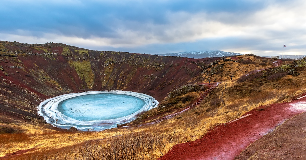
Kerið Crater, often written as Kerid Crater, is one of the most colourful and accessible volcanic crater lakes in Iceland. Located in South Iceland’s Grímsnes area, it is a popular stop on or near the Golden Circle route, known for its red volcanic slopes, green moss, dark rock and striking blue-green lake.
Kerið Crater Iceland: A Guide to the Colourful Volcanic Crater Lake on the Golden Circle
Unlike many Icelandic sights that require a long hike or rough road, Kerið is easy to visit by car or tour. Visitors can walk around the crater rim, descend toward the lake, take photos from several angles and enjoy a quick but memorable volcanic landscape only a short detour from the main Golden Circle route.
Sponsored Popular Items
Quick take: Musement.com offers a worldwide selection of tours and attractions
Kerid Crater Iceland – Nature Excursion Iceland A listing may offer admission, a guided visit, transport, a combination package or premium access. Check current availability, inclusions and booking details before you go.
What Is Kerið Crater?
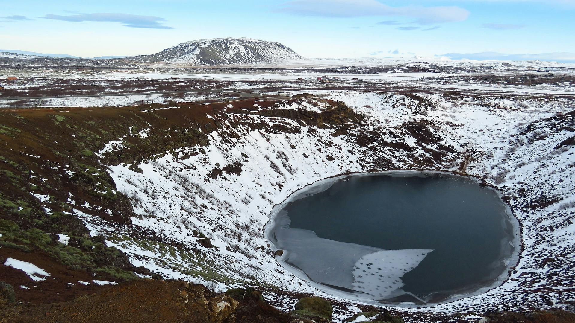
Kerið is a volcanic crater lake in South Iceland. It is part of a volcanic landscape in the Grímsnes area and is known for its bowl-shaped crater, steep red and brown volcanic walls, mossy green patches and a lake at the bottom.
The crater is often described as younger than many other volcanic formations in Iceland, which is one reason its slopes retain such vivid colour and shape. The contrast between the red volcanic rock and blue-green water makes it one of the most photogenic short stops near the Golden Circle.
Why Visit Kerið Crater?
Kerið is worth visiting because it is quick, easy and visually different from many other Golden Circle stops. Þingvellir is broad and historic, Geysir is geothermal and active, Gullfoss is powerful and dramatic, while Kerið feels compact, colourful and volcanic.
It is also practical. You do not need a long hike, specialist gear or a full day. Most visitors can experience the crater in under an hour, making it ideal as a final Golden Circle stop before returning to Reykjavík or continuing along the South Coast.
Kerið and the Golden Circle
Kerið is not always included in the classic three-stop Golden Circle route, but it is one of the best add-ons. The classic Golden Circle usually includes Þingvellir National Park, Geysir geothermal area and Gullfoss waterfall. Kerið sits farther south and is commonly added on the return drive toward Reykjavík.
If you are self-driving, Kerið is easy to include after Gullfoss and Geysir, especially if your route returns through Selfoss or the south-western side of the Golden Circle.
What to See at Kerið
The Crater Rim
The rim gives the best overall view of the crater shape. From above, you can see the full oval bowl, the lake below and the changing colours of the crater walls.
The Crater Lake
The lake at the bottom is the main visual feature. Depending on light and weather, it can look deep blue, turquoise, green-blue or dark and reflective.
The Red Volcanic Slopes
Kerið’s red and rust-coloured slopes make it stand out from darker volcanic landscapes elsewhere in Iceland. The red tones contrast beautifully with green moss and pale grasses.
Changing Light
The crater looks different throughout the day. Bright sun brings out the colour of the water, while cloud creates a moodier volcanic look. After rain, the slopes can appear richer and darker.
Walking Around the Crater Rim
The rim walk is the best way to appreciate Kerið’s shape. The path around the top gives multiple viewpoints, so do not stop only at the first lookout.
The walk is not long, but it can be exposed to wind. Some sections may be uneven, muddy, icy or slippery depending on the season. Stay on the path and avoid walking too close to the edge.
Walking Down to the Lake
Visitors can usually walk down toward the lake using the marked path and steps. This gives a different perspective from the crater floor, where the walls rise around you and the water feels much closer.
The descent is worthwhile if conditions are safe and you have suitable shoes. In winter or icy conditions, take extra care or enjoy the crater from the rim only.
Why Is Kerið So Colourful?
Kerið’s colour comes from the mix of volcanic rock, minerals, moss, grasses and lake water. The red volcanic slopes are especially striking because they differ from the black lava landscapes many visitors expect in Iceland.
The water colour changes with the sky, season and light. On a bright day, the lake can look vivid blue-green. On a grey day, it may appear darker and more reflective.
How to Get There from Reykjavík
Kerið is located in South Iceland, roughly east of Reykjavík and close to the Golden Circle driving route. Most visitors arrive by rental car or as part of a Golden Circle tour that includes Kerið as an extra stop.
For self-drivers, Kerið is reached via Route 35 in the Grímsnes area. It is generally easy to find, with a parking area near the entrance. Always check road conditions in winter, as Icelandic weather can change quickly.
Entry Fee and Opening Hours
Kerið is one of the Icelandic natural attractions that charges a small service fee. The official Kerið website currently lists the service fee at 700 ISK.
Opening is generally daylight-based rather than a typical indoor-attraction schedule. In summer, this gives long visiting hours because of Iceland’s extended daylight. In winter, daylight is short, so plan your visit carefully.
Best Time to Visit
Summer
Summer gives long daylight, easier walking conditions and strong colour contrast between red slopes, green moss and blue water. It is also the busiest season.
Autumn
Autumn can be beautiful, with cooler air, softer light and fewer visitors. The earthy crater colours often look especially rich in autumn weather.
Winter
Winter can make Kerið look dramatic, especially if snow lines the rim or the lake partly freezes. Paths may be icy, and daylight is limited, so wear proper footwear and avoid rushing.
Spring
Spring brings changing light, melting snow and quieter conditions before the main summer season. Paths can be muddy or slippery, so good shoes are useful.
How Long to Spend There
20 minutes: Enough for a quick look from the rim and a few photos.
30 to 45 minutes: Best for most visitors. This gives time to walk part or all of the rim and descend toward the lake.
One hour: Ideal if you want relaxed photography, changing viewpoints and a slower walk.
Kerið is usually a short stop, not a full-day destination. Its strength is that it adds a vivid volcanic landscape to a Golden Circle itinerary without taking too much time.
Simple Golden Circle Itinerary with Kerið
Classic Full-Day Self-Drive Route
Morning: Leave Reykjavík and drive to Þingvellir National Park.
Late morning: Continue to the Geysir geothermal area.
Midday: Visit Gullfoss waterfall.
Afternoon: Drive toward Kerið Crater and walk the rim.
Late afternoon: Continue toward Selfoss or return to Reykjavík.
Short Golden Circle Add-On
Visit Geysir and Gullfoss first.
Stop at Kerið on the return route.
Allow 30 to 45 minutes for the crater.
Return to Reykjavík before dark in winter.
What to See Nearby
Þingvellir National Park
Þingvellir is one of Iceland’s most important historic and geological sites, where the North American and Eurasian tectonic plates pull apart.
Geysir Geothermal Area
The Geysir area is famous for Strokkur, the active geyser that erupts regularly and is one of the main Golden Circle highlights.
Gullfoss Waterfall
Gullfoss is a powerful two-tiered waterfall and one of Iceland’s most famous natural attractions.
Selfoss
Selfoss is a useful town for fuel, food and overnight stays when travelling between the Golden Circle, Reykjavík and the South Coast.
Secret Lagoon
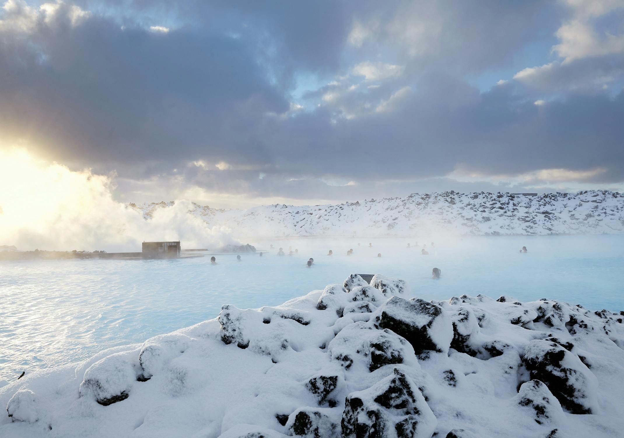
The Secret Lagoon near Flúðir is a popular geothermal bathing stop that can be added to a Golden Circle day if you want a warm soak.
What to Wear and Bring
Warm layer or windproof jacket
Comfortable walking shoes
Waterproof jacket in wet weather
Hat and gloves in winter
Camera or phone
Power bank
Water bottle
Microspikes in icy winter conditions
Card or payment method for the service fee
Practical Travel Tips
Walk More Than One Viewpoint
The crater looks different from every side. Walk at least part of the rim before deciding you have seen it properly.
Wear Proper Shoes
The path can be muddy, gravelly, windy or icy depending on the season. Avoid smooth-soled shoes.
Visit Late in the Day for Softer Light
Late afternoon can be excellent for photos, especially in summer and autumn. In winter, make sure you still have enough daylight.
Do Not Fly a Drone Without Permission
Drone restrictions may apply, and many Icelandic natural sites restrict or prohibit drone use. Check local signs and rules before flying.
Stay on Marked Paths
The crater slopes are fragile and can be slippery. Staying on marked tracks protects both visitors and the landscape.
Do Not Treat It as a Swimming Stop
Kerið is best visited as a viewpoint and walking stop. The lake is not a normal swimming attraction.
Check Winter Road Conditions
If visiting in winter, check Icelandic road and weather information before driving. Conditions can change quickly.
Add It to the End of the Golden Circle
Kerið works especially well as a final stop before returning to Reykjavík, because it is easy to visit in under an hour.
FAQs About Kerið Crater
Where is Kerið Crater?
Kerið Crater is in the Grímsnes area of South Iceland, close to the Golden Circle route and east of Reykjavík.
Is Kerið Crater worth visiting?
Yes. Kerið is worth visiting because it is colourful, easy to access and quick to add to a Golden Circle itinerary.
How much does Kerið Crater cost?
The official Kerið website currently lists a 700 ISK service fee to visit the crater and lake.
How long do you need at Kerið?
Most visitors need 30 to 45 minutes. Allow up to one hour if you want to walk the rim, go down to the lake and take photos slowly.
Can you walk around Kerið Crater?
Yes. Visitors can walk around the rim and usually descend toward the lake using marked paths.
Is Kerið part of the Golden Circle?
Kerið is often included as an extra Golden Circle stop, although the classic Golden Circle usually focuses on Þingvellir, Geysir and Gullfoss.
Can you visit Kerið in winter?
Yes, but paths can be icy and daylight is short. Wear proper footwear and check road conditions before travelling.
Can you swim in Kerið Crater Lake?
No. Kerið should be treated as a scenic crater-lake viewpoint, not a swimming spot.
Do you need a tour to visit Kerið?
No. Kerið is easy to visit by rental car. Many Golden Circle tours also include it as an additional stop.
What makes Kerið Crater red?
The red colour comes from the volcanic rock and mineral-rich slopes, which contrast strongly with moss, grasses and the blue-green lake.
Final Thoughts
Kerið Crater is one of the easiest ways to add a vivid volcanic landscape to a Golden Circle trip. Its red crater walls, blue-green lake and simple walking paths make it a rewarding short stop for photographers, families and self-drive travellers.
For the best experience, allow at least 30 to 45 minutes, walk part of the rim, go down toward the lake if conditions are safe, and visit in good light if photography matters. Kerið may be a quick stop, but its colour and shape make it one of South Iceland’s most memorable small natural attractions.
Sponsored Popular Items
Quick take: Musement.com offers a worldwide selection of tours and attractions
Kerid Crater Iceland – Nature Excursion Iceland A listing may offer admission, a guided visit, transport, a combination package or premium access. Check current availability, inclusions and booking details before you go.
Golden Circle and Blue Lagoon Admission Tickets with Kerid Volcanic Crater Iceland Golden Circle and Blue Lagoon admission tickets with Kerid Volcanic Crater provides a structured way to visit a notable attraction or cultural site. Check current availability, inclusions and booking details before you go.
Tour of the Golden Circle and Kerid Crater – Reykjavik Guided Tour Iceland Tour of the Golden Circle and Kerid Crater is a convenient way to add structure, local context and purposeful sightseeing to the itinerary. Check current availability, inclusions and booking details before you go.
Skaftafell Glacier is one of the most accessible and memorable glacier areas in south-east Iceland. Located within Vatnajökull National Park, the Skaftafell area is known for outlet glaciers, dramatic mountain scenery, black-sand plains, waterfall walks, glacier hiking tours and views of Europe’s largest ice cap.
Skaftafell Glacier Iceland: A Guide to Glacier Hikes, Viewpoints, Waterfalls and Vatnajökull National Park
Travellers often use the name “Skaftafell Glacier” to refer to the glacier experiences around Skaftafell, especially Skaftafellsjökull, Falljökull and nearby outlet glaciers flowing down from Vatnajökull. Whether you want a guided glacier hike, an easy viewpoint walk, a waterfall trail or a stop on Iceland’s South Coast, Skaftafell is one of the best places to experience the power of Icelandic ice.
Sponsored Popular Items
Quick take: Musement.com offers a worldwide selection of tours and attractions
Vatnajökull ice cave tour with a glacier hike – Outdoor Adventure Iceland Vatnajökull ice cave tour with a glacier hike adds structure, local context and purposeful sightseeing to the itinerary. Check current availability, inclusions and booking details before you go.
What Is Skaftafell Glacier?
Skaftafell Glacier usually refers to the glacier landscape around Skaftafell in Vatnajökull National Park. The most commonly visited glacier tongue is Skaftafellsjökull, an outlet glacier flowing down from the Vatnajökull ice cap. Nearby glaciers such as Falljökull and Svínafellsjökull are also associated with Skaftafell glacier tours and viewpoints.
This is not one single fenced attraction. Skaftafell is a wider nature area with trails, glacier tongues, guided tour meeting points, campsites, viewpoints and access to some of Iceland’s most dramatic south-east landscapes.
Why Visit Skaftafell?
Skaftafell is worth visiting because it gives travellers several classic Icelandic landscapes in one area: glaciers, mountains, black volcanic ground, waterfalls, birch woodland, braided rivers and views toward Vatnajökull.
It works for many travel styles. You can do a short walk to a glacier viewpoint, join a guided glacier hike, walk to Svartifoss waterfall, take a longer hike to Sjónarnípa, or use Skaftafell as a base between Jökulsárlón Glacier Lagoon and the South Coast.
Skaftafell and Vatnajökull National Park
Skaftafell is part of Vatnajökull National Park, one of Iceland’s most important protected landscapes. Vatnajökull is the huge ice cap that dominates south-east Iceland, and its outlet glaciers flow down through valleys toward the lowlands.
The Skaftafell area is especially popular because it is relatively easy to reach from Iceland’s Ring Road while still feeling wild and powerful. It is one of the best places in Iceland to understand how glaciers shape valleys, rivers, plains and mountains.
Skaftafellsjökull Glacier Viewpoint
Skaftafellsjökull is the easiest glacier tongue to view from the Skaftafell visitor area. A marked walking route leads toward a viewpoint where you can see the glacier, its moraine, meltwater and surrounding mountains.
This is a good option if you want to see a glacier without joining a guided ice hike. The walk is not the same as walking on the glacier itself; it is a land-based viewpoint route. Do not leave the marked trail or attempt to step onto the ice without a qualified guide and proper glacier equipment.
Guided Glacier Hikes
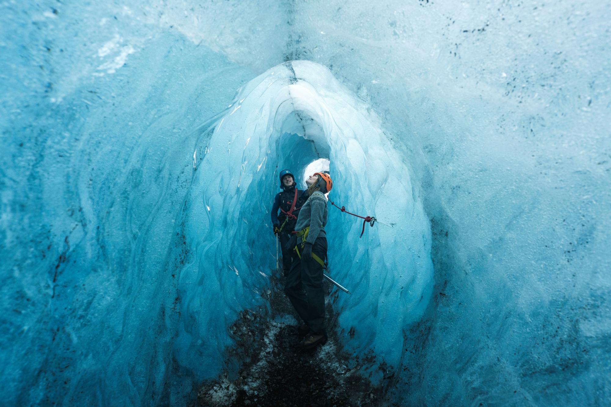
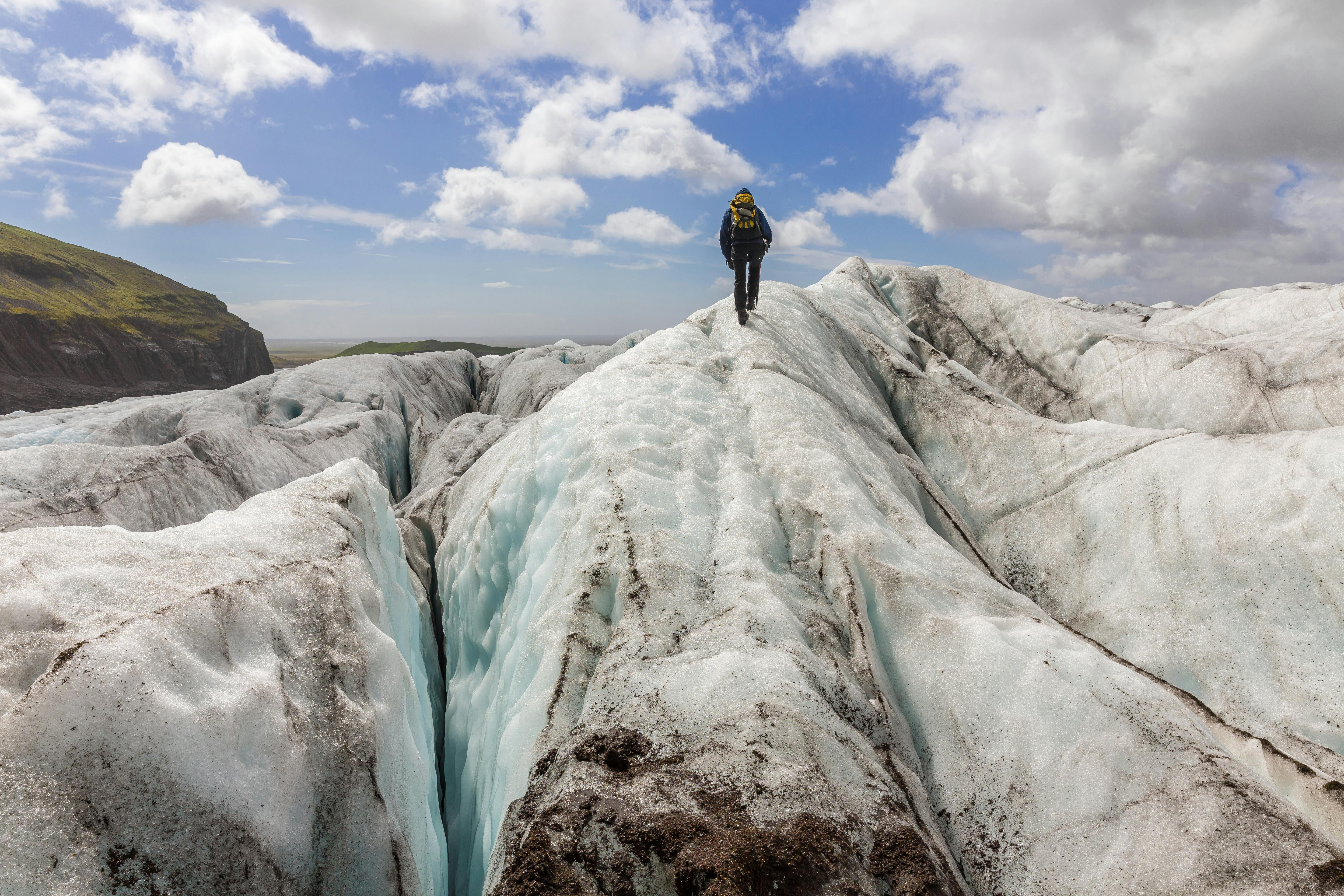
Guided glacier hikes are one of the main reasons travellers come to Skaftafell. These tours usually provide specialist equipment such as crampons, helmets, harnesses where required and ice axes, along with instruction from trained glacier guides.
A typical beginner-friendly glacier hike may involve walking across ice, learning how to use crampons, seeing crevasses from a safe distance, exploring blue ice features and understanding how the glacier moves. More advanced tours may include longer routes, deeper crevasse areas or ice climbing.
Glacier hikes should be booked in advance during busy seasons. Tour times, minimum ages, difficulty levels and meeting points vary by operator, so read the details carefully before booking.
Ice Caves and Winter Glacier Experiences
Natural ice caves are usually a winter experience in Iceland because colder conditions make some caves more stable. Skaftafell and the wider Vatnajökull region are popular bases for winter ice-cave tours, although exact cave locations change from year to year.
Never enter an ice cave independently. Ice caves can change rapidly because of melt, movement, temperature, rain and structural instability. Go only with a professional guide who has checked current conditions.
Svartifoss Waterfall
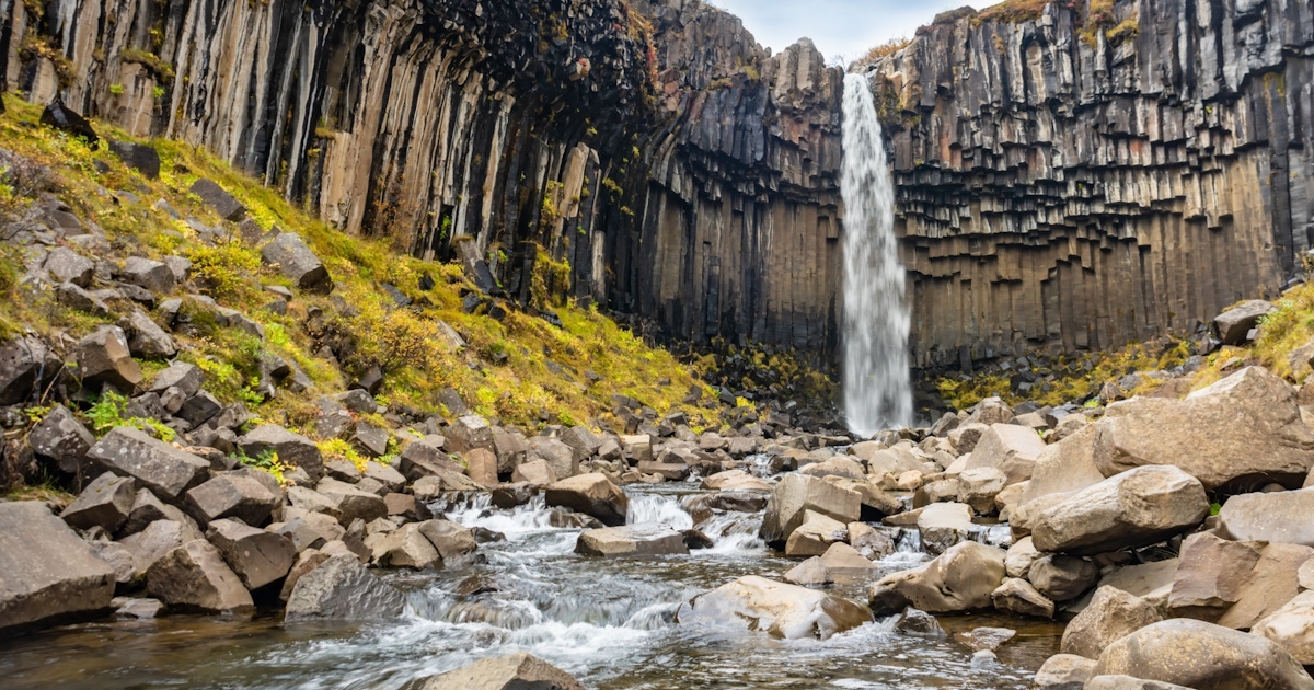
Svartifoss is one of Skaftafell’s most famous non-glacier attractions. The waterfall drops over dark basalt columns, creating one of Iceland’s most distinctive waterfall scenes.
The hike to Svartifoss is moderately uphill and takes more effort than a roadside stop, but it is one of the best short hikes in the area. The basalt-column setting makes it especially photogenic.
Sjónarnípa Viewpoint
Sjónarnípa is a scenic viewpoint above Skaftafell with sweeping views toward Skaftafellsjökull and the surrounding glacier landscape. It is a longer and more demanding walk than the simple glacier viewpoint, but it is rewarding in clear weather.
This is a good choice for travellers who want a hiking experience rather than only a short stop. Weather and visibility matter, so check conditions at the visitor centre before heading out.
Skaftafell Visitor Centre
Skaftafellsstofa Visitor Centre is the practical starting point for most visits. It provides information about trails, conditions, safety, accommodation, camping, recreation and the local environment.
Before hiking, stop here to check current trail conditions, weather, closures and advice. Icelandic weather can change quickly, and local guidance is valuable, especially if you are planning anything beyond the shortest marked walks.
How to Get There
Skaftafell is located in south-east Iceland along the Ring Road, between Kirkjubæjarklaustur and Jökulsárlón Glacier Lagoon. Most visitors arrive by rental car, campervan, guided South Coast tour or multi-day Iceland tour.
Driving from Reykjavík is a long journey, so Skaftafell is best included as part of a multi-day South Coast itinerary rather than a rushed day trip from the capital. Many travellers stay nearby or continue to Höfn, Jökulsárlón, Vík or Kirkjubæjarklaustur depending on their route.
Best Time to Visit Skaftafell
Summer
Summer is best for long daylight, green landscapes, hiking trails and easier driving. Glacier hikes usually operate in summer, but natural ice caves are generally not the main focus then.
Autumn
Autumn can be beautiful, with fewer crowds, cooler weather and changing colours. Conditions become more variable, so waterproof and warm clothing are important.
Winter
Winter is best for ice-cave tours, snowy scenery and a more dramatic frozen atmosphere. Driving can be more difficult, daylight is short and weather can disrupt plans.
Spring
Spring can offer a mix of snow, ice, meltwater and improving daylight. Trail conditions vary, and some higher routes may still be affected by snow or ice.
How Long to Spend There
One to two hours: Enough for a short stop at the visitor centre and a simple walk toward the Skaftafellsjökull viewpoint.
Half day: Good for Svartifoss, Sjónarnípa or a shorter guided glacier walk.
Full day: Best if you want a glacier hike plus one waterfall or viewpoint trail.
Two days: Ideal if you want to combine Skaftafell with Jökulsárlón, Diamond Beach, an ice cave, longer hiking or a slower South Coast route.
Simple Skaftafell Itinerary
Half-Day Visit
Arrive at Skaftafell Visitor Centre.
Check trail and weather conditions.
Walk to the Skaftafellsjökull glacier viewpoint.
Return to the visitor area for a short break.
If time allows, add a shorter section of the Svartifoss trail.
Full-Day Glacier and Waterfall Plan
Arrive early and meet your guided glacier hike operator.
Join a glacier hike with crampons and safety gear.
Have lunch near the visitor centre or picnic area.
Walk to Svartifoss waterfall in the afternoon.
Continue to Jökulsárlón or stay nearby overnight.
Winter Ice-Cave Plan
Check road and weather conditions before departure.
Join a guided ice-cave or glacier tour only with a qualified operator.
Wear warm waterproof clothing and sturdy boots.
Allow extra driving time because winter roads can be slower.
Add Jökulsárlón Glacier Lagoon or Diamond Beach if daylight allows.
What to See Nearby
Jökulsárlón Glacier Lagoon
Jökulsárlón is one of Iceland’s most famous sights, with floating icebergs, glacier views and boat tours in season. It is an easy add-on from Skaftafell by South Coast standards.
Diamond Beach
Diamond Beach sits near Jökulsárlón, where ice chunks wash onto black sand. Conditions change daily, but it can be spectacular when ice is present.
Fjallsárlón Glacier Lagoon
Fjallsárlón is a smaller glacier lagoon near Jökulsárlón. It is often quieter and gives beautiful glacier views.
Hofskirkja Turf Church
Hofskirkja is a small turf-roofed church near the Skaftafell area. It is a quick cultural photo stop if your route passes nearby.
Vík and Reynisfjara
Farther west, Vík and Reynisfjara black sand beach are major South Coast stops. They are not immediately next to Skaftafell, but they are often included on the same multi-day route.
What to Wear and Bring
Waterproof jacket
Warm layers
Sturdy hiking boots with ankle support
Gloves and hat
Waterproof trousers if hiking in wet weather
Reusable water bottle
Snacks or packed lunch
Camera or phone with power bank
Sunglasses for glacier glare
Small backpack
Microspikes for non-glacier icy trails if conditions require them
Glacier Safety Tips
Do Not Walk Onto a Glacier Alone
Glaciers are active, moving landscapes with crevasses, moulins, unstable ice, meltwater channels and changing surfaces. Only step onto a glacier with a qualified guide and proper equipment.
Use Proper Equipment
Glacier hikes require equipment such as crampons, helmets and sometimes harnesses or ice axes. Tour operators usually provide specialist gear, but you still need suitable boots and clothing.
Check Weather and Road Conditions
Weather in south-east Iceland can change quickly. Wind, rain, snow, fog and road closures can affect travel plans at any time of year.
Stay on Marked Trails
For land-based hikes, stay on marked paths and follow signs. Glacier fronts, moraine areas and river edges can be unstable.
Never Step on Floating Ice
Icebergs and floating ice can roll, break or drift suddenly. Never step onto ice in lagoons or near glacier lakes.
Respect Closures
Trail and area closures are used for safety and conservation. Do not enter closed paths, glacier access areas or unstable moraine zones.
Be Honest About Fitness
Glacier hikes vary in difficulty. Choose a tour that matches your fitness, age, experience and comfort with cold, uneven terrain.
FAQs About Skaftafell Glacier
Where is Skaftafell Glacier?
Skaftafell Glacier is in the Skaftafell area of Vatnajökull National Park in south-east Iceland, close to the Ring Road and west of Jökulsárlón Glacier Lagoon.
Is Skaftafell Glacier worth visiting?
Yes. Skaftafell is one of the best places in Iceland for glacier views, guided glacier hikes, waterfall trails and South Coast mountain scenery.
Can you walk on Skaftafell Glacier without a guide?
No. You should not walk onto any glacier in Iceland without proper experience, equipment and local knowledge. A certified glacier guide is strongly recommended.
What glacier is near Skaftafell?
Skaftafellsjökull is the most accessible glacier tongue near the Skaftafell visitor area. Nearby glacier-tour areas may also include Falljökull and Svínafellsjökull.
How long is the walk to the Skaftafellsjökull viewpoint?
The walk is a relatively short return route from the visitor area, but conditions and exact timing vary. Allow roughly one to two hours if you want to walk, take photos and return comfortably.
What is the best glacier hike in Skaftafell?
The best glacier hike depends on your fitness and experience. Beginners should choose an introductory guided glacier walk, while more active travellers may prefer a longer glacier hike or ice-climbing tour.
Can you visit ice caves in Skaftafell?
Ice-cave tours are usually winter experiences in the Skaftafell and Vatnajökull region. Exact cave locations and availability change each season.
Is Skaftafell good for families?
Yes, Skaftafell can be good for families, especially for short walks and viewpoints. Glacier hikes may have minimum age limits, so check tour requirements before booking.
What else can you do in Skaftafell besides glacier hiking?
You can hike to Svartifoss, walk to Skaftafellsjökull viewpoint, visit Sjónarnípa, use the visitor centre, camp nearby and combine the area with Jökulsárlón and Diamond Beach.
What is the best time to visit Skaftafell?
Summer is best for hiking and long daylight. Winter is best for ice caves and snowy glacier scenery. Spring and autumn can be quieter but more weather-dependent.
Final Thoughts
Skaftafell Glacier is one of the best places in Iceland to experience the meeting of ice, mountains and black volcanic landscape. Whether you join a guided glacier hike, walk to a glacier viewpoint or hike to Svartifoss, the area gives a powerful sense of how glaciers shape Iceland’s South Coast.
For the best visit, stop first at Skaftafellsstofa Visitor Centre, check current conditions, book glacier tours ahead in busy seasons and never step onto glacier ice without a qualified guide. With the right planning, Skaftafell can be one of the most memorable stops on an Iceland Ring Road or South Coast itinerary.
Sponsored Popular Items
Quick take: Musement.com offers a worldwide selection of tours and attractions
Vatnajökull ice cave tour with a glacier hike – Outdoor Adventure Iceland Vatnajökull ice cave tour with a glacier hike adds structure, local context and purposeful sightseeing to the itinerary. Check current availability, inclusions and booking details before you go.
The Golden Gate Bridge is the most recognisable landmark in San Francisco and one of the most famous bridges in the world. Spanning the Golden Gate Strait between San Francisco and Marin County, the bridge is known for its International Orange colour, Art Deco towers, sweeping suspension cables, bay views, fog, coastal cliffs and dramatic viewpoints.
Golden Gate Bridge San Francisco: A Guide to Walking, Cycling, Viewpoints, Tolls and Visitor Tips
For first-time visitors, the best Golden Gate Bridge experience usually includes walking part or all of the bridge, visiting the Golden Gate Bridge Welcome Center, stopping at Battery Spencer or Vista Point for photos, exploring Crissy Field or Fort Point, and seeing the bridge from at least one beach or coastal overlook.
Sponsored Popular Items
Quick take: Musement.com offers a worldwide selection of tours and attractions
The Golden Gate Bridge is worth visiting because it combines engineering, scenery, history and San Francisco atmosphere in one unforgettable landmark. The bridge looks different depending on the weather: bright and sharp under blue skies, moody in fog, glowing at sunset, or partly hidden by low cloud rolling through the bay.
It is not only a bridge to photograph from a distance. Walking or cycling across it gives you views of San Francisco Bay, Alcatraz, Angel Island, Marin Headlands, the Pacific Ocean, Fort Point and the city skyline.
A Short History of the Bridge
The Golden Gate Bridge was built during the 1930s and opened in 1937. At the time, it was an extraordinary engineering achievement, crossing a difficult stretch of water known for strong tides, wind, fog and deep currents.
The bridge’s distinctive colour is called International Orange. It was chosen because it stands out against the natural landscape, fog and water, while still complementing the surrounding hills and bay.
The bridge remains both a working transport link and a symbol of San Francisco. It carries vehicle traffic, pedestrians and cyclists, while also serving as one of the city’s most visited attractions.
Walking Across the Golden Gate Bridge
Walking across the Golden Gate Bridge is one of the best ways to experience it. The full bridge span is longer than many visitors expect, so allow enough time and dress for wind.
You do not have to walk the whole bridge. Many visitors walk from the Welcome Center to the first tower and back, which gives excellent views without committing to the full crossing.
Walking Options
Short walk: Walk from the south side to the first tower and return.
Half crossing: Walk farther toward the middle for bay and city views.
Full crossing: Walk from San Francisco to the north side near Vista Point, then return or continue into Marin.
Pedestrian sidewalk hours can change seasonally or because of maintenance and events. Check the official Golden Gate Bridge sidewalk schedule before planning an early morning or evening walk.
Cycling Across the Bridge
Cycling across the Golden Gate Bridge is popular, especially as part of a ride from San Francisco to Sausalito. Many visitors rent bikes near Fisherman’s Wharf, ride through the Marina and Crissy Field, cross the bridge, continue downhill to Sausalito, then return by ferry.
Cyclists should follow bridge rules carefully. The sidewalks can be narrow, crowded and windy, especially near the towers. Cyclists must yield to pedestrians, obey speed limits and use the correct sidewalk according to the official schedule.
Electric bikes are allowed, but riders still need to follow cyclist rules. Scooters, skateboards, roller skates and rollerblades are not permitted on the bridge sidewalks.
Best Golden Gate Bridge Viewpoints
The Golden Gate Bridge is best seen from several viewpoints because each angle gives a different impression. Some viewpoints look across the bay, some place the city behind the towers, and others show the bridge from beaches, cliffs or historic forts.
Battery Spencer
Battery Spencer in the Marin Headlands is one of the most famous Golden Gate Bridge viewpoints. It gives a close, elevated view looking south across the bridge toward San Francisco.
This is one of the best places for classic bridge photos, especially in the late afternoon or around sunset. Parking is limited, roads can be busy, and fog may block the view, so allow extra time.
Golden Gate Bridge Vista Point
Vista Point is on the north side of the bridge in Marin County. It is easy to reach after crossing the bridge from San Francisco and gives good views back toward the city, bay and bridge.
It is convenient for drivers and cyclists, but it can be crowded. It works well as a quick stop if you are driving north toward Sausalito, Muir Woods, Marin Headlands or Napa/Sonoma routes.
Fort Point
Fort Point sits directly beneath the southern end of the Golden Gate Bridge. This viewpoint shows the huge scale of the bridge from below, with the red steel structure rising above the historic brick fort.
It is one of the best places for dramatic close-up photos. The fort itself is also worth visiting if open, especially for history lovers and photographers.
Quick take: Musement.com offers a worldwide selection of tours and attractions
San Francisco City Self-Guided Audio Tour through Golden Gate Bridge United States San Francisco city self-guided audio tour through Golden Gate Bridge is designed for travellers who prefer independent exploration while still having structured digital guidance available. Check current availability, inclusions and booking details before you go.
Crissy Field
Crissy Field offers a wide, relaxed waterfront view of the Golden Gate Bridge from the San Francisco side. It is excellent for walking, cycling, picnics, dog walking, beach views and skyline photos.
This area is especially good for families because it is flatter and more open than many other viewpoints. It also connects naturally with the Presidio, Palace of Fine Arts and Fort Point.
Baker Beach and Marshall’s Beach
Baker Beach gives a classic beach-level view of the Golden Gate Bridge with the Marin Headlands behind it. It is a strong sunset location, although fog can roll in quickly.
Marshall’s Beach is smaller and more rugged, with a closer coastal view of the bridge. Access involves trails and steps, so it is less convenient than Baker Beach but rewarding for photographers.
Swimming is not recommended at these beaches because of cold water, strong currents and rough conditions.
Golden Gate Bridge Welcome Center
The Golden Gate Bridge Welcome Center on the San Francisco side is a useful starting point. It has visitor information, exhibits, souvenirs, restrooms nearby and access to the bridge sidewalk and south-side viewpoints.
This is one of the easiest places to begin if you are using public transport, rideshare, bike rental or a tour. It is also convenient for short walks onto the bridge.
Golden Gate Bridge Tolls
Golden Gate Bridge vehicle tolls are collected electronically in the southbound direction into San Francisco. There are no cash toll collectors. Drivers can pay through FasTrak, a License Plate Account, One-Time Payment or a Toll Invoice.
If you are driving a rental car, check the rental company’s toll policy before crossing. Some rental agencies charge extra administrative fees. Visitors can also make a one-time payment before crossing or shortly after crossing if they choose not to use the rental company’s toll program.
Pedestrians and cyclists do not pay a toll to cross the bridge.
How to Get There
By Public Transport
Public transport can get you close to the bridge, especially via bus routes serving the Presidio and Golden Gate Bridge area. Check current routes and schedules before travelling, as services and stops can change.
By Bike
Cycling is one of the most popular ways to reach the bridge. A common route starts near Fisherman’s Wharf, continues through the Marina and Crissy Field, crosses the bridge and ends in Sausalito.
By Car
Driving is useful if you want to visit Battery Spencer, Marin Headlands or multiple viewpoints, but parking can be limited. Expect traffic during weekends, holidays and clear-weather afternoons.
By Rideshare or Taxi
A rideshare is an easy option for reaching the Welcome Center or nearby viewpoints, especially if you do not want to manage parking.
Parking Tips
Parking near the Golden Gate Bridge is limited and can fill quickly. Some lots close during busy weekends and holidays, especially around major visitor periods.
If you plan to drive, arrive early, check official parking alerts and have a backup viewpoint. Crissy Field, Baker Beach, Battery East and the Presidio may offer alternatives, depending on your route and timing.
Best Time to Visit
The Golden Gate Bridge can be visited year-round, but weather changes quickly. Fog is common, especially in summer, and it can hide the bridge completely or create dramatic partial views.
Morning
Morning can be good for lighter crowds and calmer walking. Fog may be present, but it can also create beautiful atmosphere.
Afternoon
Afternoon often brings better visibility, although wind can increase. This is a good time for bridge walks and south-side viewpoints.
Sunset
Sunset is excellent from Battery Spencer, Baker Beach, Marshall’s Beach and the Marin Headlands. Arrive early because parking fills and fog can change the view quickly.
Clear Winter Days
Some of the clearest bridge views happen in winter after rain, when the air is crisp and visibility across the bay is excellent.
What to See Nearby
The Presidio
The Presidio is a former military post turned national park site, with trails, picnic areas, historic buildings, viewpoints, museums and open spaces near the bridge.
Fort Point
Fort Point is directly beneath the bridge and combines military history with one of the best close-up bridge views.
Crissy Field
Crissy Field is ideal for flat walking, cycling, picnics and relaxed bay views.
Palace of Fine Arts
The Palace of Fine Arts is a beautiful architectural landmark near the Marina and pairs well with Crissy Field and the bridge.
Sausalito
Sausalito is a scenic waterfront town north of the bridge, popular with cyclists, day-trippers, cafés, galleries and ferry returns to San Francisco.
Marin Headlands
The Marin Headlands offer some of the best bridge views, coastal trails, military batteries, beaches and ocean scenery.
Simple Golden Gate Bridge Itinerary
Classic Half-Day Visit
Start at the Golden Gate Bridge Welcome Center.
Walk onto the bridge to the first tower or farther if time allows.
Visit Battery East or nearby south-side viewpoints.
Continue down to Fort Point for a view from underneath the bridge.
Walk or cycle through Crissy Field.
Finish at the Palace of Fine Arts or return to Fisherman’s Wharf.
Photo-Focused Visit
Start early at Battery Spencer or the Marin Headlands if driving.
Visit Vista Point for a north-side view.
Cross back toward San Francisco and stop at Fort Point.
Continue to Baker Beach or Marshall’s Beach for beach-level photos.
Stay for sunset if conditions are clear.
Bike Ride to Sausalito
Rent a bike near Fisherman’s Wharf or the Marina.
Ride through Crissy Field toward the bridge.
Cross the Golden Gate Bridge using the correct bicycle sidewalk.
Continue downhill to Sausalito.
Have lunch by the waterfront.
Return by ferry to San Francisco if available and convenient.
What to Wear and Bring
Warm jacket or windproof layer
Comfortable walking shoes
Hat or beanie if windy
Sunglasses
Water bottle
Phone or camera
Power bank
Bike helmet if cycling
Small day bag
Transit card or payment method if using public transport
Safety Tips
Dress for Wind
The bridge can be much colder and windier than nearby streets. Bring a layer even on sunny days.
Stay on the Sidewalk
Do not climb railings, barriers or bridge structures. Stay on permitted pedestrian and cycling areas.
Follow Bicycle Rules
Cyclists should use the correct sidewalk, slow near towers, yield to pedestrians and obey posted speed limits.
Watch Children Closely
The bridge is busy, windy and close to traffic. Keep children close and avoid letting them run ahead.
Be Careful at Coastal Viewpoints
Battery Spencer, Marshall’s Beach and cliffside areas can have steep drops, loose ground and strong wind. Stay behind barriers where present.
Protect Valuables in Cars
Do not leave bags or valuables visible in parked cars at bridge viewpoints, beaches or trailheads.
Check Fog Before Committing to Sunset
Fog can hide the bridge completely. If photography is important, check live cameras or local weather before travelling across the city.
FAQs About the Golden Gate Bridge
Where is the Golden Gate Bridge?
The Golden Gate Bridge connects San Francisco with Marin County across the Golden Gate Strait in California.
Can you walk across the Golden Gate Bridge?
Yes. Pedestrians can walk on the bridge sidewalk during permitted hours. Check the current official sidewalk schedule before visiting.
How long does it take to walk across the Golden Gate Bridge?
A full one-way walk usually takes about 35 to 45 minutes for many visitors, depending on pace, wind and photo stops. A return walk can take 90 minutes or more.
Is it free to walk across the Golden Gate Bridge?
Yes. Walking and cycling across the Golden Gate Bridge are free.
Do cars pay a toll on the Golden Gate Bridge?
Yes. Vehicle tolls are collected electronically in the southbound direction into San Francisco. Northbound travel out of San Francisco is not tolled.
Can you bike across the Golden Gate Bridge?
Yes. Cyclists can cross the bridge, but they must follow the official sidewalk schedule and rules. Cyclists have toll-free access 24 hours a day.
What is the best viewpoint for the Golden Gate Bridge?
Battery Spencer is one of the best elevated viewpoints. Fort Point is best from below, Crissy Field is best for a relaxed bay view, and Baker Beach is excellent for a beach-level view.
Why is the Golden Gate Bridge orange?
The bridge colour is called International Orange. It improves visibility in fog and complements the surrounding landscape.
Is the Golden Gate Bridge always visible?
No. Fog can hide the bridge partly or completely, especially in summer. Conditions can change quickly.
What should I combine with the Golden Gate Bridge?
Good nearby stops include the Presidio, Fort Point, Crissy Field, Palace of Fine Arts, Baker Beach, Marin Headlands and Sausalito.
Final Thoughts
The Golden Gate Bridge is more than a photo stop. It is best experienced from several angles: walking onto the span, standing beneath it at Fort Point, seeing it from Crissy Field, and viewing it from the Marin Headlands or Baker Beach.
For the best visit, dress for wind, check sidewalk access hours, arrive early if driving, and allow time for fog to shift. Whether it appears bright against blue sky or half-hidden in mist, the Golden Gate Bridge remains one of the most memorable landmarks in California.
Sponsored Popular Items
Quick take: Musement.com offers a worldwide selection of tours and attractions
San Francisco Golden Gate Bridge Bike and Brew Tour United States San Francisco Golden Gate Bridge bike and brew tour is a convenient way to add structure, local context and purposeful sightseeing to the itinerary. Check current availability, inclusions and booking details before you go.
San Francisco City Self-Guided Audio Tour through Golden Gate Bridge United States San Francisco city self-guided audio tour through Golden Gate Bridge is designed for travellers who prefer independent exploration while still having structured digital guidance available. Check current availability, inclusions and booking details before you go.
Glacier National Park is one of the most spectacular mountain parks in the United States. Located in north-west Montana, close to the Canadian border, it is known for turquoise lakes, rugged peaks, glaciers, waterfalls, alpine meadows, wildlife, historic lodges and one of America’s most famous scenic drives: Going-to-the-Sun Road.
Glacier National Park Travel Guide: Going-to-the-Sun Road, Many Glacier, Lake McDonald, Wildlife and Hiking Tips
For first-time visitors, the best Glacier trip usually includes Lake McDonald, Going-to-the-Sun Road, Logan Pass, St. Mary Lake, Many Glacier, Two Medicine and at least one short hike. The park is beautiful but highly seasonal, so road openings, shuttle rules, lodging availability and trail conditions should always be checked before travel.
Sponsored Popular Items
Quick take: Musement.com offers a worldwide selection of tours and attractions
Glacier National Park is worth visiting for its dramatic mountain scenery, glacial valleys, clear lakes, wildlife, wildflowers and historic park roads. The landscape feels wilder and more alpine than many other U.S. national parks, with steep peaks, narrow roads, cold lakes and rugged hiking country.
The park is especially good for road-trippers, photographers, hikers, wildlife watchers and travellers who enjoy mountain landscapes. Even if you are not a serious hiker, you can still enjoy Glacier through scenic drives, lake views, shuttle stops, short walks and historic lodges.
Going-to-the-Sun Road
Going-to-the-Sun Road is Glacier’s signature experience. This narrow mountain road crosses the park from West Glacier to St. Mary, passing Lake McDonald, Avalanche Creek, The Loop, Logan Pass, alpine cliffs, waterfalls, St. Mary Lake and dramatic high-country viewpoints.
The road is about 50 miles across the park, but it should not be treated as a quick drive. Traffic, roadwork, wildlife, shuttle stops, parking shortages and photo pullouts can make the journey take much longer than expected.
The full road is usually open only in summer and early autumn. Lower sections may open earlier, but the alpine section over Logan Pass often remains closed until late June or sometimes later, depending on snow clearing and weather.
Logan Pass
Logan Pass is the highest point on Going-to-the-Sun Road and one of the busiest places in Glacier National Park. It sits on the Continental Divide and gives access to alpine meadows, mountain views, wildlife sightings and popular trails.
Two of the best-known trails from Logan Pass are the Hidden Lake Overlook Trail and the Highline Trail. Hidden Lake Overlook is shorter and very popular, while the Highline Trail is longer, more exposed and best for prepared hikers.
Parking at Logan Pass is extremely limited. In 2026, the park is using time-limited parking at Logan Pass, so visitors who want longer hikes should check shuttle and parking rules before relying on a car space.
Lake McDonald
Lake McDonald is the largest lake in Glacier National Park and one of the easiest places to enjoy the park’s west side. The lake is known for clear water, colourful stones, mountain reflections and sunset views.
Apgar Village, near the south end of the lake, is a practical first stop for visitors entering from West Glacier. It has visitor services, lake access, shops, lodging nearby and access to the park shuttle system in season.
Lake McDonald Lodge is another classic stop along Going-to-the-Sun Road. Even if you are not staying there, it is worth visiting for the historic atmosphere and lakeside setting.
Many Glacier
Many Glacier is often considered one of the most beautiful areas of the park. It is known for steep mountains, lakes, glaciers, wildlife and some of Glacier’s most famous hikes.
Popular hikes in this area include Grinnell Glacier, Iceberg Lake, Ptarmigan Falls and Swiftcurrent Pass. These trails vary in difficulty, and snow, bear activity or trail damage can affect access, so always check trail status before setting out.
Many Glacier is also a strong wildlife area. Moose, bears, bighorn sheep and other animals may be seen, especially early or late in the day, but all wildlife must be viewed from a safe distance.
St. Mary Lake
St. Mary Lake lies on the east side of Going-to-the-Sun Road and offers some of the park’s most beautiful roadside views. The lake is long, blue and framed by open slopes, peaks and weather-shaped landscapes.
Wild Goose Island Overlook is one of the most famous photo stops in Glacier. This view looks over a small island in St. Mary Lake with mountains behind it, creating one of the park’s classic images.
The St. Mary area is a useful base for the east side of Going-to-the-Sun Road, Logan Pass, Many Glacier and Two Medicine routes.
Two Medicine
Two Medicine is a quieter and very rewarding section of Glacier National Park. It has a different feel from the busy west side and Logan Pass areas, with lake scenery, hiking trails, boat trips in season and a more peaceful mountain atmosphere.
Good options in this area include Running Eagle Falls, Two Medicine Lake, Aster Falls and longer hikes for more experienced walkers. It is a strong choice if you want scenery without the heaviest Going-to-the-Sun Road crowds.
North Fork and Polebridge
The North Fork area is more remote and less developed than Glacier’s main visitor corridor. It includes Polebridge, Bowman Lake and Kintla Lake, with rougher roads, fewer services and a wilder feel.
This area is best for travellers who have extra time, a suitable vehicle, patience for slower roads and an interest in quieter lake scenery. Check road conditions carefully before travelling, especially after rain or during shoulder seasons.
Best Walks and Hikes
Glacier has walks and hikes for many fitness levels, but even popular trails can involve mountain weather, wildlife, snow patches, steep ground and limited services. Choose routes carefully.
Easy or Shorter Walks
Trail of the Cedars: A short, accessible forest boardwalk near Avalanche Creek.
Running Eagle Falls: A short walk in the Two Medicine area.
Lake McDonald shoreline: Good for relaxed lake views and photography.
Sun Point area: Useful for short views over St. Mary Lake.
Moderate Hikes
Avalanche Lake: A popular hike through forest to a mountain lake.
Hidden Lake Overlook: A classic Logan Pass walk with alpine scenery.
St. Mary and Virginia Falls: A rewarding waterfall hike on the east side.
Ptarmigan Falls: A good Many Glacier hike option.
Strenuous Hikes
Highline Trail: One of Glacier’s most famous hikes, starting at Logan Pass.
Grinnell Glacier: A demanding but outstanding Many Glacier hike.
Iceberg Lake: A long hike to a dramatic mountain lake.
Swiftcurrent Pass: A strenuous route for experienced hikers.
Wildlife in Glacier
Glacier National Park is excellent for wildlife viewing. Visitors may see mountain goats, bighorn sheep, marmots, deer, elk, moose, black bears, grizzly bears, eagles and many smaller animals.
Logan Pass is known for mountain goats and bighorn sheep. Many Glacier is a strong area for bears and moose. Lake and valley areas can also be good for birds and mammals, especially early in the morning or late in the evening.
Wildlife viewing must be done safely. Stay at least 25 yards from most wildlife and at least 100 yards from bears and wolves. Carry bear spray when hiking, know how to use it and keep it quickly accessible.
Where to Stay
West Glacier and Apgar
Best for first-time visitors entering from the west side. This area is convenient for Lake McDonald, Apgar, the west side of Going-to-the-Sun Road and Glacier Park International Airport.
St. Mary
Best for the east side of Going-to-the-Sun Road, St. Mary Lake, Logan Pass access and driving toward Many Glacier or Two Medicine.
Many Glacier
Best for hikers and wildlife watchers. Lodging is limited and highly sought after, so book early.
Whitefish
Best for a comfortable town base with restaurants, shops, hotels and access to Glacier’s west side. It is farther from the park interior but more developed.
Kalispell
Best for airport access, wider accommodation choices and practical services. Expect longer drives into the park.
East Glacier Park
Useful for Two Medicine and the east side of the park, especially if arriving by train or exploring quieter areas.
How Long to Spend
One day: Very rushed. Focus on Lake McDonald and part of Going-to-the-Sun Road, or choose one side of the park only.
Two days: Enough for Going-to-the-Sun Road and one additional area such as Many Glacier or Two Medicine.
Three days: A good minimum for first-time visitors. You can see the west side, Logan Pass, St. Mary and Many Glacier or Two Medicine.
Four to five days: Better for hikes, wildlife viewing, weather flexibility and slower scenic driving.
One week: Ideal for serious hikers, photographers and travellers who want to explore Many Glacier, Two Medicine, North Fork and both sides of Going-to-the-Sun Road.
Simple Glacier Itinerary
Day 1: West Glacier, Lake McDonald and Avalanche
Enter through West Glacier.
Stop at Apgar Village and Lake McDonald.
Drive along the west side of Going-to-the-Sun Road.
Walk Trail of the Cedars.
Hike to Avalanche Lake if you have time and energy.
Stay in West Glacier, Whitefish, Kalispell or Lake McDonald area.
Day 2: Going-to-the-Sun Road and Logan Pass
Start very early to reduce traffic and parking stress.
Drive Going-to-the-Sun Road if fully open.
Stop at The Loop, alpine pullouts and Logan Pass.
Walk Hidden Lake Overlook if conditions allow.
Continue toward St. Mary Lake and Wild Goose Island Overlook.
Stay on the east side if possible.
Day 3: Many Glacier or Two Medicine
Choose Many Glacier for big mountain hikes and wildlife.
Choose Two Medicine for a quieter lake-and-waterfall experience.
Check trail and road status before committing to the day’s plan.
Return to your lodging or continue around the park loop by road.
Optional Day 4: Extra Hiking or North Fork
Add Grinnell Glacier, Iceberg Lake or Highline Trail if you are a prepared hiker.
Or take a slower day around Bowman Lake, Polebridge or Lake McDonald.
Use this day as a weather buffer if smoke, storms or road closures affected earlier plans.
Best Time to Visit
Late June to Early July
This is often when the full Going-to-the-Sun Road begins opening, depending on snow. Waterfalls are strong, but some high trails may still have snow.
July and August
This is the main summer season, with the best access to roads, trails, shuttles and services. It is also the busiest period, with limited parking and heavy demand for lodging.
September
September is one of the best months for Glacier. Crowds may ease, weather can still be good, and autumn colour begins in some areas. Services and road access can start changing later in the month.
October
October can be beautiful but unpredictable. Alpine roads may close because of snow, and visitor services are reduced. It suits flexible travellers.
Winter and Spring
Winter and spring are quiet and snowy, with limited road access. These seasons are best for experienced winter visitors, cross-country skiing, snowshoeing and low-crowd scenery rather than full park touring.
Vehicle Reservations, Fees and Parking
For 2026, Glacier National Park is not requiring vehicle reservations for any area of the park. Visitors still need a valid park entrance pass.
Parking remains the real challenge, especially at Logan Pass, Avalanche, Many Glacier trailheads and popular lake areas. Arrive early, use shuttles where suitable and keep backup plans ready.
The park is cashless for entrance fees, so bring a card or buy your pass online before arrival. Non-US residents should check current entrance-fee rules carefully before visiting.
How to Get There
By Air
Glacier Park International Airport near Kalispell is the closest major airport and is about 30 miles from the West Entrance.
By Train
Amtrak’s Empire Builder route serves the Glacier area, including West Glacier year-round and East Glacier Park seasonally. This is one of the most scenic rail approaches to a U.S. national park.
By Car
A car gives the most flexibility, especially if visiting both west and east sides of the park. However, seasonal roads, construction and parking limits can affect travel times.
From Canada
Glacier is close to Waterton Lakes National Park in Canada. A passport is required for international border crossings, and opening times at seasonal border posts should be checked before planning a cross-border trip.
What to Wear and Pack
Layered clothing for changing mountain weather
Rain jacket or wind shell
Warm jacket for Logan Pass and early mornings
Comfortable hiking shoes
Hat, sunglasses and sunscreen
Reusable water bottle
Snacks or picnic supplies
Bear spray for hiking
Binoculars for wildlife
Offline maps or paper map
Power bank
Small first-aid kit
Insect repellent in summer
Safety Tips
Carry Bear Spray
Glacier is grizzly and black bear country. Carry bear spray on hikes, keep it accessible and know how to use it before you need it.
Keep Wildlife Distance
Stay at least 100 yards from bears and wolves, and at least 25 yards from all other wildlife. Do not feed animals or approach them for photos.
Check Road and Trail Status Daily
Roads, trails and parking access can change because of snow, storms, bear activity, fires, construction or congestion. Check official updates before setting out.
Prepare for Fast Weather Changes
Mountain weather can change quickly. Logan Pass may be cold, windy or foggy even when the lake areas feel warm.
Do Not Walk on Fragile Alpine Meadows
Stay on boardwalks and designated trails at Logan Pass and other alpine areas. Short growing seasons make these plants especially fragile.
Use Pullouts Safely
Going-to-the-Sun Road is narrow and busy. Pull completely off the road before stopping for photos or wildlife.
Avoid Overambitious Hiking Plans
Glacier hikes can be longer, steeper and more exposed than expected. Start early, carry water and turn around if weather or conditions worsen.
Respect Cold Water
Glacier’s lakes and streams are very cold. Use caution when swimming, paddling or walking near fast water.
FAQs About Glacier National Park
Where is Glacier National Park?
Glacier National Park is in north-west Montana, near the Canadian border and close to communities such as West Glacier, Whitefish, Kalispell, St. Mary and East Glacier Park.
Is Glacier National Park worth visiting?
Yes. Glacier is one of the most beautiful mountain parks in the United States, with alpine lakes, glaciers, wildlife, waterfalls, wildflowers and the famous Going-to-the-Sun Road.
Do you need a vehicle reservation for Glacier in 2026?
No. Vehicle reservations are not required in any areas of Glacier National Park in 2026, but an entrance pass is still required.
When does Going-to-the-Sun Road open?
The full road usually does not open until late June at the earliest, depending on snow clearing and weather. Always check current road status before travelling.
How long does it take to drive Going-to-the-Sun Road?
The drive from West Glacier to St. Mary via Going-to-the-Sun Road is about 50 miles and roughly two hours without major stops, but most visitors should allow much longer.
How many days do you need in Glacier?
Three days is a good minimum for first-time visitors. Four to five days is better for hiking, wildlife viewing, Many Glacier, Two Medicine and weather flexibility.
What is the best area for first-time visitors?
Lake McDonald, Going-to-the-Sun Road, Logan Pass, St. Mary Lake and Many Glacier are the strongest first-time areas.
Can you see wildlife in Glacier?
Yes. Visitors may see mountain goats, bighorn sheep, moose, deer, bears, marmots and birds. Wildlife sightings are never guaranteed and must be done from a safe distance.
Is Glacier good for families?
Yes. Families can enjoy Lake McDonald, scenic drives, short walks, boat tours, visitor centres and easy hikes. Families should be careful with wildlife, steep trails and cold water.
Where should I stay for Glacier National Park?
West Glacier and Whitefish work well for the west side. St. Mary and Many Glacier are better for the east side and hiking. Kalispell is practical for airport access and wider hotel choice.
Final Thoughts
Glacier National Park is a destination that rewards planning. Its beauty is immense, but the season is short, parking is limited, roads are narrow and weather can change quickly. The best trips combine realistic timing with flexibility.
For a first visit, allow at least three days, check road and trail status daily, start early, carry bear spray on hikes and avoid building your whole trip around one parking lot or one trail. Whether you come for Going-to-the-Sun Road, Many Glacier, Lake McDonald or alpine wildlife at Logan Pass, Glacier is one of America’s most unforgettable mountain landscapes.
Sponsored Popular Items
Quick take: Musement.com offers a worldwide selection of tours and attractions
Riyue Mountain, also called Sun and Moon Mountain, is one of the most meaningful stops between Xining and Qinghai Lake. Located near Huangyuan County in Qinghai Province, this high-altitude mountain pass is known for wide plateau views, prayer flags, Sun and Moon pavilions, Tibetan cultural elements and the famous legend of Princess Wencheng on her journey to Tibet.
Xining Riyue Mountain: A Guide to Sun and Moon Mountain, Princess Wencheng Legends and Qinghai Plateau Views
For travellers exploring Qinghai, Riyue Mountain is usually visited as part of a day trip from Xining to Qinghai Lake, Chaka Salt Lake or the wider Qinghai-Gansu loop. It is not a long hiking destination for most visitors. Instead, it is a scenic and cultural stop where the landscape changes noticeably from farmland and valleys to open grassland and Tibetan Plateau scenery.
Sponsored Popular Items
Quick take: Musement.com offers a worldwide selection of tours and attractions
Da Nang/Hoi An: Monkey Mountain, Marble Mountain, Am Phu Cave Vietnam Explore the mysterious caves and ancient temples on the Marble Mountains and admire the majestic Lady Buddha at Monkey Mountain on this tour from Hoi An or Da Nang with a local guide
What Is Riyue Mountain?
Riyue Mountain is a historic and scenic mountain pass in Qinghai Province, west of Xining and close to the route toward Qinghai Lake. Its Chinese name is 日月山, meaning Sun and Moon Mountain.
The mountain has long been seen as a transition point between different landscapes and cultures. To the east are valleys, farmland and more settled agricultural areas. To the west, the land opens into grasslands, high plateau scenery and the route toward Qinghai Lake and Tibetan regions.
For travellers, the stop is memorable because the scenery changes quickly. Prayer flags flutter across the slopes, Tibetan-style pavilions sit on the hills, and the wide skies and open grassland give a strong first impression of the Qinghai-Tibet Plateau.
Why Visit Sun and Moon Mountain?
Riyue Mountain is worth visiting because it adds cultural and geographic meaning to a Qinghai Lake trip. Many visitors would otherwise drive from Xining directly to the lake, but stopping at Sun and Moon Mountain helps explain why this route has mattered for centuries.
The site is linked with Princess Wencheng, Tang-Tibetan history, plateau trade routes, and the meeting point between farming and nomadic pastoral landscapes. It is also a good place to stretch your legs, take photos, experience the altitude and see the difference between the eastern and western sides of the mountain pass.
The scenery is broad rather than dramatic in the cliff-and-waterfall sense. Expect open views, rolling grassland, pavilions, prayer flags, wind, high-altitude light and a strong sense of crossing from one world into another.
The Legend of Princess Wencheng
The most famous story connected with Riyue Mountain is the legend of Princess Wencheng. During the Tang Dynasty, Princess Wencheng travelled west to marry the Tibetan king Songtsen Gampo, a marriage remembered as an important moment in Tang-Tibetan relations.
According to local legend, the princess carried a treasured mirror that could show her homeland. When she reached this mountain pass and looked into the mirror, she could no longer see Chang’an and her family as she had hoped. Overcome with sorrow, she threw the mirror down, and it broke into two pieces. One piece became associated with the sun and the other with the moon, giving the mountain its name.
Whether treated as history, legend or cultural memory, the story gives Riyue Mountain its emotional identity. The site is not only a viewpoint; it is a place associated with departure, homesickness, diplomacy, sacrifice and connection between cultures.
Sun Pavilion and Moon Pavilion
The Sun Pavilion and Moon Pavilion are the best-known structures at Riyue Mountain. They stand on separate hilltops and are built in a Tibetan-inspired architectural style. Prayer flags, bright colours and open plateau views make them popular photo spots.
These pavilions are modern scenic-area structures rather than ancient Tang Dynasty buildings, but they represent the legend of Princess Wencheng and the mountain’s sun-and-moon symbolism.
Visitors usually walk up short paths or steps to the pavilions, take photos, look over the surrounding grassland and feel the wind and altitude of the mountain pass.
A Natural Geographic Divide
One of the most interesting things about Riyue Mountain is its role as a geographic boundary. Local tourism and government descriptions emphasise that the mountain marks several important divides: the Loess Plateau and the Qinghai-Tibet Plateau, farming and pastoral regions, monsoon and non-monsoon zones, and contrasting eastern and western landscapes.
This is why the area feels different from lower-altitude sightseeing around Xining. East of the mountain, the scenery is more agricultural, with valleys, villages and cultivated land. West of the mountain, the landscape becomes broader, drier, higher and more pastoral.
For travellers, this makes Riyue Mountain a good place to understand Qinghai’s geography. It is not only a scenic stop; it is a visible transition into the plateau world.
What to See at Riyue Mountain
Sun Pavilion
The Sun Pavilion is one of the main photo stops. It is usually decorated with bright colours and surrounded by prayer flags, giving it a strong plateau atmosphere.
Moon Pavilion
The Moon Pavilion is the companion structure to the Sun Pavilion. Together, the two pavilions represent the broken mirror legend and the mountain’s name.
Prayer Flags
Colourful prayer flags are one of the most striking visual features of the area. They add movement and colour to the open slopes, especially when the plateau wind is strong.
Princess Wencheng Memorial Elements
Depending on the exact area visited, you may see statues, memorial displays or cultural references to Princess Wencheng and her journey to Tibet.
Plateau Views
The broad views are the main natural attraction. Look east and west to notice how the scenery changes across the pass.
Grassland Scenery
In the warmer months, the slopes can be green, with grazing animals, wildflowers, tents and wide-open skies adding to the highland atmosphere.
Combining Riyue Mountain with Qinghai Lake
Most visitors do not travel to Riyue Mountain as a standalone day trip. It is usually included on the road from Xining to Qinghai Lake, especially when heading toward Erlangjian Scenic Area, Heima River, Chaka Salt Lake or the larger Qinghai-Gansu loop.
A typical route may include Xining, Riyue Mountain, Daotang River, Qinghai Lake and then onward to Chaka Salt Lake or an overnight stop near the lake. This makes Riyue Mountain a convenient cultural and scenic pause before reaching the huge blue expanse of Qinghai Lake.
If time is short, you can treat Riyue Mountain as a 30-minute to one-hour stop. If you enjoy photography, legends and slow sightseeing, allow more time to walk between viewpoints and absorb the landscape.
Altitude and Weather
Riyue Mountain is a high-altitude area, with the main pass commonly described at around 3,520 metres. Some surrounding areas and ridges are higher. Even if you are only stopping briefly, the altitude can feel noticeable, especially if you have just arrived in Xining from a lower-elevation city.
Most visitors can manage a short stop without difficulty, but it is sensible to walk slowly, avoid running or climbing too fast, drink water and keep warm. The wind can be strong, and temperatures can feel much colder than in Xining or lower valleys.
People with heart, lung or significant altitude sensitivity should be cautious and seek medical advice before travelling through high-altitude Qinghai routes.
Best Time to Visit
The best time to visit Riyue Mountain is usually from late spring to early autumn, especially May to September. During this period, the grasslands are greener, flowers may appear, and the route to Qinghai Lake is at its most scenic.
Summer is popular because the grasslands look lush and Qinghai Lake trips are in full season. However, summer also brings more visitors, traffic and tour groups.
Winter can be stark and beautiful, with snow and clear plateau light, but it can also be very cold, windy and less comfortable for casual sightseeing. Always check road and weather conditions before travelling in colder months.
How to Get There from Xining
Riyue Mountain is usually reached by car, private driver, organised day tour or group tour from Xining. It lies on the main travel route toward Qinghai Lake, so transport is often arranged as part of a wider lake or loop itinerary.
Driving time from Xining is commonly around two hours depending on traffic, weather, road conditions and stops. If you are joining a full Qinghai Lake or Chaka Salt Lake day tour, expect an early start and a long day on the road.
Independent public transport may be possible via regional buses and local transfers, but for most overseas travellers, a private driver or organised tour is much simpler.
How Long to Spend There
30 minutes: Enough for a quick photo stop, restroom break and view of the pavilions.
One hour: Better for walking up to the pavilions, taking photos and enjoying the view without rushing.
One to two hours: Best if you want to explore the scenic area slowly, read displays, take photos and spend time with the Princess Wencheng story.
Most travellers will not need more than two hours unless they are visiting with a guide, doing detailed photography or using the area as a slow scenic break.
Simple Xining to Riyue Mountain Itinerary
Classic Qinghai Lake Day Route
Morning: Depart Xining after breakfast.
First stop: Visit Riyue Mountain for views, pavilions and Princess Wencheng legends.
Late morning: Continue toward Daotang River or roadside grassland stops if included.
Midday: Arrive at Qinghai Lake or Erlangjian Scenic Area.
Afternoon: Explore the lake, take photos and enjoy the plateau scenery.
Evening: Return to Xining or continue toward Chaka Salt Lake if staying overnight.
Long Qinghai Lake and Chaka Salt Lake Day
Leave Xining very early.
Stop briefly at Riyue Mountain.
Continue to Qinghai Lake for sightseeing.
Drive onward to Chaka Salt Lake.
Return late to Xining or stay overnight near Chaka or Qinghai Lake.
This longer route can be tiring because of distance and altitude. It is usually better as an overnight trip if your schedule allows.
What to Wear and Bring
Warm jacket or windproof layer
Comfortable walking shoes
Hat and sunglasses
Sunscreen
Water bottle
Small snacks
Camera or phone with power bank
Scarf or neck warmer if windy
Medication you may need for high-altitude travel
Cash or mobile payment option for small purchases
Practical Travel Tips
Do Not Underestimate the Altitude
The stop may be short, but the altitude is high. Walk slowly, avoid rushing up steps and give yourself time to adjust.
Bring Warm Clothing Even in Summer
High-altitude wind can make Riyue Mountain feel cold even when Xining or Qinghai Lake feels mild.
Visit as Part of a Qinghai Lake Route
Riyue Mountain is most useful as a stop between Xining and Qinghai Lake rather than as a separate full-day destination.
Use the Chinese Name in Maps
Search for 日月山 if English map names are unclear. This reduces confusion with other similarly translated places.
Expect Wind
The mountain pass is often windy. Secure hats, scarves and loose clothing before walking up to viewpoints.
Check Opening and Ticket Details Locally
Published opening hours and ticket prices vary between travel platforms. Ask your hotel, driver or guide for the current details before departure.
Respect Prayer Flags and Cultural Objects
Do not pull, climb on or disturb prayer flags, statues or memorial features. Treat the site as a cultural landscape, not only a photo backdrop.
Avoid Peak Holiday Crowds
Chinese public holidays and summer travel periods can bring heavy traffic on the Xining to Qinghai Lake route.
Watch for Sudden Weather Changes
Qinghai plateau weather can change quickly. Sun, cloud, wind, rain and cold can all appear in one day.
Keep the Stop in Perspective
Riyue Mountain is meaningful and scenic, but it is a short plateau stop. Its value is greatest when understood as part of the historic route toward Qinghai Lake and Tibet.
FAQs About Xining Riyue Mountain
Where is Riyue Mountain?
Riyue Mountain is near Huangyuan County, west of Xining in Qinghai Province, China, on the route toward Qinghai Lake.
What does Riyue Mountain mean?
Riyue Mountain means Sun and Moon Mountain. In Chinese, it is written as 日月山.
Why is Riyue Mountain famous?
It is famous for the Princess Wencheng legend, Sun and Moon pavilions, high-altitude grassland scenery and its role as a geographic divide between different plateau landscapes.
Is Riyue Mountain worth visiting?
Yes, it is worth visiting if you are travelling from Xining to Qinghai Lake. It is best treated as a meaningful scenic and cultural stop rather than a full-day destination.
How high is Riyue Mountain?
The mountain area averages around 4,000 metres, while the main pass on the Qinghai-Tibet highway is commonly described at about 3,520 metres.
How long do you need at Riyue Mountain?
Most visitors need about one hour. A quick stop can take 30 minutes, while a slower visit may take one to two hours.
Can you visit Riyue Mountain from Xining in one day?
Yes. It is commonly visited on a day trip from Xining to Qinghai Lake, and sometimes as part of a longer route toward Chaka Salt Lake.
What is the Princess Wencheng story?
Legend says Princess Wencheng broke her sun-and-moon mirror at this mountain pass while travelling to Tibet, and the broken pieces became associated with the sun and moon, giving the mountain its name.
What is the best time to visit Riyue Mountain?
May to September is generally best for green grasslands, wildflowers and more comfortable road conditions.
Do I need to worry about altitude sickness?
Most visitors only stop briefly and do not have serious problems, but the altitude is high. Walk slowly, keep warm, stay hydrated and avoid strenuous activity if you feel unwell.
Final Thoughts
Xining Riyue Mountain is not simply a photo stop on the way to Qinghai Lake. It is a symbolic crossing point where geography, legend and culture meet. The pavilions, prayer flags, plateau wind and Princess Wencheng story give the landscape a deeper meaning than its short visit time might suggest.
For the best experience, include Riyue Mountain on a Xining to Qinghai Lake route, allow enough time to walk up to the pavilions, dress warmly for the wind and pause to notice the change in scenery between the eastern valleys and western plateau. It is a small stop with a large sense of transition.
Sponsored Popular Items
Quick take: Musement.com offers a worldwide selection of tours and attractions
Da Nang/Hoi An: Monkey Mountain, Marble Mountain, Am Phu Cave Vietnam Explore the mysterious caves and ancient temples on the Marble Mountains and admire the majestic Lady Buddha at Monkey Mountain on this tour from Hoi An or Da Nang with a local guide
Da Nang: Golden Bridge, Marble Mountain & Monkey Mountain Vietnam Explore Da Nang’s highlights on a private trip to the Golden Bridge, Marble Mountains, and Lady Buddha at Monkey Mountain, with comfortable transportation and flexible timing
Great Smoky Mountains National Park is one of America’s most loved mountain parks, known for mist-covered ridges, ancient forests, waterfalls, historic cabins, black bears, elk, wildflowers, scenic drives and autumn colour. Spread across Tennessee and North Carolina, the park protects a beautiful section of the southern Appalachian Mountains and offers everything from easy roadside viewpoints to long backcountry hikes.
Great Smoky Mountains National Park: A Guide to Cades Cove, Kuwohi, Waterfalls, Wildlife and Scenic Drives
For first-time visitors, the best Great Smoky Mountains trip usually includes Cades Cove, Newfound Gap Road, Kuwohi, Roaring Fork Motor Nature Trail, Laurel Falls, Oconaluftee, Gatlinburg or Cherokee, and at least one slower walk through forest or beside a mountain stream.
Sponsored Popular Items
Quick take: Musement.com offers a worldwide selection of tours and attractions
Great Smoky Mountains National Park Self-Driving Tour – Guided Tour United States Great Smoky Mountains National Park Self-Driving Tour places landscapes, habitats or wildlife at the centre of the day. Check current availability, inclusions and booking details before you go.
Why Visit Great Smoky Mountains National Park?
Great Smoky Mountains National Park is worth visiting because it combines easy scenic driving with deep mountain nature. You can see grand viewpoints from your car, walk to waterfalls, explore historic homesteads, watch wildlife in valleys, picnic beside streams and drive through forests that change dramatically with the seasons.
The park is especially good for travellers who enjoy road trips, photography, waterfalls, autumn foliage, wildlife, family-friendly walks and historic mountain landscapes. It is also one of the most accessible national parks in the eastern United States, with gateway towns such as Gatlinburg, Pigeon Forge, Townsend, Cherokee and Bryson City nearby.
Cades Cove
Cades Cove is one of the most famous areas of the Smokies. It is a broad mountain valley surrounded by forested ridges, with an 11-mile one-way loop road, open fields, historic cabins, churches, barns, cemeteries, a gristmill and excellent wildlife-viewing opportunities.
This is one of the best places in the park to look for black bears, white-tailed deer, wild turkeys and coyotes, although sightings are never guaranteed. Early morning and late afternoon are usually best for wildlife and softer light.
The loop road can be very slow in peak season. Allow at least two to four hours, and more if you plan to stop often, walk to historic buildings or hike one of the nearby trails. Use pullouts when stopping for photos or wildlife so traffic can continue moving.
Kuwohi and Newfound Gap
Kuwohi, formerly known as Clingmans Dome, is the highest point in Great Smoky Mountains National Park. It is reached by a seasonal road from Newfound Gap and has a paved but steep path leading to an observation tower.
On clear days, the tower offers sweeping views across the Smokies and surrounding Appalachian ridges. On cloudy or foggy days, the view may disappear completely, but the high-elevation spruce-fir forest can still feel atmospheric and beautiful.
The walk to the tower is short but steep. Take your time, especially if you are not used to elevation or have knee, heart or breathing concerns. Bring a jacket because temperatures at the top can be much cooler than in Gatlinburg or Cherokee.
Newfound Gap Road
Newfound Gap Road, also known as US 441, crosses the park between Gatlinburg, Tennessee, and Cherokee, North Carolina. It is one of the best scenic drives in the Smokies and the main route for reaching Newfound Gap and Kuwohi Road.
The drive climbs through different forest zones, from lower-elevation hardwoods to cool high-elevation forest. There are several pullouts along the way, and Newfound Gap itself is an important viewpoint and Appalachian Trail crossing.
Weather can change quickly on this road. Fog, ice, snow, heavy rain and rockfall can cause temporary closures, so always check current park road conditions before relying on it for travel between Tennessee and North Carolina.
Roaring Fork Motor Nature Trail
Roaring Fork Motor Nature Trail is a narrow one-way scenic drive near Gatlinburg. It is known for forest, mountain streams, historic cabins, waterfalls and access to popular walks such as Grotto Falls and Rainbow Falls.
This is a good choice if you want a scenic drive that feels more intimate than Newfound Gap Road. The road is narrow and winding, so it is not suitable for large RVs or trailers.
Roaring Fork is typically seasonal, so check current opening dates before planning your day around it.
Best Waterfalls
The Smokies are full of waterfalls, cascades and mountain streams. Some are easy to reach, while others require longer hikes.
Laurel Falls
Laurel Falls is one of the most popular waterfall hikes in the park. The paved trail makes it more accessible than many other waterfall walks, but it can be busy and parking fills quickly. Start early if this is a priority.
Grotto Falls
Grotto Falls is reached from the Roaring Fork area and is famous because the trail passes behind the waterfall. It is a rewarding moderate walk when the road and trail are open.
Rainbow Falls
Rainbow Falls is a longer, more strenuous hike from the Roaring Fork area. It is best for hikers with enough time, water and fitness.
Abrams Falls
Abrams Falls is reached from Cades Cove and is one of the area’s most popular hikes. The waterfall is not extremely tall, but it has strong water flow. Swimming is dangerous and should be avoided.
Deep Creek Waterfalls
The Deep Creek area near Bryson City offers good waterfall walks, including Juney Whank Falls, Tom Branch Falls and Indian Creek Falls. It is a good option on the North Carolina side.
Wildlife Viewing
Great Smoky Mountains National Park is a strong wildlife destination. Visitors may see black bears, elk, deer, wild turkeys, coyotes, salamanders, birds and smaller mammals.
Cades Cove is one of the best-known wildlife areas on the Tennessee side. Oconaluftee and Cataloochee are strong areas for elk, especially around dawn and dusk.
Wildlife should always be viewed from a safe distance. Never feed animals, never approach a bear or elk for a photo, and never block traffic in the middle of the road. If an animal changes its behaviour because of you, you are too close.
Oconaluftee and Cherokee Entrance
Oconaluftee is the southern gateway to the Smokies near Cherokee, North Carolina. It is a good base for elk viewing, the Oconaluftee Visitor Center, the Mountain Farm Museum and access to Newfound Gap Road.
The Mountain Farm Museum gives visitors a look at historic Appalachian buildings and rural life. The Oconaluftee River Trail is an easy walk beside the river and is one of the few park trails where dogs and bicycles are permitted.
Gatlinburg and Tennessee Side
Gatlinburg is the busiest gateway town on the Tennessee side of the park. It offers hotels, restaurants, attractions, shops and quick access to Sugarlands Visitor Center, Newfound Gap Road, Roaring Fork and the Elkmont area.
Pigeon Forge and Sevierville are nearby and offer even more accommodation, entertainment and family attractions. Townsend is quieter and works well for visitors focusing on Cades Cove and a calmer Smokies experience.
Where to Stay
Gatlinburg
Best for first-time visitors who want quick access to park roads, restaurants and town attractions. It is convenient but busy.
Pigeon Forge
Best for families who want shows, attractions, shopping and a wide range of accommodation. It is farther from the park interior than Gatlinburg.
Townsend
Best for a quieter stay near Cades Cove and the western side of the park. It has a calmer feel than Gatlinburg or Pigeon Forge.
Cherokee
Best for Oconaluftee, elk viewing, the North Carolina entrance and access to Newfound Gap Road from the south.
Bryson City
Best for Deep Creek, rafting, scenic train trips and a quieter North Carolina mountain-town base.
Inside the Park
The park has campgrounds and backcountry sites, but no large in-park hotel lodge system like some western national parks. LeConte Lodge is a unique hike-in lodge, but it must be planned well ahead and is not a normal drive-up accommodation option.
How Long to Spend There
One day: Enough for a scenic drive and one or two major stops, but very rushed.
Two days: Good for Cades Cove, Newfound Gap Road, Kuwohi and one waterfall walk.
Three days: A strong first-time visit. You can explore both Tennessee and North Carolina sides, add wildlife viewing and enjoy a slower pace.
Four to five days: Better for hikers, photographers and visitors who want Cades Cove, Roaring Fork, Deep Creek, Oconaluftee, waterfalls and less rushing.
One week: Ideal for deeper exploration, longer hikes, quieter areas and nearby towns.
Simple Smoky Mountains Itinerary
Day 1: Gatlinburg, Newfound Gap and Kuwohi
Start at Sugarlands Visitor Center.
Drive Newfound Gap Road toward Newfound Gap.
Stop at scenic pullouts along the way.
Continue to Kuwohi Road if open.
Walk to the Kuwohi observation tower if conditions suit.
Return to Gatlinburg or continue to Cherokee.
Day 2: Cades Cove
Start very early to reduce traffic and improve wildlife-viewing chances.
Drive the 11-mile Cades Cove Loop Road.
Stop at historic churches, cabins, barns and Cable Mill.
Use pullouts for photos and wildlife viewing.
Add Abrams Falls only if you have enough time and fitness.
Return via Townsend or Wears Valley.
Day 3: Roaring Fork or Oconaluftee
If staying on the Tennessee side, drive Roaring Fork Motor Nature Trail when open.
Walk to Grotto Falls or choose a shorter forest stop.
If staying on the North Carolina side, visit Oconaluftee and the Mountain Farm Museum.
Look for elk near Oconaluftee at dawn or dusk, keeping a safe distance.
Finish with a relaxed town dinner in Gatlinburg, Townsend, Cherokee or Bryson City.
Best Time to Visit
Spring
Spring is excellent for wildflowers, waterfalls and fresh green forest. Weather can be changeable, and higher elevations may still be cold.
Summer
Summer brings warm weather, full visitor services and busy family travel. It can be humid at lower elevations, so start hikes early and expect crowds.
Autumn
Autumn is one of the most popular times to visit because of the fall foliage. The colours can be spectacular, but traffic and parking pressure are heavy. Book accommodation early.
Winter
Winter is quieter and can be beautiful, especially with snow at higher elevations. Some roads close seasonally or temporarily, and icy conditions can affect access.
Parking Tags and Entry Rules
Great Smoky Mountains National Park does not charge a standard entrance fee, but vehicles parked inside the park for longer than 15 minutes need a valid parking tag. Daily, weekly and annual tags are available.
A parking tag does not guarantee a parking space. Popular trailheads and viewpoints can fill early, especially Cades Cove, Laurel Falls, Kuwohi, Newfound Gap and Roaring Fork trailheads. Plan to arrive early or have a backup destination.
Physical display is required, so do not rely only on a digital copy. If you buy a daily or weekly tag online, print it before arrival.
What to Wear and Bring
Comfortable walking or hiking shoes
Layered clothing
Rain jacket
Warm layer for high elevations
Hat and sunglasses
Reusable water bottle
Snacks or picnic food
Printed parking tag if bought online
Paper map or offline maps
Binoculars for wildlife
Camera or phone with power bank
Insect repellent in warmer months
Small first-aid kit
Safety Tips
Keep Your Distance from Wildlife
Stay at least 50 yards from bears and elk. Do not feed, touch, tease or disturb wildlife. Wildlife that becomes too comfortable around people can become dangerous and may have to be removed or euthanised.
Use Pullouts
Do not stop in traffic lanes for photos or wildlife. Use paved pullouts and keep all four wheels off the roadway.
Check Road Conditions
Roads can close because of snow, ice, fallen trees, rockslides, storms or maintenance. Check current park alerts before setting out.
Do Not Climb on Wet Rocks
Waterfall and stream areas can be extremely slippery. Many injuries happen when visitors climb near water for photos.
Be Weather Ready
The Smokies can be hot and humid in valleys but cold, windy or foggy at higher elevations. Bring layers even in warmer months.
Start Early
Early starts help with wildlife, parking, cooler temperatures and quieter roads. This is especially important in summer and autumn.
Respect Historic Buildings
Do not carve, climb on, remove items from or damage historic cabins, churches, barns or cemeteries.
FAQs About Great Smoky Mountains National Park
Where is Great Smoky Mountains National Park?
Great Smoky Mountains National Park is on the border of Tennessee and North Carolina in the southern Appalachian Mountains.
Is Great Smoky Mountains National Park worth visiting?
Yes. It is one of the best national parks for scenic drives, waterfalls, forest walks, wildlife, autumn colour, historic buildings and accessible mountain views.
Does Great Smoky Mountains National Park have an entrance fee?
No standard entrance fee is charged, but vehicles parked inside the park for more than 15 minutes need a valid parking tag.
What is the best area for first-time visitors?
Cades Cove, Newfound Gap Road, Kuwohi, Sugarlands and Roaring Fork are excellent first-time areas. Oconaluftee is also very worthwhile on the North Carolina side.
What is Cades Cove famous for?
Cades Cove is famous for its 11-mile one-way loop road, historic buildings, mountain valley scenery and wildlife viewing.
What is Clingmans Dome called now?
The highest peak in the park is now officially called Kuwohi. It was formerly known as Clingmans Dome.
How many days do you need in the Smokies?
Three days is a good minimum for first-time visitors. Four or five days is better if you want waterfalls, wildlife, scenic drives and both Tennessee and North Carolina sides.
When is the best time to visit?
Spring is best for wildflowers and waterfalls, summer for full access, autumn for foliage and winter for fewer crowds and quiet mountain scenery.
Can you see bears in the Smoky Mountains?
Yes, black bears live throughout the park, and Cades Cove is a common viewing area. Sightings are never guaranteed, and visitors must keep a safe distance.
Is the park good for families?
Yes. Families can enjoy scenic drives, short walks, visitor centres, historic buildings, waterfalls and picnic areas. Children should be supervised closely near streams, roads and wildlife.
Final Thoughts
Great Smoky Mountains National Park is a destination that rewards slow travel. Its beauty is not only in big viewpoints, but also in mist rising over ridges, quiet creeks, old cabins, mossy forests, wildflowers and the changing light of the mountains.
For the best first visit, allow at least three days, buy and display your parking tag, start early for Cades Cove and popular trailheads, check road conditions daily and keep a respectful distance from wildlife. Whether you come for waterfalls, fall colours, black bears, mountain drives or Appalachian history, the Smokies offer one of the most accessible and memorable national park experiences in the United States.
Sponsored Popular Items
Quick take: Musement.com offers a worldwide selection of tours and attractions
Great Smoky Mountains National Park Self-Driving Tour – Guided Tour United States Great Smoky Mountains National Park Self-Driving Tour places landscapes, habitats or wildlife at the centre of the day. Check current availability, inclusions and booking details before you go.
Smoky Mountains Tours & Visitor Attractions United States Compare sightseeing experiences in Smoky Mountains Tours & Visitor, with practical tips on timing, inclusions and choosing the right option. Check current availability, prices and booking conditions before you go.
Cades Cove and Great Smoky Self-Guided Bundle Tour – Self-Guided Tour Cades Cove and Great Smoky Self-Guided Bundle Tour is designed for travellers who prefer independent exploration while still having structured digital guidance available. Check current availability, inclusions and booking details before you go.
Miami is one of the most vibrant cities in Florida, known for beaches, Art Deco architecture, Cuban culture, Latin food, nightlife, street art, shopping, tropical weather and easy access to the Everglades. It is a city of neighbourhoods, each with a different personality: glamorous South Beach, colourful Wynwood, cultural Little Havana, high-rise Brickell, waterfront Downtown and relaxed Coconut Grove.
Miami Florida Travel Guide: South Beach, Art Deco, Little Havana, Wynwood, Biscayne Bay and Everglades Day Trips
For first-time visitors, the best Miami trip usually includes South Beach and Ocean Drive, the Art Deco Historic District, Little Havana’s Calle Ocho, Wynwood Walls, a Biscayne Bay boat tour, a beach morning, a Cuban meal, and a half-day or full-day visit to the Everglades.
Sponsored Popular Items
Quick take: Musement.com offers a worldwide selection of tours and attractions
Miami Beach Art Deco, Ocean Drive & Bike Tours Guide United States Plan your Miami Beach trip with Art Deco District highlights, Ocean Drive cruising, bike and eBike rentals, guided tours, and nightlife like salsa and mojitos. Check current availability, inclusions and booking details before you go.
Why Visit Miami?
Miami is worth visiting because it offers a rare mix of beach holiday, city break, food destination, nightlife hub and cultural gateway. You can start the day with a swim at South Beach, have Cuban coffee in Little Havana, photograph murals in Wynwood, take a boat ride on Biscayne Bay and finish with dinner in Brickell or Miami Beach.
The city also works well as a base for South Florida. From Miami, you can visit Everglades National Park, Key Biscayne, Coral Gables, Fort Lauderdale, the Florida Keys and nearby coastal towns.
South Beach
South Beach is Miami’s most famous visitor area. It is known for its wide sandy beach, turquoise water, lifeguard towers, Art Deco hotels, restaurants, nightlife, beach clubs and Ocean Drive atmosphere.
During the day, South Beach is best for swimming, walking, cycling, people-watching and enjoying the beachfront path. In the evening, the area becomes livelier, especially around Ocean Drive, Collins Avenue, Washington Avenue and nearby restaurants and bars.
If you only have one day in Miami, South Beach is usually the place to start because it combines beach scenery, architecture and classic Miami energy in one walkable area.
Art Deco Historic District
The Art Deco Historic District is one of Miami Beach’s signature attractions. The area is filled with pastel-coloured buildings, geometric details, curved corners, neon signs, porthole windows, terrazzo floors and stylish 1930s-era design.
The best way to enjoy the district is on foot. Walk along Ocean Drive, Collins Avenue and Washington Avenue, then look closely at hotel facades, signage and architectural details. A guided walking tour is worthwhile if you enjoy architecture and history.
Early morning is best for quieter photos. Evening is best for neon lights and atmosphere.
Ocean Drive
Ocean Drive is the postcard street of Miami Beach. It runs alongside Lummus Park and is lined with Art Deco hotels, cafés, restaurants, bars and palm trees.
It can be touristy and expensive for dining, but it is still worth walking. The view of pastel buildings, palms, classic signs and the beach park across the road is one of Miami’s most recognisable scenes.
For food, compare menus before sitting down and check prices carefully. For atmosphere, walk the street slowly in the late afternoon or evening.
Little Havana and Calle Ocho
Little Havana is the cultural heart of Miami’s Cuban community. The main visitor area is Calle Ocho, where you will find Cuban restaurants, cigar shops, coffee windows, music, murals, Domino Park, Latin bakeries and cultural landmarks.
Good things to do in Little Havana include trying a cafecito, eating a Cuban sandwich, watching domino players at Máximo Gómez Park, visiting local galleries, listening to live music and tasting guava pastries or ice cream.
Little Havana is best visited during the day or early evening. A guided food or cultural tour can be a good option if you want context rather than just a quick walk.
Wynwood and Wynwood Walls
Wynwood is Miami’s street-art and creative district. It is known for large murals, galleries, design shops, breweries, cafés, restaurants and the famous Wynwood Walls outdoor art attraction.
The area is very photogenic, but it is not only about one attraction. Walk the surrounding streets to see murals, warehouse-style buildings, art spaces and independent businesses.
Wynwood is good during the day for photography and shopping, and in the evening for restaurants, bars and nightlife. Wear comfortable shoes and allow time to wander.
Downtown Miami and Brickell
Downtown Miami and Brickell show the modern high-rise side of the city. Brickell is Miami’s financial district, but it is also popular for rooftop bars, restaurants, luxury apartments, shopping and nightlife.
Downtown has waterfront views, Bayside Marketplace, museums, arenas, boat tours and Metromover access. This area is useful if you want to see Miami’s skyline and Biscayne Bay rather than only beach neighbourhoods.
Brickell is a strong base for travellers who want city restaurants, nightlife and easy transport, but it does not offer the classic beach-on-your-doorstep experience of Miami Beach.
Biscayne Bay Boat Tours
A Biscayne Bay boat tour is one of the easiest ways to see Miami from the water. Many tours depart near Bayside Marketplace and cruise past the Miami skyline, Star Island, Fisher Island, PortMiami, waterfront mansions and bay views.
Sunset cruises are especially scenic because the skyline lights begin to appear as the water changes colour. If you prefer nature over celebrity homes, look for tours around Biscayne National Park, Key Biscayne or eco-focused bay experiences.
Best Beaches in Miami
South Beach
South Beach is the most famous Miami beach, best for atmosphere, people-watching, Art Deco access and classic Miami photos.
Mid-Beach
Mid-Beach is quieter than South Beach and has a more resort-style feel, with hotels, beach clubs and a slightly calmer atmosphere.
North Beach
North Beach is more relaxed and less showy, with a good beachfront path and a more local feel than South Beach.
Crandon Park Beach
Crandon Park on Key Biscayne is a family-friendly option with palm-lined beach scenery, picnic areas and calmer surroundings.
Bill Baggs Cape Florida State Park
Bill Baggs Cape Florida State Park is a good choice for quieter beach time, lighthouse views, cycling and a less urban coastal experience.
Everglades Day Trip from Miami
The Everglades are one of the best nature day trips from Miami. Shark Valley is one of the most accessible areas from the city and is known for wildlife viewing, alligators, birds, a 15-mile loop trail and an observation tower.
Visitors can explore Shark Valley by tram tour, bicycle or walking sections of the trail. For many travellers, a tram tour is the easiest way to learn about the ecosystem without cycling the full loop.
Airboat tours are also popular around the Everglades region, but not all airboat operators are inside Everglades National Park. Check exactly where your tour goes and whether it is a nature-focused experience or a more commercial wildlife attraction.
What to Eat in Miami
Miami is one of the best food cities in the United States, especially for Cuban, Latin American, Caribbean, seafood and modern fusion dining.
Cuban Sandwich
A Cuban sandwich is one of Miami’s classic foods, usually made with roast pork, ham, Swiss cheese, pickles and mustard on pressed Cuban bread.
Cafecito
Cafecito is strong, sweet Cuban espresso and a key part of Miami coffee culture. Try it from a ventanita, or coffee window, in Little Havana or elsewhere in the city.
Stone Crab
Stone crab is a South Florida speciality, usually served chilled with mustard sauce during the season.
Arepas and Latin Street Food
Miami has excellent Venezuelan, Colombian, Peruvian, Nicaraguan and other Latin American food. Arepas, empanadas, ceviche and grilled meats are easy to find.
Key Lime Pie
Key lime pie is strongly associated with South Florida and the Keys, but it is easy to enjoy in Miami as a sweet finish to a meal.
Shopping in Miami
Miami has excellent shopping, from luxury malls to outdoor retail streets and local boutiques.
Lincoln Road: Pedestrian shopping and dining street in Miami Beach.
Bal Harbour Shops: Luxury designer shopping north of Miami Beach.
Aventura Mall: Large shopping mall north of Miami.
Brickell City Centre: Modern shopping and dining in Brickell.
Design District: Luxury fashion, architecture, art and high-end dining.
Wynwood: Boutiques, art stores, streetwear and creative shops.
Where to Stay in Miami
South Beach
Best for first-time visitors who want beach access, Art Deco architecture, nightlife and walkability. It can be busy and expensive, especially on weekends.
Mid-Beach
Best for resort-style stays, beach clubs and a slightly quieter experience while still being close to South Beach.
Brickell
Best for restaurants, nightlife, city hotels, rooftop bars and easy access to Downtown. It is not directly on the beach.
Downtown Miami
Good for bay views, museums, boat tours, events and transport. It works well for travellers taking cruises from PortMiami.
Coconut Grove
Best for a leafy, relaxed, village-like atmosphere with cafés, parks, marina views and a calmer pace.
Coral Gables
Good for elegant streets, historic hotels, restaurants, shopping and access to Venetian Pool and Miracle Mile.
How Long to Stay
Two nights: Enough for South Beach, Art Deco, Little Havana and one evening out, but rushed.
Three nights: A good minimum for first-time visitors. You can see South Beach, Wynwood, Little Havana, Downtown and take a bay cruise.
Four to five nights: Better if you want beach time, Everglades, Key Biscayne, shopping and relaxed meals.
One week: Ideal if you want to combine Miami with the Florida Keys, Everglades, Fort Lauderdale or a slower beach holiday.
Simple Miami Itinerary
Day 1: South Beach and Art Deco
Start with a morning walk along South Beach.
Explore Ocean Drive and the Art Deco Historic District.
Have lunch near Lincoln Road or Española Way.
Spend the afternoon at the beach or by the hotel pool.
Return to Ocean Drive or South of Fifth for dinner.
Day 2: Little Havana and Wynwood
Visit Little Havana in the morning.
Try Cuban coffee, a Cuban sandwich and guava pastry.
Walk Calle Ocho and stop at Domino Park.
Head to Wynwood in the afternoon for murals and galleries.
Stay in Wynwood for dinner or return to Brickell or Miami Beach.
Day 3: Biscayne Bay and Downtown
Explore Downtown Miami or Brickell.
Take a Biscayne Bay boat tour from the waterfront area.
Visit a museum, Bayside Marketplace or Brickell City Centre.
Have sunset drinks or dinner with skyline views.
Day 4: Everglades or Key Biscayne
Choose Shark Valley or an Everglades tour for wildlife and wetlands.
Alternatively, spend the day at Key Biscayne and Bill Baggs Cape Florida State Park.
Return to Miami for a final beach walk or seafood dinner.
Best Time to Visit Miami
The best time to visit Miami is usually from December to April, when the weather is warm, less humid and more comfortable for beach days and sightseeing. This is also high season, so hotels are more expensive and popular areas are busier.
May and November can be good shoulder-season months, with warm weather and potentially better hotel rates. Summer is hot, humid and stormy, but it can be cheaper and good for travellers who do not mind heat.
Hurricane season runs during the warmer part of the year, so travellers visiting from June to November should monitor forecasts, consider travel insurance and stay flexible with plans.
Getting Around Miami
Miami is spread out, so transport depends on where you stay and what you want to see. South Beach is walkable, but moving between Miami Beach, Downtown, Wynwood, Little Havana, Coral Gables and the Everglades often requires a car, rideshare, taxi or tour.
Useful Transport Options
Walking: Best in South Beach, Wynwood, Little Havana and parts of Downtown.
Rideshare and taxis: Convenient for neighbourhood hopping.
Miami Beach trolley: Useful for moving around Miami Beach.
Metromover: Free and useful around Downtown and Brickell.
Metrorail: Useful for selected routes, including airport connections.
Rental car: Useful for Everglades, Key Biscayne, Coral Gables and longer South Florida trips.
Miami International Airport
Miami International Airport, known as MIA, is the main airport serving Miami and one of the major gateways to Florida, Latin America and the Caribbean.
Public transport connections from the airport are available through the Miami Intermodal Center. The Route 150 Miami Beach Airport Express is a useful low-cost option for travellers heading to Miami Beach, while taxis and rideshare are simpler if you have luggage or arrive late.
If you are cruising from PortMiami, allow enough time between your flight and cruise boarding. Traffic, baggage delays and port check-in can add stress if your timing is too tight.
Practical Travel Tips
Do Not Stay Too Far From Your Main Interests
If your priority is the beach, stay in Miami Beach. If your priority is dining and nightlife, Brickell or South Beach may suit. If you are cruising, Downtown can be practical.
Use Sunscreen and Hydrate
Miami sun is strong, even on cloudy days. Use sunscreen, wear a hat and drink water, especially in summer.
Expect Expensive Parking
Parking in Miami Beach and Downtown can be costly. Check hotel parking fees before booking a rental car.
Book Popular Restaurants
Miami dining can be busy, especially on weekends and during high season. Reserve ahead for well-known restaurants.
Visit South Beach Early
Morning is the best time for beach walks, photos and a calmer atmosphere before the heat and crowds build.
Keep Beach Safety in Mind
Swim near lifeguards, follow flag warnings and watch for currents. Ocean conditions can change quickly.
Check Weather in Summer
Summer storms can arrive quickly. Plan flexible afternoons and keep indoor options ready.
Choose Everglades Tours Carefully
Check whether the tour enters Everglades National Park or visits a private airboat attraction outside the park. Both can be fun, but they are different experiences.
Use Spanish Basics Where Helpful
English is widely used, but Spanish is a major part of Miami’s daily life. A few simple Spanish phrases can be useful and appreciated.
Watch Your Belongings
Miami is a major city. Keep valuables secure at beaches, restaurants, nightlife areas and busy tourist spots.
FAQs About Miami Florida
Is Miami worth visiting?
Yes. Miami is worth visiting for beaches, Art Deco architecture, Cuban culture, Latin food, nightlife, Wynwood street art, Biscayne Bay and Everglades day trips.
What is Miami famous for?
Miami is famous for South Beach, Ocean Drive, Art Deco buildings, Little Havana, Cuban food, Wynwood murals, nightlife, Biscayne Bay, luxury shopping and tropical weather.
How many days do you need in Miami?
Three nights is a good minimum for first-time visitors. Four or five nights is better if you want beach time, Everglades, Key Biscayne and a slower pace.
Where should first-time visitors stay in Miami?
First-time visitors usually do well in South Beach if they want beaches and Art Deco atmosphere, or Brickell if they prefer city dining, nightlife and modern hotels.
Is South Beach the same as Miami?
No. South Beach is part of Miami Beach, which is a separate island city from mainland Miami. Many visitors use “Miami” broadly, but Miami Beach and Miami are different areas.
Do you need a car in Miami?
You do not need a car if staying mainly in South Beach and using rideshare for short trips. A car is useful for Everglades, Key Biscayne, Coral Gables and wider South Florida exploring.
What is the best time to visit Miami?
December to April is generally the best time for comfortable weather. Summer is hotter, more humid and more storm-prone, but often cheaper.
Can you visit the Everglades from Miami?
Yes. Shark Valley and other Everglades areas can be visited as day trips from Miami. Guided tours, tram tours, bike rides and airboat experiences are common options.
Is Miami good for families?
Yes. Families can enjoy beaches, parks, boat tours, museums, aquariums, Key Biscayne, Everglades wildlife trips and relaxed neighbourhood walks.
Is Miami only for nightlife?
No. Miami has strong nightlife, but it is also excellent for beaches, food, art, architecture, culture, shopping, boating and nature day trips.
Final Thoughts
Miami is a city of contrasts: beach and skyline, Cuban coffee and luxury dining, Art Deco hotels and modern towers, street murals and mangrove wetlands. It is not just a beach stop; it is one of the most culturally distinctive cities in the United States.
For the best first visit, spend at least three or four nights, stay close to the area that matches your travel style, walk South Beach early, explore Little Havana and Wynwood, take a Biscayne Bay cruise and leave time for the Everglades. Miami is bright, busy, warm and colourful, and it rewards travellers who explore beyond the beach.
Sponsored Popular Items
Quick take: Musement.com offers a worldwide selection of tours and attractions
Miami Beach Art Deco, Ocean Drive & Bike Tours Guide United States Plan your Miami Beach trip with Art Deco District highlights, Ocean Drive cruising, bike and eBike rentals, guided tours, and nightlife like salsa and mojitos. Check current availability, inclusions and booking details before you go.
Miami Beach Art Deco Self-Balancing Scooter Tour - Guided Sightseeing Tour United States Miami Beach Art Deco self-balancing scooter tour is a convenient way to add structure, local context and purposeful sightseeing to the itinerary. Check current availability, inclusions and booking details before you go.
Napier: Art Deco + Te Mata Peak + Garden Walk + Wine Tasting New Zealand Join this 3.5-hour excursion showcasing Te Mata Peak, Bluff Hill Lookout, a seated guided wine tasting at Askerne Estate, your guide's colourful gardens and reconstructed Deco Napier
The French Quarter is the historic heart of New Orleans and one of the most atmospheric neighbourhoods in the United States. Known locally as the Vieux Carré, it is famous for iron balconies, colourful Creole townhouses, jazz clubs, courtyards, restaurants, bars, antique shops, street performers, riverfront views and some of the city’s most recognisable landmarks.
French Quarter New Orleans: A Guide to Jackson Square, Bourbon Street, Music, Food and Historic Streets
For first-time visitors, the French Quarter is usually the best place to begin exploring New Orleans. It is compact, walkable and full of character, with Jackson Square, St. Louis Cathedral, Bourbon Street, Royal Street, the French Market and the Mississippi River all within easy reach.
Sponsored Popular Items
Quick take: Musement.com offers a worldwide selection of tours and attractions
New Orleans Pirate Pub Crawl: French Quarter Bars & Dark History United States Pirate Pub Crawl in New Orleans: French Quarter Bars, Dark History and Bourbon Street is a convenient way to add structure, local context and purposeful sightseeing to the itinerary. Check current availability, inclusions and booking details before you go.
Why Visit the French Quarter?
The French Quarter is worth visiting because it brings together the most distinctive parts of New Orleans in one walkable neighbourhood: music, food, history, architecture, nightlife and street life.
It is not a polished museum district. It is lively, layered and sometimes noisy, with old buildings beside busy bars, elegant restaurants near souvenir shops, quiet courtyards behind crowded streets, and live music drifting through open doorways.
Visitors come for different reasons. Some want jazz and cocktails. Others want history, architecture, food, ghost tours, photography or a romantic city break. The French Quarter can suit all of these, as long as you choose the right streets and time of day.
Jackson Square
Jackson Square is the classic starting point for a French Quarter visit. This historic square sits beside St. Louis Cathedral, the Cabildo, the Presbytère and the Mississippi Riverfront.
The square is often filled with artists, musicians, fortune tellers, street performers, horse-drawn carriages and visitors taking photos of the cathedral. It is one of the most recognisable views in New Orleans.
Take time to walk around the outside of the square, then step inside the gates if open. The best photos are usually from the Decatur Street side looking toward St. Louis Cathedral.
St. Louis Cathedral
St. Louis Cathedral is one of the most important landmarks in New Orleans. Its three spires rise above Jackson Square and create the postcard view most people associate with the French Quarter.
The cathedral is still an active place of worship, so visitors should be respectful if entering. Step inside quietly, avoid flash photography if services are taking place, and dress with basic courtesy.
Bourbon Street
Bourbon Street is the French Quarter’s most famous nightlife street. It is known for bars, neon signs, balconies, music, crowds, drinks and late-night energy.
By day, Bourbon Street can feel quieter and slightly worn. By night, it becomes loud, busy and party-focused. It is worth seeing once, but it is not the whole French Quarter. Travellers who do not enjoy heavy nightlife may prefer Royal Street, Chartres Street, Jackson Square, the riverfront or Frenchmen Street just outside the Quarter.
If you visit Bourbon Street at night, keep your belongings secure, stay with your group and avoid getting drawn into arguments, street scams or overly aggressive bar promotions.
Royal Street
Royal Street is one of the most beautiful streets in the French Quarter. It is known for galleries, antique shops, boutiques, balconies, historic buildings and a more refined atmosphere than Bourbon Street.
During the day, Royal Street is excellent for walking, photography, window shopping and listening to street musicians. If you want to appreciate French Quarter architecture without the full Bourbon Street party scene, Royal Street is one of the best places to start.
French Market
The French Market is a historic open-air market area near the river, with food stalls, souvenirs, local products and casual shopping. It is a good stop for snacks, gifts and a relaxed walk between Jackson Square and the lower end of the Quarter.
Bring some cash as well as a card, because some smaller vendors may prefer or require cash. The market is especially useful if you want an easy daytime stop rather than a formal restaurant meal.
Live Music in the French Quarter
Music is one of the main reasons to visit New Orleans. In the French Quarter, you may hear jazz, brass bands, blues, funk, piano music, buskers and small live performances throughout the day and night.
Bourbon Street has plenty of music, but not all of it is traditional New Orleans jazz. For a more music-focused evening, look for respected small venues, hotel jazz lounges or head just beyond the French Quarter to Frenchmen Street in the Marigny.
Street musicians are part of the city’s character. If you stop to listen or take photos, leave a tip.
What to Eat in the French Quarter
The French Quarter is one of the best places to try New Orleans food, from casual snacks to old-line Creole restaurants.
Beignets
Beignets are square pieces of fried dough covered in powdered sugar. They are a classic French Quarter treat, often eaten with café au lait.
Gumbo
Gumbo is a rich Louisiana stew often made with seafood, chicken, sausage, okra, roux and spices. Versions vary, so try it in a restaurant known for Creole or Cajun cooking.
Jambalaya
Jambalaya is a seasoned rice dish with meat, seafood or sausage. It is hearty, flavourful and easy to find around the Quarter.
Po’boys
Po’boys are New Orleans sandwiches, often filled with fried shrimp, roast beef, oysters or other local ingredients. They are a good casual lunch option.
Muffuletta
The muffuletta is a famous New Orleans sandwich made with Italian meats, cheese and olive salad on round bread. It is strongly associated with the French Quarter and nearby Italian-American food history.
Pralines
Pralines are sweet, sugary pecan candies sold in many shops. They make an easy food souvenir, although they are very sweet.
French Quarter Architecture
The French Quarter is famous for its architecture: Creole townhouses, Spanish colonial influences, iron balconies, shutters, courtyards, brick walls, carriageways and hidden gardens.
Despite the name “French Quarter,” much of the visible architecture reflects later Spanish-era rebuilding after major fires in the 18th century. Look for wrought iron, colourful facades, tall windows, louvered shutters and enclosed courtyards.
The best streets for architecture walks include Royal Street, Chartres Street, Burgundy Street, Dauphine Street and quieter residential blocks away from the busiest nightlife zone.
Mississippi Riverfront
The Mississippi River is just steps from Jackson Square. Walk toward the riverfront to see steamboats, river traffic, benches, public spaces and views across the water.
The riverfront is a good place to pause after the busy streets of the Quarter. You can also connect to the Riverfront streetcar or continue walking toward the French Market and nearby neighbourhoods.
Museums and Historic Sites
The French Quarter has several important historic and cultural sites. Good options include the Cabildo, the Presbytère, the Historic New Orleans Collection, the New Orleans Jazz Museum area and the Jean Lafitte French Quarter Visitor Center when open.
These sites help explain the city’s French, Spanish, African, Caribbean, Creole and American layers. A museum or walking tour is especially worthwhile if you want more than food, drinks and photos.
French Quarter by Day vs Night
By Day
During the day, the French Quarter is best for architecture, galleries, shopping, museums, Jackson Square, the French Market, food and photography. It is easier to appreciate the buildings and quieter streets before the main nightlife begins.
By Night
At night, the Quarter becomes livelier. Bourbon Street fills with music and crowds, restaurants get busy, bars open up, ghost tours begin, and the neighbourhood takes on a more theatrical atmosphere.
The best experience is to see both moods. Walk the Quarter in the morning or afternoon, then return after dark for dinner, music and illuminated streets.
How Long to Spend There
Half day: Enough for Jackson Square, Royal Street, the French Market and a quick meal.
One full day: Good for the main sights, a museum, food stops and evening music.
Two days: Better for a relaxed visit with architecture, restaurants, live music, shopping, ghost tours and nearby Frenchmen Street.
Three days or more: Ideal if the French Quarter is your main base and you want to explore slowly while also visiting the Garden District, Marigny, Bywater and other New Orleans neighbourhoods.
Simple French Quarter Itinerary
Morning
Start with coffee and beignets.
Walk to Jackson Square and photograph St. Louis Cathedral.
Visit the Cabildo, Presbytère or another nearby museum.
Walk along Chartres Street and Royal Street for architecture and galleries.
Midday
Have lunch with gumbo, po’boys, jambalaya or muffuletta.
Browse the French Market.
Walk to the Mississippi Riverfront for a break from the crowds.
Afternoon
Explore quieter residential streets of the Quarter.
Stop for pralines or a cold drink.
Take a guided walking tour if you want history, architecture, food or ghost stories.
Evening
Have dinner at a Creole or New Orleans restaurant.
Walk Bourbon Street briefly to experience the nightlife scene.
Choose a live music venue or continue to Frenchmen Street for a more music-focused night.
Where to Stay
Staying in or near the French Quarter is convenient, especially for first-time visitors. You can walk to major sights, restaurants and music venues, and avoid needing a car.
Inside the French Quarter
Best for atmosphere and convenience. Choose carefully if noise matters, especially near Bourbon Street.
Central Business District
Good for hotels, business-style accommodation, easy access to the Quarter and slightly more modern surroundings.
Warehouse District
Good for restaurants, museums, galleries and a slightly calmer base within easy reach of the Quarter.
Marigny
Good for live music and Frenchmen Street, with a more local-feeling atmosphere just beyond the French Quarter.
Getting Around
The French Quarter is best explored on foot. Many streets are narrow, parking is difficult and driving inside the Quarter can be frustrating.
For nearby areas, use streetcars, taxis, rideshares, pedicabs or walking routes depending on distance and time of day. The Riverfront streetcar is useful for parts of the riverfront, while other streetcar lines connect nearby neighbourhoods.
Most visitors do not need a rental car if they are staying in central New Orleans and focusing on the French Quarter, Garden District, Marigny and major city attractions.
Best Time to Visit
Spring
Spring is one of the best times to visit New Orleans. Weather is generally pleasant, festivals are active and walking the French Quarter is comfortable.
Autumn
Autumn is another excellent season, with warm weather, fewer crowds than major festival periods and good conditions for outdoor dining and walking tours.
Winter
Winter can be mild and enjoyable, especially outside major holiday and Mardi Gras periods. It is a good time for travellers who prefer cooler walking weather.
Summer
Summer is hot, humid and often stormy. Hotel prices may be lower, but you should plan indoor breaks, drink water and avoid overloading the hottest part of the day.
Mardi Gras and Festivals
Mardi Gras is famous but extremely busy. If you want parades, crowds and celebration, book far ahead. If you want a quiet French Quarter visit, avoid peak Mardi Gras dates and major festival weekends.
Safety Tips
Stay Aware at Night
The French Quarter is busy and tourist-friendly, but petty theft and opportunistic crime can happen. Keep your phone and wallet secure, especially in crowds.
Avoid Empty Side Streets Late
Stick to well-lit, populated streets at night. If an area feels deserted, use a rideshare or taxi.
Do Not Flash Valuables
Keep jewellery, cameras and phones discreet when not in use. Avoid leaving bags on chair backs or under tables in busy bars and restaurants.
Be Careful With Street Scams
Do not engage with anyone pressuring you into bets, “free” items or strange street challenges. Politely keep walking.
Drink Responsibly
New Orleans nightlife is strong, and drinks can be powerful. Pace yourself, eat properly and stay with your group.
Use Official Transport
Use licensed taxis, recognised rideshare apps or hotel-arranged transport when travelling late at night.
FAQs About the French Quarter
Where is the French Quarter?
The French Quarter is in central New Orleans, Louisiana, beside the Mississippi River and close to the Central Business District, Marigny and Tremé.
What is the French Quarter famous for?
The French Quarter is famous for Jackson Square, Bourbon Street, St. Louis Cathedral, Royal Street, the French Market, live music, Creole architecture, restaurants, bars and historic streets.
Is the French Quarter worth visiting?
Yes. The French Quarter is the most iconic neighbourhood in New Orleans and is essential for first-time visitors.
Is Bourbon Street the same as the French Quarter?
No. Bourbon Street is one street within the French Quarter. The neighbourhood also includes quieter historic streets, restaurants, galleries, museums, the French Market and Jackson Square.
How long do you need in the French Quarter?
One full day is enough for the highlights, but two days is better if you want food, music, museums, shopping and a slower pace.
Do you need a car in the French Quarter?
No. The French Quarter is highly walkable, and parking can be difficult. Most visitors are better off walking, using streetcars, taxis or rideshares.
Is the French Quarter safe?
The main visitor areas are generally manageable with normal city awareness, but visitors should stay alert, especially at night, and avoid empty side streets or obvious street scams.
What is the best street to walk in the French Quarter?
Royal Street is one of the best streets for architecture, galleries and daytime walking. Bourbon Street is best for nightlife, while Chartres Street and Decatur Street are also useful visitor routes.
What should I eat in the French Quarter?
Try beignets, gumbo, jambalaya, po’boys, muffuletta, pralines, oysters, red beans and rice, and classic Creole dishes.
When is the best time to visit the French Quarter?
Spring and autumn are generally the best seasons for comfortable weather. Winter can also be pleasant, while summer is hot and humid.
Final Thoughts
The French Quarter is the neighbourhood that gives many visitors their first real sense of New Orleans. Its balconies, courtyards, music, food, history and nightlife create a place that feels unlike any other American city district.
For the best visit, explore it slowly. See Jackson Square, walk Royal Street, taste local food, listen to live music, experience Bourbon Street without letting it define the whole neighbourhood, and leave time for quieter corners. The French Quarter is touristy, historic, lively and beautiful all at once, and that mix is exactly what makes it unforgettable.
Sponsored Popular Items
Quick take: Musement.com offers a worldwide selection of tours and attractions
New Orleans Pirate Pub Crawl: French Quarter Bars & Dark History United States Pirate Pub Crawl in New Orleans: French Quarter Bars, Dark History and Bourbon Street is a convenient way to add structure, local context and purposeful sightseeing to the itinerary. Check current availability, inclusions and booking details before you go.
The New Orleans French Quarter Historical Tour - Guided Sightseeing Tour United States The New Orleans French Quarter Historical tour is a convenient way to add structure, local context and purposeful sightseeing to the itinerary. Check current availability, inclusions and booking details before you go.
Maui is one of Hawaiʻi’s most loved islands, known for golden beaches, volcanic landscapes, rainforest roads, waterfalls, whale watching, snorkelling, surf towns, luxury resorts and quiet upcountry views. It offers a beautiful mix of coast, mountain, culture and adventure, but it is also an island where respectful travel matters deeply.
For first-time visitors, the classic Maui experience includes Haleakalā National Park, the Road to Hāna, Wailea and Kāʻanapali beaches, ʻĪao Valley, snorkelling at Molokini or nearby reefs, sunset dinners, local food trucks and scenic drives through Upcountry Maui. Travellers should also be aware that parts of West Maui, especially Lahaina, continue to recover from the 2023 wildfires, so it is important to follow current local guidance, support local businesses and avoid treating recovery areas as sightseeing stops.
Sponsored Popular Items
Quick take: Musement.com offers a worldwide selection of tours and attractions
Maui: Haleakala National Park Sunrise Tour United States Have a lifetime experience watching the sunrise over Haleakalā National Park. Relax with hotel pickup, learn about the history and culture of Haleakalā, and savor a delicious breakfast. Check current availability, inclusions and booking conditions.
Why Visit Maui?
Maui is worth visiting because it gives travellers a strong mix of Hawaiian landscapes in one island. You can watch sunrise above the clouds at Haleakalā, drive through rainforest on the Road to Hāna, swim at calm resort beaches, snorkel with reef fish, eat fresh poke, explore small towns and watch sunset from the coast.
The island suits many travel styles. Couples come for resorts and sunsets, families come for beaches and easy activities, nature lovers come for hikes and waterfalls, and road-trippers come for scenic drives. Maui is not as urban as Oʻahu and not as remote as some smaller islands, making it a balanced first or second Hawaiʻi destination.
Main Regions of Maui
South Maui
South Maui includes Kīhei, Wailea and Mākena. It is sunny, beach-focused and convenient for families, couples and resort stays. Wailea is more polished and luxurious, while Kīhei has a more casual feel with condos, beach parks, cafés and food trucks.
West Maui
West Maui includes Kāʻanapali, Kapalua, Nāpili and Lahaina. Kāʻanapali and Kapalua are known for resorts, beaches, golf and snorkelling. Lahaina was devastated by the 2023 wildfires, and visitors should check current local guidance before planning time in affected areas.
Central Maui
Central Maui includes Kahului and Wailuku. This is where the main airport is located, and it is useful for ʻĪao Valley, local food, shopping and practical services.
East Maui
East Maui includes the Road to Hāna, Hāna town, waterfalls, rainforest, black sand beaches and the Kīpahulu section of Haleakalā National Park. It is scenic but requires patient driving and careful planning.
Upcountry Maui
Upcountry includes Makawao, Pukalani and Kula on the slopes of Haleakalā. It offers cooler air, farms, gardens, local shops, rural views and access to the summit road.
Haleakalā National Park
Haleakalā is Maui’s great volcanic landmark. The summit area rises above 10,000 feet and offers one of the island’s most unforgettable views: clouds below, volcanic crater landscapes, cold mountain air and huge skies.
Sunrise at Haleakalā is famous, but it requires planning. Vehicles entering the summit area for sunrise need an advance reservation, and the park entrance fee is separate. Visitors without a sunrise reservation can still enter later in the day.
Sunset can be a good alternative if sunrise reservations are unavailable or if you do not want to wake in the middle of the night. The summit is much colder than the coast, so bring warm layers, closed shoes and a windproof jacket.
Road to Hāna
The Road to Hāna is Maui’s most famous drive. It follows the lush eastern coast through rainforest, waterfalls, bridges, curves, coastal views, fruit stands, small communities and scenic pullouts.
The drive is beautiful, but it is not easy. The road has many narrow bridges, sharp turns, limited parking and local traffic. Visitors should drive slowly, use legal pullouts only, never block the road and avoid stopping at unsafe or unofficial spots.
For many travellers, a guided Road to Hāna tour is less stressful than self-driving. It allows everyone in the group to enjoy the scenery and helps reduce parking and navigation pressure.
Waiʻānapanapa State Park
Waiʻānapanapa State Park is one of the best-known stops near Hāna, famous for its black sand beach, sea caves, lava rock, coastal paths and wild shoreline scenery.
Advance reservations are required for non-resident visitors. Do not arrive without checking current booking rules, entry windows and parking arrangements. This is one of the most common mistakes on the Road to Hāna.
The beach is visually stunning, but ocean conditions can be rough. Treat it as a scenic stop first and a swimming stop only if conditions are clearly safe.
Best Beaches on Maui
Kāʻanapali Beach
Kāʻanapali is one of Maui’s classic resort beaches, with golden sand, hotels, restaurants, a beach walk and snorkelling near Black Rock when conditions are suitable.
Wailea Beach
Wailea Beach is polished, scenic and popular with resort guests. It is good for swimming in calm conditions, sunset walks and easy access to restaurants and hotels.
Kamaʻole Beaches
The Kamaʻole beach parks in Kīhei are practical and popular, with sand, swimming areas, picnic spaces and sunset views. They are especially useful for families staying in South Maui condos.
Nāpili Bay
Nāpili Bay is a beautiful crescent beach in West Maui, known for swimming, snorkelling and a calmer atmosphere than some larger resort areas.
Mākena Beach
Mākena Beach, often called Big Beach, is broad and dramatic. It is beautiful for walking and photos, but shore break can be dangerous, so swimmers should be cautious.
Snorkelling and Marine Life
Maui is excellent for snorkelling, especially when conditions are calm. Popular snorkelling areas include Molokini, Turtle Town, Honolua Bay, Kapalua Bay, Nāpili Bay, Black Rock and selected South Maui reefs.
Always check ocean conditions before entering the water. Calm-looking beaches can still have currents, surf, reef hazards or sudden changes. Never stand on coral, never chase turtles or marine life, and keep a respectful distance from all animals.
Use reef-safe sun protection, preferably a rash guard and mineral sunscreen where appropriate. Coral reefs are fragile, and careless snorkelling can cause real damage.
Whale Watching
Maui is one of the best places in Hawaiʻi for humpback whale watching. Whale season usually runs through the winter months, with the strongest activity often from January to March.
Whales can sometimes be seen from shore, especially from West and South Maui viewpoints, but a boat tour gives a better chance of close views while still following wildlife regulations.
Choose responsible operators who follow safe viewing distances and do not harass marine life.
Upcountry Maui
Upcountry Maui offers a quieter, cooler side of the island. The slopes of Haleakalā include farms, gardens, small towns, ranch land, cafés, galleries and beautiful views down toward the coast.
Makawao is known for its paniolo, or Hawaiian cowboy, heritage and local shops. Kula is useful for farm visits, gardens, produce stands and access to the Haleakalā summit road.
Upcountry is a good addition if you want a break from resort beaches and coastal heat.
ʻĪao Valley
ʻĪao Valley is a lush, green valley in Central Maui known for the ʻĪao Needle, steep ridges, cultural history and short walking paths. It is a good half-day or short stop from Kahului, Wailuku or other central locations.
The valley can receive heavy rain, and conditions can change quickly. Check current access, parking and reservation requirements before visiting.
West Maui and Lahaina Recovery
West Maui includes some of the island’s most popular resort areas, but it is also where the 2023 Lahaina wildfire caused devastating loss. Visitors should be thoughtful, informed and respectful.
Do not enter restricted recovery zones, do not photograph damaged private property, and do not treat Lahaina’s recovery as a tourist attraction. Instead, support locally owned businesses that are open, follow County of Maui updates and be sensitive when discussing the fires with residents.
If staying in West Maui, choose legal accommodation and spend money with local restaurants, shops, guides and activity providers where appropriate.
What to Eat on Maui
Maui’s food scene ranges from casual food trucks to fine dining. Good things to try include poke, shave ice, plate lunch, fresh fish tacos, loco moco, banana bread, malasadas, tropical fruit, coconut, local coffee and farm-to-table meals.
Food Experiences to Consider
Fresh poke from a local market
Banana bread on the Road to Hāna
Shave ice after a beach day
Fish tacos in Kīhei or Lahaina-area communities where businesses are open
Upcountry farm cafés
Sunset dinner in Wailea or Kāʻanapali
Local food trucks around Kahului, Kīhei or Hāna routes
Where to Stay on Maui
Wailea
Wailea is best for luxury resorts, manicured beaches, golf, spas and a polished holiday atmosphere. It is one of Maui’s most comfortable but expensive areas.
Kīhei
Kīhei is practical, sunny and more casual. It has condos, beach parks, food trucks, supermarkets and good access to South Maui beaches.
Kāʻanapali
Kāʻanapali is a classic resort area with a long beach, beach walk, restaurants and easy access to West Maui activities.
Kapalua and Nāpili
Kapalua and Nāpili are quieter West Maui options, good for scenic bays, golf, snorkelling and a more relaxed resort feel.
Hāna
Staying overnight in Hāna turns the Road to Hāna into a slower, more respectful experience. It avoids rushing the drive both ways in one day.
Upcountry
Upcountry stays suit travellers who want cooler temperatures, rural scenery and easy access to Haleakalā, but they are less convenient for beach-focused holidays.
How Long to Stay
Three nights: Enough for a short Maui taste, but you will need to choose carefully between beach time, Haleakalā and the Road to Hāna.
Five nights: A good minimum for first-time visitors. You can enjoy beaches, Haleakalā, one major scenic drive and a snorkelling or boat trip.
Seven nights: Ideal for most travellers. This allows beach days, Road to Hāna, Haleakalā, Upcountry, ʻĪao Valley, snorkelling and slower rest time.
Ten nights or more: Best if you want to stay in more than one region, spend a night in Hāna, take multiple ocean trips and avoid rushing.
Simple Maui Itinerary
Day 1: Arrival and Beach Sunset
Arrive at Kahului Airport.
Pick up rental car and drive to your accommodation.
Keep the first day simple with a beach walk and early dinner.
Watch sunset from Kīhei, Wailea, Kāʻanapali or Nāpili.
Day 2: South Maui Beaches and Snorkelling
Start early at a calm South Maui beach.
Snorkel only if ocean conditions are safe.
Have lunch in Kīhei or Wailea.
Spend the afternoon relaxing at the beach or pool.
Enjoy a sunset dinner.
Day 3: Haleakalā and Upcountry
Visit Haleakalā for sunrise if you have a reservation, or go later for a less rushed day.
Bring warm layers for the summit.
Stop in Kula or Makawao on the way down.
Visit a farm, garden, café or local shop.
Return to the coast for dinner.
Day 4: Road to Hāna
Start early or join a permitted guided tour.
Stop only in legal parking areas.
Visit waterfalls, food stands and scenic viewpoints safely.
Use your Waiʻānapanapa reservation if booked.
Consider staying overnight in Hāna to avoid a rushed return.
Day 5: ʻĪao Valley and Central Maui
Visit ʻĪao Valley if access is open and conditions are suitable.
Explore Wailuku or local food spots.
Spend the afternoon at a beach or return to your favourite area.
Book a snorkelling, sunset sail or whale-watching trip depending on season.
Day 6: West Maui or Ocean Day
Visit open West Maui areas respectfully, such as Kāʻanapali, Kapalua or Nāpili.
Support local businesses that are operating.
Avoid restricted Lahaina recovery areas.
Finish with a relaxed dinner or sunset walk.
Day 7: Slow Morning and Departure
Have a final swim or café breakfast.
Allow extra time to return the rental car.
Depart from Kahului Airport.
Best Time to Visit Maui
Winter
Winter is excellent for whale watching and comfortable weather, but it is also a popular travel season. North shore surf can be large, so choose beaches carefully.
Spring
Spring is one of the best times for Maui, with pleasant weather, fewer crowds than peak holidays and good conditions for many activities.
Summer
Summer is warm and popular with families. Ocean conditions can be calmer in some areas, but prices and crowds may rise during school holiday periods.
Autumn
Autumn can be a good-value season with warm water, fewer crowds and generally pleasant conditions. Always check weather and ocean forecasts because conditions vary by side of the island.
Getting Around Maui
A rental car is the easiest way to explore Maui. The island has public buses, taxis and rideshare, but many beaches, scenic drives and rural areas are far easier with your own vehicle.
Drive slowly, especially on the Road to Hāna, in Upcountry areas and on narrow coastal roads. Do not drive prohibited back roads if your rental contract excludes them. Some roads are remote, narrow, poorly serviced and can void rental coverage.
Parking can be limited at popular beaches and trailheads, so start early and use legal parking only.
Responsible Travel Tips
Respect Lahaina Recovery
Follow official Maui County updates, avoid restricted areas and do not photograph fire-damaged private property. Treat recovery with dignity.
Support Local Businesses
Spend with locally owned restaurants, shops, farms, guides and cultural experiences where possible.
Book Legal Accommodation
Choose properly permitted accommodation and be aware of Maui’s housing pressures, especially after the wildfires.
Follow Ocean Safety
Check surf, wind and current conditions. When in doubt, do not go out. Never turn your back on the ocean.
Protect Reefs
Do not stand on coral, touch marine life or leave rubbish on beaches. Use sun protection that helps reduce reef impact.
Respect Private Land
Do not enter waterfalls, pools, trails or viewpoints on private property unless clearly open to visitors.
Use Designated Parking
Illegal parking blocks roads, frustrates residents and can be dangerous. This matters especially on the Road to Hāna.
Learn Basic Hawaiian Place Names
Using place names respectfully and learning a little local context makes your trip more meaningful.
What to Wear and Bring
Swimwear
Rash guard or sun shirt
Reef-conscious sunscreen
Hat and sunglasses
Light rain jacket for Hāna or rainforest areas
Warm layers for Haleakalā summit
Comfortable sandals and walking shoes
Reusable water bottle
Dry bag or waterproof phone pouch
Snorkel gear if you prefer your own
Power bank
Motion sickness tablets if needed for Road to Hāna or boat tours
FAQs About Maui
Is Maui worth visiting?
Yes. Maui is worth visiting for beaches, Haleakalā, the Road to Hāna, snorkelling, whale watching, rainforest scenery, local food and a mix of resort comfort and natural beauty.
Is Maui open to tourists?
Yes, Maui is open to visitors, but travellers should follow current local guidance, respect Lahaina recovery areas and support responsible tourism.
How many days do you need on Maui?
Five nights is a good minimum. Seven nights is better for beaches, Haleakalā, Road to Hāna, snorkelling, Upcountry and time to relax.
What is Maui famous for?
Maui is famous for Haleakalā National Park, the Road to Hāna, Kāʻanapali Beach, Wailea, whale watching, snorkelling, waterfalls, rainforest drives and beautiful sunsets.
Do you need a car on Maui?
Yes, a rental car is strongly recommended for most visitors because beaches, scenic drives and attractions are spread out.
Do you need a reservation for Haleakalā sunrise?
Yes. Vehicles entering the Haleakalā summit area between 3:00 am and 7:00 am for sunrise need an advance reservation, separate from the park entrance fee.
Is the Road to Hāna hard to drive?
It can be challenging because of curves, narrow bridges, traffic, limited parking and changing weather. A guided tour is a good option if the driver wants to enjoy the scenery too.
Can you do the Road to Hāna in one day?
Yes, but it is a long day. Staying overnight in Hāna makes the experience slower and less rushed.
When is whale season on Maui?
Whale season is generally in winter, with peak activity often from January to March.
Where should first-time visitors stay?
First-time visitors often choose Kīhei or Wailea for South Maui beaches, or Kāʻanapali, Nāpili or Kapalua for West Maui resorts and sunset views.
Final Thoughts
Maui is a beautiful island, but it is not just a holiday backdrop. It is a living place with communities, cultural history, fragile reefs, rural roads and ongoing recovery needs. The best Maui trip balances beaches and scenic drives with respect, patience and local awareness.
For a first visit, allow at least five to seven nights, book Haleakalā sunrise and Waiʻānapanapa reservations early if they matter to your plans, consider a guided Road to Hāna tour, support local businesses and stay flexible with ocean and weather conditions. Maui rewards travellers who slow down, tread lightly and appreciate both the beauty of the island and the people who call it home.
Sponsored Popular Items
Quick take: Musement.com offers a worldwide selection of tours and attractions
Maui: Haleakala National Park Sunrise Tour United States Have a lifetime experience watching the sunrise over Haleakalā National Park. Relax with hotel pickup, learn about the history and culture of Haleakalā, and savor a delicious breakfast. Check current availability, inclusions and booking conditions.
Maui spectacular Haleakala sunrise tour United States Plan Maui spectacular Haleakala sunrise tour, a guided sightseeing experience, with practical tips on timing, inclusions and what to check before booking. Compare current availability, prices and booking conditions before you go.
Maui spectacular Haleakala sunset tour United States Plan Maui spectacular Haleakala sunset tour, a guided sightseeing experience, with practical tips on timing, inclusions and what to check before booking. Compare current availability, prices and booking conditions before you go.
Niagara Falls is one of North America’s most famous natural attractions, known for its thundering waterfalls, heavy mist, rainbow views, boat cruises, illuminated night scenery and easy access from both Canada and the United States. The destination includes three waterfalls: Horseshoe Falls, American Falls and Bridal Veil Falls.
Niagara Falls Travel Guide: Canada vs USA, Boat Tours, Viewpoints, Attractions and Practical Tips
For most first-time visitors, the Canadian side offers the widest and most dramatic views of the falls, especially from the promenade near Table Rock. The U.S. side offers a more park-like experience with close access to Niagara Falls State Park, Goat Island, Cave of the Winds and Maid of the Mist.
Sponsored Popular Items
Quick take: Musement.com offers a worldwide selection of tours and attractions
Niagara Falls is worth visiting because it is powerful, easy to access and impressive in every season. The roar, spray and movement of the water are far more dramatic in person than in photos. Whether you see it from a lookout, boat, tunnel, observation deck or riverside path, the scale of the falls is unforgettable.
The destination is also flexible. It can be a romantic weekend, a family holiday, a quick stop from Toronto or Buffalo, a cross-border trip, a wine-region add-on, or part of a longer road trip through Ontario, New York State or the Great Lakes region.
Niagara Falls Canada vs USA
The Canadian and U.S. sides offer different experiences. Many travellers visit both if they have the correct travel documents and enough time.
Canadian Side
The Canadian side is best for wide, front-facing views of Horseshoe Falls, American Falls and Bridal Veil Falls. It is also stronger for hotels with falls views, restaurants overlooking the water, Clifton Hill entertainment, Niagara Parks attractions and the classic promenade walk.
U.S. Side
The U.S. side is best for close-up nature access. Niagara Falls State Park gives visitors walking paths, Goat Island, Luna Island, Terrapin Point, Cave of the Winds and Maid of the Mist. It feels more like a park visit and less like a resort strip.
Which Side Is Better?
For first-time scenic views, the Canadian side usually has the advantage. For getting close to the water and enjoying a quieter park setting, the U.S. side is excellent. The best experience is to see both sides if your schedule and border documents allow.
Horseshoe Falls
Horseshoe Falls is the largest and most powerful of the three Niagara waterfalls. Most of it lies on the Canadian side, and it creates the huge plume of mist that defines the Niagara skyline.
The best land views are from the Canadian promenade near Table Rock, where you can stand close to the brink and feel the power of the water as it drops into the gorge. Terrapin Point on the U.S. side also gives a close view from Goat Island.
American Falls and Bridal Veil Falls
American Falls and Bridal Veil Falls are on the U.S. side and are especially beautiful when viewed from Canada. From the Canadian promenade, you can see both falls facing you, with the city of Niagara Falls, New York, behind them.
On the U.S. side, Goat Island and Luna Island allow you to get much closer to the brink and edge of these falls. Cave of the Winds is the most intense way to experience Bridal Veil Falls up close.
Niagara Falls Boat Tours
A boat tour is one of the best Niagara Falls experiences. Boats take passengers into the mist near the base of the falls, where the sound, spray and scale are much stronger than from land.
Maid of the Mist
Maid of the Mist operates from the U.S. side at Niagara Falls State Park. It is the classic American-side boat experience and usually runs seasonally from spring to autumn.
Niagara City Cruises
Niagara City Cruises operates from the Canadian side and runs the Voyage to the Falls boat tour. This route takes visitors past the American and Bridal Veil Falls and close to the Canadian Horseshoe Falls.
Boat tours are wet experiences, even with ponchos. Wear shoes that can handle spray, protect your phone and expect your hair, glasses and clothing to get damp.
Journey Behind the Falls
Journey Behind the Falls is one of the Canadian side’s most popular attractions. Visitors descend near the base of Horseshoe Falls and access tunnels and viewing areas behind or beside the falling water.
The experience is especially good because it lets you feel the force of the falls from a different angle. The sound is deep and constant, and the lower viewing area can be very misty in warmer months.
Timed ticketing may apply, so book ahead during busy periods or choose your time early in the day.
Cave of the Winds
Cave of the Winds is one of the best close-up experiences on the U.S. side. Visitors descend from Goat Island and walk on platforms near Bridal Veil Falls, including the famous Hurricane Deck area when available.
This attraction is very wet and very popular. Tickets are timed, so make your booking early in the day if this is a must-do. Seasonal access and deck configuration can vary, especially outside the warmer months.
Table Rock and Canadian Viewpoints
Table Rock is one of the most important visitor areas on the Canadian side. It sits beside Horseshoe Falls and gives one of the closest land-based views of the brink.
The surrounding promenade is ideal for walking, photos and simply watching the changing mist. It is also near Journey Behind the Falls, Niagara Parks facilities, restaurants and gift shops.
Niagara Falls State Park
Niagara Falls State Park is the main visitor area on the U.S. side. It includes Prospect Point, Goat Island, Luna Island, Terrapin Point, Cave of the Winds, Maid of the Mist access, walking trails and several viewpoints.
This side is especially rewarding if you enjoy park-style walking. You can move between islands, look down at the rapids, stand near the brink and experience the falls from several close angles.
Night Illumination and Fireworks
Niagara Falls is illuminated at night, creating a colourful display across the falling water and mist. The night view is a completely different experience from daytime sightseeing.
Seasonal fireworks are also offered on selected nights, weather permitting. Check the current official schedule before planning your evening around fireworks.
Clifton Hill and Family Attractions
Clifton Hill is the main entertainment strip on the Canadian side. It is bright, busy and touristy, with restaurants, arcades, wax museums, mini golf, haunted houses, go-karts, souvenir shops and the Niagara SkyWheel.
Families and teenagers often enjoy this area, especially in the evening. Travellers looking for a quieter experience may prefer staying closer to the falls promenade, Niagara Parkway or Niagara-on-the-Lake.
Niagara Parks Attractions
Niagara Parks operates many of the Canadian side’s major attractions and scenic areas. Popular options include Journey Behind the Falls, Whirlpool Aero Car, White Water Walk, Niagara Parks Power Station, Butterfly Conservatory, Floral Clock and Niagara Parkway viewpoints.
If you plan to do several attractions, compare attraction passes before buying individual tickets. Passes can save money, but only if you genuinely have enough time and interest to use the included experiences.
Crossing the Border at Rainbow Bridge
The Rainbow Bridge connects Niagara Falls, Ontario, with Niagara Falls, New York. It is the most convenient crossing for visitors who want to see both sides of the falls, and pedestrians can cross here.
You must have the correct travel documents to cross between Canada and the United States. Do not walk onto the bridge casually unless you are ready to go through border control. Requirements depend on your citizenship, visa status and direction of travel.
The pedestrian walk itself gives good views of the falls and gorge, but allow time for immigration checks, queues and the return crossing if you are visiting both sides on the same day.
How Long to Spend at Niagara Falls
Half day: Enough for a quick look from one side only, but rushed.
One full day: Enough for the Canadian viewpoints, one major attraction and evening illumination.
Two days: Best for most first-time visitors. You can see both sides, take a boat tour, visit Journey Behind the Falls or Cave of the Winds, and enjoy the night view.
Three days: Ideal if you want Niagara-on-the-Lake, wineries, Whirlpool attractions, Clifton Hill, relaxed meals and less rushing.
Simple Niagara Falls Itinerary
One-Day Canadian Side Plan
Start at Table Rock for close views of Horseshoe Falls.
Walk the promenade toward American Falls viewpoints.
Visit Journey Behind the Falls.
Take Niagara City Cruises if operating.
Have lunch near the falls or Clifton Hill.
Visit the Niagara Parks Power Station or White Water Walk.
Return after dark for the illuminated falls.
One-Day U.S. Side Plan
Start at Niagara Falls State Park.
Visit Prospect Point and the Observation Tower area.
Take Maid of the Mist if operating.
Walk across Goat Island.
Visit Cave of the Winds.
Stop at Luna Island and Terrapin Point.
Stay for evening views or cross to Canada if you have the correct documents.
Two-Day Best-of-Both-Sides Plan
Day 1: Canadian promenade, Table Rock, Journey Behind the Falls, Niagara City Cruises, Clifton Hill and night illumination.
Day 2: Cross Rainbow Bridge, explore Niagara Falls State Park, Maid of the Mist, Cave of the Winds, Goat Island and Terrapin Point.
Best Time to Visit Niagara Falls
Spring
Spring can be excellent as the falls flow strongly and attractions begin reopening. Weather can be cool and wet, so bring layers.
Summer
Summer has the warmest weather, full attraction schedules and the biggest crowds. Book hotels and major attractions early.
Autumn
Autumn is one of the best times to visit. Temperatures are more comfortable, crowds are often lighter than midsummer and fall colours can make the gorge and parks especially scenic.
Winter
Winter is cold but atmospheric. Ice, snow and mist can create dramatic scenery, although some attractions are closed or modified. It is a good time for lower crowds and winter photography.
How to Get There
From Toronto
Niagara Falls is a popular day trip or overnight trip from Toronto. Driving usually takes around 90 minutes to two hours depending on traffic. Train, bus and guided tours are also available.
From Buffalo
Buffalo is the closest major U.S. city and airport for the American side. The drive to Niagara Falls, New York, is short, making it a practical gateway.
From New York City
New York City is much farther away. Most travellers fly to Buffalo or take a longer road or rail journey if combining Niagara with upstate New York.
By Tour
Guided tours are useful if you do not want to drive or if you want transport from Toronto, Buffalo or nearby cities. Check whether boat rides, attraction tickets, lunch and border crossing are included.
Where to Stay
Fallsview, Canada
Fallsview is best if you want hotels with views of Horseshoe Falls and easy access to the Canadian promenade. It is convenient but often more expensive.
Clifton Hill, Canada
Clifton Hill is best for families, entertainment and nightlife. It is busy and touristy but close to many attractions.
Niagara Falls, New York
The U.S. side is best if you want to focus on Niagara Falls State Park, Maid of the Mist, Cave of the Winds and Goat Island.
Niagara-on-the-Lake
Niagara-on-the-Lake is quieter, prettier and better for wineries, historic streets and romantic stays. It is not right beside the falls, so you will need transport.
What to Wear and Bring
Comfortable walking shoes
Light waterproof jacket or poncho
Phone waterproof pouch
Passport or required border documents if crossing countries
Layers for changing weather
Hat, sunglasses and sunscreen in summer
Warm coat, gloves and hat in winter
Power bank
Small day bag
Cards and some small cash
Practical Travel Tips
Choose Your Side Carefully
Stay on the Canadian side for the best panoramic views. Stay on the U.S. side for state park access and closer walking routes around the falls.
Book Wet Attractions Early
Boat tours, Journey Behind the Falls and Cave of the Winds can be busy. Timed ticketing and seasonal schedules mean you should plan ahead.
Expect to Get Wet
The mist is part of the experience. Protect electronics and wear shoes that can handle spray.
See the Falls by Day and Night
The daytime view shows the colour and power of the water. The night illumination gives the falls a completely different atmosphere.
Check Border Rules Before Crossing
Do not assume you can cross easily without documents. Check entry requirements for your nationality before planning a two-country visit.
Use the Promenade
On the Canadian side, the riverside promenade is one of the best free experiences. Walk slowly and stop often for different views.
Do Not Rush the State Park
On the U.S. side, allow time for Goat Island, Luna Island and Terrapin Point, not just the boat ride.
Consider Niagara-on-the-Lake
If you have an extra day, add Niagara-on-the-Lake for wineries, historic streets, gardens and a calmer contrast to the falls area.
Watch Parking Costs
Parking can be expensive near the falls. Compare hotel parking, public lots and attraction parking before arrival.
Visit Early or Late
Early morning and evening are usually quieter than midday, especially in summer.
FAQs About Niagara Falls
Is Niagara Falls worth visiting?
Yes. Niagara Falls is one of North America’s most impressive natural attractions and is worth visiting for the views, boat tours, night illumination and close-up waterfall experiences.
Which side of Niagara Falls is better?
The Canadian side is better for panoramic views. The U.S. side is better for park access and close walking routes. Visiting both gives the best overall experience.
How many waterfalls make up Niagara Falls?
Niagara Falls is made up of three waterfalls: Horseshoe Falls, American Falls and Bridal Veil Falls.
How many days do you need at Niagara Falls?
Two days is ideal for a first visit. One day is enough for a rushed trip, while three days allows Niagara-on-the-Lake, wineries and extra attractions.
Can you do Niagara Falls as a day trip from Toronto?
Yes. Niagara Falls is a popular day trip from Toronto, although staying overnight lets you see the illuminated falls and enjoy a less rushed visit.
Do you need a passport to see both sides?
Yes, you need the correct travel documents to cross between Canada and the United States. Requirements depend on your citizenship and direction of travel.
What is the best boat tour at Niagara Falls?
Maid of the Mist operates from the U.S. side, while Niagara City Cruises operates from the Canadian side. Both offer close-up boat experiences near the falls.
Is Niagara Falls good for families?
Yes. Families can enjoy the falls viewpoints, boat rides, Clifton Hill, Niagara Falls State Park, Cave of the Winds, Journey Behind the Falls and family attractions on both sides.
Can you visit Niagara Falls in winter?
Yes. Winter visits can be beautiful and less crowded, but some attractions are closed or changed seasonally. Dress warmly and check current operating schedules.
What is the best free thing to do at Niagara Falls?
Walking the Canadian promenade and exploring Niagara Falls State Park viewpoints are the best free experiences, aside from parking or transport costs.
Final Thoughts
Niagara Falls is a destination that works best when you experience it from several angles: above, beside, behind and from the water. The Canadian side gives the grand panorama, while the U.S. side gives close park access and a stronger nature-walk feeling.
For the best first visit, stay at least one night, see the falls by day and night, take a boat tour if operating, choose either Journey Behind the Falls or Cave of the Winds, and cross to the other side if your travel documents allow. Niagara Falls is touristy, but the power of the water is real, and that is what makes it unforgettable.
Sponsored Popular Items
Quick take: Musement.com offers a worldwide selection of tours and attractions
Best of Niagara Falls Tour – Niagara Falls Canada Guided Tour Canada Best of Niagara Falls tour is a convenient way to add structure, local context and purposeful sightseeing to the itinerary. Check current availability, inclusions and booking details before you go.