Explore Australia's spectacular cities, national parks, tropical reefs, rugged outback and extraordinary coastline through our destination guides and travel articles.
Great Barrier Reef: Australia’s Living Masterpiece of Coral, Islands and Ocean Adventure
A world-famous marine wonder of coral gardens, tropical islands, snorkelling lagoons, sailing routes, dive sites and unforgettable coastal gateways along Queensland’s shoreline.
The Great Barrier Reef is one of those destinations that feels almost too big to describe properly until you see it for yourself. It is not just a single reef, a single island or a single viewpoint. It is a vast living seascape of coral formations, turquoise shallows, sandy cays, forested islands and marine life that stretches for thousands of kilometres along the Queensland coast.
What makes the reef especially appealing is the sheer variety of ways you can experience it. You can snorkel straight off a tropical pontoon, dive outer reef walls, sail through the Whitsundays, fly over coral formations, stay on an island, or base yourself in a coastal town such as Cairns, Port Douglas or Airlie Beach and head out for the day. That flexibility is part of the magic. The reef can feel adventurous, luxurious, family-friendly, remote or wonderfully easy depending on how you choose to visit.
Where Is the Great Barrier Reef?
The Great Barrier Reef lies off the coast of Queensland in northeastern Australia. It stretches along a huge section of the state’s coastline and includes coral reefs, islands, coral cays and surrounding marine environments that together create one of the world’s great natural travel experiences.
Why Visit the Great Barrier Reef?
It is one of the world’s most iconic natural wonders, and one of Australia’s most memorable travel experiences.
The variety is extraordinary, with snorkelling, diving, sailing, island stays, scenic flights and wildlife encounters all possible within the broader reef region.
It works for different travel styles, whether you want a simple day trip, a family-friendly island holiday or a more adventurous dive itinerary.
The gateway regions each feel different, which makes it easy to tailor the trip to your pace and interests.
How to Get There
Cairns
Cairns is one of the best-known and most practical gateways to the Great Barrier Reef. It is especially popular for day trips to the outer reef, pontoon experiences, snorkelling, diving and liveaboard departures.
Port Douglas
Port Douglas offers a more polished resort-town atmosphere and is a strong choice for travellers who want reef access paired with boutique accommodation, good dining and an easy tropical holiday feel.
Airlie Beach and the Whitsundays
If you are drawn to white-sand beaches, island scenery and sailing, the Whitsundays are one of the most beautiful parts of the broader reef experience. Airlie Beach is the main mainland gateway for this style of trip.
Townsville and Magnetic Island
Townsville is another useful access point and suits travellers exploring the central section of the reef, particularly if they want to combine island time with a city base.
Southern Great Barrier Reef
The southern end of the reef offers a different rhythm, often with a calmer, less crowded feel and strong appeal for travellers interested in island stays, marine life and a slower pace.
Closest Towns and Best Bases
Cairns
Cairns is the main all-round reef hub for many travellers and one of the easiest places to base yourself if you want lots of tour choices.
Port Douglas
Port Douglas is ideal if you want a more refined tropical base with good access to reef cruises and an easy holiday atmosphere.
Airlie Beach
Airlie Beach is best for Whitsunday-style reef trips, especially if you love sailing, island-hopping and scenic flights.
Townsville
Townsville works well as a central reef gateway and can be combined with nearby island experiences.
Bundaberg and the Southern Reef
Bundaberg and the southern reef gateways suit travellers who want something a little less mainstream and more nature-focused.
What to Do on the Great Barrier Reef
1. Snorkel the Reef
For many visitors, snorkelling is the easiest and most rewarding first experience. You do not need to be an expert swimmer or diver to appreciate the colour, clarity and marine life that make the reef so famous.
2. Go Scuba Diving
If you want a deeper look at the reef, diving opens up another level of the experience. It is especially appealing for travellers who want coral walls, larger marine encounters and a stronger sense of immersion.
3. Take a Sailing Trip
Sailing is one of the most atmospheric ways to experience the reef, especially in the Whitsundays. It combines island scenery, reef access and the feeling of moving slowly through a truly extraordinary marine landscape.
4. Stay on an Island
An island stay gives the reef a very different mood from a day trip. Instead of treating it as a single excursion, you wake up inside the landscape and let the days unfold more slowly.
5. See the Reef from the Air
Scenic flights are one of the best ways to understand the reef’s scale. From above, the coral formations, reef patterns and changing shades of blue become even more impressive.
6. Visit the Outer Reef
If your main goal is to see striking coral and clear water, outer reef trips are often the highlight. These experiences tend to feel more dramatic and marine-focused than simply staying close to shore.
7. Combine Reef and Island Time
One of the most satisfying ways to experience the Great Barrier Reef is to blend activity with relaxation. A day of snorkelling feels even better when balanced with beach time, island walks or a slower coastal stay.
Suggested Great Barrier Reef Trip Styles
Easy First-Time Reef Trip
Base yourself in Cairns or Port Douglas and take a full-day snorkelling or outer reef cruise.
Island Holiday
Choose an island or Whitsundays base and mix reef time with beach and sailing experiences.
Broader Coastal Itinerary
Combine the reef with Tropical North Queensland, the Whitsundays or the Southern Great Barrier Reef depending on how much time you have.
How Long Should You Allow?
1 day: enough for a day cruise or snorkelling experience.
2 to 3 days: much better if you want more than one reef outing or a mix of reef and island time.
4 days or more: ideal if you want to combine reef activities with a wider Queensland coastal trip.
Best Time to Visit
The reef can be visited year-round, but many travellers find the cooler, drier months especially appealing for visibility, comfort and on-water conditions. Seasonal wildlife events can also shape the best timing depending on what you most want to see.
What to Wear and Bring
Swimwear and a towel
Reef-safe sun protection, hat and sunglasses
Light clothing for tropical weather
A dry bag or small day bag
Motion-sickness tablets if you are sensitive on boats
A phone or camera for boat and island views
Any personal snorkel gear if you prefer your own
Useful Travel Tips
Choose your gateway carefully, because Cairns, Port Douglas, the Whitsundays and the southern reef all offer quite different styles of trip.
Book reef tours ahead in busy seasons.
Check what is included, especially snorkel gear, meals and environmental charges.
Allow for weather flexibility if reef access is central to your itinerary.
Follow reef-safe guidance and operator instructions carefully while on the water.
Who Will Love the Great Barrier Reef?
First-time visitors to Australia
Snorkellers and divers
Families wanting a memorable marine experience
Couples looking for island and sailing scenery
Travellers who enjoy nature, wildlife and tropical coastlines
Final Thoughts
The Great Barrier Reef remains one of the most remarkable places in Australia because it offers more than one kind of beauty. It can be calm and gentle in a shallow lagoon, dramatic on the outer reef, luxurious from an island resort, or exhilarating from the deck of a boat cutting across bright tropical water.
If you are planning a Queensland trip, the reef deserves more than a rushed glance. Choose the gateway that suits your style, give yourself enough time to actually get out on the water, and let the experience unfold properly. That is when the Great Barrier Reef becomes much more than a famous name. It becomes one of the great travel memories of Australia.
Sponsored Popular Items
Quick take: Musement.com offers a worldwide selection of tours and attractions
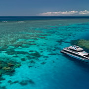
Reef Sleep: 2-Day Great Barrier Reef All Inclusive Overnight Australia Sleep overnight on the Great Barrier Reef. Experience the tranquility of just you, the sea and the stars. Explore the reef by day, watch the sun set over the water, enjoy gourmet meals… Check current availability, inclusions and booking conditions.
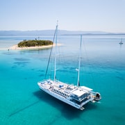
From Port Douglas: Sail to Low Isles Great Barrier Reef Australia Board a catamaran and enjoy an idyllic day on this sailing cruise. Sunbathe on an unspoiled coral cay island in the middle of the Great Barrier Reef and learn about the reef from a… Check current availability, inclusions and booking conditions.
Mandurah, Australia: Dolphins, Canals, Beaches and Easy Coastal Escape
A relaxed waterside getaway of estuary walks, playful dolphins, family-friendly beaches, scenic canals, giant outdoor art and easy day-trip access from Perth.
Mandurah is one of those coastal destinations that feels easy from the moment you arrive. The water is everywhere, the pace softens quickly, and the city seems built around simple pleasures: walking by the estuary, spotting dolphins, heading out on a boat, finding a beach that suits your mood, or settling in for a meal near the foreshore as the light changes over the water.
What makes Mandurah especially appealing is the variety packed into such an accessible place. You can spend the morning on a dolphin cruise, the afternoon beach-hopping or paddling calm estuary waters, and the evening wandering the foreshore or tracking down one of the famous Giants of Mandurah. It works beautifully for families, couples, weekenders and anyone looking for a low-fuss coastal break not far from Perth.
Where Is Mandurah?
Mandurah is in Western Australia, south of Perth, in a setting shaped by estuary waterways, canals, ocean beaches and wetland landscapes. It feels like a holiday town, but it is close enough to the city to work just as well for a day trip as for a longer coastal stay.
Why Visit Mandurah?
It is easy to reach from Perth, making it one of Western Australia’s most convenient coastal escapes.
The waterways are a major part of the appeal, with canals, estuary cruises, paddling and dolphin spotting all central to the experience.
There is strong variety, from beaches and foreshore walks to giant outdoor sculptures and family attractions.
It suits different travel styles, whether you want a relaxed beach break, a family day out or an active weekend on the water.
How to Get There
From Perth by Car
Driving from Perth is straightforward and makes Mandurah an easy coastal escape. This is the best option if you want flexibility to move between the city centre, beaches, trails and surrounding areas at your own pace.
From Perth by Train
The train is one of Mandurah’s biggest advantages. You can travel down from Perth quickly and then connect onward to the foreshore and local attractions by bus, walking or short local transfers.
Getting Around
Once you arrive, many central attractions are easy to explore on foot, especially around the foreshore, marina and canals. A car is useful if you want to include several beaches, Giants locations or outer estuary areas in one trip.
Closest Areas and Best Bases
Mandurah City Centre
The city centre and foreshore area are the most practical base for first-time visitors. You are close to restaurants, waterfront walks, tour departures and easy access to the canals and estuary.
Halls Head
Halls Head works well if you want to stay close to the coast and scenic walking areas while still being near central Mandurah.
Falcon
Falcon is a strong choice for travellers wanting calmer family-friendly beach time and a slightly more local coastal feel.
Dawesville
Dawesville is worth knowing if you want more estuary scenery, boating access and a quieter southern edge to your stay.
What to Do in Mandurah
1. Go Dolphin Spotting
Mandurah is best known for its dolphins, and spotting them is one of the signature local experiences. You can see them on cruises, from kayaks, and sometimes even from shore if you are lucky.
2. Cruise the Canals and Waterways
The canals are one of the city’s defining features. They give Mandurah a distinct look and a very relaxed, water-oriented atmosphere that feels different from many other Australian coastal centres.
3. Walk the Eastern Foreshore
The Eastern Foreshore is one of the easiest and most enjoyable places to start. It works for a casual stroll, family time, coffee stops and a good first feel for the city’s laid-back waterside mood.
4. Visit the Giants of Mandurah
The Giants of Mandurah add a creative and adventurous layer to the trip. These large outdoor sculptures are scattered through landscapes around the region and make Mandurah feel more playful and distinctive than a standard beach destination.
5. Spend Time at the Beaches
Mandurah has a good mix of beaches, from central easy-access stretches to calmer bays and more open surf-oriented spots. That makes it easy to match the beach to your mood, whether you want swimming, walking, paddling or wave watching.
6. Paddle the Estuary
If you enjoy low-key outdoor activity, the estuary is ideal for kayaking, canoeing and stand-up paddleboarding. It is a lovely way to slow down and experience the city from the water.
7. Take a Sunset Walk
Mandurah’s sunsets are part of the appeal. A simple late-day walk near the beach, canals or estuary often becomes one of the most memorable parts of the trip.
8. Browse Markets and Waterfront Spots
If your visit lines up well, the foreshore markets and waterfront dining areas can add extra life and colour to the day, especially around weekends.
Suggested Mandurah Day Plan
Arrive in the morning and start with a foreshore walk
Head out on a dolphin or canal cruise
Have lunch near the waterfront
Spend the afternoon at the beach or exploring a Giants trail
Finish with sunset views by the water
How Long Should You Stay?
Day trip: very doable from Perth and enough for the main highlights.
Weekend: ideal for combining dolphins, beaches, canals and Giants without rushing.
3 days or more: best if you want a slower coastal stay with time to explore different parts of the wider region.
What to Wear and Bring
Comfortable walking shoes
Swimwear and a towel if you plan beach time
A hat, sunscreen and sunglasses
A windproof layer for boat trips or evening foreshore walks
A camera or phone for canals, dolphins and sunset views
Water and light snacks if you are doing a Giants trail or longer outdoor day
Useful Travel Tips
Start early if you want to fit both water activities and beach or art stops into one day.
Check cruise or tour times ahead rather than assuming you can book everything on arrival.
Keep some flexibility in your schedule because dolphin sightings and weather conditions can shape the day.
Do not rush the foreshore area. Some of Mandurah’s best moments are the simple ones by the water.
Who Will Love Mandurah?
Families wanting an easy coastal break from Perth
Couples looking for a relaxed waterfront weekend
Travellers who enjoy dolphins, boats and estuary scenery
Visitors wanting beaches without a long road trip
People who like combining nature with casual food, walking and art
Final Thoughts
Mandurah works so well because it never feels like hard work. It gives you water, wildlife, beaches and scenic walking in a setting that is easy to access and easy to enjoy. You can be as active or as relaxed as you like, and the destination still feels rewarding.
If you want a Western Australia getaway that combines dolphins, foreshore atmosphere, beach time and something a little different in the form of the Giants, Mandurah is one of the strongest choices near Perth. It is simple, scenic and genuinely enjoyable.
Sponsored Popular Items
Quick take: Musement.com offers a worldwide selection of tours and attractions
Mandurah: Wild Seafood Experience Australia Cruise Mandurah’s picture-perfect waters for an interactive sea-to-plate adventure. Catch live Western Rock Lobster and dine on a chef-crafted, 8-course seafood lunch with beverages included
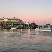
Mandurah: Sunset Cruise Australia Enjoy an evening sunset cruise and sail along the canals in Mandurah. Cruise past the marina, admire the view of the Peel Harvey Estuary and have fun with your family and friends.
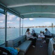
Mandurah: Premium Pontoon Boat Rental Australia Explore the waterways on a deluxe sightseeing boat. Enjoy comfortable seating, a small canopy for sun protection, and a provided map to plan your route.
Port Stephens, Australia: Beaches, Dolphins, Sand Dunes and Coastal Adventure
A beautiful New South Wales escape of calm blue bays, giant coastal dunes, scenic summit walks, marine wildlife and relaxed beach towns just north of Sydney.
Port Stephens is one of those destinations that feels generous from the moment you arrive. The water is bright, the coastline curves around sheltered bays and headlands, and there is a sense that almost every road leads to either a beach, a lookout, a marina or a place to launch into the sea. It is easy to see why so many visitors come for a weekend and immediately start planning a longer return trip.
What makes Port Stephens especially appealing is its range. This is not just a beach destination, and it is not just an adventure hub. It gives you both. You can spend the morning climbing a coastal summit, the afternoon gliding out on a dolphin cruise, and the evening dining by the water in Nelson Bay. You can swap all of that for sandboarding, whale watching, kayaking, swimming, fishing or simply doing very little on a beautiful beach. It is that flexibility that makes the area work so well for families, couples, road trippers and first-time visitors to coastal New South Wales.
Where Is Port Stephens?
Port Stephens is on the North Coast of New South Wales, just north of Newcastle and within easy reach of Sydney. The region centres around a vast natural harbour and a string of coastal towns and villages, with Tomaree National Park on one side and the remarkable Worimi sand dune system on the other.
Why Visit Port Stephens?
It is easy to reach, making it one of the most rewarding coastal getaways from Sydney.
The scenery is varied, with calm bays, surf beaches, headland walks, dunes and national park landscapes all close together.
Wildlife is a major draw, especially resident bottlenose dolphins and seasonal humpback whales.
It suits many travel styles, from active adventure weekends to easy family beach breaks.
The towns are close together, so it is simple to explore several different parts of the region in one trip.
How to Get There
From Sydney
Port Stephens is an easy road trip from Sydney and works well for a weekend or short coastal break. Driving gives you the flexibility to move between Nelson Bay, Shoal Bay, Anna Bay and the dunes without relying on limited local transport.
From Newcastle
If you are travelling from Newcastle, Port Stephens is even closer and makes an easy day trip or overnight escape. This is one of the simplest ways to enjoy beaches, wildlife and coastal walking without committing to a long drive.
Getting Around
A car is the best way to explore the region properly. The main towns are close enough to combine easily, but spread out enough that having your own transport makes the trip much smoother and more enjoyable.
Closest Towns and Best Areas to Stay
Nelson Bay
Nelson Bay is the main tourist hub and the most practical base for many visitors. It has a marina, waterfront dining, tour departures, accommodation and easy access to nearby beaches and walks.
Shoal Bay
Shoal Bay is a beautiful base for beach lovers and anyone wanting quick access to the Tomaree Head Summit walk. It feels scenic and relaxed, with a very classic holiday-town atmosphere.
Anna Bay
Anna Bay is the gateway to the dunes and a strong choice if your focus is sandboarding, beach adventure and access to the Worimi landscape.
Fingal Bay
Fingal Bay is a good option for travellers wanting a slightly quieter coastal stay with great beach access and easy links into Tomaree National Park.
What to Do in Port Stephens
1. Climb Tomaree Head Summit
This is one of Port Stephens’ signature experiences. The walk is short enough to be achievable for many visitors, but steep enough to feel satisfying, and the panoramic views from the top are among the best on the New South Wales coast.
2. Explore the Worimi Sand Dunes
The dunes are one of the most distinctive landscapes in the region. They feel immense, exposed and almost desert-like, which creates a dramatic contrast with the surrounding ocean and bushland. This is one of the highlights that makes Port Stephens feel different from a standard beach town.
3. Go Sandboarding or Join a 4WD Tour
If you want something more active, the dunes are the place to do it. Sandboarding and guided 4WD tours are among the region’s best-known adventures and are especially popular with families and groups.
4. Take a Dolphin Cruise
Port Stephens is famous for its resident bottlenose dolphins, and seeing them on the water is one of the region’s classic experiences. It adds a memorable marine element to the trip and suits visitors who want something scenic without needing to be particularly adventurous.
5. Go Whale Watching in Season
During migration season, Port Stephens becomes an excellent whale-watching destination. Whether you join a cruise or watch from one of the headlands, this is one of the most exciting times to visit.
6. Spend Time on the Beaches
One of the joys of Port Stephens is that the beaches are so varied. Some are calm and protected, ideal for swimming and families, while others feel more open and ocean-facing. This makes it easy to match the beach to your mood.
7. Swim, Kayak or Paddleboard in the Bay
The protected waters around the bay are ideal for gentle water activities. If you like a slower-paced beach day, this side of Port Stephens is especially rewarding.
8. Explore Tomaree National Park
The national park adds more than one good walk. It gives the whole area its rugged coastal character, with beaches, lookouts, heathland and headlands all contributing to the sense of wild natural beauty.
9. Enjoy Nelson Bay Marina and Foreshore
Nelson Bay is the social and practical heart of the area. The marina, waterfront restaurants and relaxed foreshore make it an easy place to return to between adventures.
Suggested Port Stephens Day Plan
Start early with the Tomaree Head Summit walk
Spend late morning in Shoal Bay or Nelson Bay
Take a dolphin cruise or enjoy lunch by the marina
Head to Anna Bay for dunes, beach time or sandboarding
Finish with sunset views or a relaxed dinner by the water
How Long Should You Stay?
Day trip: possible, but best if you focus on only a few highlights.
Weekend: ideal for beaches, a walk, a cruise and time around the towns.
3 to 4 days: much better if you want to enjoy the region without rushing and explore both the dunes and the bay properly.
Best Time to Visit
Port Stephens works year-round, but different seasons bring different strengths. Warmer months are ideal for swimming, boating and beach time, while cooler months can be excellent for hiking and whale watching. Spring and autumn often give the nicest balance of outdoor comfort and lighter crowds.
What to Wear and Bring
Comfortable walking shoes for headland tracks and lookouts
Swimwear and a towel for bay and beach stops
A hat, sunscreen and sunglasses
A windproof layer for exposed headlands or boat trips
A camera or phone for dune, beach and lookout views
Water and snacks if you plan to combine walking with dune or beach time
Useful Travel Tips
Start popular walks earlier in the day, especially in warmer weather.
Do not try to squeeze every attraction into one rushed visit. Port Stephens is best enjoyed at a slower pace.
Check local conditions before heading onto the water or into the dunes.
Bring more sun protection than you think you need, especially around the dunes and on boat trips.
If whale watching matters to you, plan your visit during the migration season.
Who Will Love Port Stephens?
Families wanting a classic NSW coastal break
Couples looking for beaches and scenic walks
Nature lovers and wildlife watchers
Travellers who enjoy both relaxation and adventure
Visitors wanting an easy escape from Sydney or Newcastle
Final Thoughts
Port Stephens is one of those destinations that feels easy to recommend because it does so many things well. It is beautiful without being difficult, active without being exhausting, and varied enough to suit almost any kind of coastal traveller. The mix of marine life, beaches, dunes and national park scenery gives it a sense of abundance that keeps the trip feeling fresh from one stop to the next.
If you want a New South Wales getaway that combines outdoor adventure, easy holiday atmosphere and genuinely memorable natural landscapes, Port Stephens is one of the strongest choices on the coast. It is easy to reach, easy to enjoy and hard to leave after only one visit.
Sponsored Popular Items
Quick take: Musement.com offers a worldwide selection of tours and attractions
Sydney: Port Stephens Private Day Tour Australia Enjoy a private transfer from Sydney to Port Stephens with optional stops along the way. Experience the thrill of sandboarding, see dolphins on a cruise, or visit a winery.
From Sydney: Port Stephens Private Tour Australia Enjoy a private tour from Sydney to Port Stephens. Experience a thrilling array of activities like sandboarding, dolphin cruises, quad biking, and more.
From Sydney: Port Stephens, Anna Bay, Sandboarding & Hike Australia Experience the beauty of Port Stephens on a day trip from Sydney. Enjoy a 4WD sand safari ride, sandboarding, a guided hike up Mount Tomaree, and free time in Nelson Bay.
Kuranda Rainforest: A Tropical Escape Above Cairns
A lush mountain village experience of ancient rainforest, soaring cableway views, heritage railway curves, waterfall lookouts, colourful markets and easy day-trip adventure from Cairns.
Kuranda has a different feel from the coast almost as soon as you begin the climb. The air cools, the road bends into greener country, and the whole landscape shifts from tropical city edge to deep rainforest atmosphere. By the time you arrive, Kuranda feels less like a stop and more like a retreat, with forest all around, birdsong in the background and a village centre full of markets, cafés, galleries and wildlife experiences.
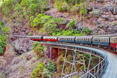
What makes Kuranda especially appealing is that getting there is part of the attraction. You can drive up through the range, float above the canopy on Skyrail, or take the Kuranda Scenic Railway through Barron Gorge with waterfalls and steep rainforest-clad slopes unfolding around you. That combination of journey, scenery and village character is what makes Kuranda one of the strongest day trips from Cairns.
Where Is Kuranda Rainforest?
Kuranda is a rainforest village in the hills above Cairns in Tropical North Queensland. It sits on the edge of the Wet Tropics and is closely linked with Barron Gorge National Park, which gives the whole area its dramatic mix of rainforest canopy, river valleys, gorge views and waterfalls.
Why Visit Kuranda?
It is one of the easiest rainforest escapes from Cairns, with straightforward access by road, rail or cableway.
The journey is part of the experience, especially if you travel one way by Skyrail and the other by train.
It combines nature with village atmosphere, so the day feels more varied than a simple lookout stop.
It suits many travel styles, from families and first-time visitors to photographers and slower-paced travellers.
It works well as a full-day outing, with enough to do beyond the transport experience itself.
How to Get There
By Car from Cairns
Driving is the simplest independent option. The trip from Cairns takes around 30 to 40 minutes, making Kuranda an easy day trip if you want flexibility and time to explore at your own pace.
By Skyrail Rainforest Cableway
Skyrail is one of the most scenic ways to arrive. It glides above and through the rainforest with stops at Red Peak and Barron Falls, giving you time to step out, walk through the forest and appreciate the scale of the gorge.
By Kuranda Scenic Railway
The railway is the more nostalgic and historic way to reach Kuranda. The journey winds through rainforest and Barron Gorge, passes waterfalls and climbs into the village through one of Tropical North Queensland’s most iconic travel experiences.
Best Way to Do It
Many visitors choose one direction by Skyrail and the other by Kuranda Scenic Railway. This gives the day more variety and lets you experience the landscape from two very different perspectives.
Closest Towns and Best Bases
Cairns
Cairns is the main base for visiting Kuranda and the easiest place to stay if you are planning the trip as a day out.
Northern Beaches
The Northern Beaches are also convenient if you want a more resort-style base while still staying within reach of Kuranda.
Port Douglas
Port Douglas is farther away but still commonly paired with a Kuranda visit as part of a broader Tropical North Queensland itinerary.
Mareeba and the Tablelands
The nearby Tablelands side gives Kuranda a different context and can work well if you are exploring inland rainforest, farms and cooler-country scenery beyond the coast.
What to Do in Kuranda Rainforest
1. Ride the Kuranda Scenic Railway
This is one of the area’s signature experiences. It is slow enough to enjoy the details, scenic enough to feel special, and historic enough to give the trip real character.
2. Float Above the Canopy on Skyrail
Skyrail brings a completely different perspective, with long views across the Wet Tropics, glimpses of the Coral Sea and close-up moments above the rainforest canopy.
3. See Barron Falls
Barron Falls is one of the standout natural highlights in the Kuranda area. Even when the flow changes with the seasons, the gorge scenery alone makes it worth the stop.
4. Walk to Din Din Barron Falls Lookout
This is one of the easiest and most rewarding short walks near Kuranda, making it a strong option for travellers who want a rainforest walk without committing to a long hike.
5. Explore Kuranda Village and Its Markets
The village itself is part of the attraction. Browsing the markets, local shops, galleries and cafés gives the day a more relaxed rhythm and helps Kuranda feel more personal than a simple transport-based outing.
6. Visit a Wildlife Attraction
Kuranda also has several popular wildlife-focused attractions, including the Australian Butterfly Sanctuary, Birdworld Kuranda and Kuranda Koala Gardens, making it especially good for families and animal lovers.
7. Try a Rainforest Walk or Trail
If you want more than village wandering, Barron Gorge National Park has short and longer walking options that add more depth to the rainforest experience.
How Long Should You Allow?
Half a day: possible, but too short to appreciate both the journey and the village.
Full day: ideal for most visitors, especially if you combine Skyrail or the railway with time in Kuranda itself.
Longer: worth considering if you want a slower village stay or plan to explore more rainforest walks and nearby attractions.
Suggested Kuranda Day Plan
Start from Cairns in the morning
Travel to Kuranda by Skyrail or Kuranda Scenic Railway
Spend late morning exploring the village
Have lunch in one of the cafés or market areas
Visit Barron Falls or a wildlife attraction in the afternoon
Return by the alternate transport option for a more complete day
What to Wear and Bring
Light clothing for tropical weather
Comfortable walking shoes
A hat, sunscreen and insect repellent
A light rain layer, especially in the wetter months
A camera or phone for gorge and canopy views
A small day bag for essentials
Useful Travel Tips
Book transport ahead if you want a specific Skyrail or railway combination.
Allow enough time in the village rather than treating Kuranda as only a transfer point.
Check current conditions for walking tracks and waterfall access before you go.
Bring water and plan for warm, humid weather even if the village feels cooler than Cairns.
Consider travelling one way by Skyrail and the other by train for the best overall experience.
Who Will Love Kuranda?
First-time visitors to Cairns and Tropical North Queensland
Families wanting an easy rainforest day trip
Travellers who enjoy scenic transport experiences
Nature lovers and photographers
Visitors wanting a balance of rainforest scenery, village charm and light adventure
Final Thoughts
Kuranda works so well because it offers more than a single viewpoint or attraction. It gives you the rainforest from above, from within and from the village edge, all in one outing. The combination of ancient forest, dramatic gorge scenery, market atmosphere and easy access from Cairns makes it one of the most rewarding short escapes in the region.
If you are planning time in Tropical North Queensland, Kuranda deserves more than a rushed stop. Give it a full day, let the journey be part of the experience, and take time to enjoy both the rainforest and the village itself. That is when Kuranda feels most memorable.
Sponsored Popular Items
Quick take: Musement.com offers a worldwide selection of tours and attractions
Kuranda Scenic Railway Australia Book your Kuranda Scenic Railway tickets online. Save time and money with our best price guarantee. Make the most of your visit to Kuranda. Check current availability, inclusions and booking conditions.
Kuranda Wildlife Experience: Koalas, Birds & Butterflies Australia Get up close and personal with incredible wildlife with access to 3 great attractions. Includes entry to Kuranda Koala Gardens, Birdworld Kuranda and The Australian Butterfly Sanctuary. Check current availability, inclusions and booking conditions.
Kuranda: Birdworld Entry Ticket Australia Immerse yourself in one of the most unique wildlife attractions of tropical North Queensland. Check current availability, inclusions and booking conditions.
Darling Harbour: Sydney’s Waterside Playground in the Heart of the City
A lively harbourside precinct of family attractions, museums, waterfront dining, parks, light-filled promenades and some of the easiest sightseeing in Sydney.
Darling Harbour is one of those places in Sydney that feels instantly easy to enjoy. You do not need a complicated plan, and you do not need to travel far out of the city to get there. The harbour, promenades, attractions, gardens and restaurants all sit close together, which makes the area ideal for relaxed sightseeing. One moment you are by the water watching ferries and people drift past, and the next you are inside an aquarium, a museum, a cinema or a waterside restaurant.
What makes Darling Harbour especially appealing is its range. It works for families, couples, solo travellers and first-time visitors to Sydney because it offers a little of everything: big attractions, easy walks, green public spaces, child-friendly activities, event venues and scenic dining spots. It is one of the few places in Sydney where you can build an entire day without needing to leave the precinct.
Where Is Darling Harbour?
Darling Harbour sits on the western side of central Sydney, right on the edge of the CBD. Its location makes it one of the most convenient waterfront destinations in the city and an easy addition to almost any Sydney itinerary.
Why Visit Darling Harbour?
It is central and easy to reach, which makes it a simple choice for visitors staying in Sydney.
There is plenty to do in one compact area, from museums and aquariums to parks, dining and entertainment.
It suits all kinds of travellers, especially families, couples and first-time visitors.
The atmosphere changes through the day, from morning walks and family outings to evening dining and harbour lights.
How to Get There
On Foot
Darling Harbour is an easy walk from central Sydney. If you come from Town Hall, the route down Bathurst Street takes you straight toward Darling Quarter and Tumbalong Park. Walking in is one of the best ways to arrive because the precinct opens up gradually as you descend toward the water.
By Light Rail
Light rail is one of the easiest public transport options. Different stops serve different parts of the precinct, so it is worth choosing the stop that matches your plans. Exhibition is useful for ICC Sydney and Tumbalong Park, Convention is best for the convention centre, and Pyrmont Bay is ideal for the maritime museum side.
By Ferry
For a more scenic arrival, ferries connect the area with Circular Quay via nearby wharves. A ferry approach adds a classic Sydney feel to the visit and works especially well if you are combining Darling Harbour with a broader harbour day out.
By Car or Taxi
Driving and taxi access are straightforward, with several city approach points and nearby parking options. This can be handy for families or visitors planning an evening meal, cinema outing or event at ICC Sydney.
Closest Areas to Stay
Sydney CBD
The CBD is the most practical all-round base. Staying here keeps Darling Harbour within easy walking distance while also giving you quick access to Circular Quay, shopping, train stations and other major landmarks.
Pyrmont
Pyrmont is right beside Darling Harbour and feels a little calmer while still being extremely convenient. It works well if you want to stay close to the water and the western side of the precinct.
Haymarket and Chinatown
Haymarket is another useful nearby base, especially if you want food options, easy transport and quick access to the southern end of Darling Harbour.
Barangaroo
Barangaroo is a polished harbourside option nearby and pairs well with a more upscale Sydney stay, especially if you plan to move between waterfront precincts.
What to Do in Darling Harbour
1. Stroll the Waterfront
Sometimes the best thing to do here is simply walk. Darling Harbour is made for wandering, with wide promenades, harbour views and enough activity around you to keep the atmosphere lively without feeling overwhelming.
2. Visit SEA LIFE Sydney Aquarium
This is one of the precinct’s best-known attractions and a major drawcard for families and marine-life lovers. It is an easy way to turn a general harbour visit into a fuller sightseeing day.
3. See WILD LIFE Sydney Zoo
If you want an accessible Australian wildlife experience without leaving the city, this is one of the most convenient places to do it.
4. Explore the Australian National Maritime Museum
The maritime museum adds depth to the precinct by balancing family entertainment with history, exhibitions and harbour culture. It is one of the most worthwhile stops if you want something more substantial than a quick attraction visit.
5. Wander Through the Chinese Garden of Friendship
This is one of Darling Harbour’s most peaceful corners. It offers a quieter contrast to the busy waterfront and is ideal when you want a more reflective, garden-style break in the middle of the city.
6. Spend Time at Darling Quarter and Tumbalong Park
These areas help make Darling Harbour especially strong for families. They give the precinct room to breathe, with green space, play areas and a more open public atmosphere than a purely commercial waterfront.
7. Catch a Film at IMAX Sydney
If you want to add evening entertainment, IMAX is a strong option and helps turn Darling Harbour into more than just a daytime sightseeing precinct.
8. Eat at Cockle Bay Wharf
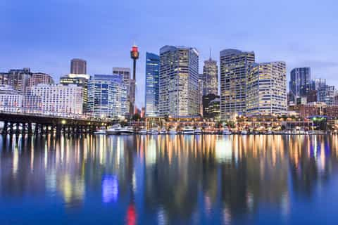
Cockle Bay Wharf is one of the best places in the precinct to sit by the water and settle in for a meal or drink. It is particularly appealing later in the day when the harbour lights begin to reflect across the water.
9. Check What’s On at ICC Sydney
Darling Harbour is also a major events precinct, so it is worth checking whether a concert, exhibition or conference is on during your visit.
Suggested Darling Harbour Day Plan
Arrive in the morning and start with a waterfront stroll
Choose one major attraction such as SEA LIFE, WILD LIFE or the maritime museum
Pause for lunch by the water
Spend the afternoon around Darling Quarter, Tumbalong Park or the Chinese Garden
Stay into the evening for dinner, a film or city lights along the harbour
How Long Should You Allow?
1 to 2 hours: enough for a scenic walk and a quick look around
Half a day: good for one attraction plus a meal and waterfront time
Full day: ideal if you want multiple attractions, slower wandering and an evening finish
What to Wear and Bring
Comfortable walking shoes
Sunglasses and sunscreen for daytime visits
A light jacket for evening harbour breezes
A camera or phone for waterfront photos
A small bag for day essentials if you are combining several attractions
Useful Travel Tips
Choose your transport stop carefully because different parts of Darling Harbour are best approached from different directions.
Do not try to do every paid attraction in one rushed visit; it is better to combine one or two with time outdoors.
Stay into the evening if you can, because the precinct feels quite different once the lights come on.
Check the events calendar before visiting, especially if you are interested in festivals, performances or family activities.
Who Will Love Darling Harbour?
First-time visitors to Sydney
Families wanting an easy day out
Couples looking for waterside dining and evening atmosphere
Travellers who prefer central, walkable attractions
Visitors wanting a flexible Sydney day with both free and ticketed options
Final Thoughts
Darling Harbour works so well because it makes Sydney feel accessible. It gives you the harbour atmosphere people come for, but without demanding a complicated plan. Everything is close, the scenery is pleasant, and there is enough variety to shape the visit around your mood.
If you want a Sydney destination that is easy, lively and full of options, Darling Harbour is one of the safest and strongest choices in the city. It can be a quick stroll, a family day, a date-night stop or a full sightseeing precinct all at once, which is exactly why it remains so popular.
Sponsored Popular Items
Quick take: Musement.com offers a worldwide selection of tours and attractions
Darling Harbour: Slow Jet Boat Cruise Vivid Sydney Australia Experience the magic of Vivid Sydney from the water on a slow jet boat cruise. See the Sydney Opera House, Harbour Bridge, and other icons illuminated as you glide through the heart of the festival.
Darling Harbour Australia Book your Darling Harbour tickets online. Save time and money with our best price guarantee. Make the most of your visit to Sydney.
Uluru (Ayers Rock): Australia’s Great Red Heart Experience
A powerful desert destination of sunrise colour, ancient culture, red-earth walks, vast skies and one of the world’s most recognisable natural landmarks.
Uluru is one of those places that feels bigger than a landmark. Yes, the rock itself is extraordinary, but what makes the experience so memorable is the wider sense of space, stillness and significance that surrounds it. The desert light shifts by the hour, the colours deepen and soften across the stone, and the whole landscape seems to carry a presence that is difficult to describe until you are actually there.
For many travellers, Uluru is a bucket-list destination. Yet it is far more than a quick photo stop in the outback. It is a place to slow down, walk, learn, watch the light change, visit nearby Kata Tjuta, and spend time understanding that this is not just a geological wonder but a living cultural landscape with deep meaning for Aṉangu Traditional Owners.
Where Is Uluru?
Uluru is in Uluṟu-Kata Tjuṯa National Park in the Northern Territory, in the heart of Australia’s Red Centre. It rises from a vast desert landscape of spinifex, red earth and open sky, creating one of the most distinctive and iconic scenes in the country.
Why Visit Uluru?
It is one of Australia’s most iconic natural landmarks, but it feels even more impressive in person than in photographs.
The landscape changes constantly, especially at sunrise and sunset when the colours across the rock shift dramatically.
It offers cultural depth as well as scenery, making the visit richer than a simple sightseeing stop.
Kata Tjuta adds a second major highlight, giving the region more than one unforgettable experience.
The desert atmosphere is part of the appeal, with huge skies, quiet roads and a sense of distance that feels uniquely Australian.
How to Get There
By Air
The easiest way to reach Uluru is to fly into Ayers Rock Airport, near Yulara. This is the most practical arrival point for most visitors and makes it possible to reach the national park without a long overland drive.
By Road
Driving from Alice Springs is also a popular option for travellers exploring more of the Red Centre. The roads are sealed, and the drive itself is part of the outback experience, with big horizons and a strong sense of remoteness.
Getting Around
Once you arrive, most visitors get around by rental car, organised tour or a dedicated local shuttle service. This is one of those destinations where transport planning matters, because the main sights are spread out across a vast desert landscape.
Closest Towns and Best Bases
Yulara
Yulara is the main accommodation base for visiting Uluru. It sits just outside the national park and is the obvious choice for most travellers because it keeps you close to sunrise, sunset and early-morning walks.
Alice Springs
Alice Springs is much farther away, but it is still an important regional hub. It works well if you are combining Uluru with a wider Red Centre road trip that includes Kings Canyon or other outback stops.
What to Do at Uluru
1. Watch Sunrise Over Uluru
Sunrise is one of the classic Uluru experiences. The early light slowly reveals the desert around you, and the rock changes through deep red, rust and glowing ochre tones. It is one of the simplest activities here, but also one of the most memorable.
2. Stay for Sunset
Sunset is just as important as sunrise, but it feels different. The light becomes warmer and more dramatic, and the atmosphere often feels softer and more reflective. If your schedule allows, do both rather than choosing only one.
3. Walk Part or All of the Base Walk
The best way to understand Uluru properly is to walk around it rather than only viewing it from a lookout. The base walk reveals changing textures, waterholes, desert plant life and a surprising variety of features that you simply do not appreciate from a distance.
4. Visit the Cultural Centre
The Cultural Centre adds essential context to the visit. This is where the experience becomes deeper and more meaningful, helping you understand the living cultural importance of the landscape and why it should be approached with care and respect.
5. Explore Kata Tjuta
Do not stop at Uluru alone. Kata Tjuta is one of the great highlights of the region and gives the trip a second, very different landscape experience. The domes feel wilder, more enclosed and more rugged, and they add real depth to any Red Centre itinerary.
6. Walk Waḻpa Gorge or Valley of the Winds
If you enjoy walking, Kata Tjuta offers some of the region’s most rewarding tracks. Waḻpa Gorge is a strong option for a shorter walk, while Valley of the Winds is better for travellers who want something more immersive and physically demanding.
7. Enjoy the Night Sky
Uluru is also a wonderful place to slow down after dark. With so little urban glow, the desert sky can feel immense. Even a quiet evening outside after dinner can become one of the trip’s most memorable moments.
How Long Should You Stay?
1 day: enough for a quick look, but too short to do the region justice
2 days: a much better minimum for Uluru sunrise or sunset, the Cultural Centre and at least one major walk
3 days or more: ideal if you want Uluru, Kata Tjuta and time to enjoy the Red Centre at a slower pace
Suggested Two-Day Plan
Arrive in Yulara and settle in
Visit the Cultural Centre
Watch sunset over Uluru
Start early the next day for sunrise
Walk part or all of the base walk in the cooler morning
Head to Kata Tjuta for Waḻpa Gorge or Valley of the Winds
Spend the evening relaxing under the desert sky
Best Time to Visit
Many travellers prefer the cooler months, when walking and outdoor sightseeing are more comfortable. Shoulder seasons can also work well, but summer conditions can be extremely hot, so early starts and careful planning become even more important.
What to Wear and Bring
Lightweight clothing for daytime heat
Layers for cooler mornings and evenings
Sturdy walking shoes
A wide-brim hat, sunscreen and sunglasses
Plenty of water for any walk
A camera or phone for sunrise and sunset light
Useful Travel Tips
Start walks early, especially in warmer months.
Give yourself enough time for both Uluru and Kata Tjuta.
Read and follow local cultural guidance carefully.
Book accommodation and transport ahead, especially in peak travel periods.
Do not underestimate distances in the Red Centre, even when the map looks simple.
Who Will Love Uluru?
First-time visitors to the Australian outback
Travellers interested in landscape and culture together
Photographers chasing changing desert light
Walkers who enjoy scenic, meaningful trails
Anyone wanting one of Australia’s most powerful travel experiences
Final Thoughts
Uluru deserves its reputation not because it is simply famous, but because it feels deeply grounded and unforgettable once you arrive. The scale, the silence, the colour and the cultural significance all work together to create an experience that stays with people long after the trip ends.
If you are planning a journey into Australia’s Red Centre, give Uluru more than a rushed stop. Stay long enough to walk, learn, watch the light change and feel the rhythm of the desert. That is when the destination becomes something much more powerful than a landmark.
Sponsored Popular Items
Quick take: Musement.com offers a worldwide selection of tours and attractions
Uluru: Guided Trek of Uluru's Base in a Small Group Australia Experience Uluru at sunrise on a 6-hour, small-group tour. Walk the full base of Uluru and enjoy breakfast along the way. See ancient rock art, explore Mutitjulu waterhole, and visit Kantju Gorge.
Uluru: Sunset, Sparkling Wine, Cheeseboard & Gourmet BBQ Australia Experience the magic of Uluru at sunset with sparkling wine and a delicious cheeseboard. Head to an exclusive spot for a gourmet BBQ dinner under the stars—an unforgettable outback evening.
Uluru: Guided Walking Tour at Sunrise with Light Breakfast Australia Discover Australia's spiritual heart on a 10.5-kilometer walk around the entire base of Uluru! Get incredible views of the red desert landscape as the sun rises. Listen to an informative commentary about the sacred site.
Melbourne to the Great Ocean Road: One of Australia’s Greatest Coastal Drives
A classic Victorian road trip of surf towns, sea cliffs, rainforest walks, famous lookouts and the unforgettable limestone stacks of the Shipwreck Coast.
The Great Ocean Road is one of those journeys that feels bigger than a simple drive. Yes, the scenery is spectacular, but what makes it so memorable is the rhythm of the trip itself. You leave Melbourne behind, reach the surf coast, wind through cliff-hugging bends, pause in relaxed seaside towns, then push deeper into a landscape of wild beaches, cool rainforest and the dramatic rock formations that have made this stretch of Victoria famous around the world.
For many travellers, the Great Ocean Road is the ultimate Melbourne escape. It works as a big day out, but it is even better when you give it time. The route rewards slow travel. The best moments are often not just the headline landmarks, but the in-between stretches: a lookout above crashing surf, coffee in a coastal town, a short rainforest walk under giant ferns, or a late-afternoon stop when the cliffs begin to glow in softer light.
Where Is the Great Ocean Road?
The Great Ocean Road begins at Torquay, southwest of Melbourne, and follows Victoria’s spectacular coastline westward through surf towns, beaches, national parks and major lookouts. For most visitors coming from Melbourne, Torquay is the gateway to the journey and the point where the road trip really begins to feel special.
Why Visit?
It is one of Australia’s most iconic road trips, combining ocean scenery, wildlife, beaches and charming coastal towns.
The variety is exceptional, with surf culture, waterfalls, rainforest, cliff-top lookouts and famous rock formations all on one route.
It suits many travel styles, from quick sightseeing loops to longer self-drive holidays.
It is easily reachable from Melbourne, which makes it one of Victoria’s best high-impact getaways.
How to Get There from Melbourne
By Car
Driving is the best way to experience the Great Ocean Road properly. From Melbourne, it takes around an hour and a half to reach Torquay, where the coastal route begins. Having your own car gives you the freedom to stop at beaches, lookouts and towns at your own pace, which is a big part of what makes the drive so enjoyable.
By Tour
If you do not want to drive, day tours from Melbourne are a popular option. They make the route accessible in a single long outing and can work well for first-time visitors with limited time. The trade-off is that you move faster and have less freedom to linger.
How Long Does It Take?
You can drive part of the Great Ocean Road in a day, but a rushed return trip from Melbourne can feel long. The most famous coastal section is easy to reach, but the farther west you go, the more worthwhile it becomes to stay overnight rather than squeeze everything into one very full day.
Closest Towns and Best Bases
Torquay
Torquay is the official starting point of the Great Ocean Road and the natural first stop from Melbourne. It is ideal if you want surf culture, beach access and a gentle beginning to the trip.
Lorne
Lorne is one of the road’s best-loved seaside towns, with a beach-town feel, scenic drives nearby and easy access to lookouts and waterfalls. It works very well for a first overnight stop.
Apollo Bay
Apollo Bay is one of the most useful bases on the route. It gives you coast on one side, the Otways on the other, and a strong mix of scenery, food and accommodation options. If you only stay one night along the route, this is one of the best places to consider.
Port Campbell
Port Campbell is the most practical base for the Twelve Apostles, Loch Ard Gorge and other Shipwreck Coast highlights. If your focus is the dramatic limestone coastline, this is the smartest overnight choice.
What to Do on the Great Ocean Road
1. Start in Torquay and Feel the Surf Coast Energy
Torquay sets the tone well. It is relaxed, beachy and unmistakably tied to Australian surf culture. It is the right place to ease into the drive rather than immediately racing west.
2. Stop at Bells Beach and Coastal Lookouts
This part of the route delivers some of the early wow-factor scenery. Surf beaches, sandstone cliffs and sweeping ocean outlooks make the Surf Coast feel dramatic without yet reaching the heavier spectacle of the western end.
3. Pause in Lorne
Lorne is one of the best towns for a break. It is lively enough to feel like a destination in its own right, but still relaxed enough to suit a slow coastal road trip. It is a good place for lunch, coffee or an overnight stay.
4. Take in Viewpoints Between Lorne and Apollo Bay
The stretch between Lorne and Apollo Bay is one of the most picturesque parts of the drive. This is where the road and the ocean feel especially close, and where scenic pullovers really earn your time.
5. Explore the Otways
The Great Ocean Road is not just about cliffs and beaches. The Otways add a completely different mood with cool rainforest, fern gullies and sheltered walking tracks. A short stop in the forest is one of the best ways to make the trip feel more varied and complete.
6. Walk Through Rainforest at Maits Rest
If you want one accessible rainforest experience, Maits Rest is a strong choice. It offers a short walk through ancient cool-temperate forest and feels like a refreshing contrast to the exposed coastline.
7. See the Twelve Apostles
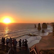
This is the landmark most visitors build the journey around. The Twelve Apostles are the defining image of the Great Ocean Road: sea, wind, cliffs and limestone stacks rising out of the Southern Ocean. Even if you have seen hundreds of photos, the real setting still feels bigger and more dramatic in person.
8. Visit Loch Ard Gorge
Loch Ard Gorge is one of the best stops on the western section of the route. It is more intimate than the Twelve Apostles and gives the coastline a different character, with beach access, steep enclosing cliffs and a strong sense of history and atmosphere.
9. Continue to Port Campbell
Port Campbell is a smart place to end the day, especially if you want to stay overnight. It keeps you close to the major limestone attractions and makes sunrise or sunset viewing much easier to plan.
Suggested One-Day Trip from Melbourne
Leave Melbourne early
Reach Torquay and begin the coastal drive
Stop at Bells Beach or an early lookout
Pause in Lorne for coffee or brunch
Continue through Apollo Bay
Add a short Otways stop if time allows
Finish at the Twelve Apostles and Loch Ard Gorge
Return inland if you are doing it as a long day trip, or stay overnight in Port Campbell
How Long Should You Allow?
1 day: possible from Melbourne, but long and best for highlights only
2 days: much better for enjoying the coast without rushing
3 days or more: ideal if you want towns, walks, lookouts, beaches and the Shipwreck Coast at a more rewarding pace
What to Wear and Bring
Comfortable walking shoes
A jacket or extra layer, as coastal weather can shift quickly
Sunscreen and sunglasses
Water and snacks for longer stretches between stops
A camera or phone for coastal lookouts and evening light
A small day bag for walks and short stops
Useful Travel Tips
Do not underestimate the distance if you are trying to do it all in one day from Melbourne.
Start early if you want to fit in multiple scenic stops.
Build in short walks, not just lookout stops, to enjoy more of the region’s variety.
Consider sleeping on the road rather than returning to Melbourne the same night.
Check weather and road conditions before setting out, especially in winter or after storms.
Who Will Love This Trip?
First-time visitors to Victoria
Road trip lovers
Photographers and nature travellers
Couples wanting a scenic coastal escape
Families looking for a memorable self-drive adventure from Melbourne
Final Thoughts
The Great Ocean Road remains one of the best journeys you can make from Melbourne because it gives you more than a destination. It gives you a sequence of landscapes and moods: surf coast, holiday towns, rainforest, cliffs, open ocean and finally the monumental drama of the western limestone coast.
If you can, resist the urge to treat it as a checklist drive. Slow down, stop often and let the road unfold properly. That is when the Great Ocean Road feels less like a famous route and more like one of Australia’s truly memorable travel experiences.
Sponsored Popular Items
Quick take: Musement.com offers a worldwide selection of tours and attractions
Great Ocean Road Hidden Coastal Gems Full Day Explorer -Tour Australia This is not just another Great Ocean Road tour. Join me on an exploratory route from Melbourne to the 12 Apostles Discover kangaroo hideaways & panoramic sea views — a unique… Check current availability, inclusions and booking conditions.
Torquay: Surf Experience on the Great Ocean Road United Kingdom Take a surf lesson at Torquay Beach, Victoria’s surf capital! Suit up in warm wetsuits, grab a softboard, and let top instructors get you riding waves on your very first lesson! Check current availability, inclusions and booking conditions.
Torquay: Skydive over the Great Ocean Road - Optional Melbourne Pickup United Kingdom Tandem skydive over the Great Ocean Road from up to 15,000ft. Experience the wild adrenaline rush of freefalling at 200km/h for up to 60s. Check current availability, inclusions and booking conditions.
Phillip Island: Penguins, Wild Coastlines and One of Victoria’s Best Easy Escapes
A classic coastal getaway where little penguins, surf beaches, rugged headlands, family attractions and relaxed seaside towns make it easy to turn a Melbourne day trip into something far more memorable.
Phillip Island is one of those destinations that feels effortlessly appealing. It is close enough to Melbourne to reach without much difficulty, yet once you cross onto the island the mood shifts quickly. The pace softens, the air feels saltier, and the whole place opens into a mix of windswept coastline, wildlife reserves, beaches, boardwalks and small-town holiday charm.
For many visitors, the island is best known for the Penguin Parade, and rightly so. Watching little penguins come ashore at sunset is one of Victoria’s most distinctive wildlife experiences. But Phillip Island is much more than one attraction. It also offers dramatic ocean views, koalas, heritage farmland, surf culture, family-friendly walks, quiet inlets and plenty of ways to fill a day or a long weekend without feeling rushed.
Where Is Phillip Island?
Phillip Island is in Victoria, south-east of Melbourne, and is connected to the mainland by bridge. It is one of the easiest and most popular coastal escapes from the city, making it ideal for day trips, weekend breaks and family holidays.
Why Visit Phillip Island?
It is close to Melbourne, which makes it easy to visit even on a short itinerary.
The wildlife experiences are a major draw, especially the world-famous Penguin Parade and the chance to spot koalas and fur seals.
The scenery is varied, with beaches, wetlands, headlands, boardwalks and rural pockets all within a relatively compact island.
It suits almost every travel style, from families and couples to photographers, road trippers and first-time visitors to Victoria.
How to Get There
By Car from Melbourne
Driving is the easiest and most flexible way to visit Phillip Island. The trip from Melbourne is straightforward, and having your own car makes it much easier to move between Cowes, the Penguin Parade, The Nobbies, surf beaches and other attractions across the island.
By Bus
Public transport is possible, but it is more limited than driving. Bus services connect from Melbourne to the island’s main town, Cowes, which can work for travellers who are planning a slower visit or focusing on one or two key attractions.
Getting Around on the Island
Phillip Island is best explored by car or on an organised tour. Distances are manageable, but attractions are spread out enough that independent public transport between sights can be less convenient, especially if you are timing your day around sunset penguin viewing.
Closest Towns and Useful Bases
Cowes
Cowes is the island’s main town and the most practical base for most visitors. It offers accommodation, cafés, restaurants, shopping and an easy central position for exploring the rest of Phillip Island.
Ventnor
Ventnor sits closer to the Penguin Parade side of the island and can be a good option if you want a quieter coastal base away from the busier town centre atmosphere.
Rhyll
Rhyll is a smaller, calmer area known for wetlands, birdlife and a more peaceful waterside feel. It suits travellers who enjoy nature and a gentler pace.
San Remo
San Remo is on the mainland side of the bridge and is worth knowing if you want a convenient stop before or after the island. It works well for a meal break, overnight stop or scenic pause on the drive.
What to Do on Phillip Island
1. See the Penguin Parade
This is the island’s signature experience. At sunset, little penguins come ashore and make their way across the beach to their burrows. It is one of the most distinctive wildlife attractions in Australia and the kind of experience that feels genuinely special rather than overly staged.
2. Walk the Nobbies Boardwalks
The Nobbies is one of the best places on the island for dramatic coastal scenery. Boardwalks lead you through rugged headland views, ocean lookouts and a landscape that feels windswept, wild and unmistakably southern Victorian.
3. Visit the Koala Conservation Reserve
If you want a second major wildlife stop beyond the penguins, the Koala Conservation Reserve is a strong choice. Elevated boardwalks and natural bushland settings make it easy to see koalas in a calmer, more spacious environment than many standard animal attractions.
4. Spend Time in Cowes
Cowes is worth more than a quick drive through. It is the island’s social centre and a good place to pause for lunch, browse the foreshore, enjoy a coffee or unwind after a day of coastal sightseeing.
5. Explore Churchill Island Heritage Farm
For something slower and more pastoral, Churchill Island offers historic buildings, farming activity, bay views and walking trails. It adds a completely different texture to a Phillip Island trip and works especially well for families or travellers who want a break from the coastal wind.
6. Head to the Beaches
Phillip Island has beaches for very different moods. Some are suited to surf culture and ocean energy, while others are better for gentler seaside downtime. Even if wildlife is your main reason for visiting, the beaches add a big part of the island’s holiday character.
7. Look Out for Fur Seals and Birdlife
The waters and coastline around Phillip Island are rich in marine and bird life. Depending on where you go and how you plan the day, you may spot fur seals, seabirds and migratory birdlife that add even more interest to the island beyond its best-known attractions.
Suggested One-Day Phillip Island Plan
Leave Melbourne in the morning
Arrive on the island and spend some time in Cowes
Visit the Koala Conservation Reserve or Churchill Island
Head to the coast for beach or lookout time
Walk The Nobbies boardwalks in the late afternoon
Finish with the Penguin Parade at sunset
How Long Should You Stay?
Day trip: enough for the key highlights if you plan the timing well
1 night: a much more relaxed way to enjoy the island, especially around the Penguin Parade
2 to 3 nights: ideal if you want beaches, wildlife, walks and slower time in the island towns
What to Wear and Bring
Layers, because coastal weather can change quickly
A windproof jacket for exposed lookouts and evening penguin viewing
Comfortable walking shoes
Sunscreen and sunglasses for daytime exploring
A camera or phone for scenery, though photography is not permitted at the Penguin Parade
Water and snacks if you are building a full day around multiple stops
Useful Travel Tips
Book Penguin Parade tickets ahead, especially in busy periods.
Arrive early for sunset wildlife experiences rather than cutting the timing too fine.
Drive carefully around dawn, dusk and at night, when wildlife is most active.
Do not try to cram in too much. Phillip Island is better enjoyed at a measured pace.
Bring warmer clothing than you think you need if you are staying out for the penguins.
Who Will Love Phillip Island?
Families wanting a classic Victoria day trip or short break
Nature and wildlife lovers
Couples looking for a scenic coastal escape
First-time visitors to Melbourne wanting an easy excursion
Travellers who enjoy a mix of beaches, boardwalks and relaxed seaside towns
Final Thoughts
Phillip Island works so well because it offers more than one reason to visit. Yes, the penguins are extraordinary, but the island also has a broader appeal that keeps the day feeling full and varied. One moment you are on a rugged boardwalk above the sea, the next you are walking through koala habitat or sitting by the water in Cowes with fish and chips.
If you want a Victoria destination that is scenic, accessible and full of natural charm, Phillip Island remains one of the strongest choices near Melbourne. It is easy to reach, easy to enjoy and memorable in a way that feels both iconic and relaxed.
Sponsored Popular Items
Quick take: Musement.com offers a worldwide selection of tours and attractions
Phillip Island and Churchill Island Visit – Guided Local Tour Australia Phillip Island and Churchill Island Visit USD 110 adds structure, local context and purposeful sightseeing to the itinerary. Check current availability, inclusions and booking details before you go.
Phillip Island Heritage Farm, Sheepdog Show & Penguin Parade Australia Experience the charm of a century-old farm. Witness traditional farm life with sheep shearing, cow milking, and a shepherd dog herding show. Watch penguins return to their nests.
Sydney Opera House: The Iconic Heart of Sydney Harbour
A world-famous masterpiece of architecture where harbour views, performance culture, guided tours and Sydney’s most recognisable skyline come together in one unforgettable destination.
The Sydney Opera House is one of those landmarks that somehow exceeds expectations, even if you have seen it in photographs for years. Its white sail-like forms rise above the harbour with a confidence that feels both elegant and dramatic, and the setting on Bennelong Point gives it a sense of occasion from every angle. Ferries pass in front, the Harbour Bridge frames the skyline nearby, and the whole precinct feels alive from morning through late evening.
What makes the Opera House such a rewarding place to visit is that it is much more than a building to admire from the outside. It is a working cultural centre, a performance venue, a guided tour destination, a dining precinct and one of the best places in Sydney simply to slow down and take in the harbour. Whether you come for a show, a tour, a meal or just a walk around the forecourt, it earns its place on any Sydney itinerary.
Where Is the Sydney Opera House?
The Sydney Opera House stands on Bennelong Point, right on Sydney Harbour and just beyond Circular Quay. Its position places it at the centre of the city’s most famous harbour sights, making it easy to combine with nearby attractions such as the Royal Botanic Garden, The Rocks and harbour ferries.
Why Visit?
It is one of the world’s great architectural landmarks, instantly recognisable and even more impressive in person.
It offers more than photo opportunities, with tours, concerts, theatre, opera, talks and dining all on site.
The location is exceptional, placing you right on Sydney Harbour with superb views in every direction.
It suits almost every kind of traveller, from first-time Sydney visitors to architecture lovers, couples and families.
How to Get There
On Foot from Circular Quay
The easiest and most scenic approach is to walk from Circular Quay. The walk is short, straightforward and one of the classic arrival experiences in Sydney, with the harbour opening up as you get closer.
By Train
Take the train to Circular Quay Station and continue on foot. This is one of the simplest options for visitors staying in the CBD or arriving from other parts of Sydney.
By Ferry
Arriving by ferry is one of the most memorable ways to reach the precinct. Circular Quay is the key ferry hub, and from there the Opera House is just a short walk away.
By Light Rail or Bus
Light rail and bus services also connect easily with Circular Quay, making the Opera House straightforward to include in a day of city sightseeing.
By Car
Driving is possible, but public transport is usually easier because of the central harbourside location. If you do drive, it is worth checking current parking arrangements before you go.
Closest Areas to Stay
Circular Quay
Circular Quay is the most convenient base if you want the Opera House close at hand. It is ideal for harbour views, transport access and easy walking to major landmarks.
The Rocks
The Rocks is a strong choice if you want history, harbour atmosphere and easy access to the Opera House, the Harbour Bridge and Circular Quay.
Sydney CBD
The Sydney CBD works well for visitors who want a broad range of hotels, shopping and transport links while still staying within easy reach of the harbour precinct.
What to Do at the Sydney Opera House
1. Take a Guided Tour
A guided tour is one of the best ways to understand why the building matters. You get more than architecture alone. You also get the story of its design, engineering, performance spaces and cultural significance. For many visitors, this transforms the Opera House from an iconic photo stop into one of Sydney’s most interesting experiences.
2. See a Performance
The Opera House is at its best when it is doing what it was built for. Seeing a concert, opera, theatre production, talk or other live performance here adds depth to the visit and makes the landmark feel fully alive.
3. Walk the Forecourt and Lower Concourse
Even without a ticketed experience, the precinct is worth exploring. Wander around the broad exterior spaces, enjoy the angles of the sails from different viewpoints and take in the harbour activity around you.
4. Enjoy the Harbour Views
The views are part of the attraction. From the Opera House precinct you can take in the Harbour Bridge, ferries, city skyline and changing light across the water. Early morning and late afternoon are especially rewarding.
5. Dine or Have a Drink by the Water
The Opera House is also a strong place to pause for lunch, dinner or a drink with a view. Even a simple stop for coffee can feel elevated here because the setting does so much of the work.
6. Combine It with Nearby Sights
The Opera House fits easily into a wider harbour itinerary. You can pair it with a walk through the Royal Botanic Garden, time in The Rocks, Circular Quay ferry rides or a Harbour Bridge viewpoint for a full Sydney day.
Best Time to Visit
The Sydney Opera House is rewarding at any time of year, but the experience changes with the light. Morning visits feel fresh and open, while sunset and evening bring more atmosphere as the building glows against the harbour. If you want photographs with softer light and fewer crowds, go earlier in the day.
How Long Do You Need?
30 to 60 minutes: enough for an exterior visit and harbour photos
1 to 2 hours: good for a relaxed walk, a drink or meal, and time around the precinct
2 to 3 hours: ideal if you are adding a guided tour
Half a day or more: worthwhile if you are combining it with nearby harbour sights or attending a performance
Suggested Visit Plan
Arrive via Circular Quay
Walk out to the Opera House and take in the harbour views
Explore the exterior and lower concourse
Join a guided tour or browse the Welcome Centre
Stop for a drink, lunch or dinner in the precinct
Continue into the Royal Botanic Garden or The Rocks
What to Wear and Bring
Comfortable walking shoes
A hat and sunscreen for daytime visits
A light layer if you are visiting in the evening or in cooler weather
A camera or phone for harbour photos
Smart-casual clothing if you are attending a performance and want to dress for the occasion
Who Will Love the Sydney Opera House?
First-time visitors to Sydney
Architecture and design enthusiasts
Couples looking for a scenic harbour experience
Cultural travellers interested in performances and tours
Anyone wanting one of Sydney’s most iconic and photogenic locations
Useful Travel Tips
Arrive early if you want cleaner photos and a more relaxed walk around the precinct.
Book tours and performances ahead if there is a specific time or event you want.
Allow extra time if you are combining the Opera House with Circular Quay ferries, The Rocks or the Botanic Garden.
Check current visitor information before you go, especially if you need accessibility services, parking details or specific tour times.
Final Thoughts
The Sydney Opera House is one of the few famous landmarks that feels both monumental and welcoming. It is visually extraordinary, but it is also easy to enjoy in simple ways: walking around the sails, looking out at the harbour, hearing the city and ferries moving around it, and realising how naturally it belongs to Sydney.
If you are visiting the city, this is not just something to photograph from a distance. Step into the precinct, take your time, and let it become part of the day. That is when the Sydney Opera House feels less like a postcard image and more like the living cultural heart of the harbour.
Sponsored Popular Items
Quick take: Musement.com offers a worldwide selection of tours and attractions
Sydney: Great Opera Hits Ticket at the Sydney Opera House Australia Join the stars of Opera Australia at the Sydney Opera House and listen to famous arias performed by some of Australia's finest singers. Check current availability, inclusions and booking conditions.
Sydney: The Original Sydney Opera House Kayak Tour Australia Kayak on Sydney Harbour with Sophie, the first kayak tour operator, the original and the best! Enjoy the closest views of the Opera House and Harbour Bridge with the best equipment, location and photos.
Sydney: Sydney Opera House VIP Backstage Tour and Breakfast Australia Sweep back the curtains and explore behind the scenes on this backstage tour of the Sydney Opera House. Enjoy breakfast and journey through rehearsal spaces that are not open to the public. Check current availability, inclusions and booking conditions.
Blue Mountains National Park: Waterfalls, Lookouts and One of Australia’s Great Escapes
A dramatic World Heritage landscape of sandstone cliffs, deep valleys, eucalyptus forest, famous lookouts and some of the best day walks in New South Wales.
Blue Mountains National Park is one of those rare places that feels iconic before you even arrive. The name alone suggests cliffs, mist, escarpments and distant blue ridgelines, and the reality more than lives up to it. Just west of Sydney, this immense protected landscape delivers grand lookouts, accessible short walks, challenging descents, waterfalls, picnic spots and heritage-rich mountain villages that make the whole region easy to explore.
What makes the Blue Mountains so appealing is their versatility. You can come for a quick lookout stop and leave impressed, or stay for several days and barely scratch the surface. Families can enjoy easy viewpoints and short bushwalks, photographers can chase morning haze and dramatic cliffs, and more active travellers can link together waterfalls, stairs, valleys and longer escarpment tracks into a rewarding hiking itinerary.
Where Is Blue Mountains National Park?
Blue Mountains National Park lies west of Sydney in New South Wales and forms part of the Greater Blue Mountains World Heritage Area. It is a vast landscape of sandstone plateaux, escarpments, deep gorges, waterfalls and eucalypt forest, with popular access points around Katoomba, Wentworth Falls, Leura, Blackheath and Glenbrook.
Why Visit?
It is one of Australia’s most famous natural landscapes, yet it is still easy to reach from Sydney.
The park offers experiences for every pace, from accessible lookouts to longer cliff-edge hikes and steep valley descents.
The scenery is constantly changing, with waterfalls, forest, rocky ledges and wide valley views all within one region.
The surrounding mountain towns add character, making it easy to turn a day trip into a longer, slower escape.
How to Get There
By Train from Sydney
One of the best things about Blue Mountains National Park is that you do not need a car to enjoy it. Regular trains run from Sydney on the Blue Mountains Line, with stations including Wentworth Falls, Leura, Katoomba, Blackheath and Lithgow. For many visitors, Katoomba is the easiest rail base because it gives quick access to some of the best-known lookouts and walking areas.
By Car
Driving is straightforward from Sydney via the M4 and Great Western Highway. This gives you more flexibility if you want to combine several lookouts and walking areas in one day, especially if you plan to move between Katoomba, Wentworth Falls and Blackheath.
Visitor Access
The park itself is always open, but individual tracks, roads and lookouts may close temporarily because of weather, maintenance or fire danger. It is wise to check current alerts before setting out, especially if you are planning walks rather than simple sightseeing stops.
Closest Towns and Best Bases
Katoomba
Katoomba is the heart of the classic Blue Mountains visitor experience. It places you close to Echo Point, the Three Sisters, major valley views and several popular walking tracks. If you are visiting for the first time, this is usually the easiest and most practical base.
Leura
Leura sits close to Katoomba and works well if you want a charming mountain village atmosphere with easy access to walks, cafés and lookouts. It is a particularly pleasant choice for couples and travellers who prefer a slower pace.
Wentworth Falls
Wentworth Falls is ideal if you want quick access to waterfalls, scenic walking tracks and the eastern end of the Grand Cliff Top Walk. It feels a little quieter while still being close to the park’s major highlights.
Blackheath
Blackheath is a strong base for travellers who love big escarpment views and a slightly less crowded feel. It gives easy access to Govetts Leap and other Grose Valley lookouts.
What to Do in Blue Mountains National Park
1. See the Three Sisters at Echo Point
This is the park’s most famous viewpoint for a reason. Echo Point delivers classic views over the Jamison Valley and the Three Sisters rock formation, and it is one of the easiest ways to appreciate the scale of the Blue Mountains even on a short visit.
2. Walk the Three Sisters Track
If you want more than a photo stop, take the short walk from Echo Point. It adds movement and perspective to the visit and makes the landmark feel more immersive than simply viewing it from the railing.
3. Explore Wentworth Falls
Wentworth Falls picnic area is one of the best starting points in the park. From here you can enjoy lookouts, bushwalks and beautiful waterfall scenery. It works well for visitors who want a scenic half-day without committing to a very long hike.
4. Take in the Views from Govetts Leap
Govetts Leap is one of the most rewarding lookouts in the Blue Mountains, with sweeping views over the Grose Valley, cliff walls and waterfalls. It is also a strong option if you want spectacular scenery without a strenuous walk.
5. Hike Part of the Grand Cliff Top Walk
If you want a more immersive experience, the Grand Cliff Top Walk links Wentworth Falls, Leura and Katoomba across 19 kilometres of escarpment country. You do not have to complete the full route to enjoy it. Even a shorter section can give you a wonderful mix of waterfalls, viewpoints and village access.
6. Try an Easy Scenic Walk
The park is not only about steep descents and full-day hikes. There are also access-friendly and easier walking options around some of the major viewpoints, which makes the region appealing for a broad range of travellers.
Suggested One-Day Blue Mountains Plan
Start early in Katoomba
Visit Echo Point and enjoy the Three Sisters views
Take a short walk if conditions suit
Head to Wentworth Falls picnic area for another change of scenery
Stop for lunch in a mountain village
Finish the day with a lookout stop at Govetts Leap in Blackheath
How Long Should You Stay?
Half a day: enough for one or two iconic lookouts
1 full day: good for the major highlights
2 to 3 days: ideal if you want to combine walks, waterfalls, villages and slower sightseeing
Longer: worthwhile for keen hikers and repeat visitors
What to Wear and Bring
Comfortable walking shoes with grip
A jacket or extra layer because mountain weather can shift quickly
Water and snacks for walks
Sunscreen and a hat
A charged phone or camera
A small daypack for longer walks
Useful Practical Tips
Check park alerts before you go, especially for walking tracks.
Start early on weekends and holidays if you want easier parking and quieter lookouts.
Do not assume every walk is easy just because the lookout is accessible. Some tracks are steep and can be challenging.
Mobile reception can be limited in parts of the park, so plan ahead for longer walks.
Pets are not permitted in the national park.
Most of the park has no general entry fee, but an $8 per vehicle per day fee applies at attractions in the Glenbrook area.
Who Will Love This Park?
First-time visitors to New South Wales
Nature lovers and photographers
Walkers wanting everything from short lookouts to longer hikes
Families looking for an easy scenic escape from Sydney
Travellers who enjoy combining wilderness with village cafés and mountain stays
Final Thoughts
Blue Mountains National Park earns its reputation because it offers real variety without losing its sense of scale. It can be dramatic, peaceful, convenient and wild all at once. One moment you are at a busy, famous lookout; the next, you are following a track into forest and waterfall country with nothing but birdsong and cliff walls around you.
If you are planning a New South Wales itinerary, this is one of the easiest and most rewarding nature destinations to add. Give it more than a rushed stop if you can. The longer you stay, the more the Blue Mountains reveal just how much landscape, atmosphere and adventure they hold.
Sponsored Popular Items
Quick take: Musement.com offers a worldwide selection of tours and attractions
From Sydney: Blue Mountains Sightseeing And Sunset Day Tour Australia Discover the Blue Mountains with a private, luxury 9-hour tour. Enjoy stunning landscapes, iconic lookouts, and a magical sunset. Perfect for small groups, traveling in style and comfort.
Blue Mountains: Overcliff-Undercliff Guided Hike Australia Embark on a guided hike of the Overcliff-Undercliff hike in the Blue Mountains. Admire the views of the Jamison Valley, explore the beauty & see waterfalls within a part of the Blue Mountains.
Taronga Zoo Sydney: Harbour Views, Wildlife Encounters and One of Sydney’s Best Family Days Out
A classic Sydney attraction where ferry rides, skyline views and close-up wildlife experiences come together in a spectacular harbourside setting.
Taronga Zoo Sydney is far more than a standard city zoo. Set above Sydney Harbour in Mosman, it combines animal encounters, conservation experiences and some of the most memorable views in the city. One moment you are watching seals dive and play, the next you are looking across the water toward the Harbour Bridge and Opera House. That mix of wildlife and world-famous scenery is what makes Taronga feel so special.
For visitors to Sydney, Taronga is one of the easiest major attractions to enjoy without needing a full-day road trip. It is scenic, practical, family-friendly and surprisingly varied, with Australian animals, big cats, birds, marine life, daily presentations and optional add-ons that can turn a simple visit into a real highlight of the trip.
Where Is Taronga Zoo Sydney?
Taronga Zoo Sydney is located on Bradleys Head Road, Mosman, on the northern side of Sydney Harbour. Its position gives it a dramatic natural backdrop and makes the journey there part of the experience, especially if you arrive by ferry from the city.
Why Visit Taronga Zoo Sydney?
It has one of the best settings of any zoo in Australia, with sweeping harbour views throughout the visit.
It works brilliantly for families, but also appeals to couples, solo travellers and first-time Sydney visitors.
You can easily combine it with other Sydney sightseeing, especially Circular Quay and the harbour ferry network.
It offers more than exhibits, with keeper talks, presentations, animal encounters and extra adventure experiences.
How to Get There
By Ferry
The most iconic way to reach Taronga Zoo is by ferry from Circular Quay. This is also the most enjoyable option for many visitors, because it turns the trip into part of the day out. After arriving at Taronga Zoo Wharf, it is a short walk to the lower entrance, and there is also a free shuttle service linked to ferry arrivals.
By Train and Ferry
If you are coming from elsewhere in Sydney, a simple option is to travel by train to Circular Quay and then continue by ferry to Taronga Zoo.
By Car
Driving is straightforward for visitors staying outside the CBD or travelling with children. Parking is available on site, making Taronga an easy half-day or full-day outing from many parts of Sydney.
By Bus
Public buses also serve the zoo, which can be useful if you are staying on the north side of the harbour or prefer not to use the ferry.
Closest Areas to Stay
Mosman
Mosman is the closest suburb to the zoo and a lovely base if you want harbour scenery, a quieter local atmosphere and easy access to Taronga.
Circular Quay and the Sydney CBD
If you want the easiest all-round tourist base, stay near Circular Quay or in the Sydney CBD. This keeps you close to ferries, major attractions and plenty of accommodation choices, while making Taronga an easy harbour excursion.
North Sydney
North Sydney is another practical option. It gives you convenient access to the city and the northern harbour suburbs, while often feeling a little calmer than the tourist core.
What to Do at Taronga Zoo Sydney
1. See Australian Wildlife
For many visitors, one of the biggest drawcards is the chance to see iconic Australian animals in one place. Taronga is a great stop for travellers who want a strong native wildlife experience without leaving Sydney.
2. Watch the Seals for the Wild Presentation
This is one of the zoo’s best-known live presentations and a favourite with families. It adds energy to the day and gives your visit more shape than simply wandering from habitat to habitat.
3. Catch the Free Flight Birds Presentation
Bird presentations are another signature Taronga experience. They are especially memorable in a harbourside setting, where the backdrop is almost as impressive as the show itself.
4. Plan Around Keeper Talks
If you want a fuller experience, build your visit around the daily keeper talks. They add context, help break up the walking and make the zoo feel more interactive and educational.
5. Book an Animal Encounter
Taronga offers a range of paid encounters that can bring you much closer to the animals than a standard visit. Depending on availability, these experiences can be one of the most memorable parts of the day.
6. Try Wild Ropes
If your group wants something more active, Wild Ropes adds an adventure element to the visit. It is a good option for families with older children or anyone wanting more than a traditional zoo day.
7. Stay Overnight
Taronga is also unusual in offering accommodation experiences. If you want to turn the visit into something more distinctive, an overnight stay can give the zoo a completely different feel.
How Long Do You Need?
You can enjoy the highlights in around three hours, but many visitors will prefer to allow at least a half day so there is time for presentations, animal viewing, breaks and harbour photos without rushing.
Best Way to Plan Your Visit
Arrive early, especially on weekends or school holidays
Check presentation and keeper talk times on arrival
Choose your must-see animals first
Work in a seal or bird presentation
Leave time to enjoy the harbour outlooks rather than treating the zoo as a checklist
What to Wear and Bring
Comfortable walking shoes
A hat, sunglasses and sunscreen
A refillable water bottle
A light layer in cooler months or windy weather
A camera or phone for harbour and wildlife photos
Who Will Love Taronga Zoo Sydney?
Families with children
First-time visitors to Sydney
Travellers who want to see Australian wildlife
Couples looking for a scenic harbour outing
Visitors who enjoy combining nature, views and easy public transport access
Things to Know Before You Go
The zoo is built on a slope, so expect some uphill and downhill walking.
Ferry access is one of the best parts of the experience, so it is worth considering even if you are staying elsewhere.
Presentation times matter if you want to make the most of your ticket.
Some premium encounters and experiences may need to be booked or secured early.
The original Sky Safari cable car is not currently operating.
Final Thoughts
Taronga Zoo Sydney earns its reputation because it delivers more than animals alone. It gives you wildlife, harbour scenery, great city views and an outing that feels unmistakably Sydney from start to finish. It is easy enough for casual visitors, varied enough for families and scenic enough to stay memorable long after the trip ends.
If you are building a Sydney itinerary and want one attraction that combines iconic views with a genuinely enjoyable day out, Taronga Zoo deserves a place near the top of the list.
Sponsored Popular Items
Quick take: Musement.com offers a worldwide selection of tours and attractions
Taronga Zoo Australia Book your Taronga Zoo tickets online. Save time and money with our best price guarantee. Make the most of your visit to Sydney.
Sydney: Whale Watching Cruise and Taronga Zoo Explorer Australia Spot migrating humpback whales on a thrilling 2.5-hour cruise, then discover incredible wildlife and stunning harbour views at Sydney’s famous Taronga Zoo.
Taronga Zoo Sydney Wild Australia Experience Australia Experience the best of Australia's wildlife up close and personal. Get behind-the-scenes access and a personalised Koala Encounter on this unforgettable Taronga Zoo tour with a zoo keeper. Check current availability, inclusions and booking conditions.
Quick take: Jump from up to 15,000ft for a bucket-list tandem skydive over Wollongong’s coastline.
Expect up to 60 seconds of freefall at around 200 km/h, followed by a peaceful canopy ride with sweeping views of beaches,
mountains and the NSW coast.
Total time to allow: around 4 hours (arrival to finish)
Day: Weekend (also available on weekdays)
Minimum age: 16+ (no maximum age limit)
Max weight: 120kg (weight surcharges apply from 94kg+)
Extras: photo/video packs available for purchase on the day
Cancellation: changes allowed up to 24 hours prior (no changes within 24 hours)
Highlights
Beach landing: touch down on the sand for an iconic finish.
Unmatched views: take in the NSW coastline, mountains and beaches from the air.
Big freefall thrill: up to 60 seconds of pure adrenaline from up to 15,000ft.
Easy add-on: return transfers from Sydney CBD are available upon request.
What to expect
Start by checking in at the Wollongong drop zone, where you’ll be geared up and taken through a safety briefing and instructions.
Then you’ll board the aircraft and climb to altitude—up to 15,000ft.
When it’s time, you and your tandem instructor will count down and step out into the sky for up to 60 seconds of freefall at around 200 km/h.
Your instructor handles the parachute deployment, and the intensity instantly shifts into a calm, scenic canopy ride—perfect for soaking in the coastline
before landing on the beach.
What’s included
Highly qualified, experienced tandem instructor
Safety briefing and instruction
Comfortable goggles (designed to fit over prescription glasses if needed)
Personalised certificate of achievement
APF levy
Personal accident insurance (Australian Parachute Federation)
Optional extras
Photo and video packages (available for purchase on the day)
Timing & duration
Arrival: please arrive at least 15 minutes prior to your scheduled jump time
Total experience time: allow approximately 4 hours
Departure location
Meet at: Drop zone check-in office, Stuart Park (corner of George Hanley Drive & Cliff Road), North Wollongong NSW 2500.
Wollongong: 90-Minute Lake Illawarra Jet Ski Tour Australia Experience the thrill of riding a jet ski on Lake Illawarra on Sydney's south coast with a guided tour from Wollongong. Learn how to operate your own jet ski and cover 50 km of water in 90 minutes.
Wollongong’s Wicked Women: Inspiring History Walking Tour Australia Walk into Wollongong's hidden history and see Wollongong in a whole new light. Discover the city’s stories, meet the women who shaped it and have a few laughs along the way.
From Wollongong: Southern Highlands Explore Tour Australia Discover the Southern Highlands at a relaxed pace — scenic lookouts, cascading waterfalls & charming countryside on a private tour from Wollongong. Perfect for all fitness levels.