Whitehaven Beach is one of Australia’s most famous beaches and one of the standout attractions of the Whitsunday Islands. Located on Whitsunday Island in Queensland, the beach is known for its brilliant white silica sand, turquoise water and spectacular views across the surrounding islands.
Stretching for more than 7 kilometres, Whitehaven Beach is a popular day-trip destination from Airlie Beach, Hamilton Island and other parts of the Whitsundays.
Whitehaven Beach, Whitsunday Island. Photo: Damien Dempsey / Wikimedia Commons, CC BY 2.0.
About Whitehaven Beach
Whitehaven Beach lies within the Whitsunday Islands and Great Barrier Reef region and is best known for its unusually bright white sand.
The sand is made up of approximately 98% silica, giving it its distinctive colour and very fine texture.
The surrounding water ranges from pale aqua to deep blue, creating the striking contrast that has made Whitehaven Beach one of the most photographed places in Queensland.
Hill Inlet
Hill Inlet is located at the northern end of Whitehaven Beach and is one of the highlights of any visit.
As the tide moves through the inlet, white silica sand and turquoise water form swirling patterns that change throughout the day.
The best views are from the elevated lookout reached by a short walking track from Tongue Bay.
Hill Inlet Lookout
The Hill Inlet Lookout provides panoramic views over the inlet, Whitehaven Beach and surrounding islands.
Many boat tours include a stop at Tongue Bay followed by a guided or self-guided walk to the lookout.
Because the appearance of the inlet changes with the tide, every visit can look slightly different.
Swimming at Whitehaven Beach
The clear water and long sandy shoreline make Whitehaven Beach popular for swimming.
Visitors should always follow local marine safety advice and wear a protective stinger suit when recommended, particularly during the warmer months.
Most organised tours provide stinger suits when conditions require them.
Snorkelling
Whitehaven Beach itself is primarily known for its sand and scenery rather than extensive coral reefs immediately offshore.
However, many Whitsunday day tours combine a visit to Whitehaven Beach with snorkelling at nearby reef locations.
This makes it possible to experience both the beach and the underwater world of the Great Barrier Reef on the same trip.
Getting to Whitehaven Beach
Whitehaven Beach is located on Whitsunday Island and is accessible only by boat or aircraft.
Popular departure points include:
Airlie Beach
Hamilton Island
Daydream Island
Visitors can reach the beach by:
Day cruise
Sailing tour
Private boat
High-speed boat tour
Helicopter
Seaplane
Day Trips from Airlie Beach
Airlie Beach is the main mainland gateway to the Whitsundays and one of the most popular departure points for Whitehaven Beach tours.
Day trips vary from relaxed sailing excursions to high-speed boat tours that combine Whitehaven Beach, Hill Inlet and snorkelling.
Some tours spend several hours on the beach, while others include multiple island and reef stops.
Day Trips from Hamilton Island
Whitehaven Beach is also easily reached from Hamilton Island.
Boat trips, sailing tours, helicopters and seaplanes operate between Hamilton Island and Whitehaven Beach.
The relatively short journey makes Whitehaven one of the most popular excursions for visitors staying on Hamilton Island.
Scenic Flights
A scenic flight provides a spectacular aerial view of Whitehaven Beach and the surrounding Whitsunday Islands.
Flights may also include views of:
Hill Inlet
Hamilton Island
Heart Reef
Great Barrier Reef
Other Whitsunday islands
Helicopter and seaplane experiences are available from Airlie Beach and Hamilton Island.
Camping at Whitehaven Beach
Camping is available at designated national park campsites at Whitehaven Beach.
Facilities are basic, and visitors need to bring their own camping equipment, food and supplies.
Camping permits are required and should be organised before travelling.
Things to Do at Whitehaven Beach
Relax on the white silica sand
Swim in the clear water
Visit Hill Inlet
Walk to the Hill Inlet Lookout
Take photographs of the swirling sand patterns
Join a sailing trip
Combine the visit with snorkelling
Take a helicopter or seaplane flight
Enjoy a picnic on the beach
Camp overnight with a permit
Best Time to Visit Whitehaven Beach
Whitehaven Beach can be visited throughout the year.
The period from approximately May to October generally brings lower humidity and comfortable temperatures, making it especially popular for sailing and sightseeing.
The warmer months can be more humid and bring tropical rain, while marine stingers are also more common during this period.
Marine Stingers
Marine stingers can occur in tropical Queensland waters, particularly during the warmer months.
Wear a stinger suit when recommended by tour operators and follow all local safety advice.
Most organised tours provide protective suits for passengers planning to swim or snorkel.
What to Take
Useful items for a Whitehaven Beach trip include:
Swimwear
Hat
Sunscreen
Drinking water
Towel
Camera
Comfortable walking shoes
Lightweight clothing
Stinger suit if not supplied
How Long Should You Spend?
Most visitors experience Whitehaven Beach as part of a full-day Whitsundays tour.
Allow enough time to visit both the main beach and Hill Inlet if possible.
Visitors with more time can choose an overnight sailing trip or camping experience to enjoy the area after many of the day visitors have departed.
Suggested Whitehaven Beach Day
A good day trip could include:
Depart Airlie Beach or Hamilton Island in the morning
Travel through the Whitsunday Islands
Arrive at Tongue Bay
Walk to Hill Inlet Lookout
Spend time swimming and relaxing at Whitehaven Beach
Enjoy lunch on the boat or beach
Stop at a nearby reef for snorkelling
Return in the late afternoon
Travel Tip
Choose a tour that specifically includes Hill Inlet Lookout if you want the classic panoramic view of Whitehaven Beach. Not every Whitehaven Beach cruise visits the northern end of the beach.
If photography is important, check whether the tour visits Hill Inlet around a suitable tide, as the famous swirling patterns are created by the movement of sand and water through the inlet.
Image credit: Damien Dempsey, via Wikimedia Commons. Licensed under Creative Commons Attribution 2.0.
Whitsundays: 2-Day, 1-Night Sailing, Snorkeling, Whitehaven Australia Habibi offers 2 fun days sailing the Whitsunday Islands, snorkel pristine reefs in the Great Barrier Reef Marine Park, visit Whitehaven Beach & Hill Inlet lookout. Geared towards 18-30yr travelers.
Whitsunday Island Camping Transfer Airlie - Whitehaven Beach Australia Camp on Whitsunday Island, home to beautiful Whitehaven Beach and 7 km of pure silica sand. Also visit Chance Bay, a quiet sandy beach, and Cairn Beach for snorkeling and hiking.
Airlie Beach: Whitehaven Beach BBQ & Hill Inlet Adventure Australia Cruise from Airlie Beach to Whitehaven Beach. Spend time at both ends of Whitehaven Beach and enjoy an Aussie BBQ lunch. Visit Hill Inlet Lookout and play on the swirling sands below the lookout.
The Whitsunday Islands are one of Queensland’s most spectacular tropical destinations, with white-sand beaches, clear blue water, coral reefs and easy access to the Great Barrier Reef.
The Whitsundays are made up of 74 islands scattered through the Coral Sea. Popular experiences include sailing, snorkelling, diving, scenic flights, island resorts and visits to the famous Whitehaven Beach.
Whitehaven Beach on Whitsunday Island. Photo: Damien Dempsey / Wikimedia Commons, CC BY 2.0.
About the Whitsunday Islands
The Whitsundays lie in the heart of the Great Barrier Reef off the central Queensland coast.
The islands range from largely undeveloped national park islands to major resort destinations such as Hamilton Island and Daydream Island.
Airlie Beach is the main mainland gateway and departure point for many sailing trips, reef cruises and island excursions.
Whitehaven Beach
Whitehaven Beach is the best-known attraction in the Whitsundays.
The beach stretches along Whitsunday Island and is famous for its brilliant white silica sand and clear turquoise water.
Visitors can reach Whitehaven Beach on day cruises, sailing trips, private boats, helicopters and seaplanes.
Hill Inlet
Hill Inlet is located at the northern end of Whitehaven Beach and is one of the most photographed locations in Queensland.
As the tide changes, white sand and turquoise water form swirling patterns through the inlet.
Walking tracks lead to elevated lookouts with panoramic views across Hill Inlet and Whitehaven Beach.
Hamilton Island
Hamilton Island is the largest resort island in the Whitsundays and offers a wide range of accommodation, restaurants and activities.
Visitors can enjoy swimming, sailing, kayaking, golf, scenic flights and excursions to Whitehaven Beach and the Great Barrier Reef.
Hamilton Island also has its own airport, making it one of the easiest Whitsunday islands to reach directly.
Daydream Island
Daydream Island is another popular resort destination and is easily accessible from Airlie Beach.
The island is known for beaches, pools, restaurants and its Living Reef, where visitors can learn more about marine life.
Great Barrier Reef
The Whitsundays are one of the main gateways to the Great Barrier Reef.
Day trips take visitors to outer reef locations where they can snorkel, scuba dive and see coral and tropical marine life.
Some tours operate to reef platforms offering activities such as:
Snorkelling
Scuba diving
Semi-submersible tours
Underwater viewing chambers
Marine biology presentations
Scenic helicopter flights
Heart Reef
Heart Reef is a naturally heart-shaped coral formation in the Great Barrier Reef near the Whitsundays.
Because of its protected location, visitors do not walk or snorkel directly on the reef, but it can be viewed during helicopter or seaplane flights.
It is one of the most recognisable aerial sights in the Great Barrier Reef region.
Sailing the Whitsundays
Sailing is one of the classic ways to experience the Whitsunday Islands.
Visitors can choose from day trips, overnight sailing tours, luxury yacht charters and bareboat holidays.
Popular sailing routes include Whitehaven Beach, secluded bays, snorkelling locations and island anchorages.
Snorkelling and Diving
The Whitsundays offer access to both fringing reefs around the islands and the outer Great Barrier Reef.
Snorkellers may encounter:
Tropical fish
Sea turtles
Coral gardens
Rays
Clams
Reef sharks
Dive operators also offer trips for certified divers and, with some operators, introductory dives for beginners.
Scenic Flights
A scenic flight is one of the best ways to appreciate the scale and colours of the Whitsundays.
Flights may pass over:
Whitehaven Beach
Hill Inlet
Heart Reef
Hamilton Island
Great Barrier Reef
Helicopter and fixed-wing flights operate from Airlie Beach and Hamilton Island.
Things to Do in the Whitsunday Islands
Visit Whitehaven Beach
See Hill Inlet from the lookout
Sail between the islands
Snorkel on the Great Barrier Reef
Go scuba diving
Take a scenic flight over Heart Reef
Stay on Hamilton Island
Visit Daydream Island
Kayak through sheltered bays
Join a sunset sailing cruise
Take a multi-day yacht trip
Airlie Beach
Airlie Beach is the main mainland base for exploring the Whitsundays.
The town has accommodation, restaurants, cafés, a marina and numerous tour operators.
Many Whitehaven Beach cruises, Great Barrier Reef trips and sailing tours depart from the Airlie Beach area.
Best Time to Visit the Whitsundays
The Whitsundays can be visited throughout the year.
The period from approximately May to October generally brings lower humidity and pleasant temperatures, making it especially popular for sailing and outdoor activities.
The warmer months are more humid and can bring tropical rain and seasonal marine stingers.
Marine Stingers
Marine stingers can occur in tropical Queensland waters, particularly during the warmer months.
Visitors should follow local safety advice and wear protective stinger suits when recommended.
Many tour operators provide stinger suits for snorkelling and swimming activities.
Getting to the Whitsunday Islands
The main gateways are Airlie Beach and Hamilton Island.
Hamilton Island has a commercial airport with direct flights from several Australian cities.
Travellers staying around Airlie Beach can fly into Whitsunday Coast Airport at Proserpine and continue by shuttle or private transfer.
Ferries and boat transfers connect the mainland with several resort islands.
How Long Should You Spend?
Allow at least 3 to 5 days if you want to experience Whitehaven Beach, the Great Barrier Reef and some of the islands without rushing.
A longer stay of a week provides time for sailing, island resort stays, scenic flights and additional reef activities.
Suggested Whitsundays Itinerary
A good three-day visit could include:
Day 1: Explore Airlie Beach and take a sunset cruise
Day 2: Visit Whitehaven Beach and Hill Inlet
Day 3: Take a Great Barrier Reef snorkelling or diving trip
Travel Tip
Whitehaven Beach, reef cruises and scenic flights are among the most popular Whitsundays experiences, so advance bookings are recommended during school holidays and peak travel periods.
If your schedule allows, combine a Whitehaven Beach cruise with a separate outer Great Barrier Reef trip so you can experience both the islands and the reef.
Image credit: Damien Dempsey, via Wikimedia Commons. Licensed under Creative Commons Attribution 2.0.
Whitsunday Island Camping Transfer Airlie - Whitehaven Beach Australia Camp on Whitsunday Island, home to beautiful Whitehaven Beach and 7 km of pure silica sand. Also visit Chance Bay, a quiet sandy beach, and Cairn Beach for snorkeling and hiking.
Airlie Beach: Transfer to/from Whitsunday Coast Airport Australia Take the stress out of travel with a convenient one-way transfer from Whitsunday Coast Airport to your accommodation in Airlie Beach or vice versa. Sit back and relax in an… Check current availability, inclusions and booking conditions.
Mossman Gorge is one of the most popular places to experience the Daintree Rainforest in Tropical North Queensland. Located near the town of Mossman, the gorge is known for clear rainforest streams, huge granite boulders, walking tracks and dense tropical vegetation.
The area forms part of Daintree National Park and the Wet Tropics of Queensland World Heritage Area. It is also an important cultural landscape for the Eastern Kuku Yalanji people.
Mossman Gorge in Daintree National Park. Photo: Bernard Gagnon / Wikimedia Commons, CC BY-SA 4.0.
About Mossman Gorge
Mossman Gorge lies within the southern section of Daintree National Park and provides relatively easy access to tropical rainforest.
The Mossman River flows through the gorge between large granite boulders, creating cascades, pools and scenic viewpoints surrounded by dense forest.
Visitors generally begin at the Mossman Gorge Cultural Centre, which provides parking, visitor information, a café, toilets, a gift shop and shuttle transport to the gorge.
Mossman Gorge Cultural Centre
The Mossman Gorge Cultural Centre is the main visitor gateway to the gorge.
Facilities include:
Visitor information
Car parking
Shuttle bus service
Mayi Café
Gift shop
Indigenous art gallery
Toilets and showers
Free Wi-Fi
The centre is also the departure point for guided cultural experiences.
Shuttle Bus to Mossman Gorge
Visitors are strongly encouraged to use the shuttle bus between the Mossman Gorge Cultural Centre and the gorge.
There is no safe pedestrian footpath along the access road, which is narrow and passes through the local community.
The shuttle normally operates every 15 minutes between 8:00 am and 5:00 pm, with the last bus leaving the gorge at approximately 4:30 pm.
Current shuttle prices should be checked before visiting because fares may change.
Walking Tracks
Mossman Gorge contains several walking tracks ranging from short rainforest boardwalks to longer circuits.
Baral Marrjanga
The Baral Marrjanga boardwalk is a short rainforest walk that leads towards views of the Mossman River.
It is a good introduction to the rainforest and suitable for visitors who do not want to undertake a longer walk.
Lower River Track
The Lower River Track follows sections of the Mossman River and provides views of granite boulders, rainforest vegetation and flowing water.
Rainforest Circuit Track
The Rainforest Circuit Track takes visitors deeper into the forest, passing vines, buttress roots, palms and towering rainforest trees.
Allow around 1 to 1.5 hours for a relaxed walk, depending on stops and conditions.
Rex Creek Suspension Bridge
The Rex Creek Suspension Bridge is one of the landmarks along the walking tracks at Mossman Gorge.
The bridge crosses a rainforest creek and provides a scenic point along the longer walking routes.
Ngadiku Dreamtime Walk
One of the most distinctive experiences at Mossman Gorge is the Ngadiku Dreamtime Walk.
These guided walks are conducted by local Indigenous guides and introduce visitors to the culture, traditions and rainforest knowledge of the Eastern Kuku Yalanji people.
Experiences may include stories, traditional plant uses and visits to culturally significant parts of the rainforest.
Swimming at Mossman Gorge
The clear water of the Mossman River can look inviting, but conditions can change rapidly.
Strong currents, submerged rocks and rapidly rising water can create hazards, particularly after heavy rain.
Visitors should always obey signs and current safety advice and should not enter the water when conditions are unsafe.
Wildlife
The rainforest around Mossman Gorge supports a wide variety of wildlife.
Animals that may be seen include:
Butterflies
Rainforest birds
Boyd’s forest dragons
Possums
Frogs
Goannas
Southern cassowaries
Wildlife should never be fed or approached closely.
Things to Do at Mossman Gorge
Walk through tropical rainforest
See the Mossman River and granite boulders
Cross the Rex Creek Suspension Bridge
Join a Ngadiku Dreamtime Walk
Visit the Indigenous art gallery
Learn about Eastern Kuku Yalanji culture
Photograph rainforest scenery
Enjoy lunch or coffee at the Cultural Centre
Continue north towards the Daintree River and Cape Tribulation
Best Time to Visit Mossman Gorge
Mossman Gorge can be visited throughout the year.
The period from approximately May to October generally brings lower humidity and less rainfall, making it particularly comfortable for walking.
The summer wet season is hotter and more humid, with heavier rainfall and an increased possibility of high river levels.
Getting to Mossman Gorge
Address: Mossman Gorge Cultural Centre 212r Mossman Gorge Road Mossman QLD 4873 Australia
Mossman Gorge is approximately 75 kilometres north of Cairns.
The drive from Cairns usually takes around 1 hour and 15 minutes, depending on traffic.
From Port Douglas, Mossman Gorge is considerably closer and makes an easy half-day or full-day excursion.
How Long Should You Spend?
Allow at least 2 to 3 hours to explore the Cultural Centre and complete some of the shorter rainforest walks.
Allow around half a day if you plan to complete a longer walking circuit or join a Dreamtime Walk.
Mossman Gorge can also be combined with a full-day drive to the Daintree River and Cape Tribulation.
Suggested Mossman Gorge Visit
A good visit could include:
Arrive at the Mossman Gorge Cultural Centre
Take the shuttle to the gorge
Walk along the river tracks
Cross the Rex Creek Suspension Bridge
Complete part of the Rainforest Circuit
Return to the Cultural Centre
Visit the Indigenous art gallery
Enjoy lunch or coffee at Mayi Café
Travel Tip
Wear comfortable walking shoes and take drinking water, insect repellent and rain protection.
Use the official shuttle rather than walking along the access road, and check current river, weather and park conditions before entering the gorge.
Image credit: Bernard Gagnon, via Wikimedia Commons. Licensed under Creative Commons Attribution-ShareAlike 4.0.
Mossman Gorge: Day Tour with River Drift Experience Australia Immerse yourself in a rainforest experience like no other. Explore Mossman Gorge by wandering through the back country and floating down the river, and enjoy a freshly prepared lunch… Check current availability, inclusions and booking conditions.
Port Douglas: Mossman Gorge Cultural Walk with Transfers Australia Explore the Mossman Gorge Daintree Rainforest on a guided walk with a Kuku Yalanji guide. Learn about bush foods, rainforest medicines, and traditional practices, visit culturally… Check current availability, inclusions and booking conditions.
Port Douglas: Daintree Rainforest & Mossman Gorge Tour Australia Journey through the lush Daintree Rainforest, discover the remote beauty of Cape Tribulation, and explore the pristine waters of Mossman Gorge, all in one unforgettable day of adventure. Check current availability, inclusions and booking conditions.
The Daintree Rainforest in Tropical North Queensland is one of Australia’s most remarkable natural attractions. Dense tropical forest, clear rivers, mountain ranges and secluded beaches combine to create a landscape unlike almost anywhere else in the country.
The Daintree forms part of the Wet Tropics of Queensland World Heritage Area and contains exceptionally ancient rainforest, an extraordinary variety of plants and wildlife, and places of great cultural importance to the Eastern Kuku Yalanji people.
Daintree Rainforest, Queensland. Photo: Robert Linsdell / Wikimedia Commons, CC BY 2.0.
About the Daintree Rainforest
Daintree National Park is generally explored in two main areas: Mossman Gorge in the south and the coastal rainforest around Cape Tribulation north of the Daintree River.
The region is particularly unusual because tropical rainforest extends towards the coastline, bringing two World Heritage-listed environments — the Wet Tropics and the Great Barrier Reef — remarkably close together.
Mossman Gorge
Mossman Gorge is one of the easiest places to experience the Daintree Rainforest and is approximately 75 kilometres north of Cairns.
The Mossman River flows through the rainforest between huge granite boulders, creating attractive cascades and clear pools surrounded by dense vegetation.
Visitors normally begin at the Mossman Gorge Centre, where shuttle buses provide transport to the main walking tracks.
Walks at Mossman Gorge
Several walking tracks allow visitors to explore different sections of the rainforest.
Baral Marrjanga
The Baral Marrjanga boardwalk is approximately 270 metres one way and leads through the lower rainforest canopy to views over the Mossman River.
Lower River Track
The Lower River Track follows the Mossman River through rainforest and provides views of granite boulders and cascading water.
Rainforest Circuit Track
The Rainforest Circuit Track is approximately 2.4 kilometres and usually takes around 1 to 1.5 hours.
The track travels deeper into the forest past huge strangler figs, vines and buttress roots.
Ngadiku Dreamtime Walk
Visitors interested in learning more about the area’s Aboriginal heritage can join a Ngadiku Dreamtime Walk at Mossman Gorge.
Guided by local Indigenous guides, these experiences introduce visitors to Eastern Kuku Yalanji culture, traditional plant uses, rainforest knowledge and the cultural significance of the landscape.
Crossing the Daintree River
To continue towards Cape Tribulation, visitors cross the Daintree River by vehicle ferry.
Once across the river, the road travels through increasingly dense rainforest with beaches, walking tracks and viewpoints located along the route.
The ferry is an important part of the Daintree experience and is the main road access to communities north of the river.
Daintree River Cruises
A wildlife cruise on the Daintree River is one of the most popular activities in the region.
Guided cruises explore the river and mangrove-lined waterways while looking for wildlife.
Animals that may be seen include:
Estuarine crocodiles
Tree snakes
Kingfishers
Herons
Frogs
Butterflies
Other tropical birds
Wildlife sightings can never be guaranteed, but experienced guides know many of the locations where crocodiles and other animals are regularly seen.
Alexandra Lookout
Alexandra Lookout provides one of the best roadside views in the Daintree.
The lookout offers panoramic views across the rainforest towards the Daintree River, surrounding coastline and Coral Sea.
It makes a convenient stop when travelling between the Daintree River and Cape Tribulation.
Rainforest Boardwalks
Several short boardwalks allow visitors to explore the rainforest without undertaking a long hike.
These walks pass through different environments including lowland rainforest, mangroves and swamp forest.
They are excellent places to look for tropical plants, butterflies, lizards and rainforest birds.
Cape Tribulation
Cape Tribulation is one of the most famous destinations within the Daintree region.
Here, forest-covered mountains descend towards beaches and the Coral Sea, creating one of Australia’s most distinctive tropical landscapes.
Visitors can explore beaches, rainforest walks and coastal viewpoints or join guided rainforest and adventure tours.
Cape Tribulation Beach
Cape Tribulation Beach is backed by dense tropical vegetation and offers impressive views of the surrounding rainforest-covered mountains.
Although the beaches are beautiful, visitors should follow local swimming advice because marine stingers and crocodiles can occur in tropical North Queensland waters.
Wildlife in the Daintree
The Daintree supports an exceptional range of wildlife, including several species found in very few other places.
Animals that may be encountered include:
Southern cassowaries
Musky rat-kangaroos
Boyd’s forest dragons
Daintree River ringtail possums
Ulysses butterflies
Wompoo fruit-doves
Victoria’s riflebirds
Estuarine crocodiles
Southern Cassowary
The endangered southern cassowary is one of the Daintree’s most famous residents.
These large flightless birds play an important role in maintaining the rainforest by eating fruit and spreading seeds.
If you encounter a cassowary, keep your distance, never feed it and follow national park safety advice.
Things to Do in the Daintree Rainforest
Explore Mossman Gorge
Join a Ngadiku Dreamtime Walk
Take a Daintree River wildlife cruise
Cross the Daintree River by ferry
Visit Alexandra Lookout
Walk through tropical rainforest
Look for cassowaries and other wildlife
Visit Cape Tribulation
Explore rainforest boardwalks
Photograph rainforest-covered mountains and beaches
Best Time to Visit the Daintree
The Daintree Rainforest can be visited throughout the year.
The period from approximately May to October generally brings lower humidity, cooler temperatures and less rainfall, making it particularly popular for sightseeing and walking.
The warmer wet season brings higher humidity and heavier tropical rainfall, but the rainforest becomes especially lush and waterfalls and streams can be more impressive.
Getting to the Daintree Rainforest
The Daintree is north of Cairns and Port Douglas in Tropical North Queensland.
Mossman Gorge is approximately 75 kilometres north of Cairns and is easily reached by road via the Captain Cook Highway.
From Port Douglas, Mossman Gorge is considerably closer and can be visited as part of a day trip.
Travellers continuing to Cape Tribulation cross the Daintree River by ferry before following the road north through the rainforest.
Great Barrier Reef Drive
The journey north from Cairns towards the Daintree follows sections of the spectacular Great Barrier Reef Drive.
The coastal road passes beaches, rainforest-covered mountains and views of the Coral Sea, making the journey part of the attraction.
How Long Should You Spend in the Daintree?
The Daintree can be visited on a full-day trip from Cairns or Port Douglas, but this provides only a brief introduction to the region.
Spending 2 to 3 days allows more time to explore Mossman Gorge, take a river cruise, walk the rainforest boardwalks and stay around Cape Tribulation.
Suggested Daintree Day Trip
A good one-day itinerary could include:
Leave Cairns or Port Douglas early in the morning
Visit Mossman Gorge
Continue to the Daintree River
Join a wildlife cruise
Cross the river by ferry
Stop at Alexandra Lookout
Complete a rainforest boardwalk
Visit Cape Tribulation
Return in the late afternoon
Travel Tip
Take insect repellent, drinking water, sun protection, comfortable walking shoes and lightweight rain protection when exploring the Daintree.
Tropical weather can change quickly, particularly during the wet season. Check current road conditions and Queensland Parks alerts before travelling north of the Daintree River.
Never swim in rivers, creeks or beaches unless the location is specifically identified as safe, and always obey crocodile and marine stinger warning signs.
Image credit: Robert Linsdell, via Wikimedia Commons. Licensed under Creative Commons Attribution 2.0.
Southern Daintree Explorer Tour - Half Day Australia Join our experienced guides as they take you through the most amazing locations of the Southern Daintree Rainforest on this exclusive small group experience. Check current availability, inclusions and booking conditions.
Private Daintree Rainforest and Wildlife Half-Day Tour Australia Discover the essence of the Daintree on a private half-day tour. Enjoy a guided rainforest walk in Mossman Gorge and a private Daintree River crocodile cruise. Check current availability, inclusions and booking conditions.
Port Douglas: Daintree Rainforest Canopy Ziplining Tour Australia Explore the rainforest canopy of the ancient Daintree Rainforest with this ziplining adventure in Cape Tribulation. Soar at heights of up to 15 meters on a fully-guided 2-hour zipline… Check current availability, inclusions and booking conditions.
The Great Barrier Reef is one of Australia’s most extraordinary natural attractions and the world’s largest coral reef system. Stretching for more than 2,300 kilometres along the Queensland coast, it contains thousands of individual reefs, hundreds of islands and an enormous variety of marine life.
The reef can be experienced from destinations including Cairns, Port Douglas, Townsville, Airlie Beach and the Whitsunday Islands. Visitors can snorkel, scuba dive, sail, cruise, take scenic flights and explore tropical islands throughout the region.
About the Great Barrier Reef
The Great Barrier Reef is made up of more than 2,900 individual reefs and around 900 islands, creating one of the most complex marine ecosystems on Earth.
The reef supports an extraordinary range of wildlife, including tropical fish, sea turtles, dolphins, rays, sharks, seabirds and numerous species of coral.
It was added to the UNESCO World Heritage List in 1981 because of its exceptional natural significance.
Snorkelling
Snorkelling is one of the easiest ways to experience the Great Barrier Reef.
Day cruises from Cairns, Port Douglas, Airlie Beach and other coastal centres take visitors to outer reef locations where coral gardens and tropical fish can often be seen in relatively shallow water.
Many operators provide snorkelling equipment and flotation devices, and guided snorkelling is often available.
Scuba Diving
The Great Barrier Reef is one of the world’s best-known scuba diving destinations.
Certified divers can explore coral walls, bommies, reef channels and deeper sites, while introductory dives are available with some operators for visitors who have never dived before.
Multi-day liveaboard trips are also available for divers who want to spend more time exploring outer reef locations.
Great Barrier Reef Cruises
A reef cruise is a convenient option for visitors who want to see the reef in a single day.
Depending on the operator, cruises may include:
Snorkelling
Scuba diving
Glass-bottom boat rides
Semi-submersible tours
Marine biology presentations
Lunch and refreshments
Visits to pontoons or reef platforms
Scenic Flights
Seeing the Great Barrier Reef from the air provides an entirely different perspective.
Scenic flights operate from several destinations, including Cairns, Port Douglas and the Whitsundays.
From above, visitors can see reef patterns, islands, turquoise lagoons and the contrast between shallow coral areas and deeper ocean water.
Heart Reef
Heart Reef is one of the Great Barrier Reef’s most recognisable natural formations.
Located in the Whitsundays, this heart-shaped coral formation is protected and cannot be snorkelled or walked on, but it can be viewed from scenic aircraft and helicopters.
Whitsunday Islands
The Whitsunday Islands are among the most popular destinations within the Great Barrier Reef region.
The islands are known for beaches, sailing, resort stays and access to nearby reef areas.
Whitehaven Beach on Whitsunday Island is particularly famous for its bright white silica sand and turquoise water.
Green Island
Green Island is a coral cay located off Cairns and is one of the easiest reef islands to visit on a day trip.
Visitors can swim, snorkel, walk through rainforest and join glass-bottom boat tours.
Fitzroy Island
Fitzroy Island, also near Cairns, combines rainforest, beaches and fringing reef.
Visitors can snorkel from the beach, walk through the national park and explore locations such as Nudey Beach.
Lady Elliot Island
Lady Elliot Island lies at the southern end of the Great Barrier Reef and is particularly well known for manta rays, turtles and clear water.
The island is accessible by light aircraft and is popular with snorkellers and divers.
Marine Life
The Great Barrier Reef supports an extraordinary variety of marine life.
Animals that may be encountered include:
Green sea turtles
Loggerhead turtles
Manta rays
Reef sharks
Dolphins
Humpback whales
Clownfish
Parrotfish
Giant clams
Numerous coral species
Whale Watching
Humpback whales migrate through waters along the Queensland coast during the cooler months.
Whales are generally seen between around June and October, depending on location and seasonal conditions.
Some reef cruises and dedicated whale-watching tours may encounter whales during this period.
Best Places to Visit the Great Barrier Reef
Cairns
Port Douglas
Airlie Beach
Whitsunday Islands
Townsville
Magnetic Island
Green Island
Fitzroy Island
Lady Elliot Island
Cairns
Cairns is one of the most popular gateways to the Great Barrier Reef.
Numerous day cruises depart from the Cairns marina for outer reef platforms, dive sites and coral islands.
Cairns is also convenient for combining a reef trip with visits to the Wet Tropics rainforest.
Port Douglas
Port Douglas provides access to the northern Great Barrier Reef and is particularly well placed for visiting the outer reef.
The town is also close to the Daintree Rainforest and Cape Tribulation, making it a popular base for combining reef and rainforest experiences.
Airlie Beach
Airlie Beach is the main mainland gateway to the Whitsunday Islands.
From here, visitors can join sailing trips, reef cruises, scenic flights and excursions to Whitehaven Beach.
Best Time to Visit the Great Barrier Reef
The Great Barrier Reef can be visited throughout the year.
The drier months from around May to October generally offer lower humidity and comfortable temperatures.
The warmer months can bring higher humidity, tropical rain and seasonal marine stingers in some northern areas.
Water visibility and weather conditions vary throughout the year, so conditions on the day can be more important than the season alone.
Marine Stingers
Marine stingers can occur in tropical Queensland waters, particularly during the warmer months.
Reef operators may provide protective stinger suits, especially in northern areas.
Visitors should follow local safety advice and use designated swimming areas where available.
How Long Should You Spend?
A single day is enough to take a reef cruise from Cairns, Port Douglas or Airlie Beach.
However, spending 3 to 5 days in the region allows time for a reef trip, an island visit and other local attractions.
Divers may prefer a multi-day liveaboard trip to reach more remote reef sites.
Things to Do at the Great Barrier Reef
Snorkel over coral gardens
Go scuba diving
Take a reef cruise
Join a scenic flight
Visit a tropical island
Sail through the Whitsundays
See Whitehaven Beach
Take a glass-bottom boat tour
Watch for turtles and dolphins
Explore an outer reef pontoon
Protecting the Reef
The Great Barrier Reef is a fragile marine environment.
Visitors can help protect it by avoiding contact with coral, using reef-safe practices, disposing of rubbish responsibly and following instructions from marine park staff and tour operators.
Choosing operators with strong environmental standards can also help support reef conservation.
Travel Tip
If this is your first visit, a full-day outer reef cruise from Cairns, Port Douglas or Airlie Beach is one of the easiest ways to experience the Great Barrier Reef.
For an even better perspective, combine a snorkelling or diving trip with a scenic flight so you can see the reef both from the water and from the air.
Reef Sleep: 2-Day Great Barrier Reef All Inclusive Overnight Australia Sleep overnight on the Great Barrier Reef. Experience the tranquility of just you, the sea and the stars. Explore the reef by day, watch the sun set over the water, enjoy gourmet meals… Check current availability, inclusions and booking conditions.
From Port Douglas: Sail to Low Isles Great Barrier Reef Australia Board a catamaran and enjoy an idyllic day on this sailing cruise. Sunbathe on an unspoiled coral cay island in the middle of the Great Barrier Reef and learn about the reef from a… Check current availability, inclusions and booking conditions.
Kosciuszko National Park is one of Australia’s most spectacular alpine destinations and home to Mount Kosciuszko, the highest mountain on the Australian mainland at 2,228 metres above sea level.
Located in the Snowy Mountains of southern New South Wales, the park offers hiking, skiing, mountain biking, scenic drives, alpine lakes, wildflowers and dramatic high-country landscapes.
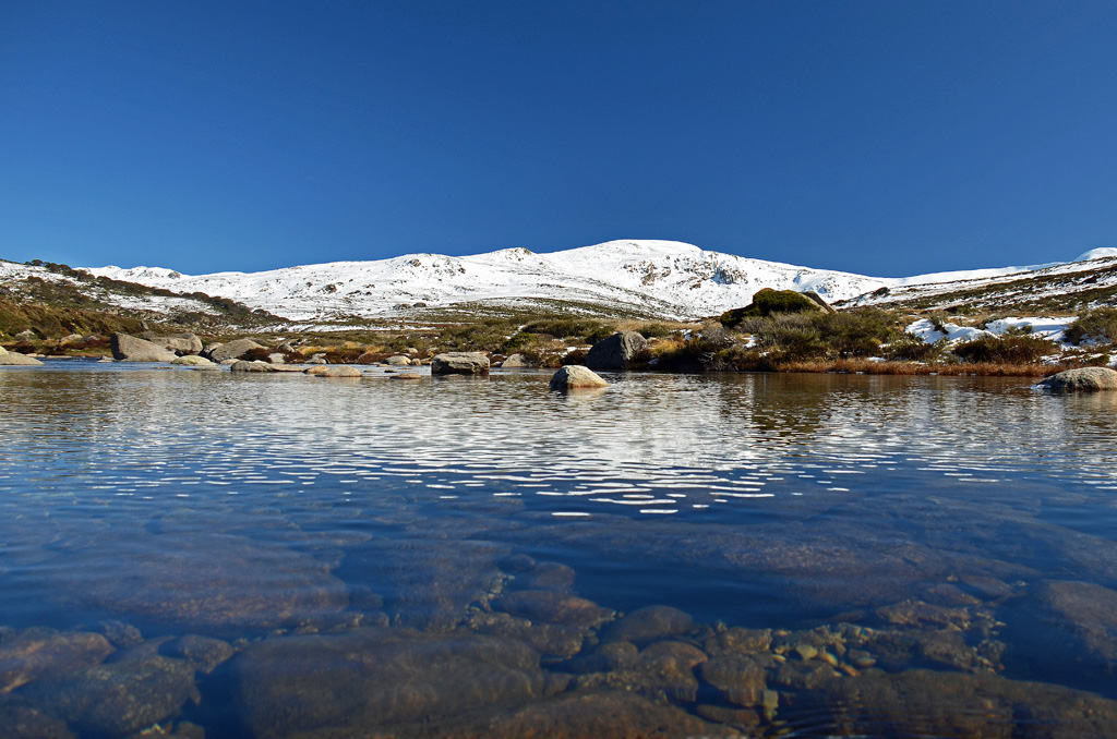
Mount Kosciuszko from the Snowy River in Kosciuszko National Park.
About Kosciuszko National Park
Kosciuszko National Park is the largest national park in New South Wales and protects much of Australia’s alpine environment.
The park includes snow-covered peaks, granite landscapes, alpine meadows, rivers, wetlands, forests and important habitats for native wildlife.
Popular visitor areas include Thredbo, Perisher, Charlotte Pass, Jindabyne, Selwyn and the high alpine country surrounding Mount Kosciuszko.
Mount Kosciuszko
Mount Kosciuszko is the highest mountain on mainland Australia and one of the main attractions in the national park.
Unlike many of the world’s highest mountains, reaching the summit does not require technical climbing during suitable summer conditions.
There are several walking routes to the summit, with popular approaches beginning from Thredbo and Charlotte Pass.
Kosciuszko Walk from Thredbo
One of the most popular ways to reach Mount Kosciuszko is from Thredbo.
Visitors can take the Kosciuszko Express chairlift up the mountain and then follow the walking track towards the summit.
The route passes through alpine landscapes and provides extensive views across the Snowy Mountains.
Conditions can change quickly at high altitude, so walkers should carry warm clothing, water and suitable footwear even during summer.
Mount Kosciuszko Summit Walk from Charlotte Pass
Another option is the Mount Kosciuszko Summit Walk from Charlotte Pass.
The official NSW National Parks route is approximately 18.6 kilometres return and usually takes around 6 to 8 hours.
The track is graded Grade 3 and follows a formed route through the high alpine landscape.
Main Range Walk
The Main Range Walk is one of the most impressive longer hikes in Kosciuszko National Park.
It explores some of Australia’s highest country and passes alpine lakes, ridges and extensive mountain scenery.
This walk is best suited to experienced and well-prepared hikers because alpine weather can change rapidly.
Thredbo
Thredbo is one of Australia’s best-known alpine villages and provides year-round access to Kosciuszko National Park.
During winter, it operates as a major ski resort.
During the warmer months, visitors come for hiking, mountain biking, sightseeing and access to the Mount Kosciuszko walking tracks.
Perisher
Perisher is another major alpine resort within Kosciuszko National Park.
It is best known for skiing and snowboarding during winter but also provides access to walking tracks and alpine scenery during the warmer months.
Charlotte Pass
Charlotte Pass is Australia’s highest alpine village and provides access to several important walking tracks.
During summer, visitors can drive to Charlotte Pass via Kosciuszko Road.
During winter, the road between Perisher and Charlotte Pass is closed to normal vehicles, and access is generally by oversnow transport.
Winter Activities
Kosciuszko National Park is Australia’s premier snow-sports destination.
Winter activities include:
Skiing
Snowboarding
Cross-country skiing
Snowshoeing
Tobogganing in designated areas
Snow sightseeing
Major ski areas include Thredbo, Perisher, Charlotte Pass and Selwyn.
Summer Activities
During the warmer months, the national park becomes an excellent destination for walking, cycling and sightseeing.
Popular summer activities include:
Walking to Mount Kosciuszko
Mountain biking
Scenic chairlift rides
Photography
Wildflower viewing
Fishing
Camping
Scenic drives
Alpine Wildflowers
During summer, sections of the high country are covered with alpine wildflowers.
The flowering season varies depending on weather and snow conditions, but December through February is generally an excellent period for seeing alpine vegetation.
Visitors should remain on marked tracks to protect fragile alpine plants.
Wildlife
Kosciuszko National Park provides habitat for a variety of native wildlife.
Animals that may be seen include:
Kangaroos
Wallabies
Wombats
Echidnas
Possums
Native birds
The park is also home to the endangered mountain pygmy-possum, one of Australia’s rarest small mammals.
Things to Do in Kosciuszko National Park
Walk to the summit of Mount Kosciuszko
Visit Thredbo
Explore Charlotte Pass
Ski or snowboard in winter
Walk the Main Range
See alpine wildflowers
Go mountain biking
Enjoy scenic drives
Visit alpine lookouts
Explore the Snowy River headwaters
Best Time to Visit
Kosciuszko National Park can be visited throughout the year.
December to March is generally the best period for hiking in the high alpine areas.
June to October is the main snow season, although exact conditions vary each year.
Spring can still bring snow and icy conditions at higher elevations.
Getting to Kosciuszko National Park
The main gateway town is Jindabyne.
From Canberra, the drive to Jindabyne is approximately two hours, depending on traffic and road conditions.
From Jindabyne:
Thredbo is approximately 33 kilometres away
Perisher is approximately 33 kilometres away
Charlotte Pass is around 40 kilometres away
Park entry fees apply on major access roads into the alpine areas.
Winter Driving
Winter driving in Kosciuszko National Park requires additional preparation.
Between the June and October long weekends, two-wheel-drive vehicles travelling on specified alpine roads are required to carry snow chains.
Roads may also close temporarily because of snow, ice or severe weather.
Always check current road conditions and park alerts before travelling.
How Long Should You Spend?
A single day is enough to visit Thredbo and complete a shorter alpine walk.
Allow 2 to 4 days if you want to explore several areas of the park, climb Mount Kosciuszko and visit Jindabyne, Charlotte Pass and other alpine locations.
A longer stay is recommended during winter if skiing or snowboarding is your main reason for visiting.
Suggested Summer Day
A good summer itinerary could include:
Start the morning in Thredbo
Take the chairlift into the alpine area
Walk towards Mount Kosciuszko
Reach the summit and enjoy the mountain views
Return to Thredbo in the afternoon
Finish the day with dinner in Thredbo or Jindabyne
Travel Tip
Alpine weather can change very quickly, even during summer. Carry warm and waterproof clothing, adequate water, sun protection and suitable walking shoes.
Before starting any longer walk, check the latest weather forecast, road conditions and NSW National Parks alerts.
Blue Mountains: Inside a World Heritage National Park Australia Immerse yourself in the beauty of the World-Heritage Blue Mountains NP. Experience the magnificent valleys, falls and gorges of this spectacular wilderness with a small group of max. of 10 guests.
Jervis Bay is one of the most beautiful coastal destinations on the New South Wales South Coast, known for its brilliant white-sand beaches, clear turquoise water, national parks and abundant marine life.
Located in the Shoalhaven region, Jervis Bay is popular for swimming, snorkelling, kayaking, bushwalking, dolphin cruises and whale watching. The main visitor centres include Huskisson, Vincentia and Hyams Beach.
Hyams Beach in Jervis Bay, New South Wales.
About Jervis Bay
Jervis Bay combines sheltered beaches with national parks, walking tracks and protected marine environments.
The area includes Jervis Bay National Park, Booderee National Park and the Jervis Bay Marine Park, providing opportunities to see dolphins, whales, seals, seabirds and other wildlife.
The calm waters and numerous beaches make the region particularly popular with families and visitors interested in outdoor activities.
Hyams Beach
Hyams Beach is one of the best-known beaches in Jervis Bay and is famous for its exceptionally white sand and clear water.
The beach is popular for swimming, snorkelling, paddleboarding and relaxing beside the bay.
Hyams Beach can become very busy during summer, weekends and holiday periods, so arriving early is recommended.
White Sands Walk
The White Sands Walk is one of the most popular coastal walks in Jervis Bay.
The track passes a series of picturesque beaches and coastal forest, offering excellent opportunities for swimming, photography and wildlife spotting.
Beaches along this part of the coastline include:
Greenfield Beach
Chinamans Beach
Hyams Beach
Seamans Beach
Booderee National Park
Booderee National Park occupies much of the southern side of Jervis Bay and is jointly managed with the traditional Aboriginal owners of the area.
The park contains beautiful beaches, bushwalking tracks, camping areas and important Aboriginal cultural sites.
Popular places within Booderee National Park include:
Murrays Beach
Cave Beach
Green Patch
Scottish Rocks
Cape St George Lighthouse
Booderee Botanic Gardens
Murrays Beach
Murrays Beach is one of the most scenic beaches in Booderee National Park.
Its relatively sheltered water makes it popular for swimming and snorkelling, while the surrounding bushland provides a beautiful natural setting.
Huskisson
Huskisson is one of the main towns around Jervis Bay and a convenient base for exploring the region.
The waterfront town has cafés, restaurants, accommodation and shops, and many dolphin and whale-watching cruises depart from its harbour.
Dolphin Watching
Jervis Bay is well known for its resident population of bottlenose dolphins.
Dolphin-watching cruises regularly operate from Huskisson and provide visitors with an opportunity to see dolphins swimming through the protected waters of the bay.
Dolphins can also sometimes be spotted from beaches, headlands and walking tracks.
Whale Watching
Jervis Bay is an excellent destination for watching migrating humpback whales.
Whales migrate along the New South Wales coast generally between May and November.
Boat tours depart from Huskisson during the migration season, while land-based viewing is also possible from several headlands around the bay.
Snorkelling and Diving
The clear waters of Jervis Bay Marine Park make the region popular for snorkelling and scuba diving.
Visitors may encounter fish, rays, dolphins, seals and other marine species.
Popular snorkelling areas include Murrays Beach and other sheltered beaches around the bay.
Kayaking and Paddleboarding
The protected waters of Jervis Bay are ideal for kayaking and stand-up paddleboarding when conditions are suitable.
Equipment hire and guided kayaking tours are available in the area, allowing visitors to explore beaches, coves and sections of the coastline from the water.
Things to Do in Jervis Bay
Relax at Hyams Beach
Walk the White Sands Walk
Explore Booderee National Park
Swim at Murrays Beach
Join a dolphin-watching cruise
Go whale watching
Snorkel in Jervis Bay Marine Park
Kayak around the bay
Explore Huskisson
Visit Booderee Botanic Gardens
Walk to coastal lookouts
Photograph the white-sand beaches
Jervis Bay National Park
Jervis Bay National Park protects areas of coastal forest, wetlands and white-sand beaches around the northern and western sides of the bay.
Visitors can enjoy swimming, snorkelling, fishing, birdwatching and bushwalking.
The park also contains several picnic areas and walking tracks.
Best Time to Visit Jervis Bay
Jervis Bay can be visited throughout the year.
Summer is ideal for swimming, snorkelling and beach activities, although this is also the busiest period.
Spring and autumn are particularly pleasant for walking and exploring the national parks.
Winter is a good time for whale watching as humpback whales migrate north along the coast.
Getting to Jervis Bay
Jervis Bay is located approximately 140 kilometres south of Sydney along the New South Wales coast.
The drive from Sydney generally takes a little over three hours, depending on traffic and your destination around the bay.
Jervis Bay is also approximately three hours by road from Canberra.
Getting Around Jervis Bay
A car is the most convenient way to explore Jervis Bay because the beaches, national parks and towns are spread around a large area.
Huskisson and Vincentia are relatively close together, while attractions such as Booderee National Park and Hyams Beach are easier to reach by car.
How Long Should You Spend in Jervis Bay?
Jervis Bay can be visited on a long day trip, but spending 2 to 4 days allows much more time to enjoy the beaches, national parks and marine activities.
A longer stay is particularly worthwhile if you want to combine swimming, walking, kayaking and a dolphin or whale-watching cruise.
Suggested Jervis Bay Day
A good one-day itinerary could include:
Start the morning at Hyams Beach
Walk part of the White Sands Walk
Have lunch in Huskisson
Join a dolphin or whale-watching cruise
Explore the Huskisson waterfront
Finish the afternoon at one of the bay’s beaches
Travel Tip
Jervis Bay becomes extremely popular during summer holidays and long weekends. Arrive early when visiting well-known locations such as Hyams Beach, particularly if you need parking.
If you are visiting the national parks, check current park alerts, weather conditions and access information before setting out.
Jervis Bay Dolphin Cruise, Lunch, Berry & Kiama Blowhole Tour Australia Discover the beauty of Jervis Bay on a full-day tour from Sydney. Enjoy a dolphin cruise, a delicious lunch, and visit the spectacular Kiama Blowhole and the iconic Berry Donut Van.
Jervis Bay, Kiama & Kangaroo Valley Day Trip From Sydney-PVT Australia This exclusive private day trip offers a perfect blend of coastal wonders, countryside charm, and natural beauty, making it an ideal choice for those looking to explore the diverse landscapes of NSW.
Jervis Bay: 3 Hour Guided Kayak Tour with Morning Tea Australia Paddle through ancient mangrove forests on a guided kayak tour in Jervis Bay. Spot local wildlife, enjoy a morning tea picnic on the beach, and learn about the area from your guide.
The Hunter Valley is one of Australia’s best-known wine regions and a popular escape from Sydney. Located in New South Wales, the region is famous for its vineyards, cellar doors, restaurants, rolling countryside, hot-air balloon flights and attractive rural accommodation.
The main wine tourism areas include Pokolbin, Lovedale, Broke and Rothbury, with Pokolbin containing many of the region’s best-known wineries, restaurants and attractions.
Vineyards in the Hunter Valley, New South Wales. Photo: thinkrorbot / Wikimedia Commons. Public domain.
About the Hunter Valley
The Hunter Valley is one of Australia’s most established wine destinations and is particularly associated with Semillon and Shiraz.
Today the region combines traditional wineries with modern cellar doors, restaurants, boutique accommodation, breweries, distilleries and other visitor attractions.
Its proximity to Sydney makes the Hunter Valley suitable for a day trip, although staying for two or three days provides much more time to explore.
Visit the Wineries and Cellar Doors
Wine tasting is one of the main reasons people visit the Hunter Valley.
The region contains numerous cellar doors ranging from historic family-owned wineries to large modern estates.
Visitors can taste local wines, learn about winemaking and often purchase bottles directly from the producer.
Popular Hunter Valley wine varieties include:
Semillon
Shiraz
Chardonnay
Verdelho
Cabernet Sauvignon
Join a Hunter Valley Wine Tour
A guided wine tour can be a convenient option if you want to visit several wineries without driving.
Tours commonly include visits to multiple cellar doors and may also include cheese, chocolate, spirits or lunch.
Both small-group and private tours operate throughout the region.
Hot-Air Ballooning
Seeing the Hunter Valley from a hot-air balloon is one of the region’s most memorable experiences.
Flights generally depart around sunrise when weather conditions are usually calmer.
From the air, visitors can see vineyards, lakes, farms, mountains and the surrounding countryside. Some balloon experiences are followed by breakfast at a winery.
Hunter Valley Gardens
Hunter Valley Gardens at Pokolbin is one of the region’s major attractions.
The gardens cover approximately 14 hectares and contain around 8 kilometres of walking paths.
There are ten themed display gardens featuring native and exotic plants, waterfalls, statues and landscaped areas.
The gardens include:
Rose Garden
Storybook Garden
Italian Grotto
Chinese Garden
Oriental Garden
Sunken Garden
Hunter Valley Gardens also hosts seasonal events throughout the year, including major spring displays and the Christmas Lights Spectacular.
Food and Restaurants
The Hunter Valley has developed into an important food destination as well as a wine region.
Visitors can choose from winery restaurants, casual cafés, fine dining, local produce stores and gourmet tasting experiences.
Cheese, chocolate, olives and locally produced foods are often available alongside the region’s wines.
Breweries and Distilleries
Wine may be the Hunter Valley’s main attraction, but the region also has a growing selection of breweries and distilleries.
Visitors can sample craft beer, gin, vodka and other spirits at venues throughout the valley.
Things to Do in the Hunter Valley
Visit winery cellar doors
Take a guided wine tour
Fly over the vineyards in a hot-air balloon
Explore Hunter Valley Gardens
Enjoy lunch at a winery restaurant
Visit local breweries and distilleries
Sample local cheese and chocolate
Explore Pokolbin and Lovedale
Visit the smaller wine area around Broke
Stay overnight among the vineyards
Pokolbin
Pokolbin is at the heart of Hunter Valley wine country and is one of the most convenient places for first-time visitors to base themselves.
Many cellar doors, restaurants and accommodation properties are located within a relatively small area.
Hunter Valley Gardens is also located at Pokolbin.
Lovedale
Lovedale is another popular wine and food area with wineries, restaurants, galleries and accommodation.
It often has a quieter rural atmosphere than central Pokolbin and makes an attractive area to explore by car.
Broke
The village of Broke and the surrounding Broke Fordwich wine region provide a more relaxed alternative to the busier parts of the Hunter Valley.
The area contains boutique wineries, restaurants and rural scenery backed by mountains.
Best Time to Visit the Hunter Valley
The Hunter Valley can be visited throughout the year.
Autumn and spring are particularly pleasant for exploring vineyards, gardens and outdoor attractions.
Summer can be warm, while winter mornings and evenings can be quite cool.
Harvest season generally brings additional activity to the vineyards, while spring is particularly attractive at Hunter Valley Gardens.
Getting to the Hunter Valley
The Hunter Valley is approximately a two-hour drive north of Sydney, depending on your destination and traffic conditions.
Hunter Valley Gardens advises visitors travelling from Sydney to use the M1 and follow the Cessnock and vineyards exits towards Pokolbin.
Newcastle Airport is another useful gateway and is approximately 50 minutes by road from Hunter Valley Gardens.
Getting Around the Hunter Valley
A car provides the greatest flexibility because wineries and attractions are spread across a large rural area.
However, visitors planning to taste wine may prefer a guided tour, private driver or organised transfer service.
Many accommodation properties can also help arrange transport to nearby restaurants and wineries.
How Long Should You Spend in the Hunter Valley?
The Hunter Valley can be visited on a long day trip from Sydney, but this limits the number of wineries and attractions you can comfortably visit.
A stay of 2 to 3 days is ideal for combining wine tasting, restaurants, gardens and sightseeing without rushing.
Suggested Hunter Valley Day
A good one-day itinerary could include:
Arrive in Pokolbin in the morning
Visit one or two cellar doors
Enjoy lunch at a winery restaurant
Explore Hunter Valley Gardens
Visit another winery or distillery
Finish the afternoon with local cheese or chocolate
Travel Tip
If you plan to visit several wineries, consider booking an organised wine tour rather than driving yourself.
For a more relaxed experience, stay overnight in Pokolbin or Lovedale so you can explore the region over several days.
Image credit: thinkrorbot, via Wikimedia Commons. The image has been released into the public domain.
The Hunter Tasting - Wine Tasting Hunter Valley Australia Explore the flavors of the Hunter Valley with a wine tasting experience that highlights the history and future of Australian wine. Learn about the history of the region and the wines you are tasting.
Hunter Valley: Tastes of the Hunter Tour Australia Discover the Hunter Valley on a half-day tour visiting a trio of different venues. Enjoy tastings of premium wines, cheese plates, spirits, and artisan chocolates paired with wines.
Byron Bay is one of Australia’s best-known coastal towns, famous for its beaches, surfing, relaxed atmosphere, coastal walks and spectacular views from Cape Byron. Located on the far north coast of New South Wales, the town is also surrounded by rainforest, rolling hinterland and attractive villages.
Visitors come for everything from swimming and surfing to whale watching, kayaking, walking, dining and exploring the surrounding Northern Rivers region.
About Byron Bay
Byron Bay combines a lively coastal town with some of the most attractive beaches and headlands in northern New South Wales.
Popular beaches include Main Beach, Clarkes Beach, Wategos Beach and Belongil Beach. Main, Clarkes and Wategos beaches are patrolled throughout the year.
Cape Byron Lighthouse
The Cape Byron Lighthouse is one of Byron Bay’s best-known landmarks.
Standing at the most easterly point of mainland Australia, the lighthouse overlooks the Pacific Ocean and Cape Byron Marine Park.
The lighthouse was completed in 1901 and remains an excellent location for viewing the coast, surrounding hinterland and marine life.
Dolphins, turtles and humpback whales can sometimes be seen from the headland. Whale sightings are particularly common during the annual migration season.
Walgun Cape Byron Walking Track
One of the best ways to explore Byron Bay is along the Walgun Cape Byron walking track.
The scenic 3.7-kilometre loop passes through rainforest, beaches, grasslands and clifftops before reaching Cape Byron Lighthouse.
NSW National Parks classifies the walk as Grade 3 and recommends allowing approximately 1 to 3 hours. The route contains some short steep hills and many steps.
Highlights along the route include:
Captain Cook Lookout
Clarkes Beach
The Pass
Wategos Beach
Little Wategos Beach
Cape Byron Lighthouse
Australia’s most easterly mainland point
Beaches in Byron Bay
Byron Bay has several beaches, each offering a slightly different experience.
Main Beach
Main Beach is closest to the town centre and is convenient for swimming, relaxing and watching the sunset.
Wategos Beach
Wategos Beach sits beneath Cape Byron and is one of the most scenic beaches in the area. It is popular for swimming, picnics and longboard surfing.
Clarkes Beach
Clarkes Beach lies between Main Beach and The Pass and offers a long stretch of sand suitable for swimming and walking.
Belongil Beach
Belongil Beach extends north from town and generally has a quieter atmosphere than Main Beach.
Surfing in Byron Bay
Byron Bay has long been associated with Australian surf culture.
The Pass and The Wreck are among the area’s best-known surf breaks, while several local surf schools offer lessons for beginners.
Conditions vary, so inexperienced surfers should use suitable beginner areas and follow local safety advice.
Whale Watching
Byron Bay is an excellent location for watching migrating humpback whales.
Whales can generally be seen during the migration period from around May to November, with particularly good viewing opportunities during winter and early spring.
Cape Byron and the lighthouse precinct provide excellent land-based viewpoints.
Julian Rocks
Julian Rocks lies approximately 2.5 kilometres offshore within the Cape Byron Marine Park.
The area is well known for scuba diving and snorkelling and supports a diverse range of marine life.
Guided dive and snorkelling trips operate from Byron Bay, depending on weather and ocean conditions.
Kayaking
Sea kayaking is another popular activity in Byron Bay.
Guided kayaking tours explore the waters around Cape Byron and may provide opportunities to see dolphins, turtles and, during migration season, whales.
Things to Do in Byron Bay
Visit Cape Byron Lighthouse
Walk the Walgun Cape Byron walking track
Swim at Main Beach
Relax at Wategos Beach
Take a surfing lesson
Go whale watching
Join a sea kayaking tour
Snorkel or dive at Julian Rocks
Explore the town’s cafés and restaurants
Visit nearby hinterland villages
Explore the Byron Bay Hinterland
The countryside surrounding Byron Bay provides an excellent contrast to the coast.
Visitors can explore rainforest, farms, waterfalls and small villages throughout the Northern Rivers hinterland.
Popular destinations include:
Bangalow
Brunswick Heads
Mullumbimby
Federal
Newrybar
Best Time to Visit Byron Bay
Byron Bay can be visited throughout the year.
Summer is popular for swimming and beach holidays, while autumn and spring usually provide pleasant temperatures for walking and exploring.
Winter is particularly attractive for visitors interested in whale watching.
Getting to Byron Bay
Location: Byron Bay NSW 2481 Australia
Byron Bay is located on the north coast of New South Wales, south of the Queensland border.
The closest major airports include Ballina Byron Gateway Airport and Gold Coast Airport. Shuttle and transfer services operate between the airports and Byron Bay.
Travellers arriving by road can reach Byron Bay via the Pacific Motorway and surrounding regional roads.
Getting Around Byron Bay
The central area of Byron Bay is compact enough to explore on foot.
Walking or cycling can be particularly convenient because parking around the town centre and popular beaches can become busy.
A car is useful if you plan to explore the surrounding hinterland and neighbouring coastal towns.
How Long Should You Spend in Byron Bay?
A full day is enough to see the main highlights, including the lighthouse, walking track and beaches.
However, spending 2 to 4 days provides more time for surfing, swimming, kayaking, whale watching and exploring the hinterland.
Suggested Byron Bay Day
A good one-day itinerary is:
Start with breakfast in Byron Bay
Walk towards The Pass and Wategos Beach
Continue along the Cape Byron walking track
Visit Cape Byron Lighthouse
Return to town for lunch
Spend the afternoon at Main Beach or Clarkes Beach
Finish the day watching the sunset
Travel Tip
Start the Cape Byron walk early in the morning when temperatures are cooler and the tracks are generally quieter.
Take water, sun protection and comfortable footwear, particularly if completing the entire 3.7-kilometre loop.
Image credit: Kpravin2, via Wikimedia Commons. Licensed under Creative Commons Attribution-ShareAlike 4.0.
Byron Bay: Cape Byron Lighthouse Guided Sunrise Tour Australia Guests are taken on a hike through rainforest, beach and clifftops to be the first people in Australia to witness the spectacular sunrise at the most easterly point in the country.
Byron Bay: Behind The Bay Waterfalls & Hidden Gems Day Tour Australia Experience the best of Byron Bay's surrounds on a relaxing day tour. Immerse yourself in the beauty of Lennox Head and Lake Ainsworth, visit Killen Falls, and discover hidden beaches at Broken Head.
Byron Bay, Gold Coast, Brisbane, Noosa Hop-On Hop-Off Pass Australia Hop-on hop-off along Australia’s East Coast! Travel Byron Bay, Brisbane, Gold Coast, Noosa & Rainbow Beach at your pace, with local tips, must-see spots & exclusive discounts.
The Blue Mountains are one of New South Wales’ most spectacular natural regions and one of the most popular day trips from Sydney. Famous for dramatic sandstone cliffs, deep forested valleys, waterfalls, bushwalking tracks and panoramic lookouts, the region forms part of the Greater Blue Mountains World Heritage Area.
The main visitor centres include Katoomba, Leura, Wentworth Falls and Blackheath, with many of the best-known attractions concentrated around Katoomba.
The Three Sisters in the Blue Mountains. Photo: Diliff / Wikimedia Commons, CC BY-SA 2.5.
About the Blue Mountains
The Blue Mountains begin approximately 60 kilometres west of Sydney and cover a vast area of rugged escarpments, eucalyptus forests, waterfalls and sandstone plateaus.
The distinctive blue haze often visible across the valleys is associated with the region’s extensive eucalyptus forests.
The landscape is part of Country traditionally cared for by Aboriginal peoples, including the Gundungurra and Darug peoples.
Three Sisters
The Three Sisters are the best-known landmark in the Blue Mountains.
These three sandstone peaks rise above the Jamison Valley and can be viewed from Echo Point at Katoomba.
The Three Sisters have important Aboriginal cultural significance and are associated with several traditional stories.
The short Three Sisters Walk begins at Echo Point and is approximately 800 metres return. Most visitors can complete it in around 25 to 45 minutes.
Echo Point Lookout
Echo Point is one of the most popular viewpoints in the Blue Mountains and provides expansive views across the Jamison Valley towards the Three Sisters, Mount Solitary and surrounding sandstone escarpments.
Visitor facilities, toilets and walking tracks are available around the lookout area.
Scenic World
Scenic World in Katoomba offers several ways to experience the mountain scenery.
Scenic Railway
Scenic Skyway
Scenic Cableway
Scenic Walkway
The Scenic Railway descends into the Jamison Valley, while the Skyway travels high above the gorge and provides extensive views of the surrounding cliffs and rainforest.
Wentworth Falls
Wentworth Falls is another major attraction in the Blue Mountains.
The waterfall drops over sandstone cliffs into the Jamison Valley and can be viewed from several lookouts and walking tracks.
The area offers everything from short walks to more demanding bushwalking routes.
Govetts Leap
Located near Blackheath, Govetts Leap Lookout provides one of the most impressive panoramas in the Blue Mountains.
The viewpoint overlooks the Grose Valley and surrounding cliffs and is an excellent stop for photography and bushwalking.
Leura
The mountain village of Leura is known for its attractive streets, cafés, restaurants, gardens and boutique shops.
It makes a pleasant stop between visits to lookouts and walking tracks and is only a short distance from Katoomba.
Things to Do in the Blue Mountains
See the Three Sisters at Echo Point
Ride the Scenic Railway at Scenic World
Visit Wentworth Falls
Walk through eucalyptus forest
Explore Leura and Katoomba
Visit Govetts Leap Lookout
Go bushwalking
Photograph waterfalls and sandstone cliffs
Visit the Blue Mountains Heritage Centre
Explore the mountain villages
Bushwalking in the Blue Mountains
The Blue Mountains contain an extensive network of bushwalking tracks ranging from easy lookout walks to challenging full-day hikes.
Popular walking areas include:
Three Sisters and Echo Point
Wentworth Falls
Leura Cascades
Govetts Leap
Evans Lookout
Grand Cliff Top Walk
Narrow Neck
Weather conditions can change quickly in the mountains, so visitors planning longer walks should carry suitable clothing, water and navigation equipment.
Blue Mountains Heritage Centre
The Blue Mountains Heritage Centre at Blackheath is a useful place to begin exploring the national park.
The centre provides maps, walking information, local history and advice about current park conditions.
Best Time to Visit the Blue Mountains
The Blue Mountains can be visited throughout the year, with each season offering a different experience.
Spring and autumn are particularly pleasant for bushwalking, while winter can bring cold temperatures and crisp mountain views.
Summer is generally warmer, but visitors should always check bushfire warnings and national park alerts before travelling.
Getting to the Blue Mountains from Sydney
The Blue Mountains are easily accessible from Sydney by car or train.
Driving from central Sydney to Katoomba generally takes around 90 minutes to two hours, depending on traffic.
Train services operate from Sydney towards Katoomba, Wentworth Falls, Leura, Blackheath and Lithgow.
Express train services to Katoomba can take around 90 minutes, while stopping services may take closer to two hours.
Getting Around
Having a car provides the greatest flexibility, particularly if you want to visit several lookouts and villages in one day.
Public buses operate from Katoomba to attractions including Echo Point and Scenic World.
A hop-on hop-off sightseeing bus also operates around Katoomba and Leura, stopping at many popular attractions and lookouts.
How Long Should You Spend in the Blue Mountains?
The Blue Mountains can be visited as a full-day trip from Sydney, particularly if you concentrate on Katoomba, the Three Sisters, Scenic World and Leura.
However, staying for two or three days provides much more time for bushwalking, waterfalls, mountain villages and some of the quieter viewpoints.
Suggested Blue Mountains Day Trip
A good one-day itinerary from Sydney is:
Arrive in Katoomba in the morning
Visit Echo Point and the Three Sisters
Explore Scenic World
Have lunch in Katoomba or Leura
Visit Wentworth Falls
Explore Leura village
Stop at another lookout before returning to Sydney
Travel Tip
The temperature in the Blue Mountains can be considerably cooler than Sydney, even on the same day. Carry a jacket and suitable walking shoes, particularly if you plan to explore the bushwalking tracks.
For the best experience, check current weather, fire warnings and national park alerts before setting out.
Image credit: Diliff, via Wikimedia Commons. Licensed under Creative Commons Attribution-ShareAlike 2.5.
From Sydney: Blue Mountains Sightseeing And Sunset Day Tour Australia Discover the Blue Mountains with a private, luxury 9-hour tour. Enjoy stunning landscapes, iconic lookouts, and a magical sunset. Perfect for small groups, traveling in style and comfort.
Blue Mountains: Overcliff-Undercliff Guided Hike Australia Embark on a guided hike of the Overcliff-Undercliff hike in the Blue Mountains. Admire the views of the Jamison Valley, explore the beauty & see waterfalls within a part of the Blue Mountains.
Bondi Beach is one of Australia’s most famous beaches and one of Sydney’s best-known coastal attractions. Located in Sydney’s eastern suburbs, Bondi is known for its golden sand, surf culture, ocean pools, coastal walks and lively collection of cafés and restaurants.
The beach is popular with swimmers, surfers, walkers and visitors who simply want to enjoy the classic Sydney beach lifestyle. Professional lifesavers patrol Bondi throughout the year, and swimmers should always stay between the red and yellow flags. :chatgpt-content-reference{index=”0″}
Bondi Beach, Sydney. Photo: Alex Proimos / Wikimedia Commons, CC BY 2.0.
About Bondi Beach
Bondi Beach is closely associated with Australian surf culture and surf lifesaving. The Bondi Surf Bathers’ Life Saving Club, founded in 1907, is recognised as one of the world’s oldest surf lifesaving clubs.
The broad sandy beach attracts visitors throughout the year, while the surrounding streets offer restaurants, cafés, shops and accommodation within easy walking distance of the water. :chatgpt-content-reference{index=”1″}
Swimming at Bondi Beach
Bondi is a popular swimming beach, but ocean conditions can change quickly.
Professional lifesavers patrol the beach throughout the year. Visitors should swim only between the red and yellow flags and follow instructions from lifeguards and lifesavers. :chatgpt-content-reference{index=”2″}
Surfing at Bondi Beach
Surfing is an important part of life at Bondi, and surfers can often be seen in the water from early morning until evening.
Beginners can also take surfing lessons with local surf schools, making Bondi a convenient place to try surfing while visiting Sydney. :chatgpt-content-reference{index=”3″}
Bondi Icebergs
At the southern end of Bondi Beach is the famous Bondi Icebergs swimming club and ocean pool.
The 50-metre ocean pool sits immediately beside the sea, with waves sometimes breaking over the edge. The location has become one of Sydney’s most photographed coastal scenes. :chatgpt-content-reference{index=”4″}
Bondi to Coogee Coastal Walk
One of the best activities at Bondi is the spectacular Bondi to Coogee Coastal Walk.
The approximately 6-kilometre walk follows Sydney’s coastline past sandstone cliffs, beaches and ocean views.
The route passes:
Bondi Beach
Tamarama Beach
Bronte Beach
Clovelly Beach
Gordons Bay
Coogee Beach
The complete walk generally takes around 2 to 3 hours, although visitors may want to allow longer for swimming, photography and café stops. :chatgpt-content-reference{index=”5″}
Bondi Pavilion
The historic Bondi Pavilion is located directly behind the main beach area.
The pavilion provides visitor facilities and is also used for cultural activities, exhibitions and community events.
Its beachfront position makes it a useful landmark when arriving at Bondi.
Things to Do at Bondi Beach
Swim between the red and yellow flags
Take a surfing lesson
Walk from Bondi to Coogee
Swim at Bondi Icebergs
Relax on the beach
Visit Bondi Pavilion
Explore local cafés and restaurants
Photograph the coastline
Watch surfers from the promenade
Enjoy a coastal picnic
Best Time to Visit Bondi Beach
Bondi can be visited throughout the year.
Summer is popular for swimming and beach activities, although the beach can become very busy during weekends, school holidays and warm weather.
Early morning is particularly attractive for walking, photography and watching surfers.
Between approximately May and November, the coastal walking route can also provide opportunities to spot migrating whales offshore. :chatgpt-content-reference{index=”6″}
Getting to Bondi Beach
Address: Campbell Parade Bondi Beach NSW 2026 Australia
Bondi Beach is easily reached from central Sydney using public transport.
A common route is to take a train to Bondi Junction and then continue by bus to Bondi Beach.
Buses also operate between the eastern suburbs and the beach, making a car unnecessary for most visitors. :chatgpt-content-reference{index=”7″}
How Long Should You Allow?
Allow around 2 to 3 hours if you want to explore the beach, promenade and Bondi Icebergs area.
Allow at least half a day if you plan to swim, have lunch and explore the surrounding neighbourhood.
If completing the Bondi to Coogee Coastal Walk, allow approximately 2 to 3 hours for the walk alone, plus additional time for stops. :chatgpt-content-reference{index=”8″}
Nearby Attractions
Bondi Icebergs
Tamarama Beach
Bronte Beach
Coogee Beach
Bondi to Coogee Coastal Walk
Bondi Pavilion
Waverley Cemetery
Travel Tip
For a good Bondi experience, arrive early in the morning, walk along the beachfront, continue past Bondi Icebergs and begin part of the Bondi to Coogee Coastal Walk.
If you are swimming at Bondi Beach, always use the patrolled area between the red and yellow flags.
Image credit: Alex Proimos, via Wikimedia Commons. Licensed under Creative Commons Attribution 2.0.
Private Sydney Beaches Tour — Bondi, Manly & Hidden Coves Australia Skip the crowded bus tours. This private full-day tour takes you to Sydney's beaches and harbour spots most visitors miss — secluded coves, coastal lookouts, and the real Bondi locals know.
The Most Famous Spots in Bali Instagram Tour – Guided Tour Indonesia The most famous spots in Bali Instagram tour is a convenient way to add structure, local context and purposeful sightseeing to the itinerary. Check current availability, inclusions and booking details before you go.
Sydney: Discover Scuba Dive at Australia's most Iconic Beach Australia Explore the world of diving with PADI Discover Scuba Diving Experience at Dive Centre Bondi. Basic theory, guided dive, and marine life. See what lives under the waves in an exciting day!
The Sydney Harbour Bridge is one of Australia’s most famous landmarks and a defining feature of the Sydney skyline. Stretching across Sydney Harbour between The Rocks and Milsons Point, the bridge carries road traffic, trains, pedestrians and cyclists between the city centre and Sydney’s North Shore.
Nicknamed the “Coathanger” because of its enormous steel arch, the bridge opened in 1932 and remains one of the city’s most popular attractions.
Sydney Harbour Bridge from Circular Quay. Photo: JJ Harrison / Wikimedia Commons, CC BY-SA 3.0.
About the Sydney Harbour Bridge
The Sydney Harbour Bridge was built to provide a permanent connection between central Sydney and the northern suburbs.
Construction took approximately eight years and the bridge officially opened on 19 March 1932.
The main steel arch spans approximately 503 metres, while the top of the bridge rises about 134 metres above Sydney Harbour. Around 53,000 tonnes of steel were used in its construction.
Walk Across the Sydney Harbour Bridge
Walking across the Sydney Harbour Bridge is one of the best free activities in Sydney.
The pedestrian walkway is located on the eastern side of the bridge and provides excellent views across Sydney Harbour, including the Sydney Opera House, Circular Quay and the surrounding city skyline.
You can begin the walk from The Rocks on the southern side or from Milsons Point on the northern side.
Allow approximately 20 to 30 minutes to walk across the bridge without long stops, although photographers may want to allow considerably longer.
Climb the Sydney Harbour Bridge
For a very different experience, visitors can climb the steel arches of the bridge with BridgeClimb Sydney.
The climb takes visitors high above the harbour and offers panoramic views across Sydney, including the Opera House, Circular Quay, Barangaroo and the distant suburbs.
Different BridgeClimb experiences are available, including climbs reaching the summit of the bridge.
The main Summit Climb takes around 3 hours in total, including approximately two hours on the bridge itself.
Visit the Pylon Lookout
The Pylon Lookout is another excellent option for visitors who want elevated views without completing the full BridgeClimb experience.
Located in the south-eastern pylon, the lookout provides panoramic views over Sydney Harbour.
The entrance is accessible from the pedestrian walkway across the bridge.
Best Views of the Sydney Harbour Bridge
There are many excellent places around Sydney Harbour where you can photograph the bridge.
Circular Quay
Sydney Opera House
Mrs Macquarie’s Point
The Rocks
Milsons Point
Luna Park Sydney
Barangaroo
Blues Point Reserve
Sydney Harbour ferries
One of the classic Sydney views combines the Sydney Harbour Bridge with the Sydney Opera House across the harbour.
See the Bridge from the Water
A ferry trip from Circular Quay is one of the easiest ways to appreciate the scale of the Sydney Harbour Bridge.
Several ferry routes provide close views of the bridge as they travel across Sydney Harbour.
Popular destinations include:
Manly
Taronga Zoo
Milsons Point
Barangaroo
Parramatta
History of the Sydney Harbour Bridge
The bridge was constructed under the direction of engineer Dr John Bradfield, who played a major role in planning the project.
British company Dorman Long & Co was responsible for its construction.
The bridge’s two enormous steel arches gradually extended from opposite sides of the harbour before meeting above the centre of the water in 1930.
The bridge opened to the public in 1932 and quickly became one of Australia’s most recognisable structures.
Interesting Sydney Harbour Bridge Facts
The bridge opened on 19 March 1932.
The steel arch spans approximately 503 metres.
The top of the arch rises about 134 metres above the harbour.
Around 53,000 tonnes of steel were used.
Approximately six million rivets were used during construction.
The bridge carries vehicles, trains, cyclists and pedestrians.
It is commonly nicknamed the “Coathanger”.
Getting to the Sydney Harbour Bridge
The southern end of the bridge is located beside The Rocks, close to Circular Quay.
From Circular Quay railway station, it is approximately a 10 to 15-minute walk to the pedestrian bridge access.
On the northern side, Milsons Point railway station provides convenient access to the bridge, Luna Park and surrounding harbour attractions.
How Long Should You Allow?
Allow approximately 30 to 60 minutes if you simply want to walk across the bridge and take photographs.
Allow around 1 to 2 hours if you are also visiting the Pylon Lookout or exploring The Rocks and Milsons Point.
A BridgeClimb experience can take approximately 2.5 to 3 hours depending on the climb selected.
Nearby Attractions
The Sydney Harbour Bridge is surrounded by many of Sydney’s best-known attractions.
Sydney Opera House
Circular Quay
The Rocks
Luna Park Sydney
Royal Botanic Garden Sydney
Museum of Contemporary Art Australia
Barangaroo Reserve
Suggested Sydney Harbour Bridge Walk
A good sightseeing route is to begin at Circular Quay, walk through The Rocks and then cross the Sydney Harbour Bridge to Milsons Point.
From Milsons Point, continue towards Luna Park and the harbour foreshore before returning to the city by train or ferry.
Travel Tip
Walk across the bridge in the late afternoon for excellent harbour views, then stay around Milsons Point or The Rocks as the city lights begin to appear.
For one of the classic Sydney experiences, combine the Sydney Harbour Bridge with a visit to the nearby Sydney Opera House and Circular Quay.
Image credit: JJ Harrison, via Wikimedia Commons. Licensed under Creative Commons Attribution-ShareAlike 3.0.
Sydney: University of Sydney Student-Led Walking Tour Australia Discover the University of Sydney on a student-led walking tour. Explore the Main Quadrangle, Fisher Library, and the Chau Chak Wing Museum while learning about the university’s history.
Sydney: Sydney Harbour Sunset Photo Tour & Cruise Australia Explore one of the most picturesque city harbours with a local professional photographer guide. They will capture once-in-a-lifetime photos plus enjoy a 30 minute harbour cruise on Sydney Harbour.
Sydney: Sydney Harbor Lunch Cruise with Welcome Drink Australia Enjoy a lunch cruise on Sydney Harbour with a welcome glass of bubbles. Savor a delicious 2-course meal inspired by locally sourced, regionally inspired cuisines.