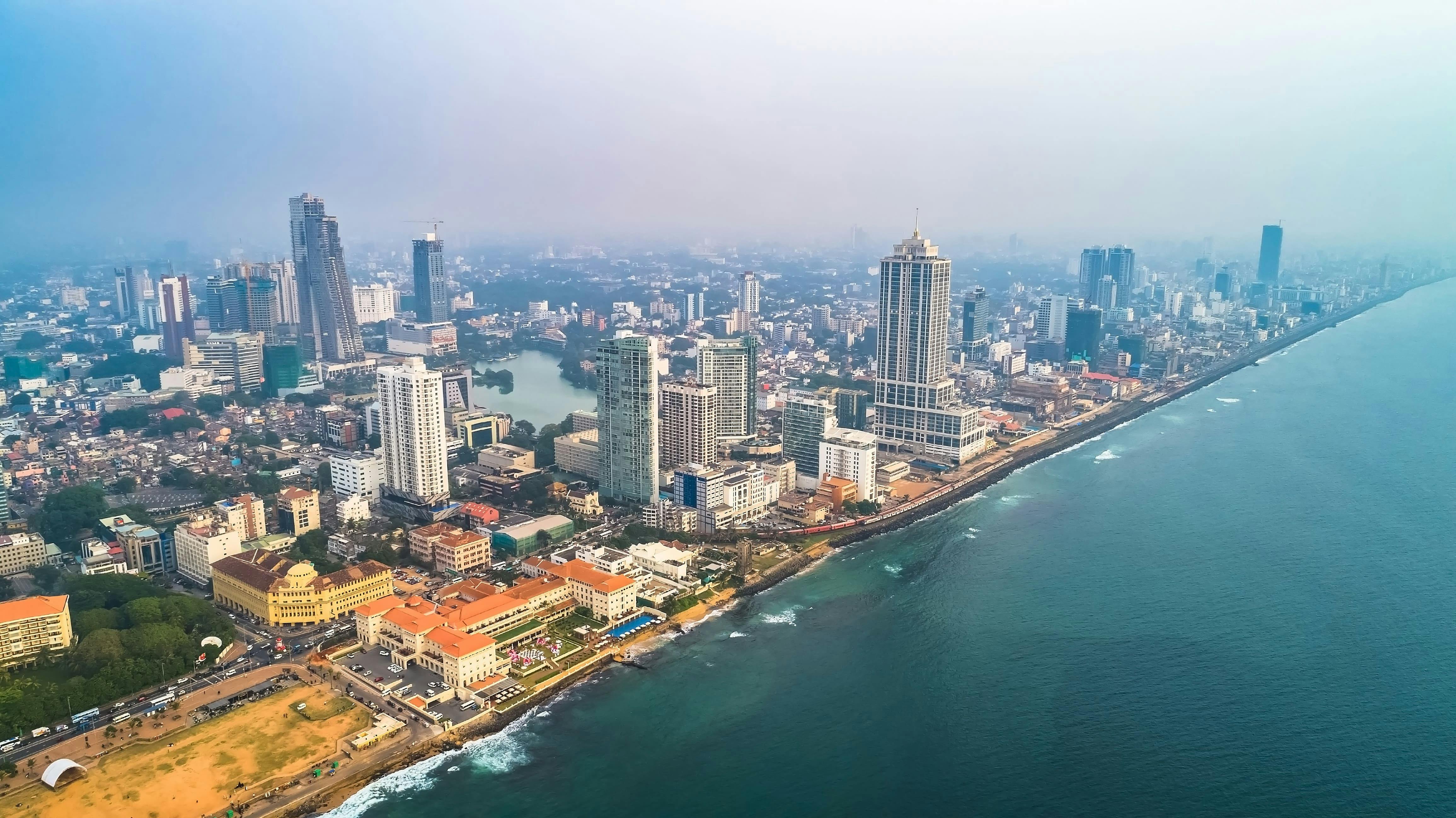
Colombo is Sri Lanka’s bustling commercial capital and coastal gateway — a city where colonial heritage, vibrant markets, seaside promenades, and rising skyscrapers all rub shoulders. It’s the place where your Sri Lankan journey often begins or ends, but it’s worth lingering in its layers for a taste of national life, street food, and urban charm.
Getting There & Best Time to Visit
How to Get There
Bandaranaike International Airport (CMB) is the main international airport, located about 30–45 minutes north of the city (traffic dependent).
You can also arrive via sea (cruise ships docking in Colombo port) though options are limited.
Once in Colombo, tuk-tuks, ride-share apps, trains, buses, and private cars move you around.
Best Time to Visit
December to March: relatively dry and cool — ideal for city walking and coastal drives.
April to September: wetter months, though showers often come in short bursts.
Pleasing trade winds help moderate humidity along the coast.
Top Sights & Neighborhoods
Galle Face Green & Seafront Promenade
A broad urban oceanfront park stretching along the Indian Ocean. Locals fly kites at sunset, snack on street food, and enjoy evening breezes.
Fort & Pettah Districts
Colombo Fort area hosts colonial buildings, banks, and high-end hotels. Adjacent Pettah is the city’s old mercantile quarter — narrow lanes and bazaars selling every imaginable good.
Independence Memorial & Cinnamon Gardens
Walk through leafy Cinnamon Gardens to the Independence Square, a centrally symbolic park where Sri Lanka’s independence was declared in 1948.
Gangaramaya Temple & Beira Lake
A colorful Buddhist temple with eclectic architecture and a glassed library. It sits beside Beira Lake, which invites a quiet stroll or boat ride.
National Museum & Colombo National Gallery
Discover Sri Lankan history and art through artifacts, regalia, colonial relics, and rotating exhibitions.
Mount Lavinia Beach
Just south of the city, this long beach is popular for evening swims, seafood dinners, and sunset walks. It’s a short drive from central Colombo.
Experiences, Food & Culture
Street food & market walks: In Pettah find kottu, hopper stalls, sweet waffles, and spice shops.
Sunset views: Rooftop bars in Fort and hotel terraces overlook city lights and ocean.
Art & gallery hopping: Small contemporary galleries and mural trails are growing.
Shopping: Odel, Arcade Independence Square, and local boutiques in Colombo 7 offer clothes, handicrafts, and modern picks.
Nightlife: Late dinners, jazz bars, lounges, and live music are concentrated in Fort and Kollupitiya.
Practical Tips & Safety
Traffic & time: Colombo’s traffic can be heavy—cross rivers and bridges early or late; allow buffers for appointments.
Tuk-tuk etiquette: Use meters if possible—or negotiate a fare ahead. Ask locals for typical rates.
Dress code: For temples and mosques, cover shoulders and knees; carry a scarf or sarong.
Staying connected: Local SIM cards (Mobitel, Dialog) are affordable and easy to get at the airport or shops.
Safety: Colombo is generally safe. Keep valuables secure, especially in busy market areas, and use licensed taxis or ride-share at night.
Colombo FAQs
Is Colombo worth visiting on a Sri Lanka itinerary?
Answer: Definitely. It offers a strong taste of urban Sri Lankan life, contrast to quieter countryside stops, and useful services (banks, SIMs, last-minute shopping).
How many days should I spend?
Answer: One full day is enough to hit highlights (temples, Fort, markets). Two days allows food tours, beach escape, and deeper strolling.
Can I use public transport?
Answer: Yes. Buses, trains, and tuk-tuks are common. Trains run along the coast and north/south lines, though schedules can be slow or crowded.
Best area to stay?
Answer: Fort or Cinnamon Gardens (Colombo 7 / 5) offer safe, walkable zones near restaurants, green spaces, and transport hubs.
Suggested 1–2 Day Itinerary
Day 1 — City & Culture
Morning: Gangaramaya Temple + Beira Lake.
Midday: Lunch in Pettah market and stroll the bazaar lanes.
Afternoon: Independence Square and National Museum.
Evening: Galle Face Green and sunset snacks.
Day 2 — Heritage & Beach
Fort heritage walk and colonial forts.
Shopping & café break in Colombo 7.
Late afternoon: head to Mount Lavinia Beach for seafood at sunset.
Why Colombo Should Be on Your Route
Colombo is more than a transit hub — it’s a living collage of old and new: colonial façades beside skyscrapers, spice scents mixing with sea breeze, rickshaws weaving past boutique cafés. It’s the place to adjust your mind to Sri Lanka — full of contrast, color, and genuine heart.
Sponsored Popular Items
Quick take: Musement.com offers a worldwide selection of tours and attractions
Colombo City Tour – Bentota City Tour Sri Lanka Like four cities in one, Colombo is a grand mix of colonial architecture, verdant cricket greens and gleaming skyscrapers. Check current availability, inclusions and booking details before you go.
Ringed by palm-fringed beaches and crowned by misty tea hills, Sri Lanka packs ancient cities, wildlife-rich parks, flavorful cuisine, and warm hospitality into a compact island. Whether you’re chasing surf on the south coast, temples in the Cultural Triangle, or cool mornings among tea estates, this guide gives you a clear, practical plan.
Getting There and Best Time to Visit
How to Get There
By air: International flights arrive at Bandaranaike International Airport (CMB), about 30–45 minutes north of Colombo (traffic-dependent).
By rail/road: Once in-country, scenic trains connect Colombo with Kandy, Ella, and Jaffna; highways and private drivers cover most routes.
When to Go
West/South/Highlands (Dec–Mar): Driest weather for beaches from Negombo to Tangalle and hill-country hikes.
East/North (May–Sep): Best for Arugam Bay surf, Trincomalee beaches, and Jaffna.
Shoulders: Apr and Oct–Nov bring mixed showers but fewer crowds and good value.
Where to Go: Regions at a Glance
Region
Why Go
Highlights
Good For
Cultural Triangle (Anuradhapura, Polonnaruwa, Sigiriya, Dambulla)
Ancient capitals, rock fortresses, cave temples
Sigiriya Rock, Dambulla Cave Temples, Minneriya elephants
History lovers, families
Hill Country (Kandy, Nuwara Eliya, Ella, Haputale)
Dry-season swap, surf and calm bays in mid-year months
Arugam Bay point break, Pigeon Island snorkelling
Surfers, summer beachgoers
Wild Parks (Yala, Udawalawe, Wilpattu)
Leopards, elephants, birdlife
Game drives at dawn/sunset
Wildlife enthusiasts
Jaffna & North
Distinct Tamil culture, temples, lagoons
Nallur Kandaswamy Kovil, Delft Island
Cultural explorers
Top Experiences
Sigiriya and the Cave Temples of Dambulla
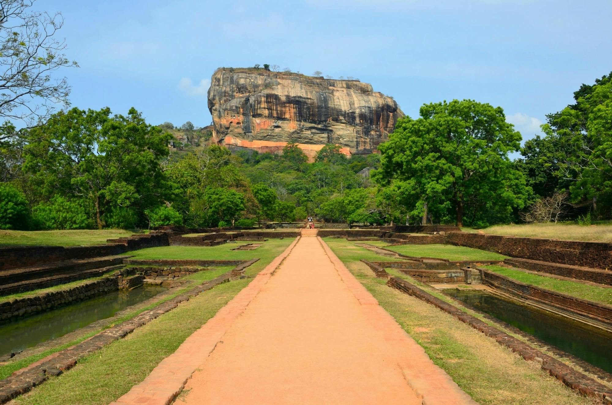
Climb Sigiriya’s lion-paw stairways for frescoes and royal ruins atop a volcanic plug. Pair with Dambulla’s Buddha-filled cave shrines for a perfect heritage day.
Tea Country by Train
Ride the blue train from Kandy to Ella past emerald tea, waterfalls, and mist. Break the journey with a factory tour and a ridge walk at sunrise.
Galle Fort and the Southern Beaches
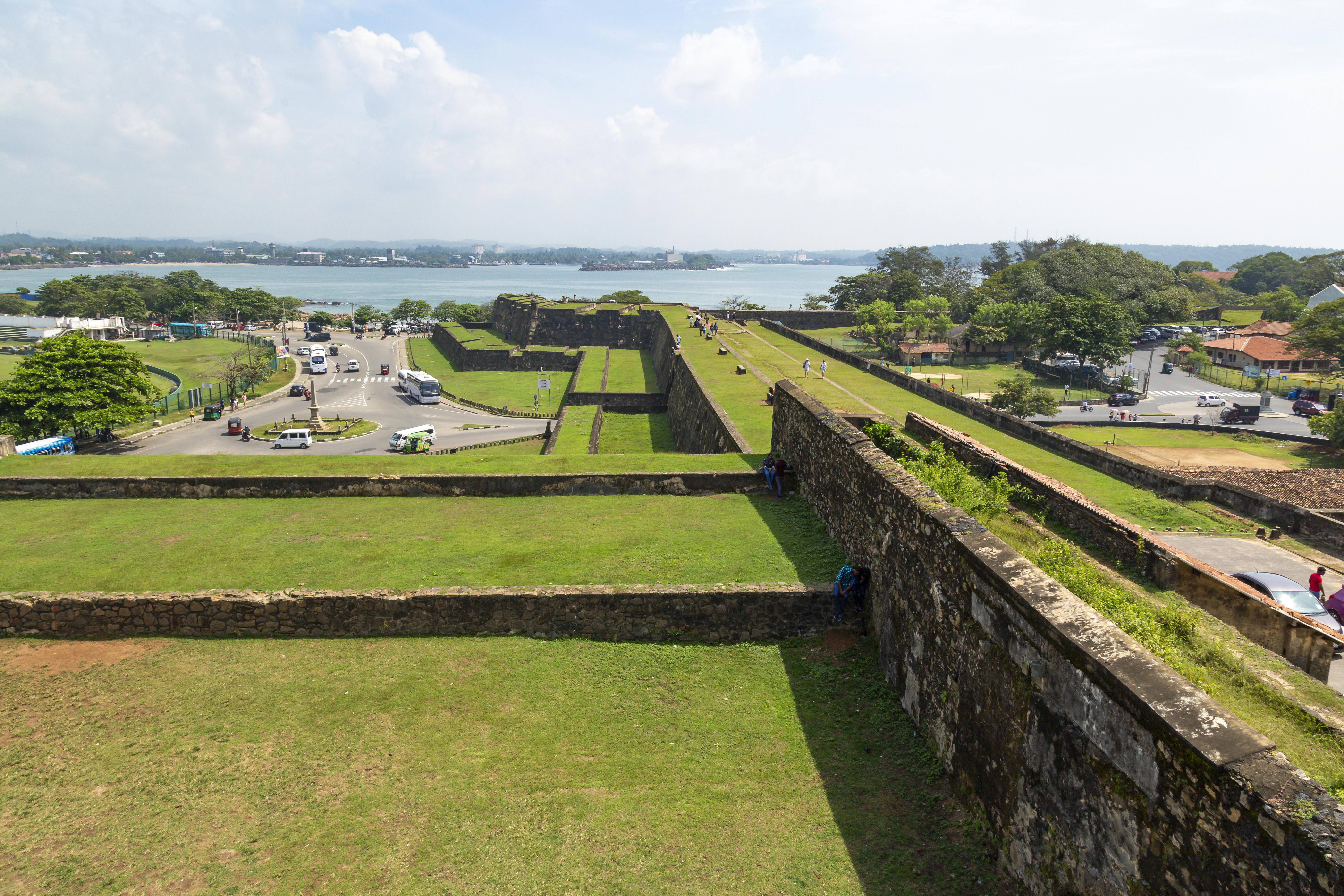
Wander UNESCO-listed Galle Fort’s ramparts, cafés, and galleries, then hop to Weligama for surf lessons or Mirissa for seasonal whale trips.
Safaris in Yala or Udawalawe
Search for leopards in Yala or herds of elephants in Udawalawe. Go at dawn or late afternoon for cooler temperatures and active wildlife.
Food, Spices, and Markets
Breakfast on hoppers with spicy sambol, try rice and curry thalis, seafood on the coast, and Jaffna crab in the north. Spice gardens and cooking classes are easy to add.
Practical Tips and Safety
Pace yourself: Distances are short, but travel can be slow; 2–4 nights per base is comfortable.
Hire a driver or mix modes: Trains are scenic; a driver fills the gaps between stations and parks.
Dress and etiquette: Shoulders/knees covered for temples; remove shoes and hats.
Wildlife etiquette: Never feed wild animals; keep distance on safaris and beaches.
Season-aware planning: Match coasts to monsoons for driest beach time.
Sri Lanka FAQs
Is Sri Lanka good for a first trip to South Asia?
Answer: Yes. It’s compact, welcoming, and varied — beaches, heritage, wildlife, and hill country within a day’s reach.
How many days do I need?
Answer: Ten to fourteen days covers the Cultural Triangle, Hill Country, and one coast. Add time for safaris and the north/east.
Is the tap water safe to drink?
Answer: Stick to bottled or filtered water; many hotels provide refill stations. Avoid ice where uncertain.
Do I need a visa?
Answer: Most travelers require an Electronic Travel Authorization (ETA) before arrival. Check current requirements for your nationality.
What about costs?
Answer: Mid-range stays and private drivers are affordable relative to many destinations; food is excellent value outside resort zones.
Suggested Itineraries
7 Days — Classic Highlights
Day 1–2: Sigiriya and Dambulla (Cultural Triangle)
Day 3–4: Kandy and train to Ella (Hill Country)
Day 5–7: South coast beaches around Weligama/Mirissa or Tangalle
10 Days — Wildlife and Tea
Day 1–2: Sigiriya, Minneriya elephant safari
Day 3–5: Kandy, Nuwara Eliya, Ella hikes
Day 6–7: Udawalawe or Yala safari lodge
Day 8–10: Galle Fort and south coast
14 Days — Two Coasts and the North
Days 1–3: Anuradhapura/Polonnaruwa + Sigiriya
Days 4–6: Kandy to Ella by train
Days 7–9: East coast (Trincomalee/Nilaveli in mid-year; Arugam Bay for surf)
Days 10–12: Jaffna culture and cuisine
Days 13–14: Colombo or south coast to unwind
Why Sri Lanka Belongs on Your List
Few places offer so much diversity in such a small package: sunrise on a fortress rock, lunch in the tea hills, sunset with turtles on the beach. With kind hosts, layered history, and year-round options, Sri Lanka suits first-timers and seasoned travelers alike.
Sponsored Popular Items
Quick take: Musement.com offers a worldwide selection of tours and attractions
Sri Lanka Adventure: Rafting, Train Ride, Safari & Whales Sri Lanka Experience Sri Lanka through white-water rafting, scenic mountain trains, wildlife safaris, coastal whale watching and authentic local experiences on a private 7-day adventure from Colombo
Sigiriya Lion Rock & Dambulla Cave Temple Tour in Sri Lanka – Heritage Tour Sri Lanka Plan Sigiriya Lion Rock & Dambulla Cave Temple Tour in Sri Lanka – Heritage Tour, a cultural or heritage experience, with practical tips on timing, inclusions and what to check before booking. Compare current availability, prices and booking conditions before you go.
Kakadu National Park: Australia’s Ancient Wilderness
Kakadu National Park is the beating heart of Australia’s Top End — a vast, living landscape of waterfalls, wetlands, escarpments, and 65,000 years of continuous Aboriginal culture. Jointly managed by its Traditional Owners and Parks Australia, Kakadu covers nearly 20,000 square kilometres, making it the largest national park in Australia and a UNESCO World Heritage site for both its natural and cultural significance.
Getting There and Best Time to Visit
How to Get There
By car: About 150 km east of Darwin via the Arnhem Highway, around a 3-hour drive to the Bowali Visitor Centre near Jabiru.
By tour: Guided day or multi-day tours depart Darwin in the dry season, combining scenic highlights and cultural sites.
By air: Scenic flights from Darwin or Jabiru reveal wetlands, escarpments, and seasonal waterfalls.
When to Go
Dry season (May to October): Best for walking, swimming, and 4WD touring. Most roads open, steady waterfall flow.
Wet season (November to April): Green Season. Rains transform the park; wetlands teem with birdlife; dramatic storms are common.
Top Attractions in Kakadu
1. Ubirr Rock Art and Lookout
Some of the world’s best-preserved Aboriginal rock art. The top lookout surveys golden floodplains at sunset.
2. Nourlangie (Burrungkuy) Rock Art
Ancient shelters with vivid depictions of spirits, animals, and stories. Add the Anbangbang Billabong walk for mirrored escarpment views.
3. Jim Jim Falls and Twin Falls
Dry-season 4WD access to towering escarpment falls and crystal plunge pools. Rugged, rewarding, and iconic.
4. Yellow Water Billabong
Dawn or sunset cruises near Cooinda for crocodiles, magpie geese, and jabirus reflected on still water.
5. Gunlom Falls
Famous natural rock pools at the top with panoramic views across savannah country. Check access conditions before you go.
6. Bowali Visitor Centre (Jabiru)
Start here for maps, safety updates, cultural interpretation, and trip planning advice.
Culture and Indigenous Heritage
Kakadu is Aboriginal land, home to the Bininj (north) and Mungguy (south) peoples. Rock art, Dreaming stories, and living traditions connect people and Country. Join ranger-led cultural walks, art tours, and seasonal events, and always respect sacred sites and signage.
Wildlife and Landscapes
Wetlands: Yellow Water and Mamukala are premier birdwatching locations with hundreds of species.
Escarpments: The Arnhem Land Plateau shelters wallabies, black cockatoos, and the shy rock python.
Rivers and billabongs: Freshwater and saltwater crocodiles occur. Obey crocodile safety signs at all times.
Savannah woodlands: Eucalypts, termite mounds, and cycads dominate the dry uplands.
Practical Tips and Safety
Park pass: Buy a Kakadu Park Pass online or at visitor centres.
Plan for distance: Kakadu is huge. Top up fuel early, carry extra water, check road reports.
Crocodile safety: Swim only where clearly signed safe. Many billabongs and rivers are off-limits.
4WD access: Jim Jim and Twin Falls are 4WD only in the dry. Hire a 4WD or join a tour if you lack experience.
Heat awareness: Start walks early. Rest in the middle of the day. Carry at least 2 L of water per person per hour on longer walks.
Kakadu FAQs
Do I need a 4WD to visit Kakadu?
Answer: Ubirr, Burrungkuy (Nourlangie), and Yellow Water are on sealed or graded roads, usually OK for 2WD. Jim Jim and Twin Falls require 4WD in the dry.
Can I swim in Kakadu?
Answer: Only in signed safe areas such as Gunlom upper pools or Maguk when open. Crocodiles are common elsewhere.
How long should I spend in Kakadu?
Answer: Two days for highlights; three to five days to include remote waterfalls and cultural tours.
When is the best time to visit?
Answer: May to October for access and hiking. November to April for dramatic storms, bursting wetlands, and fewer crowds.
Suggested 3-Day Kakadu Itinerary
Day 1 – Wetlands and Rock Art
Drive from Darwin via Fogg Dam or Adelaide River wetlands.
Visit Mamukala and Ubirr; sunset at Ubirr lookout.
Overnight in Jabiru or Cooinda.
Day 2 – Falls and Forests
Morning Yellow Water cruise.
Walk at Burrungkuy or around Anbangbang Billabong.
Optional 4WD to Maguk or Gunlom depending on conditions.
Day 3 – Culture and Return
Bowali Visitor Centre exhibits and trip planning.
Warradjan Cultural Centre near Cooinda.
Return to Darwin or continue toward Katherine.
Why Kakadu Belongs on Your Itinerary
Kakadu is a living story of Australia: ancient art, thunderous falls, crocodile-lined billabongs, and vast floodplains alive with birds. By 4WD, boat, or on foot, it connects you to the deep rhythms of the Top End.
Sponsored Popular Items
Quick take: Musement.com offers a worldwide selection of tours and attractions
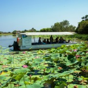
Jabiru: Guided Flight over Kakadu National Park Australia Appreciate nature during this guided, fixed-wing flight over Kakadu National Park. Marvel at Kakadu's changing landscapes and dynamic ecosystems.
From Darwin: Kakadu National Park Day Tour with Cruise Australia Discover Kakadu National Park on a full day tour from Darwin. Admire stunning wildlife and lush floodplains, see ancient rock art, and enjoy an Aboriginal river cruise. Check current availability, inclusions and booking conditions.
Darwin: Sunset Kakadu National Park with Yellow Water Cruise Australia Discover Kakadu National Park on a sunset tour from Darwin featuring the award-winning Yellow Water River Cruise; witness stunning wildlife, birdlife, lush floodplains and ancient rock art Check current availability, inclusions and booking conditions.
Carved over eons in the red heart of Australia, **Kings Canyon** lies within **Watarrka National Park** in the Northern Territory. Towering sandstone walls, hidden creeks, ancient cycads, and dramatic lookout points define this rugged landscape. Whether you’re here for the iconic rim hike or quiet rainforest pockets, Kings Canyon is a must-see on any Red Centre itinerary.
Getting There & Best Time to Visit
Where It Is
Kings Canyon is in Watarrka National Park, roughly **323 km southwest of Alice Springs**. :contentReference[oaicite:0]{index=0} It sits at the western end of the George Gill Range. :contentReference[oaicite:1]{index=1}
How to Drive There
From Alice Springs: via Stuart → Lasseter → Luritja Road (all sealed). :contentReference[oaicite:2]{index=2}
From Uluru / Yulara: about 310 km via Lasseter Highway then Luritja Road. :contentReference[oaicite:3]{index=3}
Optional route: the Mereenie Loop (4WD track) connects West MacDonnell to Kings Canyon; a permit is required. :contentReference[oaicite:4]{index=4}
When to Visit
May to October: Cooler, pleasant walking conditions. Many hikers prefer this as the prime season. :contentReference[oaicite:5]{index=5}
November to April: Hot season; high heat risk. Walks like the Rim Walk may be closed or discouraged during midday. :contentReference[oaicite:6]{index=6}
Avoid the midday sun and plan for early morning starts. :contentReference[oaicite:7]{index=7}
Top Walks & Features
Rim Walk (6 km loop, ~3–4 hours)
The most famous walk. It begins with a steep “Heart Attack Hill” climb, then follows the canyon rim, circles through the Garden of Eden waterhole, and passes sandstone domes dubbed the “Lost City.” :contentReference[oaicite:8]{index=8}
This walk is graded “difficult to moderate” (Grade 4), with the initial section being the hardest. :contentReference[oaicite:9]{index=9}
King’s Creek Walk (2.6 km return, ~1 hour)
An easier, lower-level walk along the canyon floor. You’ll see towering walls from below, native plants, and rugged terrain without the climb. :contentReference[oaicite:10]{index=10}
South Wall Return (4.8 km return, ~2 hours)
This route climbs partway to the canyon rim and returns via the south wall for different vantage points. Moderate difficulty. :contentReference[oaicite:11]{index=11}
Kathleen Springs Walk (2.4 km return, ~1.5 hours)
A gentle walk along a sealed path to a spring-fed waterhole, with interpretive signage and less strenuous terrain, often accessible to many visitors. :contentReference[oaicite:12]{index=12}
Giles Track (22 km between Kings Canyon & Kathleen Springs)
For adventurous hikers, this trail links the canyon to Kathleen Springs. It’s typically walked over multiple days. :contentReference[oaicite:13]{index=13}
Flora, Fauna & Geology
Geological Layers
The canyon cuts through two sandstone layers: the **Mereenie Sandstone** (about 400 million years old) above, and the older **Carmichael Sandstone** (~440 million years) beneath. :contentReference[oaicite:14]{index=14}
A thin shale/mudstone layer sits between them, marking ancient environmental shifts. :contentReference[oaicite:15]{index=15}
Plants & Animals
Over 750 plants recorded in the park; some 60 species are rare or relict. :contentReference[oaicite:16]{index=16}
Notable plants include cycads, palms in sheltered gorges, ferns, eucalypts, acacia. :contentReference[oaicite:17]{index=17}
Wildlife includes birds (honeyeaters, kestrels, spinifex pigeons), reptiles (perentie, ring-tailed dragons), and sometimes dingoes. :contentReference[oaicite:18]{index=18}
Practical Tips & Safety
Best Time of Day
Begin the Rim Walk at sunrise to avoid heat, and to catch golden light on canyon walls. Midday is harsh and many visitors avoid walking then. :contentReference[oaicite:19]{index=19}
Essentials to Pack
At least 1.5–2 L of water per person
Sun protection: hat, sunglasses, sunscreen
Good walking shoes or boots
Light layers (mornings get cold, midday intense sun)
First aid, insect repellent, camera
Walk Closures & Conditions
During extreme heat, the Rim Walk may be closed for safety. Always check with park rangers or the National Park website before heading out. :contentReference[oaicite:20]{index=20}
Respect Cultural Sites
Watarrka lies in Luritja and Arrernte Country. Some parts of the park are sacred, and certain waterholes or rock art are off-limits. Follow signage and guidance. :contentReference[oaicite:21]{index=21}
Suggested 2–3 Day Itineraries
2 Days: Rim & Creek
Day 1: Arrive mid-morning, hike the Rim Walk at sunrise or via early start.
Day 2: Do the Creek Walk or Kathleen Springs, then depart via Kings Creek Station or back toward Uluru. :contentReference[oaicite:22]{index=22}
3 Days: Add the Loop & Cultural Insights
Day 1: Rim Walk, sunset at the canyon edge.
Day 2: Creek Walk, South Wall return, or partial Giles Track segment.
Day 3: Scenic drive to Kathleen Springs, or connect on a Red Centre route to Uluru or Alice Springs. :contentReference[oaicite:23]{index=23}
Why Kings Canyon Deserves a Spot on Your Outback Journey
Among the red deserts of Central Australia, Kings Canyon is a dramatic gorge that reveals hidden pockets of life, from deep green waterholes to ancient cycads and wind-sculpted domes. It’s a place of contrasts: rugged cliffs paired with sheltered garden-like oases. For walkers, it’s an unforgettable vertical journey through time and terrain.
Sponsored Popular Items
Quick take: Musement.com offers a worldwide selection of tours and attractions
Northern Territory: Corroboree Billabong Nature Cruises Australia Only 90 minutes from Darwin is a nature lover's paradise and a wetland experience not to be missed. Get up close and personal to an abundance of wildlife in their natural environment… Check current availability, inclusions and booking conditions.
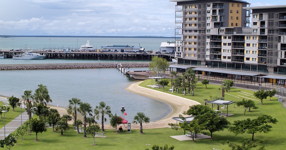
Darwin Northern Territory Visitor Guide: Attractions, Tours & Local Experiences Australia The best things to do in Darwin Northern Territory Darwin is a vibrant tropical city blending Indigenous culture, World War II history, and stunning waterfront scenery. Check current availability, inclusions and booking details before you go.
Indian Territory Grand Canyon West Tour from Las Vegas – Guided Tour United States Indian Territory Grand Canyon West tour from Las Vegas is a convenient way to add structure, local context and purposeful sightseeing to the itinerary. Check current availability, inclusions and booking details before you go.
Art Institute of Chicago: Your Complete Visitor’s Guide
Art Institute of Chicago: Your Complete Visitor’s Guide
Located in Grant Park on Michigan Avenue, the Art Institute of Chicago is one of the world’s premier art museums, home to an encyclopedic collection spanning millennia. From its iconic Impressionist paintings to contemporary galleries, this guide helps you get the most out of your visit.
Getting There & Opening Hours
How to Get There
The museum’s address is 111 South Michigan Avenue, Chicago, Illinois. :contentReference[oaicite:0]{index=0}
Public transit: nearest “L” stations include Adams/Wabash and Monroe/State; Metra & southshore lines stop at Van Buren Street. :contentReference[oaicite:1]{index=1}
Walking: it sits just west of Grant Park, near Millennium Park and major downtown attractions. :contentReference[oaicite:2]{index=2}
Hours & Best Times to Visit
Typical hours: 11 am to 5 pm on most days. :contentReference[oaicite:3]{index=3}
Thursdays often extend hours to 8 pm. :contentReference[oaicite:4]{index=4}
Closed on Tuesdays & Wednesdays (check ahead, especially for holidays or special exhibitions). :contentReference[oaicite:5]{index=5}
Avoid midday weekends if possible — crowds are lighter late afternoon or early opening. (General visitor advice) :contentReference[oaicite:6]{index=6}
Must-See Collections & Highlights
Impressionist & Post-Impressionist Masters
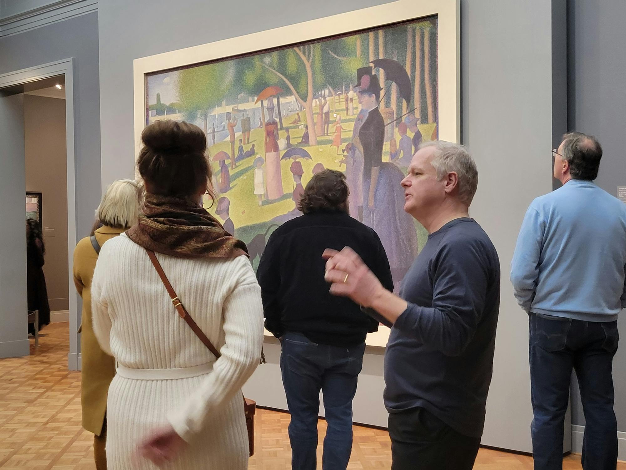
The museum’s Impressionist collection is world-class, with masterpieces by Monet, Renoir, Degas, Cézanne, and Seurat (including A Sunday on La Grande Jatte) :contentReference[oaicite:7]{index=7}
American Art & Icons
See works like Edward Hopper’s Nighthawks and Grant Wood’s American Gothic, which anchor the American art collection. :contentReference[oaicite:8]{index=8}
Modern & Contemporary, Architecture & Design
The Modern Wing, designed by Renzo Piano, opened in 2009 and houses 20th and 21st century art, design, photography, and architecture galleries. :contentReference[oaicite:9]{index=9}
The Nichols Bridgeway
Connecting the museum’s Modern Wing to Millennium Park, this pedestrian bridge offers pleasant views and is an architectural highlight in its own right. :contentReference[oaicite:10]{index=10}
Tips for Visitors & FAQs
How much time should I budget?
Answer: A solid 2–3 hours covers the highlights. If you’re deeply interested in certain collections (Impressionist, modern, architecture), plan to stay 4+ hours or return another day. :contentReference[oaicite:11]{index=11}
Should I buy tickets in advance?
Answer: Yes — buying tickets ahead helps skip lines. Some exhibitions may require timed-entry tickets. :contentReference[oaicite:12]{index=12}
Are there free or discounted admission options?
Answer: The museum offers free admission for certain groups (Illinois residents, Chicago teens, under-14) and has occasional free days. Check their official site before visiting. :contentReference[oaicite:13]{index=13}
Does the museum offer tours? Audio guides?
Answer: Yes — guided tours (free with admission) usually offered midday, and the museum app includes audio guides to many sections. :contentReference[oaicite:14]{index=14}
Is the museum accessible?
Answer: Yes. Elevators, ramps, and accessible routes are available. If you need special assistance, contact ahead. (Standard museum accessibility practice) :contentReference[oaicite:15]{index=15}
Suggested Itinerary Snippet Around the Museum
Start: Morning visit at the Art Institute.
Lunch: Museum café or nearby in the Loop.
Afternoon: Walk through Millennium Park (Cloud Gate, Crown Fountain) via Nichols Bridgeway. :contentReference[oaicite:16]{index=16}
Later: Explore Grant Park’s gardens, Buckingham Fountain, and the lakefront. :contentReference[oaicite:17]{index=17}
Why the Art Institute of Chicago Matters
The Art Institute is more than a museum — it’s a cultural anchor for Chicago and a gateway to visual histories from around the globe. Its architectural evolution (from Beaux-Arts to the Modern Wing), rich, layered collections, and placement next to urban green space make it uniquely immersive. For visitors, it’s both a place to marvel at masterworks and to see how art connects to city, landscape, and community.
Sponsored Popular Items
Quick take: Musement.com offers a worldwide selection of tours and attractions
Art Institute of Chicago Guided Tour - Guided Sightseeing Tour United States Book online the tickets and enjoy a captivating journey through the heart of creativity with a tour of the Art Institute. Check current availability, inclusions and booking details before you go.
Discover Lake Michigan: America’s Great Freshwater Coastline | Travel Guide
Discover Lake Michigan: America’s Great Freshwater Coastline
Framing four U.S. states with over 1,600 miles (2,575 km) of shoreline, Lake Michigan delivers big-lake energy: sweeping dunes, clear water, lighthouse-studded peninsulas, and a world-class city skyline in Chicago. Whether you’re here for beach days, small-town weekender charm, fall color drives, or winter ice caves, this guide helps you plan a trip that matches your style and season.
Getting There & Best Time to Visit
How to Get There
By air: Chicago (ORD/MDW) anchors the south; Milwaukee (MKE) the west; Grand Rapids (GRR) and Traverse City (TVC) the east; Green Bay (GRB) the north.
By car: Interstates and scenic byways circle the lake; many highlights are easiest with a car.
By rail/bus: Amtrak serves Chicago and Milwaukee; regional buses link coastal towns seasonally.
When to Go
Summer (Jun–Aug): Warm water, festivals, peak beach time; book early.
Shoulder (May, Sep–Oct): Mild temps, fewer crowds; brilliant fall color mid-to-late October (varies by latitude).
Winter (Dec–Mar): Quiet, dramatic ice and snow scenes; ideal for cozy, crowd-free escapes.
Where to Stay: Regions at a Glance
Region
Vibe
Highlights
Good For
Chicago & North Shore (IL)
Urban + beaches
Lakeside trail, museums, architecture, sandy city beaches
First timers, food lovers, car-free trips
Indiana Dunes (IN)
Dunes + nature
National/State Parks, tall dunes, birding
Hikers, families, day trips from Chicago
Door Peninsula (WI)
Coastal villages
Lighthouses, cherry orchards, ferries to Washington Island
Romantic getaways, fall color
West Michigan (MI)
Beach towns
Holland, Saugatuck, Grand Haven; sunsets and dunes
Weekenders, families, craft beer
Sleeping Bear Dunes (MI)
Epic landscapes
Bluffs, overlooks, scenic drives, inland lakes
Photographers, hikers, swimmers
Northwest MI & Lelanau (MI)
Wine + water
M-22 scenic byway, wineries, harbor towns
Scenic drives, tastings, boutiques
Upper Peninsula South Shore (MI)
Wild & quiet
Long beaches, shipwreck lore, winter solitude
Road-trippers, stargazers, budget escapes
Top Experiences
Beaches & Dunes
Sleeping Bear Dunes: Towering bluffs and Caribbean-hued water; choose overlooks or sand-trail hikes.
Indiana Dunes: Easy access dunes, birding hotspots, and family-friendly strands.
West Michigan beaches: Wide sands, classic piers, and technicolor sunsets.
Scenic Drives & Small Towns
M-22 (NW Michigan): A loop of vineyards, bays, and beach stops around Lelanau.
Door County backroads: Orchard stands, lighthouses, and shoreline parks.
Chicago’s lakefront: Skyline views via the multi-use Lakefront Trail.
Sailing & cruises: Sunset sails in harbor towns or architectural cruises in Chicago.
Fishing: Charter trips for salmon and trout; check licenses and seasons.
Practical Tips (Quick Steps)
Check the forecast: Big lakes create fast-changing weather; pack a light layer even in summer.
Respect currents: Swim near lifeguards when available; learn how to escape rip currents (swim parallel to shore).
Time your visit: Weekdays and early mornings mean easier parking at popular beaches.
Book ahead: Peak summer and fall foliage weekends sell out in charming towns.
Leave no trace: Stay off fragile dune grass; pack out what you bring in.
Lake Michigan FAQs
Is the water warm enough for swimming?
Answer: Summer surface temps can be very swimmable, especially in shallower bays and late in the season. Early summer and deeper areas remain brisk—bring a light rash guard if you chill easily.
What’s the best base for a first visit?
Answer: If you want city + beach, pick Chicago. For dunes and classic beach towns, try West Michigan or Indiana Dunes. For a slower, lighthouse-peppered getaway, choose the Door Peninsula.
Can I do this car-free?
Answer: In Chicago, yes—combine transit, rideshare, and bikes. For nature-heavy itineraries (dunes, wineries, lighthouses), a car is strongly recommended for flexibility.
Is winter worth it?
Answer: Absolutely, if you like quiet beauty: frozen shorelines, snow-draped forests, and cozy towns. Check road conditions, dress for wind chill, and book lodging with good heating and parking.
Suggested 3–5 Day Itineraries
3 Days — Chicago & Indiana Dunes
Day 1: Chicago Lakefront Trail, museums, sunset at a city beach.
Day 2: Train/drive to Indiana Dunes; hike a dune loop; beach time.
Day 3: Brunch in Chesterton or Valparaiso; return via lakeside stops.
4 Days — West Michigan Beaches
Day 1: Holland windmill area + beach sunset.
Day 2: Saugatuck art, dune rides, and harbor strolls.
Day 3: Grand Haven pier + lighthouse, craft breweries.
Day 4: Relaxed beach morning, scenic pullouts en route home.
5 Days — Sleeping Bear & Lelanau Loop
Day 1: Arrive Traverse City; bayfront walk.
Day 2: Sleeping Bear overlooks + short hikes; beach swim.
Day 3: M-22 wine and farm-stand circuit; lighthouse stop.
Day 4: Inland lake paddle; evening in a harbor town.
Day 5: Coffee + last-look viewpoints; depart.
Why Lake Michigan Belongs on Your List
Few places blend big-lake drama with easy small-town charm like Lake Michigan. One hour you’re edging along sun-warmed dunes; the next you’re tasting cherries on a farm road or listening to waves under a lighthouse. With four distinct seasons and countless micro-trips around its rim, it’s a destination you can return to again and again—always a little different, always refreshing.
Sponsored Popular Items
Quick take: Musement.com offers a worldwide selection of tours and attractions
Lake Michigan Self-Guided Driving Audio Tour – Self-Guided Experience United States Lake Michigan Self-Guided Driving Audio Tour is designed for travellers who prefer independent exploration while still having structured commentary available. Check current availability, inclusions and booking details before you go.
Discover Fraser Island (K’gari): Australia’s Natural Wonder
Fraser Island, now officially known by its traditional name K’gari, is a World Heritage-listed paradise off Queensland’s coast. The world’s largest sand island blends golden beaches, turquoise lakes, and rainforests growing directly on dunes. Whether you’re after 4WD thrills, freshwater swims, or stargazing on the beach, K’gari delivers a pure slice of wild Australia.
Getting There & Best Time to Visit
How to Get There
Ferry: Vehicle and passenger ferries depart from Hervey Bay and Inskip Point (near Rainbow Beach).
Guided tours: Easy 1–3 day 4WD tours run from Hervey Bay, Noosa, and Rainbow Beach.
Scenic flights: Small aircraft (seasonal) offer epic aerial views and beach landings.
When to Go
Sept–Nov & Mar–May: Warm days, ideal lake swimming and hiking.
Dec–Feb: Hot, humid; carry water and insect repellent.
Jun–Aug: Cooler, fewer crowds; whale watching in nearby Hervey Bay.
Where to Stay: Resorts, Holiday Parks & Camping
Base
Vibe
Good For
Keep in Mind
Kingfisher Bay Resort
Eco-resort on western side
Comfort, families, tours
Ferry timings; book peak dates early
Eurong Beach Resort
East-coast beach hub
Proximity to 75 Mile Beach
Soft-sand driving common
Dundubara / Central Station
National park camps
Budget, nature immersion
Permits required; limited facilities
Top Attractions on Fraser Island (K’gari)
Lake McKenzie (Boorangoora)
A perched lake filled purely by rainwater, Lake McKenzie dazzles with white silica sand and luminous turquoise water. Arrive early or late for calmer scenes and softer light.
75 Mile Beach, Eli Creek & the Maheno Shipwreck
The island’s east-coast highway is a photogenic ribbon of hard-packed sand. Float down crystal-clear Eli Creek and stop for classic shots of the Maheno Shipwreck.
Central Station Rainforest & Wanggoolba Creek
Easy boardwalks wind among satinay and kauri pines. It’s a living lesson in how lush rainforest can thrive on seemingly nutrient-poor sand.
Champagne Pools & Indian Head
At the island’s northern end, wave-fed rock pools fizz like their namesake. Climb nearby Indian Head for sweeping views and wildlife spotting (dolphins, rays, and seasonal whales).
Experiences & Activities
4WD beach cruising: Drive the sand “highway” and inland tracks (permit required).
Lake-hopping: From Lake Birrabeen’s glassy shallows to the tea-tinted waters of Lake Boomanjin.
Camping under the stars: Designated beach and forest camp areas offer true off-grid vibes.
Fishing: East-coast gutters can fire (check seasonal rules).
Practical Tips (Quick Steps)
Secure permits: Vehicle access and camping permits are mandatory for national park areas.
Check tides: Plan beach driving around low tide; avoid soft sand and washouts.
Pack smart: Water, sun protection, insect repellent, recovery gear if self-driving.
Respect dingoes: Never feed; store food securely; keep kids close in dingo zones.
Swim safely: Prefer lakes and Champagne Pools; ocean rips, sharks, and stingers make surf swimming unsafe.
Fraser Island FAQs
Do I need a 4WD to visit?
Answer: Yes. Sand tracks and beach driving require a high-clearance 4WD. If you’re not confident, join a guided tour or hire a tag-along option.
Where should I stay?
Answer: For comfort and easy logistics, choose Kingfisher Bay Resort (west) or Eurong Beach Resort (east). For nature immersion and value, book national-park camps like Dundubara or Central Station (permits essential).
Can I swim in the ocean?
Answer: It’s not recommended due to strong rips, sharks, and seasonal stingers. Choose lakes (e.g., McKenzie, Birrabeen) and the Champagne Pools for safer swims.
What should I pack?
Answer: Refillable water bottle, sun hat, SPF, insect repellent, swimmers, quick-dry clothing, first-aid kit, and if camping, full supplies (limited shops on island).
Is K’gari suitable for families?
Answer: Absolutely. Opt for resort bases, swim at lakes, and follow dingo-safe guidance. Many tours welcome children; always check age limits.
Suggested 3-Day Itinerary
Day 1 — Western Arrival & East-Coast Highlights
Ferry to Kingfisher Bay; settle in.
Drive to 75 Mile Beach; float Eli Creek; photograph the Maheno.
Sunset back on the western shore.
Day 2 — Lakes & Rainforest
Swim at Lake McKenzie (Boorangoora).
Boardwalks at Central Station and Wanggoolba Creek.
Optional second swim at Lake Birrabeen.
Day 3 — Northern Wonders
Indian Head lookout for coastal views and wildlife.
Champagne Pools soak (check tide/swell).
Return via beach highway for your ferry.
Why K’gari Belongs on Your Bucket List
Meaning “paradise” in the Butchulla language, K’gari is a rare island where rainforest, dunes, and freshwater lakes converge. From sunrise drives on 75 Mile Beach to the glassy stillness of perched lakes, it’s a destination that balances adventure with pure tranquility.
Sponsored Popular Items
Quick take: Musement.com offers a worldwide selection of tours and attractions
Fraser Island (K'gari): Remote Island and Whale Experience Australia Hike, snorkel, kayak, and more on World Heritage-listed K'gari's (Fraser Island) remote side on a cruise from Hervey Bay. Be one of the few to experience humpback whales in their… Check current availability, inclusions and booking conditions.
Hervey Bay to K'gari/Fraser Island 3-Day Tour (Beach House) Australia Explore ancient rainforests, stunning lakes, and unique landscapes on a two-night tour in our beach house accommodation, shared rooms. Drive a pink 4WD vehicle with tips from your knowledgeable guide.
From Hervey Bay: K'gari, Fraser Island Full-Day Coach Tour Australia Embark on a day trip to K'gari, Fraser Island, and learn about its natural features from your guide. Ride along sand tracks and see highlights, including Lake McKenzie, Eli Creek, and… Check current availability, inclusions and booking conditions.
Discover Ibiza: Beyond the Beats | Travel Guide 2025
Discover Ibiza: Beyond the Beats
Ibiza is often painted in neon lights — but scratch the surface, and you’ll find an island painted in soft pastel sunsets, rugged cliffs, secret bays, and centuries-old walls. This guide shows you Ibiza’s many layers: the party, yes — but also its nature, culture, food, and more.
When to Visit & Getting There
Best Time to Go
High season (June–August): Long days, buzzing nightlife, hottest weather
Off season (October–April): Quieter, cooler, many venues close
How to Arrive
By air: Ibiza Airport (IBZ) connects with many European cities
By ferry: Ferries run from mainland Spain (Barcelona, Valencia, Denia) and Mallorca
Where to Stay: Towns & Neighborhoods
Area
Vibe
Pros
Things to Note
Ibiza Town / Dalt Vila
Historic, central
Walkable old town, close to port
Busy, higher prices
Sant Antoni
Party hub
Great nightlife, sunsets
Can be noisy late
Santa Eulalia / Es Canar
Relaxed, family-friendly
Calm beaches, good amenities
Further from major clubs
Rural interior / Northern coast
Quiet, scenic
Nature, privacy
Requires transport
Top Experiences You Must Try
Sun, Sea & Secret Coves
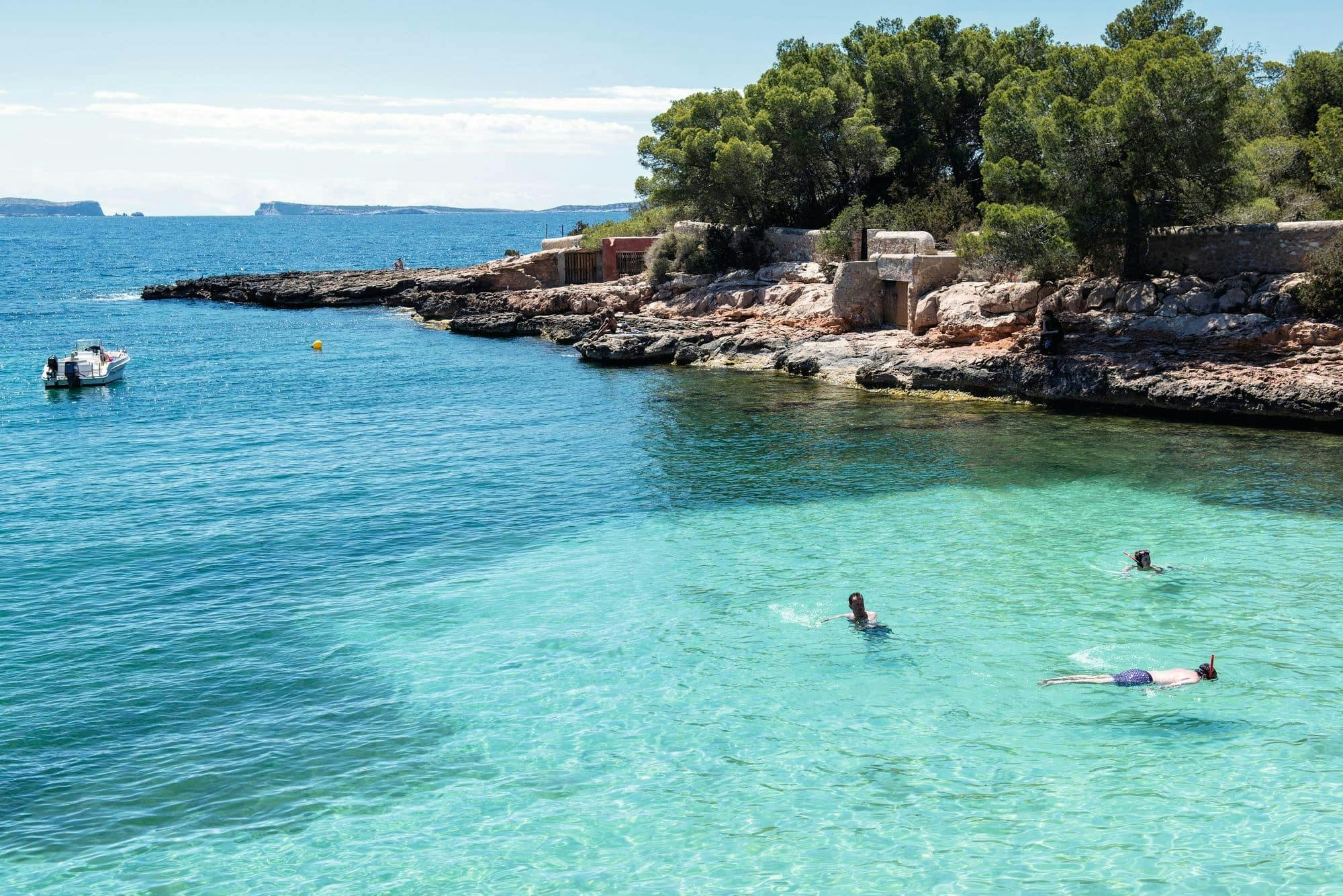
Sa Caleta: A tranquil horseshoe cove with rustic fisherman sheds; ideal for swimming and reflection.
Platja d’en Bossa: Ibiza’s longest beach, with energetic bar and club scene.
Agua Blanca: Remote nudist-friendly beach with dramatic winds and crystal water.
History, Culture & Hidden Corners
Dalt Vila (Old Town): Wander medieval walls, climb lookout points, soak in layers of history.
Es Vedrà: Mysterious rocky islet off the southwestern coast, famed for legends and views.
Hippie Markets (Es Canar, Las Dalias): Browse local crafts, clothes, and music.
Nights, Beats & After-Dark Energy
If you’re chasing the nightlife, Ibiza delivers — Playa d’en Bossa and Sant Antoni host top clubs. Many venues begin after midnight and run well into the early hours. Don’t miss beach bar sunset sets — often free or low cost. But the island also offers quieter nighttime alternatives: moonlit walks, jazz evenings, and acoustic live music in local bars.
Practical Tips & FAQs
Is Ibiza just for partygoers?
A: Far from it. While the club scene is iconic, most of the island offers tranquil beaches, hiking paths, olive groves, and small villages. Many visitors balance a few nights out with restful days.
How do I get around the island?
Bus network: Covers main towns and venues, though schedules shrink late at night.
Car or scooter rental: Offers flexibility to reach secluded spots.
Boat trips: Great for discovering hidden coves and coastal routes.
What should I pack?
Light clothing, swimwear
Good walking shoes
A pashmina or light jacket for evenings
Reusable water bottle
Power bank
Sun protection
Is Ibiza safe?
Yes. The island is generally safe for tourists. As with any destination, keep an eye on your belongings, especially in crowded nightlife areas.
Sample 3-Day Itinerary
Day 1 – Explore the Old & the Coast
Morning: Walk through Dalt Vila & walled fortifications
Afternoon: Swim at Sa Caleta
Evening: Sunset and dinner in Ibiza Town
Day 2 – Hidden Coves & Village Life
Morning: Drive north toward Agua Blanca
Afternoon: Lunch in a countryside village, stop at a hippie market
Evening: Chill evening at a seaside bar
Day 3 – Beach + Nightlife
Day: Relax at Platja d’en Bossa or another long beach
Night: Experience a major club or sunset DJ set
Why Ibiza Still Captivates
Ibiza’s magic lies in its contrasts: the pulse of dance music and the hush of hidden coves; the whitewashed lanes of its old town and the deep blue sea stretching beyond. It’s a place that invites both celebration and serenity.
Sponsored Popular Items
Quick take: Musement.com offers a worldwide selection of tours and attractions
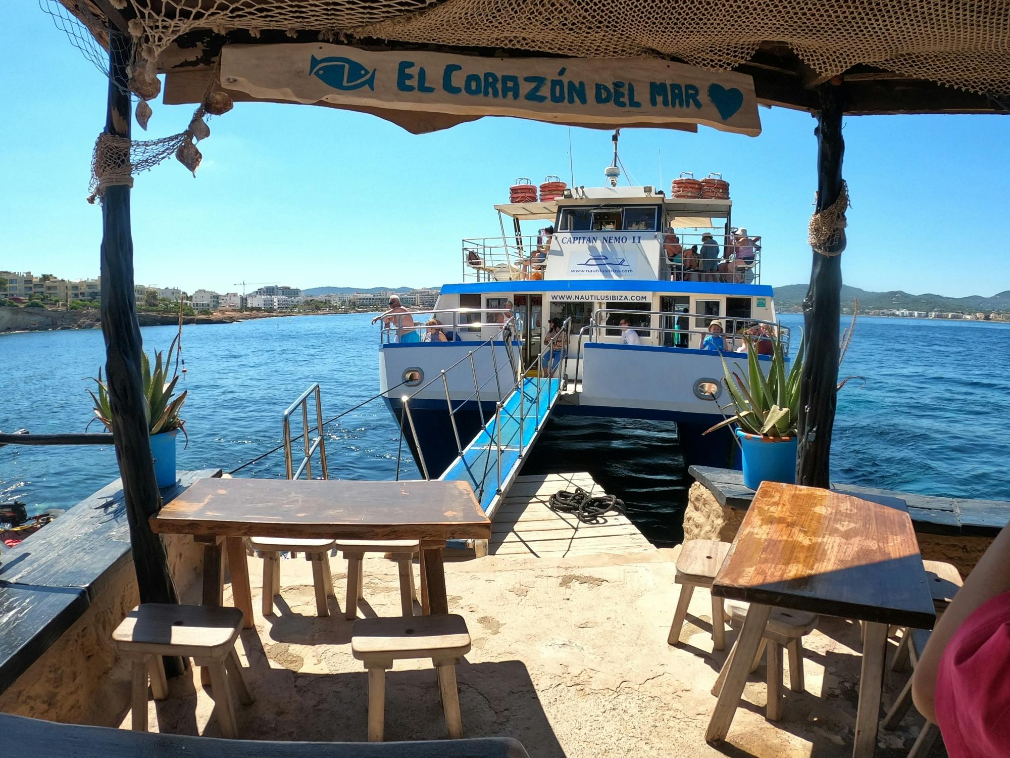
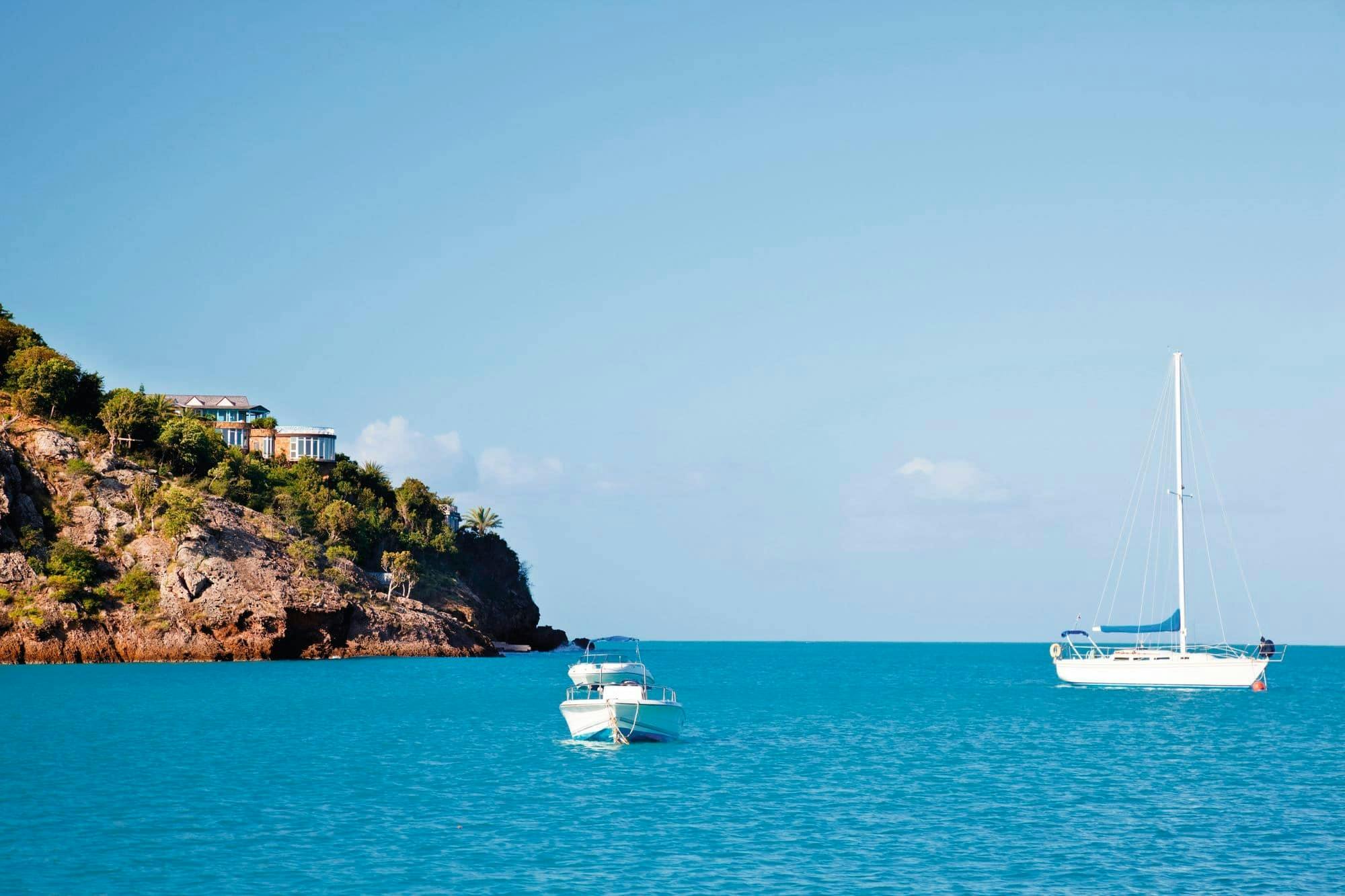
Glass -Bottom boat cruise on Ibiza's west coast with transfer Spain Plan Glass -Bottom boat cruise on Ibiza's west coast with transfer, a water-based experience, with practical tips on timing, inclusions and what to check before booking. Compare current availability, prices and booking conditions before you go.
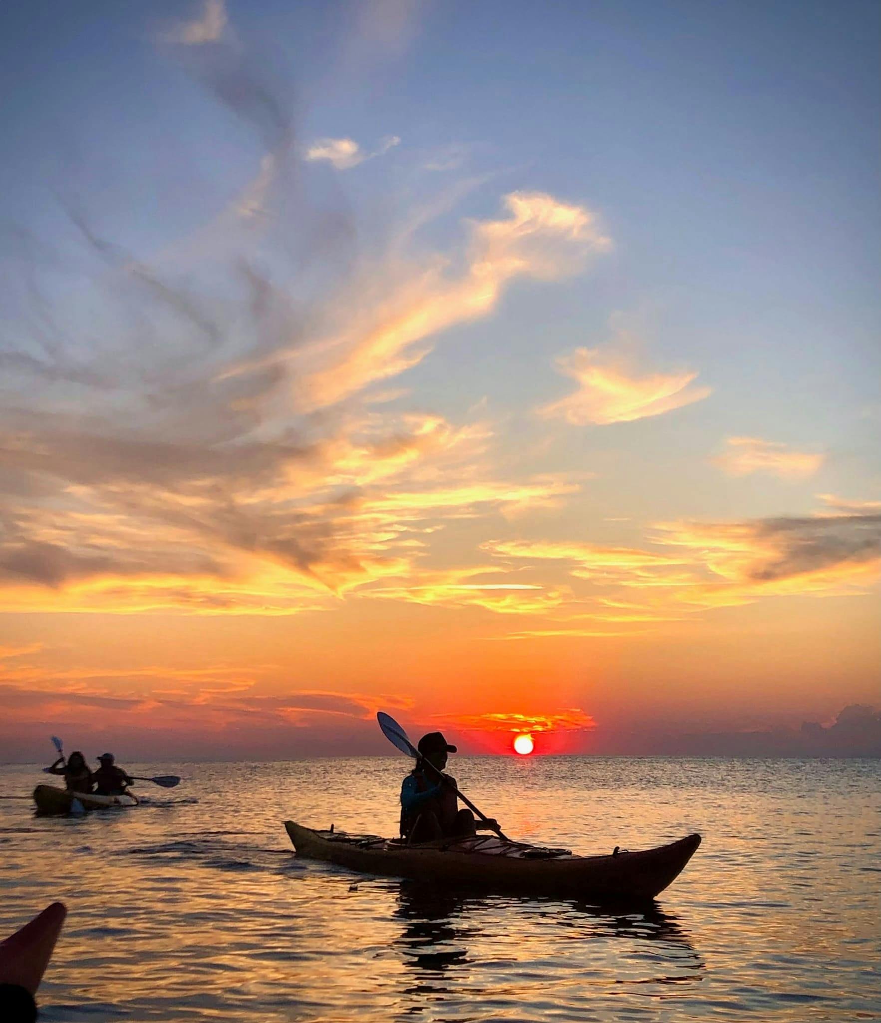
Ibiza sunset kayak tour in Portinatx Spain Plan Ibiza sunset kayak tour in Portinatx, a water-based experience, with practical tips on timing, inclusions and what to check before booking. Compare current availability, prices and booking conditions before you go.
Ibiza Hippy Market Guided Visit Spain Ibiza Hippy Market visit with a local guide is a convenient way to add structure, local context and purposeful sightseeing to the itinerary. Check current availability, inclusions and booking details before you go.
Discover Paddleboarding Lesson in Lygaria Bay museums, galleries, landmarks, parks, food culture, and hidden gems with practical tips for an easy, engaging city
Sponsored Popular Items
Quick take: Musement.com offers a worldwide selection of tours and attractions
Windsurf Lesson in Lygaria Bay - Hands-On Experience Windsurf Lesson in Lygaria Bay offers a hands-on alternative to conventional sightseeing and a chance to participate rather than simply observe. Check current availability, inclusions and booking details before you go.
Why Visit Paddleboarding Lesson in Lygaria Bay
Paddleboarding Lesson in Lygaria Bay blends history, culture, and everyday life in a way that rewards slow exploration. Travellers find a mix of museums, lively streets, and neighbourhood charm.
From landmark architecture to green spaces and local markets, the city offers a balanced itinerary for first-time visitors and repeat travellers alike.
History & Heritage Museums
Paddleboarding Lesson in Lygaria Bay museums help you step through the region’s timeline with clear exhibits and well-curated collections. Expect artifacts, multimedia displays, and concise interpretation panels.
Most venues are walkable or connected by public transport, and many offer audio guides or rotating exhibitions that spotlight local stories alongside global context.
Art Galleries & Cultural Spaces
Creative hubs in Paddleboarding Lesson in Lygaria Bay highlight classical works, contemporary installations, and community projects under one skyline. Small studios sit alongside established galleries.
Look for temporary shows, evening openings, and cultural centres where workshops, talks, and performances make art approachable and engaging for all visitors.
Science & Innovation Centers
Interactive science spaces introduce technology, nature, and engineering through hands-on exhibits. Families appreciate zones designed for curious minds at different ages.
Expect live demos, observatories or labs, and special programming during weekends or holidays that turn complex ideas into memorable experiences.
Landmarks & Architecture
Paddleboarding Lesson in Lygaria Bay combines historic façades with modern silhouettes. Prominent squares, monuments, and skyline viewpoints help orient your footsteps across the city.
Architectural walks reveal different eras side by side, while guided tours unpack details you might otherwise miss, from craftsmanship to city-planning decisions.
Family Attractions
Parks with playgrounds, small zoos or aquariums, and light-touch museums make planning with kids straightforward. Many sites include cafés, shade, and stroller-friendly paths.
Pick attractions with short dwell times and nearby rest stops, then layer in one larger activity—like a scenic ride, boat trip, or theme exhibit—per day.
Parks & Promenades
Green belts, riverside walks, and hilltop lookouts provide fresh air between museum visits. Morning jogs and sunset strolls show a quieter side of the city.
Wayfinding is generally intuitive; look for signed trails and public gardens with seasonal blooms, sculptures, and benches for unhurried breaks.
Food & Culture Highlights
Food in Paddleboarding Lesson in Lygaria Bay reflects regional produce and neighbourhood traditions. Markets offer quick tastings, while casual eateries and bakeries keep schedules flexible.
Consider a short food walk to sample local staples, sweets, or street snacks. Reserve popular spots early for weekends and arrive mid-week for calmer dining rooms.
Local Favorites & Hidden Gems
Beyond main streets, residential quarters hide pocket parks, indie bookshops, and family-run cafés. Small museums and community theatres reward curious detours.
Chat with locals for tips on viewpoint alleys, quiet courtyards, and seasonal events—simple moments that often become the highlight of a visit.
Travel Tips
Use a reloadable transit card or day pass; many sights cluster by district, making it easy to group stops. Comfortable walking shoes are essential on mixed surfaces.
Check opening days and timed-entry policies, especially on Mondays and public holidays. Carry a refillable bottle and light layers for changeable weather.
Final Thoughts
Paddleboarding Lesson in Lygaria Bay invites you to balance headline attractions with slow, local moments. Pace your days, follow your interests, and give each neighbourhood time to breathe.
With thoughtful planning and an open schedule, you’ll leave with a clear sense of place—and reasons to return.
Sponsored Popular Items
Quick take: Musement.com offers a worldwide selection of tours and attractions
Windsurf Lesson in Lygaria Bay - Hands-On Experience Windsurf Lesson in Lygaria Bay offers a hands-on alternative to conventional sightseeing and a chance to participate rather than simply observe. Check current availability, inclusions and booking details before you go.
Paddleboarding Lesson in Lygaria Bay - Hands-On Experience Paddleboarding Lesson in Lygaria Bay offers a hands-on alternative to conventional sightseeing and a chance to participate rather than simply observe. Check current availability, inclusions and booking details before you go.
Discover Boat Safari around Agia Pelagia Bay museums, galleries, landmarks, parks, food culture, and hidden gems with practical tips for an easy, engaging
Sponsored Popular Items
Quick take: Musement.com offers a worldwide selection of tours and attractions
Boat Safari Around Agia Pelagia Bay - Outdoor Adventure Seeing the destination from a boat or waterside route can change the perspective, and Boat Safari around Agia Pelagia Bay is designed around that contrast. Check current availability, inclusions and booking details before you go.
Why Visit Boat Safari around Agia Pelagia Bay USD 88
Boat Safari around Agia Pelagia Bay USD 88 blends history, culture, and everyday life in a way that rewards slow exploration. Travellers find a mix of museums, lively streets, and neighbourhood charm.
From landmark architecture to green spaces and local markets, the city offers a balanced itinerary for first-time visitors and repeat travellers alike.
History & Heritage Museums
Boat Safari around Agia Pelagia Bay USD 88’s museums help you step through the region’s timeline with clear exhibits and well-curated collections. Expect artifacts, multimedia displays, and concise interpretation panels.
Most venues are walkable or connected by public transport, and many offer audio guides or rotating exhibitions that spotlight local stories alongside global context.
Art Galleries & Cultural Spaces
Creative hubs in Boat Safari around Agia Pelagia Bay USD 88 highlight classical works, contemporary installations, and community projects under one skyline. Small studios sit alongside established galleries.
Look for temporary shows, evening openings, and cultural centres where workshops, talks, and performances make art approachable and engaging for all visitors.
Science & Innovation Centers
Interactive science spaces introduce technology, nature, and engineering through hands-on exhibits. Families appreciate zones designed for curious minds at different ages.
Expect live demos, observatories or labs, and special programming during weekends or holidays that turn complex ideas into memorable experiences.
Landmarks & Architecture
Boat Safari around Agia Pelagia Bay USD 88 combines historic façades with modern silhouettes. Prominent squares, monuments, and skyline viewpoints help orient your footsteps across the city.
Architectural walks reveal different eras side by side, while guided tours unpack details you might otherwise miss, from craftsmanship to city-planning decisions.
Family Attractions
Parks with playgrounds, small zoos or aquariums, and light-touch museums make planning with kids straightforward. Many sites include cafés, shade, and stroller-friendly paths.
Pick attractions with short dwell times and nearby rest stops, then layer in one larger activity—like a scenic ride, boat trip, or theme exhibit—per day.
Parks & Promenades
Green belts, riverside walks, and hilltop lookouts provide fresh air between museum visits. Morning jogs and sunset strolls show a quieter side of the city.
Wayfinding is generally intuitive; look for signed trails and public gardens with seasonal blooms, sculptures, and benches for unhurried breaks.
Food & Culture Highlights
Food in Boat Safari around Agia Pelagia Bay USD 88 reflects regional produce and neighbourhood traditions. Markets offer quick tastings, while casual eateries and bakeries keep schedules flexible.
Consider a short food walk to sample local staples, sweets, or street snacks. Reserve popular spots early for weekends and arrive mid-week for calmer dining rooms.
Local Favorites & Hidden Gems
Beyond main streets, residential quarters hide pocket parks, indie bookshops, and family-run cafés. Small museums and community theatres reward curious detours.
Chat with locals for tips on viewpoint alleys, quiet courtyards, and seasonal events—simple moments that often become the highlight of a visit.
Travel Tips
Use a reloadable transit card or day pass; many sights cluster by district, making it easy to group stops. Comfortable walking shoes are essential on mixed surfaces.
Check opening days and timed-entry policies, especially on Mondays and public holidays. Carry a refillable bottle and light layers for changeable weather.
Final Thoughts
Boat Safari around Agia Pelagia Bay USD 88 invites you to balance headline attractions with slow, local moments. Pace your days, follow your interests, and give each neighbourhood time to breathe.
With thoughtful planning and an open schedule, you’ll leave with a clear sense of place—and reasons to return.
Sponsored Popular Items
Quick take: Musement.com offers a worldwide selection of tours and attractions
Boat Safari Around Agia Pelagia Bay - Outdoor Adventure Seeing the destination from a boat or waterside route can change the perspective, and Boat Safari around Agia Pelagia Bay is designed around that contrast. Check current availability, inclusions and booking details before you go.
Agia Pelagia Bay Speedboat Snorkelling Tour - Scenic Water Experience Agia Pelagia Bay Speedboat Snorkelling Tour combines sightseeing with the relaxed sense of movement that comes from a boat-based experience. Check current availability, inclusions and booking details before you go.
Agia Pelagia Bay Motorboat Cruise - Scenic Water Experience Agia Pelagia Bay Motorboat Cruise combines sightseeing with the relaxed sense of movement that comes from a boat-based experience. Check current availability, inclusions and booking details before you go.
Discover In-app self-guided audio tour of El Born neighborhood museums, galleries, landmarks, parks, food culture, and hidden gems with practical tips for an
Sponsored Popular Items
Quick take: Musement.com offers a worldwide selection of tours and attractions
Why Visit In-app self-guided audio tour of El Born neighborhood USD 13
In-app self-guided audio tour of El Born neighborhood USD 13 blends history, culture, and everyday life in a way that rewards slow exploration. Travellers find a mix of museums, lively streets, and neighbourhood charm.
From landmark architecture to green spaces and local markets, the city offers a balanced itinerary for first-time visitors and repeat travellers alike.
History & Heritage Museums
In-app self-guided audio tour of El Born neighborhood USD 13’s museums help you step through the region’s timeline with clear exhibits and well-curated collections. Expect artifacts, multimedia displays, and concise interpretation panels.
Most venues are walkable or connected by public transport, and many offer audio guides or rotating exhibitions that spotlight local stories alongside global context.
Art Galleries & Cultural Spaces
Creative hubs in In-app self-guided audio tour of El Born neighborhood USD 13 highlight classical works, contemporary installations, and community projects under one skyline. Small studios sit alongside established galleries.
Look for temporary shows, evening openings, and cultural centres where workshops, talks, and performances make art approachable and engaging for all visitors.
Science & Innovation Centers
Interactive science spaces introduce technology, nature, and engineering through hands-on exhibits. Families appreciate zones designed for curious minds at different ages.
Expect live demos, observatories or labs, and special programming during weekends or holidays that turn complex ideas into memorable experiences.
Landmarks & Architecture
In-app self-guided audio tour of El Born neighborhood USD 13 combines historic façades with modern silhouettes. Prominent squares, monuments, and skyline viewpoints help orient your footsteps across the city.
Architectural walks reveal different eras side by side, while guided tours unpack details you might otherwise miss, from craftsmanship to city-planning decisions.
Family Attractions
Parks with playgrounds, small zoos or aquariums, and light-touch museums make planning with kids straightforward. Many sites include cafés, shade, and stroller-friendly paths.
Pick attractions with short dwell times and nearby rest stops, then layer in one larger activity—like a scenic ride, boat trip, or theme exhibit—per day.
Parks & Promenades
Green belts, riverside walks, and hilltop lookouts provide fresh air between museum visits. Morning jogs and sunset strolls show a quieter side of the city.
Wayfinding is generally intuitive; look for signed trails and public gardens with seasonal blooms, sculptures, and benches for unhurried breaks.
Food & Culture Highlights
Food in In-app self-guided audio tour of El Born neighborhood USD 13 reflects regional produce and neighbourhood traditions. Markets offer quick tastings, while casual eateries and bakeries keep schedules flexible.
Consider a short food walk to sample local staples, sweets, or street snacks. Reserve popular spots early for weekends and arrive mid-week for calmer dining rooms.
Local Favorites & Hidden Gems
Beyond main streets, residential quarters hide pocket parks, indie bookshops, and family-run cafés. Small museums and community theatres reward curious detours.
Chat with locals for tips on viewpoint alleys, quiet courtyards, and seasonal events—simple moments that often become the highlight of a visit.
Travel Tips
Use a reloadable transit card or day pass; many sights cluster by district, making it easy to group stops. Comfortable walking shoes are essential on mixed surfaces.
Check opening days and timed-entry policies, especially on Mondays and public holidays. Carry a refillable bottle and light layers for changeable weather.
Final Thoughts
In-app self-guided audio tour of El Born neighborhood USD 13 invites you to balance headline attractions with slow, local moments. Pace your days, follow your interests, and give each neighbourhood time to breathe.
With thoughtful planning and an open schedule, you’ll leave with a clear sense of place—and reasons to return.
Sponsored Popular Items
Quick take: Musement.com offers a worldwide selection of tours and attractions
Discover Parc de Montjuïc self-guided in-app audio tour museums, galleries, landmarks, parks, food culture, and hidden gems with practical tips for an easy,
Sponsored Popular Items
Quick take: Musement.com offers a worldwide selection of tours and attractions
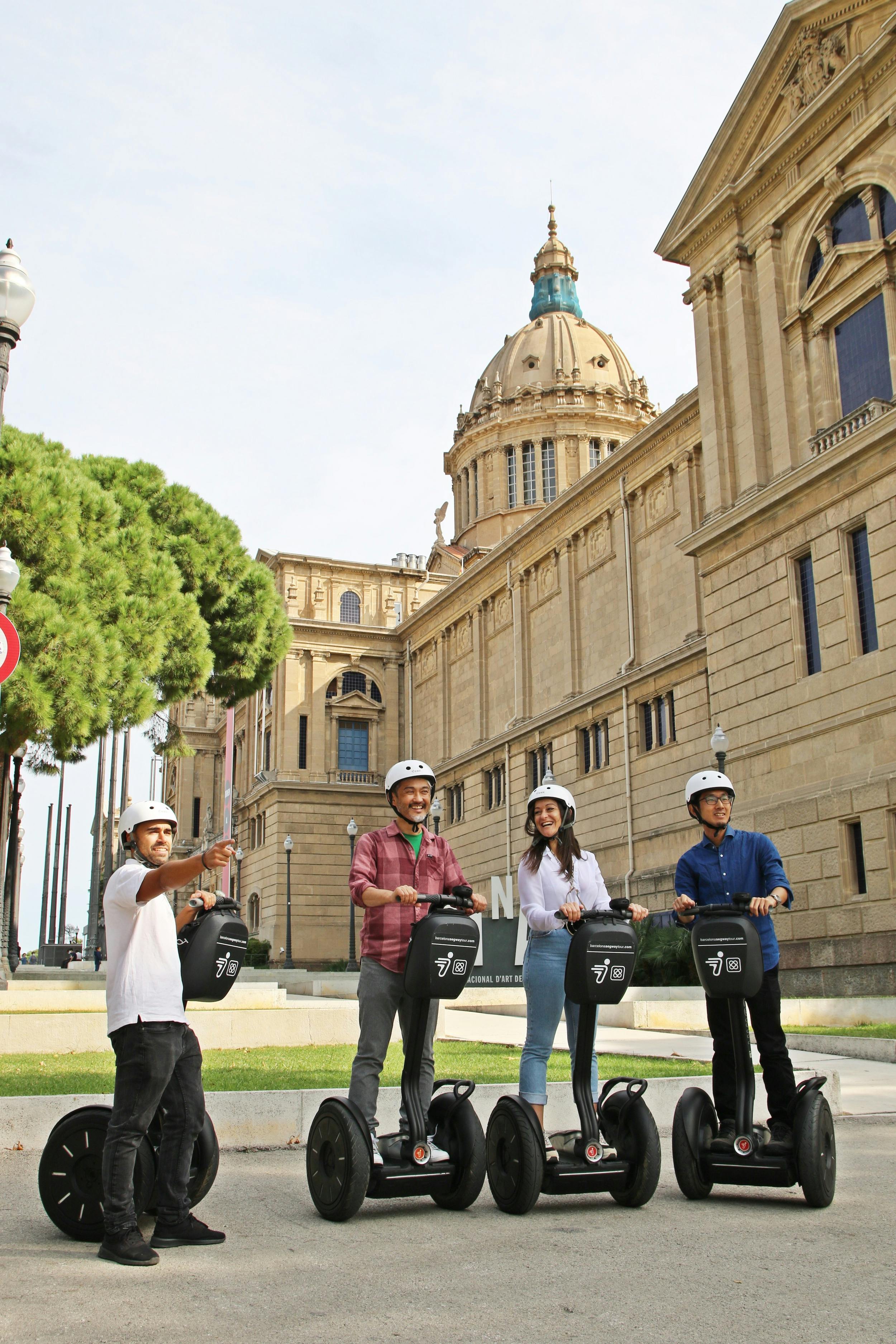
Parc De Montjuïc Self-Guided in-App Audio Tour - Self-Guided Experience Parc de Montjuïc self-guided in-app audio tour combines independent exploration with recorded commentary, allowing travellers to discover Barcelona at their own pace. Check current availability, inclusions and booking details before you go.
Why Visit Parc de Montjuïc self-guided in-app audio tour USD 18
Parc de Montjuïc self-guided in-app audio tour USD 18 blends history, culture, and everyday life in a way that rewards slow exploration. Travellers find a mix of museums, lively streets, and neighbourhood charm.
From landmark architecture to green spaces and local markets, the city offers a balanced itinerary for first-time visitors and repeat travellers alike.
History & Heritage Museums
Parc de Montjuïc self-guided in-app audio tour USD 18’s museums help you step through the region’s timeline with clear exhibits and well-curated collections. Expect artifacts, multimedia displays, and concise interpretation panels.
Most venues are walkable or connected by public transport, and many offer audio guides or rotating exhibitions that spotlight local stories alongside global context.
Art Galleries & Cultural Spaces
Creative hubs in Parc de Montjuïc self-guided in-app audio tour USD 18 highlight classical works, contemporary installations, and community projects under one skyline. Small studios sit alongside established galleries.
Look for temporary shows, evening openings, and cultural centres where workshops, talks, and performances make art approachable and engaging for all visitors.
Science & Innovation Centers
Interactive science spaces introduce technology, nature, and engineering through hands-on exhibits. Families appreciate zones designed for curious minds at different ages.
Expect live demos, observatories or labs, and special programming during weekends or holidays that turn complex ideas into memorable experiences.
Landmarks & Architecture
Parc de Montjuïc self-guided in-app audio tour USD 18 combines historic façades with modern silhouettes. Prominent squares, monuments, and skyline viewpoints help orient your footsteps across the city.
Architectural walks reveal different eras side by side, while guided tours unpack details you might otherwise miss, from craftsmanship to city-planning decisions.
Family Attractions
Parks with playgrounds, small zoos or aquariums, and light-touch museums make planning with kids straightforward. Many sites include cafés, shade, and stroller-friendly paths.
Pick attractions with short dwell times and nearby rest stops, then layer in one larger activity—like a scenic ride, boat trip, or theme exhibit—per day.
Parks & Promenades
Green belts, riverside walks, and hilltop lookouts provide fresh air between museum visits. Morning jogs and sunset strolls show a quieter side of the city.
Wayfinding is generally intuitive; look for signed trails and public gardens with seasonal blooms, sculptures, and benches for unhurried breaks.
Food & Culture Highlights
Food in Parc de Montjuïc self-guided in-app audio tour USD 18 reflects regional produce and neighbourhood traditions. Markets offer quick tastings, while casual eateries and bakeries keep schedules flexible.
Consider a short food walk to sample local staples, sweets, or street snacks. Reserve popular spots early for weekends and arrive mid-week for calmer dining rooms.
Local Favorites & Hidden Gems
Beyond main streets, residential quarters hide pocket parks, indie bookshops, and family-run cafés. Small museums and community theatres reward curious detours.
Chat with locals for tips on viewpoint alleys, quiet courtyards, and seasonal events—simple moments that often become the highlight of a visit.
Travel Tips
Use a reloadable transit card or day pass; many sights cluster by district, making it easy to group stops. Comfortable walking shoes are essential on mixed surfaces.
Check opening days and timed-entry policies, especially on Mondays and public holidays. Carry a refillable bottle and light layers for changeable weather.
Final Thoughts
Parc de Montjuïc self-guided in-app audio tour USD 18 invites you to balance headline attractions with slow, local moments. Pace your days, follow your interests, and give each neighbourhood time to breathe.
With thoughtful planning and an open schedule, you’ll leave with a clear sense of place—and reasons to return.
Sponsored Popular Items
Quick take: Musement.com offers a worldwide selection of tours and attractions
Parc De Montjuïc Self-Guided in-App Audio Tour - Self-Guided Experience Parc de Montjuïc self-guided in-app audio tour combines independent exploration with recorded commentary, allowing travellers to discover Barcelona at their own pace. Check current availability, inclusions and booking details before you go.
Lyon Parc de la Tête d’Or Guided Tour – Guided Tour France Guided Tour of Lyon's Parc de la Tête d'Or with a local guide is a convenient way to add structure, local context and purposeful sightseeing to the itinerary. Check current availability, inclusions and booking details before you go.